
Title 18 - Unified Development Ordinance
- 18.100 General Provisions
- 18.110 Rules of Interpretation and Definitions
- 18.120 Administration
- 18.130 Permits and Certificates of Occupancy
- 18.140 Applications and Procedures
- 18.150 Zoning Districts
- 18.160 A Agricultural District
- 18.170 RE Residential Estates District
- 18.174 RP-OE Planned Open Space Estate Residential District
- 18.176 RP-OS Planned Open Space Single-Family Residential District
- 18.180 R-1 Single-Family Residential District and RP-1 Planned Single-Family Residential District
- 18.190 R-1A Small-Lot Single-Family Residential District And RP-1A Planned Small-Lot Single-Family Residential District
- 18.195 RP-1N Planned Single-Family Infill Residential District
- 18.200 R-2 Two-Family Residential District and RP-2 Planned Two-Family Residential District
- 18.210 R-3 Garden Apartment District and RP-3 Planned Garden Apartment District
- 18.220 RP-4 Planned Cluster Housing District
- 18.230 RP-5 Planned Apartment House District
- 18.240 RP-6 Planned High-Rise Apartment District
- 18.245 PRN Planned Residential Neighborhood District
- 18.250 C-O Office Building District and CP-O Planned Office Building District
- 18.260 C-1 Restricted Business District and CP-1 Planned Restricted Business District
- 18.270 C-2 General Business District and CP-2 Planned General Business District
- 18.275 MXD Planned Mixed Use District
- 18.280 C-3 Commercial District and CP-3 Planned Commercial District
- 18.290 BP Business Park District
- 18.300 M-1 Industrial Park District and MP-1 Planned Industrial Park District
- 18.310 M-2 General Industrial District and MP-2 Planned General Industrial District
- 18.350 MHP Mobile Home Park District
- 18.360 Floodplain Management Ordinance
- 18.365 Stream Corridor Requirements
- 18.370 Special Uses
- 18.375 Portfolio Homes Development-Pilot Program
- 18.376 By-Right Housing Developments
- 18.377 New Single-Family Construction
- 18.380 Special Events
- 18.390 Accessory Uses and Structures
- 18.395 Communications Facilities for Wireless Services
- 18.400 Right-of-way and Easement Exaction Process
- 18.410 Nonconforming Situations and Vested Rights
- 18.420 Height and Area Exceptions
- 18.430 Parking and Loading Regulations
- 18.435 Outdoor Lighting
- 18.440 Signs
- 18.450 Landscaping and Screening
- 18.460 Subdivisions and Lot Splits
- 18.470 Vacation of Streets and Reservations
- Repealed Sections of Title 18
18.100 General Provisions
- 18.100.010 Short Title
- 18.100.020 Authority
- 18.100.030 Jurisdiction
- 18.100.040 Relationship to Other Provisions of the Code
- 18.100.041 Adoption by Reference of Overland Park Architectural Design Standards; Relationship to Other Provisions of the Code
- 18.100.042 Adoption by Reference of Infill and Redevelopment Design Guidelines and Standards; Relationship to Other Provisions Of The Code
- 18.100.043 Adoption by Reference of Overland Park Site Design Standards; Relationship to Other Provisions of the Code
- 18.100.044 Adoption by Reference of Commercial Design Guidelines and Standards; Relationship to Other Provisions of the Code
- 18.100.046 Adoption by Reference of Multi-family Design Guidelines and Standards; Relationship to Other Provisions of the Code
- 18.100.048 Adoption by Reference of Overland Park Mixed Use Design Standards; Relationship to Other Provisions of the Code
- 18.100.049 Adoption by Reference of the Downtown Form-Based Code; Relationship to Other Provisions of the Code
- 18.100.050 Relationship to Comprehensive Plan and Other Policies
- 18.100.060 Relationship to Private Restrictions
- 18.100.070 Adequate Public Facilities and Services
- 18.100.075 Unspecified Transportation Improvement Payments
- 18.100.080 Zoning of Annexed Lands
- 18.100.090 Violations of Prior Regulations
- 18.100.100 Severability
- 18.100.110 Penalty for Violations and Civil Remedies
- 18.100.120 Incorporation
- 18.100.130 Article Omissions
- 18.100.140 Sections and Subsections Omissions
- 18.100.150 Definitions Omitted
- 18.100.160 Definitions Amended
- 18.100.170 Prohibited Acts and Conduct
- 18.100.180 Violations
- 18.100.190 Penalties and Fines
- 18.100.200 Prosecution Of Actions
- 18.100.210 Zoning Map
- 18.100.220 Applicability
- 18.100.230 Application of Johnson County, Kansas, Zoning & Subdivision Regulations; Procedures
18.100.010 Short Title
This ordinance shall be known and may be cited as the Unified Development Ordinance, and may be cited and abbreviated as "U.D.O."
(History: Ord. ZRR-1725; ZRR-1637)
Effective on: 1/1/1901
18.100.020 Authority
This ordinance is adopted pursuant to the authority contained in Article 7 of Chapter 12 of the Kansas Statutes Annotated, and amendments thereto, and Article 12, Section 5 of the Kansas Constitution.
(History: Ord. ZRR-1725; ZRR-1637)
Effective on: 1/1/1901
18.100.030 Jurisdiction
This ordinance shall be effective throughout the corporate limits of the City. Provided, however, that nothing herein shall be construed to preclude the City from engaging in extraterritorial planning activities pursuant to K.S.A. 12 -747, and amendments thereto.
(History: Ord. ZRR-1725; ZRR-1637)
Effective on: 1/1/1901
18.100.040 Relationship to Other Provisions of the Code
- A.The use of buildings and land within the City shall be subject to all other applicable provisions of the Overland Park Municipal Code as well as this ordinance, whether or not such other provisions of the Code are specifically cross referenced in this ordinance. Cross references to other provisions of the Code in this ordinance are for the convenience of the reader; lack of a cross reference should not be construed as an indication that other provisions of the Code do not apply.
- B.In interpreting and applying the provisions of this ordinance, they shall be construed to be the minimum requirements necessary for the promotion of public health, safety or the general welfare. Whenever this ordinance requires a lower height of a building or lesser number of stories, or requires a greater percentage of the lot to be left unoccupied, or imposes more restrictive standards than are required pursuant to any other statute or local regulation, this ordinance shall govern.
(History: Ord. ZRR-1725; ZRR-1637)
Effective on: 1/1/1901
18.100.041 Adoption by Reference of Overland Park Architectural Design Standards; Relationship to Other Provisions of the Code.
-
A.
There is incorporated by reference, for the purpose of adopting Overland Park Architectural Design Standards within the City, the Overland Park Architectural Design Standards, dated November 4, 2024, as prepared by the City of Overland Park, Kansas. At least one copy of the Overland Park Architectural Design Standards shall be marked “Official Copy as Adopted by Ordinance No. ZRR-3461”, to which shall be attached a copy of the ordinance codified herein, and filed with the City Clerk to be open to inspection and available to the public at all reasonable business hours. The Municipal Court and all administrative departments of the City charged with the enforcement of the ordinance shall be supplied at the cost of the City such number of official copies of such ordinance as may be deemed expedient.
-
B.
Where provisions of this adopted code are identified as standards, they shall be considered ordinance requirements, and where they are specifically applicable they shall prevail over any conflicting provisions elsewhere in the Unified Development Ordinance unless otherwise specified. Where provisions of this adopted code are identified as guidelines, those guidelines have been developed to identify quality elements that should be incorporated in mixed use projects, and are to be used by applicants, architects, planners, developers, city staff, Planning Commission and Governing Body members to assist them in, where appropriate, designing, reviewing, evaluating, recommending and approving plans for such projects.
(History: Ord. No. ZRR-3461 §1, 2024; Ord. No. ZRR-3416 §1, 2023; Ord. No. ZRR-3300 §22, 2020; Ord. ZRR-2837 §1, 2009)
Effective on: 1/1/1901
18.100.042 Adoption by Reference of Infill and Redevelopment Design Guidelines and Standards; Relationship to Other Provisions Of The Code.
- A.There is incorporated by reference, for the purpose of adopting commercial and residential infill and redevelopment guidelines and standards within the City, the Infill and Redevelopment Guidelines and Standards, Final Draft, dated February 11, 2004, as prepared by the City of Overland Park, Kansas. Not less than three (3) copies of said Infill and Redevelopment Guidelines and Standards shall be marked Official Copy as Adopted by Ordinance No. ZRR-2458, to which shall be attached a copy of the ordinance codified herein, and filed with the City Clerk to be open to inspection and available to the public at all reasonable business hours. The Municipal Court and all administrative departments of the City charged with the enforcement of the ordinance shall be supplied at the cost of the City such number of official copies of such ordinance as may be deemed expedient.
- B.Where provisions of this adopted code are identified as standards, they shall be considered ordinance requirements, and where they are specifically applicable they shall prevail over any conflicting provisions elsewhere in the Unified Development Ordinance unless otherwise specified. Where provisions of this adopted code are identified as guidelines, those guidelines have been developed to identify quality elements that should be incorporated in infill and redevelopment projects, and are to be used by applicants, architects, planners, developers, city staff, Planning Commission and Governing Body members to assist them in, where appropriate, designing, reviewing, evaluating, recommending and approving plans for such projects.
(History: Ord. ZRR-2458 §1, 2004, ZRR-2380 §1, 2002)
Effective on: 1/1/1901
18.100.043 Adoption by Reference of Overland Park Site Design Standards; Relationship to Other Provisions of the Code.
-
A.There is incorporated by reference, for the purpose of adopting Overland Park Site Design Standards within the City, the Overland Park Site Design Standards, dated November 4, 2024, as prepared by the City of Overland Park, Kansas. A copy of the Overland Park Site Design Standards shall be marked "Official Copy as Incorporated by Ordinance No. ZRR-3461," to which shall be attached a copy of the ordinance codified herein, and filed with the City Clerk to be open to inspection and available to the public at all reasonable business hours. The Municipal Court and all administrative departments of the City charged with the enforcement of the ordinance shall be supplied at the cost of the City such number of official copies of such ordinance as may be deemed expedient.
-
B.Where provisions of the Overland Park Site Design Standards are identified as standards, they shall be considered ordinance requirements, and where they are specifically applicable they shall prevail over any conflicting provisions elsewhere in the Unified Development Ordinance unless otherwise specified. Where provisions of the Overland Park Site Design Standards are identified as guidelines, those guidelines have been developed to identify quality elements that should be incorporated in mixed use projects, and are to be used by applicants, architects, planners, developers, city staff, Planning Commission and Governing Body members to assist them in, where appropriate, designing, reviewing, evaluating, recommending and approving plans for such projects.
(History: Ord. No. ZRR-3461 §2, 2024; ZRR-3447 §13, 2024; ZRR-3416 §2, 2023; ZRR-3373 §1, 2023; ZRR-2837 §2, 2009)
Effective on: 1/1/1901
18.100.044 Adoption by Reference of Commercial Design Guidelines and Standards; Relationship to Other Provisions of the Code.
- A.There is incorporated by reference, for the purpose of adopting commercial design guidelines and standards within the City, the Commercial Design Guidelines and Standards, Final Draft, dated February 11, 2004, as prepared by the City of Overland Park, Kansas. Not less than three (3) copies of said Commercial Design Guidelines and Standards shall be marked Official Copy as Adopted by Ordinance No. ZRR-2458, to which shall be attached a copy of the ordinance codified herein, and filed with the City Clerk to be open to inspection and available to the public at all reasonable business hours. The Municipal Court and all administrative departments of the City charged with the enforcement of the ordinance shall be supplied at the cost of the City such number of official copies of such ordinance as may be deemed expedient.
- B.Where provisions of this adopted code are identified as standards, they shall be considered ordinance requirements, and where they are specifically applicable they shall prevail over any conflicting provisions elsewhere in the Unified Development Ordinance unless otherwise specified. Where provisions of this adopted code are identified as guidelines, those guidelines have been developed to identify quality elements that should be incorporated in commercial design projects, and are to be used by applicants, architects, planners, developers, city staff, Planning Commission and Governing Body members to assist them, where appropriate, in designing, reviewing, evaluating, recommending and approving plans for such projects.
(History: Ord. ZRR-2458 §2, 2004, ZRR-2380 §2, 2002)
Effective on: 1/1/1901
18.100.046 Adoption by Reference of Multi-family Design Guidelines and Standards; Relationship to Other Provisions of the Code.
- A.There is incorporated by reference, for the purpose of adopting multi-family design guidelines and standards within the City, the Multi-family Design Guidelines and Standards, Final Draft, dated February 11, 2004, as prepared by the City of Overland Park, Kansas. Not less than three (3) copies of said Multi-family Design Guidelines and Standards shall be marked Official Copy as Adopted by Ordinance No. ZRR-2458, to which shall be attached a copy of the ordinance codified herein, and filed with the City Clerk to be open to inspection and available to the public at all reasonable business hours. The Municipal Court and all administrative departments of the City charged with the enforcement of the ordinance shall be supplied at the cost of the City such number of official copies of such ordinance as may be deemed expedient.
- B.Where provisions of this adopted code are identified as standards, they shall be considered ordinance requirements, and where they are specifically applicable they shall prevail over any conflicting provisions elsewhere in the Unified Development Ordinance unless otherwise specified. Where provisions of this adopted code are identified as guidelines, those guidelines have been developed to identify quality elements that should be incorporated in multi-family design projects, and are to be used by applicants, architects, planners, developers, city staff, Planning Commission and Governing Body members to assist them, where appropriate, in designing, reviewing, evaluating, recommending and approving plans for such projects.
(History: Ord. ZRR-2458 §3, 2004, ZRR-2380 §3, 2002)
Effective on: 1/1/1901
18.100.048 Adoption by Reference of Overland Park Mixed Use Design Standards; Relationship to Other Provisions of the Code.
-
A.There is incorporated by reference, for the purpose of adopting Overland Park Mixed Use Design Standards within the City, the Overland Park Mixed Use Design Standards, dated January 9, 2023, as prepared by the City of Overland Park, Kansas. At least one copy of the Overland Park Mixed Use Design Standards shall be marked "Official Copy as Incorporated by Ordinance No. ZRR-3373," to which shall be attached a copy of the ordinance codified herein, and filed with the City Clerk to be open to inspection and available to the public at all reasonable business hours. The Municipal Court and all administrative departments of the City charged with the enforcement of the ordinance shall be supplied at the cost of the City such number of official copies of such ordinance as may be deemed expedient.
-
B.Where provisions of the Overland Park Mixed Use Design Standards are identified as standards, they shall be considered ordinance requirements, and where they are specifically applicable they shall prevail over any conflicting provisions elsewhere in the Unified Development Ordinance unless otherwise specified. Where provisions of the Overland Park Mixed Use Design Standards are identified as guidelines, those guidelines have been developed to identify quality elements that should be incorporated in mixed use projects, and are to be used by applicants, architects, planners, developers, city staff, Planning Commission and Governing Body members to assist them in, where appropriate, designing, reviewing, evaluating, recommending and approving plans for such projects.
(History: Ord. ZRR-3373 §2, 2023; Ord. ZRR-2813 §1, 2009)
Effective on: 1/1/1901
18.100.049 Adoption by Reference of the Downtown Form-Based Code; Relationship to Other Provisions of the Code.
-
A.There is incorporated by reference, for the purpose of adopting the Downtown Form-Based Code within the City, the Downtown Form-Based Code, dated July 1, 2024, as prepared by the City of Overland Park, Kansas. A copy of the Downtown Form-Based Code shall be marked "Official Copy as Incorporated by Ordinance No. ZRR-3447," to which shall be attached a copy of the ordinance codified herein, and filed with the City Clerk to be open to inspection and available to the public at all reasonable business hours. The Municipal Court and all administrative departments of the City charged with the enforcement of the ordinance shall be supplied at the cost of the City such number of official copies of such ordinance as may be deemed expedient.
-
B.Where provisions of the Downtown Form-Based Code are identified as standards, they shall be considered ordinance requirements, and where they are specifically applicable they shall prevail over any conflicting provisions elsewhere in the Unified Development Ordinance unless otherwise specified. Where provisions of the Downtown Form-Based Code are identified as guidelines, those guidelines have been developed to identify quality elements that should be incorporated in downtown projects, and are to be used by applicants, architects, planners, developers, city staff, Planning Commission and Governing Body members to assist them in, where appropriate, designing, reviewing, evaluating, recommending and approving plans for such projects.
(History: Ord. No. ZRR-3447 §14, 2024; Ord. ZRR-3416 §3, 2023; Ord. ZRR-3373 §3, 2023; Ord. ZRR-3370 §1, 2022; Ord. ZRR-3355 §15, 2022; Ord. ZRR-3247 §1, 2019 Ord. ZRR-3188 §1, 2018; ZRR-3134 §24, 2016; ZRR-3037 §1, 2016; ZRR-3045 §1, 2015; ZRR-2922 §1, 2011; ZRR-2887 §1, 2011)
Effective on: 1/1/1901
18.100.050 Relationship to Comprehensive Plan and Other Policies
It is the intention of the City that this Unified Development Ordinance implement the planning policies adopted for the City reflected in the Comprehensive Plan and other planning documents. While the City reaffirms its commitment that this Unified Development Ordinance and any amendment thereto be in conformity with adopted planning policies, the City hereby expresses its intent that neither this Unified Development Ordinance nor any amendment thereto may be challenged merely on the basis of an alleged nonconformity with the Comprehensive Plan or other planning policy.
(History: Ord. ZRR-3416 §4, 2023; Ord. ZRR-1725; ZRR-1637)
Effective on: 1/1/1901
18.100.060 Relationship to Private Restrictions
The provisions of this ordinance are not intended to abrogate any deed restriction, covenant, easement or any other private agreement or restriction on the use of land. Provided, that where the provisions of this ordinance are more restrictive or impose higher standards than any such private restriction, the requirements of this ordinance shall control. Where the provisions of any private restriction are more restrictive or impose higher standards than the provisions of this ordinance, such private restrictions shall control if properly enforced by a person having the legal right to enforce such restrictions; private restrictions shall not be enforced by the City.
(History: Ord. ZRR-1725; ZRR-1637)
Effective on: 1/1/1901
18.100.070 Adequate Public Facilities and Services
- A.At the time of submittal of a rezoning, special use permit or preliminary plat application, the applicant shall submit proof of having reviewed the development proposal with applicable water, sewer, fire, gas and electric utility officials. Proof of such review shall be provided on forms furnished by the Department of Planning and Development Services. Said forms shall provide an opportunity for applicable water, sewer, fire, gas and electric officials to provide comments on the existing and future availability and timing of services provided by their respective districts to the subject property.
- B.At the time of submittal of final development plan or final plat application, the applicant shall submit proof that adequate water, sewer, fire, gas and electric services are presently available to the subject property. If adequate public facilities and services are not presently available at the time of submittal of applications for final development plans or final plats, or are not planned for the near future to appropriately serve the proposed development, as determined by the affected utility company or agency, the final development plan or final plat may be denied.
(History: Ord. ZRR-2343 §1, 2002; ZRR-1725; ZRR-1637)
Effective on: 1/1/1901
18.100.075 Unspecified Transportation Improvement Payments
As of the effective date of this provision, any owner and/or developer required to make an outstanding unspecified transportation improvement payment in accordance with a stipulation of any rezoning, special use permit or revised preliminary plan, shall be required to make the payment based only on the initial per-square-foot payment rate specified; and such owner/developer shall not be required to pay any higher amount set forth in any schedule within said stipulation that increases the per-square-foot on an annual basis. Provided, in the event any such rezoning, special use permit or revised preliminary plan is subsequently repealed and superseded by a subsequent rezoning, special use permit or revised preliminary plan that sets forth a different unspecified transportation improvement rate, the owner/developer shall pay based upon the per-square-foot rate set forth in the subsequent rezoning, special use permit or revised preliminary plan. Notwithstanding the above, no refund or credit shall be made on any unspecified transportation improvement payments made prior to the effective date of this provision.
Applicable rezoning ordinances include: REZ1984-00044; REZ1986-00032; REZ1986-00067; REZ1987-00001; REZ1987-00017; REZ1987-00019; REZ1987-00027; REZ1987-00034; REZ1987-00046; REZ1987-00059; REZ1987-00063; REZ1988-00008; REZ1988-00022; REZ1988-00026; REZ1988-00032; REZ1989-00015; REZ1989-00022; REZ1989-00027; REZ1990-00013; REZ1990-00019; REZ1993-00027; REZ1993-00030; REZ1993-00031; REZ1994-00006; REZ1994-00008; REZ1994-00009; REZ1994-00012; REZ1994-00019; REZ1994-00023; REZ1994-00026; REZ1994-00030; REZ1994-00032; REZ1994-00034; REZ1995-00015; REZ1995-00024; REZ1995-00032; REZ1995-00034; REZ1995-00035; REZ1996-00001; REZ1996-00002; REZ1996-00004; REZ1996-00005; REZ1996-00006; REZ1996-00013; REZ1996-00019; REZ1996-00021; REZ1997-00002; REZ1997-00008; REZ1997-00009; REZ1997-00019; REZ1997-00021; REZ1997-00025; REZ1997-00026; REZ1997-00030; REZ1997-00032; REZ1997-00042; REZ1997-00047; REZ1998-00004; REZ1998-00008; REZ1998-00013; REZ1998-00016; REZ1998-00020; REZ1998-00021; REZ1998-00025; REZ1999-00034; REZ1998-00042; REZ1998-00046; REZ1998-00047; REZ1999-00002; REZ1999-00006; REZ1999-00008; REZ1999-00009; REZ1999-00011; REZ1999-00022; REZ1999-00024; REZ1999-00025; REZ1999-00038; REZ2000-00004; REZ2000-00009; REZ2000-00010; REZ2000-00014; REZ2000-00021; REZ2001-00003; REZ2001-00004; REZ2001-00005; REZ2001-00006; REZ2001-00010; REZ2001-00011; REZ2001-00014; REZ2002-00001; REZ2002-00002; REZ2002-00003; REZ2002-00022; REZ2003-00006; REZ2003-00007; REZ2003-00015; REZ2003-00017; REZ2004-00002; REZ2004-00006; REZ2004-00007; REZ2004-00009; REZ2004-00016; REZ2004-00020; REZ2004-00023; REZ2004-00027; REZ2005-00023; REZ2005-00026; REZ2006-00001; REZ2006-00003; REZ2006-00007; REZ2006-00009; REZ2006-00013; REZ2006-00017; REZ2006-00019; REZ2007-00003; REZ2007-00006; REZ2007-00008; REZ2007-00020; REZ2007-00021; REZ2007-00022; REZ2007-00023; REZ2007-00025; REZ2008-00002; REZ2008-00006; REZ2008-00010; REZ2008-00011; REZ2008-00013; REZ2008-00014; REZ2009-00002; REZ2010-00001; REZ2011-00001; REZ2011-00010; and REZ2011-00012.
Applicable special use permits include: SUP1989-00058; SUP1996-00010; SUP1996-00031; SUP1996-00034; SUP1996-00046; SUP1996-00064; SUP1996-00066; SUP1996-00069; SUP1997-00045; SUP1997-00049; SUP1997-00053; SUP1998-00045; SUP1998-00062; SUP1998-00063; SUP1998-00069; SUP1998-00070 SUP1999-00012; SUP1999-00027; SUP1999-00029; SUP2001-00043; SUP2002-00026; SUP2003-00012; SUP2004-00045; SUP2005-00034; SUP2006-00025; SUP2006-00039; SUP2007-00033; SUP2007-00038; SUP2008-00009; SUP2009-00009; and SUP2009-00042.
Applicable revised preliminary plan are associated with the following rezoning ordinances: REZ1970-00026; REZ1978-00016; REZ1978-00052; REZ1981-00047; and REZ1987-00050.
(History: Ord. ZRR-2964 §1, 2012)
Effective on: 1/1/1901
18.100.080 Zoning of Annexed Lands
Unless land is rezoned at the time of its annexation into the City, the land shall retain its zoning status under county or township zoning until such time as the property is rezoned pursuant to the provisions of this ordinance. The City shall have the authority to secure civil remedies for violations of such county or township regulations to the same extent that it may secure civil remedies for violations of this ordinance pursuant to Section 18.100.110. Land that retains its zoning status under county or township zoning shall nevertheless be allowed to choose to utilize the provisions for non-conforming single-family residences as contained in Sections 18.410.040E and 18.410.050B.
(History: Ord. ZRR-2860 §1, 2010; ZRR-1725; ZRR-1637)
Effective on: 1/1/1901
18.100.090 Violations of Prior Regulations
All violations of prior zoning regulations of any township, Johnson County or the City that have accrued in the corporate area of the City as of the effective date of this ordinance, shall continue to be violations and shall not be considered to be legal nonconforming situations under this ordinance. The City shall have the same authority to secure civil remedies for violations of such regulations to the same extent that it may secure civil remedies for violations of this ordinance pursuant to Section 18.100.110.
(History: Ord. ZRR-1725; ZRR-1637)
Effective on: 1/1/1901
18.100.100 Severability
It is hereby declared to be the intention of the City that the sections, subsections, paragraphs, sentences, clauses and phrases of this ordinance are severable, and if any such section, subsection, paragraph, sentence, clause or phrase is declared unconstitutional or otherwise invalid by any court of competent jurisdiction in a valid judgment or decree, such unconstitutionality or invalidity shall not affect any of the remaining sections, subsections, paragraphs, sentences, clauses or phrases of this ordinance since the same would have been enacted without the incorporation into this ordinance of such unconstitutional or invalid section, subsection, paragraph, sentence, clause or phrase.
(History: Ord. ZRR-1725; ZRR-1637)
Effective on: 1/1/1901
18.100.110 Penalty for Violations and Civil Remedies
- A.The violation of any provision of this ordinance is hereby declared to be a public offense and, pursuant to the authority of K.S.A. 12-761, a misdemeanor, and any person, firm, association, partnership or corporation convicted thereof shall be punished by a fine not to exceed $500 or by imprisonment for not more than six months for each offense or by both such fine and imprisonment. Each day's violation of this ordinance shall constitute a separate offense.
- B.The City shall have the authority to maintain civil suits or actions in any court of competent jurisdiction for the purpose of enforcing the provisions of this ordinance and to abate nuisances maintained in violation thereof. In the event that any building or structure is or is proposed to be erected, constructed, altered, converted or maintained in violation of this ordinance, or any building, structure or land is proposed to be used in violation of this ordinance, the City Attorney, or other appropriate authority of the City, may, in addition to any other remedies, institute injunction, mandamus or other appropriate action or proceeding to prevent such unlawful erection, construction, reconstruction, alteration, conversion, maintenance or use, or to correct or abate such violation, or to prevent the occupancy of such building, structure or land.
(History: Ord. ZRR-1725; ZRR-1637)
Effective on: 1/1/1901
18.100.120 Incorporation.
The Johnson County, Kansas, Zoning & Subdivision Regulations, official copy incorporated by resolution of the Board of County Commissioners the 25th day of January, 2007, is adopted and incorporated in this chapter as if fully set forth herein excepting only such parts or portions thereof as are specifically omitted, added or changed in Overland Park Municipal Code Sections 18.100.130 through 18.100.230, inclusive.
(History: Ord. ZRR-2691 §1, 2008; ZRR-2374 §1, 2002)
Effective on: 1/1/1901
18.100.130 Article Omissions.
Article 3, Article 4, Article 22, Article 23, Article 25, Article 26, Article 27, Article 28, Article 29, Article 30, Article 31, Article 32 and Article 33 of the Johnson County, Kansas, Zoning & Subdivision Regulations, official copy incorporated by resolution of the Board of County Commissioners the 25th day of January, 2007, are hereby declared to be omitted in their entirety.
(History: Ord. ZRR-2691 §2, 2008; ZRR-2374 §2, 2002)
Effective on: 1/1/1901
18.100.140 Sections and Subsections Omissions.
The following sections and subsections of the Johnson County, Kansas, Zoning & Subdivision Regulations, official copy incorporated by resolution of the Board of County Commissioners the 25th day of January, 2007, are hereby declared to be omitted in their entirety: Subsection 2.B of Article 2; Subsection 2.D of Article 2; Section 1 of Article 5; Section 6 of Article 7; Section 3 of Article 8; and Section 4 of Article 8.
(History: Ord. ZRR-2691 §3, 2008; ZRR-2374 §3, 2002)
Effective on: 1/1/1901
18.100.150 Definitions Omitted.
The following definitions contained in Section 3 of Article 2 of the Johnson County, Kansas, Zoning & Subdivision Regulations, official copy incorporated by resolution of the Board of County Commissioners the 25th day of January, 2007, are hereby declared to be omitted in their entirety: "A Zone"; "A99 Zone"; "Actuarial or Risk Premium Rates"; "AE Zone and A1-A30 Zones "; "AH Zone"; "AO Zone"; "Area of Future Conditions Flood Hazard"; "Areas of Shallow Flooding"; "Areas of Special Flood Hazard"; "Base Flood"; "Bond"; "Capital Budget"; "Capital Improvement Plan"; "Capital Improvement Program"; "Costs"; "D Zone"; "Environmental Overlay Analysis"; "Existing Construction"; "Flood" or "Flooding"; "Flood Damage Reduction System"; "Flood Elevation, Regulatory"; "Flood Hazard Area"; "Flood Insurance Study"; "Flood Plain, Regulatory"; "Flood Plain Development Permit"; "Flood Plain Management"; "Flood Plain Management Regulation"; "Flood Proofing"; "Flood Protection Elevation, Regulatory"; "Flood Protection System"; "Floodway" or "Regulatory Floodway"; "Floodway Encroachment Lines"; "Floodway Fringe"; "Flood Area, Gross"; "Flood Area, Main"; "Flood Area, Net"; "Freeboard"; "Future-Conditions Flood Hazard Area" or "Future-Conditions Flood Plain"; "Future-Conditions Hydrology"; "Johnson County Flood Insurance Rate Map (FIRM) "; "Major Street Plan"; "Major Subdivision"; "Mean Sea Level"; "Minor Subdivision"; "New Construction"; "One Hundred Year Frequency Flood"; "Other Areas in X Zone"; "Other Flood Areas in X Zone"; "Parkways"; "Plat, Final"; "Plat, Preliminary"; "Preliminary Plat"; "Preplatting Conference"; "Regulatory Flood Elevation"; "Regulatory Flood Protection Elevation"; "Road Classification"; "Rule Exception"; "Rural Policy Area"; "Sketch Plat"; "Subdivider's Agent"; "Subdivision, Major"; "Subdivision, Minor"; "Surety"; "Township Zoning Board"; "Urban Fringe Policy Area"; "Violation"; "Zone D"; "Zone X" and "Zoning Board."
(History: Ord. ZRR-2691 §4, 2008; ZRR-2374 §4, 2002)
Effective on: 1/1/1901
18.100.160 Definitions Amended.
The following definitions contained in Section 3 of Article 2 of the Johnson County, Kansas, Zoning & Subdivision Regulations, official copy incorporated by resolution of the Board of County Commissioners the 25th day of January, 2007, as adopted in Section 18.100.120 of the Overland Park Municipal Code, are hereby changed and amended to read as follows:
"Board" or "BOCC" or "Board of County Commissioners": all references to these terms shall be redefined to mean the Governing Body of the City of Overland Park, Kansas.
"Board of Zoning Appeals" or "BZA": all references to these terms shall be redefined to mean the Board of Zoning Appeals of the City of Overland Park, Kansas.
"Code Enforcement Officer": all references to this term shall be redefined to mean the Director of Planning and Development Services of the City of Overland Park, Kansas (or designee).
"Comprehensive Plan": all references to this term shall be redefined to refer to the Comprehensive Plan of the City of Overland Park, Kansas, as the same may be updated and amended from time to time.
"County": all references to this term shall be redefined to refer to the City of Overland Park, Kansas.
"County's Attorney": all references to this term shall be redefined to mean the City Attorney of the City of Overland Park, Kansas, or a designated Assistant City Attorney.
"Datum": for the purpose of determining the height limits in the Airport Overlay District set forth in these regulations, the datum shall be mean sea level elevation unless otherwise specified.
"Director": all references to this term shall be redefined to mean the Director of Planning and Development Services of the City of Overland Park, Kansas (or designee).
"Flood Plain": all references to this term shall have the same meaning as set forth in Section 18.110.250 of the Overland Park Municipal Code, and any amendments thereto. Such areas are subject to and regulated by 18.360 of the Overland Park Municipal Code.
"Governing Body": all references to this term shall be redefined to refer to the Mayor and City Council of the City of Overland Park, Kansas.
"Height": the vertical distance from the average ground elevation adjacent to a building or structure to the highest point of a building or highest point of any permanent part of the structure or building. Height, where not regulated in feet, shall be regulated by stories. A story shall be equal to twelve feet for purposes of measuring structures other than buildings. For purposes of the Airport Overlay District Zones, the datum for height measurement shall be mean sea level unless otherwise specified and the height limits in all Airport Overlay Zones shall be as established on the Airport Zoning Map.
"Long Range Road Network Plan": all references to this term shall be redefined to refer to the Official Street Map as defined in Section 18.110.445 of the Overland Park Municipal Code, as amended from time to time.
"Overlay District Zoning Map": the official map for the Airport Area Overlay District prepared by the Johnson County Planning Office on file with the Johnson County Planning Office and duly adopted by the Board of County Commissioners, and any amendments thereto.
"Planning Commission": this term shall be redefined to mean the Planning Commission of the City of Overland Park, Kansas.
"Regulations": this term shall be redefined to mean those portions of the Johnson County, Kansas, Zoning & Subdivision Regulations adopted by this ordinance and other applicable provisions of the Unified Development Ordinance as defined in Section 18.110.645 of the Overland Park Municipal Code, and any amendments thereto.
"Secretary of the Board of Zoning Appeals": this term shall be redefined to mean the person designated as the Secretary of the Board of Zoning Appeals of the City of Overland Park, Kansas.
"Structure": generally, anything more than three (3) feet in height constructed or erected by man which requires location on the ground, or attached to something having location on the ground.
"Subdivision Regulations": the official subdivision regulations of the City of Overland Park, Kansas, as set forth in 18.460 of the Overland Park Municipal Code, and any amendments thereto.
"Zoning Administrator": all references to this term shall be redefined to refer to the Director of Planning and Development Services of the City of Overland Park, Kansas (or designee).
"Zoning Map": the zoning map(s) showing zoning districts for land subject to these zoning regulations as prepared by the Johnson County Planning Office and duly adopted by the Board of County Commissioners, and provided to the City of Overland Park, Kansas, following the annexation of land by the City by both Ordinance No. A-2367 and Ordinance No. A-2719.
"Zoning Permit": a document signed by the Director of Planning and Development Services (or designee), to acknowledge that a tract has been satisfactorily developed in accordance with an approved development plan as provided in these regulations.
"Zoning Regulations": the official zoning regulations of Johnson County, Kansas, as adopted in this ordinance, and any amendments thereto.
(History: Ord. ZRR-3416 §5, 2023; Ord. ZRR-2691 §5, 2008; ZRR-2374 §5, 2002)
Effective on: 1/1/1901
18.100.170 Prohibited Acts and Conduct.
From and after the effective date of this ordinance, no person shall violate any of the provisions of the regulations adopted hereby, or fail to comply with any of the requirements of these regulations, including, but not limited to, any conditions or terms established in connection with grants of variances, nor use any property, building or structure in any way except as permitted and in the manner provided by these regulations, and any act, conduct or use which fails to comply with the provisions of these regulations and any codes, rules or standards adopted as a part of these regulations, shall be and hereby is declared to be unlawful as a violation of the Unified Development Ordinance of the City of Overland Park, Kansas.
(History: Ord. ZRR-2691 §6, 2008; ZRR-2374 §6, 2002)
Effective on: 1/1/1901
18.100.180 Violations.
The failure of any person to comply with, or the violation of, any provision, requirement, standard or condition contained within or as a part of these regulations, shall be a public offense. The failure of any person to comply with, or the violation of, any order, directive or notice of the Director of Planning Development Services, or his/her designee, related to the provisions of these regulations, shall be a public offense.
(History: Ord. ZRR-2691 §7, 2008; ZRR-2374 §7, 2002)
Effective on: 1/1/1901
18.100.190 Penalties and Fines.
Any person violating the provisions of the Johnson County, Kansas, Zoning & Subdivision Regulations, official copy incorporated by resolution of the Board of County Commissioners the 25th day of January, 2007, as incorporated herein and as amended, shall be subject to the penalties, fines, and civil remedies as set forth in Section 18.100.110 of the Overland Park Municipal Code.
(History: Ord. ZRR-2691 §8, 2008; ZRR-2374 §8, 2002)
Effective on: 1/1/1901
18.100.200 Prosecution Of Actions.
The City Attorney, or his/her designee, shall have the duty of prosecuting all actions for the enforcement of these regulations and shall be vested with all of the discretion with respect to the prosecution of these regulations as may be vested in any other prosecuting attorney with statutory authority to prosecute actions for the enforcement of zoning regulations.
(History: Ord. ZRR-2691 §9, 2008; ZRR-2374 §9, 2002)
Effective on: 1/1/1901
18.100.210 Zoning Map.
The properties annexed into the City of Overland Park by Ordinance No. A-2367, effective upon publication on May 8, 2002, shall retain the Johnson County zoning district classifications in effect prior to annexation, as shown on the "Zoning Map of Johnson County, Kansas," in effect on May 8, 2002, together with all explanatory matter thereon. The properties annexed into the City of Overland Park by Ordinance No. A-2719, effective upon publication on March 13, 2008, shall retain the Johnson County zoning district classifications in effect prior to annexation, as shown on the “Zoning Map of Johnson County, Kansas,” in effect on March 13, 2008, together with all explanatory matter thereon. Said properties shall be added to the Official Zoning Map of the City incorporated by reference in Section 18.150.020 of the Overland Park Municipal Code, and the Johnson County zoning district boundaries shall be reflected thereon.
(History: Ord. ZRR-2691 §10, 2008; ZRR-2374 §10, 2002)
Effective on: 1/1/1901
18.100.220 Applicability.
The provisions of this Article govern the size, placement, use and structural quality of outdoor signs and other advertising and identification devices together with their appurtenant and auxiliary apparatus. No sign shall be erected, enlarged, constructed, reconstructed, relocated, refaced, or structurally or otherwise altered, without first obtaining a separate sign permit as set forth in this Article. Any sign for which a permit is required is allowed to maintain noncommercial speech in addition to or in lieu of any other speech.
(History: Ord. ZRR-2691 §11, 2008; ZRR-2374 §11, 2002)
Effective on: 1/1/1901
18.100.230 Application of Johnson County, Kansas, Zoning & Subdivision Regulations; Procedures.
The Johnson County, Kansas, Zoning & Subdivision Regulations incorporated by this ordinance, as amended, are adopted in order to assure the stability and continuity of zoning for properties zoned pursuant to such regulations prior to the annexation of such properties into the City of Overland Park by both Ordinance No. A-2367, effective May 8, 2002, and Ordinance No. A-2719, effective March 13, 2008. All properties zoned pursuant to such regulations shall be entitled to develop under the uses and regulations set forth therein. Appeals or requests for variances from the provisions of such regulations shall be made to the Overland Park Board of Zoning Appeals in accordance with the provisions of Title 18 of the Overland Park Municipal Code. The provisions of 18.140 of the Overland Park Municipal Code shall apply to plan approvals and any other action, as applicable. No property may be rezoned to a Johnson County, Kansas, zoning district or be granted a conditional use permit pursuant to the Johnson County, Kansas, Zoning & Subdivision Regulations after the effective date of this ordinance. In the case of conflicts between the applicable provisions of the Johnson County, Kansas, Zoning & Subdivision Regulations and other provisions of the Unified Development Ordinance, the provisions of the Johnson County, Kansas, Zoning & Subdivision Regulations shall control.
(History: Ord. ZRR-2691 §12, 2008; ZRR-2374 §12, 2002)
Effective on: 1/1/1901
18.110 Rules of Interpretation and Definitions
18.110.010 Rules of Interpretation
For purposes of interpreting this ordinance, the following rules shall apply.
- A.Unless the context clearly indicates to the contrary, words used in the present tense include the future tense, words used in the singular include the plural, words used in the plural include the singular, words importing the masculine gender include the feminine and neuter, the word ”shall” is mandatory, the word “building” includes the word “structure”, and the term “used for” includes “designed for” or “intended for.”
- B.Unless specifically provided, in computing any period of time prescribed or allowed by this ordinance, the day of the act, event, or default from which the designated period of time begins to run shall not be included. The last day of the period so computed is to be included, unless it is a Saturday, Sunday or a legal holiday, in which event the period runs until the end of the next day which is not a Saturday, Sunday or a legal holiday. When the period of time proscribed or allowed is less than seven (7) days, intermediate Saturdays, Sundays and legal holidays shall be excluded in the computation. A half-holiday shall be considered as other days and not as a holiday. “Legal holiday” includes any day designated as a holiday by the Congress of the United States or by the Kansas legislature. Whenever a notice, petition or other document is required to be filed within a specified time period, the notice, petition or document must be filed with the appropriate city official or in the appropriate City office not later than 5:00 p.m. on the last day of the period as computed above.
- C.Where this ordinance permits or requires an act on the part of an “owner” or “landowner,” and a particular lot or tract of land is owned by several persons, whether in joint tenancy, tenancy in common, partnership, joint venture or other form of joint ownership, the act shall be taken on behalf of, and with the express consent of, all such persons.
(History: Ord. ZRR-1725; ZRR-1637)
Effective on: 1/1/1901
18.110.020 Definitions
- A.Where a word or term is not defined in this Chapter but is defined elsewhere in this ordinance or in the Code, such definition shall be applicable unless the context indicates that a standard dictionary definition is more appropriate.
- B.Where a word or term is defined in this Chapter and also defined elsewhere in this ordinance, the definition contained in this Chapter shall be generally applicable except in the Chapter or Section to which the other definition applies.
(History: Ord. ZRR-1725; ZRR-1661; ZRR-1637)
18.110.030 Accessory Building
Accessory building means a subordinate building having a use customarily incident to and located on the lot occupied by the main building. A building housing an accessory use is considered to be an integral part of the main building when it has any part of a wall in common with the main building, or is under an extension of the main roof and designed as an integral part of the main building.
(History: Ord. ZRR-1725; ZRR-1637; ZRR-889 §18.02)
Effective on: 1/1/1901
18.110.035 Accessory Use
Accessory use means a use of a building or land which serves an incidental function to and is customarily associated with, and located on the same lot or premises as, the main use of the premises.
(History: Ord. ZRR-1725; ZRR-1637; ZRR-889 §18.02)
Effective on: 1/1/1901
18.110.040 Agricultural Use
Agricultural use refers to the use of land where such land is devoted to the production of plants, animals or horticultural products, including but not limited to: forages; grains and feed crops; dairy animals and dairy products; poultry and poultry products; beef cattle, sheep, swine and horses; bees and apiary products; trees and forest products; fruits, nuts and berries; vegetables; or nursery, floral, ornamental and greenhouse products. Agricultural use shall not include use of land for recreational purposes, suburban residential acreages, rural home sites or farm home sites and yard plots whose primary function is for residential or recreational purposes even though such properties may produce or maintain some of those plants or animals listed in the foregoing definition.
(History: Ord. ZRR-1725; ZRR-1661; ZRR-1637)
Effective on: 1/1/1901
18.110.045 Alley
Alley means a minor way, dedicated for public use, which is used primarily for vehicular access to the sides or rear of lots.
(History: Ord. ZRR-1725; ZRR-1661; ZRR-1637; ZRR-889 §18.02)
Effective on: 1/1/1901
18.110.050 Alteration
Alteration means any addition, removal, extension or change in location of any exterior wall of the main building or accessory building.
(History: Ord. ZRR-1725; ZRR-1661; ZRR-1637; ZRR-889 §18.02)
Effective on: 1/1/1901
18.110.052 Antenna - Satellite Dish
Satellite Dish Antenna shall mean a dish-shaped antenna used to receive signals transmitted from satellites. Large Satellite Dish Antennas are those where the maximum diameter of the dish is greater than 36 inches. Small Satellite Dish Antennas are those where the maximum diameter of the dish is 36 inches or less in diameter.
(History: Ord. ZRR-3134 §13, 2016; ZRR-2004 § 1, 96)
Effective on: 1/1/1901
18.110.055 Apartment
Apartment means a room or a suite of rooms within an apartment house arranged, intended or designed for a place of residence of a single family or group of individuals living together as a single housekeeping unit.
(History: Ord. ZRR-1725; ZRR-1661; ZRR-1637; ZRR-889 §18.02)
Effective on: 1/1/1901
18.110.060 Apartment House
Apartment house means a building arranged, intended or designed for residence by more than two families.
(History: Ord. ZRR-1725; ZRR-1661; ZRR-1637; ZRR-889 §18.02)
Effective on: 1/1/1901
18.110.065 Arcade
Arcade shall mean any establishment housing 5 or more video games, pinball games, air hockey, or similar coin-operated amusement apparatus.
(History: Ord. ZRR-1725; ZRR-1661; ZRR-1637; ZRR-1197; ZRR-889 §18.02)
Effective on: 1/1/1901
Base flood elevation– see 18.110.505.
Effective on: 1/1/1901
Base flood protection elevation– see 18.110.510.
Effective on: 1/1/1901
18.110.070 Block
Block means a tract or parcel of land entirely surrounded by public highways or streets, other than alleys. In cases where the platting is incomplete or disconnected, the Director of Planning and Development Services shall determine the outline of the block.
(History: Ord. ZRR-2343 §2, 2002; ZRR-1725; ZRR-1661; ZRR-1637; ZRR-889 §18.02)
Effective on: 1/1/1901
18.110.071 Best Management Practice (BMP)
Best Management Practice or BMP mean physical facilities, schedules of activities, prohibitions of practices, maintenance procedures, and other management practices which, when properly designed, installed and maintained, will be effective to prevent or reduce the discharge of water or air pollution associated with land disturbance activities regulated by this Ordinance.
(History: Ord. ZRR-2420 §1, 2003)
Effective on: 1/1/1901
18.110.072 Build-to Line
Build-to line means a line, parallel to the respective lot line, and internal to the lot, which defines the required maximum and minimum setback for the entire building façade as specified in the district regulations.
(History: Ord. ZRR-2343 §3, 2002)
Effective on: 1/1/1901
18.110.074 Building Permit
Building permit means an official document or certificate issued by the Director of Planning and Development Services which authorizes any owner or authorized agent to construct, enlarge, alter, repair, move, demolish, or change the occupancy of a building or structure, or to install, enlarge, alter, remove, replace any electrical, gas, mechanical, or plumbing system, the installation of which is regulated by Title 16 of the Overland Park Municipal Code, or to cause any such work to be done. A building permit may also specifically authorize land disturbance and installation of site improvements in lieu of separate site development and land disturbance permits.
(History: Ord. ZRR-2420 §2, 2003)
Effective on: 1/1/1901
18.110.075 Church
Church means a building for public religious worship, and includes synagogues and temples.
(History: Ord. ZRR-1725; ZRR-1661; ZRR-1637)
Effective on: 1/1/1901
18.110.080 City
City means the City of Overland Park, Kansas.
(History: Ord. ZRR-1725; ZRR-1661; ZRR-1637)
Effective on: 1/1/1901
18.110.085 City Attorney
City Attorney means the duly appointed City Attorney of the City, or his or her designee.
(History: Ord. ZRR-1725; ZRR-1661; ZRR-1637)
Effective on: 1/1/1901
18.110.090 City Clerk
City Clerk means the duly appointed City Clerk of the City, or his or her designee.
(History: Ord. ZRR-1725; ZRR-1661; ZRR-1637)
Effective on: 1/1/1901
18.110.095 City Council
City Council means the duly elected or appointed City Council of the City.
(History: Ord. ZRR-1725; ZRR-1661; ZRR-1637)
Effective on: 1/1/1901
18.110.100 City Engineer
City Engineer means the duly appointed City Engineer of the City, or his or her designee.
(History: Ord. ZRR-1725; ZRR-1661; ZRR-1637)
Effective on: 1/1/1901
18.110.105 Club
Club means a Class A or Class B Club. Class A Club means a premises that is owned or leased by a corporation, partnership, business trust or association, and that is operated thereby as a bona fide nonprofit, social, fraternal or war veterans' club as determined by the Director of Alcoholic Beverage Control of the Kansas Department of Revenue, for the exclusive use of the corporate stockholders, partners, trust beneficiaries or associates and their families and guests accompanying them as provided in K.S.A. 41-2637 (as may be amended). Class B Club means a premises operated for profit by a corporation, partnership, or individual to which members of such club may resort for the consumption of food or alcoholic beverages and for entertainment. (See 5.20.055 I-K, and K.S.A. 41-2601 (e) - (g))
(History: Ord. ZRR-3355; § 1, 2022; Ord. ZRR-1725; ZRR-1661; ZRR-1637; ZRR-1447; ZRR-889 §18.02)
Effective on: 1/1/1901
18.110.110 Code or O.P.M.C.
Code or O.P.M.C. means the Overland Park Municipal Code.
(History: Ord. ZRR-1725; ZRR-1661; ZRR-1637)
Effective on: 1/1/1901
18.110.115 Code Administrator
Code Administrator means the duly appointed Code Administrator of the City, or his or her designee.
(History: Ord. ZRR-1725; ZRR-1661; ZRR-1637)
Effective on: 1/1/1901
18.110.120 Commercial Districts
Commercial districts means districts C-O, CP-O, C-1, CP-1, C-2, CP-2, C-3, CP-3, DFD and MXD.
(History: Ord. ZRR-3164 §1, 2017; ZRR-2478 §1, 2004; ZRR-2343 §4, 2002; ZRR-1725; ZRR-1661; ZRR-1637)
Effective on: 6/13/2017
18.110.125 Community Development Committee
Community Development Committee means the Community Development Committee of the City Council.
(History: Ord. ZRR-1725; ZRR-1661; ZRR-1637)
Effective on: 1/1/1901
18.110.130 Comprehensive Plan
Comprehensive plan means the current Comprehensive Plan for the City, as adopted in accordance with K.S.A. 12-747.
(History: Ord. ZRR-3416 §6, 2023; Ord. ZRR-1725; ZRR-1661; ZRR-1637)
Effective on: 1/1/1901
18.110.132 Continuing Care Community
Continuing Care Community means a multi-unit residential project, consisting of one or several buildings designed as a unified development, and providing health related services to its residents such as nursing care or assistance with activities of daily living. Continuing care communities typically provide a range of housing options, as well as common facilities to accommodate resident services such as meals, transportation and social activities. Free-standing buildings containing 4 or fewer dwelling units for independent senior living may be a component of the continuing care community provided they do not comprise more than 25 percent of the total units within the development.
(History: Ord. ZRR-2650 §1, 2007)
Effective on: 1/1/1901
18.110.135 Court
Court means an open, unoccupied space, other than a yard, bounded on three or more sides by exterior walls of a building, or by exterior walls of a building and lot lines on which walls are allowable.
(History: Ord. ZRR-1725; ZRR-1661; ZRR-1637)
Effective on: 1/1/1901
18.110.140 Cul-de-sac
Cul-de-sac means a street having only one end open to traffic with the other end permanently terminated by a vehicular turnaround.
(History: Ord. ZRR-1725; ZRR-1661; ZRR-1637)
Effective on: 1/1/1901
18.110.145 Curb Level
Curb Level means the mean level of the curb in front of the lot or, in the case of a corner lot, along the abutting street, where the mean curb level is the highest.
(History: Ord. ZRR-1725; ZRR-1661; ZRR-1637; ZRR-889 §18.02)
Effective on: 1/1/1901
18.110.150 Customary Passenger Car
Customary passenger car means a motor vehicle with motive power designed for carrying 10 passengers or fewer, including vans, but excluding trailers and vehicles constructed on a truck chassis with a gross weight of more than 6,000 pounds.
(History: Ord. ZRR-1725; ZRR-1661; ZRR-1637)
Effective on: 1/1/1901
18.110.155 Day Care
Day care means the provision of supervision, training, food, lodging or medical services to persons for less than 24 hours a day.
Effective on: 1/1/1901
Child care center means a facility which provides care and educational activities for 13 or more children two weeks to 16 years of age for more than three hours and less than 24 hours per day including day time, evening, and nighttime care; or which provides before and after school care for school-age children. A facility may have fewer than 13 children and be licensed as a center if the program and building meet child care center regulations set out in K.S.A. Chapter 65 and K.A.R. Chapter 28.
Effective on: 1/1/1901
Day care home means a structure designed and used as a one or two-family dwelling where day care is provided for a maximum of twelve (12) children, which is regulated under K.S.A. Chapter 65 and K.A.R. Chapter 28.
Effective on: 1/1/1901
Mother's Day Out means a day care program operating more than five (5) consecutive hours or more than one day per week and in which any one child is enrolled for not more than one session per week.
Effective on: 1/1/1901
Preschool means a day care facility providing educational experiences and operating in compliance with the definitions and regulations of the State of Kansas.
(History: Ord. ZRR-2903 §1, 2011; ZRR-1725; ZRR-1693; ZRR-1661; ZRR-1637; ZRR-1237; ZRR-889 §18.02)
Effective on: 1/1/1901
18.110.160 Department Store
Department Store means a retail establishment with at least 80,000 square feet of gross floor area and offering a wide variety of merchandise and services, usually organized in separate departments.
(History: Ord. ZRR-1725; ZRR-1661; ZRR-1637)
Effective on: 1/1/1901
18.110.165 Detached
Detached means that a building does not have a wall, roof or other structure member in common with or in contact with another building.
(History: Ord. ZRR-1725; ZRR-1661; ZRR-1637; ZRR-889 §18.02)
Effective on: 1/1/1901
18.110.170 Developer
Developer means a person who engages in development of real estate, whether or not that person is the landowner.
(History: Ord. ZRR-1725; ZRR-1661; ZRR-1637)
Effective on: 1/1/1901
18.110.175 Development
Development means a grouping of buildings or building sites that are planned as an integrated unit or cluster on property under unified control or ownership at the time the zoning was approved by the City.
(History: Ord. No. ZRR-3300 §23, 2020; Ord. ZRR-2812 §14, 2009; ZRR-1725; ZRR-1661; ZRR-1637; ZRR-941; ZRR-889 §18.02)
Effective on: 1/1/1901
18.110.180 Director of Planning and Development Services or Director
Director of Planning and Development Services or Director means the duly appointed Director of Planning and Development Services of the City (or designee).
(History: Ord. ZRR-3416 §7, 2023; Ord. ZRR-2343 §5, 2002; ZRR-1725; ZRR-1661; ZRR-1637)
Effective on: 1/1/1901
18.110.185 Display or Catalog Showroom
Display or catalog showroom means an establishment for the sale of merchandise exclusively from a display or catalog and where no exchange of merchandise takes place at the time of sale.
(History: Ord. ZRR-1725; ZRR-1661; ZRR-1637)
Effective on: 1/1/1901
18.110.187 Downtown Districts
Repealed.
(History: Ord. ZRR-3164 §6, 2017; ZRR-2343 §6, 2002)
Effective on: 6/13/2017
18.110.188 Drainageway
Drainageway means a man-made or natural conveyance that transports stormwater overland which is frequently referred to as a channel, swale, ditch, gully, stream, or watercourse. The drainageway includes all land inundated during the 1% design storm.
(History: Ord. ZRR-2564 §1, 2005)
Effective on: 1/1/1901
18.110.190 Drinking Establishment
Drinking establishment means a premises that may be open to the general public, where alcoholic liquor and cereal malt beverage by the individual drink is served. (See license requirements in 5.20.055 N and K.S.A. 41-2601(h), each as may be amended.
(History: Ord. ZRR-3355 §2, 2022; Ord. ZRR-1725; ZRR-1661; ZRR-1637)
Effective on: 1/1/1901
18.110.195 Drive
Drive means a right-of-way which affords principal means of vehicular access to or through a lot or tract of land and which is owned and maintained by the landowner.
(History: Ord. ZRR-1725; ZRR-1661; ZRR-1637; ZRR-889 §18.02)
Effective on: 1/1/1901
18.110.200 Drive-in Service
Drive-in service means the service of food or other goods, services or entertainment where patrons remain in their motor vehicles which are parked in spaces provided on the premises for that purpose.
(History: Ord. ZRR-1725; ZRR-1661; ZRR-1637; ZRR-1148; ZRR-889 §18.02)
Effective on: 1/1/1901
18.110.205 Drive-through Service
Drive-through service means service where patrons are served through a window or other device while remaining in their motor vehicles and where products served to patrons are normally not consumed on the premises.
(History: Ord. ZRR-1725; ZRR-1661; ZRR-1637; ZRR-1148; ZRR-889 §18.02)
Effective on: 1/1/1901
18.110.210 Dwelling
Dwelling means a building or portion thereof designed exclusively for residential occupancy, including one-family, two-family and multi-family dwellings, but not including hotels or motels.
(History: Ord. ZRR-1725; ZRR-1661; ZRR-1637; ZRR-889 §18.02)
Effective on: 1/1/1901
18.110.215 Dwelling, Multi-family
Dwelling, multi-family means a building, or portion thereof, arranged, intended or designed for occupancy by 3 or more families, and commonly referred to as a triplex, fourplex, townhouse or apartment building. The term “multi-family dwelling” may also include residential projects designed for older adults but which do not provide the health related services of a continuing care community.
(History: Ord. ZRR-2650 §2, 2007; ZRR-1725; ZRR-1661; ZRR-1637; ZRR-889 §18.02)
Effective on: 1/1/1901
18.110.220 Dwelling, One-family
Dwelling, One-family means a building arranged, intended or designed for occupancy by one family, but excluding manufactured homes or mobile homes.
(History: Ord. ZRR-1725; ZRR-1661; ZRR-1637; ZRR-889 §18.02)
Effective on: 1/1/1901
18.110.225 Dwelling, Two-family
Dwelling, two-family means a building arranged, intended or designed for occupancy by 2 families, commonly referred to as a duplex.
(History: Ord. ZRR-1725; ZRR-1661; ZRR-1637; ZRR-889 §18.02)
Effective on: 1/1/1901
18.110.230 Dwelling Unit
Dwelling unit means an enclosure containing sleeping, kitchen and bathroom facilities designed for and used or held ready for use as a permanent residence by one family.
(History: Ord. ZRR-1725; ZRR-1661; ZRR-1637)
Effective on: 1/1/1901
18.110.235 Easement
Easement means a permanent or temporary grant of right by a landowner to the public, a corporation or other persons, of the use of a portion of a lot or tract of land for specified purposes where title to said portion of the lot or tract of land remains with the landowner.
(History: Ord. ZRR-1725; ZRR-1661; ZRR-1637)
Effective on: 1/1/1901
18.110.240 Family
Family means any of the following:
- 1.A group of not more than four (4) related or unrelated persons of any age living together by joint agreement and occupying a single housekeeping unit with common kitchen facilities, or a mixed group of related and non-related persons of any age who together constitute no more than a cumulative total of four (4) persons living together by joint agreement and occupying a single housekeeping unit with common kitchen facilities.
- 2.A group of any size and age consisting entirely of an immediate family. For the purpose of this section an “immediate family” shall be a group consisting of only a spouse, parent, child, grandchild, grandparent, brother or sister, all related by marriage or consanguinity, and all of who can provide documentation of such relationship within a reasonable time upon request by the appropriate enforcement officers of the City. Ten (10) calendar days shall constitute a reasonable period of time unless the occupants can establish the necessity of an extension of time to obtain such documentation from the authorized sources, and any request for an extension of time to the City must be submitted in writing prior to the expiration of the ten day response time, and must be accompanied by names, dates and location of the births or marriages sought to be documented.
- 3.A group of not more than seven (7) persons who are 18 years of age or older who are related by marriage or consanguinity, all living together and occupying a single housekeeping unit with common kitchen facilities, and all of who can provide documentation of such relationship within a reasonable time upon request by the appropriate enforcement officers of the City, as provided in subsection (2) above.
- 4.In any civil or criminal prosecution for violation of the permitted occupancy of a single-family dwelling, a court may, where appropriate, infer from the evidence presented in that prosecution, including, without being limited to, evidence that more than four (4) persons age 18 or older are occupying a single family dwelling, that such occupancy constitutes an occupancy in violation of the Municipal Code.
(History: Ord. ZRR-2281 §1, 2001; ZRR-1725; ZRR-1661; ZRR-1637; ZRR-889 §18.02)
Effective on: 1/1/1901
18.110.245 Fence
Fence means a freestanding structure intended to provide privacy, prevent escape or intrusion or to redirect a person's direction of travel. A fence may be constructed of posts, wire, boards, stone or any standard building materials. Fence sections 16 feet or less in cumulative horizontal lengths, 4 feet or less in height and unattached to a fence shall be considered a landscape element and not a fence.
(History: Ord. ZRR-1725; ZRR-1661; ZRR-1637; ZRR-1409; ZRR-889 §18.02)
Effective on: 1/1/1901
18.110.250 Floodplain or 100-year Floodplain
Floodplain or 100-year floodplain is defined in Section 18.360.410.
(History: Ord. ZRR-2812 §1, 2009; ZRR-2450 §11, 2003; ZRR-1725; ZRR-1661; ZRR-1637; ZRR-1432; ZRR-941; ZRR-889 §18.02)
Effective on: 1/1/1901
18.110.255 Floodway
Floodway is defined in Section 18.360.410.
(History: Ord. ZRR-2812 §2, 2009; ZRR-1725; ZRR-1661; ZRR-1637)
Effective on: 1/1/1901
18.110.260 Flood Fringe (formerly Floodway Fringe)
Flood Fringe is defined in Section 18.360.410.
(History: Ord. ZRR-2812 §3, 2009; ZRR-2450 §12, 2003; ZRR-1725; ZRR-1661; ZRR-1637)
Effective on: 1/1/1901
18.110.265 Floor Area
Floor Area means the area of a building, or a portion of a building, measured in square feet.
Effective on: 1/1/1901
Gross floor area or total floor area means the sum of the gross horizontal areas of the several stories of the building, including accessory buildings, measured from the exterior faces of the exterior walls or from the center line of party walls, and including garages, porches, utility rooms, stairways, recreation rooms and storage rooms, but excluding unenclosed balconies and patios.
Effective on: 1/1/1901
Ground floor area means the gross floor area of the building at grade, also known as the building's footprint.
(History: Ord. ZRR-3416 §8, 2023; Ord. ZRR-1725; ZRR-1661; ZRR-1637; ZRR-889 §18.02)
Effective on: 1/1/1901
18.110.270 Future Development Plan
Future Development Plan means the map portion of the Comprehensive Plan which is the graphic representation of the City's land use goals, subgoals, and strategies as developed and identified in the Plan Implementation section of the Comprehensive Plan.
(History: Ord. ZRR-3416 §9, 2023; Ord. ZRR-1725; ZRR-1661; ZRR-1637)
Effective on: 1/1/1901
18.110.275 Garage
Garage means an accessory building or portion of a main building primarily used for storage of motor vehicles.
(History: Ord. ZRR-1725; ZRR-1661; ZRR-1637; ZRR-889 §18.02)
Effective on: 1/1/1901
18.110.280 Garden Apartment Building
Garden apartment building means an apartment building located on a lot either singly or together with other similar apartment buildings, such buildings generally being one or two stories in height and having grounds completely landscaped.
(History: Ord. ZRR-1725; ZRR-1661; ZRR-1637)
Effective on: 1/1/1901
18.110.285 Governing Body
Governing Body means the Mayor and City Council of the City.
(History: Ord. ZRR-1725; ZRR-1661; ZRR-1637)
Effective on: 1/1/1901
18.110.290 Ground Cover
Ground cover means landscape materials, or living low-growing plants other than turf grass, installed in such a manner so as to form a continuous cover over the ground surface.
(History: Ord. ZRR-1725; ZRR-1661; ZRR-1637)
Effective on: 1/1/1901
18.110.295 Gross Land Area
Gross land area means all land contained within the boundaries of a particular lot or tract of legally-described property, including all existing and proposed public and private streets and one-half of any abutting street rights-of-way, excluding state and federal street rights-of-way.
(History: Ord. ZRR-1725; ZRR-1661; ZRR-1637)
Effective on: 1/1/1901
18.110.300 Group Boarding Home for Adults
Group boarding home for adults means a residential dwelling unit for 5 or more persons, 18 years of age or over, not constituting a “family” as defined at Section 18.110.240; provided, however, that this definition shall not include an existing or proposed use of a residential dwelling unit which also meets the definition of “group home” as defined in K.S.A. 12-736 and any amendments thereto and is otherwise in full compliance with that section of Kansas statutes. Such latter use shall be considered to be a single-family residential use and shall not be considered to be a “group boarding home for adults” for the purposes of this Unified Development Ordinance.
(History: Ord. ZRR-1725; ZRR-1661; ZRR-1637; ZRR-889 §18.02)
Effective on: 1/1/1901
18.110.305 Group Boarding Home for Minors
Group boarding home for minors means a residential dwelling unit for 5 or more persons under 18 years of age who do not constitute a “family” as defined at Section 18.110.240, who for various reasons cannot reside in their natural home and where 24-hour adult care, supervision and consultation exists under license of the Kansas Secretary of Health and Environment or the Secretary of Social and Rehabilitation Services; provided, however, that this definition shall not include an existing or proposed use of a residential dwelling unit which also meets the definition of “group home” as defined in K.S.A. 12-736 and any amendments thereto and is otherwise in full compliance with that section of the Kansas statutes. Such latter use shall be considered to be a single-family residential use and shall not be considered to be a “group boarding home for minors” for the purposes of the Unified Development Ordinance.
(History: Ord. ZRR-1725; ZRR-1661; ZRR-1637; ZRR-889 §18.02)
Effective on: 1/1/1901
18.110.310 Height of a Building or Structure
Height of a building or structure means the vertical distance from the average ground level abutting a building or structure to the highest point of a building or highest point of any permanent part of a structure other than a building; except that for a single-family, two-family, or multi-family residence, the distance shall be from the average ground level at the front of the residence to the highest point of a flat roof, the deck line of a mansard roof, or the average height between the plate and ridge of a gable, hip, shed or gambrel roof. Height, where not regulated in feet, shall be regulated by stories, and a story shall be equal to 12 feet for purposes of measuring structures.
(History: Ord. ZRR-2134 §1, 98; ZRR-1925 §1,95; ZRR-1725; ZRR-1661; ZRR-1637; ZRR-889 §18.02)
Effective on: 1/1/1901
18.110.315 Highway
Highway means a thoroughfare controlled and maintained by the Kansas Department of Transportation.
(History: Ord. ZRR-1725; ZRR-1661; ZRR-1637)
Effective on: 1/1/1901
18.110.320 Home Occupation
Home occupation means an accessory use by the occupant(s) of a dwelling unit in which goods are produced or traded, or services are rendered, as an economic enterprise. Such use shall be clearly incidental or subordinate to the residential use of a dwelling.
(History: Ord. ZRR-1725; ZRR-1661; ZRR-1637)
Effective on: 1/1/1901
18.110.325 Industrial Districts
Industrial Districts means districts BP, M-1, MP-1, M-2 and MP-2.
(History: Ord. ZRR-1725; ZRR-1661; ZRR-1637)
Effective on: 1/1/1901
18.110.327 Infill Development
Infill Development shall mean development on a vacant or substantially vacant tract of land surrounded by existing development except that tracts of land larger than ten (10) acres shall not be considered infill development.
(History: Ord. ZRR-2848 §1, 2010)
Effective on: 1/1/1901
18.110.330 Junior Department Store
Junior department store means a retail establishment with less than 80,000 square feet of gross floor area and offering a wide variety of merchandise and services, usually organized in separate departments.
(History: Ord. ZRR-1725; ZRR-1661; ZRR-1637)
Effective on: 1/1/1901
18.110.335 Kennel
Kennel means a commercial operation that (i) provides food, shelter and care for more than 4 animals of 6 months of age or older for purposes not primarily related to medical care (a kennel may or may not be run by or associated with a veterinarian), or (ii) regularly engages in the breeding of animals for sale.
(History: Ord. ZRR-1725; ZRR-1661; ZRR-1637)
Effective on: 1/1/1901
18.110.336 Land Disturbance
Land disturbance means any activity that changes the physical conditions of landform, vegetation and hydrology, creates bare soil, or otherwise may cause erosion or sedimentation. Such activities include, but are not limited to, clearing, removal of vegetation, stripping, grading, grubbing, excavating, filling, logging and storing of materials.
(History: Ord. ZRR-2420 §3, 2003)
Effective on: 1/1/1901
18.110.337 Land Disturbance Permit
Land disturbance permit means an official document or certificate issued by the Director of Planning and Development Services authorizing land disturbance. A land disturbance permit may only be issued to the property owner.
(History: Ord. ZRR-2420 §4, 2003)
Effective on: 1/1/1901
18.110.340 Landowner
Landowner means the legal or beneficial owner or owners of a lot or tract. The holder of a contract to purchase or other person having an enforceable proprietary interest in a lot or tract shall be deemed a landowner.
(History: Ord. ZRR-1725; ZRR-1661; ZRR-1637)
Effective on: 1/1/1901
18.110.345 Landscape Material
Landscape material means such living materials as trees, shrubs, ground cover, vines, turf grasses, and non-living materials such as rocks, pebbles, sand, bark, brick pavers, earthen mounds (excluding pavement), and other items of a decorative or embellishment nature such as fountains, pools, walls, fencing, sculpture, etc.
(History: Ord. ZRR-1725; ZRR-1661; ZRR-1637)
Effective on: 1/1/1901
18.110.350 Landscaped Open Space
Landscaped open space means that part of the gross land area in open space which is free of streets, structures, or parking areas and provided to improve the drainage, microclimate and aesthetics of the site. Such areas are usually landscaped and appropriately located to achieve maximum effect and appeal. Typically, such space includes lawn areas, shrubs and trees, walkways, paved terraces, sitting areas and outdoor recreational areas. Unpaved land areas within private or public street rights-of-way are not counted as landscaped open space unless they are in excess of minimum right-of-way standards.
(History: Ord. ZRR-1725; ZRR-1661; ZRR-1637; ZRR-1427; ZRR-889 §18.02)
Effective on: 1/1/1901
18.110.355 Landscaped Open Space Ratio
Landscaped Open Space Ratio means the numerical ratio between the landscaped open space and the gross land area of a site.
(History: Ord. ZRR-1725; ZRR-1661; ZRR-1637)
Effective on: 1/1/1901
18.110.360 Landscaped Setback
Landscaped setback means the area between the street right-of-way (in the case of a public street) or the curb line (in the case of a private street) and the building setback line.
(History: Ord. ZRR-1725; ZRR-1661; ZRR-1637)
Effective on: 1/1/1901
18.110.365 Landscaping
Landscaping means the bringing of the soil surface to a smooth finished grade and installing of sufficient trees, shrubs, ground cover and grass to soften building lines, provide shade and generally produce a pleasing visual effect of the premises.
(History: Ord. ZRR-1725; ZRR-1661; ZRR-1637; ZRR-889 §18.02)
Effective on: 1/1/1901
18.110.375 Lot
Lot means a parcel of land occupied, or to be occupied, by one main building or unit group of buildings, and the accessory buildings or uses customarily incident thereto, including such open spaces as are required under these regulations, and having its principal frontage upon a public street. A lot as used in this ordinance may consist of one or more platted lots or tracts, or parts thereof.
Effective on: 1/1/1901
Platted lot means a portion of a subdivision intended as a unit for transfer of ownership or for development.
Effective on: 1/1/1901
Corner lot means a lot abutting upon 2 or more streets at their intersection. A corner lot shall be deemed to front on that street on which it has its least dimension, unless otherwise specified by the Director of Planning and Development Services, except that a lot made up of more than one platted lot shall be deemed to front on the street upon which the platted lots front.
Effective on: 1/1/1901
Double-frontage lot means a lot abutting upon 2 or more streets, at least 2 of which do not intersect.
Effective on: 1/1/1901
Interior lot means a lot whose side lot lines do not abut upon any street.
Effective on: 1/1/1901
Through lot means an interior, double-frontage lot.
(History: Ord. ZRR-2343 §7, 2002; ZRR-1725; ZRR-1661; ZRR-1637; ZRR-889 §18.02)
Effective on: 1/1/1901
18.110.380 Lot Coverage
Lot coverage means that portion of the net site area which is covered by the ground floor of any structure, parking lots, and private streets and drives. Pools, tennis courts, sidewalks and plazas are not counted toward lot coverage.
(History: Ord. ZRR-1725; ZRR-1661; ZRR-1637; ZRR-1427; ZRR-889 §18.02)
Effective on: 1/1/1901
18.110.385 Lot Depth
Lot depth means the mean horizontal distance from the front lot line to the rear lot line.
(History: Ord. ZRR-1725; ZRR-1661; ZRR-1637; ZRR-889 §18.02)
Effective on: 1/1/1901
18.110.390 Lot line
Lot line means the boundary line of a lot.
Effective on: 1/1/1901
Front lot line means that lot line abutting a street or private drive. In the case of a corner lot where there are two lot lines abutting intersecting streets, the front lot line shall normally be the one with the shortest length. In the case of a through lot, the front lot line shall be the one adjacent to the street which provides primary access to the lot or towards which the main building on the lot is oriented.
Effective on: 1/1/1901
Side lot line means any lot line which intersects the front lot line. A side lot line shall include any linked line segments or arcs which have a bearing which is within 45 degrees of a line drawn perpendicular to the front lot line.
Effective on: 1/1/1901
Rear lot line means any lot line which is not a front lot line or a side lot line.
Where the application of the rules is ambiguous or where the property owner requests an alternative designation, the Director of Planning and Development Services may specifically designate the various lot lines for a particular lot.
(History: Ord. ZRR-2343 §8, 2002; ZRR-1725; ZRR-1661; ZRR-1637; ZRR-889 §18.02)
Effective on: 1/1/1901
18.110.395 Lot Width
Lot width means the horizontal distance between the side lot lines, measured at the front setback line or the front platted building line, whichever is greater.
(History: Ord. ZRR-1725; ZRR-1661; ZRR-1637; ZRR-889 §18.02)
Effective on: 1/1/1901
18.110.400 Main Building or Main Structure
Main building or main structure means the primary building or structure on a lot or a building or a structure that houses a principal use.
(History: Ord. ZRR-1725; ZRR-1661; ZRR-1637)
Effective on: 1/1/1901
18.110.405 Manufactured Home
Manufactured home means a structure which is subject to the federal manufactured home construction and safety standards established pursuant to 42 U.S.C. Section 5403.
Effective on: 1/1/1901
Residential-design manufactured home means a manufactured home on a permanent foundation which has (A) minimum dimensions of 22 body feet in width, (B) a pitched roof and (C) siding and roofing materials which are customarily used on site-built homes.
(History: Ord. ZRR-1725; ZRR-1661; ZRR-1637)
Effective on: 1/1/1901
18.110.415 Mobile Home
Mobile home means a transportable, factory-built structure, designed to be used as a year-round residential dwelling, built prior to enactment of the National Manufactured Home Construction and Safety Standards Act, which became effective June 15, 1976.
(History: Ord. ZRR-1725; ZRR-1661; ZRR-1637; ZRR-889 §18.02)
Effective on: 1/1/1901
18.110.420 Mobile Home Park
Mobile home park means a tract of land meeting the requirements of this ordinance containing suitable drives, utilities and other supporting elements, and devoted to the sole purpose of accommodating mobile homes or manufactured homes on a permanent or a semi-permanent basis.
(History: Ord. ZRR-1725; ZRR-1661; ZRR-1637; ZRR-889 §18.02)
Effective on: 1/1/1901
18.110.425 Mobile Home Space
Mobile home space means that area of land within a mobile home park set aside for use as a site for one mobile home or manufactured home, including the open spaces around said home.
(History: Ord. ZRR-1725; ZRR-1661; ZRR-1637; ZRR-889 §18.02)
Effective on: 1/1/1901
18.110.430 Native Grasses
Native grasses means those species of perennial grass other than those designated as noxious weeds by the Kansas Department of Agriculture and Entomology.
(History: Ord. ZRR-1725; ZRR-1661; ZRR-1637)
Effective on: 1/1/1901
18.110.435 Net Site Area
Net site area means the land area of a lot or tract remaining after subtraction of all public street and alley rights-of-way as are required by this ordinance.
(History: Ord. ZRR-1725; ZRR-1661; ZRR-1637; ZRR-889 §18.02)
Effective on: 1/1/1901
18.110.440 Nonconforming Situation
Nonconforming situation means a situation that occurs when, on the effective date of this ordinance, an existing lot, structure or improvement, or the use of an existing lot, structure or improvement no longer conforms to one or more of the regulations applicable to the zoning district in which the lot, structure or improvement is located.
Effective on: 1/1/1901
Nonconforming dimension means a nonconforming situation that occurs when the height, size or minimum floor area of a structure or the relationship between an existing building or buildings and the other buildings or lot lines does not conform to the regulations applicable to the zoning district in which the property is located.
Effective on: 1/1/1901
Nonconforming lot means a lot existing on the effective date of this ordinance (and not created for purposes of evading the restrictions of this ordinance) that does not meet the minimum area requirement of the zoning district in which the lot is located.
Effective on: 1/1/1901
Nonconforming project means any structure, development or undertaking that is incomplete on the effective date of this ordinance and would be inconsistent with one or more of the regulations applicable to the zoning district in which it is located if completed as proposed or planned.
Effective on: 1/1/1901
Nonconforming site improvement means a nonconforming situation that occurs when, on the effective date of this ordinance, an existing site improvement on a lot, including but not limited to parking areas, storm drainage facilities, sidewalks and landscaping, no longer conforms to one or more of the regulations of this ordinance applicable to the property.
Effective on: 1/1/1901
Nonconforming use means a nonconforming situation that occurs when property is used for a purpose or in any manner made unlawful by the use regulations or development and performance standards applicable to the zoning district in which the property is located. The term also refers to the activity that constitutes the use made of the property. For purposes of these definitions, the “effective date of this ordinance” shall be deemed to include the effective date of any amendments to this ordinance if the amendment, rather than this ordinance as originally adopted, creates a nonconforming situation.
(for nonconforming signs see 18.440.160)
(History: Ord. No. ZRR-3300 §24, 2020; Ord. ZRR-1725; ZRR-1661; ZRR-1637; ZRR-889 §18.02)
Effective on: 1/1/1901
18.110.445 Official Street Map
Official Street Map means the current official map adopted by the Governing Body pursuant to K.S.A. 12-765.
(History: Ord. ZRR-1725; ZRR-1661; ZRR-1637)
Effective on: 1/1/1901
18.110.450 Official Zoning Map
Official Zoning Map means the zoning map adopted by the City pursuant to K.S.A. 12-753.
(History: Ord. ZRR-1725; ZRR-1661; ZRR-1637)
Effective on: 1/1/1901
18.110.455 100-year Frequency Flood
100-year frequency flood is defined in Section 18.360.410.
(History: Ord. ZRR-2812 §4, 2009; ZRR-1725; ZRR-1661; ZRR-1637; ZRR-889 §18.02; ZRR-832)
Effective on: 1/1/1901
18.110.460 Open Space
Open space means the total horizontal area of uncovered open space plus one-half of the total horizontal area of covered open space subject to the limitations set forth below.
Effective on: 1/1/1901
Uncovered open space means the total gross land area not covered by buildings plus open exterior balconies and roof areas improved as recreation space.
Effective on: 1/1/1901
Covered open space means the usable open space closed to the sky but having two unobstructed open or partially open sides. “Partially open” is to be construed as fifty percent or more open. Examples of covered open space are covered balconies, carports, roofed porches, covered portions of improved roof areas, or spaces under buildings supported on columns or posts, or cantilevered. The number of square feet countable as open space shall not exceed the number of square feet of the open sides.
Effective on: 1/1/1901
Open Space Lands means that portion of a tract of land zoned RP-OE or RP-OS that is set aside for the protection of sensitive natural features, farmland, scenic views, and other unique features. Open space lands may or may not be accessible to the residents of the development and the general public.
(History: Ord. ZRR-2345 §1, 2002; ZRR-1725; ZRR-1662; ZRR-1637)
Effective on: 1/1/1901
18.110.465 Open Space Ratio
Open space ratio means the numerical ratio between the open space of the site and the gross land area of the site.
(History: Ord. ZRR-1725; ZRR-1661; ZRR-1637)
Effective on: 1/1/1901
18.110.470 Ordinance
Ordinance means the Unified Development Ordinance.
(History: Ord. ZRR-1725; ZRR-1661; ZRR-1637)
Effective on: 1/1/1901
18.110.475 Overlay District
Overlay district means a district which acts in conjunction with the underlying zoning district or districts.
(History: Ord. ZRR-1725; ZRR-1661; ZRR-1637; ZRR-889 §18.02)
Effective on: 1/1/1901
18.110.480 Planned Zoning District
Planned zoning district means the zoning of a lot or tract to permit that development as specifically depicted on plans approved in the process of zoning that lot or tract.
(History: Ord. ZRR-1725; ZRR-1661; ZRR-1637; ZRR-889 §18.02)
Effective on: 1/1/1901
18.110.485 Platted
Platted means real property which is subject of a final plat recorded with the Register of Deeds.
Effective on: 1/1/1901
Final plat means a drawing of a permanent nature showing the precise location and dimension of such features as streets, lots, easements and other elements pertinent to transfer of property and prepared for permanent record.
Effective on: 1/1/1901
Preliminary plat means a drawing showing the proposed general patterns of streets, lots and land uses within a tract to be subdivided.
(History: Ord. ZRR-1725; ZRR-1661; ZRR-1637)
Effective on: 1/1/1901
18.110.490 Play Equipment
Play equipment means equipment or apparatus primarily intended for use by children for recreational purposes, including but not limited to basketball goals, swingsets, jungle gyms and slides, but not including bicycle or skateboard ramps.
(History: Ord. ZRR-1725; ZRR-1661; ZRR-1637)
Effective on: 1/1/1901
18.110.492 Property Owner
Property Owner means the named property owner(s) as indicated by the records of the Johnson County Register of Deeds or Appraiser’s Office. May also be referred to as owner or landowner. To the extent applicable, the term may include the Property Owner’s designated agent authorized to act on behalf of the Property Owner.
(History: Ord. No. ZRR-3300 §25, 2020)
Effective on: 1/1/1901
18.110.495 Recreational Vehicle
Recreational vehicle means a vehicular-type unit built on or for use on a chassis and designed primarily as living quarters for recreational, camping, vacation or travel use and which has its own motive power or is mounted on or drawn by another vehicle, and which has a body width not exceeding 8 feet and a body length not exceeding 40 feet; provided, however, that such term shall not include a unit which has no electrical system which operates above 12 volts and has no provisions for plumbing, heating and any other component or feature for which a standard is adopted by K.S.A. 75-1212 et seq.
(History: Ord. ZRR-1725; ZRR-1661; ZRR-1637)
Effective on: 1/1/1901
18.110.500 Recycling Collection Point
Recycling collection point means an accessory use or structure that serves as a drop-off point for recyclable materials. The temporary storage of such items would be permitted, but no processing would be allowed.
(History: Ord. ZRR-1725; ZRR-1661; ZRR-1637)
Effective on: 1/1/1901
18.110.503 Redevelopment
Redevelopment shall mean development on a tract of land that has been previously developed in accordance with a development plan, either under City or County zoning codes or where all or most of the existing structures and/or site improvements built under that plan are proposed to be razed and a new structure or structures or other site improvements are proposed to be constructed in accordance with an approved development plan or plat.
(History: Ord. ZRR-2848 §2, 2010)
Effective on: 1/1/1901
18.110.505 Base Flood Elevation (Formerly Regulatory Flood Elevation)
Base flood elevation is defined in Section 18.360.410.
(History: Ord. ZRR-2812 §5, 2009; Ord. ZRR-2450 §13, 2003; ZRR-1725; ZRR-1661; ZRR-1637; ZRR-941; ZRR-889)
Effective on: 1/1/1901
18.110.510 Base Flood Protection Elevation (Formerly Regulatory Flood Protection Elevation)
Repealed.
(History: Ord. ZRR-2812 §14, 2009; ZRR-2450 §14, 2003; ZRR-1725; ZRR-1661; ZRR-1637; ZRR-941; ZRR-889)
Effective on: 1/1/1901
18.110.515 Residential Districts
Residential districts means districts DND, RE, RP-OE, RP-OS, R-1, RP-1, R-1A, RP-1A, RP-1N, R-2, RP-2, R-3, RP-3, RP-4, R-5, RP-5, R-6, RP-6, PRN, former District R-4, and Oxford Township Districts RR, R-1A, R-1B, R-2, R-3 and R-4 (per the March, 1982 Zoning and Subdivision Regulations for Oxford Township).
(History: Ord. ZRR-2590 §1, 2005; ZRR-2507 §1, 2004; ZRR-2343 §9, 2002; ZRR-1725; ZRR-1661; ZRR-1637)
Effective on: 1/1/1901
18.110.520 Residentially Zoned Property
Residentially zoned property means property zoned for any residential district.
(History: Ord. ZRR-1725; ZRR-1661; ZRR-1637)
Effective on: 1/1/1901
18.110.525 Restaurant
Restaurant (also referred to as Food Establishment or Food Service Establishment) means any place wherein food is prepared and served or offered for sale or service on the premises or elsewhere in ready-to-eat form to the public for human consumption. "Restaurant” includes cafe, cafeteria, grill, pizza parlor, diner, snack shop, hamburger shop and steak house, but does not include roadside or farmers markets that offer only fresh fruits, nuts and vegetables for sale. (See K.S.A. 65-656(v).) If a restaurant is also licensed as a "drinking establishment" or as a "club," it must also meet all city code provisions applicable to drinking establishments or clubs.
(History: Ord. ZRR-3355 §3, 2022; Ord. ZRR-1725; ZRR-1661; ZRR-1637; ZRR-889 §18.02)
Effective on: 1/1/1901
18.110.530 Retail sales of alcoholic liquor or cereal malt beverages
Retail sales of alcoholic liquor or cereal malt beverages means the sale of alcoholic liquor or cereal malt beverages in the unopened package for consumption off the premises by a retailer licensed by the State and the City. See license requirements for cereal malt beverages in 5.12, and license requirements for alcoholic liquor in 5.48)
(History: Ord. ZRR-3355 §3, 2022; Ord. ZRR-1725; ZRR-1661; ZRR-1637)
Effective on: 1/1/1901
18.110.535 Rezoning
Rezoning means an application for amendment of the zoning district classification applicable to one or more specific lots or tracts.
(History: Ord. ZRR-1725; ZRR-1661; ZRR-1637)
Effective on: 1/1/1901
18.110.540 Rule Exception
Rule exception means the allowing of a subdivision to deviate from one or more specific standards and requirements of these rules and regulations.
(History: Ord. ZRR-1725; ZRR-1661; ZRR-1637)
Effective on: 1/1/1901
18.110.545 Setback Line
Setback line means a line, parallel to the respective lot line and internal to the lot, which defines the required building setback as specified in the district regulations.
Effective on: 1/1/1901
Front setback line shall be parallel to the front lot line and shall extend from side lot line to side lot line.
Effective on: 1/1/1901
Rear setback line shall be parallel to all rear lot lines and shall extend from side lot line to side lot line. If there is no rear lot line, there shall be no rear setback line.
Effective on: 1/1/1901
Side setback lines are parallel to any side lot line and extend from the front setback line to the rear setback line or another side setback line.
(History: Ord. ZRR-1725; ZRR-1661; ZRR-1637)
Effective on: 1/1/1901
18.110.550 Shopping center
Shopping center means a group of commercial establishments planned, developed, owned or managed as a unit, related in size (gross floor area) and type of shops to the trade area that the unit serves, and with off-street parking provided on the property.
(History: Ord. ZRR-1725; ZRR-1661; ZRR-1637)
Effective on: 1/1/1901
18.110.555 Shrub
Shrub means any self-supporting, woody plant of a species which normally grows to an overall height of less than 15 feet in this region.
(History: Ord. ZRR-1725; ZRR-1661; ZRR-1637)
Effective on: 1/1/1901
18.110.583 Site Development Permit
Site development permit means an official document or certificate issued by the Director of Planning and Development Services authorizing installation of site improvements, including but not limited to, pavement, curbs, sidewalks, stormwater facilities, retaining walls and bank stabilization, and work related to such construction, including but not limited to clearing, grading, and grubbing.
(History: Ord. ZRR-2420 §5, 2003)
Effective on: 1/1/1901
18.110.585 Stable
Stable means a structure or premises for the keeping of horses, ponies or mules.
Effective on: 1/1/1901
Private stable means a stable for horses, ponies or mules which are owned by the occupants of the premises and which are not kept for remuneration, hire or sale.
Effective on: 1/1/1901
Public stable means a stable other than a private stable or riding stable.
Effective on: 1/1/1901
Riding stable means a stable in which horses, ponies or mules used exclusively for pleasure riding or driving are housed, boarded or kept for remuneration, hire or sale.
(History: Ord. ZRR-1725; ZRR-1661; ZRR-1637; ZRR-889 §18.02)
Effective on: 1/1/1901
18.110.590 Storage or Stored
Storage or stored shall mean the keeping of items, equipment, vehicles, trailers or materials for a period of time longer than would be involved in the normal day-to-day use or consumption of the same.
(History: Ord. ZRR-1725; ZRR-1661; ZRR-1637; ZRR-935; ZRR-889)
Effective on: 1/1/1901
18.110.595 Story
Story means that part of a building included between the surface of one floor and the surface of the floor above or, if there is no floor above, that part of the building which is between the surface of the floor and the ceiling next above. A top story attic is a half-story when the main line of the eaves is not above the middle of the interior height of such story. The first story is a half-story when between 50 and 75 percent of the area of its exterior walls are exposed to outside light and air entirely above grade in which exterior walls contain windows or doors permitting the entrance of daylight and outside air. When less than 50 percent of the area of the walls of the first story is exposed to outside light and air entirely above grade, that story shall be classed as a basement and in the case of multiple-family dwellings may not be occupied as a residence by other than a caretaker or manager.
(History: Ord. ZRR-1725; ZRR-1661; ZRR-1637; ZRR-889 §18.02)
Effective on: 1/1/1901
18.110.600 Street
Street means a right-of-way which affords principal means of vehicular access to property abutting thereon.
Effective on: 1/1/1901
Private street means a right-of-way which affords principal access to property abutting thereon, which right-of-way is owned, controlled and maintained by persons other than the public.
Effective on: 1/1/1901
Public street means a right of way which affords the principal means of vehicular access to property abutting thereon which right-of-way has been dedicated to the public for such use.
(History: Ord. ZRR-1725; ZRR-1661; ZRR-1637; ZRR-889 §18.02)
Effective on: 1/1/1901
18.110.605 Street Line
Street line means the dividing line between the street right-of-way and the abutting property.
(History: Ord. ZRR-1725; ZRR-1661; ZRR-1637; ZRR-889 §18.02)
Effective on: 1/1/1901
18.110.610 Structural Alteration
Structural alteration means any change in the supporting members of a building, such as bearing walls, columns, beams or girders.
(History: Ord. ZRR-1725; ZRR-1661; ZRR-1637; ZRR-889 §18.02)
Effective on: 1/1/1901
18.110.615 Utility Structure (formerly Structure)
Utility Structure means any cabinet, pedestal, box, building or other structure used for public utility services, public service corporations, or telecommunications providers including any associated equipment such as condensing units and generators. Towers, poles and traffic signal controllers shall not be considered utility structures. Facilities with a footprint smaller than two square feet, or underground facilities that extend no more than six inches above grade are exempt from this definition.
(History: Ord. ZRR-3023 §1, 2013; ZRR-2262 §1, 2001; ZRR-1725; ZRR-1661; ZRR-1637; ZRR-941; ZRR-889)
Effective on: 1/1/1901
18.110.620 Subdivider
Subdivider means a person, firm or corporation undertaking the subdividing of land.
(History: Ord. ZRR-1725; ZRR-1661; ZRR-1637)
Effective on: 1/1/1901
18.110.625 Subdivision
Subdivision or subdivision of land, (noun) means a tract of land which has been zoned and (preliminary or final) platted to be divided into two or more lots, tracts, parcels or other divisions of land for sale or development. (Often used for the purpose of constructing residences or commercial lots which will be sold individually.)
Subdivision or subdivision of land, (verb) except for “lot-split” as defined below, means the division of a lot, tract or parcel of land into two or more lots, plots, sites, tracts or parcels where any such division results in one or more lots, plots, sites, tracts or parcels. The meaning of this term, except for ”lot split” as defined below, shall include the resubdivision of land that has already been platted and the creation of new streets, alleys or other public ways by dedication. This term shall not include the vacation of public rights-of-way or easements, or the dedication of additional rights-of-way in conjunction with an existing street.
Effective on: 1/1/1901
Lot-Split means the division of a lot into two or more lots or portions thereof.
(History: Ord. No. ZRR-3300 §26, 2020; Ord. ZRR-3039 §1, 2014; ZRR-1893 §1, 94; ZRR-1725; ZRR-1661; ZRR-1637)
Effective on: 1/1/1901
18.110.630 Tract
Tract means a single unit of real property under one ownership, which may be platted or unplatted.
(History: Ord. ZRR-1725; ZRR-1661; ZRR-1637)
Effective on: 1/1/1901
18.110.635 Trailer
Trailer means a vehicle other than a mobile home or manufactured home, equipped with wheels and normally towed over the road behind a motor vehicle.
Effective on: 1/1/1901
Advertising trailer means a trailer carrying, or having attached thereto a sign, billboard, or other media for advertising purposes, such advertising being the prime purpose and use of the trailer.
Effective on: 1/1/1901
Hauling trailer means a trailer designed and normally used for over-the-road transportation of belongings, equipment, merchandise, livestock and other objects, but not equipped for human habitation.
(History: Ord. ZRR-1725; ZRR-1661; ZRR-1637; ZRR-889 §18.02)
Effective on: 1/1/1901
18.110.640 Tree
Tree means any self-supporting, woody plant of a species which normally grows to an overall minimum height of 15 feet in this region.
Effective on: 1/1/1901
Deciduous trees mean those trees which shed their leaves annually, such as ash, sycamore and willow.
Effective on: 1/1/1901
Evergreen trees mean those trees which do not shed their leaves annually, such as pine, spruce and juniper.
Effective on: 1/1/1901
Small trees mean trees 30 feet or less in height at maturity, including ornamental flowering trees and “patio” trees.
Effective on: 1/1/1901
Medium trees mean trees 30 to 70 feet in height at maturity.
Effective on: 1/1/1901
Large trees mean those species of trees that reach a height of 70 feet or taller at maturity. The American Standard for Nursery Stock, as published by the American Association of Nurseryman and incorporated by reference herein, shall be referred to in determining the applicability of the above definitions.
(History: Ord. ZRR-1725; ZRR-1661; ZRR-1637)
Effective on: 1/1/1901
18.110.645 Unified Development Ordinance
Unified Development Ordinance means Ordinance No. ZZR-1637, and amendments thereto.
(History: Ord. ZRR-1725; ZRR-1661; ZRR-1637)
Effective on: 1/1/1901
Utility structure– see 18.110.615.
Effective on: 1/1/1901
18.110.650 Variance
Variance means a variation from a specific requirement in this ordinance applicable to a specific piece of property.
(History: Ord. ZRR-1725; ZRR-1661; ZRR-1637; ZRR-889 §18.02)
Effective on: 1/1/1901
18.110.652 Wind Turbine
Wind Turbine means any machine designed for the purpose of converting wind energy into electrical energy. Wind turbine shall include all parts of the system, including the tower and turbine composed of the blades and rotor.
Effective on: 1/1/1901
Horizontal-axis wind turbine means the main rotor shaft of the turbine is oriented horizontally. This type of turbine must be pointed into the wind.
Effective on: 1/1/1901
Meteorological tower means a tower separate from a wind turbine designed to support the gathering of wind energy resource data. A meteorological tower shall include the tower, anemometers, wind direction vanes, and any telemetry devices that are used to monitor or transmit wind speed and wind flow characteristics at a given location.
Effective on: 1/1/1901
Roof-mounted wind turbine means a turbine system mounted to the roof of a building.
Effective on: 1/1/1901
Vertical-axis wind turbine means the main rotor shaft of the turbine is arranged vertically and does not have to be pointed into the wind.
(History: Ord. ZRR-2836 §1, 2010)
Effective on: 1/1/1901
18.110.655 Yard
Yard means an open space at grade between a building and the adjoining lot lines, unoccupied and unobstructed by any portion of a structure from the ground upward, except as otherwise provided. In measuring a yard for the purpose of determining the width of a side yard, the depth of a front yard or the depth of a rear yard, the least horizontal distance between a lot line and the building shall be used. Where lots abut a street that is designated a thoroughfare street on the
Official Street Map, all yards abutting the street shall be measured from a line one-half the proposed right-of-way width from the center line or from the lot line, whichever provides the greater setback. On other lots, all yards abutting a street shall be measured from a line 25 feet from the center line, or from the lot line, whichever provides the greater setback.
Effective on: 1/1/1901
Front yard means a yard across the full width of the lot extending from the front line of the main building to the front lot line.
Effective on: 1/1/1901
Rear yard means the yard between the rear lot line and the rear line of the main building and the side lot lines.
Effective on: 1/1/1901
Side yard means a yard between the main building and the adjacent side line of the lot, and extending entirely from a front yard to the rear yard.
Effective on: 1/1/1901
Required yard means that portion of any yard constituting the minimum area required in any zoning district, but excluding that portion of the yard in excess of the minimum required area.
Effective on: 1/1/1901
Yard setback or building setback means that area between a lot line and the respective setback line which shall remain unobstructed by buildings or structures from the ground to the sky, except as may be specifically permitted by other provisions of the zoning ordinance.
(History: Ord. ZRR-1725; ZRR-1661; ZRR-1637; ZRR-889 §18.02)
Effective on: 1/1/1901
18.120 Administration
- 18.120.010 Director of Planning and Development Services as Administrative Official
- 18.120.015 Authority to Adopt Construction Details and Standards for Private Sidewalks
- 18.120.020 Planning Commission - Authority for Continuation
- 18.120.030 Planning Commission - Membership, Terms and Vacancies
- 18.120.040 Planning Commission - Officers
- 18.120.050 Planning Commission - Meetings
- 18.120.060 Planning Commission - Powers and Duties
- 18.120.070 Board of Zoning Appeals - Authority for Continuation
- 18.120.080 Board of Zoning Appeals - Membership, Terms and Vacancies
- 18.120.090 Board of Zoning Appeals - Officers
- 18.120.100 Board of Zoning Appeals - Meetings
- 18.120.110 Board of Zoning Appeals - Powers and Duties
18.120.010 Director of Planning and Development Services as Administrative Official
Except where otherwise specifically provided in this ordinance, the Director of Planning and Development Services shall be the administrative official charged with interpreting and enforcing the provisions of this ordinance.
(History: Ord. ZRR-2343 §10, 2002; ZRR-1725 §1, 1992; ZRR-1637 §1, 1990)
Effective on: 1/1/1901
18.120.015 Authority to Adopt Construction Details and Standards for Private Sidewalks
All private sidewalks, except those on individual residential lots, within the City shall be in accordance with the standard detail and minimum design standards and specifications for construction as set forth. The standard detail shall be adopted and amended by the Director of Planning and Development Services and shall be on file in the office of the Director.
The Director may waive or modify this design standard in order to encourage pedestrian access through alternative or innovative practices that implement the intent of the standard and provide equivalent public benefits without significant adverse impacts on surrounding development.
(History: Ord. ZRR-2715 §1, 2008)
Effective on: 1/1/1901
18.120.020 Planning Commission - Authority for Continuation
The Planning Commission is continued in accordance with the authority of K.S.A. 12-744 and amendments thereto.
(History: Ord. ZRR-1725 §1, 1992; ZRR-1637 §1, 1990; CPC-657 §2, 1971)
Effective on: 1/1/1901
18.120.030 Planning Commission - Membership, Terms and Vacancies
- A.The Planning Commission shall have eleven members, of which two members shall reside outside of, but within 3 miles of the corporate limits of the City. The remaining members shall be residents of the City.
- B.The members of the Planning Commission shall be appointed by the Mayor with the consent of the City Council and shall serve until their successors are appointed and qualified in the manner herein provided. Members shall be appointed for terms of 3 years and shall serve without compensation for their service.
- C.Vacancies on the Planning Commission shall be filled by appointment of the Mayor with the consent of the City Council for the remainder of the unexpired term of the Planning Commissioner whose position has been vacated.
(History: Ord. ZRR-1725 §1, 1992; ZRR-1637 §1, 1990; CPC-657 §2, 1971; CPC-68 §1, 1960)
Effective on: 1/1/1901
18.120.040 Planning Commission - Officers
The Planning Commission shall elect one of its members as Chairperson and one as Vice-Chairperson, who shall serve one year and until their successors have been selected. The Director of Planning and Development Services shall serve as the Secretary of the Planning Commission.
(History: Ord. ZRR-2343 §11, 2002; ZRR-1725 §1, 1992; ZRR-1637 §1, 1990; ZRR-889 §1, 1976; CPC-657 §3, 1971; CPC-68 §2, 1960)
Effective on: 1/1/1901
18.120.050 Planning Commission - Meetings
The members of the Planning Commission shall meet at least once a month according to the schedule approved by the Commission. Special meetings may be called at any time by the Chairperson, or in his or her absence, by the Vice-Chairperson. A majority of the Commission shall constitute a quorum for the transaction of business. The Commission shall cause a proper record to be kept of its meetings. The Planning Commission shall adopt bylaws governing hearing procedures and the transaction of business.
(History: Ord. ZRR-2896 §1, 2011; ZRR-1725 §1, 1992; ZRR-1637 §1, 1990; ZRR-889 §1, 1976; CPC-657 §3, 1971; CPC-68 §2, 1960)
Effective on: 1/1/1901
18.120.060 Planning Commission - Powers and Duties
The powers and duties of the Planning Commission shall be those authorized by Article 7 of Chapter 12 of the Kansas Statutes Annotated, and amendments thereto. The Planning Commission is hereby designated as the administrative body to administer the provisions of this ordinance in reviewing preliminary development plans and final development plans for planned zoning districts.
(History: Ord. ZRR-1725 §1, 1992; ZRR-1637 §1, 1990; CPC-657 §4, 1971; CPC-68 §9, 1960)
Effective on: 1/1/1901
18.120.070 Board of Zoning Appeals - Authority for Continuation
The Board of Zoning Appeals is continued in accordance with the provisions of K.S.A. 12-759 and amendments thereof.
(History: Ord. ZRR-1725 §1, 1992; ZRR-1637 §1, 1990; ZRR-889 §1, 1976; BZA-579 §1, 1971)
Effective on: 1/1/1901
18.120.080 Board of Zoning Appeals - Membership, Terms and Vacancies
- A.The Board shall consist of seven members, all of whom shall be residents of the City.
- B.The members of the Board shall be appointed by the Mayor with the consent of the City Council and shall serve until their successors are appointed and qualified in the manner herein provided. Members shall be appointed for terms of 3 years and shall serve without compensation for their service.
- C.Vacancies on the Board shall be filled by appointment of the Mayor with the consent of the City Council for the unexpired term of the Board member whose position has been vacated.
(History: Ord. ZRR-1725 §1, 1992; ZRR-1637 §1, 1990; ZRR-889 §1, 1976; BZA-579 §3, 1971; ZRR-178 §2, 1963)
Effective on: 1/1/1901
18.120.090 Board of Zoning Appeals - Officers
The members of the Board shall elect from their membership a Chairperson who shall serve for a term of one year from the date of his or her election. In addition, the Board shall appoint a secretary, who may be an officer or an employee of the City, who shall serve until his or her successor is appointed.
(History: Ord. ZRR-1725 §1, 1992; ZRR-1637 §1, 1990; ZRR-889 §1, 1976; BZA-579 §3, 1971; ZRR-178 §2, 1963)
Effective on: 1/1/1901
18.120.100 Board of Zoning Appeals - Meetings
Meetings of the Board shall be held at the call of the Chairperson, provided that whenever three or more members of the Board request the Chairperson to summon a meeting of the Board, the Chairperson shall call a meeting. The presence of four members of the Board shall constitute a quorum for transacting business and taking official action. An affirmative vote of four (4) or more members of the Board shall be necessary to grant a variance, reverse or modify an administration decision, or grant a non-conforming situation permit. The Secretary shall keep minutes of the Board's proceedings and official actions and keep records of its examinations and findings and shall file the same in the Department of Planning and Development Services.
(History: Ord. ZRR-2454 §1, 2003; ZRR-2343 §12, 2002; ZRR-1725 §1, 1992; ZRR-1637 §1, 1990; ZRR-889 §1, 1976; BZA-579 §3, 1971; ZRR-178 §2, 1963)
Effective on: 1/1/1901
18.120.110 Board of Zoning Appeals - Powers and Duties
The Board shall have those powers and duties authorized by this ordinance and by K.S.A. 12-759 and any amendments thereto.
(History: Ord. ZRR-1725 §1, 1992; ZRR-1637 §1, 1990; ZRR-889 §1, 1976; BZA-579 §4, 1971; ZRR-178 §2, 1963)
Effective on: 1/1/1901
18.130 Permits and Certificates of Occupancy
- 18.130.010 Land Disturbance Permits -- When Required
- 18.130.012 Land Disturbance Permits -- Exemptions
- 18.130.013 General Land Disturbance Permits for Franchised and/or Public Utilities
- 18.130.014 Land Disturbance Permits -- Limitations of Usage
- 18.130.015 Site Development Permits -- When Required
- 18.130.016 Public Improvement Permits – When Required
- 18.130.020 Building Permits -- When Required
- 18.130.025 Adoption by Reference of Address Standards; Relationship to Other Provisions of the Code.
- 18.130.030 Land Disturbance Permits, Site Development Permits and Building Permits -- Applications
- 18.130.040 Number of Permits Required for Buildings
- 18.130.045 Site Development and Building Permits - Compliance with Subdivision Regulations
- 18.130.050 Site Development Permits and Building Permits - Minimum Rights-Of-Way Required
- 18.130.055 Building Permits and Site Development Permits -- Compliance with Existing Land Disturbance Permits.
- 18.130.057 Building Permits, Site Development Permits and Land Disturbance Permits -- Closure.
- 18.130.080 Permits -- Conformance of Construction
- 18.130.090 Action on Permit Applications
- 18.130.095 Suspension of Permits
- 18.130.098 Expiration of Permits
- 18.130.100 Revocation of Permits
- 18.130.110 Certificates of Occupancy -- When Required
- 18.130.120 Certificates of Occupancy -- Records
- 18.130.130 Certificates of Occupancy -- Connection with Sewer System
- 18.130.140 Certificates of Occupancy -- Parking
- 18.130.150 Filing Fees
18.130.010 Land Disturbance Permits -- When Required
A land disturbance permit shall be obtained from the Director of Planning and Development Services prior to commencement of any of the following:
- A.Any activity that changes the physical conditions of landform, vegetation and hydrology, creates bare soil, or otherwise may cause erosion or sedimentation. Such activities include, but are not limited to, clearing, removal of vegetation, stripping, grading, grubbing, excavating, filling, logging and storing of materials. Exemptions permitted in 18.130.012(A)(1) are not applicable to land disturbance activities in the Special Flood Hazard Area pursuant to 18.360 of this Code.
- B.Utility construction; except for storm sewer construction which requires a Site Development Permit or Public Improvement Permit.
(History: Ord. ZRR-2564 §2, 2005; ZRR-2450 §15, 2003; ZRR-2420 §6, 2003; ZRR-1725; ZRR-1637; ZRR-941; ZRR-889 §18.54)
Effective on: 1/1/1901
18.130.012 Land Disturbance Permits -- Exemptions
- A.A Land disturbance permit is not required for the following:
- 1.Land disturbance activities that cumulatively disturb less than one acre, and are not part of a larger common plan of development or sale which disturbs a cumulative area of 1 acre or more, and involves fill of less than 3 feet in height, and containing less than 50 cubic yards, and does not create a slope in excess of 3 horizontal to 1 vertical, and does not obstruct a drainageway.
- 2.Work to correct or remedy emergencies, including situations that pose an immediate danger to life or property or substantial flood or fire hazards.
- 3.Agricultural uses.
- 4.Land disturbance activities specifically authorized by a building permit which includes an erosion and sediment control plan covering the entire area of disturbance. This exemption is not intended to exempt the building permit from erosion and sediment control requirements provided by 16.200 of this Code.
- 5.Linear utility projects with less than 1,000 feet of cumulative open trench construction that are located outside the boundaries of a development project.
- B.If the land disturbance activity threatens or impedes the ability of the City to meet its own permit requirements under the National Pollutant Discharge Elimination System (NPDES), the Director of Planning and Development Services may terminate the exemption and require the applicant to obtain a land disturbance permit in full compliance with 16.200 of the Code.
(History: Ord. ZRR-2564 §3, 2005; ZRR-2420 §7, 2003)
Effective on: 1/1/1901
18.130.013 General Land Disturbance Permits for Franchised and/or Public Utilities
In lieu of obtaining individual project Land Disturbance Permits for utility-funded linear projects, the City may issue a General Permit to franchised and public utilities which shall be renewed annually. To apply for a General Permit, the utility must submit a permit application which includes:
- 1.Effective erosion control standards and construction methods that are to be implemented on the utility’s projects, conforming to 16.200. The General Permit does not relieve the utility of the responsibility of preparing and implementing project specific Storm Water Pollution Prevention Plans (SWPP), as defined by the State of Kansas, for projects disturbing over one acre of area.
- 2.A procedure to notify the City, no less than 14 days prior to work beginning, of projects disturbing a cumulative area greater than one acre. The notification shall be accompanied by a copy of the Storm Water Pollution Prevention Plan (SWP2) and the associated Kansas Department of Health and Environment (KDHE) Notice of Intent (NOI).
- 3.A mechanism to reimburse the City for the cost of all abatement actions. The Director may revoke a Land Disturbance General Permit for failure to reimburse City abatement costs within 60 days of receipt of an abatement invoice.
The utility must notify the Director in writing within 14 days of any State or Federal citations related to erosion and sediment control violations in the City. The Director shall revoke any general permit when the activities authorized by that General Permit cause the City of Overland Park to be noncompliant with the City’s National Pollutant Discharge Elimination System (NPDES) permit.
(History: Ord. ZRR-2564 §4, 2005)
Effective on: 1/1/1901
18.130.014 Land Disturbance Permits -- Limitations of Usage
Construction of a project with a final development plan approved by the Planning Commission or the Director of Planning and Development Services requires a site development permit or a building permit, or both if a project is constructed in phases. Construction of a project with a final development plan cannot be accomplished solely through a land disturbance permit.
(History: Ord. ZRR-2420 §8, 2003)
Effective on: 1/1/1901
18.130.015 Site Development Permits -- When Required
A site development permit authorizes any land disturbance activity listed in Section 18.130.010 and the following additional items: construction of any site improvements including but not limited to: pavement; curbs; sidewalks; private stormwater conveyance and treatment facilities; retaining walls and bank stabilization and work related to such construction, including but not limited to clearing, grading and grubbing, unless a building permit authorizes the work. A site development permit may be waived by the Director of Planning and Development Services for work of a minor nature such as sidewalks on private property, retaining walls under four feet in height, patios and other minor flatwork, residential driveways, maintenance or in-kind replacement of existing driveways and parking lots, and similar construction. All private sidewalks, except those on individual residential lots, within the City shall require a site development permit and shall be in accordance with the standard detail and minimum design standards and specifications for construction as set forth in the standard adopted by the Director pursuant to Section 18.120.015.
(History: Ord. ZRR-2715 §2, 2008; ZRR-2675 §1, 2008; ZRR-2564 §5, 2005; ZRR-2420 §9, 2003)
Effective on: 1/1/1901
18.130.016 Public Improvement Permits – When Required
A public improvement permit shall be obtained from the Director of Planning and Development Services prior to construction of any privately funded construction of public streets, public storm sewer systems, public street lighting and the appurtenances related to these public facilities.
(History: Ord. ZRR-2564 §6, 2005)
Effective on: 1/1/1901
18.130.020 Building Permits -- When Required
A building permit shall be obtained from the Director of Planning and Development Services prior to commencement of construction or expansion of any building or structure when required by this ordinance or Title 16 of the Code.
(History: Ord. ZRR-2420 §10, 2003; ZRR-1725; ZRR-1637)
Effective on: 1/1/1901
18.130.025 Adoption by Reference of Address Standards; Relationship to Other Provisions of the Code.
-
A.There is incorporated by reference, for the purpose of adopting Address Standards within the City, the Overland Park Address Standards, dated March 4, 2024, as prepared by the City of Overland Park, Kansas. Not less than three (3) copies of the Overland Park Address Standards shall be marked Official Copy as Adopted by Ordinance No. ZRR-3442, to which shall be attached a copy of the ordinance codified herein, and filed with the City Clerk to be open to inspection and available to the public at all reasonable business hours. The Municipal Court and all administrative departments of the City charged with the enforcement of the ordinance shall be supplied at the cost of the City such number of official copies of such ordinance as may be deemed expedient.
-
B.Prior to the issuance of any building permit, an address shall be assigned based on the standards contained in the Overland Park Address Standards.
-
C.The provisions of the Overland Park Address Standards are identified as standards, and shall be considered ordinance requirements. Where they are specifically applicable, they shall prevail over any conflicting provisions elsewhere in the Unified Development Ordinance unless otherwise specified.
(History: Ord. ZRR-3442 §1, 2024; Ord. ZRR-3301 §1, 2021; Ord. ZRR-3162 §1, 2017; ZRR-3038 §1, 2014; ZRR-2528 §1, 2005)
Effective on: 1/1/1901
18.130.030 Land Disturbance Permits, Site Development Permits and Building Permits -- Applications
- A.Applications for land disturbance, site development, or building permits shall be filed upon forms prescribed by the City and conform with the following:
- 1.Construction documents shall clearly indicate the location, nature and extent of the work proposed and show in detail that it will conform to the provisions of this ordinance, and other relevant laws, rules and regulations as determined by the Director of Planning and Development Services.
- 2.The construction documents shall include a site plan drawn to scale showing the size and location of new construction and existing structures on the site and the legal description of the lot tract or parcel.
- 3.The construction documents shall include a grading plan, drainage map, and a erosion and sediment control plan in conformance with 16.200 of this Code.
- B.Applications for land disturbance permits and site development permits shall be submitted for approval by the Director of Planning and Development Services. Issuance of land disturbance permits and site development permits shall conform to the following:
- 1.Where the proposed land disturbance activity covers multiple tracts of land or multiple lots, the permit shall be issued only to the common owner.
- 2.A contact person or field representative shall be identified on every permit as a responsible party whom the City can contact regarding the installation, maintenance, and removal of erosion and sediment control measures. The permit holder is responsible for timely written notification to the Codes Administrator of any changes to the contact person or field representative.
- 3.The permit holder may request that the permit be transferred to another party. The transfer of a permit from one party to another shall be subject to the approval of the Director of Planning and Development Services and not be effective until written approval is issued.
- 4.The owner of the property may designate, in writing, others to act on his or her behalf, however the responsibility for compliance with this Code with respect to land disturbance activities shall remain with the owner of the property until the issued permit has been officially closed.
- C.Applications for site development permits shall be submitted for approval by the Director of Planning and Development Services.
- D.Land disturbance permits issued for land disturbances less than one acre are intended to track small projects that may impact the public safety and welfare, or sensitive areas. In these cases, a site-specific erosion and sediment control plan is not required unless deemed necessary by the Director of Planning and Development Services. The applicant is required to acknowledge their intent to conform with the City’s standards for erosion and sediment control in accordance with 16.200 of this Code and shall employ BMP methods proportional to the scale of the land disturbance activity.
- E.Applications for building permits shall be submitted for approval by the Director of Planning and Development Services.
(History: Ord. ZRR-2564 §7, 2005; ZRR-2420 §11, 2003; ZRR-1725; ZRR-1637)
Effective on: 1/1/1901
18.130.040 Number of Permits Required for Buildings
When construction of groups of buildings and accessory buildings for a principal building is to be simultaneous, and when all the buildings are to be constructed on land zoned for one classification and use, the Code Administrator may, in his or her discretion, issue one permit for such groups of buildings or may require a separate permit for each building or structure to be constructed.
(History: Ord. ZRR-1725; ZRR-1637; ZRR-889 §18.54; ZRR-412-19; ZRR-412 §28)
Effective on: 1/1/1901
18.130.045 Site Development and Building Permits - Compliance with Subdivision Regulations
No building permit to allow the construction of new floor area, nor site development permit for recreational facilities shall be issued unless the applicant can demonstrate compliance with the standards and requirements of 18.460. Provided, however, that land which has already been platted need not be replatted so long as all other requirements of 18.460, including but not limited to development standards and required improvements, are satisfied. Provided further, that the owner of a single lot may apply to the Planning Commission for a rule exception according to the standards set forth in Section 18.460.210.
(History: Ord. ZRR-2420 §12, 2003; ZRR-1725)
Effective on: 1/1/1901
18.130.050 Site Development Permits and Building Permits - Minimum Rights-Of-Way Required
-
A.When a site development permit, or building permit is requested on a lot or tract abutting a public street other than a thoroughfare as defined in Section 18.400.020.D., the Director shall determine that adequate right-of-way exists on that portion of the public street abutting the property. The minimum right-of-way, measured from the center line of the street to the property line of the lot or tract, shall be determined based upon the classification of the abutting street. Classification of the abutting street shall be determined by reference to the Comprehensive Plan, the Official Street Map or a master street plan; if the classification is not designated on any of such documents, the Director shall determine the street classification by reference to existing or planned land uses of abutting properties.
-
B.Once the street classification has been determined, right-of-way requirements shall be calculated in an amount equal to one-half of the total right-of-way requirement established for such street classification in Title 13 of the Code and summarized in Table 18.460.110 of this ordinance. Where the property lies on both sides of the public street, the right-of-way requirement shall be equal to the amount set forth in Title 13 of the Code and summarized in Table 18.460.110 of this ordinance.
-
C.No site development permit or building permit shall be issued for any lot or tract where the abutting right-of-way does not clearly comply with the right-of-way requirements until title for the additional required right-of-way has been conveyed to the City by plat or deed and accepted by the Governing Body.
-
D.Any requirement for dedication of right-of-way pursuant to this section may be waived by the Director
(History: Ord. ZRR-3416 §10, 2023; Ord. ZRR-2420 §13, 2003; ZRR-2015 §8, 97; ZRR-1725; ZRR-1637)
Effective on: 1/1/1901
18.130.055 Building Permits and Site Development Permits -- Compliance with Existing Land Disturbance Permits.
Issuance of any building permit or site development permit that is part of a common plan of development with a pre-existing land disturbance permit, will require written agreement by the permit applicant to comply with the provisions of the pre-existing land disturbance permit.
(History: Ord. ZRR-2420 §14, 2003)
Effective on: 1/1/1901
18.130.057 Building Permits, Site Development Permits and Land Disturbance Permits -- Closure.
- A.Closure of a building permit shall be completed in accordance with the provisions of Title 16 of this Code. In cases where there is not a separate land disturbance permit or site development permit issued for a particular site, a final certificate of occupancy shall not be issued until the site has been permanently stabilized and all temporary erosion and sediment control BMP’s are removed, and all drainage and grading is found to be in compliance with this Code.
- B.Closure of a site development permit shall be completed by obtaining a satisfactory final inspection and issuance of a certificate of compliance or certificate of occupancy by the Codes Administrator. In cases where there is not a separate land disturbance permit issued for a particular site, a certificate of compliance shall not be issued until the site has been permanently stabilized, all temporary erosion and sediment control BMP’s are removed, and all drainage and grading has been found to be in compliance with this Code.
- C.Closure of a land disturbance permit or site development permit is independent of closure of other permits. If a site has been partially stabilized, a land disturbance permit can be closed upon issuance of a subsequent land disturbance permit covering remaining unstabilized areas. Closure of a land disturbance permit or site development permit shall be completed by obtaining a satisfactory final inspection and issuance of a certificate of compliance. Timing of final inspections for land disturbance permits shall conform with the following:
- 1.For single-family or two-family construction only, where the permit holder seeks closure of the entire site subject to the permit, a final inspection can be completed when all housing units have received final certificates of occupancy, or when all of the following have occurred;
- a.The Land Disturbance Permit for the overall development has been in place at least three (3) years.
- b.All areas not covered by buildings, pavement, or other permanent structures have final stabilization in place in accordance with the City’s erosion and sediment control specifications.
- c.The rate of home construction for the previous two years disturbs less than one (1) acre per year or less than one (1) acre of land remains to be developed.
- d.All temporary erosion and sediment control devices serving more than one (1) lot are no longer needed and have been removed.
In cases where a Land Disturbance Permit has been closed based upon satisfaction of items a-d above, and the rate of home construction exceeds one (1) acre per year, a new land disturbance permit for all vacant lots shall be required. Failure to obtain a new land disturbance permit shall be a violation of 16.200 of the Municipal Code.
- 2.For development other than single-family or two-family residential development, a final inspection can occur when all temporary erosion and sediment control BMP’s serving more than one lot are no longer needed and are removed.
- 3.For single-family or two-family multiple lot permits; the land disturbance or site development permitee is not responsible for activities that occur on an individual lot after all dwellings on the lot have received a Certificate of Occupancy. Individual lots must pass a final erosion and sediment control inspection prior to issuance of a certificate of occupancy and release from the general development land disturbance permit.
- D.Certification for permanent stormwater treatment facilities required by 16.210: Prior to closing a permit of any kind that includes permanent stormwater treatment facilities, written certification that the facilities are constructed in accordance with the approved plans shall be submitted. The certification must be prepared by the designer or others approved by the Director. Alternately, Section 16.210.080 has specific provisions that allow construction of some stormwater treatment facilities to be delayed.
(History: Ord. ZRR-2838 §1, 2009; ZRR-2675 §2, 2008; ZRR-2564 §8, 2005; ZRR-2420 §15, 2003)
Effective on: 1/1/1901
18.130.080 Permits -- Conformance of Construction
No permit shall be issued for any building, structure, sign or disturbance of land unless the same shall be in conformance in every respect with:
- A.All provisions of this ordinance;
- B.Any conditions or stipulations attached to the approval of any applicable rezoning, special use permit, preliminary development plan, final development plan, site plan or other form of development plan approval;
- C.The content of any applicable final development plans, site plans, or other development plans approved by the Governing Body, Planning Commission or the Planning & Development Services Department; and
- D.Title 16 of the Code and any other applicable provisions of the Code.
(History: Ord. ZRR-2420 §16, 2003; ZRR-2343 §15, 2002; ZRR-1925; ZRR-1725; ZRR-1637; ZRR-889 §18.54; ZRR-777)
Effective on: 1/1/1901
18.130.090 Action on Permit Applications
In the event of refusal to issue a permit upon an application based upon noncompliance with the provisions of this ordinance, the applicant shall have the right to appeal to the Board of Zoning Appeals as set forth in 18.140.
(History: Ord. ZRR-1725; ZRR-1637; ZRR-889 §18.54)
Effective on: 1/1/1901
18.130.095 Suspension of Permits
Suspension of building, site development, and land disturbance permits shall comply with the following:
- A.Suspension of building permits are subject to the provisions of Title 16 of this Code.
- B.A land disturbance or site development permit can be suspended by the City if the Director of Planning and Development Services determines that:
- 1.The site is not in substantial compliance with the approved plan or any permit condition.
- 2.A violation of any provision of this Chapter or any other applicable law, ordinance, rule, or regulation relating to this work exists.
- 3.A condition exists, or act is being done that constitutes a nuisance or hazard or endangers human life or the property of others.
- 4.The approved plan is failing to achieve required erosion and sediment control objectives due to improper installation, maintenance, or failure of the plan to perform anticipated erosion and sediment control functions as required by 16.200 of this Code.
- C.A site development or land disturbance permit shall be suspended by issuance of written notice to the permit holder, or the permit holder’s representative. The notice shall indicate the reason for permit suspension and indicate corrective measures required and the timeframe within which corrections must be made to reinstate the permit. The notice shall also include a stop work order pursuant to 16.200 of the Code, if not previously issued. If the applicant fails to make corrective measures within the timeframe required the Director of Planning and Development Services may revoke the permit.
(History: Ord. ZRR-2420 §17, 2003)
Effective on: 1/1/1901
18.130.098 Expiration of Permits
Expiration of building, site development, and land disturbance permits shall comply with the following:
- A.
- B.Site development permits shall expire if the authorized work has not commenced within 180 days of permit issuance, or if the authorized work is suspended or abandoned for a period of greater than 180 days. The Director of Planning and Development Services is authorized to grant, in writing, extensions up to 180 days each.
- C.Land disturbance permits shall expire if the authorized work has not commenced within 180 days after permit issuance. A land disturbance permit shall not expire after land disturbance activities have begun, but shall be closed pursuant to Section 18.130.057.
(History: Ord. ZRR-2420 §18, 2003)
Effective on: 1/1/1901
18.130.100 Revocation of Permits
A permit may be revoked by the official issuing the permit at any time prior to the completion of the land disturbance, site development, building, structure or sign for which the same was issued, when it appears to such official that one or more of the following conditions is present: there is departure from the plans, specifications or conditions as required under the terms of the permit; that the permit was procured by false representation; that the permit was issued by mistake; or that any of the provisions of this title are being violated. Written notice of such revocation shall be served upon the owner, the owner's agent or contractor, or upon any person employed in the building or structure for which such permit was issued, or shall be posted in a prominent location on the property. Where notice of revocation has been served or posted, no further construction or use of the property shall proceed. Any revocation of a permit other than a building permit may be appealed to the Board of Zoning Appeals as provided in 18.140. Except where revocation of a building permit is successfully appealed to the Code Board of Appeals, or another permit revocation is successfully appealed to the Board of Zoning Appeals, a revoked permit may not be reinstated.
(History: Ord. ZRR-2420 §19, 2003; ZRR-1725; ZRR-1637; ZRR-889 §18.54; ZRR-837)
Effective on: 1/1/1901
18.130.110 Certificates of Occupancy -- When Required
No new or existing building or structure shall be occupied or used, and no change in the character or use of land or of a building shall occur, until a certificate of occupancy has been issued by the Code Administrator certifying that such building or use complies with all regulations of this ordinance, Title 16 and other applicable provisions of the Code.
(History: Ord. ZRR-1725; ZRR-1637)
Effective on: 1/1/1901
18.130.120 Certificates of Occupancy -- Records
A record of all certificates of occupancy shall be kept on file in the office of the Code Administrator.
(History: Ord. ZRR-1725; ZRR-1637; ZRR-889 §18.58)
Effective on: 1/1/1901
18.130.130 Certificates of Occupancy -- Connection with Sewer System
Except where some other method of handling liquid waste has been specifically approved by the City, no certificate of occupancy shall be issued by the Code Administrator for any building or use until the property has been connected with a public sanitary sewer system.
(History: Ord. ZRR-1725; ZRR-1637; ZRR-889 §18.58)
Effective on: 1/1/1901
18.130.140 Certificates of Occupancy -- Parking
Prior to issuance of a certificate of occupancy for a new use or change in use of an existing building or structure, all parking requirements as specified in this ordinance for the new use shall be met.
(History: Ord. ZRR-1725; ZRR-1637; ZRR-889 §18.58)
Effective on: 1/1/1901
18.130.150 Filing Fees
Filing fees for all applications for permits and certificates of occupancy shall be fixed by the City Manager, pursuant to the Planning and Development Fee and Cost Recovery Policy as adopted by the Governing Body, and the City Manager or their designee may establish any and all policies or waivers related to the same. Copies of the current schedule of filing fees shall be on file in the offices of the City Clerk, the Director of Planning and Development Services and the Code Administrator.
(History: Ord. CM-3433 §4, 2023; Ord. ZRR-2343 §16, 2002; ZRR-1725; ZRR-1637; ZRR-889 §18.54)
Effective on: 1/1/1901
18.140 Applications and Procedures
- 18.140.010 Who May Apply; Application Fees
- 18.140.020 Applications -- Proof of Ownership and/or Authorization of Agent
- 18.140.030 Pre-application Conference
- 18.140.040 Submission of Technical Studies
- 18.140.050 When Applications Deemed Complete
- 18.140.060 Application and Submission Deadlines
- 18.140.065 Neighborhood Meetings
- 18.140.070 Publication Notices
- 18.140.080 Notices to Surrounding Property Owners
- 18.140.090 Posting of Signs for Rezonings and Special Use Permits
- 18.140.100 Public Hearings
- 18.140.110 Continuances
- 18.140.120 Consideration of Zoning Text Amendments
- 18.140.130 Rezoning Applications -- Submission Requirements
- 18.140.140 Special Use Permit Applications -- Submission Requirements
- 18.140.150 Consideration of Rezonings and Special Use Permits
- 18.140.160 Rezoning for Lesser Change
- 18.140.170 Site Plans -- Contents
- 18.140.180 Site Plans: Consideration
- 18.140.190 Preliminary Development Plans -- Submission Requirements and Contents
- 18.140.200 Preliminary Development Plans: Consideration
- 18.140.210 Final Development Plans -- Contents and Submission Requirements
- 18.140.220 Final Development Plans: Consideration
- 18.140.240 Final Development Plans: Abandonment
- 18.140.250 Preliminary Plats -- Contents and Submission Requirements
- 18.140.260 Consideration of Preliminary Plats
- 18.140.270 Final Plats -- Contents and Submission Requirements
- 18.140.280 Consideration of Final Plats
- 18.140.290 Applications for Lot Splits
- 18.140.300 Consideration of Lot Splits
- 18.140.310 Applications for Vacation of Streets or Reservations
- 18.140.320 Consideration of Vacations
- 18.140.330 Applications for Appeals of Administrative Decisions
- 18.140.340 Consideration of Appeals
- 18.140.350 Consideration of Variances
- 18.140.360 Applications for Nonconforming Situations Permits
- 18.140.370 Applications for Vested Development Rights Permits
- 18.140.380 Consideration of Nonconforming Situations Permits and Vested Development Rights Permits
- 18.140.390 Consideration of Dedication Requirements Appeals
- 18.140.400 Conditional Approvals
- 18.140.410 Written Findings
- 18.140.420 Final Decision Where Ordinance Required
- 18.140.430 Appeals of Final Decisions
- 18.140.450 Filing Fees
- 18.140.460 Limitation on Successive Rezoning Applications by Landowner
18.140.010 Who May Apply; Application Fees
-
A.Application for a zoning text amendment may only be filed by the Governing Body or Planning Commission.
-
B.An application for rezoning to a conventional zoning district or for a revised final development plan for a planned zoning district may be filed by either the Governing Body, the Planning Commission or the landowner or the landowner's agent.
-
C.An application for an appeal to the Board of Zoning Appeals may be filed by any person aggrieved, or by any officer of the City or any governmental agency or body affected by any decision of an official administering the provisions of this ordinance.
-
D.All other applications provided for in this chapter may only be filed by the landowner or the landowner's agent.
-
E.Fees for all applications provided for in this chapter shall be fixed by the City Manager, pursuant to the Planning and Development Fee and Cost Recovery Policy as adopted by the Governing Body, and the City Manager or their designee may establish any and all policies or waivers related to the same.
-
F.All applications shall be made on forms prescribed by the City and available in the Department of Planning and Development Services.
(History: Ord. C-3433 §5, 2023; Ord. ZRR-2343 §17, 2002; ZRR-1725; ZRR-1637; ZRR-1314)
Effective on: 1/1/1901
18.140.020 Applications -- Proof of Ownership and/or Authorization of Agent
- A.Where an application has been filed by, or on behalf of, a landowner, an affidavit of ownership shall be submitted to the City.
- B.Where an application has been filed by an agent of a landowner, an affidavit of the landowner establishing the agent's authorization to act on behalf of the landowner shall also be submitted.
- C.The affidavits required by this section shall be on forms prescribed by the City or in such form as is acceptable to the Director of Planning and Development Services, and shall be submitted at the time of filing the application.
(History: Ord. ZRR-2343 §18, 2002; ZRR-1725; ZRR-1637; ZRR-1314)
Effective on: 1/1/1901
18.140.030 Pre-application Conference
-
A.A pre-application conference with the City's professional planning staff is required prior to submission of any application for a: (i) rezoning, (ii) special use permit, (iii) preliminary development plan, (iv) preliminary plat; or (v) by-right housing development. The purpose of this conference is to:
-
1.Acquaint the applicant with the procedural requirements of this Unified Development Ordinance;
-
2.Provide for an exchange of information regarding the proposed development plan and applicable elements of this Unified Development Ordinance, the Comprehensive Plan and other development requirements;
-
3.Advise the applicant of any public sources of information that may aid the application;
-
4.Identify policies and regulations that create opportunities or pose significant restraints for the proposed development;
-
5.Review any proposed concept plans and consider opportunities to increase development benefits and mitigate undesirable project consequences; and
-
6.Permit staff input into the general design of the project.
-
-
B.The applicant shall provide a concept sketch of the site, at a standard engineer scale, for consideration by the staff. The applicant shall also include a summary of the project that lists the proposed density of residential uses and the floor area ratio of non-residential uses.
-
C.The Director may waive the requirement of a pre-application conference or waive any part of the submission requirements. The Director may also require additional plans, details, studies and reports be provided at the time of a pre-application conference.
(History: Ord. ZRR-3527, §14, 2026; Ord. ZRR-3416 §11, 2023; Ord. ZRR-2782 §1, 2008; ZRR-2343 §19, 2002; ZRR-1725; ZRR-1637)
Effective on: 1/1/1901
18.140.040 Submission of Technical Studies
- A.The Director of Planning and Development Services may require applicants for rezonings, special use permits, preliminary development plans or preliminary plats to submit such technical studies as may be necessary to enable the Planning Commission or Governing Body to evaluate the application. Examples of technical studies that may be required shall include, but not be limited to, traffic studies, engineering studies, geologic or hydrogeologic studies, flood studies, environmental impact assessments, noise studies, market studies or economic impact reports. The persons or firms preparing the studies shall be subject to the approval of the Director of Planning and Development Services. The costs of all studies shall be borne by the applicant. Any decision of the Director of Planning and Development Services to require any such study or to disapprove the person or firm selected by the applicant to perform the study may be appealed to the Planning Commission. The decision of the Planning Commission on any such appeal shall be final.
- B.Notwithstanding the fact that the Director of Planning and Development Services did not require submission of any such technical study in support of the application, either the Planning Commission or the Governing Body may require the submission of such study prior to taking action on the application. In such case, the persons or firms selected to perform the studies shall be subject to the approval of the entity requesting that the study be performed. Any decision of the Planning Commission or the Governing Body to require that a study be performed or to disapprove the person or firm selected by the applicant to perform the study shall be final.
(History: Ord. ZRR-2343 §20, 2002; ZRR-1725; ZRR-1637)
Effective on: 1/1/1901
18.140.050 When Applications Deemed Complete
No application shall be deemed complete until all items required to be submitted in support of the application have been submitted. Subject to the provisions of Section 18.140.060, however, all items required to be submitted in support of an application need not be submitted at the same time that the application is filed.
(History: Ord. ZRR-1725; ZRR-1637)
Effective on: 1/1/1901
18.140.060 Application and Submission Deadlines
The Director of Planning and Development Services or the Planning Commission may administratively provide for submission deadlines for materials required in support of any application provided for in this chapter. Compliance with such deadlines shall generally be required in order to have the application placed on an agenda to be heard by the Planning Commission. At the discretion of the Director of Planning and Development Services, non-agenda items may be brought before the Planning Commission for hearing; provided that the Planning Commission in its sole discretion may refuse to hear non-agenda items.
(History: Ord. ZRR-2343 §21, 2002; ZRR-1725; ZRR-1637; ZRR-1314)
Effective on: 1/1/1901
18.140.065 Neighborhood Meetings
- A.Intent: It is the City’s position that the land development process is enhanced when there is open dialogue between interested parties that gives neighbors an opportunity to learn about a proposal and ask questions in advance of public hearings before the Planning Commission and decisions by the Governing Body. Therefore, the City recommends neighborhood outreach for all applications.
- B.Required Neighborhood Meetings:
- 1.An applicant is required to hold a neighborhood meeting for rezonings, special use permits and revised preliminary plans with substantial changes for the following application types where the application area is within 500 feet of property zoned and used as single-family residential or other residential housing that is designed for individual ownership and when any of the following criteria are met:
- a.Rezoning requests from low-density residential districts to a less restrictive district as identified in Section 18.150.010 of the UDO;
- b.Any zoning request larger than 10 acres in size to a multi-family or less restrictive district as identified in Section 18.150.010 of the UDO;
- c.Any revised preliminary development plan with substantial changes as outlined by 18.140.200.A.3 of the UDO on property zoned multi-family or a less restrictive district as identified in 18.150.010; or
- d.Special use permits for new construction.
- 2.The Director of Planning and Development Services shall have the authority to take into consideration the context and specific nature of any request and may:
- a.Waive the requirement for a neighborhood meeting;
- b.Extend the distance requirement for sending meeting notifications for a neighborhood meeting; or
- c.Require a neighborhood meeting for an application that does not meet the criteria set forth in subsection 1 above.
- 3.Notwithstanding that a neighborhood meeting was held or was not required under subsection 1 or 2 above, either the Planning Commission or the Governing Body may require a neighborhood meeting prior to taking action on an application.
- C.Neighborhood Meeting Specifics:
- 1.Required neighborhood meetings shall be held no less than 10 days prior to the scheduled Planning Commission meeting.
- 2.A good faith effort should be made to hold the meeting on a day and time that allow the majority of interested parties to attend and at a location convenient to the neighborhood.
- 3.Neighborhood meetings may consist of a formal presentation or may be conducted in an open house style. The format of the meeting should ensure that those in attendance have an opportunity to learn about the proposal and ask questions of the development team.
- 4.Attendance should be taken and a written meeting summary provided to the City’s planning staff no less than 7 days in advance of the Planning Commission meeting.
- D.Neighborhood Meeting Notification:
- 1.Notification of a neighborhood meeting shall be provided no less than 10 days in advance of the scheduled meeting and shall be sent to all residential property owners of record and any registered homeowner associations or neighborhood groups within 500 feet of the application (or distance required by the Director). A copy shall also be provided to the City’s planning staff and to the ward council members where the application is located.
- 2.The notification may be sent by regular mail. The notification shall provide: (i) the time, date and location of the meeting; (ii) the City-assigned plan number; (iii) the location and general description of the proposal; and (iv) contact information for the applicant or their agent. It is recommended that the notification also include a copy of the applicant’s proposal. Failure of a property owner to receive the notification will not invalidate the applicant’s notification for their scheduled meeting.
- 3.This neighborhood meeting notification shall not be sent in the same envelope as the certified notification to surrounding property owners required by Section 18.140.080.
- 4.Prior to the Planning Commission meeting, the applicant shall file with the Secretary of the Planning Commission an affidavit stating the names and addresses of the persons to whom notice was sent; failure to submit the affidavit prior to the hearing may result in a continuance of the hearing.
(History: Ord. ZRR-3263 §1, 2019)
Effective on: 1/1/1901
18.140.070 Publication Notices
Unless otherwise specifically provided for in this Chapter, all publication notices for public hearings required by this Chapter shall be published in one issue of the official City newspaper, and at least 20 clear days shall elapse between the date of such publication and the date set for hearing. For purposes of this section, in computing the time both the day of publication and the day of the public hearing shall be excluded. The publication notice shall fix the time and place for the public hearing. Where the hearing is for consideration of changes in the text of this ordinance, or a general revision of the boundaries of zoning districts, the notice shall contain a statement regarding the proposed changes in the ordinance or in the boundaries of the zone or district. If the hearing is on an application which concerns specific property, the property shall be designated by legal description and general street location, and the notice shall contain a general statement regarding the purpose of the application.
(History: Ord. ZRR-1725; ZRR-1637; ZRR-1314)
Effective on: 1/1/1901
18.140.080 Notices to Surrounding Property Owners
-
A.Unless otherwise specifically provided in this Chapter, whenever notice to surrounding property owners is required for consideration of an application, such notice shall be given as follows:
-
1.The applicant shall mail all notices at least 20 days prior to the hearing, thus notifying such property owners of the opportunity to be heard. Notice shall be mailed to all owners of record of land within 200 feet of the property subject to the application. If the subject property is located adjacent to unincorporated property outside the City's limits, then the area of notification shall be extended to include all unincorporated land within 1000 feet of the subject property. For the purposes of this Chapter, the phrase "adjacent to unincorporated property outside the City's limits" shall mean property which lies upon or touches (1) the City boundary line; or (2) a street or public way, railway or watercourse which lies upon the City boundary line.
-
2.Such mailed notice shall be given by certified mail, and shall be in letter form stating: (i) the time and place of the hearing, (ii) a general description of the proposal, (iii) the property’s legal description or a general description sufficient to identify the property under consideration, and (iii) a statement explaining that the public may be heard at the public hearing.
-
3.In cases of applications for which protest petitions may be submitted, the notice shall also contain a statement stating that property owners required to be notified by this Section shall have the opportunity to submit a protest petition, in conformance with Kansas Statute and this Chapter, to be filed with the office of the City Clerk within 14 days after the conclusion of the public hearing.
-
4.Newspaper clippings of the publication notices shall not be used for the mailed notice. Mailed notices shall be addressed to the owners of the property and not to mere occupants thereof.
-
-
B.When the notice has been properly addressed and deposited in the mail, failure to receive mailed notice shall not invalidate any action taken on the application.
-
C.Mailed notice may be waived provided that a verified statement specifically indicating such waiver is signed by all property owners of each property within the notification area waiving notice, and is filed with the City Clerk or the Secretary of the Planning Commission, or the Board of Zoning Appeals, as the case maybe, at least two business days prior to the hearing.
-
D.Prior to the public hearing, the applicant shall file with the Secretary of the Planning Commission, or the Board of Zoning Appeals, as the case may be, the certified mailings and an affidavit stating the names and addresses of the persons to whom notice was sent;. fFailure to submit the affidavit prior to the hearing may result in a continuance of the hearing.
(History: Ord. ZRR-3527, §15, 2026; Ord. ZRR-3263 §2, 2019; Ord. ZRR-2856 §1, 2010; ZRR-2782 §2, 2008; ZRR-1725; ZRR-1637)
Effective on: 1/1/1901
18.140.090 Posting of Signs for Rezonings and Special Use Permits
- A.In the case of rezonings and special use permits, the applicant shall place a sign on the property informing the general public that a public hearing will be held at a specific time and place concerning proposed changes in use. The sign shall be provided by the City to the applicant, and the applicant shall maintain the sign for at least the 15 days immediately preceding the date of the public hearing. The sign shall be firmly installed on the frame provided by the City within 5 feet of the street right-of-way line in a perpendicular orientation in a central position on the lot, tract or parcel of land so that the sign is free of any visual obstructions surrounding the sign. If a lot, tract or parcel of land is larger than 5 acres, a sign as required herein shall be placed on each of the streets abutting thereto.
- B.The size, style, coloring and wording of signs for rezoning and special use permits shall be determined by the Governing Body by resolution.
- C.The applicant shall file an affidavit with the Secretary of the Planning Commission at the time of the public hearing verifying that the sign has been maintained and posted as required by this ordinance and applicable resolutions; failure to submit the affidavit prior to the hearing may result in a continuance of the hearing.
- D.The sign may be removed at the conclusion of the public hearing and must be removed at the end of all proceedings on the application or upon withdrawal of the application.
- E.It shall be a public offense for any person to remove, deface or destroy any sign provided for in subsection A.
(History: Ord. ZRR-3263 §3, 2019;Ord. ZRR-1725; ZRR-1637; ZRR-1314)
Effective on: 1/1/1901
18.140.100 Public Hearings
Where the consideration of an application requires a public hearing, the following provisions shall apply:
- A.The purpose of a public hearing is to allow the applicant and all other interested parties a reasonable and fair opportunity to be heard, to present evidence relevant to the application and to rebut evidence presented by others.
- B.An accurate written summary of the proceedings shall be made for all public hearings.
- C.The Governing Body, Planning Commission and Board of Zoning Appeals may adopt rules of procedure for public hearings by resolution or bylaws.
- D.If an item which is subject to a public hearing is continued or otherwise carried over to a subsequent date and the public hearing has been opened, then the public hearing shall not be deemed concluded until the date on which the hearing is formally closed. No additional notices shall be required once the public hearing is opened.
(History: Ord. ZRR-1725; ZRR-1637; ZRR-1314)
Effective on: 1/1/1901
18.140.110 Continuances
-
A.Continuance Requests.
-
1.When requesting a continuance, an applicant (or authorized agent) shall provide a written request to the Director (or designee) outlining the specific need for the continuance and identifying the dates when the application will be ready for consideration.
-
2.The Planning Commission, Board of Zoning Appeals or Governing Body may grant a continuance of an application at any time for good cause shown. The record shall indicate the reason the continuance was made and any stipulations or conditions of the continuance.
-
3.All motions for a continuance shall state the date on which the matter will be heard. A majority vote of those members present and voting at the meeting is required to grant a continuance.
-
4.When a continuance request is approved, the applicant shall change the posting on the property to reflect the new hearing or consideration date, and shall make every feasible attempt to timely notify all parties initially entitled to notice and any additional interested parties (as determined by the Director) of the approved continuation by means of U.S. mail, phone, e-mail or hand-delivered notice. In addition, the Planning Commission, Board of Zoning Appeals or Governing Body may direct the applicant to send written notice of the new date to all parties initially entitled to notice in the same manner and with the same time schedule as required for the original hearing, and may direct the staff to publish the new date in the official City newspaper.
-
-
B.Planning Commission / Board of Zoning Appeals. For applications before the Planning Commission or Board of Zoning Appeals:
-
1.An applicant shall have the right to one continuance of a public hearing, provided a written request is submitted to the Director by the end of business on the Thursday prior to the scheduled hearing before the Planning Commission or Board of Zoning Appeals.
-
2.The Director shall have the discretion to approve a second or third continuance to serve the public interest when necessary revisions to the plan, new or missing information or other good cause make consideration of an application premature, provided, a written request is submitted to the Director by the end of business on the Thursday prior to the scheduled hearing before the Planning Commission or Board of Zoning Appeals.
-
3.Continuance requests that are either (i) not approved by the Director, (ii) made after the above-prescribed deadlines, or (iii) made after a third continuance, must be made in person to the Planning Commission or Board of Zoning Appeals. After review of the progress on the application, the Commission or Board may, at its discretion, continue the item to a date certain or deny the continuance request. If the applicant is not ready to proceed after a denial of the continuance, the item will be deemed withdrawn.
-
4.At any time when there has been a lack of proper notice as required by this Chapter, or when otherwise appropriate to serve the public interest, the Director shall recommend approval of a continuance.
-
5.In cases when the applicant has failed to reasonably stay in contact with city staff and has failed to make progress in the application for a period in excess of 60 days, the Director, in the Director’s reasonable discretion, may deem the item withdrawn.
-
-
C.Governing Body. For planning or zoning recommendation submitted to the Governing Body:
-
1.An applicant shall have the right to one continuance, provided a written request is submitted to the Director by the end of business on the Thursday prior to the scheduled meeting for the Governing Body’s consideration. In such event, the matter shall be continued to the first meeting of the following month when the Governing Body regularly considers planning matters, unless the Governing Body otherwise specifically sets an alternative date.
-
2.Except as provided in C.1., continuance requests must be made in person to the Governing Body, which, after the review of the progress on the application, may, at its discretion, continue the item to a date certain or deny the continuance request.
-
(History: Ord. ZRR-3420, §1, 2023; Ord. ZRR-2787 §1, 2009; ZRR-2454 §2, 2003; ZRR-1725; ZRR-1637; ZRR-1314)
Effective on: 1/1/1901
18.140.120 Consideration of Zoning Text Amendments
- A.Public hearing required.
Consideration of zoning text amendments shall require a public hearing before the Planning Commission following publication notice as provided in Section 18.140.070.
- B.Action by Planning Commission.
A vote either for or against a zoning text amendment by a majority of all of the Planning Commissioners present and voting shall constitute a recommendation of the Planning Commission. If a motion for or against the zoning text amendment fails to receive a majority vote, the Planning Commission may entertain a new motion. A tie vote, or the failure to obtain a majority vote on any motion, shall constitute a recommendation for denial. The Planning Commission recommendation to approve or disapprove shall be submitted to the Governing Body for action, accompanied by an accurate written summary of the hearing proceedings. A recommendation to approve a zoning text amendment shall be submitted in the form of an ordinance.
- C.Governing Body action upon Planning Commission recommendation.
- 1.When the Planning Commission submits a recommendation to approve a zoning text amendment and the Governing Body approves that recommendation, then the Governing Body shall adopt the submitted ordinance. When the Planning Commission submits a recommendation to disapprove a zoning text amendment and the Governing Body approves that recommendation, no further action need be taken by the Governing Body and the application shall be deemed terminated.
- 2.Upon receipt of a recommendation of the Planning Commission which the Governing Body disapproves, the Governing Body shall either override the Planning Commission's recommendation by the affirmative vote of nine (9) or more members of the Governing Body, or return such recommendation to the Planning Commission for further consideration, together with a statement specifying the basis for disapproval. A failure to obtain a vote necessary to approve or override the Planning Commission's first recommendation shall constitute a disapproval. Requests for amendments or modifications which constitute substantial changes, or requests for clarification by the Planning Commission, shall be treated as disapprovals for purposes of these procedures unless they are approved by the affirmative vote of nine (9) or more members of the Governing Body.
- D.Applications returned to Planning Commission.
Upon receipt of an application returned by the Governing Body, the Planning Commission may resubmit its original recommendation giving the reasons therefor or submit a new or amended recommendation. If the Planning Commission fails to deliver its recommendation to the Governing Body following the Planning Commission's next regular meeting after receipt of the Governing Body's statement specifying disapproval, the Governing Body may consider such course of inaction on the part of the Planning Commission as a resubmission of the original recommendation and proceed accordingly. For purposes of this subsection, the "receipt" of the Governing Body's statement of disapproval shall be deemed to occur on the date of the first Planning Commission meeting on which the returned item is placed on the agenda for consideration.
- E.
Reconsideration by Governing Body.
Upon receipt of the Planning Commission's recommendation after reconsideration, or if no action is taken at the next regular meeting following the Planning Commission's receipt of the Governing Body's disapproval of the prior recommendation without a new recommendation being submitted, the Governing Body may take such action as it deems appropriate, including approval, disapproval or amendment of the application and adoption as amended, or the Governing Body may return the same to the Planning Commission for further consideration. Unless the Governing Body returns the application to the Planning Commission for further consideration or continues its consideration of the matter to another date, the Governing Body's action on the application shall constitute a final decision.
(History: Ord. ZRR-2454 §3, 2003; ZRR-1725; ZRR-1637)
Effective on: 1/1/1901
18.140.130 Rezoning Applications -- Submission Requirements
The following items shall be submitted in support of any application for rezoning:
- A.Legal description of the property.
- B.A statement of the reasons why rezoning is being requested.
- C.In the case of an application for rezoning to a planned zoning district, a preliminary development plan.
- D.All studies as may reasonably be required by the Director of Planning and Development Services pursuant to Section 18.140.040.
- E.Assurances of adequate public facilities as required by Section 18.100.070.
(History: Ord. ZRR-2487 §1, 2004; ZRR-2343 §22, 2002; ZRR-1725; ZRR-1637)
Effective on: 1/1/1901
18.140.140 Special Use Permit Applications -- Submission Requirements
The following items shall be submitted in support of an application for a special use permit:
- A.Legal description of the property.
- B.A statement of the reasons why the special use permit is being requested.
- C.Either a site plan or a preliminary development plan, whichever is, in the opinion of the Director of Planning and Development Services, necessary in order for the City staff, Planning Commission and Governing Body to properly evaluate the application. Notwithstanding a determination by the Director of Planning and Development Services that only a site plan is required, the Planning Commission or Governing Body may require the submission of a preliminary development plan prior to taking action on the application.
- D.All studies as may reasonably be required by the Director of Planning and Development Services pursuant to Section 18.140.040.
- E.Assurance of adequate public facilities as required by Section 18.100.070.
(History: Ord. ZRR-2343 §23, 2002; ZRR-1725; ZRR-1637)
Effective on: 1/1/1901
18.140.150 Consideration of Rezonings and Special Use Permits
-
A.Public hearing required. Except as provided in subsection C.1.a., consideration of all applications for rezoning or a special use permit shall require a public hearing before the Planning Commission, with publication notice and notice to surrounding property owners as required by 18.140.070 and 18.140.080, respectively, and a neighborhood meeting when required by 18.140.065.
-
B.Procedures. Except as hereinafter provided, the procedures for Planning Commission and Governing Body consideration of rezoning or special use permit applications shall conform to the procedures set forth in 18.140.120 for zoning text amendments. Prior to submission of the application to the Planning Commission, City staff shall determine whether dedication of right-of-way will be required pursuant to the provisions of 18.400. The Governing Body shall not take action on an original recommendation of the Planning Commission unless the time for filing the protest petition as provided in subsection C has elapsed. Provided, however, that where the right to file a protest petition has been waived in a verified statement signed by all property owners holding such right, the Governing Body may consider the recommendation at any time.
-
C.Protest petitions.
-
1.A protest petition against any rezoning or a special use permit application shall be filed in the office of the City Clerk not later than the end of the business day (5:00 p.m.) on the 14th day following the date of the conclusion of the Planning Commission's public hearing held pursuant to the publication notice. In order to be considered a "valid" protest, a protest petition must be timely filed and duly signed and verified by the owners of record of 20% or more of the property subject to the application or by the owners of record of 20% or more of the total property within the area required to be notified by 18.140.080, excluding streets and public ways and the property subject to the application when provided for by K.S.A. 12-757(f). Verification of the genuineness and correctness of the signatures on the protest petition, either individually or collectively, shall be made by a person who has signed the protest petition.
-
a.Whenever the property owner (and not the City or the County) initiates a rezoning of the owner's property to a single-family residential district (e.g., RE, RP-OE, RP-OS, R-1, RP-1, R-1A, RP-1A, RP-1N), such rezoning application shall require publication notice and a public hearing as required in subsection A, however the application shall not require written notice to surrounding property owners and shall not be subject to the protest petition provisions of this subsection C.
-
-
2.The 14-day period for filing the protest petition shall begin with the day following the conclusion of the public hearing before the Planning Commission and shall end at 5:00 p.m. on the 14th calendar day thereafter. For purposes of calculating the 14-day period, weekends and holidays shall be counted. Provided, however, if the filing deadline falls on a weekend, holiday or other non-business day for City offices, then the filing deadline shall be at 5:00 p.m. on the next regular business day.
-
3.Once a valid protest petition has been filed with the City, it may be withdrawn as follows:
-
a.A property owner who has signed a protest petition may withdraw the property owner's name and property from the protest petition by filing with the City Clerk a verified affidavit of the property owner's withdrawal from the protest petition no later than the end of business (5:00 pm) on the third day following the end of the above-described 14-day period. The affidavit shall state and fully explain the rights being waived by the withdrawal. In such event, the protest percentage for the total protest area shall be adjusted accordingly. If the property is owned by more than one owner of record, the withdrawal of any owner shall be sufficient to effectuate the withdrawal under this section.
-
b.The entire protest petition may be withdrawn if every property owner who signed the protest petition signs a verified affidavit of withdrawal which states and fully explains the rights being waived by the withdrawal of the protest petition. Such affidavits of withdrawal must be filed with the City Clerk no later than the end of business (5:00 pm) on the third day following the end of the above-described 14-day period.
-
c.For purposes of withdrawal, signatures shall not be required of the City where City-owned property lies within the protest area or of entities controlling rights-of-way or utility easements.
-
-
-
D.Adoption where valid protest petition filed. Where a valid protest petition has been filed, an ordinance approving the rezoning or special use permit application shall not be passed except by the affirmative vote of ten (10) or more members of the Governing Body.
-
E.Criteria for considering applications. In considering any application for rezoning or a special use permit, the Planning Commission and the Governing Body may give consideration to the criteria stated below, to the extent they are pertinent to the particular application. In addition, the Planning Commission and Governing Body may consider other factors which may be relevant to a particular application.
-
1.The character of the neighborhood.
-
2.The zoning and uses of nearby properties, and the extent to which the proposed use would be in harmony with such zoning and uses.
-
3.The suitability of the property for the uses to which it has been restricted under the applicable zoning district regulations.
-
4.The length of time the property has remained vacant as zoned.
-
5.The extent to which approval of the application would detrimentally affect nearby properties.
-
6.The extent to which the proposed use would substantially harm the value of nearby properties.
-
7.The extent to which the proposed use would adversely affect the capacity or safety of that portion of the road network influenced by the use, or present parking problems in the vicinity of the property.
-
8.The extent to which utilities and services, including but not limited to, sewers, water service, police and fire protection, and parks and recreation facilities, are available and adequate to serve the proposed use.
-
9.The extent to which the proposed use would create excessive stormwater runoff, air pollution, water pollution, noise pollution or other environmental harm.
-
10.The extent to which there is a need for the use in the community.
-
11.The economic impact of the proposed use on the community.
-
12.The ability of the applicant to satisfy any requirements applicable to the specific use imposed pursuant to the zoning district regulations or 18.370.
-
13.The gain, if any, to the public health, safety and welfare due to denial of the application as compared to the hardship imposed upon the landowner, if any, as a result of denial of the application.
-
14.The conformance of the proposed use to the Comprehensive Plan and other adopted planning policies.
-
15.The recommendation of professional staff.
-
(History: Ord. ZRR-3527, §16, 2026; Ord. ZRR-3416 §12, 2023; Ord. ZRR-3314 §1, 2021; Ord. ZRR-2454 §4, 2003; ZRR-2440 §1, 2003; ZRR-2015 §9, 97; ZRR-1725; ZRR-1637)
Effective on: 1/1/1901
18.140.160 Rezoning for Lesser Change
The Planning Commission may recommend and the Governing Body may adopt a change in zoning which is a lesser change than the one requested, provided that the more restrictive district is in the same residential, commercial or industrial grouping as the district for which the change was requested. (See Section 18.150.010). In no case may a change to a residential district be approved if the application is for a commercial or industrial district, and in no case may a commercial district be approved if the application is for an industrial district. Applications for District A may not be changed to another category unless a new application is filed. A Planned Zoning District shall be equally restrictive to its equivalent Conventional Zoning District and the Governing Body may adopt a change in zoning to an equivalent district. (For example, a zoning of District RP-1 may be approved under a request for District R-1.) Provided, the Governing Body may refer any such application back to the Planning Commission for further consideration if, in its judgment, it deems such referral advisable and in the best interest of the public and the applicant.
(History: Ord. ZRR-3164 §2, 2017; ZRR-1725; ZRR-1637)
Effective on: 1/1/1901
18.140.170 Site Plans -- Contents
All site plans shall contain the following information:
- A.North arrow and scale.
- B.Location of existing rights-of-way, easements and infrastructure (streets, sewers, water lines, etc.).
- C.Size and location of existing and proposed structures and drives on the subject property, and existing structures and drives on surrounding properties.
- D.Location of floodplain and special flood hazard areas.
- E.Conceptual locations, types and sizes of all storm drainage conveyance, detention and treatment facilities.
- F.Location of proposed drives and parking areas.
- G.Platted setback lines.
- H.Elevations of proposed buildings.
- I.Final grades.
- J.Landscaping.
- K.Name and address of landowner.
- L.Name and address of architect, landscape architect, planner, engineer, surveyor, or other person involved in the preparation of the plan.
- M.Date of preparation of the plan.
(History: Ord. ZRR-2675 §3, 2008; ZRR-1725; ZRR-1637)
Effective on: 1/1/1901
18.140.180 Site Plans: Consideration
-
A.Site Plan Requirement. No Property with a zoning district classification requiring approval of a site plan may be developed or redeveloped without a site plan (or revised site plan) being submitted to and approved by the Director. Unless appealed, the decision of the Director shall be final.
-
B.Site Plan Criteria. The criteria for consideration of an application for a site plan or a revised site plan shall be the criteria set forth in 18.140.150 E., to the extent they are pertinent to the particular application, as well as the following additional criteria:
-
-
1.All submission requirements have been met.
-
2.The plan conforms with all applicable regulations and design standards for the site’s zoning district, as well as any other applicable adopted plans or policies (including but not limited to, landscaping and screening plan, lighting, architecture and setbacks).
-
3.The site is capable of accommodating the proposed uses, buildings, parking and drives with appropriate open space, and adequate separation from surrounding land uses.
-
4.The plan provides for safe and easy ingress, egress and internal traffic circulation.
-
5.The plan is consistent with good land planning and site engineering design principles.
-
6.The plan provides an appropriate degree of harmony between the architectural quality of the proposed buildings and the surrounding neighborhood.
-
7.The plan represents an overall development pattern that is consistent with the Comprehensive Plan, the Official Street Map and other adopted planning policies.
-
8.Right-of-way for any abutting thoroughfare has been dedicated pursuant to the provisions of 18.400.
-
-
C.Appeals.
-
1.The Director’s disapproval of a site plan or revised site plan may be appealed to the Planning Commission by filing a notice of appeal with the City Clerk within 14 days after the Director’s decision. The Planning Commission may affirm, reverse or modify the Director’s decision with a simple majority vote.
-
2.The Planning Commission’s decision on the appeal may be appealed to the Governing Body by either the applicant or the Director by filing a notice of appeal with the City Clerk within 14 days after the date of the Planning Commission’s decision. The Governing Body may affirm, reverse or modify the Planning Commission’s decision with a simple majority vote.
-
(History: Ord. ZRR-3417 §1, 2023; Ord. ZRR-3416 §13, 2023; Ord. ZRR-2015 §10, 97; ZRR-1725; ZRR-1637)
Effective on: 1/1/1901
18.140.190 Preliminary Development Plans -- Submission Requirements and Contents
-
A.A preliminary development plan, in a form required by the Director, shall be submitted in support of the application. The preliminary development plan shall contain the following information:
-
1.North arrow and scale.
-
2.With regard to the subject property only:
-
a.Existing topography with contours at 5-foot intervals, and delineating any land areas within the 100-year floodplain.
-
b.Proposed location of buildings and other structures, parking areas, drives, walks, screening, drainage patterns, public streets and any existing easements.
-
c.Conceptual locations, types and sizes of all storm drainage conveyance, detention and treatment facilities.
-
d.Sufficient dimensions to indicate relationship between buildings, property lines, parking areas and other elements of the plan.
-
e.General extent and character of proposed landscaping.
-
-
3.With regard to areas within 200 feet of the subject property:
-
a.Any public streets which are of record.
-
b.Any drives which exist or which are proposed to the degree that they appear on plans on file with the City, except those serving single-family houses.
-
c.Any buildings which exist or are proposed to the degree that their location and size are shown on plans on file with the City. Single- and two-family residential buildings may be shown in approximate location and general size and shape.
-
d.The location and size of any drainage structures, such as culverts, paved or earthen ditches or stormwater sewers and inlets.
-
-
4.Preliminary sketches depicting the general style, size and exterior construction materials of the buildings proposed. Where several building types are proposed on the plan, such as apartments and commercial buildings, a separate sketch shall be prepared for each type. Such sketches shall include elevation drawings, but detailed drawings and perspectives are not required.
-
5.A schedule shall be included indicating total floor area, dwelling units, land area, parking spaces, and other quantities relative to the submitted plan in order that compliance with requirements of this Ordinance can be determined.
-
6.For all developments proposed in the RP-OE, RP-OS, RP-3, RP-5 and RP-6 Districts, the following information, if applicable, shall be submitted if requested by the Director (or designee), in addition to the above-listed requirements:
-
a.Up to three site section plans.
-
b.Slope analysis representing slopes falling within the following categories:
-
1.0%-5% slope;
-
2.6%-10% slope;
-
3.11%-17% slope;
-
4.18% slope and greater.
-
-
c.Existing streams and other bodies of water.
-
d.Surface drainage channels.
-
e.Location, massing and pattern of existing vegetation.
-
f.Views within the site.
-
g.Vistas to and from the site.
-
h.Focal points and site amenities.
-
i.Existing structures on the site.
-
j.Street and traffic patterns affecting the site.
-
k.Pedestrian and vehicular access points.
-
l.Physical barriers (such as interstate highways).
-
m.Noise generation sources.
-
n.Surrounding uses, activities and influences of the site and adjacent properties.
-
-
7.For all developments proposed in the PRN District, the following information, if applicable, shall be submitted if requested by the Director (or designee), in addition to the above-listed requirements:
-
a.Up to three site section plans.
-
b.Slope analysis representing slopes falling within the following categories:
-
1.0%-5% slope;
-
2.6%-10% slope;
-
3.11%-17% slope;
-
4.18% slope and greater.
-
-
c.Existing streams and other bodies of water.
-
d.Surface drainage channels.
-
e.Location, massing and pattern of existing vegetation.
-
f.Views within the site.
-
g.Vistas to and from the site.
-
h.Focal points and site amenities.
-
i.Existing structures on the site.
-
j.Street and traffic patterns affecting the site.
-
k.Pedestrian and vehicular access points.
-
l.Physical barriers (such as interstate highways).
-
m.Noise generation sources.
-
n.Surrounding uses, activities and influences of the site and adjacent properties.
-
o.A plan clearly defining the type of residential dwelling unit to be constructed on each block or specific area.
-
p.A written criteria (can include drawings or pictures) describing each residential area or building type to be constructed in the Planned Residential Neighborhood development. Items to be included are possibly residential type (Colonial, Prairie, etc.), colors, materials and any other information that will help explain the proposal.
-
q.Typical elevations for the various building types.
-
r.A pedestrian and open space concept plan.
-
-
8.Name and address of landowner.
-
9.Name and address of architect, landscape architect, planner, engineer, surveyor, or other person involved in the preparation of the plan.
-
10.Date of preparation of the plan.
-
-
B.The following information shall be submitted in support of the application for the preliminary development plan approval:
-
1.All studies as may reasonably be required by the Director pursuant to 18.140.040.
-
2.Assurances of adequate public facilities as required by 18.100.070.
-
-
C.For all developments proposed in the RP-OE, RP-OS, and PRN zoning districts an acceptable plan shall be submitted to the City that demonstrates that all common open space and natural conservation areas will be managed by a responsible party and how these areas will be managed.
-
D.For all developments proposed in the MXD zoning district the following additional submittals shall be required:
-
1.Regulating Plan.
-
2.Building Type Plan.
-
3.Street Type Plan.
-
4.Utility Location Strategy.
-
5.Project Design Manual.
-
6.Additional plans or studies deemed necessary by the Director.
-
(History: Ord. ZRR-3373 §4, 2023; Ord. ZRR-2829 §1, 2009; ZRR-2675 §4, 2008; ZRR-2590 §2, 2005; ZRR-2345 §2, 2002; ZRR-1725; ZRR-1637)
Effective on: 1/1/1901
18.140.200 Preliminary Development Plans: Consideration
-
A.Plans for planned zoning districts.
-
1.Preliminary Development Plan Requirement. No property with a planned zoning district classification may be developed or redeveloped without an approved preliminary and final development plan. When property is rezoned to a planned zoning district, the preliminary development plan shall be considered and approved as part of the rezoning application. Changes in the preliminary development plan may be made only after the approval of a revised preliminary development plan as set forth hereafter. In the event that the application for the revised preliminary development plan is denied, the previously-approved preliminary development plan will remain in effect.
-
2.Determination of Changes. Unless additional information is requested, the Director shall determine whether a proposed revised preliminary development plan contains “substantial or significant changes” within 5 business days of filing the application. For purposes of this Section, "substantial or significant changes" shall mean any of the following:
-
a.Increases in the density or intensity of residential uses of more than 5%.
-
b.Increases in the total floor area of all nonresidential buildings covered by the plan of more than 10%.
-
c.Increases of lot coverage of more than 5%.
-
d.Increases in the height of any building of more than 10%.
-
e.Changes of architectural style which will make the project less compatible with surrounding uses.
-
f.Changes in ownership patterns or stages of construction that will lead to a different development concept.
-
g.Changes in ownership patterns or stages of construction that will impose substantially greater loads on streets and other public facilities.
-
h.Decreases of any peripheral setback of more than 5%.
-
i.Decreases of areas devoted to open space of more than 5% or the substantial relocation of such areas.
-
j.Changes of traffic circulation patterns that will affect traffic outside of the project boundaries.
-
k.Modification or removal of conditions or stipulations to the preliminary development plan approval.
-
l.For any developments proposed in the RP-OE, RP-OS, or PRN zoning districts, any change in the specified use or maintenance of any designated open space lands.
-
m.For any developments proposed in the PRN zoning district, any changes in the type of dwelling units or style of dwelling units proposed to be constructed in a particular area or block.
-
n.For any developments proposed in the MXD zoning district the following shall apply (see Mixed Use Design Guidelines for additional information):
-
1.Internal sub-zones in an MXD development may be changed administratively if no internal property or units have been sold to a separate entity.
-
2.Perimeter sub-zones in an MXD development may be changed to a less intensive sub-zone without a public hearing. Any changes of the perimeter property line of an MXD zoned development shall result in a revised preliminary plan subject to the requirements found in 18.140.150.
-
-
-
3.Revised Preliminary Development Plan - Non-substantial Change. Changes in the preliminary development plan which are not substantial or significant may be approved by the Planning Commission by a simple majority vote. Unless appealed, the decision of the Planning Commission shall be final.
-
4.Revised Preliminary Development Plan - Substantial Change. Substantial or significant changes in the preliminary development plan shall require a public hearing before the Planning Commission, with publication notice and notice to surrounding property owners in the manner required by 18.140.070 and 18.140.080 respectively, and a neighborhood meeting when required by 18.140.065. The Planning Commission shall recommend approval or denial to the Governing Body by a simple majority vote; a tie vote shall be deemed a recommendation for denial. The Governing Body may accept or override the Planning Commission’s recommendation with a simple majority vote.
-
a.Protest Petition. A protest petition may be filed against a revised preliminary development plan with substantial or significant changes in the same manner and process as set forth in 18.140.150 C. When a valid protest petition is filed, approval of the revised preliminary plan shall require a vote of 10 or more members of the Governing Body.
-
b.PRN Districts. For substantial or significant changes to preliminary development plans in the PRN, Planned Residential Neighborhood District only the area directly affected by the revisions or that area subject to the application will be subject to the notice and protest provisions.
-
c.Single-Family Residential Districts. For substantial or significant changes to preliminary development plans for single-family development in a single-family residential district (e.g., RP-OE, RP-OS, RP-1, R-1A, RP-1A, RP-1N), such application shall require publication notice and a public hearing as required above, however, the application shall not require written notice to surrounding property owners and shall not be subject to the protest petition provisions of subsection 4a.
-
-
5.Preliminary Development Plan Criteria. The criteria for consideration of an application for a preliminary development plan or revised preliminary development plan shall be the criteria set forth in 18.140.150 E., to the extent they are pertinent to the particular application, as well as the following additional criteria:
-
a.All submission requirements have been met.
-
b.The plan conforms with all applicable regulations and design standards for the site’s zoning district, as well as any other applicable adopted plans or policies (including but not limited to, landscaping and screening plan, lighting, architecture and setbacks).
-
c.The site is capable of accommodating the proposed uses, buildings, parking and drives with appropriate open space, and adequate separation from surrounding land uses.
-
d.The plan provides for safe and easy ingress, egress and internal traffic circulation.
-
e.The plan is consistent with good land planning and site engineering design principles.
-
f.The plan provides an appropriate degree of harmony between the architectural quality of the proposed buildings and the surrounding neighborhood.
-
g.The plan represents an overall development pattern that is consistent with the Comprehensive Plan, the Official Street Map, and other adopted planning policies.
-
h.Right-of-way for any abutting thoroughfare has been dedicated pursuant to the provisions of 18.400.
-
-
6.Appeals.
-
a.The Director’s determination of whether a proposed revised preliminary development plan contains “substantial or significant changes” may be appealed to the Planning Commission by filing a notice of appeal with the City Clerk within 14 days after the date of the Director’s decision. The Planning Commission may affirm, reverse or modify the Director’s decision with a simple majority vote, and its decision will be final. (See A.2 above).
-
b.The Planning Commission’s disapproval of a revised preliminary development plan with non-substantial changes may be appealed to the Governing Body by filing a notice of appeal with the City Clerk within 14 days after the date of the Planning Commission’s decision. The Governing Body may affirm, reverse or modify the Planning Commission’s decision with a simple majority vote. (See A.3 above)
-
-
-
B.Plans for non-residential uses in residential districts.
-
1.Development Plan Requirement. No property being used for a non-residential use in a residential district may be developed or redeveloped without an approved preliminary and final development plan. Changes in the preliminary development plan may be made only after the approval of a revised preliminary development plan as set forth hereafter. In the event the application is denied, any previously-approved preliminary development plan will remain in effect.
-
2.Preliminary Development Plan. A preliminary development plan or a revised preliminary development plan for a non-residential use in a residential district shall require a public hearing before the Planning Commission, with publication notice and notice to surrounding property owners in the manner required by 18.140.070 and 18.140.080 respectively, and a neighborhood meeting when required by 18.140.065. The Planning Commission may approve or deny the application by a simple majority vote. Unless appealed, the decision of the Planning Commission shall be final.
-
3.Preliminary Development Plan Criteria. The criteria for consideration of a preliminary development plan or a revised preliminary development plan for a non-residential use in a residential district shall be the criteria set forth in 18.140.200 A.5. above.
-
4.Appeals.
-
a.By Applicant. The applicant may appeal the Planning Commission’s decision for a preliminary development plan or a revised preliminary development plan for a non-residential use in a residential district to the Governing Body by filing a notice of appeal with the City Clerk within 14 days after the date of the Planning Commission’s decision. The Governing Body may affirm, reverse or modify the Planning Commission’s decision with a simple majority vote.
-
b.By Neighboring Property Owners. The owners of 20% of the total property within the area required to be notified by subsection B2. above (applying the notice requirement of 18.140.180), excepting public streets and ways, may appeal the Planning Commission’s approval of a preliminary development plan or a revised preliminary development plan for a non-residential use in a residential district to the Governing Body by filing a petition for appeal with the City Clerk within 14 days after the date of the Planning Commission’s decision. Verification of the genuineness and correctness of the signatures on the petition for appeal, either individually or collectively, shall be made by a person who has signed the petition. The Governing Body may affirm, reverse or modify the Planning Commission’s decision with a simple majority vote. Withdraw of a petition for appeal or any signature thereon may be made in the same manner as set forth in 18.140.150 C.3.
-
-
5.Combined Preliminary and Final Development Plan. With the Director’s consent, final development plans for non-residential uses in residential districts may be combined with the (revised) preliminary development plan provided that all information required by both 18.140.190 and 18.140.210 is submitted with the plan. Where a combined preliminary and final development plan is submitted, it shall be considered in accordance with the provisions of B.2 above.
-
(History: Ord. ZRR-3527, §17, 2026; Ord. ZRR-3417 §2, 2023; Ord. ZRR-2829, §2, 2009; ZRR-2698, §1, 2007; ZRR-2590, §3, 2005; ZRR-2454, §5, 2003; ZRR-2345, §3, 2002; ZRR-2156, §1, 99; ZRR-2015 §11,97; ZRR-1725; ZRR-1637)
Effective on: 1/1/1901
18.140.210 Final Development Plans -- Contents and Submission Requirements
-
A.A final development plan shall be submitted, in a form required by the Director, in support of the application. The final development plan shall contain the following information:
-
1.A small key map indicating the location of the property within the City.
-
2.A site plan including the following:
-
a.Finished grades or contours for the entire site at two-foot contour intervals.
-
b.All existing and proposed adjacent public right-of-way with centerline location.
-
c.All existing and proposed adjacent public street and public drive locations, widths, curb cuts and radii.
-
d.Location, width and limits of all existing and proposed sidewalks.
-
e.Location, size and radii of all existing and proposed median breaks and turning lanes.
-
f.Distance between all buildings, between buildings and property lines and between all parking areas and property lines.
-
g.Location of all required building and parking set-backs.
-
h.Location, dimensions, number of stories and area in square feet of all proposed buildings.
-
i.Area of land on site plan in square feet or acres.
-
j.Limits, location, size and material to be used in all proposed retaining walls.
-
k.Location and dimensions of all driveways, parking lots, parking stalls, aisles, loading and service areas and docks.
-
l.Location, height, candle power and type of outside lighting fixtures for buildings and parking lots.
-
m.Location, size, type of material and message of all proposed monument or detached signs.
-
n.Pertinent peripheral information to include adjacent developments, alignment and location of public and private driveways and streets, medians, public and semi-public easements.
-
o.Preliminary design and location of all proposed storm drainage conveyance, detention and treatment facilities and locations of existing drainage facilities.
-
-
3.Building elevations including the following:
-
a.Elevations of all sides of proposed buildings including notation indicating building materials to be used on exteriors and roofs.
-
b.Size, location, color and materials of all signs to be attached to building exteriors, unless private sign criteria have previously been approved by the Planning Commission.
-
c.Location, size and materials to be used in all screening of rooftop mechanical equipment.
-
d.Building sections.
-
-
4.Floor plans indicating dimensions and areas of all floors within proposed buildings.
-
5.Landscaping and screening plans as required by 18.450.040, which include:
-
a.Size, species, location and number of all proposed landscape materials.
-
b.Notation of all areas to be seeded or sodded.
-
c.Location, size and materials to be used for all screening, including screening of outside trash enclosure areas.
-
-
-
B.All site plans are to be drawn to a standard engineer's scale. The actual scale used will depend on the development and shall be subject to the approval of the Director.
-
C.The following shall be submitted in support of the application for final development plan approval:
-
1.Deeds of dedication for all rights-of-way or easements required as a result of preliminary development plan approval if conveyance thereof is not to be made by plat or by the filing of the final development plan pursuant to 18.150.070F.
-
2.A copy of all covenants and restrictions applicable to the development, if required by the terms of the preliminary development plan.
-
3.Evidence of the establishment of the agency for the ownership and maintenance of any common open space and all assurances of the financial and administrative ability of such agency required pursuant to approval of the preliminary development plan, if required by the terms of the approved preliminary development plan.
-
4.Evidence of satisfaction of any stipulations of the preliminary development plan approval which were conditions precedent to consideration of the final development plan.
-
5.Proof of filing of the statement required by 18.140.230.
-
6.Assurances of adequate public facilities as required by 18.100.070.
-
(History: Ord. ZRR-3373 §5, 2023; Ord. ZRR-2675 §5, 2008; ZRR-2343 §24, 2002; ZRR-1725; ZRR-1637)
Effective on: 1/1/1901
18.140.220 Final Development Plans: Consideration
-
A.Final Development Plan Requirement. No property with either (i) a planned zoning district classification, or (ii) that is being used for a non-residential use in a residential district, may be developed or redeveloped without an approved final development plan. Final development plans must conform with the approved preliminary development plan and can be approved as set forth hereafter. Prior to consideration of any final development plan, City staff shall determine whether dedication of right-of-way will be required pursuant to 18.400.
-
B.Consideration of Modifications. Unless additional information is requested, the Director shall determine whether a proposed final development plan contains any modifications and whether such modifications are “substantial or significant changes” within 5 business days of filing the application. For purposes of this Section, "substantial or significant changes" shall mean any of the factors set forth in 18.140.200 A.2.
-
C.Final Development Plan.
-
1.No Modification or Non-Substantial Change. A final development plan which contains no modifications or additions or which contains modifications but is in substantial compliance with the approved preliminary development plan shall be approved by the Planning Commission if the Commission determines that:
-
a.All relevant new details are provided;
-
b.All applicable standards are satisfied and deemed to be adequate, including but not limited to the landscaping and screening plan, lighting, architecture, and other factors not considered with the preliminary development plan; and
-
c.All other submission requirements and required stipulations have been satisfied.
The Planning Commission's decision shall be made with a simple majority vote.
-
-
2.
Substantial Change. In the event of a determination that the proposed final development plan is not in substantial compliance with the approved preliminary development plan or that it contains “substantial or significant changes,” the applicant shall not proceed with its final development plan application but shall instead be required to make an application for a revised preliminary plan pursuant to 18.140.200
-
3.
Appeals.
-
a.The determination of the Director of whether a proposed final development plan: (i) contains modifications; (ii) is not in substantial compliance with the approved preliminary development plan; or (iii) contains “substantial or significant changes,” may be appealed to the Planning Commission by filing a notice of appeal with the City Clerk within 14 days after the date of the Director’s decision. The Planning Commission may affirm, reverse or modify the Director’s decision with a simple majority vote, and its decision will be final.
-
b.The Planning Commission’s disapproval of non-substantial changes to a final development plan may be appealed to the Governing Body by filing a notice of appeal with the City Clerk within 14 days after the date of the Planning Commission’s decision. The Governing Body may affirm, reverse or modify the Planning Commission’s decision with a simple majority vote.
-
-
-
D.Revisions to Approved Final Development Plans. Revisions to an approved final development plan which are not substantial or significant in nature may be approved administratively by the Director. Revisions to an approved final development which are substantial or significant cannot be approved, and the applicant shall instead be required to make an application for a revised preliminary plan pursuant to 18.140.200. For purposes of this Section, "substantial or significant changes" shall mean any of the factors set forth in 18.140.200 A.2.
(History: Ord. ZRR-3417 §3, 2023; Ord. ZRR-2829 §3, 2009; ZRR-2454 §6, 2003; ZRR-2015 §12, 97; ZRR-1725; ZRR-1637)
Effective on: 1/1/1901
18.140.240 Final Development Plans: Abandonment
In the event that a plan or a section thereof is given final development plan approval and thereafter the landowner (or designee) either: (i) abandons said plan or the section thereof; or (ii) fails to commence the planned development within 18 months after final development plan approval has been granted, then in either event such final approval shall terminate and shall be deemed null and void. Whenever a final development plan or section thereof has been abandoned as provided in this Section, no development shall take place on the property until a new final development plan has been approved.
(History: Ord. ZRR-3417 §4, 2023; Ord. ZRR-1725; ZRR-1637)
Effective on: 1/1/1901
18.140.250 Preliminary Plats -- Contents and Submission Requirements
- A.Seven copies of the preliminary plat shall be submitted in support of the application. The plat shall contain the following information:
- 1.North arrow and scale.
- 2.Legal description.
- 3.The proposed name of the subdivision and the names of adjacent subdivisions.
- 4.The boundary lines of the tract with approximate dimensions.
- 5.The general pattern and sizes of proposed lots and tracts.
- 6.The general location, width and alignment of existing and proposed streets, alleys and sidewalks.
- 7.Conceptual locations, types and sizes of all storm drainage conveyances, detention and treatment facilities.
- 8.All platted or existing streets and property lines or land adjacent for a distance of not less than 400 feet.
- 9.Topography of the area contained in the plat shown by two-foot or five-foot contour intervals.
- 10.Approximate gradients of proposed streets within the plat.
- 11.Description of any existing streets or roads which abut, touch upon or extend through the subdivision. The description shall include types and widths of existing surfaces, right-of-way widths, and dimensions of any bridges or culvert.
- 12.Location of the 100-year floodplain and special flood hazard areas.
- 13.The proposed use of land, whether for single-family, multi-family, commercial, industrial, parks, schools, etc.
- 14.Indication of the ground floor area classification for residential subdivisions.
- 15.Name and address of landowner.
- 16.Name and address of architect, landscape architect, planner, engineer, surveyor or other person involved in the preparation of the plat.
- 17.Date of preparation of the plat.
- 18.Signature block for appropriate City officials.
- B.The following items shall be submitted in support of an application for preliminary plat approval:
- 1.All studies as may reasonably be required by the Director of Planning and Development Services pursuant to Section 18.140.040.
- 2.Assurances of adequate public facilities as required by Section 18.100.070.
- 3.For residential subdivisions in Districts R-1, R-1A and R-2, a master fence/screening plan as required by Section 18.460.220.
- 4.A current title report (less than 90 days old) together with legible copies of all pertinent exception documents; or a copy of a current American Land Title Association (ALTA) survey; or both as directed by the City.
(History: Ord. ZRR-2675 §6, 2008; ZRR-2343 §25, 2002; ZRR-2218; ZRR-1725; ZRR-1637; ZRR-1409; ZRR-1343; ZRR-942; ZRR-901; ZRR-772; ZRR-413)
Effective on: 1/1/1901
18.140.260 Consideration of Preliminary Plats
-
A.The Planning Commission shall act on a proposed preliminary plat within 60 days after the first Planning Commission meeting following the submission of a completed application. No public hearing on any subdivision review and no notice of the meeting at which such matters are considered are required.
-
B.The Planning Commission shall approve the preliminary plat if it finds that the following criteria are satisfied:
-
1.The proposed preliminary plat conforms to the requirements of 18.460, the applicable zoning district regulations and any other applicable provisions of the Unified Development Ordinance, subject only to acceptable rule exceptions.
-
2.The subdivision represents an overall development pattern that is consistent with the Comprehensive Plan and the Official Street Map.
-
3.The plat contains a sound, well-conceived parcel and land subdivision layout which is consistent with good land planning and site engineering design principles.
-
4.The spacing and design of proposed curb cuts and intersection locations is consistent with good traffic engineering design and public safety considerations.
-
5.All submission requirements have been satisfied.
-
-
C.The decision of the Planning Commission to approve or deny the proposed preliminary plat shall be final.
(History: Ord. ZRR-3527, §18, 2026; Ord. ZRR-3416 §14, 2023; Ord. ZRR-2454 §7, 2003; ZRR-1725; ZRR-1637)
Effective on: 1/1/1901
18.140.270 Final Plats -- Contents and Submission Requirements
- A.Final plats shall be drawn to a scale of one inch to 100 feet, or at such other scale acceptable to Director of Planning and Development Services. Seven copies of the final plat shall be submitted in support of the application. The final plat shall contain the following information:
- 1.North arrow and scale.
- 2.Legal description.
- 3.The name of the subdivision and adjacent subdivisions.
- 4.A system of lot and block numbers in orderly sequence.
- 5.The names of streets which shall conform to the existing pattern.
- 6.A boundary survey of third order surveying accuracy (maximum closure error one in 5,000) with bearings and distances referring to section or fractional section corners or other baseline shown on the plat and readily reproducible on the ground.
- 7.The dimensions, in feet and decimals of feet, of setback lines along front and side streets and the location and dimension of all necessary easements, including, but not limited to, those specified in Section 18.460.235.
- 8.Certification of dedication of all streets, highways and other rights-of-way or parcels for public park or other public use, signed by the owners and all other parties who have a mortgage or lien interest in the property.
- 9.A statement on the plat concerning utility easements as follows:
An easement or license to enter upon, locate, construct, use and maintain or authorize the location, construction or maintenance and use of conduits, water, gas, sewer pipes, poles, wires, drainage facilities, irrigation systems, ducts and cables, and similar facilities, upon, over and under these areas outlined and designated on this plat as "Utility Easement" or "U/E" is hereby granted to the City with subordinate use of the same by other governmental entities and public utilities as may be authorized by state law to use such easement for said purposes. Utility easements shall be kept clear of obstructions that impair the strength or interfere with the use and/or maintenance of public utilities located within the easement.
- 10.A statement on the plat concerning drainage easements as follows:
An easement or license to enter upon, locate, construct, use and maintain or authorize the location, construction, maintenance or use of conduits, surface drainage facilities, subsurface drainage facilities, and similar facilities, upon, over and through those areas outlined and designated on this plat as “Drainage Easement” or “D/E” is hereby granted to the City. Drainage easements shall be kept clear of obstructions that impair the strength or interfere with the use and/or maintenance of storm drainage facilities.
- 11.A statement on the plat concerning prior easement rights as follows:
The undersigned proprietor of said property shown on this plat does hereby dedicate for public use and public ways and thoroughfares, all parcels and parts of land indicated on said plat as streets, terraces, places, roads, drives, lanes, parkways, avenues and alleys not heretofore dedicated. Where prior easement rights have been granted to any person, utility or corporation on said parts of the land so dedicated, and any pipes, lines, poles and wires, conduits, ducts or cables heretofore installed thereupon and therein are required to be relocated, in accordance with proposed improvements as now set forth, the undersigned proprietor hereby absolves and agrees to indemnify the City from any expense incident to the relocation of any such existing utility installations within said prior easement.
- 12.Location and elevations of the 100-year floodplain for all lots thereby affected shall be shown and shall include calculations.
- 13.Tracts or easements designating location of fencing/screening for R-1, R-1A and R-2 subdivisions adjacent to thoroughfares or super-collectors, unless there is a separate tract designated as a hike/bike trail, consistent with the approved preliminary plat.
- 14.Certification by a registered land surveyor to the effect that the plat represents a survey made by him or her.
- 15.Name and address of landowner.
- 16.Name and address of the land surveyor preparing the plat.
- 17.Date of preparation of the plat.
- 18.Signature block for appropriate City officials.
- B.The following items shall be submitted in support of the application for final plat approval:
- 1.Documentation assuring permanent responsibility for the maintenance of the fence/screening tracts or easements.
- 2.Assurances of adequate public facilities as required by Section 18.100.070. Where development on septic tanks has been approved, the results of septic tank percolation tests performed by a licensed engineer or competent professional testing company shall be submitted. If such tests indicate that the public health, safety and general welfare will be adversely impacted, the applicant shall submit a second study which indicates what measures or alternative sanitary waste treatment will take place. In any event, the Planning Commission may deny the final plat or portion thereof if adequate measures cannot be provided to safely handle sanitary waste with the use of septic tanks on each lot.
- 3.Upon request by the City, a current title report (less than 90 days old) together with legible copies of all pertinent exception documents, or a copy of a current American Land Title Association (ALTA) survey, or both.
- 4.Calculation documents containing the following data: coordinates of the plat boundary; square feet of each lot, tract and right-of-way; and the unadjusted error of closure of the field traverse that established the plat.
(History: Ord. ZRR-2843 §1, 2010; ZRR-2748 §1, 2008; ZRR-2698 §2, 2007; ZRR-2343 §26, 2002; ZRR-2219; ZRR-1725; ZRR-1637)
Effective on: 1/1/1901
18.140.280 Consideration of Final Plats
-
A.The Planning Commission shall act on a proposed final plat within 60 days after the first Planning Commission meeting following the submission of a completed application.
-
B.Prior to consideration of any final plat, City staff shall determine whether dedication of right-of-way will be required pursuant to the provisions of 18.400.
-
C.Final plats shall be approved by the Planning Commission if it determines that:
-
1.The final plat substantially conforms to the approved preliminary plat and rule exceptions granted thereto.
-
2.The plat conforms to all applicable requirements of the Code, subject only to approved rule exceptions.
-
3.All submission requirements have been satisfied.
-
-
D.Following approval of the final plat by the Planning Commission, the final plat shall be submitted to the Governing Body for review of land proposed to be dedicated for public purposes. The Governing Body shall approve or disapprove the dedication of land for public purposes within 30 days after the first meeting of the Governing Body following the date of the submission of the plat to the City Clerk. The Governing Body may defer action for an additional 30 days for the purpose of allowing for modifications to comply with the requirements established by the Governing Body. No additional filing fees shall be assessed during that period. If the Governing Body defers or disapproves any such dedication, it shall advise the Planning Commission of the reasons therefor. No plat shall be filed with the Register of Deeds unless such plat bears the endorsement that the land dedicated to public purposes has been approved by the Governing Body.
-
E.Upon final approval by the Planning Commission and/or the acceptance by the City Council of dedications, the final plat shall be submitted in a digital format approved by the Director of Planning and Development Services. The digital version of the final plat shall contain as a minimum the requirements set forth in Section 18.140.270. Any final plat not submitted in a digital format will be converted by the City and the cost will be charged to the applicant prior to recording the plat.
-
F.Final plats shall be recorded with the Register of Deeds within 18 months following Governing Body approval of land dedicated to public purposes. Final plats which are not recorded within said time period shall be deemed null and void.
-
1.The Director, at the Director’s discretion, may grant up to a 1-year extension of time. Consideration for the extension shall be based upon, but not limited to, factors such as whether code or adopted policy changes have occurred that would impact the proposed development and whether there have been any substantial changes to the plat as previously approved.
-
(History: Ord. ZRR-3527, §19, 2026; Ord. ZRR-2454 §8, 2003; ZRR-2015 §13, 97; ZRR-1725; ZRR-1637)
Effective on: 1/1/1901
18.140.290 Applications for Lot Splits
Applications for lot splits shall be accompanied by a survey showing the new lots to be created, together with legal descriptions of each new lot.
(History: Ord. ZRR-1725; ZRR-1637)
Effective on: 1/1/1901
18.140.300 Consideration of Lot Splits
The Director of Planning and Development Services shall approve applications for lot splits if it is determined that the lot has not been previously split, that the new lots so created conform to the requirements of this ordinance, and that adequate street rights-of- way and easements exist to serve the properties. The Director of Planning and Development Services may require the dedication of additional street rights-of-way or easements as a condition precedent to issuance of buildings permits for the new lots where such dedications are reasonably related to the development of the properties. All applications for lot splits shall be acted upon by the Director of Planning and Development Services within 30 days after receipt of a complete application therefor. Denial of an application for a lot split by the Director of Planning and Development Services may be appealed to the Planning Commission, which shall act on the appeal within 30 days following the filing thereof. All decisions of the Planning Commission shall be final.
(History: Ord. ZRR-2343 §27, 2002; ZRR-1725; ZRR-1637; ZRR-1343)
Effective on: 1/1/1901
18.140.310 Applications for Vacation of Streets or Reservations
Where an application for the vacation of any street, alley, utility easement or other public reservation by ordinance is not made by the owners of lands adjoining on both sides of the street, alley or public reservation to be vacated, the application shall be accompanied by affidavits of all such owners not joining in the application indicating their consent to the vacation. Copies of the application shall be filed in both the office of the City Clerk and the office of the Director of Planning and Development Services. The application shall be accompanied by a legal description and survey or such other drawing acceptable to the Director of Planning and Development Services depicting the street, alley or public reservation sought to be vacated and the properties and property ownerships surrounding said street, alley or public reservation.
(History: Ord. ZRR-2343 §28, 2002; ZRR-1725; ZRR-1637)
Effective on: 1/1/1901
18.140.320 Consideration of Vacations
- A.Applications to vacate a street, alley, utility easement or other public reservation by ordinance may only be considered at a public hearing following notice to surrounding property owners as provided in Section 18.140.080 and publication notice as hereinafter provided. Notice shall be published for two consecutive weeks in an official City newspaper. The notice shall state that an application for vacation has been filed in the office of the City Clerk, describing the property fully, and that a hearing thereon before the Governing Body will be held on a date certain after the completion of such publication notice, naming the day on which the hearing will be held, and that at such time and place all persons interested can appear and be heard concerning the application.
- B.The Governing Body or the Director of Planning and Development Services may determine that it would be advisable to obtain the recommendation of Planning Commission concerning a vacation application prior to the public hearing before the Governing Body. In that event, the Planning Commission shall hold its own public hearing on the application following publication notice and notice to surrounding property owners in accordance with the provisions of Sections 18.140.070 and 18.140.080, respectively. At the conclusion of any such hearing, the Planning Commission shall submit its recommendation on the application to the Governing Body.
- C.At the time designated in the publication notice for its hearing, the Governing Body shall proceed to hear the application, or may adjourn the hearing from time to time to some day and hour certain, as deemed necessary, and which adjournment shall be noted upon the record of the proceedings thereof. At the hearing, the Governing Body shall hear such testimony as may be presented or required in order to fully understand the true nature of the application and the propriety of granting the same.
- D.The Governing Body shall approve the application if it determines from the evidence that:
- 1.Due and legal notice has been given by publication as required herein.
- 2.No private rights will be injured or endangered by the vacation.
- 3.The public will suffer no loss or inconvenience thereby and that in justice to the applicant or applicants the application should be granted.
- E.An application shall not be granted if, at the time of or before the hearing, a written objection thereto is filed with the Governing Body by any owner or adjoining owner who would be a proper party to the application, but has not joined therein.
(History: Ord. ZRR-2343 §29, 2002; ZRR-1725; ZRR-1637)
Effective on: 1/1/1901
18.140.330 Applications for Appeals of Administrative Decisions
An application for appeal from a decision of the Director of Planning and Development Services, the Code Administrator, or any other officer administering the provisions of this ordinance, which shall constitute a notice of appeal, shall be filed with the Director of Planning and Development Services within 30 days of the date of the decision by the officer administering this ordinance which is being appealed. A copy of the notice of appeal shall be served on the person whose decision is being appealed. The officer whose decision is being appealed shall thereafter transmit to the secretary of the Board of Zoning Appeals all the papers constituting the record upon which the action appealed from was taken.
(History: Ord. ZRR-2343 §30, 2002; ZRR-1725; ZRR-1637)
Effective on: 1/1/1901
18.140.340 Consideration of Appeals
- A.Appeals from the decision of any official administering the provisions of this ordinance shall be filed with the Secretary of the Board of Zoning Appeals within 30 days from the date of the decision by the officer whose decision is being appealed. A copy of the notice of appeal shall also be served upon the officer whose decision is being appealed. Thereafter, the officer whose decision is being appealed shall prepare and transmit to the Secretary of the Board of Zoning Appeals a complete record of all proceedings relating to the appeal.
- B.Consideration of appeals by the Board of Zoning Appeals shall be at a public hearing, following publication notice as provided by Section 18.140.070.
(History: Ord. ZRR-1725; ZRR-1637)
Effective on: 1/1/1901
18.140.350 Consideration of Variances
-
A.The Board of Zoning Appeals may grant a variance from the specific terms of this ordinance which would not be contrary to the public interest and where, owing to special conditions, a literal enforcement of the provisions of this ordinance would result in unnecessary hardship for the applicant, and provided that the spirit of this ordinance shall be observed, the public safety and welfare secured and substantial justice done of the applicant. Provided, however, that the Board shall not have jurisdiction to grant a variance for property zoned under a Planned Zoning District.
-
B.An application for a variance may only be granted upon a finding by the Board that all of the following conditions have been met:
-
1.That the variance requested arises from a condition which is unique to the property in question, is not ordinarily found in the same zoning district, and is not created by an action or actions of the landowner or the applicant.
-
2.That the granting of the variance will not adversely affect the rights of adjacent landowners or residents.
-
3.That the strict application of the provisions of this ordinance would constitute unnecessary hardship upon the landowner represented in the application.
-
4.That the variance desired will not adversely affect the public health, safety, morals, order, convenience, prosperity or general welfare.
-
5.That granting the variance will not be opposed to the general spirit and intent of this ordinance.
-
-
C.Variances shall only be considered after a public hearing has been held, following publication notice and notice to surrounding property owners as provided by Sections 18.140.070 and 18.140.080, respectively. A copy of the publication notice shall also be mailed to the applicant and to the Planning Commission. Proof of mailing shall be filed under oath by the applicant with the Secretary of the Board of Zoning Appeals prior to the hearing.
(History: Ord. ZRR-3164 §3, 2017; ZRR-2856 §2, 2010; ZRR-2343 §31, 2002; ZRR-1725; ZRR-1637)
Effective on: 1/1/1901
18.140.360 Applications for Nonconforming Situations Permits
An application for a nonconforming situations permit shall be accompanied by a sketch plan, in such detail as may be reasonably required by the Director of Planning and Development Services, depicting the proposed nonconformity and its relationship with surrounding properties.
(History: Ord. ZRR-2343 §32, 2002; ZRR-1725; ZRR-1637)
Effective on: 1/1/1901
18.140.370 Applications for Vested Development Rights Permits
An application for a vested development rights permit shall be accompanied by such other information as may reasonably be required by the Director of Planning and Development Services.
(History: Ord. ZRR-2343 §33, 2002; ZRR-1725; ZRR-1637)
Effective on: 1/1/1901
18.140.380 Consideration of Nonconforming Situations Permits and Vested Development Rights Permits
Nonconforming situations permits and vested development rights permits shall be considered by the permit-issuing authority in accordance with the provisions of 18.410. The permit-issuing authority may, in its discretion, elect to conduct a public hearing, following publication notice and/or notice to surrounding property owners as provided by Sections 18.140.070 and 18.140.080, respectively, prior to consideration of any such permit.
(History: Ord. ZRR-1725; ZRR-1637)
Effective on: 1/1/1901
18.140.390 Consideration of Dedication Requirements Appeals
Any person required to dedicate street right-of-way or other land for public purposes as a condition to approval of any permit or application may appeal such requirement to the Governing Body within 15 days of the imposition of such condition. On appeal, the burden will be on the appellant to establish the lack of an essential nexus between the dedication requirement and any public purpose sought to be achieved through such requirement, or lack of rough proportionality between the dedication requirement and the traffic demands or safety concerns created by the development.
(History: Ord. ZRR-2015 §14, 97; ZRR-1725; ZRR-1637)
Effective on: 1/1/1901
18.140.400 Conditional Approvals
In approving any application, the approving authority may stipulate that the approval is subject to compliance with certain specified conditions including, but not limited to, limitations on permitted uses, time of performance requirements, limitation on hours of operation, participation in transportation systems management programs, participation in improvement districts or other programs for financing public facilities, dedication of rights-of-way, etc.
(History: Ord. ZRR-2015 §15, 97; ZRR-1725; ZRR-1637)
Effective on: 1/1/1901
18.140.410 Written Findings
Unless otherwise specifically provided in this ordinance, written findings are not required for a final decision on any application. Provided, however, that any decision may be expressly made subject to the subsequent adoption of written findings and, in such cases, the decision shall not be considered final until such findings are adopted. Provided further, that where an appeal of any quasi-judicial decision has been filed in the District Court of Johnson County pursuant to K.S.A. 12-760 or K.S.A. 60-2101(d) in cases where written findings have not been adopted, written findings shall be adopted by the approving authority within 45 days of service of the appeal on the City and thereafter shall be certified to the District Court as part of the administrative record. The 45-day time period for adoption and certification of findings may be extended with the permission of the District Court.
(History: Ord. ZRR-1725; ZRR-1637)
Effective on: 1/1/1901
18.140.420 Final Decision Where Ordinance Required
In the case of approval of a zoning text amendment, rezoning, special use permit or other application where adoption of an ordinance is required, the decision approving the application shall not be deemed to be final until the ordinance has been published in an official City newspaper. Except as otherwise provided in Section 18.140.160, in all other cases, the decision shall be deemed final as of the date that the approving authority votes to approve or deny the application.
(History: Ord. ZRR-1725; ZRR-1637)
Effective on: 1/1/1901
18.140.430 Appeals of Final Decisions
Except where this ordinance provides for an appeal to another quasi-judicial or administrative body, any person, official or agency aggrieved by a final decision on an application provided for in this ordinance desiring to appeal said decision shall file the appeal in the District Court of Johnson County within 30 days of the making of the decision.
(History: Ord. ZRR-1725; ZRR-1637; ZRR-413 §17.24)
Effective on: 1/1/1901
18.140.450 Filing Fees
Filing fees for all applications shall be .fixed by the City Manager, pursuant to the Planning and Development Fee and Cost Recovery Policy as adopted by the Governing Body, and the City Manager or their designee may establish any and all policies or waivers related to the same. Copies of the current schedule of filing fees shall be on file in the offices of the City Clerk and the Director of Planning and Development Services.
(History: Ord. CM-3433 §6, 2023; Ord. ZRR-2343 §34, 2002; ZRR-1725; ZRR-1637; ZRR-835; ZRR-413 §17.24)
Effective on: 1/1/1901
18.140.460 Limitation on Successive Rezoning Applications by Landowner
- A.No application for rezoning by a landowner or a landowner's agent shall be accepted if any application for substantially the same property has been filed and advertised for public hearing within the preceding 6 months.
- B.For purposes of subsection A, the preceding 6-month period shall be determined as follows:
- 1.If there was final action (either approval or denial) on the prior application, the 6-month period shall run from the date of such action.
- 2.If the prior application was withdrawn after being advertised for public hearing, the 6-month period shall run from the date the application was withdrawn.
- C.The Director of Planning and Development Services shall determine if an application concerns "substantially the same property" as a prior application. The landowner may appeal any such determination to the Planning Commission.
- D.The Governing Body may waive the limitation in this section for good cause shown.
(History: Ord. ZRR-2343 §35, 2002; ZRR-1725; ZRR-1637)
Effective on: 1/1/1901
18.150 Zoning Districts
- 18.150.010 Districts Designated
- 18.150.015 Status of Repealed Zoning Districts
- 18.150.020 Official Zoning Map
- 18.150.030 Conformance to Comprehensive Plan
- 18.150.040 General Requirements Applicable to All Zoning Districts
- 18.150.050 Performance Standards; Measurement
- 18.150.060 Planned Zoning Districts; Statement of Objectives
- 18.150.070 Planned Zoning Districts and Non-residential Uses in Residential Districts; Standards of Development; Deviations
18.150.010 Districts Designated
For the purpose of regulating and restricting the use of land and the erection, construction, reconstruction, altering, moving or use of buildings and structures, the corporate area of the City is divided into twenty Conventional Zoning Districts enacted pursuant to K.S.A. 12-753, nineteen Planned Zoning Districts enacted pursuant to K.S.A. 12-755, and a Special Flood Hazard Area enacted pursuant to K.S.A. 12-753 and K.S.A. 12-766.
- A.The Conventional Zoning Districts are designated as follows:
| District A – Agricultural District | |
|
District RE – Residential Estates District
District R-1 – Single-Family Residential District District R-1A – Small-Lot Single-Family Residential District District R-2 – Two-Family Residential District District R-3 – Garden Apartment District |
most restrictive ↑
least restrictive ↓
|
|
District C-O – Office Building District
District C-1 – Restricted Business District District C-2 – General Business District District C-3 – Commercial District |
most restrictive ↑
least restrictive ↓ |
|
District M-1 – Industrial Park District
District M-2 – General Industrial District |
most restrictive ↑ least restrictive ↓ |
|
District MHP – Mobile Home Park District |
|
The Planned Zoning Districts are designated as follows:
|
District RP-OE – Planned Open Space Estate Residential District District RP-OS – Planned Open Space Single-Family Residential District District RP-1 – Planned Single-Family Residential District District RP-1A – Planned Small-Lot Single-Family Residential District District RP-1N – Planned Single-Family Infill Residential District District RP-2 – Planned Two-Family Residential District District RP-4 – Planned Cluster Housing District District RP-3 – Planned Garden Apartment District District RP-5 – Planned Apartment House District District RP-6 – Planned High-Rise Apartment District |
most restrictive ↑
least restrictive ↓ |
| District PRN – Planned Residential Neighborhood District | |
|
District CP-O – Planned Office Building District District CP-1 – Planned Restricted Business District District CP-2 – Planned General Business District District CP-3 – Planned Commercial District |
most restrictive ↑
least restrictive ↓ |
| District MXD – Planned Mixed Use District | |
| District DFD – Downtown Form District | |
|
District BP – Business Park District District MP-1 – Planned Industrial Park District District MP-2 – Planned General Industrial District |
most restrictive ↑
least restrictive ↓ |
- B.The Special Flood Hazard Area is designated in, and subject to the provisions of, Chapter 18.360. In addition to the regulations set forth in Chapter 18.360, all property lying within the boundaries of the Special Flood Hazard Area shall also be subject to the regulations specified in Chapter 18.360 .
(History: Ord. ZRR-3164 §4, 2017; ZRR-2590 §4, 2005; ZRR-2507 §2, 2004; ZRR-2478 §2, 2004; ZRR-2450 §16, 2003; ZRR-2343 §39, 2002; ZRR-2345 §4 2002; ZRR-2025 §1, 97; ZRR-1725; ZRR-1636; ZRR-889 §18.04; ZRR-772)
Effective on: 1/1/1901
18.150.015 Status of Repealed Zoning Districts
All properties in the City which were zoned R-4, Cluster Dwelling District, prior to August 3, 1977, or REC, Recreational District, prior to June 27, 1990, shall remain so designated on the Zoning District Map but shall be limited to those uses permitted under the respective district regulations as they were in effect immediately prior to the date they were repealed. The existing structures on the properties may remain in place subject to the restrictions which apply to nonconforming structures as set out in 18.410. Existing signs, fences and accessory structures may be replaced and maintained, but shall not be increased in size or in number without rezoning the property to a district listed in Section 18.150.010 or receiving approval of a special use permit for the use of the property. The construction of any new structures or the redevelopment of existing structures not otherwise permitted under 18.410 shall be permitted only after the property is rezoned to a district listed in Section 18.150.010 or a special use permit is approved for the use of the property.
(History: Ord. ZRR-1725)
Effective on: 1/1/1901
18.150.020 Official Zoning Map
The boundaries of the zoning districts enumerated in Section 18.150.010 and in Article 7 of the Johnson County, Kansas, Zoning & Subdivison Regulations adopted herein shall be shown on a map officially designated as the Zoning District Map, which map is hereby incorporated by reference. Such "Zoning District Map" shall be marked "official copy of zoning district map incorporated into the zoning regulations by adoption of a zoning ordinance by the Governing Body of the City on the ____ day of _________, 2007," and shall be filed in the office of the Director of Planning and Development Services of the City of Overland Park, Kansas, to be open to inspection and available to the public at all reasonable business hours. Ordinances amending the boundaries of zoning districts shall order the "Zoning District Map" to be changed to reflect such amendment, shall amend this Section 18.150.020, and shall reincorporate such "Zoning District Map" as amended.
(History: Ord. ZRR-2691 §13, 2008; ZRR-2450 §17, 2003; ZRR-2374 §13, 2002; ZRR-2012; ZRR-1725; ZRR-1636; ZRR-889 §18.04)
Effective on: 1/1/1901
18.150.030 Conformance to Comprehensive Plan
In the consideration of any application for a zoning amendment or a special use request, the Planning Commission and the Governing Body shall determine whether the proposal conforms to the adopted Comprehensive Plan and any other recognized plans, studies or policies normally utilized by the City in making land use decisions.
(History: Ord. ZRR-3416 §15, 2023; Ord. ZRR-1725; ZRR-1636; ZRR-889 §18.04)
Effective on: 1/1/1901
18.150.040 General Requirements Applicable to All Zoning Districts
- A.Except as otherwise specifically provided, no building or structure shall be erected, constructed, reconstructed, moved or altered, nor shall any building, structure or land be used for any purpose other than is permitted in the chapter of this ordinance applicable to the zoning district in which such building, structure or land is situated.
- B.Except as otherwise specifically provided, no building or structure shall be erected, constructed, reconstructed, moved or altered to exceed the height or area limits established in the chapter of this ordinance applicable to the zoning district in which such building or structure is situated.
- C.Except as otherwise specifically provided, no lot area shall be reduced or diminished so that the yards or other open spaces shall be smaller than prescribed, nor shall the density be increased in any manner, except in conformity with the area regulations in the chapter of this ordinance applicable to the zoning district in which the lot or property is situated.
- D.Except as otherwise specifically provided, all provisions of this ordinance applicable to a conventional zoning district shall be equally applicable to an equivalent planned zoning district. For such purposes, the following districts are considered to be equivalent: R-1 and RP-1; R-1A and RP-1A; R-2 and RP-2; R-3 and RP-3; R-5 and RP-5; R-6 and RP-6; C-0 and CP-0; C-1 and CP-1; C-2 and CP-2; C-3 and CP-3; M-1 and MP-1; and M-2 and MP-2.
- E.Except as otherwise specifically provided, no building, structure or site improvement shall be erected, constructed, reconstructed, moved or altered except in compliance with any applicable final development plans, site plans or other development plans approved by the Governing Body, the Planning Commission or the Planning and Development Services Department. For the purposes of this section, compliance with approved plans shall include both compliance with the content of the plan drawings and compliance with any conditions or stipulations attached to such approval.
(History: Ord. ZRR-2343 §40, 2002; ZRR-1925; ZRR-1725; ZRR-1637)
Effective on: 1/1/1901
18.150.050 Performance Standards; Measurement
In some districts, performance standards capable of quantitative measurement are established. Except to the extent modified in the specific zoning district regulations, the following general provisions shall apply to measure compliance with such performance standards.
- A.Smoke
For the purpose of determining the density of equivalent opacity of smoke, the Ringlemann Chart, as adopted and published by the United States Department of Interior, Bureau of Mines, shall be used. The Ringlemann number indicated as the performance standard in certain zoning districts refers to the number of the area of the Ringlemann Chart that coincides most nearly with the visual density of equivalent opacity of the emission of smoke observed.
- B.Vibration
Vibrations are measured in particle velocity and are to be measured at the property line or other designated location. The instrument used to measure vibrations shall be a three- component measuring system capable of simultaneous measurement of vibration in three mutually perpendicular directions. The vibration maximums indicated as the performance standard in certain zoning districts may be measured directly with suitable instrumentation or computed on the basis of displacement and frequency. When computed, the following formula shall be used:
PV = 6.28 F x D
Where:
PV = particle velocity, inches-per-second
F = vibration frequency, cycles-per-second
D = single amplitude displacement of the vibration, inches
- The maximum velocity shall be the vector sum of the three components recorded. Unless specifically indicated to the contrary in the zoning district regulations, vibration resulting from temporary construction activity that occurs between 7:00 a.m. and 7:00 p.m. shall be exempt from the indicated performance standard.
- C.Glare
Illumination levels shall be measured with a photoelectric photometer having a spectral response similar to that of the human eye, following the standard spectral luminous efficiency curve adopted by the International Commission on Illumination.
(History: Ord. ZRR-2285 §1, 2001; ZRR-1725; ZRR-1637; ZRR-1314)
Effective on: 1/1/1901
18.150.060 Planned Zoning Districts; Statement of Objectives
The zoning of land to one of the planned zoning districts designated in subsection B of Section 18.150.010 shall be for the purpose of encouraging and requiring orderly development at a quality level generally equal to or exceeding that commonly found in projects developed under conventional zoning, but permitting deviations from the normal and established development techniques. The use of planned zoning procedures is intended to encourage large-scale developments, efficient development of small tracts, innovative and imaginative site planning, conservation of natural resources and minimum waste of land. The following are specific objectives of the planned zoning districts:
- A.The conventional zoning districts should generally not be applied to the improvement of land by other than lot-by-lot development. Consequently, with the exception of standard single-family and two-family residential subdivisions, development proposals which are intended to be subdivided into multiple lots should generally be rezoned to one or more planned zoning districts to ensure the compatibility, coordination, timing and sequencing of development.
- B.Planned developments are groupings of buildings or building sites that are planned as an integrated unit or cluster on property under unified control or ownership at the time the zoning was approved by the City. The sale, subdivision or other partition of the site after zoning approval does not exempt the project or portions thereof from complying with the development standards, architectural quality, sign concepts and other conditions that were committed to at the time of the rezoning. The submittal by the developer and the approval by the City of development plans represents a firm commitment by the developer that development will indeed follow the approved plans in concept, intensity of use, aesthetic levels and quantities of open space.
- C.Planned residential developments should be designed in a manner that will produce more usable open space, better recreational opportunities, and safer and more attractive neighborhoods than under conventional zoning and development techniques.
- D.Planned commercial developments should be designed so as to result in attractive, viable and safe centers and clusters, as opposed to strip patterns of developments. Control of vehicular access, architectural quality, landscaping and signs will be exercised to soften the impact on nearby residential neighborhoods, and to assure minimum adverse affects on the street system and other services of the community.
- E.The developer will be given latitude in using innovative techniques in the development of land not feasible under application of conventional zoning requirements.
- F.Deviations from development requirements as provided for in Section 18.150.070 may be approved if it is deemed that other amenities or conditions will be gained to the extent that an equal or higher quality development is produced.
(History: Ord. ZRR-2698 §3, 2007; ZRR-1725; ZRR-1637; ZRR-1217; ZRR-1117; ZRR-889 §18.04)
Effective on: 1/1/1901
18.150.070 Planned Zoning Districts and Non-residential Uses in Residential Districts; Standards of Development; Deviations
-
A.The uses permitted in any planned zoning district shall be those set forth in the chapter applicable to that planned zoning district. Provided, however, where found to be reasonably necessary in the interest of the public health, safety and general welfare, the City may condition approval of a development plan by specifying that certain uses otherwise permitted in the district shall not be allowed in that particular development.
-
B.At the time of preliminary development plan approval, the applicant may propose, or the City may require, that a phasing plan be submitted setting forth the timing and sequencing of development among various types of uses or subgroups of uses or buildings in the development.
-
C.As a general rule, the density or intensity of residential land uses shall be as set forth in the chapter applicable to a particular planned zoning district. Provided, however, that as long as the overall density of the development does not exceed the density otherwise permitted for a parcel of that size, taking into consideration standard street patterns and right-of-way requirements, the density of portions of the development may vary from that otherwise applicable to that planned zoning district. In determining whether or not to allow the density of development to be varied, the Planning Commission and Governing Body shall give consideration to the following: (1) the amount, location and proposed use of common open space; (2) the location and physical characteristics of the site of the proposed development; and (3) the location, design and type of dwelling units and other uses.
-
D.Any common open space resulting from the variance of standards for density or intensity of land shall be set aside for the use and benefit of the residents of such development. Several planned zoning districts contain minimum landscaped open space requirements; in other cases, the amount of common open space shall be determined at the time of preliminary development plan approval. As a condition of preliminary development plan approval, the Planning Commission or Governing Body may require that the developer provide for and establish an agency for the ownership and maintenance of any common open space and may require assurance of the financial and administrative ability of any such agency. Further, the Planning Commission or Governing Body may require that any such agency shall not be dissolved or permitted to dispose of any common open space by sale or otherwise (except to a new agency assuming all the duties and obligations of the original agency) without first offering to dedicate the same to the City or any other government agency. Failure of the agency to maintain the common open space shall be considered to be a violation of this Ordinance and subject to the penalties and/or remedies set forth in Section 18.100.110.
-
E.Except as specifically provided in the chapters relating to particular planned zoning districts, there shall be no minimum number of dwelling units and no minimum acreage requirements for any planned development.
-
F.At the time of final development plan approval, the Planning Commission may apply the provisions of 18.460 and 18.470 to the planned development and, upon the acceptance of the Governing Body, the filing of the final development plan with the Johnson County Records and Tax Administration shall constitute the effective dedication of easements, rights-of-way, access control and the equivalent of and alternate for the platting of land prior to the issuance of buildings permits for the planned development. Rule exceptions to the standards set forth in 18.460 may be granted at the time of such final development plan approval under the same conditions applicable to plat approvals.
-
G.Standards for the design, bulk and location of buildings and structures shall be as set forth in the chapters applicable to any planned zoning district. Provided, that the Planning Commission or Governing Body may, in the process of approving preliminary or final development plans, approve the following deviations from the minimum standards where there is ample evidence that the deviations will not adversely affect neighboring property and that such action will not constitute the mere granting of a privilege:
-
1.Setbacks of buildings and paved areas from a public street right-of-way may be reduced to 75% of the stated requirement.
-
2.Setbacks of buildings from a property line other than a public street right-of-way may be reduced to 85% of the stated requirement and setbacks of paved areas from a property line other than a public street right-of-way may be reduced to zero, if existing or proposed development on said adjacent land justifies any such reduction.
-
3.Side yards between buildings may be reduced to zero.
-
4.Setbacks of buildings and paved areas from a freeway right-of-way may be reduced to five feet.
-
5.A portion of the parking area required under this Title may remain unimproved until such time as the City Council deems it must be improved to serve parking demand adequately.
-
6.In the RP-3, RP-5 and RP-6 districts, the required front, side and rear yards between abutting R-1 property, commercial streets, super-collectors and thoroughfares or rights-of-way for interstates, highways and freeways may be reduced in such circumstances where the project sufficiently mitigates negative impacts by the use of unique and innovative site planning, buffering or landscaping techniques.
-
7.Reduction of setbacks or other open space shall be compensated by additional open space in other appropriate portions of the project and shall be in keeping with good land use planning principles.
-
-
H.Property in a planned district is subject to both the development and performance standards of the district as specified in the UDO and any relevant design standards as adopted by reference. In recognition of the complexity of development and the intent of the City's regulations to improve the overall quality of development, reasonable flexibility from the standards to promote higher quality design may at times be necessary in order to recognize circumstances and factors that are specific to the proposed use, structure, features or land proposed for development.
Unless otherwise specifically stated in the code, the Planning Commission or Governing Body may, in the process of approving preliminary or final development plans, approve deviations from either: (i) applicable development standards for non-residential uses in residential districts, or (ii) applicable development standards for planned developments other than those listed in subsection G of this Section , if it finds that all of the following conditions are met:-
1.The relief requested promotes development that complements surrounding properties in terms of building scale, form and land utilization.
-
2.The granting of the deviation will not adversely affect the rights of adjacent landowners or residents.
-
3.There are circumstances or conditions affecting the development such that the strict application of these regulations would unreasonably affect the applicant or landowner.
-
4.That the deviation desired will not adversely affect the public health, safety, or general welfare.
-
5.The relief requested promotes sound planning and urban design principles that are consistent with the general spirit and intent of this Ordinance.
-
-
I.The design of all planned developments and all non-residential uses in residential districts shall be such that access and circulation by firefighting equipment and other emergency vehicles is assured and may not be retarded by steep grades, heavy landscaping or building spacing.
(History: Ord. ZRR-3396 §1, 2023; Ord. ZRR-3285 §1, 2020; Ord. ZRR-2698 §4, 2007; ZRR-1725; ZRR-1636; ZRR-889 §18.04)
Effective on: 1/1/1901
18.160 A Agricultural District
18.160.010 Statement of Intent
The zoning of property as A, Agricultural District, is intended to maintain and enhance agricultural operations and preserve agricultural lands utilized for crop production or the raising of livestock and to serve as a holding zone for lands where future urban expansion is possible, but not yet appropriate due to the unavailability of urban level facilities and services. The preservation of agricultural land is intended to prevent urban sprawl, control the public costs of providing urban services and reduce urban/rural conflicts which arise as a result of premature development of rural areas. The district is further intended to preserve open space and natural resource areas.
(History: Ord. ZRR-1725; ZRR-1637)
Effective on: 1/1/1901
18.160.020 Permitted Uses
No building, structure, land or premises shall be used and no building or structure shall be hereafter erected, constructed, reconstructed, moved or altered except for one or more of the following uses, subject to the development and performance standards set forth in Section 18.160.060:
- A.Single-family dwellings;
- B.Agricultural uses;
- C.Fish hatcheries and aviaries;
- D.Fishing lakes and picnic groves provided no concession or retail sales shall be permitted;
- E.Forests and wildlife reservations, or similar facilities;
- F.Fur farming for the raising of fur bearing animals, excluding skunks and civet cats;
- G.Accessory uses as provided in 18.390;
- H.Utility structures, subject to the provisions set forth in Section 18.180.070(H).
- I.Wind turbine and roof-mounted wind turbine(s).
(History: Ord. ZRR-2836 §2, 2010; ZRR-2262 §2, 2001; ZRR-1725; ZRR-1637; ZRR-889 §18.06)
Effective on: 1/1/1901
18.160.030 Height and Area Regulations
The maximum height of buildings, the minimum dimensions of lots and yards, and the minimum lot area per dwelling permitted on any lot shall be as follows, except as otherwise provided in 18.420:
- A.Maximum height:
- 1.Residences -- 2-1/2 stories, not exceeding 35 feet;
- 2.Agricultural structures -- 50 feet;
- 3.Accessory structures and uses, other than agricultural structures -- 1-1/2 stories, not exceeding 20 feet and not exceeding the height of the main residential structure.
- B.Minimum front yard -- 50 feet;
- C.Minimum side yard -- 25 feet;
- D.Minimum rear yard -- 75 feet;
- E.Minimum lot width -- 300 feet;
- F.Minimum lot depth -- 300 feet;
- G.Maximum lot depth to width ratio -- 3:1;
- H.Lot area per dwelling -- 20 acres.
(History: Ord. ZRR-3039 §2, 2014; ZRR-1725; ZRR-1637; ZRR-889 §18.06)
Effective on: 1/1/1901
18.160.040 Parking Regulations
See 18.430 for parking regulations.
(History: Ord. ZRR-3373 §6, 2023; Ord. ZRR-1725; ZRR-1637; ZRR-889 §18.06)
Effective on: 1/1/1901
18.160.060 Development and Performance Standards
-
A.Agricultural uses are permitted with no restrictions as to operation of such vehicles or machinery as are customarily incidental to such uses, and with no restrictions to the sale or marketing of products raised on the premises; provided that any buildings, structure or yard for the raising, feeding, pasturing, housing or sale of livestock or poultry shall be located at least 100 feet from residentially zoned land, and provided further that there shall be no disposal of garbage, rubbish or offal, other than regular removal, within 300 feet of property residentially zoned land.
-
B.A building permit in this district will not be issued until a plot plan showing the proposed building and property lines is submitted and approved by the Director of Planning and Developmental Services.
-
C.No detached accessory buildings shall be located within the required front yard.
-
D.All detached accessory buildings located within a side yard shall be set back a minimum of 10 feet from the side lot line in the case of an interior lot, or 25 feet in the case of a corner lot.
-
E.All detached accessory buildings located in the rear yard shall be set back a minimum of 25 feet from the rear lot line.
-
F.A ground-mounted wind turbine is permitted to a maximum height of 100 feet, measured from average grade at the tower base to the highest point of the wind turbine structure, including blades, if applicable. A lightning rod, not to exceed 10 feet, shall not be included within the height limitations. In addition, a ground- or roof-mounted wind turbine shall be subject to the performance standards outlined in 18.370.040.
(History: Ord. No. ZRR-3357 §3, 2022; Ord. ZRR-3039 §3, 2014; ZRR-2836 §3, 2010; ZRR-1725; ZRR-1637; ZRR-889 §18.06)
Effective on: 1/1/1901
18.170 RE Residential Estates District
- 18.170.010 Statement of Intent
- 18.170.020 Permitted Uses
- 18.170.030 Height and Area Regulations
- 18.170.040 Parking Regulations
- 18.170.050 District Size
- 18.170.060 Plan Approval
- 18.170.080 Septic Tank Study Required
- 18.170.090 Deed Restrictions Required
- 18.170.100 Development and Performance Standards
18.170.010 Statement of Intent
The zoning of property as RE, Residential Estates District, is intended to provide for single-family detached dwellings at a density not to exceed one dwelling unit per acre and other selected uses which are compatible with the large-lot/low-density residential character of this district. Property zoned RE should include only those tracts which abut or are in close proximity to existing large-lot single-family development and which have an established neighborhood character of single-family dwellings on large lots containing a minimum of one acre. Land considered for the RE District should also include only that land which, due to its location or the conditions resulting from adjacent large-lot residential development, will not be provided public sanitary sewers within a reasonable period of time.
(History: Ord. ZRR-1725; ZRR-1637; ZRR-1342)
Effective on: 1/1/1901
18.170.020 Permitted Uses
No building, structure, land or premises shall be used and no building or structure shall be hereafter erected, constructed, reconstructed, moved or altered except for one or more of the following uses, subject to the development and performance standards set forth in Section 18.170.100:
- A.Agricultural uses;
- B.Dwellings, one family;
- C.Churches and publicly-owned and operated community buildings, public museums, public libraries;
- D.Public parks and playgrounds, including public recreation and service buildings and publicly-owned swimming pools;
- E.Private parks, playgrounds, swimming pools, tennis courts, clubhouses and other recreation facilities within a subdivision for the use of subdivision residents;
- F.Public schools, and private schools with a curriculum equivalent to that of a public school, and institutions of higher learning, including stadiums and dormitories in conjunction therewith, if located on the campus;
- G.Golf courses and clubhouses appurtenant thereto (except miniature golf courses, driving ranges, and other similar activities operated as a business);
- H.Residential real estate sales offices;
- I.Accessory uses as provided in 18.390;
- J.Utility structures, subject to the provisions set forth in Section 18.180.070(H).
(History: Ord. ZRR-2262 §3, 2001; ZRR-1725; ZRR-1637; ZRR-1342)
Effective on: 1/1/1901
18.170.030 Height and Area Regulations
The maximum height of buildings, the minimum dimensions of lots and yards, and the minimum lot area per dwelling permitted on any lot shall be as follows, except as otherwise provided in 18.420:
- A.Maximum height:
- 1.Residences -- two and one-half stories, not exceeding 35 feet.
- 2.Non-residential structures -- 50 feet.
- 3.Accessory structures and uses, other than non-residential structures -- one and one-half stories, not exceeding 20 feet.
- B.Minimum front yard -- 50 feet.
- C.Minimum side yard -- 25 feet.
- D.Minimum rear yard -- 75 feet.
- E.Minimum lot width -- 125 feet.
- F.Maximum lot depth to width ratio -- 3:1.
- G.Minimum Lot area per dwelling -- one acre (43,560 square feet).
(History: Ord. ZRR-1725; ZRR-1637; ZRR-1342)
Effective on: 1/1/1901
18.170.040 Parking Regulations
See 18.430 for parking regulations.
(History: Ord. ZRR-3373 §7, 2023; Ord. ZRR-1725; ZRR-1637; ZRR-1342)
Effective on: 1/1/1901
18.170.050 District Size
All parcels hereafter zoned RE shall contain a minimum of forty acres of land; provided that the Planning Commission and Governing Body may waive this requirement if the proposed tract abuts an existing large-lot development and the proposed tract will enable a compatible extension of existing development.
(History: Ord. ZRR-1725; ZRR-1637; ZRR-1342)
Effective on: 1/1/1901
18.170.060 Plan Approval
For all uses and structures other than single-family residences and their accessory uses, preliminary development plans and final development plans shall be approved prior to the issuance of building permits. Preliminary development plan approvals given by the Planning Commission prior to September 1, 1985, are hereby deemed to have expired unless final development plans have also been approved prior to the effective date of this ordinance. The procedures applicable to all such preliminary and final development plans are set forth in 18.140. Once a preliminary or final development plan has been approved by the City, no development approvals shall be granted and no building permits shall be issued for any construction activity within the boundary of that plan that is not in compliance with the approved plan.
(History: ZRR-2156 §2, 99; ZRR-1725; ZRR-1637; ZRR-1399; ZRR-1342)
Effective on: 1/1/1901
18.170.080 Septic Tank Study Required
At the time of filing an application for RE zoning, the applicant shall submit a septic tank suitability study for consideration by the Planning Commission and Governing Body. Such septic tank suitability study shall be conducted by a licensed engineer or competent professional testing company. The septic tank study shall include results of percolation tests on the ratio of one test hole per five acres, or fraction thereof, of land contained within the application. The required test holes shall be spaced evenly throughout the property so as to give a septic suitability analysis of the entire tract. The Planning Commission and Governing Body may require additional testing of the site pending review of the initial study results. Such septic tank study shall show that the use of septic tanks on the requested land will not endanger the public health, safety or general welfare. If the study indicates that septic tank usage would have an adverse effect on the public health, safety or general welfare, the applicant may submit a proposal to mitigate the problem in such a way as to permit the use of septic tanks in a safe manner. See Section 18.140.270.B.2 for additional requirements.
(History: Ord. ZRR-1725; ZRR-1637; ZRR-1342)
Effective on: 1/1/1901
18.170.090 Deed Restrictions Required
At the time of filing an application for RE zoning, the applicant shall submit deed restrictions which as a minimum shall contain provisions which cover conditions outlined in Sections 13.05.035, 13.08.025 and 15.08.100 of the Overland Park Municipal Code. Such deed restrictions shall apply to all of the land contained within the requested RE district, and shall run with the land. A copy of such deed restrictions recorded with the Johnson County Register of Deeds shall be furnished to the Director of Planning and Development Services prior to the publication of any rezoning ordinance for any RE district.
(History: Ord. ZRR-2343 §44, 2002; ZRR-1725; ZRR-1637; ZRR-1342)
Effective on: 1/1/1901
18.170.100 Development and Performance Standards
- A.No detached accessory building shall be located within the front yard.
- B.All detached accessory buildings located within a side yard shall be set back a minimum of 10 feet from the side lot line in the case of an interior lot, or 25 feet in the case of a corner lot.
- C.All detached accessory buildings located in the rear yard shall be set back a minimum of 25 feet from the rear lot line.
- D.Approval or disapproval of proposed preliminary development plans for non-residential uses shall be based upon the following:
- 1.The capability of the site to accommodate the building, parking and drives with appropriate open space and safe and easy ingress and egress.
- 2.An appropriate degree of harmony will prevail between the architectural quality of the proposed building and the surrounding neighborhood.
- 3.The appropriateness of the minimum dimensions and areas of lots and yards stated in Section 18.170.030 may be considered and increased; in the case of a church, the site shall be of not less than four acres in area, and shall have direct access to a thoroughfare, super-collector or collector street.
- E.Residential real estate sales offices are subject to the following standards:
- 1.There shall be only one residential real estate sales office in any one subdivision.
- 2.All sales shall be limited to the sale of new properties located within that subdivision.
- 3.Any sales office within a subdivision shall be located within a permanent residential structure with a minimum dwelling size classification equal to or greater than that of the approved subdivision. Manufactured homes, mobile homes and construction trailers shall not be permitted.
- 4.No additional parking facilities other than adjacent on-street or customary driveway parking shall be permitted.
- 5.Each residential real estate sales office shall obtain a Certificate of Occupancy from the Code Administrator or his designee prior to commencement of the sales office. Revocation of the Certificate of Occupancy may result if any of the above standards are violated.
- 6.Upon issuance of any Certificate of Occupancy for 90% of the homes within the subdivision, the sales office shall be terminated.
- 7.Any residential real estate sales office which meets the above standards will be exempt from the plan approval requirements set forth in 18.140.
(History: Ord. ZRR-2698 §5, 2007; ZRR-2285 §2, 2001; ZRR-1725; ZRR-1637; ZRR-1342)
Effective on: 1/1/1901
18.174 RP-OE Planned Open Space Estate Residential District
18.174.010 Statement of Intent
The zoning of property as RP-OE, Planned Open Space Estate Residential District, is intended to provide for the development of very low-density residential development in newly developing areas, where adequate public facilities and infrastructure are available or will be available in the near future, and where greater flexibility is needed to allow for the preservation of natural features, such as riparian areas, flood plain, wetlands, and areas with steep slopes. Flexibility from the traditional residential estate large-lot standards (RE, Residential Estate District) is offered to allow for creative subdivision design, while maintaining a very low-density character and an opportunity to preserve open space. Property zoned RP-OE shall be provided with public sanitary sewers prior to, or concurrent with, development.
(History: Ord. ZRR-2345 §5, 2002)
Effective on: 1/1/1901
18.174.020 Permitted Uses
No building, structure, land or premises shall be used, and no building or structure shall be hereafter erected, constructed, reconstructed, moved or altered except for one or more of the uses permitted in District R-1, subject to the development and performance standards set forth in 18.180.
(History: Ord. ZRR-2345 §5, 2002)
Effective on: 1/1/1901
18.174.030 Height and Area Regulations
The maximum height of buildings, the minimum dimension of lots and yards, and the minimum lot area per dwelling permitted on a lot shall be as follows, except as provided in 18.420.
- A.Maximum height:
- 1.Residences limited to two and one-half stories, not exceeding 35 feet.
- 2.Accessory structures and uses, other than nonresidential structures, one-story, not exceeding 20 feet and not exceed the height of the main structure.
- B.Minimum front yard -- 15 feet.
- C.Minimum side yard.
- 1.The total of both side yards shall be not less than 20% of the width of the lot, except that no side yard other than a street-side yard on a corner lot need be more than 15 feet.
- 2.No side yard shall be less than six feet.
- 3.On corner lots, the side yard on the street side shall not be less than 15 feet.
- D.Minimum rear yard – 10 feet when adjacent to designated open space lands, otherwise 25 feet.
- E.Minimum lot width – 50 foot.
- F.Average lot depth – 85 feet when lot is adjacent to designated open space lands, otherwise 115-feet.
- G.Maximum density – 1 unit per gross acre.
(History: Ord. ZRR-2449 §1, 2003; ZRR-2345 §5, 2002)
Effective on: 1/1/1901
18.174.040 Parking Regulations
See 18.430 for parking regulations.
(History: Ord. ZRR-3373 §8, 2023; Ord. ZRR-2345 §5, 2002)
Effective on: 1/1/1901
18.174.050 Development and Performance Standards
-
A.District Size – All parcels hereafter zoned RP-OE, Planned Open Space Estate Residential District shall contain a minimum of 15 acres of land, provided that the Planning Commission and Governing Body may waive this requirement if the proposed tract of land abuts an existing development zoned RP-OE; Planned Open Space Estate Residential District, and the proposed tract will enable a compatible extension of the existing development.
-
B.Open Space Lands Requirement - The subdivision must include at least 40% of the total gross land acreage as open space lands.
-
1.Not less than 10% of this open space lands shall be in a form usable to and accessible by the residents.
-
2.In addition, no more than 50% of the open space lands shall be comprised of active recreational uses.
-
-
C.Uses Permitted on Open Space Lands
The following uses are permitted in open space land areas:
-
1.Low-impact passive uses include conservation of open land in its natural state (for example, woodland, fallow field, or managed meadow), agricultural uses as defined by 18.110.040, village/central greens, neighborhood squares, common areas, picnic areas, community gardens, walking trails, bikeways, other kinds of pathways, cemeteries, and similar low-impact passive recreational uses specifically excluding motorized off-road vehicles, rifle ranges, and other uses similar in character and potential impact as determined by the Planning Commission and Governing Body.
-
2.Active recreation uses (no more than 50% of the required open space lands) include recreational playing fields, golf courses, playgrounds, tennis courts, neighborhood pools, clubhouse structures, equestrian facilities, and parking lots provided such areas do not consume more than half of the minimum required open space land. Recreational playing fields, playgrounds, and tennis courts shall not be located within 100 feet of abutting properties. Parking facilities should generally be unlighted and provide no more than 10 parking spaces.
-
-
D.See 18.180.070, which is incorporated herein by reference.
(History: Ord. ZRR-3373 §9, 2023; Ord. ZRR-2480 §1, 2004, ZRR-2345 §5, 2002)
Effective on: 1/1/1901
18.174.060 Submittal and Review Requirements
- A.Architectural Review
All single-family homes and single-family accessory structures are exempt from the architectural review identified in Sections 18.140.190.A4 and 18.140.210.A3 for Preliminary and Final Development Plans, respectively.
- B.Maintenance of Open Space
The applicant shall, at the time of preliminary plan submission, provide a plan acceptable to the City that demonstrates that all common open space and natural conservation areas will be managed by a responsible party able to maintain those areas in a natural and open space state, and in a neat and attractive condition in compliance with any applicable laws, ordinances, rules or regulations, in perpetuity. The plan may include, without being limited to, mechanisms such as deed restrictions, covenants or conditions which include the authority to lien the developed property for the costs of maintenance; conservation easements to private or public entities; dedication to a governmental entity; non-development agreements; homeowner, condominium or town home or community associations maintenance agreements; use of national, state or local land trusts, or other legal means that ensure the permanent protection and perpetual maintenance of such areas in an undeveloped and properly maintained condition. Such legal means shall be legally enforceable by the City or private parties, or both, and must provide that upon failure of a responsible party to properly manage and maintain such areas, the City may assume those responsibilities and charge the owners of the developed property (lot owners within that subdivision responsible for the maintenance of the open space lands) a fee which covers maintenance and administrative costs and collect such costs through a lien on the property if necessary. Where appropriate, and when approved by the City, some or all of such areas can be maintained in a variety of ways, including, without being limited to, being kept for agricultural or passive recreational use or left in the natural state. The form of any instrument used to ensure open space and natural areas preservation shall be approved by the City Attorney as to form and the Director of Planning and Development Services as to content before being submitted as part of any requested land use approval and recorded with the Register of Deeds.
(History: Ord. ZRR-2345 §5, 2002)
Effective on: 1/1/1901
18.176 RP-OS Planned Open Space Single-Family Residential District
18.176.010 Statement of Intent
The zoning of property as RP-OS, Planned Open Space Single-Family Residential District, is intended to provide for the development of low-density residential development in newly developing areas, where adequate public facilities and infrastructure is available, and where greater flexibility is needed to allow for the preservation of natural features, such as riparian areas, flood plain, wetlands, and other site features. Flexibility from the traditional single-family residential district standards (R-1, Single-Family Residential District) is offered to allow for creative subdivision design, while maintaining a low-density single-family residential character and an opportunity to preserve open space. Property zoned RP-OS shall be provided with public sanitary sewers prior to, or concurrent with, development.
(History: Ord. ZRR-2345 §6, 2002)
Effective on: 1/1/1901
18.176.020 Permitted Uses
No building, structure, land or premises shall be used, and no building or structure shall be hereafter erected, constructed, reconstructed, moved or altered except for one or more of the uses permitted in District R-1, subject to the development and performance standards set forth in 18.180.
(History: Ord. ZRR-2345 §6, 2002)
Effective on: 1/1/1901
18.176.030 Height and Area Regulations
The maximum height of buildings, the minimum dimension of lots and yards, and the minimum lot area per dwelling permitted on a lot shall be as follows, except as provided in 18.420.
- A.Maximum height:
- 1.Residences limited to two and one-half stories, not exceeding 35 feet.
- 2.Accessory structures and uses, other than nonresidential structures, one-story, not exceeding 20 feet and not exceed the height of the main structure.
- B.Minimum front yard -- 15 feet.
- C.Minimum side yard.
- 1.No side yard shall be less than six feet.
- 2.On corner lots, the side yard on the street side shall be not less than 10 feet.
- D.Minimum rear yard -- 10 feet when adjacent to designated open space lands, otherwise 25 feet.
- E.Minimum lot width – 50 foot.
- F.Average lot depth – 85 feet when lot is adjacent to designated open space lands, otherwise 115-feet.
- G.Maximum density – 5 units per gross acre.
(History: Ord. ZRR-2613 §1, 2006; ZRR-2449 §2, 2003; ZRR-2345 §6, 2002)
Effective on: 1/1/1901
18.176.040 Parking Regulations
See 18.430 for parking regulations.
(History: Ord. ZRR-3373 §10, 2023; Ord. ZRR-2345 §6, 2002)
Effective on: 1/1/1901
18.176.050 Development and Performance Standards
-
A.District Size – All parcels hereafter zoned RP-OS, Planned Open Space Single-Family Residential District shall contain a minimum of 15 acres of land, provided that the Planning Commission and Governing Body may waive this requirement if the proposed tract of land abuts an existing development zoned RP-OS; Planned Open Space Single-Family Residential District, and the proposed tract will enable a compatible extension of the existing development.
-
B.Open Space Lands Requirement - The subdivision must include at least 30% of the total gross land acreage as open space lands.
-
1.Not less than 20% of this open space lands shall be in a form usable to and accessible by the residents.
-
2.In addition, no more than 50% of the open space lands shall be comprised of active recreational uses.
-
-
C.Uses Permitted on Open Space Lands
The following uses are permitted in open space land areas:-
1.Low-impact passive uses include conservation of open land in its natural state (for example, woodland, fallow field, or managed meadow), agricultural uses as defined by 18.110.040, village/central greens, neighborhood squares, common areas, picnic areas, community gardens, walking trails, bikeways, other kinds of pathways, cemeteries, and similar low-impact passive recreational uses specifically excluding motorized off-road vehicles, rifle ranges, and other uses similar in character and potential impact as determined by the Planning Commission and Governing Body.
-
2.Active recreation uses (no more than 50% of minimum required open space lands) include recreational playing fields, golf courses, playgrounds, tennis courts, neighborhood pools, clubhouse structures, equestrian facilities, and parking lots provided such areas do not consume more than half of the minimum required open space land. Recreational playing fields, playgrounds, and tennis courts shall not be located within 100 feet of abutting properties. Parking facilities should generally be unlighted and provide no more than 10 parking spaces.
-
-
D.See 18.180.070, which is incorporated herein by reference.
(History: Ord. ZRR-3373 §11, 2023; Ord. ZRR-2345 §6, 2002)
Effective on: 1/1/1901
18.176.060 Submittal and Review Requirements
- A.Architectural Review
All single-family homes and single-family accessory structures are exempt from the architectural review identified in Sections 18.140.190.A4 and 18.140.210.A3 for Preliminary and Final Development Plans, respectively.
- B.
Maintenance of Open Space
The applicant shall, at the time of preliminary plan submission, provide a plan acceptable to the City that demonstrates that all common open space and natural conservation areas will be managed by a responsible party able to maintain those areas in a natural and open space state, and in a neat and attractive condition in compliance with any applicable laws, ordinances, rules or regulations, in perpetuity. The plan may include, without being limited to, mechanisms such as deed restrictions, covenants or conditions which include the authority to lien the developed property for the costs of maintenance; conservation easements to private or public entities; dedication to a governmental entity; non-development agreements; homeowner, condominium or town home or community associations maintenance agreements; use of national, state or local land trusts, or other legal means that ensure the permanent protection and perpetual maintenance of such areas in an undeveloped and properly maintained condition. Such legal means shall be legally enforceable by the City or private parties, or both, and must provide that upon failure of a responsible party to properly manage and maintain such areas, the City may assume those responsibilities and charge the owners of the developed property (lot owners within that subdivision responsible for the maintenance of the open space lands) a fee which covers maintenance and administrative costs and collect such costs through a lien on the property if necessary. Where appropriate, and when approved by the City, some or all of such areas can be maintained in a variety of ways, including, without being limited to, being kept for agricultural or passive recreational use or left in the natural state. The form of any instrument used to ensure open space and natural areas preservation shall be approved by the City Attorney as to form and the Director of Planning and Development Services as to content before being submitted as part of any requested land use approval and recorded with the Register of Deeds.
(History: Ord. ZRR-2345 §6, 2002)
Effective on: 1/1/1901
Chapter 18.180 R-1 Single-Family Residential District and RP-1 Planned Single-Family Residential District
18.180.010 Statement of Intent
The zoning of property as R-1, Single-Family Residential District, or RP-1, Planned Single-Family Residential District, is intended to provide for standard low-density residential developments in areas where adequate public facilities and services exist for such development and such development is appropriate given the surrounding land uses and neighborhood. Property zoned R-1 or RP-1 shall be provided with public sanitary sewers, or suitable alternatives, prior to development.
(History: Ord. ZRR-1725; ZRR-1635)
Effective on: 1/1/1901
18.180.020 Permitted Uses
No building, structure, land or premises shall be used, and no building or structure shall be hereafter erected, constructed, reconstructed, moved, or altered, except for one or more of the following uses, subject to the development and performance standards set forth in Section 18.180.070:
- A.Dwellings, one-family;
- B.Residential-design manufactured homes;
- C.Churches and publicly-owned and operated community buildings, museums and libraries;
- D.Public parks and playgrounds, including public recreation or service buildings and publicly-owned swimming pools;
- E.Private parks, playgrounds, swimming pools, tennis courts, clubhouses and other recreational facilities within a subdivision for the use of subdivision residents;
- F.Public schools, and private schools with a curriculum equivalent to that of a public school, and institutions of higher learning, including stadiums and dormitories in conjunction therewith, if located on the campus;
- G.Golf courses and clubhouses appurtenant thereto (except miniature golf courses, driving ranges and other similar activities operated as a business);
- H.Agricultural uses;
- I.Residential real estate sales offices;
- J.Accessory uses as provided in 18.390;
- K.Communications Facilities
- 1.Towers and Base Stations designed as an architecturally compatible element to an existing non-residential use such as schools, churches, etc., and that comply with the same height and setback requirements as other structures in this district.
- 2.Antennas mounted on and designed as an architecturally compatible element to an existing non-residential structure or building.
- 3.Small Cell/DAS facilities on utility poles or street lights in the public right-of-way.
- L.Utility structures.
- M.Roof-mounted wind turbine(s) on non-residential structures and non-residential buildings and wind turbines mounted on parking lot light poles located on property developed with a non-residential use.
(History: Ord. ZRR-3134 §14, 2016; ZRR-2836 §4, 2010; ZRR-2262 §4, 2001; ZRR-2004 §3, 96; ZRR-1725; ZRR-1635; ZRR-1205; ZRR-889 §18.08)
Effective on: 1/1/1901
18.180.030 Height and Area Regulations
The maximum height of buildings, the minimum dimension of lots and yards, and the minimum lot area per dwelling permitted on any lot shall be as follows, except as provided in 18.420:
- A.Maximum height:
- 1.Residences -- two and one-half stories, not exceeding 35 feet.
- 2.Accessory structures and uses, other than non-residential structures -- one story, not exceeding 20 feet and not exceeding the height of the main structure.
- B.Minimum front yard:
- 1.20 feet.
- 2.30 feet if the property has been preliminary platted prior to January 1, 2010.
- 3.For Infill and Redevelopment the following shall apply:
- a.The front setback shall not be less than the average existing setback along the same and facing block faces.
- b.The front setback shall not be greater than 15 feet back from the average existing setback.
- C.Minimum side yard:
- 1.The total of both side yards shall be not less than 20% of the width of the lot, except that no side yard other than a street-side yard on a corner lot need be more than 15 feet.
- 2.No side yard shall be less than 7 feet.
- 3.The street-side yard on corner lots shall be not less than 20 feet; provided that where the lot backs up to another corner lot, the street-side yard shall be not less than 15 feet.
- D.Minimum rear yard -- 25 feet.
- E.Minimum lot width -- 70 feet.
- F.Average lot depth -- 115 feet.
- G.Minimum lot area per dwelling -- 8,000 square feet.
(History: Ord. ZRR-2848 §3, 2010; ZRR-1725; ZRR-1637; ZRR-889 §18.08)
Effective on: 1/1/1901
18.180.040 Parking Regulations
See 18.430 for parking regulations.
(History: Ord. ZRR-3373 §12, 2023; Ord. ZRR-1725; ZRR-1637; ZRR-889 §18.08)
Effective on: 1/1/1901
18.180.050 Plan Approval
For all uses and structures other than single-family residences and their accessory uses, preliminary development plans and final development plans shall be approved prior to the issuance of building permits. Preliminary development plan approvals given by the Planning Commission prior to September 1, 1985 are hereby deemed to have expired unless final development plans have also been approved prior to the effective date of this ordinance. The procedures applicable to all such preliminary and final development plans are set forth in 18.140. Once a preliminary or final development plan has been approved by the City, no development approvals shall be granted and no building permits shall be issued for any construction activity within the boundary of that plan that is not in compliance with the approved plan.
(History: ZRR-2156, §3, 99; ZRR-1725; ZRR-1637; ZRR-1399 §2; ZRR-889 §18.08)
Effective on: 1/1/1901
18.180.070 Development and Performance Standards
-
A.Detached accessory buildings shall not be located in any required front or side yard setback area, but may be located in the rear yard setback area provided that no such building may be closer than 3 feet to any interior property line, closer than 20 feet from any street right-of-way line, or in front of any building setback line. The ground area of all detached accessory buildings in the rear yard shall not exceed 30% of the total land area in the rear yard setback. No more than 2 detached accessory buildings shall be permitted for each residence.
-
B.No single-family dwelling shall be constructed, reconstructed, altered or moved unless it conforms to the minimum dwelling size regulations set forth in 18.460.
-
C.Approval or disapproval of proposed preliminary development plans for non-residential uses shall be based upon the following:
-
1.The capability of the site to accommodate the building, parking and drives with appropriate open space, and safe and easy ingress and egress, with direct access to a thoroughfare, super-collector or a collector street.
-
2.An appropriate degree of harmony will prevail between the architectural quality of the proposed building and the surrounding neighborhood.
-
3.The appropriateness of the minimum dimensions and areas of lots and yards stated in 18.180.030 may be considered and increased.
-
-
D.Residential real estate sales offices are subject to the following standards:
-
1.There shall be only one residential real estate sales office in any one subdivision.
-
2.All sales shall be limited to the sale of new properties located within that subdivision.
-
3.Any sales office within a subdivision shall be located within a permanent residential structure with a minimum dwelling size classification equal to or greater than that of the approved subdivision. Manufactured homes, mobile homes and construction trailers shall not be permitted.
-
4.No additional parking facilities other than adjacent on-street or customary driveway parking shall be permitted.
-
5.Each residential real estate sales office shall obtain a Certificate of Occupancy from the Code Administrator or his designee prior to commencement of the sales office. Revocation of the Certificate of Occupancy may result if any of the above standards are violated.
-
6.Upon issuance of any Certificate of Occupancy for 90% of the homes within the subdivision, the sales office shall be terminated.
-
7.Any residential real estate sales office which meets the above standards will be exempt from the plan approval requirements set forth in 18.140.
-
8.A model home complex operated in conjunction with a residential sales office may include a decorative fence in the front yard enclosing or defining the extent of the complex. To qualify as a decorative fence, the surface of the fence must be at least 50% open, the fence cannot be constructed of chain link or other wire materials and cannot exceed 4 feet in height. The front yard fence shall be removed upon the termination of the sales office.
-
-
E.Residential-design manufactured homes are subject to the following architectural or aesthetic standards:
-
1.The roof shall be double-pitched and have a minimum vertical rise of 4 feet for each 12 feet of horizontal run, and shall be covered with roofing material that is residential in appearance, including, but not limited to, approved wood, asphalt composition shingles or fiberglass, but excluding corrugated aluminum, corrugated fiberglass or metal roofs.
-
2.All roof structures shall provide an eave projection of no less than 9 inches, which shall include a gutter.
-
3.The exterior siding shall consist predominantly of vinyl or metal horizontal lap siding (the reflectivity of which does not exceed that of gloss white paint), wood, hardboard, brick, stone or stucco comparable in composition, appearance and durability to the exterior siding commonly used in standard residential construction in the City.
-
4.The manufactured home shall be set up in accordance with the recommended installation procedures of the manufacturer and the standards set by the current National Conference of States on Building Codes and Standards and published in "Manufactured Home Installations" (referred to as NCS BCS A225.1), and a continuous, permanent masonry foundation or masonry curtain wall, unpierced except for required ventilation and access, shall be installed under the perimeter of the manufactured home.
-
5.Stairs, porches, entrance platforms, ramps and other means of entrance and exit to and from the home shall be installed or constructed in accordance with the standards set out in Title 16, and shall be attached firmly to the primary structure and anchored securely to the ground.
-
6.All fuel supply systems shall be constructed and installed within the foundation wall or underground in compliance with all applicable building and safety codes, except that any bottled gas tanks may be located above ground and outside the foundation wall provided they are fenced so as not to be clearly visible from the street or abutting properties.
-
7.The moving hitch, transporting lights, and wheels and axles shall be removed.
-
8.The manufactured home shall be oriented on the lot so that its long axis is parallel with the street. A perpendicular or diagonal placement may be permitted if the narrow dimension of the unit, as it appears from the street, is no less than 50% of the unit's long dimension.
-
9.The lot shall be landscaped to ensure compatibility with surrounding properties. The lot shall be seeded, sodded or planted with other appropriate ground cover in compliance with 18.450.030.
-
10.The manufactured home shall have a length not exceeding four times its width, with length measured along the longest axis and width measured at the narrowest part of the other axis. The minimum dimensions of the manufactured home shall be 22 feet in width and 40 feet in length.
-
11.A garage or carport, constructed in accordance with the requirements of Title 16, shall be provided.
-
12.If the manufactured home is located within a subdivision that has a minimum floor area classification established in compliance with 18.460.350, then the total livable floor area of the manufactured home shall comply with the minimum floor area required for that subdivision.
-
-
F.Communication Facilities - Communications Facilities are subject to the Application, location and performance standards of 18.395 - Communications Facilities.
-
G.Utility structures: Except as allowed by 18.180.070 H 4, utility structures may only be installed in a utility easement. Additional locations may be approved as allowed by 18.370. A Right-of-way Permit shall be obtained for any work associated with the utility structure that will disturb the public right-of-way. Utility structures are subject to the following standards:
-
1.When placing utility structures, priority shall be given to finding available utility easements in preferred locations. Preferred locations, as listed in order of priority, are: 1) properties developed with non-residential uses; 2) thoroughfare or super-collector landscape easements; 3) rear yards; 4) street side yards on a corner lot behind the front yard setback; and 5) front yards within the required side yard setback. Unless approved by the City Engineer, no above ground utility structures shall be constructed, reconstructed or relocated in any portion of a utility easement that crosses over or is included in a drainage easement or a stormwater treatment facility. When requested, applicants shall provide the City with adequate documentation to establish that preferred locations, in order of priority, are not reasonably available.
-
2.Size and Height - The structure is limited to 66 inches in height above average grade and shall be limited to a footprint no larger than 20 square feet in area, except as otherwise provided in this Section.
-
3.Thoroughfare or super-collector landscape easements - If the structure is located within a thoroughfare or super-collector landscape easement, the structure is subject to site plan approval. The structure shall be limited to 7 feet in height above average grade and shall be limited to a footprint no larger than 42 square feet in area. Paved access to the structure from a thoroughfare or super-collector street may be considered, in which case an asphalt driveway meeting the requirements of 18.430.020 shall be constructed. The City Engineer may waive the requirements for curbing and drainage facilities when they are not needed for drainage purposes. The driveway shall be designed such that vehicles can turn around without backing onto the thoroughfare.
-
4.Location in public right-of-way - Any structure located within the public right-of-way shall be located behind the sidewalk and is subject to approval by the City Engineer.
-
5.Landscaping - Landscaping shall be provided for all structures with a footprint greater than 2 square feet, where necessary to substantially screen the structure from public view and/or the view of adjacent homeowners. Where landscaping is used for screening, a landscape plan signed by a registered landscape architect shall be submitted with an application for a right-of-way work permit. If multiple locations of similar structures are proposed, then the utility may submit a minimum of 2 typical landscape plans, prepared by a licensed landscape architect for review and approval by the City. As part of any right-of-way work permit, landscaping shall be installed in accordance with an approved plan. Maintenance of all landscaping shall be the responsibility of the utility, unless written acceptance of such responsibility is provided from the property owner or homes association.
-
6.Noise - The structure shall comply with all noise requirements, established by the City.
-
7.Non-residential uses - Utility structures that are located on property that has been approved for a non-residential use, are subject to the requirements set forth in 18.250.050 H and are exempt from the above standards.
-
8.Abandonment - Any structure that is not operated for a continuous period of 6 months shall be considered abandoned. The owner of said structure shall remove the structure and return the site to its original condition within 30 days following abandonment of the structure.
-
9.Notwithstanding any provisions to the contrary, utility structures may continue to be installed upon the issuance of a special use permit under the applicable provisions of the UDO as they existed on January 1, 2001, and any applicant for approval of a utility structure may elect to follow those procedures and requirements or elect to comply with the amended provisions allowing a right-of-way work permit to be issued without a special use permit.
-
-
H.Roof-mounted wind turbines may be installed on a structure located on property developed with a non-residential use or on a non-residential building subject to the performance standards in 18.250.050 J. Wind turbines may be installed on parking lot light poles located on property developed with a non-residential use subject to the performance standards in 18.250.050 K.
(History: Ord. ZRR-3373 §13, 2023; Ord. ZRR-3134 §15, 2016; ZRR-2836 §5, 2010; ZRR-2795 §1, 2009; ZRR-2748 §2, 2008; ZRR-2698 §6, 2007; ZRR-2626 §1, 2006; ZRR-2439 §1, 2003; ZRR-2262 §5, 2001; ZRR-2285 §3, 2001; ZRR-2004 §4, 96; ZRR-1725; ZRR-1637)
Effective on: 1/1/1901
18.190 R-1A Small-Lot Single-Family Residential District And RP-1A Planned Small-Lot Single-Family Residential District
18.190.010 Statement of Intent
The zoning of property as R-1A, Small-Lot Single-Family Residential District, or RP-1A, Planned Small-Lot Single-Family Residential District, is intended to provide for detached single-family residential development, at densities greater than in the R-1 District, in areas where adequate public services and facilities exist for such development and such development is appropriate given the surrounding land uses and neighborhood. The R-1A and RP-1A Districts are intended to be located within areas shown as Medium-Density Residential on the Future Development Plan, or within areas shown as Low-Density Residential upon a finding of compatibility with surrounding uses. The R-1A and RP-1A Districts are intended to promote affordable housing by lowering development costs, to provide single-family detached housing for persons desiring such housing on smaller lots, and to allow the development of zero lot line subdivisions. Property zoned R-1A or RP-1A shall be served by public sanitary sewers, or suitable alternatives, prior to development.
(History: ZRR-1725; ZRR-1637)
Effective on: 1/1/1901
18.190.020 Permitted Uses
No building, structure, land or premises shall be used, and no building or structure shall be hereafter erected, constructed, reconstructed, moved or altered except for one or more of the uses permitted in District R-1, subject to the development and performance standards set forth in 18.180.
(History: ZRR-1725; ZRR-1637)
Effective on: 1/1/1901
18.190.030 Height and Area Regulations
The maximum height of buildings, the minimum dimension of lots and yards, and the minimum lot area per dwelling permitted on a lot shall be as follows, except as provided in 18.420:
- A.Maximum height:
- 1.Residences -- two and one-half stories, not exceeding 35 feet.
- 2.Accessory structures and uses, other than non-residential structures -- one story, not exceeding 20 feet and not exceeding the height of the main structure.
- B.Minimum front yard:
- 1.15 feet from property line if fronting on a public street; or
- 2.25 feet from back of curb if fronting on a private street.
- 3.For Infill and Redevelopment the following shall apply:
- a.The front setback shall not be less than the average existing setback along the same and facing block faces.
- b.The front setback shall not be greater than 15 feet back from the average existing setback.
- C.Minimum side yard:
- 1.6 feet on both sides; or
- 2.In a platted zero lot line subdivision, only one side yard shall be required, which shall be a minimum of 12 feet.
- 3.In the case of a corner lot, the side yard adjacent to the street shall be 6 feet from the right-of-way of a public street or 16 feet from the curb of a private street; provided, however, that where the side yard of such a lot is adjacent to the front yard of another lot, the street-side yard setback shall be 10 feet from the right-of-way of a public street or 20 feet from the curb of a private street.
- D.Minimum rear yard -- 25 feet.
- E.Minimum lot width -- 50 feet.
- F.Average lot depth -- 100 feet.
- G.Minimum lot area per dwelling -- 5,000 square feet.
(History: Ord. ZRR-2848 §4, 2010; ZRR-1725; ZRR-1637)
Effective on: 1/1/1901
18.190.040 Parking Regulations
See 18.430 for parking regulations.
(History: Ord. ZRR-3373 §14, 2023; ZRR-1725; ZRR-1637)
Effective on: 1/1/1901
18.190.050 Plan Approval
For all uses and structures other than single-family residences and their accessory uses, preliminary development plans and final development plans shall be approved prior to the issuance of building permits. The procedures applicable to all such preliminary and final development plans are set forth in 18.140. Once a preliminary or final development plan has been approved by the City, no development approvals shall be granted and no building permits shall be issued for any construction activity within the boundary of that plan that is not in compliance with the approved plan.
(History: ZRR-2156, §4, 99; ZRR-1725; ZRR-1637)
Effective on: 1/1/1901
18.190.060 Development and Performance Standards
- A.See Section 18.180.070, which is incorporated herein by reference.
- B.Zero lot line subdivisions shall be permitted only in District RP-1A. No windows or doors shall be located on the zero lot line side of the structure
(History: ZRR-1725; ZRR-1637)
Effective on: 1/1/1901
18.195 RP-1N Planned Single-Family Infill Residential District
18.195.010 Statement of Intent
The zoning of property as RP-1N, Planned Single-Family Infill Residential District, is intended to encourage renewed investment in established Overland Park neighborhoods in the form of new, compatible, single-family development. It is envisioned that this district will be used for large-scale infill and redevelopment and not on a lot-by-lot basis. Flexibility from the traditional single-family residential district standards is offered to maintain single-family character where site and development characteristics might otherwise discourage single-family development. Property zoned RP-1N shall be provided with public sanitary sewers prior to, or concurrent with, development.
The RP-1N District is intended to be located on residential property shown as Medium-Density Residential on the Comprehensive Plan or on lots with existing duplex zoning. Where lot widths and setbacks are in context with existing single-family developments, the RP-1N district may be considered within areas shown as Low-Density Residential on the Comprehensive Plan as a buffer between uses of different intensities or where development constraints such as access, topography, drainage issues and infrastructure availability warrant design flexibility.
(History: Ord. ZRR-2848 §5, 2010; ZRR-2507 §3, 2004)
Effective on: 1/1/1901
18.195.020 Permitted Uses
No building, structure, land or premises shall be used, and no building or structure shall be hereafter erected, constructed, reconstructed, moved, or altered, except for one or more of the following uses permitted in District R-1, subject to the development and performance standards set forth in 18.180.
(History: Ord. ZRR-2507 §3, 2004)
Effective on: 1/1/1901
18.195.030 Height and Area Regulations
The maximum height of buildings, the minimum dimension of lots and yards, the minimum lot area per dwelling permitted on a lot shall be as follows, except as provided in 18.420:
- A.Maximum height:
- 1.Residences -- two and one-half stories, not exceeding 35 feet.
- 2.Accessory structures and uses, other than non-residential structures -- one story, not exceeding 20 feet and not exceeding the height of the main structure.
- B.Minimum front yard:
- 1.Minimum of 15 feet but, no greater than 30 feet.
- 2.For Infill and Redevelopment the following shall apply:
- a.The front setback shall not be less than the average existing setback along the same and facing block faces.
- b.The front setback shall not be greater than 15 feet back from the average existing setback.
- C.Minimum side yard:
- 1.6 feet on both sides; or
- 2.In a platted zero lot line subdivision, only one side yard shall be required, which shall be a minimum of 12 feet.
- 3.In the case of a corner lot, the side yard adjacent to the street shall be not less than 20 feet; provided that where the lot backs up to another corner lot, the street side yard shall be not less than 15 feet.
- D.Minimum rear yard -- 20 feet
- E.Minimum lot width -- 50 feet
- F.Minimum lot depth -- 85 feet
- G.Minimum lot area per dwelling -- 4,250 square feet
(History: Ord. ZRR-2848 §6, 2010; ZRR-2507 §3, 2004)
Effective on: 1/1/1901
18.195.040 Parking Regulations
See 18.430 for parking regulations.
(History: Ord. ZRR-3373 §15, 2023; Ord. ZRR-2507 §3, 2004)
Effective on: 1/1/1901
18.195.050 Plan Approval
In consideration of rezoning to RP-1N, preliminary development plans shall be submitted in accordance with Section 18.140.190. Final development plans shall be submitted for approval in accordance with Section 18.140.210.
(History: Ord. ZRR-2507 §3, 2004)
Effective on: 1/1/1901
18.195.060 Development and Performance Standards
- A.District size - All parcels hereafter zoned RP-1N shall contain a minimum of 1 acre of land area; provided that the Planning Commission and Governing Body may waive this requirement if the proposed tract abuts an existing RP-1N development and the proposed tract will enable a compatible extension of the existing development.
- B.See Section 18.180.070, which is incorporated herein by reference.
- C.Zero lot line subdivisions shall be permitted in the RP-1N District. No windows or doors shall be located on the zero lot line side of the structure.
(History: Ord. ZRR-2848 §7, 2010; ZRR-2507 §3, 2004)
Effective on: 1/1/1901
18.200 R-2 Two-Family Residential District and RP-2 Planned Two-Family Residential District
18.200.010 Statement of Intent
The zoning of property as R-2, Two-Family Residential District, or RP-2, Planned Two-Family Residential District, is intended to allow for the development of conventional attached dwellings, commonly known as duplexes. Due to the potential for reducing development costs, zoning of property as R-2 or RP-2 also promotes affordable housing in a low-density environment.
(History: Ord. ZRR-1725; ZRR-1637; ZRR-889 §18.10)
Effective on: 1/1/1901
18.200.020 Permitted Uses
No building, structure, land or premises shall be used, and no building or structure shall be hereafter erected, constructed, reconstructed, moved, or altered, except for one or more of the following uses, subject to the development and performance standards set forth in Section 18.200.050:
- A.Any use permitted in District R-1A subject to the applicable development and performance standards.
- B.Dwellings, two-family.
- C.Accessory uses as provided in 18.390.
(History: Ord. ZRR-1725; ZRR-1637; ZRR-889 §18.10)
Effective on: 1/1/1901
18.200.030 Height and Area Regulations
The maximum height of buildings, the minimum dimensions of lots and yards, and the minimum lot area per dwelling permitted on any lot shall be as follows, except as otherwise provided in 18.420:
- A.Maximum height:
- 1.Residences -- two and one-half stories, not exceeding 35 feet.
- 2.Accessory structures and uses, other than non-residential structures -- one story, not exceeding 20 feet and not exceeding the height of the main structure.
- B.Minimum front yard:
- 1.20 feet
- 2.30 feet if the property is part of a preliminary plat prior to January 1, 2010.
- 3.For Infill and Redevelopment the following shall apply:
- a.The front setback shall not be less than the average existing setback along the same and facing block faces.
- b.The front setback shall not be greater than 15 feet back from the average existing setback.
- C.Minimum side yards:
- 1.The total of both side yards shall be not less than 20% of the width of the lot, except that no side yard need be more than 15 feet.
- 2.No side yard shall be less than 7 feet.
- 3.On corner lots, the side yard on the street side shall be not less than 15 feet.
- D.Minimum rear yard -- 25 feet.
- E.Minimum lot width -- 80 feet.
- F.Average lot depth -- 115 feet.
- G.Minimum lot area per two-family dwelling unit -- 4,000 square feet per unit.
(History: Ord. ZRR-2848 §8, 2010; ZRR-1725; ZRR-1637; ZRR-889 §18.10)
Effective on: 1/1/1901
18.200.040 Parking Regulations
See 18.430 for parking regulations.
(History: Ord. ZRR-3373 §16, 2023; Ord. ZRR-1725; ZRR-1637; ZRR-889 §18.10)
Effective on: 1/1/1901
18.200.050 Development and Performance Standards
- A.Detached accessory buildings shall not be located in any required front or side yard setback area, but may be located in the rear yard setback area provided that no such building may be closer than 3 feet to any interior property line, closer than 22 feet from any street right-of-way line, or in front of any building setback line. The ground area of all detached accessory buildings in the rear yard shall not exceed 30 percent of the total land area in the rear yard setback. No more than two detached accessory buildings shall be permitted for each residence.
- B.Two-family dwellings which otherwise comply with the ordinances of the City may be divided at the party wall as to ownership and owned as separate dwelling units by separate owners and such ownership shall not constitute violation of the lot and yard requirements of this chapter.
(History: Ord. ZRR-2285 §4, 2001; ZRR-1725; ZRR-1637; ZRR-889 §18.10)
Effective on: 1/1/1901
18.210 R-3 Garden Apartment District and RP-3 Planned Garden Apartment District
18.210.010 Statement of Intent
The zoning of property as R-3, Garden Apartment District, or RP-3, Planned Garden Apartment District, is intended to provide quality apartment development with emphasis on open space and access to light and air. The intent of garden apartment development is to provide residents the convenience of multi-family living and the amenities generally available to low-density residential development. Garden apartments will all be low-rise developments with commonly maintained landscaped open space.
(History: Ord. ZRR-1725; ZRR-1637; ZRR-1202 §1)
Effective on: 1/1/1901
18.210.020 Permitted Uses
No building, structure, land, or premises shall be used, and no building or structure shall be hereafter erected, constructed, reconstructed, moved or altered except for one or more of the following uses, subject to the development and performance standards set forth in Section 18.210.050:
- A.Any use permitted in District R-2, subject to the applicable development and performance standards;
- B.Garden apartment buildings;
- C.Accessory uses as provided in 18.390; and
- D.Utility structures, subject to the provisions set forth in Section 18.250.050(H).
(History: Ord. ZRR-2262 §6, 2001; ZRR-1725; ZRR-1637; ZRR-889 §18.12)
Effective on: 1/1/1901
18.210.030 Height and Area Regulations
The maximum height of buildings, the minimum dimensions of lots and yards, and the minimum lot area per dwelling permitted on any lot shall be as follows, except as otherwise provided in 18.420:
- A.Maximum height:
- 1.Three-story maximum. Three-story structures shall be permitted provided the three-story portion of any building shall be setback a minimum of 50 feet from any adjacent streets or single-family residential development.
- 2.Accessory structures and uses -- one story, not exceeding 20 feet and not exceeding the height of the main structure.
- B.Minimum setbacks:
- 1.All main structures shall be located at least 15 feet from any lot line, except where the lot line abuts a street or property zoned R-1.
- 2.Where a lot line abuts a street, the minimum setback for main structures shall be as follows:
- a.40 feet from an interstate, highway or freeway;
- b.20 feet from a thoroughfare; or
- c.10 feet from a super-collector, collector or any other street.
- 3.Where a lot line abuts property zoned R-1, but not a public street, the minimum setback for main structures shall be 25 feet from the lot line.
- 4.All accessory structures shall be located at least 10 feet from any interior lot line.
- 5.All accessory structures shall be at least 20 feet from any lot line which abuts a street or property zoned R-1.
- 6.The minimum setback between buildings on the same lot shall be 15 feet.
- 7.For Infill or Redevelopment projects, the perimeter setback along a public street shall not be less than the average setback for residential uses along the same and facing block faces.
- C.Net site area per multi-family dwelling unit -- 3,500 square feet (12.4 units per net acre).
(History: Ord. ZRR-2848 §9, 2010; ZRR-2698 §7, 2007; ZRR-1725; ZRR-1637; ZRR-889 §18.12)
Effective on: 1/1/1901
18.210.040 Parking Regulations
See 18.430 for parking regulations.
(History: Ord. ZRR-3373 §17, 2023; Ord. ZRR-1725; ZRR-1635; ZRR-1427 §10; ZRR-889 §18.12)
Effective on: 1/1/1901
18.210.050 Development and Performance Standards
- A.Garden apartments may not be constructed where adequate sanitary sewers are not available for connection thereto.
- B.The maximum lot coverage shall be 50%.
- C.Pedestrian circulation systems (sidewalks, walkways and paths) shall be located and designed to provide adequate physical separation from vehicles along all public and private streets and drives and within any parking area.
- D.Site drainage patterns shall be designed, graded and constructed to prevent surface drainage from collecting on and flowing across pedestrian paths, walks and sidewalks.
- E.Prior to issuance of any building permit, site plan approval shall be obtained as provided for in 18.140.
(History: Ord. ZRR-2848 §10, 2010; ZRR-2285 §5, 2001; ZRR-1868 §1, 94; ZRR-1725; ZRR-1637; ZRR-889 §18.12)
Effective on: 1/1/1901
18.220 RP-4 Planned Cluster Housing District
18.220.010 Statement of Intent
The zoning of property as RP-4, Planned Cluster Housing District, is intended to provide attached and/or detached dwelling units designed as an integrated project with common open space. This district allows for a mix of densities among living units. Projects may be developed on a single lot or parcel of land. The RP-4 District is intended to encourage the conservation of natural resources and maximization of functional open space.
(History: Ord. ZRR-1725; ZRR-1637; ZRR-1202 §2)
Effective on: 1/1/1901
18.220.020 Permitted Uses
No building, structure, land or premises shall be used and no building or structure shall be hereafter erected, constructed, reconstructed, moved or altered except for one or more of the following uses, subject to the development and performance standards set forth in Section 18.220.050:
- A.Residential buildings containing one to five dwelling units;
- B.Churches and publicly-owned and operated community buildings, public museums, public libraries;
- C.Public parks and playgrounds, including public recreation or service buildings and publicly-owned swimming pools;
- D.Private parks, playgrounds, swimming pools, tennis courts, clubhouses and other recreational facilities within the project for the use of project residents;
- E.Public schools, and private schools with a curriculum equivalent to that of a public school, and institutions of higher learning, including stadiums and dormitories in conjunction therewith, if located on the campus;
- F.Golf courses and clubhouses appurtenant thereto (except miniature golf courses, driving ranges and other similar activities operated as a business);
- G.Residential real estate sales offices;
- H.Accessory uses as provided in 18.390;
- I.Utility structures, subject to the provisions set forth in Section 18.180.070(H).
(History: Ord. ZRR-2262 §7, 2001; ZRR-1725; ZRR-1637; ZRR-889 §18.14)
Effective on: 1/1/1901
18.220.030 Height and Area Regulations
The maximum height of buildings, the minimum dimensions of lots and yards and the minimum site area per dwelling unit permitted on any lot shall be as follows, except as otherwise provided in 18.150 and 18.420:
- A.Maximum height:
- 1.Residential structures--two and one-half stories, not exceeding 35 feet.
- 2.Accessory structures and uses, other than non-residential structures--one story, not exceeding 20 feet and not exceeding the height of the residential structures.
- B.Minimum yard areas/setbacks:
- 1.Where a lot line abuts a street, the minimum setback for main structures shall be as follows:
- a.20 feet from thoroughfare; or
- b.10 feet from a super-collector, collector or any other street.
- 2.Each residential building shall provide a yard between the building and a property line of the project, other than a street line, of not less than 10 feet.
- 3.Each accessory building shall provide a yard between the building and the property line of the project, other than a street line, of not less than 7 feet.
- 4.There shall be a yard between buildings of not less than 12 feet.
- 5.For Infill or Redevelopment projects, the perimeter setback along a public street shall not be less than the average setback for residential uses along the same and facing block faces
- C.The minimum net site area per dwelling unit shall be 6,000 square feet.
(History: Ord. ZRR-2848 §11, 2010; ZRR-1725; ZRR-1637; ZRR-889 §18.14)
Effective on: 1/1/1901
18.220.040 Parking Regulations
See 18.430 for parking regulations.
(History: Ord. ZRR-3373 §18, 2023; Ord. ZRR-1725; ZRR-1637; ZRR-889 §18.14)
Effective on: 1/1/1901
18.220.050 Development and Performance Standards
- A.No cluster housing project shall be constructed until said project is zoned under the planned zoning procedures of this title.
- B.
- C.No cluster housing project shall be constructed on a lot or parcel of a size smaller than one acre.
- D.Residential real estate sales offices are subject to the following standards:
- 1.There shall be only one residential real estate sales office in any one subdivision.
- 2.All sales shall be limited to the sale of new properties located within that subdivision.
- 3.Any sales office within a subdivision shall be located within a permanent residential structure with a minimum dwelling size classification equal to or greater than that of the approved subdivision. Mobile homes and/or construction trailers shall not be permitted.
- 4.No additional parking facilities other than adjacent on-street or customary driveway parking shall be permitted.
- 5.Each residential real estate sales office shall obtain a Certificate of Occupancy from the Code Administrator or his designee prior to commencement of the sales office. Revocation of the Certificate of Occupancy may result if any of the above standards are violated.
- 6.Upon issuance of any Certificate of Occupancy for 90% of the homes within the subdivision, the sales office shall be terminated.
- 7.Any residential real estate sales office which meets the above standards will be exempt from the plan approval requirements set forth in 18.140.
- E.The maximum lot coverage shall be 60%.
(History: Ord. ZRR-2848 §12, 2010; ZRR-2285 §6, 2001; ZRR-1725; ZRR-1635)
Effective on: 1/1/1901
18.230 RP-5 Planned Apartment House District
18.230.010 Statement of Intent
It is the intent of the RP-5, Planned Apartment House District, to provide quality garden apartments and townhouses in a higher-density setting, while ensuring that livability, property values, open spaces, high levels of landscaping, safety and the general welfare will be sustained. (History: Ord. ZRR-1725; ZRR-1635; ZRR-1344 §1; ZRR-1202 §3)
Effective on: 1/1/1901
18.230.020 Permitted Uses
No building, structure, land or premises shall be used and no structure shall be hereafter erected, constructed, reconstructed, or altered except for one or more of the following uses, subject to the development and performance standards set forth in Section 18.230.050.
- A.Multi-family dwellings, including garden apartment buildings.
- B.Utility structures, subject to the provisions set forth in Section 18.250.050(H).
(History: Ord. ZRR-2262 §8, 2001; ZRR-1725; ZRR-1637; ZRR-889 §18.16)
Effective on: 1/1/1901
18.230.030 Height and Area Regulations
The maximum height of buildings, the minimum dimensions of lots and yards, and the minimum lot area per dwelling permitted on any lot shall be as follows, except as otherwise provided in 18.420:
- A.Maximum height:
- 1.Multi-family buildings -- three stories, not exceeding 45 feet.
- 2.Accessory structures and uses -- one story, not exceeding 20 feet and not exceeding the height of the main structure.
- 3.Apartment complex clubhouses -- two stories, not exceeding 30 feet.
- B.Minimum setbacks:
- 1.All main structures shall be located at least 15 feet from any lot line, except where the lot line abuts a street.
- 2.Where a lot line abuts a street, the minimum setback for main structures shall be as follows:
- a.40 feet from an interstate, highway or freeway;
- b.20 feet from a thoroughfare; or
- c.10 feet from a super-collector, collector or any other street.
- 3.All accessory structures shall be located at least 10 feet from any interior lot line.
- 4.All accessory structures shall be at least 20 feet from any lot line which abuts a street.
- 5.The minimum setback between buildings on the same lot shall be 15 feet.
- 6.For Infill or Redevelopment projects, the perimeter setback along a public street shall not be less than the average setback for residential uses along the same and facing block faces.
- C.Net site area per dwelling unit -- 2,650 square feet (16.4 units per net acre).
(History: Ord. ZRR-2848 §13, 2010; ZRR-2698 §8, 2007; ZRR-2134 §2, 98; ZRR-1725; ZRR-1637; ZRR-1344; ZRR-1202; ZRR-889 §18.16)
Effective on: 1/1/1901
18.230.040 Parking Regulations
See 18.430 for parking regulations.
(History: Ord. ZRR-3373 §19, 2023; Ord. ZRR-1725; ZRR-1637; ZRR-1427; ZRR-889 §18.16)
Effective on: 1/1/1901
18.230.050 Development and Performance Standards
-
A.Unless exceptional circumstances are demonstrated, no RP-5 district shall be located in areas designated as Suburban Neighborhood or Rural Transition Zone on the Future Development Character Framework. Exceptional circumstances shall be determined at the discretion of the Planning Commission or the Governing Body and shall be supported by findings stated in the record.
-
B.Where an RP-5 development has a property line common with single-family detached residential properties or undeveloped property designated as Suburban Neighborhood or Rural Transition Zone on the Future Development Character Framework, the following transitions shall apply:
-
1.Increased setback and building orientation per Site Design Standards SDS 6.4.4.
-
2.Reduced building height per Architectural Design Standards ADS 5.4.4 when adjacent to existing residential structures. When adjacent to undeveloped property, any portion of a building closer than 50 feet from the common property line shall have a maximum height of 35 feet.
-
-
C.The maximum lot coverage shall be 60%.
-
D.Pedestrian circulation systems (sidewalks, walkways and paths) shall be located and designed to provide adequate physical separation from vehicles along all public and private streets and drives and within any parking area.
-
E.Site drainage patterns shalle be designed, graded and constructed so as to prevent surface drainage from collecting on and flowing across pedestrian paths, walks and sidewalks.
-
F.On land having a natural slope of 7 feet or greater vertical change in 100 feet horizontal distance, the Planning Commission may approve buildings to be occupied for residential purposes of a height of four stories, not exceeding 60 feet, in the downhill portion upon submittal of preliminary site and building plans. Such approval shall be given only after the Planning Commission has satisfied itself that adequate natural light and air will be available to all dwelling units and that no occupant shall be required to traverse more than one story of stairs from the building entrance to the highest or lowest occupied story.
(History: Ord. ZRR-3461 §3, 2024; ZRR-2848 §14, 2010; ZRR-2698 §9, 2007; ZRR-2285 §7, 2001; ZRR-2134 §3, 98; ZRR-1725; ZRR-1637; ZRR-889 §18.08)
Effective on: 1/1/1901
18.240 RP-6 Planned High-Rise Apartment District
18.240.010 Statement of Intent
The zoning of property as RP-6, Planned High-Rise Apartment District, is intended to provide high-density residential living in buildings up to 5 stories in height with an attic story, while ensuring that livability, open spaces, high levels of landscaping, safety and general welfare will be sustained.
(History: Ord. ZRR-3461§4, 2024; ZRR-3416 §16, 2023; ZRR-2698 §10, 2007; ZRR-1725; ZRR-1637; ZRR-1202 §9; )
Effective on: 1/1/1901
18.240.020 Permitted Uses
No building, structure, land or premises shall be used and no structure shall be hereafter erected, constructed, reconstructed or altered except for one or more of the following uses, subject to the development and performance standards set forth in Section 18.240.050.
- A.High-rise apartment buildings.
- B.Utility structures, subject to the provisions set forth in Section 18.250.050(H).
(History: Ord. ZRR-2262 §9, 2001; ZRR-1725; ZRR-1637; ZRR-1202; ZRR-889 §18.18)
Effective on: 1/1/1901
18.240.030 Height and Area Regulations
The height of buildings, the minimum dimensions of lots and yards and the minimum lot area per dwelling permitted on any lot shall be as follows, except as otherwise provided in 18.420:
-
A.Maximum Height:
-
1.High-rise apartment buildings -- 5 stories. An attic story (habitable space situated within the structure of a pitched roof and above the uppermost story) is not included in the height measurement.
-
2.Accessory structures and uses -- two stories, not exceeding 30 feet.
-
-
B.Minimum setbacks:
-
1.All main structures shall be located at least 20 feet, plus five feet for each story in excess of four, from any lot line, except where the lot line abuts a street.
-
2.Where a lot line abuts a street, the minimum setback from main structures shall be as follows:
-
a.40 feet, plus three feet for each story in excess of four, from an interstate, highway or freeway;
-
b.20 feet from a thoroughfare; or
-
c.10 feet from a super-collector, collector or any other street.
-
-
3.All accessory structures shall be located at least 10 feet from any interior lot line.
-
4.All accessory structures shall be at least 20 feet from any lot line which abuts a street.
-
5.For Infill or Redevelopment projects, the perimeter setback along a public street shall not be less than the average setback for residential uses along the same and facing block faces.
-
-
C.Net site area per dwelling unit -- 1,000 square feet (43.6 units per net acre), subject to the maximum density allowed per Site Design Standards Section SDS 6.2
(History: Ord. ZRR-3461§5, 2024; ZRR-2848 §15, 2010; ZRR-2698 §11, 2007; ZRR-1725; ZRR-1637; ZRR-1202; ZRR-889 §18.18)
Effective on: 1/1/1901
18.240.040 Parking Regulations
See 18.430 for parking regulations.
(History: Ord. ZRR-3373 §20, 2023; Ord. ZRR-1725; ZRR-1635; ZRR-1427; ZRR-889 §18.18)
Effective on: 1/1/1901
18.240.050 Development and Performance Standards
-
A.Unless exceptional circumstances are demonstrated, no RP-6 District shall be located in areas designated as Suburban Neighborhood or Rural Transition Zone on the Future Development Character Framework. Exceptional circumstances shall be determned at the discretion of the Planning Commission or the Governing Body and shall be supported by findings stated in the record.
-
B.Where an RP-6 development has a property line common with single-family detached residential property or undeveloped property designed as Suburban Neighborhood or Rural Transition Zone on the Future Development Character Framework, the following transitions shall apply:
-
1.Increased setback and building orientation per Site Design Standards SDS 6..4.4.
-
2.Reduced building height per Architectural Design Standards ADS 5.4.4 when adjacent to existing residential structures. When adjacent to undeveloped property, any portion of a building closer than 50 feet from the common property line shall have a maximum height of 35 feet.
-
-
C.The maximum lot coverage shall be 70%.
-
D.Pedestrian circulation systems (sidewalks, walkways and paths) shall be located and designed so as to provide adequate physical separation from vehicles along all public and private streets and drives and within any parking area.
-
E.Site drainage patterns shall be designed, graded and constructed so as to prevent surface drainage from collecting on and flowing across pedestrian paths, walks and sidewalks.
(History: Ord. ZRR-3461 §6, 2024; ZRR-2848 §16, 2010; ZRR-2285 §8, 2001; ZRR-1725; ZRR-1637)
Effective on: 1/1/1901
18.245 Planned Residential Neighborhood District
18.245.010 Statement of Intent
The zoning of property as PRN, Planned Residential Neighborhood District is intended to offer a mixture of residential opportunities in a single development. This planned zoning district would provide opportunities for its residents to live in a more planned neighborhood with reduced setbacks, smaller lots, alleys, porches, public meeting areas, parks for residents, and a variety of housing opportunities located in close proximity to each other. These neighborhoods would be designed with pedestrians in mind and would lessen the visual impact of garages and automobiles. Dwelling units within the PRN should be developed with a variety of architectural styles and layouts. The Planned Residential Neighborhood zoning district is intended to be used within any Residential Comprehensive Plan classification except for the Very-Low Density Category and subject to meeting the Planned Residential Neighborhood Guidelines.
(History: Ord. ZRR-3416 §17, 2023; Ord. ZRR-2590 §5, 2005)
Effective on: 1/1/1901
18.245.020 Permitted Uses
- A.Dwelling units (all types) subject to meeting all height and development and performance standards;
- B.Assisted living;
- C.Elderly housing;
- D.Public parks and playgrounds including public recreation or service buildings and publicly-owned swimming pools;
- E.Private parks, playgrounds, swimming pools, tennis courts, clubhouses and other recreational facilities for the use of a development’s residents;
- F.Public schools, and private schools with a curriculum equivalent to that of a public school, and institutions of higher learning, including stadiums and dormitories in conjunction therewith, if located on the campus;
- G.Publicly owned and operated community buildings, museums and libraries;
- H.Religious facilities;
- I.Accessory uses as provided in 18.390;
- J.Agricultural uses;
- K.Accessory dwelling units;
- L.Communications Facilities
- 1.Towers and Base Stations designed as an architecturally compatible element to an existing non-residential use such as schools, churches, etc., and that comply with the same height and setback requirements as other structures in this district.
- 2.Antennas mounted on and designed as an architecturally compatible element to an existing non-residential structure or building.
- 3.Small Cell/DAS facilities on utility poles or street lights in the public right-of-way.
- M.Utility structures.
- N.Roof-mounted wind turbine(s) on non-residential structures and non-residential buildings and wind turbines mounted on parking lot light poles located on property developed with a non-residential use.
(History: Ord. ZRR-3134 §16, 2016; ZRR-2836 §6, 2010; ZRR-2590 §5, 2005)
Effective on: 1/1/1901
18.245.030 Height and Area Regulations
The maximum height of buildings, the minimum dimension of lots and yards, and the minimum lot area per dwelling unit permitted on any lot shall be as follows, except as provided in 18.420:
- A.Maximum density - The maximum density for a development shall be established by the approved development plan at the time of rezoning. The density shall be calculated by dividing the total number of dwelling units with the boundaries of the rezoning request by the gross land area of the rezoning request.
- 1.Lands that cannot be included as part of the gross land area include lands to be sold or dedicated to another entity for that entity’s exclusive use and which are not constructed to be utilized by the Planned Residential Neighborhood residents. (i.e. churches, schools, private ball fields/parks not for use by the development’s residents, and other similar lands).
- B.Maximum height:
- 1.45 feet.
- 2.Accessory structures and uses shall not exceed the height of the main structure.
- C.Minimum setback
- 1.All structures shall be setback a minimum of 10 feet from public street right-of-way.
- 2.All structures shall be setback a minimum of 20 feet from back of curb if fronting on a private drive.
- 3.All garages attached to the main residential structures shall be setback a minimum of 20 feet from the street right-of-way line and at least four (4) feet behind the front façade of the main dwelling unit.
- D.Minimum side yard:
- 1.Six (6) feet on both sides; or
- 2.In a platted zero lot line area, only one side yard shall be required, which shall be a minimum of 12 feet.
- 3.No side yard setback shall be required for units sharing common party walls.
- E.The minimum separation for buildings located on the same lot shall be 12 feet. (Not including accessory structures unless required by building code.)
- F.Minimum rear yard – 20 feet.
- G.Minimum lot depth – 85 feet.
- H.Detached accessory buildings including garages and carports shall not be located in any required front or side yard setback area, but may be located in the rear yard setback area provided that no such building may be closer than three (3) feet to any interior property line, closer than 20 feet from any street right-of-way line, or in front of any building setback line. The ground area of all detached accessory buildings in the rear yard shall not exceed fifty percent (50%) of the total land area in the rear yard setback. No more than two (2) detached accessory buildings shall be permitted for each residence.
(History: Ord. ZRR-2590 §5, 2005)
Effective on: 1/1/1901
18.245.040 Parking Regulations
See 18.430 for parking regulations.
(History: Ord. ZRR-3373 §21, 2023; Ord. ZRR-2590 §5, 2005)
Effective on: 1/1/1901
18.245.050 Development and Performance Standards
-
A.District Size: All parcels hereafter zoned PRN, Planned Residential Neighborhood District shall contain a minimum 40 acres of land, provided that the Planning Commission and Governing Body may waive these requirements if the proposed tract of land abuts an existing development zoned PRN, and the proposed tract will enable a compatible extension of the existing development.
-
B.No less than 75% of the total gross acreage being rezoned to PRN shall be developed with single-family detached units and common open space (see C below for minimum common open space).
-
C.Minimum common open space: 15% of gross land area (includes parks, natural open space areas, etc.) (Areas not allowed as part of Common Open Space can be found in the Site Design Standards).
-
D.Developments shall use a minimum of 3 dwelling unit types in a Planned Residential Neighborhood Development 10% of the overall housing units to count). The different dwelling units include the following:
-
1.Multi-family dwellings containing more than 4 units per building;
-
2.Single-family detached dwellings;
-
3.Single-family units served by alleys;
-
4.Two-family dwellings;
-
5.Triplexes, or four-plexes;
-
6.Assisted living;
-
7.Elderly housing.
-
-
E.One community gathering place (such as but not limited to a resident clubhouse, recreation center, meeting building, open air pavilion, etc.) shall be constructed per development (does not include swimming pools).
-
F.Sidewalks shall be constructed on both sides of all streets and be a minimum of five (5) feet in width.
-
G.No more than 2 detached accessory buildings shall be permitted for each residence.
-
H.Private alleys may be allowed.
-
I.Accessory dwelling units shall be limited as follows:
-
1.Only 1 accessory dwelling unit is permitted per lot and shall be a minimum of 400 square feet in size.
-
2.Accessory dwelling units shall be limited to a maximum 50% of the primary dwelling unit square footage.
-
-
J.Fences may be permitted in the front yard but shall be limited to 3 feet in height and must be located entirely on the private lot. The fence shall be no more than 50% opaque and constructed of split rail, wood rail, wrought iron, or spaced picket fence. (All other regulations in 18.390.140 C shall be met.)
-
K.At the time of preliminary development plan approval the following shall be submitted:
-
1.A plan clearly defining the type of residential dwelling unit to be constructed on each block or specific area;
-
2.A written criteria (can include drawings or pictures) describing each residential area or building type. Items to be included are possibly residential type (Colonial, Prairie, etc.), colors, materials and any other information that will help explain the proposal;
-
3.Typical elevations for the various building types, and
-
4.A pedestrian and open space concept plan.
-
-
L.At the time of construction plan approval, the developer shall submit a letter confirming that each single-family dwelling unit conforms to the single-family architectural criteria approved at the time of preliminary development plan. This shall be provided at the time of construction plan approval.
-
M.Approval or disapproval of proposed preliminary development plans for non-residential uses shall be based upon the following:
-
1.The capability of the site to accommodate the building, parking and drives with appropriate open space, and safe and easy ingress and egress, with direct access to a thoroughfare, super-collector or a collector street.
-
2.An appropriate degree of harmony will prevail between the architectural quality of the proposed building and the surrounding neighborhood.
-
3.The appropriateness of the minimum dimensions and areas of lots and yards stated in 18.180.030 may be considered and increased.
-
-
N.No single-family dwelling shall be constructed, reconstructed, altered or moved unless it conforms to the minimum dwelling size regulations set forth in 18.460.
-
O.Residential real estate sales offices are subject to the following standards:
-
1.There shall be only one residential real estate sales office in any one subdivision.
-
2.All sales shall be limited to the sale of new properties located within that subdivision.
-
3.Any sales office within a subdivision shall be located within a permanent residential structure with a minimum dwelling size classification equal to or greater than that of the approved subdivision. Manufactured homes, mobile homes and construction trailers shall not be permitted.
-
4.No additional parking facilities other than adjacent on-street or customary driveway parking shall be permitted.
-
5.Each residential real estate sales office shall obtain a Certificate of Occupancy from the Code Administrator or his or her designee prior to commencement of the sales office. Revocation of the Certificate of Occupancy may result if any of the above standards are violated.
-
6.Upon issuance of any Certificate of Occupancy for 90% of the homes within the subdivision, the sales office shall be terminated.
-
7.Any residential real estate sales office which meets the above standards will be exempt from the plan approval requirements set forth in 18.140.
-
8.A model home complex operated in conjunction with a residential sales office may include a decorative fence in the front yard enclosing or defining the extent of the complex. To qualify as a decorative fence, the surface of the fence must be at least 50% open, the fence cannot be constructed of chain link or other wire materials and cannot exceed 4 feet in height. The front yard fence shall be removed upon the termination of the sales office.
-
-
P.Residential-design manufactured homes are subject to the following architectural or aesthetic standards:
-
1.The roof shall be double-pitched and have a minimum vertical rise of 4 feet for each 12 feet of horizontal run, and shall be covered with roofing material that is residential in appearance, including, but not limited to, approved wood, asphalt composition shingles or fiberglass, but excluding corrugated aluminum, corrugated fiberglass or metal roofs.
-
2.All roof structures shall provide an eave projection of no less than 9 inches, which shall include a gutter.
-
3.The exterior siding shall consist predominantly of vinyl or metal horizontal lap siding (the reflectivity of which does not exceed that of gloss white paint), wood, hardboard, brick, stone or stucco comparable in composition, appearance and durability to the exterior siding commonly used in standard residential construction in the City.
-
4.The manufactured home shall be set up in accordance with the recommended installation procedures of the manufacturer and the standards set by the current National Conference of States on Building Codes and Standards and published in "Manufactured Home Installations" (referred to as NCS BCS A225.1), and a continuous, permanent masonry foundation or masonry curtain wall, unpierced except for required ventilation and access, shall be installed under the perimeter of the manufactured home.
-
5.Stairs, porches, entrance platforms, ramps and other means of entrance and exit to and from the home shall be installed or constructed in accordance with the standards set out in Title 16, and shall be attached firmly to the primary structure and anchored securely to the ground.
-
6.All fuel supply systems shall be constructed and installed within the foundation wall or underground in compliance with all applicable building and safety codes, except that any bottled gas tanks may be located above ground and outside the foundation wall provided they are fenced so as not to be clearly visible from the street or abutting properties.
-
7.The moving hitch, transporting lights, and wheels and axles shall be removed.
-
8.The manufactured home shall be oriented on the lot so that its long axis is parallel with the street. A perpendicular or diagonal placement may be permitted if the narrow dimension of the unit, as it appears from the street, is no less than 50% of the unit's long dimension.
-
9.The lot shall be landscaped to ensure compatibility with surrounding properties. The lot shall be seeded, sodded or planted with other appropriate ground cover in compliance with 18.450.030.
-
10.The manufactured home shall have a length not exceeding 4 times its width, with length measured along the longest axis and width measured at the narrowest part of the other axis. The minimum dimensions of the manufactured home shall be 22 feet in width and 40 feet in length.
-
11.A garage or carport, constructed in accordance with the requirements of Title 16, shall be provided.
-
12.If the manufactured home is located within a subdivision that has a minimum floor area classification established in compliance with 18.460.350, then the total livable floor area of the manufactured home shall comply with the minimum floor area required for that subdivision.
-
-
Q.Communication Facilities - Communications Facilities are subject to the Application, location and performance standards of 18.395 - Communications Facilities.
-
R.Utility structures may be installed upon the issuance of a building permit and are subject to the following standards:
-
1.Size and Height - The structure is limited to 54 inches in height above average grade and shall be limited to a footprint no larger than 12 square feet in area, except as otherwise provided in this Section.
-
2.Thoroughfare or super-collector landscape easements - If the structure is located within a thoroughfare or super-collector landscape easement, the structure is subject to site plan approval. The structure shall be limited to 7 feet in height above average grade and shall be limited to a footprint no larger than 42 square feet in area. Paved access to the structure from a thoroughfare street may be considered, in which case an asphalt driveway meeting the requirements of 18.430.020 shall be constructed. The City Engineer may waive the requirements for curbing and drainage facilities when they are not needed for drainage purposes. The driveway shall be designed such that vehicles can turn around without backing onto the thoroughfare.
-
3.Location in public right-of-way - Any structure located within the public right-of-way shall be located behind the sidewalk and is subject to approval by the City Engineer.
-
4.Landscaping - Any structure that is located between the public right-of-way and an established building line shall be substantially screened from public view. Where landscaping is used for screening, a landscape plan signed by a registered landscape architect shall be submitted with an application for a building permit. The landscape plan is subject to approval by the City. Maintenance of all landscaping shall be the responsibility of the utility, unless written acceptance of such responsibility is provided from the property owner or homes association.
-
5.Noise - The structure shall comply with all noise requirements, established by the City.
-
6.Non-residential uses - Utility structures that are located on property that has been approved for a non-residential use, are subject to the requirements set forth in 18.250.050 H and are exempt from the above standards.
-
7.Abandonment – Any structure that is not operated for a continuous period of 6 months shall be considered abandoned. The owner of said structure shall remove the structure and return the site to its original condition within 30 days following abandonment of the structure.
-
8.Notwithstanding any provisions to the contrary, utility structures may continue to be installed upon the issuance of a special use permit under the applicable provisions of the UDO as they existed on January 1, 2001, and any applicant for approval of a utility structure may elect to follow those procedures and requirements or elect to comply with the amended provisions allowing a building permit to be issued without a special use permit.
-
-
S.Roof-mounted wind turbines may be installed on a structure located on property developed with a non-residential use or on a non-residential building subject to the performance standards in 18.250.050 J. Wind turbines may be installed on parking lot light poles located on property developed with a non-residential use subject to the performance standards in 18.250.050 K.
(History: Ord. ZRR-3373 §22, 2023; Ord. ZRR-3134 §17, 2016; ZRR-2836 §7, 2010; ZRR-2848 §17, 2010; ZRR-2795 §2, 2009; ZRR-2698 §12, 2007; ZRR-2590 §5, 2005)
Effective on: 1/1/1901
18.250 C-O Office Building District and CP-O Planned Office Building District
18.250.010 Statement of Intent
The zoning of property as C-O, Office Building District or CP-O, Planned Office Building District, is intended to provide for restricted commercial development, limited to office uses and certain service and retail uses compatible with offices.
(History: Ord. ZRR-1725; ZRR-1637)
Effective on: 1/1/1901
18.250.020 Permitted Uses
No building, structure, land or premises shall be used, and no building or structure shall be hereafter erected, constructed, reconstructed, moved or altered, except for one or more of the following uses, subject to the development and performance standards set forth in 18.250.050:
-
A.Offices for the administrative and management functions only of businesses and civic organizations.
-
B.Services, limited to the following:
Accounting and bookkeeping;
Advertising;
Banks and financial institutions;
Broadcasting studios;
Business machine services (including photocopy, telefacsimile, computer and data processing);
Consulting services;
Employment services;
Engineering, architects and designers;
Information services;
Insurance;
Investment services;
Labor unions and business associations;
Legal services;
Medical and dental offices;
Medical and optical labs;
Postal services;
Public and private utilities;
Real estate;
Securities and commodities brokers;
Travel agents.
-
C.Marketing, display or repairs of business equipment, medical equipment, medical supplies, pharmaceuticals and cosmetics.
-
D.Day care centers and preschools.
-
E.Institutions of higher learning and classrooms for business and professional schools.
-
F.Accessory uses as provided in 18.390.
-
G.Restaurants in an office park with at least 150,000 square feet of office building floor area.
-
H.Communication Facilities
-
1.Antennas mounted on existing buildings and water towers.
-
2.Small Cell/DAS facilities on utility poles or street lights in the public right-of-way.
-
-
I.
Utility structures.
-
J.Roof-mounted wind turbine(s) and wind turbines mounted on parking lot light poles.
-
K.Churches, publicly-owned and operated community buildings, museums and libraries.
(History: Ord. ZRR-3355 §5, 2022; Ord. ZRR-3134 §18, 2016; ZRR-2994 §1, 2013; ZRR-2895 §1, 2011; ZRR-2836 §8, 2010; ZRR-2262 §10, 2001; ZRR-2004 §5, 96; ZRR-1725; ZRR-1637; ZRR-1193; ZRR-889 §18.20; ZRR-412 §20,37)
Effective on: 1/1/1901
18.250.030 Height and Area Regulations
The height of buildings and the minimum dimensions of lots and yards shall be as follows, except as otherwise provided in 18.420:
- A.Height:
- 1.In District C-O, the height of buildings or structures shall not exceed 30 feet.
- 2.In District CP-O, there shall be no maximum height.
- B.Minimum front yard -- 10 feet (All new buildings along the perimeter of a partially-developed office complex shall comply with the building setbacks of the development plan approved prior to January 1, 2010).
- C.Side yard setbacks:
- 1.Setbacks from an interior side lot line:
- a.Buildings not exceeding 18 feet in height -- 7 feet;
- b.Buildings not exceeding 30 feet in height -- 10 feet;
- c.Buildings in excess of 30 feet in height -- 20 feet.
- 2.Setbacks from street-side side lot lines -- 10 feet (All new buildings along the perimeter of a partially-developed office complex shall comply with the building setbacks of a development plan approved prior to January 1, 2010).
- D.Minimum rear yard -- 30 feet.
(History: Ord. ZRR-2848 §18, 2010; ZRR-1725; ZRR-1637; ZRR-1018; ZRR-889 §18.02)
Effective on: 1/1/1901
18.250.040 Parking Regulations
See 18.430 for parking regulations.
(History: Ord. ZRR-3373 §23, 2023; Ord. ZRR-2848 §19, 2010; ZRR-1725; ZRR-1637; ZRR-1181; ZRR-1040; ZRR-889 §18.20)
Effective on: 1/1/1901
18.250.050 Development and Performance Standards
-
A.Development and performance standards applicable to all uses:
-
1.Prior to the issuance of any building permit, site plan approval shall be obtained as provided for in 18.140.
-
-
B.Business Use:
-
1.All business shall be conducted within the building, except as follows:
-
a.Financial institutions may be permitted drive-up or walk-up service as part of final development plan approval in District CP-O.
-
b.Day-care centers and preschools may be permitted outdoor activity areas as part of final development plan approval in District CP-O.
-
-
2.Areas devoted to the display of business equipment, medical equipment, medical supplies, pharmaceuticals or cosmetics shall not exceed 50% of any tenant space. Areas devoted to repair services shall not exceed 10% of any tenant space. No over-the-counter sales shall be permitted except as provided in 18.390.060. Storage of the permitted items shall not constitute warehousing or distribution in the normal sense but shall be limited to that quantity of stock necessary for the normal administrative, service and sales function of the business.
-
-
C.Retail sales of goods and services:
-
1.No merchandise shall be handled or displayed except inside buildings and no equipment or vehicle other than passenger cars shall be stored outside a building in this district for more than twenty-four hours in a 30-day period.
-
2.Where pharmacies or optical shops are permitted as an accessory use as provided in 18.390, there shall be no direct exterior entrance to the pharmacy.
-
-
D.Restaurant - A restaurant is allowed as a detached accessory building in an office park that consists of at least 150,000 square feet of office building floor area. One single-tenant restaurant building is allowed per 150,000 square feet gross square footage of office buildings, not including basement square footage, up to a maximum of two single-tenant restaurant buildings. The restaurant may be licensed as a drinking establishment, provided it meets the requirements in 18.260.050. All detached restaurant buildings shall meet the following standards:
-
1.No drive-in, drive-thru or walk-up service is allowed.
-
2.See 18.430 for parking regulations.
-
3.The architectural design for a detached restaurant building shall meet all applicable requirements of the Architectural Design Standards. Parking lot areas for detached accessory restaurants shall meet the requirements of the Site Design Standards.
-
4.Any outdoor food service or outdoor seating areas shall meet the requirements in 18.260.050.
-
-
E.Outdoor Lighting - See 18.435.
-
F.Communication Facilities (Towers, Base Stations and Antennas) - Communications facilities are subject to the application, location and performance standards of 18.395 - Communications Facilities.
-
G.Utility Structures - Utility structures meeting the following standards may be installed upon the approval of an application for site plan approval. A right-of-way work permit shall be obtained for any work associated with the utility structure that will disturb the public right-of-way.
-
1.Size and Height - The structure shall be limited to 7 feet in height above average grade and shall be limited to a footprint no larger than 42 square feet in area. If the structure is larger than the size requirements outlined above, it may be permitted if located within proximity (adjacent to, clustered with) existing buildings so as to be inconspicuous from any public street or adjacent property.
-
2.Parking - The structure shall not be located such that it will cause a reduction in the required number of parking spaces, nor be located so as to interfere with normal circulation patterns or any sight-distance triangle.
-
3.Location - Except when the structure is located within the public right-of-way, it shall comply with all setback requirements from the public right-of-way as outlined in the zoning district regulations. The structure shall be located a minimum of 30-feet from any existing single-family residential property line, or any vacant property designated in the Comprehensive Plan for low- or very low-density residential uses. If the structure is located within the public right-of-way, it shall be located behind the sidewalk, and is subject to approval by the City Engineer.
-
4.Noise - The structure shall comply with all noise requirements, established by the City.
-
5.Landscaping - Landscaping shall be provided for all structures with a footprint greater than 2 square feet, where necessary to substantially screen the structure from public view and/or the view of adjacent homeowners. Where landscaping is used for screening, a landscape plan signed by a registered landscape architect shall be submitted with an application for a right-of-way work permit. If multiple locations of similar structures are proposed then the utility may submit a minimum of 2 typical landscape plans prepared by a licensed landscape architect for review and approval by the City. As part of any right-of-way work permit, landscaping shall be installed in accordance with an approved plan. Maintenance of all landscaping shall be the responsibility of the utility, unless written acceptance of such responsibility is provided from the property owner.
-
6.Access - The structure shall be accessed from an internal private drive, or adjacent commercial public street. Where that is not possible, access to the structure from a thoroughfare or super-collector street may be considered, in which case an asphalt driveway meeting the requirements of 18.430.020 shall be constructed. The City Engineer may waive the requirements for curbing and drainage facilities when they are not needed for drainage purposes. The driveway shall be designed such that vehicles can turn around without backing onto the thoroughfare.
-
7.Abandonment – Any structure that is not operated for a continuous period of six (6) months shall be considered abandoned. The owner of said structure shall remove the structure and return the site to its original condition within 30 days following abandonment of the structure.
-
8.Notwithstanding any provisions to the contrary, utility structures may continue to be installed upon the issuance of a special use permit under the applicable provisions of the UDO as they existed on January 1, 2001, and any applicant for approval of a utility structure may elect to follow those procedures and requirements or elect to comply with the amended provisions allowing a right-of-way work permit to be issued without a special use permit.
-
-
H.Wind turbines:
-
1.Wind turbines may be installed on any non-single-family structure (such as a building, water tower, etc.) 3 stories in height or greater but no less than 35 feet provided that the wind turbines shall add no more than 20 feet to the height of said existing structure. Wind turbines which are architecturally compatible to the building architecture may be located on non-residential buildings less than 3 stories or 35 feet in height, subject to final development plan approval. The maximum height which may be approved for a roof-mounted wind turbine on a non-residential building less than 3 stories or 35 feet in height shall be equal to one-half the height of the building, measured from the surface of roof on which the turbine is mounted to the highest point of the wind turbine structure, including blades, if applicable. Associated equipment may be permitted on the roof so long as it is screened from view in accordance with 18.450.100. The roof-mounted wind turbine itself is exempt from the screening provisions of this subsection for optimum functionality of the turbine.
-
2.Wind turbines may be installed on parking lot light poles. The mounting height for parking lot light fixtures shall not exceed 33 feet as measured to the top of the fixture from grade. 20% of the height of the light pole may be added above the light fixture for the purpose of installing a wind turbine. The overall height of the parking lot light pole and wind turbine shall not exceed 40 feet, measured to the highest point of the wind turbine structure, including blades, if applicable. The wind turbine and any required appurtenances shall be painted to match the light pole and fixture.
-
(History: Ord. No. ZRR-3447 §15, 2024; Ord. ZRR-3416 §18, 2023; Ord. ZRR-3373 §24, 2023; Ord. ZRR-3355 §6, 2022; Ord. No. ZRR-3300 §27, 2020; Ord. ZRR-3134 §19, 2016; ZRR-2836 §9, 2010; ZRR-2795 §3, 2009; ZRR-2750 §1, 2008; ZRR-2698 §13, 2007; ZRR-2626 §2, 2006; ZRR-2262 §11, 2001; ZRR-2285 §9, 2001; ZRR-2004 § 6, 96; ZRR-1725; ZRR-1637)
Effective on: 1/1/1901
18.260 C-1 Restricted Business District and CP-1 Planned Restricted Business District
18.260.010 Statement of Intent
The zoning of property as C-1, Restricted Business District, or CP-1, Planned Restricted Business District, is intended to provide for the majority of retail business uses within the City. These districts are limited to retail activities which are con-ducted wholly within the facility, with certain minor exceptions. The districts are intended to be used primarily for neighborhood shopping centers.
Effective on: 1/1/1901
18.260.020 Permitted Uses
No building, structure, land or premises shall be used, and no building or structure shall be hereafter erected, constructed, reconstructed, moved or altered, except for one or more of the following uses, subject to the development and performance standards set forth in 18.260.050:
-
A.Any use permitted in District C-0 subject to the applicable development and performance standards in 18.250.050, except for those differences set forth in 18.260.050.
-
B.Retail sale of goods and services including or similar to the following, but excluding any use specifically listed in District C-2 or District C-3:
Alterations and tailoring;
Apparel;
Antiques;
Appliances;
Appliance and electronics repair;
Art galleries and studios (incl. photo);
Automotive parts;
Bakeries (retail only);
Barber shops and hair salons;
Books and periodicals;
Cameras and photo equipment;
Carpet & floor coverings;
Clubs and Drinking establishments;
Consumer electronics;
Drugs and cosmetics;
Flowers and plants;
Food (incl. candy, meat & specialty items);
Furniture and home furnishings;
Greeting cards and stationery;
Hardware;
Health or fitness clubs;
Housewares and kitchenware;
Interior decorating;
Jewelry;
Junior department stores;
Mortuaries and funeral parlors;
Music and musical instruments;
Office supplies;
Optical shops;
Retail sales of alcoholic liquor or cereal malt beverages;
Paint and wallpaper;
Pet stores;
Photocopying and retail printing;
Picture framing;
Restaurants;
Shoe repairs;
Sporting goods & bicycles;
Toys and hobby supplies;
Veterinarian (domesticated pets only);
Video rental. -
C.Dry cleaning and laundry pick-up or coin-operated laundry and dry cleaning operations classified as low hazard in applicable codes.
-
D.Accessory uses as provided in 18.390.
(History: Ord. ZRR-3355 §7, 2022; Ord. ZRR-1725; ZRR-1637; ZRR-889 §18.24; ZRR-813; ZRR-772 §3; ZRR-412 §14; ZRR-412 §11)
Effective on: 1/1/1901
18.260.030 Height and Area Regulations
The maximum height of buildings and the minimum dimensions of lots and yards shall be as follows, except as otherwise provided in 18.420:
- A.Height:
- 1.In District C-1, the height of buildings or structures shall not exceed 40 feet.
- 2.In District CP-1, there is no height limit.
- B.Minimum front yard -- 10 feet.
- C.Side yards:
- 1.No side yard is required except that where a side lot line abuts the side lot line of residentially zoned property, or property zoned C-O or CP-O, a side yard shall be provided which is at least equal to the minimum side yard required in the district which the property abuts, plus one foot for every 6 feet of building height over 30 feet or portion thereof.
- 2.On the street side of a corner lot, a 10 foot side yard shall be provided.
- D.Rear yard -- no rear yard is required except that where a rear lot line abuts residentially zoned property or property zoned C-O or CP-O, a rear yard shall be provided of not less than 10 feet, plus one foot for every 6 feet of building height over 30 feet or portion thereof.
(History: Ord. ZRR-2848 §20, 2010; ZRR-1725; ZRR-1637; ZRR-889 §18.24)
Effective on: 1/1/1901
18.260.040 Parking Regulations
See 18.430 for parking regulations.
(History: Ord. ZRR-3373 §25, 2023; Ord. ZRR-2848 §21, 2010; ZRR-1725; ZRR-1637; ZRR-1181; ZRR-889 §18.24)
Effective on: 1/1/1901
18.260.050 Development and Performance Standards
-
A.Development and performance standards applicable to all uses:
-
1.Prior to the issuance of any building permit, site plan approval shall be obtained as provided for in 18.140.
-
2.No smoke, radiation, vibration or concussion, heat or glare shall be produced that is perceptible outside a building, and no dust, fly ash or gas that is toxic, caustic or obviously injurious to humans or property shall be produced.
-
3.Outdoor lighting - see 18.435.
-
-
B.Retail sales of goods and services:
-
1.No wholesale sales shall be conducted.
-
2.No goods, merchandise or equipment shall be stored or displayed outside of a building.
-
3.All goods, merchandise and equipment shall be sold or rented, and all services rendered, inside of a building, except as provided in subsection C - E.
-
-
C.Drive-in, Drive-thru and Walk-up service - Drive-in, drive-thru or walk-up service may be permitted as part of final development plan approval in District CP-1. The location and design of any drive-in or drive-thru facility shall be such that potential adverse effects on adjacent property are minimal or nonexistent, and the Planning Commission or Governing Body may attach conditions to any development approval for a drive-in or drive-thru facility relating to the configuration, design or operation of the facility intended to lessen potential adverse effects.
Exception: Drive-in, drive-thru or walk-up service is not permitted for:
1. Restaurants;
2. Retail sales of alcoholic liquor or cereal malt beverages;
3. Sales for consumption of alcoholic liquor or cereal malt beverages. -
D.Curbside service - Curbside service may be permitted. The location and design of any designated walk-up or curbside service facility shall be such that potential adverse effect is minimal or nonexistent upon pedestrian and vehicular traffic for the site or upon adjacent property.
-
E.Outdoor food service area - Restaurants or drinking establishments may have an outdoor food service area that is accessory to the main restaurant or drinking establishment function.
-
1.The outdoor food service area must be:
-
a.A well-defined space, enclosed by a fence, a wall, or another appropriate material or barrier approved by the Director, in such a way as to allow access only through the interior of the building or through an official gate or entrance (see E.2 below);
-
b.Located on a paved surface at the level of the restaurant. If the outdoor food service area is to be located in an area that has been used for parking, the area must be brought up to the sidewalk level of the restaurant, with adequate pedestrian circulation provided around the outdoor food service area.
-
c.Adequately lighted during all business hours; and
-
d.Designed and serviced to keep debris from blowing off the premises.
-
-
2.Patrons must gain entrance to the outdoor food service area through the main entrance to the restaurant or drinking establishment, but at least one exit from the outdoor service area must be provided for fire safety.
-
3.If outdoor food service area is installed on or adjacent to an existing pedestrian walkway, clear sidewalk width meeting the requirements in Site Design Standards SDS 4.7.2 for pedestrian passing shall be provided outside the defined area.
-
4.The tables and chairs shall be located at least 10 feet from any doors.
-
-
F.Outdoor seating areas - Restaurants may provide a small area of tables and chairs on an existing sidewalk where service is not provided by restaurant staff.
-
1.Seating areas along a pedestrian walkway shall allow clear sidewalk width meeting the requirements in Site Design Standards SDS 4.7.2 for pedestrian passing. No required ADA areas shall be obstructed.
-
2.The tables and chairs shall be located at least 10 feet from any doors.
-
3.Drinking establishments that do not provide outdoor service by staff members shall follow the provisions in E above if alcohol is allowed to be taken outside.
-
-
G.Clubs, drinking establishments, or restaurants serving alcoholic liquor or cereal malt beverages.
-
1.Clubs, drinking establishments or restaurants serving alcoholic liquor or cereal malt beverages must be licensed with the State and the City. (See 5.12, 5.20, 5.48)
-
2.Clubs, drinking establishments or restaurants serving alcoholic liquor or cereal beverages in an outdoor food service area (see E above), must monitor all gates or entrances to the outdoor area as appropriate to ensure no alcoholic liquor or cereal malt beverages are removed from the premises.
-
-
H.Retail Sales of Alcoholic liquor or cereal malt beverages.
-
1.Retail sales of alcoholic liquor or cereal malt beverages not for consumption on the premises are allowed for retailers that are properly licensed in compliance with all State and City alcoholic liquor or cereal malt beverage licensing requirements. (See 5.12, 5.20 and 5.48)
-
2.Retail sales of alcoholic liquor or cereal malt beverages are subject to the provisions of B above.
-
3.Pursuant to K.S.A. 41-710 (as may be amended), the exterior walls of an alcoholic liquor retailer premises shall not be located within 200 feet of the property line of any public or parochial school or college or church, except that if any such school, college or church is established within 200 feet of any existing alcoholic liquor retailer this setback restriction shall not apply.
-
(History: Ord. No. ZRR-3447 §16, 2024; Ord. ZRR-3355 §8, 2022; Ord. ZRR-3072 §1, 2015; ZRR-2285 §10, 2001; ZRR-1725; ZRR-1637; ZRR-1447 §3; ZRR-1429 §3; ZRR-1250 §1; ZRR-1148 §3; ZRR-889 §18.24; ZRR-813; ZRR-412-6; ZRR-412 §14)
Effective on: 1/1/1901
18.270 C-2 General Business District and CP-2 Planned General Business District
18.270.010 Statement of Intent
The zoning of property as C-2, General Business District or CP-2, Planned General Business District, is intended to provide for all but the harshest commercial uses. Outside storage and display of merchandise is permitted in this district.
(History: Ord. ZRR-1725; ZRR-1637)
Effective on: 1/1/1901
18.270.020 Permitted Uses
No building, structure, land or premises shall be used, and no building or structure shall be hereafter erected, constructed, reconstructed, moved or altered, except for one or more of the following uses, subject to the development and performance standards set forth in 18.270.050:
-
A.Any use permitted in District C-1 subject to the applicable development and performance standards in 18.260.050, except for those differences set forth in 18.270.050.
-
B.Retail sale of goods and services including or similar to the following, but excluding any use specifically listed in District C-3:
Motorcycles;
Building supplies;
Communication & specialty electronics;
Delivery services;
Department stores;
Gasoline and other motor vehicle fuels;
Glass;
Medical equipment;
Newspaper publishing and printing;
Office equipment;
Theaters, movie and stage. -
C.
Retail or wholesale sales of new passenger cars, including used car lots accessory and subordinate thereto, and recreational vehicles where sold in conjunction with new passenger cars.
-
D.
Rental or leasing of new and used passenger cars.
-
E.
Rental or leasing of furniture and home furnishings.
-
F.
Passenger car repair in connection with new passenger car sales, and automotive services limited to glass installation and replacement, brake and muffler repairs, window tinting, radio and stereo installation, tire and battery stores, and tune-up, quick lube and auto diagnostic centers.
-
G.
Tunnel car washes and single-bay automatic car washes operated in conjunction with a gas station.
-
H.
Services such as pest control, custom maintenance and small equipment repair.
-
I.
Classrooms and training facilities for business and trade schools.
-
J.
Entertainment or recreational uses including or similar to the following, but excluding any other use specifically requiring a special use permit: bowling alleys; pool or billiard parlors; skating rinks; indoor tennis and racquet courts; or indoor miniature golf.
-
K.
Plumbing and electrical supplies and services.
-
L.
Accessory uses as provided in 18.390.
(History: Ord. ZRR-3355 §9, 2022; Ord. ZRR-2176 §1, 99; ZRR-1725; ZRR-1637; ZRR-1429 §4; ZRR-1257 §1; ZRR-889 §18.26; ZRR-772; ZRR-412-22; ZRR-412 §15)
Effective on: 1/1/1901
18.270.030 Height and Area Regulations
The maximum height of buildings and the minimum dimensions of lots and yards shall be as follows, except as otherwise provided in 18.420:
- A.Height:
- 1.In District C-2, the height of buildings or structures shall not exceed 40 feet.
- 2.In District CP-2, there is no height limit.
- B.Minimum front yard -- 10 feet.
- C.Side yards:
- 1.No side yard is required except that where a side lot line abuts the side lot line of residentially zoned property, or property zoned C-O or CP-O, a side yard shall be provided which is at least equal to the minimum side yard required in the district which the property abuts, plus one foot for every 6 feet of building height over 30 feet or portion thereof.
- 2.On the street side of a corner lot, a 10 foot side yard shall be provided.
- D.Rear yards - no rear yard is required except that where a rear lot line abuts residentially zoned property, or property zoned C-O or CP-O, a rear yard shall be provided of not less than 10 feet, plus one foot for every 6 feet of building height over 30 feet or portion thereof.
(History: Ord. ZRR-2848 §22, 2010; ZRR-1725; ZRR-1637; ZRR-889 §18.26)
Effective on: 1/1/1901
18.270.040 Parking Regulations
See 18.430 for parking regulations.
(History: Ord. ZRR-3373 §26, 2023; Ord. ZRR-2848 §23, 2010; ZRR-1725; ZRR-1637; ZRR-1181; ZRR-889 §18.26)
Effective on: 1/1/1901
18.270.050 Development and Performance Standards
-
A.Development and performance standards applicable to all uses:
-
1.Prior to the issuance of any building permit, site plan approval shall be obtained as provided for in 18.140.
-
2.Outdoor lighting - See 18.435.
-
3.No smoke, radiation, vibration or concussion, heat or glare shall be produced that is perceptible outside a building, and no dust fly ash or gas that is toxic, caustic or obviously injurious to humans or property shall be produced.
-
-
B.Retail sales of goods and services - Merchandise which may be appropriately displayed or stored outside a building shall be kept off the public sidewalks and streets, shall not reduce the capacity of a parking lot below that required by this title, and shall not occupy an area outside the building that is greater than 20% of the ground floor area of the building.
-
C.Drive-in, Drive-thru and Walk-up service
-
1.Drive-in, drive-thru or walk-up service may be permitted as part of the final development plan approval in District CP-2. The location and design of any drive-in, drive-thru or walk-up facility shall be such that potential adverse effects on adjacent property are minimal or nonexistent, and the Planning Commission or Governing Body may attach conditions to any development approval for a drive-in or drive-thru facility relating to the configuration, design or operation of the facility intended to lessen potential adverse effects.
-
a.No order box, order window, payment window, pickup window, drive-in service stall, or similar point of interaction for the drive-in or drive-thru facility shall be located within 200 feet of any residentially zoned property. Provided, however, that the distance restriction above may be reduced or waived by the Planning Commission or the Governing Body at the time of preliminary and final development plan approval where the residentially zoned land is not designated on the Future Development Plan as being within a residential category. In determining to what degree the 200-foot distance should be reduced, if any, the Planning Commission and/or Governing Body shall consider, but not be limited to, the following factors:
-
1.The likelihood that the residentially zoned property will be developed for a residential use or will continue to be utilized for a residential use in the foreseeable future.
-
2.The degree to which the current or anticipated use of the residentially zoned property is likely to be sensitive to or affected by the noise, headlight glare, exhaust fumes and litter that may result from the operation of the drive-in or drive-thru facility.
-
3.The degree to which the property containing the drive-in or drive-thru facility also contains or is proposed to contain landscaping, fencing, berming, and/or other buffering techniques to lessen the impact of the drive-in or drive-thru on the residentially zoned property.
-
4.The degree to which the residentially zoned property has a site configuration, a building design or other physical features which would lessen the impact of the drive-in or drive-thru facility on the residentially zoned property.
-
-
b.Adequate passenger car stacking space shall be provided from the order box or order window to ensure that public right-of-way or common driveway easements will not be blocked due to the drive-in or drive-thru facility. The amount of stacking space is to be determined as part of the preliminary development plan and after consultation with the Traffic Engineer of the City.
-
-
-
D.Curbside service - see 18.260.050.
-
E.Outdoor food service areas - see 18.260.050.
-
F.Outdoor seating areas - see 18.260.050.
-
G.Clubs, drinking establishments, or restaurants serving alcoholic liquor or cereal malt beverages - - see 18.260.050.
-
H.Retail Sales of Alcoholic liquor or cereal malt beverage - see 18.260.050.
-
I.Outdoor Kennels - Outdoor kennels or runs are not permitted in conjunction with veterinary clinics.
-
J.Car washes - Tunnel car washes designed to clean a moving vehicle using paid employees or automated equipment inside a fully enclosed building shall be permitted only in the CP-2 district, subject to the following development and performance standards:
-
1.The tunnel car wash shall be on the same property as and integrally designed with a gas station.
-
2.The entrance and exit of the tunnel car wash shall be a minimum of 200 feet from any residentially zoned property. Provided, however, that the distance restriction may be reduced or waived by the Planning Commission or the Governing Body at the time of preliminary and final development plan approval where the residentially zoned property is not designated on the Future Development Plan as being within a residential category. In determining to what degree the 200-foot distance should be reduced, if any, the Planning Commission and/or Governing Body shall consider the same factors referenced in 18.270.050 A1.
-
3.Adequate stacking of vehicles at the entrance to the tunnel car wash is provided so that all stacking occurs within the site boundaries without negatively impacting internal site circulation and does not occur on public streets or access drives. The Planning Commission and Governing Body shall determine the amount of vehicle stacking required at the time of preliminary development plan approval after consultation with the City Traffic Engineer.
-
4.If full-service drying of vehicles (i.e. vehicles are dried by employees of the car wash) is provided as a separate process outside the building, adequate stacking shall be provided as indicated in subsection 2 above.
-
5.Adequate information shall be provided which indicates that the tunnel car wash will not exceed the decibel levels outlined in the Code and will not have a negative impact on surrounding properties.
-
6.No outside vacuums shall be permitted.
-
-
K.Car Rental or Lease Offices - Offices for the rental or leasing of new and used passenger cars may be permitted only after final development plans or site plans have been approved by the Planning Commission with the following standards applying:
-
1.The servicing of the passenger cars shall occur inside a building with the servicing limited to washing, cleaning, oil and tire changing.
-
2.The number of vehicles to be kept on the site at any one time shall be determined by the size and location of the site and its relationship to surrounding property. The passenger cars shall be parked in an orderly manner on the site as depicted on the approved plan.
-
3.No advertising shall be permitted on the passenger cars.
-
-
L.Car Sales
-
1.Automobiles and trucks for sale may be stored or displayed outside a building, but not within 15 feet of a street right-of-way, nor within six feet of a side or rear lot line.
-
2.In addition to the other applicable provisions of the Code, any newly constructed new car dealership south of Interstate 435 shall only be allowed in a planned zoning district, and shall comply with all of the standards listed in the Section. The perimeter of such new car dealership use shall be clearly defined on the preliminary development plan.
-
a.All structures and parking lots associated with such new-car dealership shall meet the following setback and separation requirements based on the Comprehensive Plan designation of the adjacent property:
SEPARATION Single-Family Residential 250 feet Multi-Family Residential or Office 100 feet SET-BACKS FROM: Public R-O-W 30 feet Commercial property lines N/A Perimeter of defined new car dealership use, excluding R-O-W 75 feet Adjacent Residential property lines See Separation Requirements Adjacent Auto Dealer Use 15 feet Private Drive 15 feet -
b.No required setback area shall be used for vehicle display. Vehicle display areas shall be identified on the preliminary and final plan. A single elevated vehicle platform shall be permitted for each dealership if it is constructed of landscape materials or building materials consistent with the construction of the building. The maximum allowable height shall be six feet. In no event shall vehicle display areas or platforms rotate or move in any manner.
-
c.The preliminary and final plan shall identify areas for vehicle loading and unloading. In the case of three or more new car dealerships in a unified development, a common area for vehicle loading and unloading may be identified.
-
d.The site plan shall designate parking spaces for employees, customers and for cars being serviced on-site. Such parking shall be provided at the ratio of four spaces per 1,000 square feet of building area and shall be landscaped according to 18.450.070.
-
e.Service areas shall be located internally and garage doors shall be oriented so they do not face any area designated on the Comprehensive Plan for residential uses unless screened by a solid masonry wall.
-
f.The use of loud speakers or other exterior amplification devices shall be prohibited.
-
g.Landscaping shall be provided at the rate of four trees per 1,000 square feet of landscaped open space, excluding setbacks along any street frontage. For street frontages, one tree for every 40 feet of public or private street frontage shall be provided. A screening fence shall be provided as required by 18.450.100D. The location and design of all security fences, bollards, gates, etc., for individual dealerships are subject to review and approval at the time of final plan approval.
-
h.Flagpoles shall be limited to a maximum height of 30 feet as measured from grade.
-
-
-
.
(History: Ord. No. ZRR-3447 §17, 2024; Ord. ZRR-3416 §19, 2023; Ord. ZRR-3355 §10, 2022; Ord. ZRR-3072 §2, 2015; ZRR-2285 §11, 2001; ZRR-2160 §1, 99; ZRR-2176 §2, 99; ZRR-1956 §1,95; ZRR-1725; ZRR-1637; ZRR-1528; ZRR-1429 §5; ZRR-1257 §2; ZRR-1148 §4; ZRR-1109; ZRR-889 §18.26; ZRR-813; ZRR-412-27; ZRR-412-26; ZRR-412 §5)
Effective on: 1/1/1901
18.275 MXD Planned Mixed Use District
18.275.010 Statement of Intent
The zoning of property to the MXD, Planned Mixed Use District, is intended to create a dynamic walkable, mixed-use environment, provide a range of housing choices in close proximity to each other, and to create quality usable public spaces. In addition, the MXD district proposes high standards of design for buildings, infrastructure, and landscaping as well as guarantees a high degree of pedestrian and vehicular connectivity. Streets and squares feel enclosed by buildings located close to the streets. Streets will be utilized for on-street parking but will be designed to allow for slow speeds. As part of this District, the development process will be expedited for developments. This planned zoning district is intended for those areas designated on the Comprehensive Plan as office or commercial, or where a special study has been undertaken that recommends a nonresidential-focused mixed use development. This District is not intended for areas designated on the Comprehensive Plan for residential development.
(History: Ord. ZRR-3416 §20, 2023; Ord. ZRR-2829 §4, 2009; ZRR-2478 §3, 2004)
Effective on: 1/1/1901
18.275.020 Permitted Uses
No building, structure, land or premises shall be used, and no building or structure shall be hereafter erected, constructed, moved or altered, except for one or more of the following uses, subject to the development and performance standards set forth in 18.275.050 (intensity of uses is governed by sub-zone, lot location and parking requirements as found in the Mixed Use Design Standards):
-
A.Single-family and multi-family dwellings.
-
B.Any use permitted in District CP-2 subject to applicable development and performance standards in 18.270.050, except for those differences listed below.
-
C.Assisted living.
-
D.Elderly housing.
-
E.Public buildings.
-
F.Public or private schools.
-
G.Public or private parks and playgrounds.
-
H.Religious facilities.
-
I.Auditoriums.
-
J.Arenas.
-
K.Communication Facilities
-
1.Antennas mounted on existing buildings and water towers.
-
2.Small Cell/DAS facilities on utility poles or street lights in the public right-of-way.
-
-
L.Conference facilities.
-
M.Convention centers.
-
N.Hotels and lodging.
-
O.Sports or recreational facilities of all types.
-
P.Accessory residential units.
-
Q.Roof-mounted wind turbine(s) and wind turbines mounted on parking lot light poles.
(History: Ord. ZRR-3355 §11, 2022; Ord. ZRR-3134 §20, 2016; ZRR-2836 §10, 2010; ZRR-2829 §5, 2009; ZRR-2478 §3, 2004)
Effective on: 1/1/1901
18.275.030 Height and Area Regulations
The maximum height of buildings and the minimum dimensions of lots and yards shall be as follows, except as otherwise provided in 18.420:
- A.Height of each building is determined by sub-zone and type of building as identified in the Building Height section of the Mixed Use Design Standards.
- B.Setbacks of each building are determined by the sub-zone and type of building as identified in the Building Envelopes section of the Mixed Use Design Standards.
(History: Ord. ZRR-2829 §6, 2009; ZRR-2478 §3, 2004)
Effective on: 1/1/1901
18.275.040 Parking Regulations
See 18.430 for parking regulations.
(History: Ord. ZRR-3373 §27, 2023; Ord. ZRR-2829 §7, 2009; ZRR-2478 §3, 2004)
Effective on: 1/1/1901
18.275.050 Development and Performance Standards
-
A.Development and performance standards applicable to all uses:
-
1.Prior to the issuance of any building permit, site plan approval shall be obtained as provided for in 18. 140.
-
2.No smoke, radiation, vibration or concussion, heat or glare shall be produced that is perceptible outside a building, and no dust, fly ash or gas that is toxic, caustic or obviously injurious to humans or property shall be produced.
-
-
B.Retail sales of goods and services: Merchandise, which may be appropriately displayed outside a building, shall be kept off the public sidewalks, parking lots, landscaped areas, and streets, and shall not occupy an area greater than 10% of the ground floor area of the nonresidential portion of the adjacent building. All merchandise shall be displayed on a concrete or similar hard surface. No merchandise (including motorcycles, scooters, and automotives) may be left outdoors when the business is not open.
-
C.Drive-in, Drive-thru and Walk-up service - Drive-in, drive-thru or walk-up service may be permitted as part of final development plan approval. The drive-in, drive-thru or walk-up facility shall be integrally designed into the development, and the drive-thru lane and drive-thru window may not be located adjacent to the public street network or drives. See 18.430.140 for stacking requirements.
-
D.Curbside service - Curbside service may be permitted as part of final development plan approval. The location of the curbside service shall be integrally designed into the development.
-
E.Outdoor food service areas - Restaurants or drinking establishments may have an outdoor food service area that is accessory to the main restaurant or drinking establishment function as designated on the approved development plan. The outdoor food service area shall be subject to the provisions set forth in 18.260.050.
-
F.Outdoor seating areas - see 18.260.050.
-
G.Clubs, drinking establishments, or restaurants serving alcoholic liquor or cereal malt beverages - Clubs, drinking establishments, or restaurants serving alcoholic liquor or cereal malt beverages shall be subject to the provisions set forth in 18.260.050.
-
H.Retail Sales of Alcoholic liquor or cereal malt beverages - Retail sales of alcoholic liquor or cereal malt beverages are subject to the provisions set forth in 18. 260.050.
-
I.The canopy structure over the gas pumps shall be located behind or to the rear of the main gas station building but not adjacent to a perimeter public street. No servicing or storage of cars is permitted.
-
J.Communications Facilities - Communications facilities are subject to the application, location and performance standards of 18.395 - Communications Facilities.
-
K.Wind turbines
-
1.Wind turbines may be installed on any non-single-family structure (such as a building, water tower, etc.) 3 stories in height or greater but no less than 35 feet provided that the wind turbines shall add no more than 20 feet to the height of said existing structure. Wind turbines which are architecturally compatible to the building architecture may be located on non-residential buildings less than 3 stories or 35 feet in height, subject to final development plan approval. The maximum height which may be approved for a roof-mounted wind turbine on a non-residential building less than 3 stories or 35 feet in height shall be equal to one-half the height of the building, measured from the surface of roof on which the turbine is mounted to the highest point of the wind turbine structure, including blades, if applicable. Associated equipment may be permitted on the roof so long as it is screened from view in accordance with 18.450.100. The roof-mounted wind turbine itself is exempt from the screening provisions of this subsection for optimum functionality of the turbine.
-
2.Wind turbines may be installed on parking lot light poles. The mounting height for parking lot light fixtures shall not exceed 33 feet as measured to the top of the fixture from grade. 20% of the height of the light pole may be added above the light fixture for the purpose of installing a wind turbine. The overall height of the parking lot light pole and wind turbine shall not exceed 40 feet, measured to the highest point of the wind turbine structure, including blades, if applicable. The wind turbine and any required appurtenances shall be painted to match the light pole and fixture.
-
(History: Ord. ZRR-3373 §28, 2023; Ord. ZRR-3355 §12, 2022; Ord. ZRR-3134 §21, 2016; ZRR-2836 §11, 2010; ZRR-2829 §8, 2009; ZRR-2795 §4, 2009; ZRR-2478 §3, 2004)
Effective on: 1/1/1901
18.280 C-3 Commercial District and CP-3 Planned Commercial District
18.280.010 Statement of Intent
The zoning of property as C-3, Commercial District or CP-3, Planned Commercial District, is intended to provide for retail and wholesale sales and services with only minor restrictions. In addition, limited manufacturing of products to be sold on the premises is permitted.
(History: Ord. ZRR-1725; ZRR-1637)
Effective on: 1/1/1901
18.280.020 Permitted Uses
No building, structure, land or premises shall be used, and no building or structure shall be hereafter erected, constructed, reconstructed, moved or altered, except for one or more of the following uses, subject to the development and performance standards set forth in Section 18.280.050:
- A.Any use permitted in District C-2 subject to the applicable development and performance standards.
- B.Rental, leasing or sale at retail or wholesale of used passenger cars; and new or used boats, trucks, trailers and recreational vehicles.
- C.Rental or leasing of lawn care equipment.
- D.Sales and servicing of swimming pools, patio furnishings and related equipment.
- E.Repair and servicing of motor vehicles, machinery and equipment of all types, including body shops, paint shops, transmission shops, and facilities for engine overhauls.
- F.Commercial or wholesale facilities for bakeries, printing and publishing, cold storage and ice, and nurseries and greenhouses.
- G.Car washes.
- H.Outdoor miniature golf.
- I.Taxi and limousine dispatching centers.
- J.Manufacture or assembly of products to be sold only at retail on the premises.
- K.Accessory uses as provided in 18.390.
(History: Ord. ZRR-1916 §1; ZRR-1725; ZRR-1637; ZRR-1429 §6; ZRR-889 §18.28)
Effective on: 1/1/1901
18.280.030 Height and Area Regulations
The maximum height of buildings and structures and the minimum dimensions of lots and yards shall be as follows, except as otherwise provided in 18.420:
-
A.Maximum height:
-
1.In District C-3, the height of buildings or structures shall not exceed 40 feet.
-
2.In Districts CP-3, the height of buildings or structures shall not exceed 144 feet.
-
-
B.Minimum front yard -- no building, or any parking, storage or display area, shall be located within 10 feet of the front lot line.
-
C.Side yards:
-
1.No side yard is required except that where a side lot line abuts the side lot line of residentially zoned property, or property zoned C-0 or CP-0, a side yard shall be provided which is at least equal to the minimum side yard required in the district which the property abuts, plus one foot for every 6 feet of building height over 30 feet or portion thereof.
-
2.On the street side of a corner lot, a side yard shall be provided of 15 feet, plus one foot for every 4 feet of building height over 30 feet or portion thereof.
-
-
D.Rear yard -- no rear yard is required except that where a rear lot line abuts residentially zoned property or property zoned C-0, CP-0, C-1 or CP-1, a rear yard shall be provided of not less than 20 feet, plus one foot for every 6 feet of building height over 30 feet or portion thereof.
(History: Ord. ZRR-3373 §29, 2023; Ord. ZRR-1725; ZRR-1637; ZRR-889 §18.28)
Effective on: 1/1/1901
18.280.040 Parking Regulations
See 18.430 for parking regulations.
(History: Ord. ZRR-3373 §30, 2023; Ord. ZRR-2848 §24, 2010; ZRR-1725; ZRR-1635; ZRR-1181 §5; ZRR-889 §18.28)
Effective on: 1/1/1901
18.280.050 Development and Performance Standards
-
A.Drive-in and drive-through service may be provided at any establishment. The location and design of any drive-in or drive-through facility shall be such that potential adverse effects on adjacent property are minimal or nonexistent, and the Planning Commission or Governing Body may attach conditions to any development approval for a drive-in or drive-through facility relating to the configuration, design or operation of the facility intended to lessen potential adverse effects. All property for which drive-in or drive-through service is provided shall be zoned CP-3 and shall be subject to the following limitations:
-
1.No order box, order window, payment window, pickup window, drive-in service stall or similar point of interaction for the drive-in or drive-through facility shall be located within 200 feet of any residentially zoned property. Provided, however, that the distance restriction above may be reduced or waived by the Planning Commission or the Governing Body at the time of preliminary and final development plan approval where the residentially zoned land is not designated on the Future Development Plan as being within a residential category. In determining to what degree the 200-foot distance should be reduced, if any, the Planning Commission and/or Governing Body shall consider, but not be limited to, the following factors:
-
a.The likelihood that the residentially zoned property will be developed for a residential use or will continue to be utilized for a residential use in the foreseeable future.
-
b.The degree to which the current or anticipated use of the residentially zoned property is likely to be sensitive to or affected by the noise, headlight glare, exhaust fumes and litter that may result from the operation of the drive-in or drive-through facility.
-
c.The degree to which the property containing the drive-in or drive-through facility also contains or is proposed to contain landscaping, fencing, berming, and/or other buffering techniques to lessen the impact of the drive-in or drive-through facility on the residentially zoned property.
-
d.The degree to which the residentially zoned property has a site configuration, a building design or other physical features which would lessen the impact of the drive-in or drive-through facility on the residentially zoned property.
-
-
2.See 18.430.140 for stacking requirements.
-
-
B.Any manufacturing or assembly of products shall be entirely within a totally enclosed building.
-
C.No smoke, radiation, vibration or concussion, or heat shall be produced that is perceptible outside a building and no dust, fly ash or gas that is toxic, caustic or obviously injurious to humans or property shall be produced.
-
D.Outdoor lighting - See 18.435.
-
E.Merchandise which may appropriately be displayed or stored outside a building shall be kept off public sidewalks and streets and shall not reduce the capacity of a parking lot below that required by this title. Automobiles and trucks for sale may be stored or displayed outside a building, but not within 10 feet of a street right-of-way, nor within 6 feet of a side or rear lot line.
-
F.Prior to issuance of any building permit, site plan approval shall be obtained as provided for in 18.140.
-
G.In addition to the other applicable provisions of the Code, any new car or used car dealership south of Interstate 435 shall only be allowed in a planned zoning district. The perimeter of such dealership use shall be clearly defined on the preliminary development plan.
-
1.All structures and parking lots associated with such dealership use shall meet the following setback and separation requirements based on the Comprehensive Plan designation of the adjacent property:
-
| SEPARATION | |
| Single-Family Residential | 250 feet |
| Multi-Family Residential or Office | 100 feet |
| SETBACKS FROM: | |
| Public R-O-W | 30 feet |
| Commercial property lines | N/A |
| Perimeter of defined new car dealership use, excluding R-O-W | 75 feet |
| Adjacent Residential property lines | See Separation Requirements |
| Adjacent Auto Dealer use | 15 feet |
| Private Drive | 15 feet |
-
-
2.No required setback area shall be used for vehicle display. Vehicle display areas shall be identified on the preliminary and final plan. A single elevated vehicle platform shall be permitted for each dealership if it is constructed of landscape materials or building materials consistent with the construction of the building. The maximum allowable height shall be 6 feet. In no event shall vehicle display areas or platforms rotate or move in any manner.
-
3.The preliminary and final plan shall identify areas for vehicle loading and unloading. In the case of three or more car dealerships in a unified development, a common area for vehicle loading and unloading may be identified.
-
4.The site plan shall designate parking spaces for employees, customers and for cars being serviced on-site. Such parking shall be provided at the ratio of 4 spaces per 1,000 square feet of building area and shall be landscaped according to Section 18.450.070.
-
5.Service areas shall be located internally and garage doors shall be oriented so they do not face any area designated on the Comprehensive Plan for residential uses unless screened by a solid masonry wall.
-
6.The use of loud speakers or other exterior amplification devices shall be prohibited.
-
7.Landscaping shall be provided at the rate of 4 trees per 1,000 square feet of landscaped open space, excluding setbacks along any street frontage. For street frontages, 1 tree for every 40 feet of public or private street frontage shall be provided. A screening fence shall be provided as required by 18.450.100D. The location and design of all security fences, bollards, gates, etc. for individual dealerships are subject to review and approval at the time of final plan approval.
-
8.Flagpoles shall be limited to a maximum height of 30 feet as measured from grade.
-
(History: Ord. No. ZRR-3447 §18, 2024; Ord. ZRR-3416 §21, 2023; Ord. ZRR-3373 §31, 2023; Ord. ZRR-2285 §12, 2001; ZRR-2160 §2, 99; ZRR-1956 §2, 96; ZRR-1725; ZRR-1635; ZRR-1429 §7; ZRR-1148 §5; ZRR-889 §18.28)
Effective on: 1/1/1901
18.290 BP Business Park District
18.290.010 Statement of Intent
The zoning of property as BP, Business Park District, is intended to allow a mix of office, light industrial and limited retail and service uses in a planned business park setting. This district is a planned zoning district designed to provide for low-density, high-quality development with increased amenities and open space; consequently, in appropriate circumstances, property zoned BP may be located adjacent to residential uses.
(History: Ord. ZRR-1725; ZRR-1635)
Effective on: 1/1/1901
18.290.020 Permitted Uses
No building, structure, land or premises shall be used, and no building or structure shall hereafter be erected, constructed, reconstructed, moved or altered, except for one or more of the following uses, subject to the development and performance standards set forth in Section 18.290.050:
-
A.Any use permitted in District C-0 subject to the applicable development and performance standards.
-
B.Display or catalog showrooms.
-
C.Manufacturing, processing, fabricating or assembling of any commodity except junk or salvage.
-
D.Warehousing, wholesaling or storage of any commodity except junk or salvage.
-
E.Laboratories.
-
F.Printing and publishing.
-
G.Photographic processing facilities.
-
H.Radio and television broadcasting stations.
-
I.Motion picture production and distribution.
-
J.Building and construction contractor services, including display areas.
-
K.Veterinary hospitals and clinics.
-
L.Colleges and universities.
-
M.Business and trade schools.
-
N.Preschools and day care centers.
-
O.Public parks, playgrounds and recreation areas.
-
P.Public or private golf courses, tennis or other courts and swimming pools.
-
Q.Convention centers.
-
R.Auditoriums and conference facilities.
-
S.Commercial pick-up and delivery services.
-
T.Health or exercise clubs.
-
U.Restaurants, not including drive-up or drive-through service.
-
V.Furniture and home furnishings.
-
W.Carpet and floor coverings.
-
X.Paint and wallpaper.
-
Y.Plumbing and electrical supplies.
-
Z.Art galleries and studios.
-
AA.Gymnastic and dance studios.
-
BB.Research establishments of industrial, medical or scientific nature.
-
CC.Sales and installation of cellular phones, stereos, radios and similar electronic equipment for vehicles.
-
DD.The following uses are permitted provided the sales and display floor area shall not exceed 25% of the gross floor area of the main use, and in no event shall such areas exceed 7,500 square feet.
-
1.Sales of commodities manufactured, processed, fabricated, assembled, warehoused or stored on the premises.
-
2.Business machines or office supplies; sales and repair.
-
3.Appliances; sales and repair.
-
4.Electronics; sales and repair.
-
-
EE.Post offices and Public Utility Administrative Offices.
(History: Ord. ZRR-1865 §1,94; ZRR-1725; ZRR-1637)
Effective on: 1/1/1901
18.290.030 Height and Area Regulations
The maximum height of buildings and structures and the minimum dimensions of lots and yards shall be as follows, except as otherwise provided in 18.420:
-
A.Maximum height:
-
1.Buildings -- 40 feet.
-
2.Structures other than buildings -- 100 feet, provided such structure is set back from all property lines a distance equal to or greater than its height.
-
-
B.Minimum setbacks:
-
1.All buildings or structures shall be set back a minimum of 50 feet from any public street right-of-way forming the peripheral property line of the business park.
-
2.All buildings or structures shall be set back a minimum of 30 feet from any internal street right-of-way.
-
3.All buildings or structures shall be set back a minimum of 75 feet from the property line of any residentially zoned property, where such property is already developed for residential use or is designated residential on the City's current Future Development Plan.
-
4.All buildings or structures shall be set back a minimum of 20 feet from any peripheral property line other than a street right-of-way line or residentially zoned property.
-
5.All buildings or structures shall be set back a minimum of 6 feet from the lot line of any lot within the business park where such lot line does not abut a street right-of-way or the property line of another property other than the business park property.
-
(History: Ord. ZRR-3373 §32, 2023; Ord. ZRR-1865 §2,94; ZRR-1725; ZRR-1637)
Effective on: 1/1/1901
18.290.040 Parking and Loading Regulations
-
A.See 18.430 for parking regulations.
-
B.Each establishment shall provide adequate loading space within a building or in a side or rear yard, in such a way that all storage, standing and maneuvering of trucks shall be off the public right-of-way.
(History: Ord. ZRR-3373 §33, 2023; Ord. ZRR-1865 §3,94; ZRR-1725; ZRR-1637)
Effective on: 1/1/1901
18.290.050 Development and Performance Standards
-
A.The minimum parcel size of property to be rezoned District BP shall be 15 acres.
-
B.All operations shall be conducted within a fully enclosed building.
-
C.There shall be no outside storage of materials, products or equipment, other than in trash receptacles which must be completely screened utilizing the same building materials as the main building, unless such outside storage is specifically approved as part of the preliminary development plan.
-
D.No use shall be permitted or so operated as to produce or emit from a vent, stack, chimney or combustion process any smoke darker than Ringlemann No. 1, except that smoke darker than Ringlemann No. 2 is permissible for a duration of not more than 4 minutes during any 8-hour period if the source of such emission is not located within 250 feet of residentially zoned property.
-
E.No use may generate any ground-transmitted vibration in excess of .10 inches per second at the property line or in excess of .02 inches per second measured at any residential property line. These values may be multiplied by two for impact vibrations, i.e., discrete vibration pulsations not exceeding 1 second in duration and having a pause of at least 1 second between pulses.
-
F.Outdoor lighting - See 18.435.
-
G.No heat from furnace processing equipment or other device shall be sensed at the lot line or property line to the extent of raising the temperature of air or materials more than 5 degrees Fahrenheit.
-
H.No emission of air contaminants from any source within the boundaries of any lot or tract shall exceed emission rates established by the Kansas Secretary of Health and Environment pursuant to K.S.A. 65-3001 et seq., or amendments thereto, and any administrative regulations adopted thereunder.
-
I.No odor shall be permitted at any lot line or property line exceeding the lowest amount set forth in Table III (Odor Thresholds) of Chapter 5, "Physiological Effects," of the Air Pollution Abatement Manual of the Manufacturing Chemists Association, according to the latest edition of such table for the compounds described therein. For compounds not described in Table III, odor thresholds may be established by methods indicated in Chapter 5 of the manual, and no odor shall be permitted at any lot line or property line exceeding the amount determined by the application of such methods.
-
J.No activity shall be permitted that creates any electrical disturbance that adversely affects any operations or equipment other than those of the creator of such disturbance, or which otherwise causes, creates, or contributes to the interference with electronic signals (including television and radio broadcasting transmissions) to the extent that the operation of any equipment not owned by the creator of such disturbance is adversely affected.
-
K.The minimum landscaped open space ratio for the entire business park shall be .20.
-
L.No loading dock shall be permitted to face any street unless a screening plan therefor is approved as part of final plan approval.
(History: Ord. No. ZRR-3447 §19, 2024; Ord. ZRR-2285 §13, 2001; ZRR-1865 §4,94; ZRR-1725; ZRR-1637)
Effective on: 1/1/1901
18.300 M-1 Industrial Park District and MP-1 Planned Industrial Park District
18.300.010 Statement of Intent
The zoning of property as M-1, Industrial Park District, or MP-1, Planned Industrial Park District, is intended to provide for light industrial uses, ideally in an industrial park setting. These districts are primarily intended to serve businesses engaged in light manufacturing and related uses, with limited retail and service uses permitted as well.
(History: Ord. ZRR-1725; ZRR-1635)
Effective on: 1/1/1901
18.300.020 Permitted Uses
No building, structure, land or premises shall be used, and no building or structure shall hereafter be erected, constructed, reconstructed, moved or altered, except for one or more of the following uses, subject to the development and performance standards set forth in Section 18.300.050:
- A.Manufacturing, processing, fabricating or assembling of any commodity except junk or salvage.
- B.Warehousing, wholesaling or storage of any commodity except junk or salvage.
- C.Commercial pick-up and delivery services.
- D.Laboratories.
- E.Public and private utility facilities, and governmental maintenance facilities, including the storage and maintenance of motor vehicles and equipment.
- F.Printing and publishing.
- G.Appliance repair centers.
- H.Retail sales of commodities manufactured, processed, fabricated, assembled, warehoused or stored on the premises.
- I.Commercial bakeries.
- J.Administrative offices associated with another permitted use.
- K.Restaurants and automatic food and beverage vending machines.
- L.Dry cleaning and laundries.
- M.Pest control services.
- N.Accessory uses as provided in 18.390.
- O.Communications Facilities
- 1.Towers up to a maximum height of 100 feet may permitted administratively; provided, an additional 50 feet to accommodate Collocation may be approved by the Director upon information to the Director's satisfaction certifying the capacity of the tower for two additional providers and an owner’s letter indicating the owner’s intent to share space. A lightning rod, not to exceed 10 feet, shall not be included within these height limitations.
- 2.Base stations that comply with the same height and setback requirements as other structures in this district.
- 3.Antennas mounted on existing buildings and water towers.
- 4.Small Cell/DAS facilities on utility poles or street lights in the public right-of way.
- P.Utility structures, subject to the requirements outlined in Section 18.250.050(H).
- Q.Wind turbine, roof-mounted wind turbine(s), and wind turbines mounted on parking lot light poles.
- R.Lawn care companies.
(History: Ord. ZRR-3134 §22, 2016; ZRR-2914 §1, 2011; ZRR-2836 §12, 2010; ZRR-2262 §12, 2001; ZRR-2004 §7, 96; ZRR-1923 §1, 95; ZRR-1725; ZRR-1637; ZRR-889 §18.30; ZRR-772; ZRR-412)
Effective on: 1/1/1901
18.300.030 Height and Area Regulations
The maximum height of buildings and structures and the minimum dimensions of lots and yards shall be as follows, except as otherwise provided in 18.420:
- A.Maximum height:
- 1.Buildings -- 35 feet.
- 2.Structures other than buildings -- 100 feet, provided such structure is set back from all property lines a distance equal to or greater than its height.
- B.Minimum front yard -- 50 feet.
- C.Minimum side yards:
- 1.The total of the side yards shall be not less than 40 feet, except that no side yard shall be less than 10 feet.
- 2.Side yards abutting a street or residentially zoned property shall be not less than 20 feet.
- D.Minimum rear yard -- 15 feet.
(History: Ord. ZRR-1725; ZRR-1637; ZRR-889 §18.30)
Effective on: 1/1/1901
18.300.040 Parking and Loading Regulations
-
A.See 18.430 for parking regulations.
-
B.Each establishment shall provide adequate loading space within a building or in a side or rear yard, in such a way that all storage, standing and maneuvering of trucks shall be off the public right-of-way.
(History: Ord. ZRR-3373 §34, 2023; Ord. ZRR-1725; ZRR-1637; ZRR-889 §18.30)
Effective on: 1/1/1901
18.300.050 Development and Performance Standards
-
A.All operations shall be conducted within a fully enclosed building.
-
B.All storage of materials, products or equipment shall be within a fully enclosed building or in an open yard screened such that the materials, products or equipment are not visible at eye level from adjacent property.
-
C.Areas devoted to retail sales shall not exceed 10% of the gross floor area of the main use, and in no event shall the total of such areas exceed 5,000 square feet.
-
D.No use shall be permitted or so operated as to produce or emit from a vent, stack, chimney or combustion process any smoke darker than Ringlemann No. 1, except that smoke darker than Ringlemann No. 2 is permissible for a duration of not more than four minutes during any 8-hour period if the source of such emission is not located within 250 feet of residentially zoned property.
-
E.No use may generate any ground-transmitted vibration in excess of .10 inches per second at the property line or in excess of .02 inches per second measured at any residential property line. These values may be multiplied by two for impact vibrations, i.e., discrete vibration pulsations not exceeding 1 second in duration and having a pause of at least 1 second between pulses.
-
F.Outdoor lighting - See 18.435.
-
G.No heat from furnace processing equipment or other device shall be sensed at the lot line or property line to the extent of raising the temperature of air or materials more than 5 degrees Fahrenheit.
-
H.No emission of air contaminants from any source within the boundaries of any lot or tract shall exceed emission rates established by the Kansas Secretary of Health and Environment pursuant to K.S.A. 65-3001 et seq., or amendments thereto, and any administrative regulations adopted thereunder.
-
I.No odor shall be permitted at any lot line or property line exceeding the lowest amount set forth in Table III (Odor Thresholds) of Chapter 5, "Physiological Effects," of the Air Pollution Abatement Manual of the Manufacturing Chemists Association, according to the latest edition of such table for the compounds described therein. For compounds not described in Table III, odor thresholds may be established by methods indicated in Chapter 5 of the manual, and no odor shall be permitted at any lot line or property line exceeding the amount determined by the application of such methods.
-
J.No activity shall be permitted that creates any electrical disturbance that adversely affects any operations or equipment other than those of the creator of such disturbance, or which otherwise causes, creates, or contributes to the interference with electronic signals (including television and radio broadcasting transmissions) to the extent that the operation of any equipment not owned by the creator of such disturbance is adversely affected.
-
K.No loading dock shall be permitted to face any street unless a screening plan therefor is approved as part of final plan approval.
-
L.Prior to issuance of any building permit, site plan approval shall be obtained as provided for in 18.140.
-
M.Communications Facilities - Communications facilities are subject to the application, location and performance standards of 18.395 - Communications Facilities.
-
N.A ground-mounted wind turbine is permitted to a maximum height of 100 feet, measured from average grade at the tower base to the highest point of the wind turbine structure, including blades, if applicable. A lightning rod, not to exceed 10 feet, shall not be included within the height limitations. In addition, a ground- or roof-mounted wind turbine shall be subject to the performance standards outlined in 18.370.040. Wind turbines mounted on parking lot light poles shall be subject to the performance standards set out in 18.250.050.
(History: Ord. No. ZRR-3447 §20, 2024; Ord. No. ZRR-3357 §4, 2022; Ord. ZRR-3134 §23, 2016; ZRR-2836 §13, 2010; ZRR-2795 §5, 2009; ZRR-2285 §14, 2001; ZRR-2004 §8, 96; ZRR-1725; ZRR-1635; ZRR-889 §18.30)
Effective on: 1/1/1901
18.310 M-2 General Industrial District and MP-2 Planned General Industrial District
18.310.010 Statement of Intent
The zoning of property as M-2, General Industrial District, or MP-2, Planned General Industrial District, is intended to provide for a broad range of light industrial and commercial uses. These districts are the least restrictive districts allowed within the City.
(History: Ord. ZRR-1725; ZRR-1635)
Effective on: 1/1/1901
18.310.020 Permitted Uses
No building, structure, land or premises shall be used, and no building or structure shall hereafter be erected, constructed, reconstructed, moved or altered, except for one or more of the following uses, subject to the development and performance standards set forth in Section 18.310.050:
- A.Any use permitted in District M-1 subject to the applicable development and performance standards.
- B.Any use permitted in District C-3 subject to the applicable development and performance standards.
- C.Bottling works.
- D.Bus barns or lots.
- E.Carpentry, cabinet or pattern shops.
- F.Carpet cleaning establishments where the cleaning occurs on the premises.
- G.Chemical laboratories.
- H.Cleaning, pressing and dyeing plants.
- I.Cold storage plants.
- J.Animal pounds and kennels within an enclosed building.
- K.Electro-plating works.
- L.Freight terminals (rail or truck).
- M.Lumber yards and concrete mixing plants.
- N.Machine shops.
- O.Moving, transfer or storage plants.
- P.Plumbing and sheet metal shops.
- Q.Railroad yards.
- R.Sales rooms, yards and service for farm machinery, contra ctors' equipment and oil well supplies.
- S.Sign painting or fabrication facilities.
- T.Taxi and limousine storage and maintenance facilities.
- U.Accessory uses as provided in 18.390.
(History: Ord. ZRR-1725; ZRR-1637; ZRR-889 §18.32; ZRR-772)
Effective on: 1/1/1901
18.310.030 Height and Area Regulations
The maximum height of buildings and structures and the minimum dimensions of lots and yards shall be as follows, except as otherwise provided in 18.420:
- A.Maximum height:
- 1.Buildings -- 35 feet.
- 2.Structures other than buildings -- 100 feet, provided such structure is set back from all property lines a distance equal to or greater than its height.
- B.Minimum front yard -- 30 feet.
- C.Minimum side yards:
- 1.The total of the side yards shall be not less than 40 feet, except that no side yard shall be less than 10 feet.
- 2.Side yards abutting a street or residentially zoned property shall be not less than 20 feet.
- D.Minimum rear yard -- 20 feet.
(History: Ord. ZRR-1725; ZRR-1637; ZRR-889 §18.32)
Effective on: 1/1/1901
18.310.040 Parking and Loading Regulations
-
A.See 18.430 for parking regulations.
-
B.Each parking area shall be permanently surfaced and shall be located on the premises or within 300 feet thereof on land zoned for commercial or industrial uses or having a special use permit for such purpose.
-
C.Each establishment shall provide adequate loading space within a building or in a side or rear yard in such a way that all storage, standing and maneuvering of trucks shall be off the public right-of-way.
(History: Ord. ZRR-3373 §35, 2023; Ord. ZRR-1725; ZRR-1637; ZRR-889 §18.32)
Effective on: 1/1/1901
18.310.050 Development and Performance Standards
-
A.No use shall be permitted or so operated as to produce or emit from a vent, stack, chimney or combustion process any smoke darker than Ringlemann No. 2, except that smoke darker than Ringlemann No. 3 is permissible for a duration of not more than 4 minutes during any 8-hour period if the source of emission is not located within 500 feet of res identially zoned property.
-
B.No use may generate any ground-transmitted vibration in excess of .20 inches per second at the property line or in excess of .02 inches per second measured at any residential property line. These values may be multiplied by two for impact vibrations; i.e., discrete vibration pulsations not exceeding 1 second in duration and having a pause of at least 1 second between pulses.
-
C.Outdoor lighting - See 18.435.
-
D.No heat from furnace processing equipment or other device shall be sensed at the lot line or property line to the extent of raising the temperature of air or materials more than 5 degrees Fahrenheit.
-
E.No emission of air contaminants from any source within the boundaries of any lot or tract shall exceed emission rates established by the Kansas Secretary of Health and Environment pursuant to K.S.A. 65-3001 et seq., or amendments thereto, and any administrative regulations adopted thereunder.
-
F.No odor shall be permitted at any lot line or property line exceeding the lowest amount set forth in Table III (Odor Thresholds) of Chapter 5, "Physiological Effects," of the Air Pollution Abatement Manual of the Manufacturing Chemists Association, according to the latest edition of such table for the compounds described therein. For compounds not described in Table III, odor thresholds may be established by methods indicated in Chapter 5 of the manual, and no odor shall be permitted at any lot line or property line exceeding the amount determined by the application of such methods.
-
G.No activity shall be permitted that creates any electrical disturbance that adversely affects any operations or equi pment other than those of the creator of such disturbance, or which otherwise causes, creates, or contributes to the interference with electronic signals (including television and radio broadcasting transmissions) to the extent that the operation of any equipment not owned by the creator of such disturbance is adversely affected.
-
H.Prior to issuance of any building permit, site plan approval shall be obtained as provided for in 18.140.
(History: Ord. No. ZRR-3447 §21, 2024; Ord. ZRR-2285 §15, 2001; ZRR-1725; ZRR-1637; ZRR-889 §18.32)
Effective on: 1/1/1901
18.350 MHP Mobile Home Park District
18.350.010 Statement of Intent
The zoning of property as MHP, Mobile Home Park District, is intended to provide for mobile home parks where such development is appropriate given the surrounding land uses and neighborhood. The MHP district is intended to promote affordable housing consistent with the provisions of the Comprehensive Plan.
(History: Ord. ZRR-3416 §22, 2023; Ord. ZRR-1725; ZRR-1637)
Effective on: 1/1/1901
18.350.020 Permitted Uses
No land or premises shall be used and no structure shall be hereafter erected, constructed, reconstructed, moved or altered except for one or more of the following uses, subject to the development and performance standards set forth in Section 18.350.050:
- A.Mobile homes;
- B.Manufactured homes;
- C.Utility structures, subject to the requirements outlined in Section 18.180.070(H).
(History: Ord. ZRR-2262 §13, 2001; ZRR-1725; ZRR-1637)
Effective on: 1/1/1901
18.350.030 Plan Approval
Prior to approval of MHP zoning, a development plan for the proposed mobile home park shall be prepared for consideration concurrent with the rezoning application. The plan shall be accurately drawn, at a scale acceptable to the Director of Planning and Development Services, and shall show the following:
- 1.Proposed street and drive pattern.
- 2.Proposed mobile/manufactured home spaces and their approximate dimensions.
- 3.Any existing streets in or abutting the property.
- 4.Location and size of parking spaces.
- 5.Location and size of park and playground areas.
- 6.Location of shelters
- 7.Screening and landscaping.
- 8.Legal description of the tract.
- 9.Name of the landowner, developer and the firm preparing the plan.
- 10.North point, scale and date.
Five copies of the plan shall be submitted with the rezoning application.
(History: Ord. ZRR-2343 §46, 2002; ZRR-1725; ZRR-1637)
Effective on: 1/1/1901
18.350.040 Area and Setback Requirements
- A.All mobile home parks shall have a site area of at least 40 acres.
- B.Density of mobile home parks shall be not greater than five units per acre.
- C.All units shall be set back a minimum of 30 feet from the boundary line of the mobile home park and from the right-of-way line of any public street.
- D.The minimum width of each mobile home space shall be 50 feet.
- E.The minimum depth of each mobile home space shall be 100 feet.
(History: Ord. ZRR-1725; ZRR-1637)
Effective on: 1/1/1901
18.350.050 Development and Performance Standards
- A.No mobile home manufactured on or after September 1, 1973 shall be located in a mobile home park unless such mobile home complies with the provisions of K.S.A. 75-1211 et seq., as amended, and rules and regulations adopted thereunder. No mobile home manufactured prior to September 1, 1973 shall be placed, stored or parked within a mobile home park unless such mobile home is in compliance with applicable provisions of the Building Code.
- B.Each mobile home space shall contain a portland cement or asphaltic concrete stand upon which the unit will be situated, and each unit shall be equipped with skirts on all sides, such skirts to be of material harmonious to the unit structure and installed within ten days of the unit placement.
- C.All mobile/manufactured homes installed within the mobile home park shall be anchored to the ground by means of anchors attached both to the frame and with straps extending over the top and completely surrounding the sides and roof. Anchor design shall be approved by the Code Administrator prior to installation and shall comply with all requirements of the State of Kansas. In addition, test data giving certified results of pull tests in soils representative of the area in which the anchors are to be used shall be submitted to the Code Administrator. Minimum load in direct pull shall be 5,400 pounds. Anchors shall be marked so that after installation, the identification is in plain view for inspection.
- D.Each mobile home park shall provide sufficient and adequate number of shelters from natural disasters. Shelters shall be placed at such intervals within the park to ensure maximum safety for residents during times of natural disasters. Design and location of such shelters shall be determined at the time of plan approval, but in no case shall the construction of the initial phase of a mobile home park be allowed to proceed without the concurrent construction of appropriate shelters.
- E.All streets within the park shall be improved to City standards for residential streets. There shall be at least two street or drive openings into the park providing ingress and egress. All private drives shall be not less than 24 feet in width, having portland cement curbs, and be surfaced with at least six inches of compacted stone base with two inches of hot mix bituminous concrete as the surface course, or the equivalent, as determined by the City Engineer.
- F.At least two parking spaces for each mobile/manufactured home shall be provided within 60 feet of the unit. Such parking spaces shall be off the public street or private drive, and each shall be not less than 9 feet by 20 feet in size, and shall be surfaced to at least the standards set forth above for private drives.
- G.Each mobile/manufactured home shall be located on the mobile home space so that no part of one home structure, including canopies, awnings, carports and other protrusions, is closer than 12 feet to another home, or to the edge of the surface of a drive. Each mobile home space shall have not less than two live trees of two to two and one-half inch caliper in such open space area.
- H.Park and playground space shall be provided for occupants of the mobile home park on the basis of 300 square feet for each space in the park. Such playground space shall be separate and in addition to the open space required for each mobile home space, and shall be equipped and maintained for the use of the residents of the park.
- I.All liquid wastes shall be disposed of through a sanitary sewer system and treatment facility, the plans of which shall be approved by the City Engineer prior to constru ction. All solid waste shall be disposed of by accumulation in tight containers, and removed at regular intervals.
- J.All power and telephone lines shall be underground and shall be in compliance with standards of the utility corporation involved.
- K.The site of the park shall be graded so that surface water will not accumulate, but will run off in a manner that will not adversely affect the residential character of the park or adjacent property. The proposed drainage system shall be approved by the City Engineer prior to construction of streets or other portions of the park.
- L.Each mobile home park shall have a resident manager and shall be operated in a sanitary, orderly and efficient manner, and shall maintain a neat appearance at all times. Suitable and effective rules for regulating the outside storage of equipment, the removal of wheels and installation of skirtings, the collection of trash and garbage, and the attachment of appurtenances to the unit shall be continually enforced. All portions of the mobile home park shall be open and accessible to fire, police and other emergency and protective vehicles and personnel, including city, county and state inspectors. A map shall be placed at the main entrance to the park, clearly showing the location of each space, and the name and address of the occupant. Such map shall be illuminated at all times and be enclosed in a weatherproof case within full view of persons entering the park.
(History: Ord. ZRR-1725; ZRR-1637)
Effective on: 1/1/1901
18.360 Floodplain Management Ordinance
- 18.360.400 Generally
- 18.360.405 Flood Insurance Rate Map
- 18.360.410 Definitions
- 18.360.420 Statutory Authorization and Findings of Fact
- 18.360.430 General Provisions
- 18.360.440 Administration
- 18.360.450 Provisions for Flood Hazard Reduction
- 18.360.460 Permitted Uses; Prohibited Uses
- 18.360.470 Floodplain Management Variance Procedures
- 18.360.480 Penalties for Violation
- 18.360.490 Amendments
18.360.400 Generally
It is the purpose of this Chapter to promote the public health, safety, and general welfare; to minimize those losses described in Section 18.360.420 B.1.; to establish or maintain the City’s eligibility for participation in the National Flood Insurance Program (NFIP) as defined in 44 Code of Federal Regulations (CFR) 59.22(a)(3) as amended; and to meet the requirements of 44 CFR 60.3(d) as amended and K.A.R. 5-44-4 as amended by applying the provisions of this Chapter to:
- A.Restrict or prohibit uses that are dangerous to health, safety, or property in times of flooding or cause undue increases in flood heights or velocities;
- B.
- C.Protect individuals from buying lands that are unsuited for the intended development purposes due to the flood hazard.
(History: Ord. ZRR-3250 §1, 2019; Ord. ZRR-2450 §1, 2003)
Effective on: 1/1/1901
18.360.405 Flood Insurance Rate Map
The Flood Insurance Rate Maps (FIRM) dated August 3, 2009, and subsequent letters of map change approved by the Floodplain Administrator are hereby adopted by the City as the official map of the City which delineates both the Special Flood Hazard Areas and the risk premium zones applicable to the City. The Director of Planning and Development Services shall retain the Flood Insurance Rate Maps (FIRM) on file and have them available and open to inspection at all reasonable business hours.
(History: Ord. ZRR-3250 §2, 2019; Ord. ZRR-2812 §6, 2009)
Effective on: 1/1/1901
18.360.410 Definitions
Unless specifically defined below, words or phrases used in this Chapter shall be interpreted so as to give them the same meaning they have in common usage and to give this Chapter its most reasonable application.
100-year Flood see "base flood."
Effective on: 1/1/1901
Accessory structure means a structure that is on the same parcel of property as the principle structure to be insured and the use of which is incidental to the use of the principal structure.
Effective on: 1/1/1901
Agricultural structure means a structure used solely for agricultural purposes in which the use is exclusively in connection with the production, harvesting, storage, drying, or raising of agricultural commodities, including the raising of livestock, and includes no provisions for human habitation or occupancy, the structure is a single wall design, and there is no permanent retail, wholesale, or manufacturing use in the structure.
Effective on: 1/1/1901
Administrator means the Federal Insurance Administrator.
Effective on: 1/1/1901
Agency means the Federal Emergency Management Agency (FEMA).
Effective on: 1/1/1901
Appeal means a request for review of the Floodplain Administrator's interpretation of any provision of this Chapter or a request for a floodplain management variance.
Effective on: 1/1/1901
Area of shallow flooding means a designated AO or AH zone on a City's Flood Insurance Rate Map (FIRM) with a one percent or greater annual chance of flooding to an average depth of one (1) to three (3) feet where a clearly defined channel does not exist, where the path of flooding is unpredictable and where velocity flow may be evident. Such flooding is characterized by ponding or sheet flow.
Effective on: 1/1/1901
Base flood means the flood having a one percent chance of being equaled or exceeded in any given year.
Effective on: 1/1/1901
Base flood elevation means elevation indicated in the Flood Insurance Study (FIS) or approved by the Floodplain Administrator as the water surface elevation of the base flood.
Effective on: 1/1/1901
Basement means any area of the structure having its floor subgrade (below ground level) on all sides.
Effective on: 1/1/1901
Building see "structure."
Effective on: 1/1/1901
City means the City of Overland Park, Kansas.
Effective on: 1/1/1901
Chief Engineer means the Chief Engineer of the Division of Water Resources, Kansas Department of Agriculture.
Effective on: 1/1/1901
Chief Executive Officer or Chief Elected Official means the official of the community who is charge with the authority to implement and administer laws, ordinances and regulations for that community.
Effective on: 1/1/1901
Community means any State or area or political subdivision thereof, which has authority to adopt and enforce floodplain management regulations for the areas within its jurisdiction.
Effective on: 1/1/1901
Critical Facilities means structures which the City identifies as essential to the health or welfare of the population and that are especially important following a disaster.
Effective on: 1/1/1901
Development means any man-made change to improved or unimproved real estate, including but not limited to buildings or other structures, levees, levee systems, mining, dredging, filling, grading, paving, excavation or drilling operations, stream channelization, bank stabilization, or storage of equipment or materials.
Effective on: 1/1/1901
Elevated Building means for insurance purposes, a non-basement building which has its lowest elevated floor raised above ground level by foundation walls, shear walls, posts, piers, pilings, or columns.
Effective on: 1/1/1901
Eligible Community or Participating Community means a community for which the Federal Insurance Administrator has authorized the sale of flood insurance under the National Flood Insurance Program (NFIP).
Effective on: 1/1/1901
Existing construction means for the purposes of determining rates, structures for which the "start of construction" commenced before the effective date of the City’s FIRM which was September 30, 1977. "Existing structures" may also be referred to as "existing construction."
Effective on: 1/1/1901
Existing manufactured home park or subdivision means a manufactured home park or subdivision for which the construction of facilities for servicing the lots on which the manufactured homes are to be affixed (including, at a minimum, the installation of utilities, the construction of streets, and either final site grading or the pouring of concrete pads) is completed before the effective date of the floodplain management regulations adopted by the City.
Effective on: 1/1/1901
Expansion to an Existing Manufactured Home Park or Subdivision means the preparation of additional sites by the construction of facilities for servicing the lots on which the manufactured homes are to be affixed (including the installation of utilities, the construction of streets, and either final site grading or the pouring of concrete pads).
Effective on: 1/1/1901
Federal Insurance Administrator means the position established in FEMA by 42 U.S. Code Section 412.
Effective on: 1/1/1901
FEMA means the Federal Emergency Management Agency.
Effective on: 1/1/1901
Flood or Flooding means a general and temporary condition of partial or complete inundation of normally dry land areas from: (1) the overflow of inland waters; (2) the unusual and rapid accumulation or runoff of surface waters from any source; and (3) the collapse or subsidence of land along the shore of a lake or other body of water as a result of erosion or undermining caused by waves or currents of water exceeding anticipated cyclical levels or suddenly caused by an unusually high water level in a natural body of water, accompanied by a severe storm, or by an unanticipated force of nature, such as flash flood, or by some similarly unusual and unforeseeable event which results in flooding as defined above in item (1).
Effective on: 1/1/1901
Flood elevation study means an examination, evaluation and determination of flood hazards and if appropriate, corresponding water surface elevations.
Effective on: 1/1/1901
Flood fringe means that part of the Special Flood Hazard Area outside the floodway encroachment lines, but still subject to inundation by the base flood.
Effective on: 1/1/1901
Flood Insurance Rate Map (FIRM) means an official map of the City, on which the Administrator has delineated both the Special Flood Hazard Areas and the risk premium zones applicable to the City.
Effective on: 1/1/1901
Flood Insurance Study (FIS) means an examination, evaluation and determination of flood hazards and, if appropriate, corresponding water surface elevations.
Effective on: 1/1/1901
Floodplain or 100-year floodplain means that land area susceptible to being inundated by water (see "flooding") or more specifically the 100-year floodplain has a one percent chance of being inundated by water in any given year. For this Chapter the “Base Flood” is the 100-year floodplain, which includes the Special Flood Hazard Areas.
Effective on: 1/1/1901
Floodplain Administrator refers to the person designated in Section 18.360.440 B. to administer and implement the provisions of this Chapter for the City.
Effective on: 1/1/1901
Floodplain development permit means a signed document from the Floodplain Administrator or designee, authorizing development in a floodplain, including all necessary supporting documentation such as: (1) the site plan; (2) an elevation certificate; and (3) any other necessary or applicable approvals or authorizations from local, state or federal authorities.
Effective on: 1/1/1901
Floodplain management means the operation of an overall program of corrective and preventive measures for reducing flood damage, including but not limited to emergency preparedness plans, flood control works, and floodplain management regulations.
Effective on: 1/1/1901
Floodplain management regulations means zoning ordinances, subdivision regulations, building codes, health regulations, special purpose ordinances (such as floodplain and grading ordinances) and other applications of police power. The term describes such state or local regulations, in any combination thereof, that provide standards for the purpose of flood damage prevention and reduction.
Effective on: 1/1/1901
Floodplain Variance means a grant of relief by the City from a specific requirement in this Chapter applicable to a specific piece of property. A "floodplain variance" from this Chapter’s floodplain management requirements does not apply to flood insurance requirements which remain in place for any varied use or structure and cannot be varied by the City.
Effective on: 1/1/1901
Floodproofing means any combination of structural and nonstructural additions, changes, or adjustments to structures that reduce or eliminate flood damage to real estate or improved real property, water and sanitary facilities, or structures and their contents.
Effective on: 1/1/1901
Floodway or Regulatory floodway means that part of the Special Flood Hazard Area consisting of a river channel or other watercourse and the adjacent land areas that must be reserved in order to discharge the base flood without cumulatively increasing the water surface elevation more than one (1) foot at any point.
Effective on: 1/1/1901
Floodway encroachment lines means the lines marking the limits of floodways on federal, state and local floodplain maps.
Effective on: 1/1/1901
Freeboard means a factor of safety usually expressed in feet above a flood level for purposes of floodplain management. "Freeboard" tends to compensate for the many unknown factors that could contribute to flood heights greater than the height calculated for a selected size flood and floodway conditions, such as bridge openings and the hydrological effect of urbanization of the watershed.
Effective on: 1/1/1901
Highest adjacent grade means the highest natural elevation of the ground surface prior to construction next to the proposed walls of a structure.
Effective on: 1/1/1901
Historic structure means any structure that is: (a) listed individually in the National Register of Historic Places (a listing maintained by the Department of Interior) or preliminarily determined by the Secretary of the Interior as meeting the requirements for individual listing on the National Register; (b) certified or preliminarily determined by the Secretary of the Interior as contributing to the historical significance of a registered historic district or a district preliminarily determined by the Secretary to qualify as a registered historic district; (c) individually listed on a state inventory of historic places in states with historic preservation programs which have been approved by the Secretary of the Interior; or (d) individually listed on a local inventory of historic places in communities with historic preservation programs that have been certified either (1) by an approved state program as determined by the Secretary of the Interior; or (2) directly by the Secretary of the Interior in states without approved programs.
Effective on: 1/1/1901
Letter of Map Changes (LOMCs) are documents issued by FEMA that revise or amend the flood hazard information shown on the FIRM without requiring the FIRM to be physically revised and republished. LOMCs include documents such as Letter of Map Amendments (LOMAs), Letter of Map Revisions (LOMRs), Letter of Map Revisions based on fill (LOMR-F) and the conditional status of each document.
Effective on: 1/1/1901
Lowest adjacent grade means the lowest elevation of the ground surface next to the walls of an existing or proposed structure.
Effective on: 1/1/1901
Lowest floor means the lowest floor of the lowest enclosed area, including basement. An unfinished or flood-resistant enclosure, usable solely for parking of vehicles, building access, or storage, in an area other than a basement area, is not considered a building's lowest floor, provided that such enclosure is not built so as to render the structure in violation of the applicable floodproofing design requirements of this Chapter.
Effective on: 1/1/1901
Manufactured home means a structure which is subject to the federal manufactured home construction and safety standards established pursuant to 42 U.S.C. Section 5403. It is transportable in one or more sections built on a permanent chassis and designed for use with or without a permanent foundation when attached to the required utilities. The term "manufactured home" does not include a "recreational vehicle."
Effective on: 1/1/1901
Manufactured home park or subdivision means a parcel (or contiguous parcels) of land divided into two or more manufactured home lots for rent or sale.
Effective on: 1/1/1901
Market value or Fair market value means an estimate of what is fair, economic, just and equitable value under normal local market conditions.
Effective on: 1/1/1901
Mean sea level means, for purposes of the National Flood Insurance Program (NFIP), the National Geodetic Vertical Datum (NGVD) of 1929 or other datum, to which base flood elevations shown on the City's Flood Insurance Rate Map (FIRM) are referenced.
Effective on: 1/1/1901
New construction means, for the purposes of determining insurance rates, structures for which the "start of construction" commenced on or after the effective date of an initial FIRM or after December 31, 1974, whichever is later, and includes any subsequent improvements to such structures. For floodplain management purposes, "new construction" means structures for which the "start of construction" commenced on or after the effective date of the floodplain management regulations adopted by the City and includes any subsequent improvements to such structures.
Effective on: 1/1/1901
New manufactured home park or subdivision means a manufactured home park or subdivision for which the construction of facilities for servicing the lot on which the manufactured homes are to be affixed (including at a minimum, the installation of utilities, the construction of streets, and either final site grading or the pouring of concrete pads) is completed on or after the effective date of floodplain management regulations adopted by the City.
Effective on: 1/1/1901
NFIP means the National Flood Insurance Program (NFIP).
Effective on: 1/1/1901
Person includes any individual or group of individuals, corporation, partnership, association, or any other entity, including federal, state, and local governments and agencies.
Effective on: 1/1/1901
Principally above ground means that at least 51 percent of the actual cash value of the structure, less land value, is above ground.
Effective on: 1/1/1901
Reasonably safe from flooding refers to the standard of construction established by the City which is based on FEMA’s Technical Bulletin 10-01 dated May 2001, as amended, the City’s adopted edition of the International Building Code (IBC), and/or written construction standards adopted by the Floodplain Administrator to bring the City into compliance current FEMA requirements.
Effective on: 1/1/1901
Recreational vehicle means a vehicle which is: (a) built on a single chassis; (b) 400 square feet or less when measured at the largest horizontal projections; (c) designed to be self-propelled or permanently able to be towed by a light-duty truck; and (d) designed primarily not for use as a permanent dwelling but as temporary living quarters for recreational, camping, travel, or seasonal use.
Effective on: 1/1/1901
Remedy a violation means to bring the structure or other development into compliance with federal, state, or local floodplain management regulations; or, if this is not possible, to reduce the impacts of its noncompliance.
Effective on: 1/1/1901
Residential construction for the purposes of this Chapter means a building or portion thereof regulated by the City’s adopted edition of the International Residential Code (IRC) which includes single family dwellings and duplexes but does not include apartment complexes. It also includes the site work or grading associated with the building construction activity.
Effective on: 1/1/1901
Special Flood Hazard Area (SFHA) is the land in the floodplain within the City subject to a one percent or greater chance of flooding in any given year and shown on a FIRM as zones (unnumbered or numbered) A, AO, AE, or AH.
Effective on: 1/1/1901
Start of construction includes substantial-improvements, and means the date the building permit was issued, provided the actual start of construction, repair, reconstruction, rehabilitation, addition placement, or other improvements were within 180 days of the permit date. The actual start means either the first placement of permanent construction of a structure on a site, such as the pouring of slabs or footings, the installation of piles, the construction of columns, any work beyond the stage of excavation, or the placement of a manufactured home on a foundation. Permanent construction does not include land preparation, such as clearing, grading and filling, the installation of streets and/or walkways, excavation for a basement, footings, piers, foundations, the erection of temporary forms, nor installation on the property of accessory structures, such as garages or sheds not occupied as dwelling units or not part of the main structure. For a substantial-improvement, the actual start of construction means the first alteration of any wall, ceiling, floor, or other structural part of a building, whether or not that alteration affects the external dimensions of the building.
Effective on: 1/1/1901
State Coordinating Agency means the Division of Water Resources, Kansas Department of Agriculture, or other office designated by the governor of the Kansas or by state statute at the request of the Federal Insurance Administrator to assist in the implementation of the National Flood Insurance Program (NFIP) in that state.
Effective on: 1/1/1901
Structure means, for floodplain management purposes, a walled and roofed building, including a gas or liquid storage tank, that is principally above ground, as well as a manufactured home. "Structure" for insurance purposes, means a walled and roofed building, other than a gas or liquid storage tank that is principally above ground and affixed to a permanent site, as well as a manufactured home on a permanent foundation, or a travel trailer without wheels on a permanent foundation. For the latter purpose, the term includes a building while in the course of construction, alteration or repair, but does not include building materials or supplies intended for use in such construction, alteration or repair, unless such materials or supplies are within an enclosed building on the premises.
Effective on: 1/1/1901
Substantial-damage means damage of any origin sustained by a structure whereby the cost of restoring the structure to pre-damaged condition would equal or exceed 50 percent of the market value of the structure before the damage occurred.
Effective on: 1/1/1901
Substantial-improvement means any reconstruction, rehabilitation, addition, or other improvement of a structure, the cost of which equals or exceeds 50 percent of the market value of the structure before "start of construction" of the improvement. This term includes structures, which have incurred "substantial-damage," regardless of the actual repair work performed. The term does not, however, include either: (1) any project for improvement of a structure to correct existing violations of state or local health, sanitary, or safety code specifications that have been identified by the local code enforcement official and which are the minimum necessary to assure safe living conditions; or (2) any alteration of a "historic structure," provided that the alteration will not preclude the structure's continued designation as a "historic structure."
Effective on: 1/1/1901
Violation means the failure of a structure or other development to be fully compliant with the City's floodplain management regulations. A structure or other development without the elevation certificate, other certifications, or other evidence of compliance required by this Chapter is presumed to be in violation until such time as that documentation is provided.
Effective on: 1/1/1901
Water surface elevation means the height, in relation to the National Geodetic Vertical Datum (NGVD) of 1929 (or other datum where specified) of floods of various magnitudes and frequencies in the floodplain riverine areas.
(History: Ord. ZRR-3250 §3, 2019; Ord. ZRR-2812 §7, 2009; ZRR-2450 §2, 2003)
Effective on: 1/1/1901
18.360.420 Statutory Authorization and Findings of Fact
- A.Statutory Authorization
- 1.Approval of Draft Ordinance by Kansas Chief Engineer Prior to Adoption
The following floodplain management regulations, as written, were approved in draft form by the Chief Engineer of the Division of Water Resources of the Kansas Department of Agriculture on April 22, 2019.
- 2.Kansas Statutory Authorization
The Legislature of the State of Kansas has in K.S.A. 12-741 et seq. as amended, and specifically in K.S.A. 12-766 as amended, delegated the responsibility to local governmental units to adopt floodplain management regulations designed to protect the health, safety, and general welfare. Therefore, the Governing Body ordains as follows:
- B.Findings of Fact
- 1.
Flood Losses Resulting from Periodic Inundation
The Special Flood Hazard Areas of the City are subject to inundation which results in loss of life and property, health and safety hazards, disruption of commerce and governmental services, extraordinary public expenditures for flood protection and relief, and impairment of the tax base; all of which adversely affect the public health, safety and general welfare. - 2.General Causes of the Flood Losses
These flood losses are caused by: (1) the cumulative effect of development in any delineated floodplain causing increases in flood heights and velocities; and (2) the occupancy of flood hazard areas by uses vulnerable to floods, hazardous to others, inadequately elevated, or otherwise unprotected from flood damages.
- 3.Methods Used to Analyze Flood Hazards
The Flood Insurance Study (FIS) that is the basis of this Chapter uses a standard engineering method of analyzing flood hazards, which consist of a series of interrelated steps.
- a.Selection of a base flood that is based upon engineering calculations, which permit a consideration of such flood factors as its expected frequency of occurrence, the area inundated, and the depth of inundation. The base flood selected for this Chapter is representative of large floods, which are characteristic of what can be expected to occur on the particular streams subject to this Chapter. It is in the general order of a flood which could be expected to have a one percent chance of occurrence in any one year as delineated on the Federal Insurance Administrator's FIS, and illustrative materials dated August 3, 2009, as amended, and any future revisions thereto.
- b.Calculation of water surface profiles that are based on a standard hydraulic engineering analysis of the capacity of the stream channel and over bank areas to convey the base flood.
- c.
- d.Delineation of floodway encroachment lines within which no development is permitted that would cause any increase in flood height.
- e.Delineation of flood fringe, i.e., that area outside the floodway encroachment lines, but still subject to inundation by the base flood.
(History: Ord. ZRR-3250 §4, 2019; Ord. ZRR-2812 §8, 2009; ZRR-2450 §3, 2003)
Effective on: 1/1/1901
18.360.430 General Provisions
- A.Lands to Which Chapter Applies
This Chapter shall apply to all lands within the jurisdiction of the City identified as the Special Flood Hazard Area which includes numbered and unnumbered A Zones, AE, AO, and AH Zones, on the Index Map dated August 3, 2009, of the Flood Insurance Rate Map (FIRM) as amended, and any future revisions thereto. All minimum elevation provisions provided under Section 18.360.450 shall also apply to properties which have been previously removed from the Special Flood Hazard Area by Letter of Map Revision based on Fill (LOMR-F). Some provisions of Section 18.360.440 C. also apply to areas formerly included in the Special Flood Hazard Area. In all areas covered by this Chapter, no development shall be permitted except through the issuance of a floodplain development permit, granted by the Floodplain Administrator or the duly designated representative under such safeguards and restrictions as the Governing Body or the designated representative may reasonably impose for the promotion and maintenance of the general welfare, health of the inhabitants of the City, and as specifically noted in Section 18.360.450.
- B.Compliance
No development located within the Special Flood Hazard Areas of the City shall be located, extended, converted, or structurally altered without full compliance with the terms of this Chapter and other applicable regulations.
- C.Abrogation and Greater Restrictions
It is not intended by this Chapter to repeal, abrogate, or impair any existing easements, covenants, or deed restrictions. However, where this Chapter imposes greater restrictions, the provisions of this Chapter shall prevail. All other ordinances inconsistent with this Chapter are hereby repealed to the extent of the inconsistency only.
- D.Interpretation
In their interpretation and application, the provisions of this Chapter shall be held to be minimum requirements, shall be liberally construed in favor of the City, and shall not be deemed a limitation or repeal of any other powers granted by Kansas statutes.
- E.Warning and Disclaimer of Liability
The degree of flood protection required by this Chapter is considered reasonable for regulatory purposes and is based on engineering and scientific methods of study. Larger floods may occur on rare occasions or the flood heights may be increased by man-made or natural causes, such as ice jams and bridge openings restricted by debris. This Chapter does not imply that areas outside the floodway and flood fringe or land uses permitted within such areas will be free from flooding or flood damage. This Chapter shall not create a liability on the part of the City, any officer or employee thereof, for any flood damages that may result from reliance on this Chapter or any administrative decision lawfully made thereunder.
- F.Severability
If any section; clause; provision; or portion of this Chapter is adjudged unconstitutional or invalid by a court of appropriate jurisdiction, the remainder of this Chapter shall not be affected thereby.
(History: Ord. ZRR-3250 §5,2019; Ord. ZRR-2812 §9, 2009; ZRR-2450 §4, 2003)
Effective on: 1/1/1901
18.360.440 Administration
- A.Floodplain Development Permit
A floodplain development permit shall be required for all proposed construction or other development, including the placement of manufactured homes, in the areas described in Section 18.360.430 A. No person, firm, corporation, or unit of government shall initiate any development or substantial-improvement or cause the same to be done without first obtaining a separate floodplain development permit for each structure or other development.
- B.Designation of Floodplain Administrator
The Director of Planning and Development Services or his/her designee is hereby appointed to administer and implement the provisions of this Chapter as "Floodplain Administrator."
- C.Duties and Responsibilities of Floodplain Administrator
Duties of the Floodplain Administrator for properties within the Special Flood Hazard Areas shall include, but not be limited to:
- 1.Review of all applications for floodplain development permits to assure that sites are reasonably safe from flooding and that the floodplain development permit requirements of this Chapter have been satisfied;
- 2.Review of all applications for floodplain development permits for proposed development to assure that all necessary permits have been obtained from federal, state, or local governmental agencies from which prior approval is required by federal, state, or local law;
- 3.Review all subdivision proposals and other proposed new development, including manufactured home parks or subdivisions, to determine whether such proposals will be reasonably safe from flooding;
- 4.Issue floodplain development permits for all approved applications;
- 5.Assure notification of affected adjacent communities and the Division of Water Resources, Kansas Department of Agriculture, prior to any alteration or relocation of a watercourse, and retain records of such notification for FEMA;
- 6.Assure that the flood-carrying capacity is not diminished and shall be maintained within the altered or relocated portion of any watercourse;
- 7.Verify and maintain a record of the actual elevation (in relation to mean sea level) of the lowest floor, including basement, of all new or substantially improved structures;
- 8.Verify and maintain a record of the actual elevation (in relation to mean sea level) that the new or substantially improved non-residential structures have been floodproofed; and
- 9.When floodproofing techniques are utilized for a particular non-residential structure, the Floodplain Administrator shall require certification from a registered professional engineer or architect.
- In addition, the Floodplain Administrator shall establish requirements for building permits on property removed from the Special Flood Hazard Area to verify structures meet the City’s standards for "reasonably safe from flooding."
- D.Application for Floodplain Development Permit
To obtain a floodplain development permit, the applicant shall first file an application in writing on a form furnished for that purpose. Every floodplain development permit application shall:
- 1.Describe the land on which the proposed work is to be done by lot, block and tract, house and street address, or similar description that will readily identify and specifically locate the proposed structure or work;
- 2.Identify and describe the work to be covered by the floodplain development permit;
- 3.Indicate the use or occupancy for which the proposed work is intended;
- 4.Indicate the assessed value of the structure and the fair market value of the improvement;
- 5.
- 6.Identify the existing Base Flood Elevation and the elevation of the proposed development;
- 7.Give such other information as reasonably may be required by the Floodplain Administrator such as:
- a.Typical valley cross-sections and profile showing the channel of the stream, elevation of land areas adjoining each side of the channel, cross-sectional areas to be affected by the proposed development and elevation of the 100-year flood.
- b.Plan or surface view showing elevations or contours of the ground; fill or storage elevations; size, location and spatial arrangement of all proposed and existing structures on the site; location and elevations of streets, water supply, sanitary facilities, and other data that will assist the Floodplain Administrator make a determination of flooding.
- 8.Be accompanied by plans and specifications for proposed construction;
- 9.Within Special Flood Hazard Areas, be accompanied by elevations of the lowest floor including basement or in the case of floodproofed nonresidential structures, the elevation to which it has been floodproofed. Documentation or certification of such elevations will be maintained by the Floodplain Administrator; and
- 10.Be signed by the permittee or his authorized agent who may be required to submit evidence to indicate such authority.
(History: Ord. ZRR-3250 §6, 2019; Ord. ZRR-2812 §10, 2009; ZRR-2450 §5, 2003)
Effective on: 1/1/1901
18.360.450 Provisions for Flood Hazard Reduction
-
A.General Standards
-
1.No floodplain development permit shall be granted for new construction, substantial-improvements, and other improvements, including the placement of manufactured homes, within Special Flood Hazard Areas unless the conditions of this Section are satisfied.
-
2.Structures used solely for parking and limited storage purposes, not attached to any other structure on the site, of limited investment value, and not larger than 400 square feet, may be constructed at grade and wet flood-proofed provided there is no human habitation or occupancy of the structure; the structure is of single wall design; a floodplain variance has been granted from the standard floodplain management requirements of this Chapter; and a floodplain development permit has been issued. Provided, however, this 400 square foot limitation shall not apply to agricultural structures that require minimal investment, where the structure is used for temporary storage of equipment or crops, or temporary shelter for livestock, and only in circumstances where it can be demonstrated that such structures can be designed in a manner that flooding results in minimal damage to the structure and its contents and will create no additional threats to public safety.
-
3.All areas identified as unnumbered A zones on the FIRM are subject to inundation of the 100-year flood; however, the Base Flood Elevation is not provided. Development within unnumbered A zones is subject to all provisions of this Chapter. If Flood Insurance Study data is not available or flood studies have not been completed, a professional engineer licensed in the State of Kansas shall obtain, review and reasonably utilize any base flood elevation or floodway data currently available from federal, state or other sources. Conclusive engineering data which establishes the Base Flood Elevations and floodway shall then be submitted by the professional engineer to the City for review.
-
4.Until a floodway is designated, no new construction, substantial improvements, or other development, including fill, shall be permitted within the Special Flood Hazard Area unless it is demonstrated that the cumulative effect of the proposed development, when combined with all other existing and anticipated development, will not increase the water surface elevation of the base flood more than one (1) foot at any point. Additional conditions are established in Section 18.360.450 A. 5.
-
5.Grading changes within the Flood Fringe must not cause an increase in the Base Flood Elevation unless the Floodplain Administrator has expressly issued a written waiver of this requirement and acknowledges the rise.
-
6.The boundaries of the Floodway and Flood Fringe shall be determined by reviewing the Flood Insurance Rate Map (FIRM) and amendments thereto, the Flood Insurance Study (FIS) or other available data. Where interpretation is needed to locate the boundaries of the Floodway or Flood Fringe, the Floodplain Administrator may make the necessary interpretation when sufficient data is available. If the interpretation is contested, the applicant may apply to FEMA for a Letter of Map Change to clarify the location of the Floodway and/or Flood Fringe. If property near the Flood Fringe is lower than the Base Flood Elevation, this property shall be considered part of the Floodway or Flood Fringe for the purposes of this Chapter, regardless of the FIRM designation. If the FIRM indicates property is within the Floodway or Flood Fringe and such property is higher than the Base Flood Elevation, the FIRM designation shall establish the requirements of this Chapter until a Letter of Map Change revises the FIRM.
-
7.The Floodplain Administrator is authorized to request a Letter of Map Change or Physical Map Revision for any work performed in the Special Flood Hazard Area in order to maintain proper records and assist in the notification process.
-
8.All new construction, subdivision proposals, substantial-improvements, prefabricated structures, placement of manufactured homes, and other developments shall require:
-
a.Design or adequate anchorage to prevent flotation, collapse, or lateral movement of the structure resulting from hydrodynamic and hydrostatic loads, including the effects of buoyancy;
-
b.Construction with materials resistant to flood damage;
-
c.Utilization of methods and practices that minimize flood damages;
-
d.All electrical, heating, ventilation, plumbing, air-conditioning equipment, and other service facilities be designed and/or located so as to prevent water from entering or accumulating within the components during conditions of flooding;
-
e.New or replacement water supply systems and/or sanitary sewage systems be designed to minimize or eliminate infiltration of flood waters into the systems and discharges from the systems into flood waters, and on-site waste disposal systems be located so as to avoid impairment or contamination from them during flooding; and
-
f.All additions constructed outside the existing walls of a structure in the Special Flood Hazard Area shall be constructed with the lowest floor elevated two (2) feet above the B.F.E., except non-residential structures, excluding apartment buildings, are allowed to flood proof to two (2) feet above B.F.E. This includes minor additions and substantial improvements for pre-firm and post-firm structures.
-
g.Subdivision proposals and other proposed new development, including manufactured home parks or subdivisions, located within Special Flood Hazard Areas are required to assure that:
-
1.All such proposals are consistent with the need to minimize flood damage;
-
2.All public utilities and facilities, such as sewer, gas, electrical, and water systems are located and constructed to minimize or eliminate flood damage;
-
3.Adequate drainage is provided so as to reduce exposure to flood hazards;
-
4.All proposals for development include within such proposals Base Flood Elevation data;
-
5.New subdivision plats or rezonings which contain Special Flood Hazard Areas, cannot create a new lot within the Special Flood Hazard Area which would allow constructing a residential dwelling;
-
6.New subdivision plats with only one public street for access during any phase of platting, shall meet one of the following:
-
a.The public street, including the street’s intersection to existing streets, shall be constructed outside the Special Flood Hazard Areas; or
-
b.The depth of storm water for public streets constructed in the Special Flood Hazard Area shall meet the City’s most current storm water design criteria, including the street’s intersection to existing streets, or a deviation from the City’s design criteria for storm water depths in public streets must be approved by the Fire Department; or
-
c.A secondary emergency access route is provided, as approved by the Fire Department.
-
-
7.Critical Facilities:
-
a.All new or substantially improved critical nonresidential facilities including, but not limited, to governmental buildings, police stations, fire stations, hospitals, orphanages, penal institutions, communication centers, water and sewer pumping stations, water and sewer treatment facilities, transportation maintenance facilities, emergency aviation facilities, and schools shall be protected from the 0 .2 percent annual chance flood event, also referred to as the 500-year flood event, by either:
-
-
1.
-
2.Flood proofing the structure and its attendant utility and sanitary facilities below the 500-year flood level. Habitable spaces must be constructed so the structure is water tight with walls substantially impermeable to the passage of water and with structural components having the capability of resisting hydrostatic and hydrodynamic loads and the effects of buoyancy. If a space is non-habitable, other means of flood proofing may be accomplished provided the contents of the structure cannot be damaged by storm water. A professional engineer or registered architect shall certify that the standards of this subsection are satisfied. Certification shall be provided to the Floodplain Administrator as set forth in Section 18.360.440 C 7-9.
-
-
-
b.All critical facilities shall have access routes that are above the elevation of the 500-year flood.
-
c.No critical facilities shall be constructed in any designated floodway, except sanitary sewer and water supply facilities.
-
-
-
-
9.Storage, Material, and Equipment
-
a.The storage or processing of materials within the Special Flood Hazard Area that are in time of flooding buoyant, flammable, explosive, or could be injurious to human, animal, or plant life is prohibited.
-
b.
-
-
10.Nonconforming Use
A structure, or the use of a structure or premises that was lawful before the passage or amendment of the Chapter, but which is not in conformity with the provisions of this Chapter, may be continued subject to the following conditions:
-
a.
-
b.No such use or substantial improvement of that use shall be expanded, changed, enlarged or altered in any way which increases the nonconformity. Provided, however, substantial improvements to existing buildings are permissible provided that the building be modified to comply with Section 18.360.450 B - F inclusively, that the footprint of the building is not increased, the total floor area is not increased, and except for any accessory structures, an access path is available for emergency vehicles meeting the requirements of Section 18.360.450.A.8.g.6.a through 18.360.450.A.8.g.6.c inclusively.
-
c.If any nonconforming use or structure is destroyed by any means, including flood, it shall not be reconstructed if the cost is more than fifty (50) percent of the pre-damaged market value of the structure except as provided under Section 18.360.450 A.10.b. This limitation does not include the cost of any alteration to comply with existing state or local health, sanitary, building, safety codes, regulations or the cost of any alteration of a structure listed on the National Register of Historic Places, the State Inventory of Historic Places, or local inventory of historic places upon determination.
-
-
-
B.Specific Standards
In all areas identified as numbered and unnumbered A zones, AE, and AH Zones (also known as the Special Flood Hazard Areas), where Base Flood Elevation data have been provided, as set forth in Section 18.360.450 A.3., the following provisions are required:
-
1.Residential Construction
New construction or substantial-improvement of any residential structures, including manufactured homes, shall have the lowest floor, including basement, elevated a minimum of two (2) feet above Base Flood Elevation. Mechanical and HVAC equipment servicing the building shall be elevated or floodproofed to the same level as the lowest floor. The elevation of the lowest floor shall be certified by a licensed land surveyor or professional engineer.
In addition, new construction of any residential structure shall have the lowest adjacent grade a minimum of one (1) foot above the energy grade line of the base flood for fully developed conditions upstream.
-
2.Non-Residential Construction
New construction or substantial-improvement of any commercial, industrial, or other non-residential structures, including manufactured homes, shall have the lowest floor, including basement, elevated a minimum of two (2) feet above the Base Flood Elevation or, together with attendant utility and sanitary facilities, be floodproofed to a minimum of two (2) feet above the Base Flood Elevation so the structure is watertight with walls substantially impermeable to the passage of water and with structural components having the capability of resisting hydrostatic and hydrodynamic loads and effects of buoyancy. A registered professional engineer or architect shall certify that the standards of this subsection are satisfied. Mechanical and HVAC equipment servicing the building shall be elevated or floodproofed to the same level as the lowest floor. The elevation of the lowest floor shall be certified by a licensed land surveyor or professional engineer. Such certification shall be provided to the Floodplain Administrator as set forth in Section 18.360.440 C 7-9.
-
3.Require for all new construction and substantial-improvements that fully enclosed areas below the lowest floor are used solely for parking vehicles, building access or storage in an area other than a basement and that are subject to flooding shall be designed to automatically equalize hydrostatic flood forces on exterior walls by allowing for the entry and exit of flood waters. Designs for meeting this requirement must either be certified by a registered professional engineer or architect or meet or exceed the following minimum criteria:
-
a.A minimum of two (2) openings having a total net area of not less than one (1) square inch for every square foot of enclosed area subject to flooding shall be provided; and
-
b.The bottom of all opening shall be no higher than one (1) foot above grade. Openings may be equipped with screens, louvers, valves, or other coverings or devices provided that they permit the automatic entry and exit of flood waters.
-
-
-
C.Manufactured Homes
-
1.All manufactured homes to be placed within the Special Flood Hazard Area on the City's FIRM shall be required to be installed using methods and practices that minimize flood damage. For the purposes of this requirement, manufactured homes must be elevated and anchored to resist flotation, collapse, or lateral movement. Methods of anchoring may include, but are not limited to, use of over-the-top or frame ties to ground anchors. This requirement is in addition to applicable state and City anchoring requirements for resisting wind forces.
-
2.Require manufactured homes that are placed or substantially improved within the Special Flood Hazard Areas on the City's FIRM on sites:
-
a.Outside of a manufactured home park or subdivision;
-
b.In a new manufactured home park or subdivision;
-
c.In an expansion to and existing manufactured home park or subdivision; or
-
d.In an existing manufactured home park or subdivision on which a manufactured home has incurred substantial-damage as the result of a flood;
-
-
be elevated on a permanent foundation such that the lowest floor of the manufactured home is elevated a minimum of two (2) feet above the Base Flood Elevation and be securely attached to an adequately anchored foundation system to resist flotation, collapse, and lateral movement. Mechanical and HVAC equipment servicing the building shall be elevated or floodproofed to the same level as the lowest floor. The elevation of the lowest floor shall be certified by a licensed land surveyor or professional engineer.
-
-
3.Require that manufactured homes to be placed or substantially improved on sites in an existing manufactured home park or subdivision within the Special Flood Hazard Area on the City's FIRM, that are not subject to the provisions of Section 18.360.450 C.2. of this Chapter, be elevated so that the lowest floor of the manufactured home is a minimum of two (2) feet above the Base Flood Elevation. Mechanical and HVAC equipment servicing the building shall be elevated or floodproofed to the same level as the lowest floor. The elevation of the lowest floor shall be certified by a licensed land surveyor or professional engineer.
-
-
D.Areas of Shallow Flooding (AO and AH zones)
Located within Special Flood Hazard Areas described in Section 18.360.430 A. are areas designated as AO zones. These Special Flood Hazard Areas have special flood hazards associated with base flood depths of one (1) to three (3) feet where a clearly defined channel does not exist and where the path of flooding is unpredictable and indeterminate. The following provisions apply:
-
1.AO Zones
-
a.All new construction and substantial-improvements of residential structures, including manufactured homes, shall have the lowest floor, including basement, elevated above the highest adjacent grade at least two (2) feet higher than the depth number specified in feet on the City's FIRM (at least four (4) feet if no depth number is specified). Mechanical and HVAC equipment servicing the building shall be elevated or floodproofed to the same level as the lowest floor. The elevation of the lowest floor shall be certified by a licensed land surveyor or professional engineer.
-
b.All new construction and substantial-improvements of any commercial, industrial, or other non-residential structures, including manufactured homes, shall have the lowest floor, including basement, elevated above the highest adjacent grade at least as high as the depth number specified in feet on the City FIRM (at least two (2) feet if no depth number is specified) or together with attendant utilities and sanitary facilities be completely floodproofed to that so that the structure is watertight with walls substantially impermeable to the passage of water and with structural components having the capability of resisting hydrostatic and hydrodynamic loads and effects of buoyancy. Mechanical and HVAC equipment servicing the building shall be elevated or floodproofed to the same level as the lowest floor. The elevation of the lowest floor shall be certified by a licensed land surveyor or professional engineer.
-
c.Adequate drainage paths shall be required around structures on slopes, in order to guide floodwaters around and away from proposed structures.
-
-
2.AH Zones
-
a.The specific standards for all Special Flood Hazard Areas where Base Flood Elevation has been provided shall be required as set forth in Section 18.360.450 B.
-
b.Adequate drainage paths shall be required around structures on slopes, in order to guide floodwaters around and away from proposed structures.
-
-
-
E.Floodway
Located within Special Flood Hazard Areas established in Section 18.360.430 A., are areas designated as floodways. Since the floodway is an extremely hazardous area due to the velocity of floodwaters that carry debris and potential projectiles, the following provisions shall apply:
-
1.The City shall select and adopt a floodway based on the principle that the area chosen for the floodway must be designed to carry the waters of the base flood without increasing the water surface elevation of that flood more than one (1) foot at any point.
-
2.The City shall prohibit any encroachments, including fill, new construction, substantial improvements, and other development within the adopted floodway unless it has been demonstrated through hydrologic and hydraulic analyses performed in accordance with standard engineering practice that the proposed encroachment would not result in any increase in flood levels within the City during the occurrence of the base flood discharge.
-
3.If Section 18.360.450 E.2., is satisfied, all new construction and substantial-improvements shall comply with all applicable flood hazard reduction provisions of Section 18.360.450.
-
4.In unnumbered A zones, the City shall obtain, review, and reasonably utilize any Base Flood Elevation or floodway data currently available from federal, state, or other sources as set forth in Section 18.360.450 A.3.
-
-
F.
Recreational vehicles placed in compliance with Chapter 7.22 (Vehicle Use, Parking and Storage) on sites within the Special Flood Hazard Area on the City’s FIRM shall either:
-
1.Be on the site for fewer than 180 consecutive days; or
-
2.Be fully licensed and ready for highway use*; or
-
3.Meet the permitting, elevation, and anchoring requirements for manufactured homes of this Chapter.
-
*A recreational vehicle is ready for highway use if it is on its wheels or jacking system, is attached to the site only by quick-disconnect type utilities and security devices, and has no permanently attached additions.
(History: Ord. ZRR-2812 §11, 2009; ZRR-2450 §7, 2003)
Effective on: 1/1/1901
18.360.460 Permitted Uses; Prohibited Uses
- A.Floodway
Only uses having a low flood-damage potential and not obstructing flood flows shall be permitted within the Floodway to the extent they are not prohibited by any applicable law, ordinance or regulation. No use shall create ANY increase in the Base Flood Elevation. The following uses are permitted in accordance with standards established in this Chapter:
- 1.Agricultural uses such as general farming, pastures, nurs eries, forestry.
- 2.Residential uses such as lawns, gardens and yard areas, however, residential parking areas shall not be permitted.
- 3.Boat ramps.
- 4.Public and private recreational uses such as golf courses, archery ranges, picnic grounds, parks, wildlife and nature preserves.
- 5.Utilities.
- 6.Continuation of non-conforming uses subject to provisions of Section 18.360.450 A.10.
- Any use not enumerated above is prohibited within the floodway.
- B.Flood Fringe
Any uses allowed in the zoning district shall be permitted within the flood fringe in accordance with standards established in this Chapter EXCEPT:
- 1.Hazardous material storage and/or handling.
- 2.Parking for residential and apartment uses.
(History: Ord. ZRR-2812 §12, 2009; ZRR-2450 §7, 2003)
Effective on: 1/1/1901
18.360.470 Floodplain Management Variance Procedures
- A.Establishment of Appeal Board
The Board of Zoning Appeals as established by the City shall hear and decide appeals and requests for floodplain variances from the requirements of this Chapter.. All requests for appeals and floodplain variances shall follow the procedures established in Chapter 18.140.
- B.Responsibility of Board of Zoning Appeals
Where an application for a floodplain development permit is denied by the Floodplain Administrator, the applicant may apply for such floodplain development permit directly to the Board of Zoning Appeals.
The Board of Zoning Appeals shall hear and decide appeals when it is alleged that there is an error in any requirement, decision, or determination made by the Floodplain Administrator in the enforcement or administration of this Chapter.
- C.
- D.Floodplain Variances for Historic Places
Floodplain variances may be issued for the reconstruction, repair, rehabilitation or restoration of structures listed on the National Register of Historic Places or the State Inventory of Historic Places, without strict adherence to the criteria and conditions set forth in Subsections F and G, and the floodplain variance is the minimum necessary to preserve the historic character and design of the structure.
- E.
Any floodplain variance granted for an accessory structure shall be decided individually based on a case by case analysis of the building's unique circumstances. Floodplain variances granted shall meet the following conditions as well as those criteria and conditions set forth in Sections 18.360.470.F and 18.360.470.G of this Chapter. In order to minimize flood damages during the one percent annual chance flood event, also referred to as the 100-year flood, and the threat to public health and safety, the following conditions shall be included for any floodplain variance issued for accessory structures that are constructed at-grade and wet-floodproofed:
- 1.Use of the accessory structures must be solely for parking and limited storage purposes in zone A only as identified on the community's Flood Insurance Rate Map (FIRM).
- 2.For any new or substantially damaged accessory structures, the exterior and interior building components and elements (i.e., foundation, wall framing, exterior and interior finishes, flooring, etc.) below the base flood elevation, must be built with flood-resistant materials in accordance with Section 18.360.450 B.
- 3.The accessory structures must be adequately anchored to prevent flotation, collapse, or lateral movement of the structure in accordance with Section 18.360.450 A.8. All of the building's structural components must be capable of resisting specific flood-related forces including hydrostatic, buoyancy, and hydrodynamic and debris impact forces.
- 4.Any mechanical, electrical, or other utility equipment must be located above the base flood elevation or floodproofed so that they are contained within a watertight, floodproofed enclosure that is capable of resisting damage during flood conditions in accordance with Section 18.360.450 A.8.d.
- 5.The accessory structures must meet all NFIP opening requirements. The NFIP requires that enclosure or foundation walls, subject to the one percent annual chance flood event, also referred to as the 100-year flood, contain openings that will permit the automatic entry and exit of flood waters in accordance with Section 18.360.450 B.3.
- 6.The accessory structures must comply with the floodplain management floodway encroachment provisions of Section 18.360.450 E.2. No variances may be issued for accessory structures within any designated floodway, if any increase in flood levels would result during the 100-year flood. Further, construction of accessory structures in the floodway are restricted in accordance with Section 18.360.460 A.
- 7.Equipment, machinery, or other contents must be protected from any flood damage.
- 8.No disaster relief assistance under any program administered by any Federal agency shall be paid for any repair or restoration costs of the accessory structures.
- 9.The City shall notify the applicant in writing over the signature of a City official that: (1) the issuance of a floodplain variance to construct a structure below base flood level will result in increased premium rates for flood insurance up to amounts as high as $25.00 for $100.00 of insurance coverage; and (2) such construction below the base flood level increases risks to life and property. Such notification shall be maintained with the record of all floodplain variance actions as required by this Chapter.
- 10.Wet-floodproofing construction techniques must be reviewed and approved by the City and registered professional engineer or architect prior to the issuance of any floodplain development permit for construction.
- F.Floodplain Variance Criteria
The floodplain variance criteria set forth in this Section are based on the general principles applicable to zoning variances set forth in Section 18.140.350, together with other considerations that pertain to the special nature of a floodplain variance from flood control regulations designed to help protect the citizens of the City from flooding. This need is so compelling and the implications of the cost of insuring a structure built below the base flood elevation are so serious that floodplain variances from the flood elevation or from other requirements of this Chapter should be quite rare. The long term goal of preventing and reducing flood loss and damage can only be met if floodplain variances are strictly limited. Therefore, the floodplain variance guidelines provided in this Chapter are more detailed and contain multiple specific provisions that must be met before a floodplain variance can be properly granted (conditions) and other circumstances that must be evaluated and weighed and balanced in considering whether to grant a floodplain variance (criteria). The conditions and criteria established in this Chapter are designed to screen out those situations in which alternatives other than a floodplain variance are more appropriate. In addition to the conditions established in Section 18.140.350, the Board of Zoning Appeals shall consider all technical data and evaluations, all relevant factors, standards specified in other sections of this Chapter, the UDO or the Overland Park Municipal Code, including the following criteria and the additional conditions set forth in subsection G below:
- 1.Danger to life and property due to flood damage;
- 2.Danger that materials may be swept onto other lands to the injury of others;
- 3.Susceptibility of the proposed facility and its contents to flood damage and the effect of such damage on the individual owner;
- 4.Importance of the services provided by the proposed facility to the City;
- 5.Necessity to the facility of a waterfront location, where applicable;
- 6.Availability of alternative locations, not subject to flood damage, for the proposed use;
- 7.Compatibility of the proposed use with existing and anticipated development;
- 8.Relationship of the proposed use to the comprehensive plan and floodplain management program for that area;
- 9.Safety of access to the property in times of flood for ordinary and emergency vehicles;
- 10.Expected heights, velocity, duration, rate of rise and sediment transport of the flood waters, if applicable, expected at the site; and
- 11.Costs of providing governmental services during and after flood conditions, including maintenance and repair of public utilities and facilities such as sewer, gas, electrical, and water systems; streets, and bridges.
- G.Conditions for Approving Floodplain Management Variances
- 1.Generally, floodplain variances may be issued for new construction and substantial-improvements to be erected on a lot of one-half acre or less in size contiguous to and surrounded by lots with existing structures constructed below the Base Flood Elevation, providing items G2.-G6. below have been fully considered. As the lot size increases beyond the one-half acre, the technical justification required for issuing the floodplain variance increases.
- 2.Floodplain variances may be issued for the reconstruction, rehabilitation, or restoration of structures listed on the National Register of Historic Places, the State Inventory of Historic Places, or local inventory of historic places upon determination, provided the proposed activity will not preclude the structure’s continued historic designation.
- 3.Floodplain variances shall not be issued within any designated floodway if any significant increase in flood discharge would result.
- 4.Floodplain variances shall only be issued upon a determination that the variance is the minimum necessary, considering the flood hazard, to afford relief.
- 5.Floodplain variances shall only be issued upon: (a) showing of good and sufficient cause; (b) determination that failure to grant the floodplain variance would result in exceptional hardship to the applicant; and (c) determination that the granting of a floodplain variance will not result in increased flood heights, additional threats to public safety, extraordinary public expense, create nuisances, cause fraud on or victimization of the public, or conflict with existing local laws or ordinances.
- 6.The City shall notify the applicant in writing over the signature of a City official that: (a) the issuance of a floodplain variance to construct a structure below Base Flood Elevation will result in increased premium rates for flood insurance up to amounts as high as $25.00 for $100.00 of insurance coverage; and (b) such construction below the Base Flood Elevation increases risks to life and property. Such notification shall be maintained with the record of all floodplain variance actions as required by this Chapter.
- 7.Upon consideration of the factors listed above and the purposes of this Chapter, the Board of Zoning Appeals may attach such conditions to the granting of floodplain variances as it deems necessary to further the purpose of this Chapter.
- 8.
(History: Ord. ZRR-3250 §9, 2019 Ord. ZRR-2812 §13, 2009; ZRR-2450 §8, 2003)
Effective on: 1/1/1901
18.360.480 Penalties for Violation
Penalties and civil remedies for violations of this Chapter shall be as set forth in Chapter 18.100.110.
(History: Ord. ZRR-3250 § 10, 2019; Ord. ZRR-2450 §9, 2003)
Effective on: 1/1/1901
18.360.490 Amendments
The regulations, restrictions, and boundaries set forth in this Chapter may from time to time be amended, supplemented, changed, or appealed to reflect any and all changes in the National Flood Disaster Protection Act of 1973, provided, however, that no such action may be taken until after a public hearing in relation thereto, at which parties of interest and citizens shall have an opportunity to be heard. Notice of the time and place of such hearing shall be published in a newspaper of general circulation in the City. At least twenty (20) days shall elapse between the date of this publication and the public hearing. A copy of such amendments will be provided to the FEMA Region VII office. The regulations of this Chapter are in compliance with the NFIP regulations.
(History: Ord. ZRR-2450 §10, 2003)
Effective on: 1/1/1901
18.365 Stream Corridor Requirements
- 18.365.010 Purpose and Findings.
- 18.365.020 Definitions.
- 18.365.030 Scope.
- 18.365.040 Designation of Stream Corridor.
- 18.365.050 Delineation of the Stream Corridor.
- 18.365.060 Stream Bank Stability.
- 18.365.070 Flood Plain.
- 18.365.080 Allowable Uses.
- 18.365.090 Maintenance of the Stream Corridor.
- 18.365.100 Deviations.
18.365.010 Purpose and Findings.
- A.This ordinance is created to establish acceptable minimum requirements to preserve and protect stream corridors and other valuable aquatic riparian resources within the City.
- B.The Governing Body finds that stream corridors provide multiple benefits to the citizens of Overland Park, benefits which include (a) preservation of habitat for plants and animals; (b) protection of water quality and base flow potential through infiltration, filtration, runoff velocity control and sediment retention; (c) stabilization of stream banks thus minimizing bank erosion, stream migration and property damage due to stream bank instability; (d) temporary storage and velocity reduction of flood waters; (e) recreational and educational opportunities; (f) beautification and aesthetic enhancement of the City; (g) effective visual and auditory screening between adjoining land uses; and (h) enhance property value.
- C.Further, the Governing Body finds that proper management of stream corridors will continue to enhance the quality of life for the citizens of Overland Park and that conservation and preservation of stream corridors is necessary to protect the public health, safety and welfare.
- D.Further, the Governing Body finds that regulation of stream corridors by establishing acceptable minimum standards is an important component of the
City's overall storm water management strategy and that such regulation is consistent with the provisions and goals of the Clean Water Act, the National Pollutant Discharge Elimination System, and other federal, state, and local requirements for water quality and environmental preservation.
- E.Further, the Governing Body finds that natural channels migrate in response to a variety of factors, including changes in upstream and downstream land uses, and property owners must consider the potential for migration when locating facilities.
(History: Ord. ZRR-2382 §1, 2002)
Effective on: 1/1/1901
18.365.020 Definitions.
For the purposes of this Chapter, these words and phrases shall have the following meaning:
Active Stream Zone is the area of the stream that lies between the ordinary high water mark established on each side.
Effective on: 1/1/1901
Best Management Practices (Also known as “BMPs”) is the utilization of methods, techniques or products that have been demonstrated to be the most effective and reliable in minimizing adverse impacts on water bodies and the adjacent Stream Corridors.
Effective on: 1/1/1901
Director is the Director of Planning and Development Services.
Effective on: 1/1/1901
Ordinary High Water Mark is the line on the shore established by the fluctuation of water indicated by a physical characteristic such as a clear natural line impressed on the bank, shelving, changes in the character of the soil, destruction of terrestrial vegetation, presence of litter or debris, or other appropriate means.
Effective on: 1/1/1901
Recreational field is a facility such as picnic area, playground, soccer, baseball, softball and football fields, excluding parking lots and paved facilities such as tennis and basketball courts.
Effective on: 1/1/1901
Storm sewer system refers to structures such as pipes, culverts, reinforced concrete boxes, lined ditches or other man made alterations, other than in situ materials, designed to convey storm water runoff which were built in accordance with 15.08 or which the Director determines are substantially equivalent to those built in accordance with 15.08.
Effective on: 1/1/1901
Stream is a body of running water moving over the earth’s surface in a channel or bed, such as a creek, rivulet or river that flows at least part of the year. Streams are dynamic in nature and their structure is maintained through build up and loss of sediment. Streams are typically formed by natural forces but also includes drainageways, outside of street right-of-way, which were formed by man in the past. Storm sewer systems and roadside ditches in street right-of-way are not considered streams.
Effective on: 1/1/1901
Stream Corridor is a stream and the adjacent land that is set aside in conformance to this ordinance and which is substantially preserved in a natural state.
(History: Ord. ZRR-2382 §1, 2002)
Effective on: 1/1/1901
18.365.030 Scope.
No land shall be disturbed nor structure built, located, converted or altered without full compliance with this Chapter unless development occurs as allowed by the following exceptions:
- A.A preliminary plan or plat was approved prior to October 7, 2002, and the preliminary plan or plat shows elimination of all streams and all natural drainageways through the construction of a concrete piped storm sewer system or concrete ditch liner.
- B.Revisions to an approved preliminary plan or plat specified in Section 18.365.030.A above which retain the storm sewer system specified in Section 18.365.030.A throughout the entire project.
- C.A preliminary plan or plat was approved prior to October 7, 2002 and the City Council granted a variance from constructing an enclosed storm sewer system or concrete ditch liner prior to October 7, 2003. Revisions to the plan that was the basis of the variance will continue to qualify for an exemption from this Chapter only when both the following conditions are met:
- 1.the revisions do not constitute a “substantial or significant change” as defined by Section 18.140.200; and
- 2.paved surfaces and structures are no closer to streamways than shown on the approved plan or plat.
- D.For land immediately adjacent to a stream or natural drainageway which has a drainage area in excess of 1500 acres and is within a preliminary plan or plat approved prior to October 7, 2002, the following conditions apply:
- 1.if revisions that do not constitute a “substantial or significant change” as defined by Section 18.140.200 are proposed, then such development is exempt from this Chapter only if paved surfaces and structures are no closer to streamways than shown on the preliminary plan or plat approved prior to October 7, 2002; and
- 2.if revisions are proposed to a plan or plat approved prior to October 7, 2002, and the revisions constitute a “substantial or significant change” as outlined by Section 18.140.200, the revised plan or plat no longer qualifies for an exemption from this Chapter.
(History: Ord. ZRR-2675 §7, 2008; ZRR-2382 §1, 2002)
Effective on: 1/1/1901
18.365.040 Designation of Stream Corridor.
The stream corridor shall consist of the stream and all lands adjacent to the stream on both sides for the minimum distance from the ordinary high water mark specified below:
| Stream tributary area: | *Minimum distance from “ordinary high water mark” to the limit of stream corridor on each side: |
| Less than 25 acres | See 18.365.040 B |
| Including 25 acres up to 40 acres | 30 feet (See 18.365.040 C) |
| Including 40 acres up to 160 acres | 60 feet |
| Including 160 acres up to 5000 acres | 100 feet |
| 5000 acres and greater | 120 feet |
| *Distances in excess of the minimum may be required as indicated in 18.365.060(A). | |
- A.A stream corridor shall be designated along streams with a tributary drainage area of 40 acres or more with the following exceptions:
- 1.Streams of less than 300 feet in length measured along the center of the active stream zone and which are between portions of an existing storm sewer system may be enclosed within a pipe or box structure.
- 2.Streams adjoining an existing storm sewer system may be enclosed within a pipe or box structure, if the application of this Chapter would otherwise leave a stream remnant less than 300 feet in length measured along the center of the active stream zone.
- B.Streams with tributary areas less than 25 acres may construct a storm sewer system in accordance with 15.10. If a storm sewer system is not constructed, a stream corridor may be delineated which may be variable in width but is generally not less than 15 feet from “ordinary high water mark” to the limit of stream corridor on each side. The actual corridor width shall be adequate to provide for: stream geomorphology, stream bank stability, preservation of tree canopy, flood control and maintenance access.
- C.Streams with tributary areas including 25 acres up to 40 acres may construct a storm sewer system in accordance with 15.10. If a storm sewer system is not constructed, a stream corridor shall be delineated of not less than 30 feet from “ordinary high water mark” to the limit of the stream corridor on each side.
- D.Stream corridors shall be terminated when a stream discharges into a pond, lake or other body of water and shall resume at the outlet from the water body. Property reserved for the pond, lake or other body of water shall include at a minimum all areas that would have been reserved for a stream corridor had there been no pond, lake or body of water.
- E.Stream corridor delineation is not required for man-made ditches within street right-of-way.
- F.Stream corridor designation is not required for construction projects which are undertaken to explicitly protect existing buildings or property from flooding and/or erosion caused by actions such as channel migration or bank instability.
- G.Regardless of the stream or stream corridor size, buildings must maintain a minimum distance of 40 feet from the ordinary high water mark of a stream.
- H.Delineation of stream corridors under this Ordinance is based on the existing location of the stream. Relocation of existing streams to new locations is not authorized by this Ordinance.
All developments, which do not dedicate a stream corridor in accordance with this Chapter, shall construct storm sewer systems to meet the requirements of 15.10 of the Overland Park Municipal Code. In the event an approved development plan showing the construction of a storm sewer system cannot obtain a permit from the appropriate state or federal agencies then the owner of such property is required to comply with this Ordinance and reapply for a preliminary plan, preliminary plat, special use permit or rezoning, as appropriate.
(History: Ord. ZRR-2675 §8, 2008; ZRR-2382 §1, 2002)
Effective on: 1/1/1901
18.365.050 Delineation of the Stream Corridor.
The stream corridor shall be delineated on preliminary plats, preliminary plans, final plans and final plats. The boundary of the stream corridor shall be documented by a legal boundary description in such instrument as the Director may require, which could include but is not limited to a separate tract of land, a conservation easement, or dedication on the final plat. The Director may adopt written regulations to implement the provisions of this Section. The instrument used to document the boundary must also identify the area as a "Natural Stream Preservation Corridor" and shall stipulate that these areas are subject to the restrictions and protections provided for in 18.365 of the Overland Park Municipal Code. The instrument shall further stipulate that restrictions and protections are subject to change by action of the Governing Body.
(History: Ord. ZRR-2675 §9, 2008; ZRR-2382 §1, 2002)
Effective on: 1/1/1901
18.365.060 Stream Bank Stability.
- A.To minimize the need for future bank stability measures, the Director may require geotechnical or geomorphological studies of streams prior to approval of development plans or building permits for any structure to be located adjacent to a stream. Such studies may be used to increase the stream corridor width requirement and could include the delineation of the maximum expected natural channel migration, analyses of slope stability, and foundation analysis of adjacent structures. At a minimum, for slope stability and foundation analysis purposes, it will be assumed streams migrate at least one half the distance of the minimum stream corridor indicated in 18.365.040; provided, however, the same studies may also be required to be performed assuming the maximum channel migration has occurred. The City Engineer is authorized but not required to issue technical guidance to assist applicants in making this estimate of channel migration potential.
- B.The use of rip-rap, retaining walls, gabions, revetments or other bank armoring techniques shall not be used to reduce the stream corridor boundaries established in 18.365.040. Such activities are allowed only when the Director or the City Engineer determine them to be necessary to protect structures, primarily when stream migration has exceeded the original estimate of natural channel migration. The Director may allow bank stabilization measures that are designed to incorporate natural channel features and vegetation in situations where projects will enhance the value of the stream corridor and minimize the likelihood of more extreme measures being needed at a later time.
(History: Ord. ZRR-2382 §1, 2002)
Effective on: 1/1/1901
18.365.070 Flood Plain.
Additional restrictions to activities within the stream corridor shall be applied in accordance to the Floodplain Management Ordinance in 18.360.
(History: Ord. ZRR-2450 §18, 2003; ZRR-2382 §1, 2002)
Effective on: 1/1/1901
18.365.080 Allowable Uses.
- A.“Active stream zone” allowable uses should utilize best management practices to minimize disturbance to and impacts on the stream corridor and include:
- 1.Sanitary sewer line crossings.
- 2.Other utilities crossings as approved by the Director.
- 3.Roadway crossings, limited to minimum required to provide access for orderly development.
- 4.Crossings for foot, bicycle, golf cart, and similar uses.
- 5.Flood control structures.
- 6.Stream restoration projects and bioengineered bank stabilization.
- 7.Storm sewer pipe discharge.
- 8.Stream gauging and water quality monitoring.
- 9.Pump stations and structures required to transport water from the stream.
- Crossing the active stream zone shall be minimized, crossing at skewed angles shall be avoided, and the length and area disturbed shall be restricted, to the maximum extent feasible.
- B.“Stream corridor” allowable uses shall utilize best management practices to minimize disturbance or impacts to the stream corridor and include:
- 1.All activities allowed in the “active stream zone.”
- 2.Paved or unpaved paths for foot, bike, golf carts, and other similar uses. Paths must be constructed near natural grade to minimize clearing, filling and grading.
- 3.Utility installations are allowed provided it is demonstrated installing the utility outside the stream corridor isn’t feasible. Storm sewer pipes may discharge into the active stream zone or stream corridor if appropriate measures to prevent erosion and scouring are taken. Utility easements will be dedicated on the subdivision plat, or by separate document after platting if Director approval is obtained for the utility location. The Director may establish minimum standards for utility construction in the stream corridor.
- 4.Other uses approved by the Director that meet the intent of this Chapter.
Allowable uses in the stream corridor are limited to low-impact passive uses that require little or no disturbance, grading, clearing, or filling of the existing native vegetation, and are related to recreation, public enjoyment, and protection of the stream and stream corridor. These uses may include small non-habitable structures ancillary to the approved use. Examples of allowable structures include play equipment, gazebos and picnic shelters. Allowable uses do not include parking facilities.
- 5.Recreational fields, public parklands and golf course fairways may encroach into the stream corridor, reducing the stream corridor width up to one-half the width indicated in Section 18.365.040, provided the following guidelines are followed:
- a.Recreational fields, public parklands and golf course fairways, which reduce the stream corridor, will be required to compensate
- b.Golf course fairway crossings will be given the following additional latitude.
- 1.Fairway crossings within the stream corridor are allowed if the crossing does not exceed 120 feet (measured perpendicular to the fairway direction) and the number of crossings is limited to 2 per 1000 feet of stream.
- 2.Fairway crossings within the stream corridor shall be maintained as either unmowed native grasses and trees or as “low rough,” which permits grasses mowed to about 1 ½ to 2 inches. Additional stabilization may be required immediately adjacent to the stream banks where “low rough” is established.
- 3.Designers are encouraged to limit the size and number of stream crossings, to minimize stream crossing impacts on wooded areas, and to orient stream crossings perpendicular to the stream.
- 6.Existing agricultural uses.
- 7.Low impact enhancements to the stream corridor for purposes of stormwater treatment as allowed under 16.210 of this Code.
- C.Private lakes and other impoundments for recreational, aesthetic, or irrigation purposes are allowed within the active stream zone and stream corridor with the following criteria:
- 1.Lakes and other impoundments shall be constructed in accordance to 15.10 and all State and Federal regulations.
- 2.Pre-existing private lakes within a development are allowed when the developer provides certification from a licensed engineer either that the preexisting or reconstructed outlet works, dam structure, and other hydraulic functions of the lake meet current Federal, State and City requirements.
- 3.Where an existing or new private lake or pond is created, the stream corridor terminates at the normal pool level where storm water discharges into the body of water and resumes 10 feet below the toe of the dam embankment. Where private lakes are removed or filled as part of development, the stream shall be restored through that area and the stream corridor shall be created through the existing private lake area. See Section 18.365.040.D for additional requirements.
(History: Ord. ZRR-2675 §10, 2008; ZRR-2382 §1, 2002)
Effective on: 1/1/1901
18.365.090 Maintenance of the Stream Corridor.
- A.Allowed maintenance (as approved and specified in the Maintenance Agreement):
- 1.Removal of dead trees/brush and trash.
- 2.Removal of debris that could cause flooding.
- 3.Selective tree trimming or tree removal to mitigate safety hazards or that could cause flooding.
- 4.Selective (spot) chemical spraying for noxious weeds.
- 5.Cutting or mowing of non-woody vegetation or other management practices shown to enhance natural conditions when completed as part of an approved Stream Corridor Maintenance Agreement, or when approved by the Director.
- 6.Maintenance of all City-approved improvements.
- 7.Maintenance of City-approved bank stabilization measures.
- B.Prohibited Maintenance
- 1.Cutting or mowing of non-woody vegetation outside of approved recreational use areas, unless such mowing is part of an approved Stream Corridor Maintenance Agreement, or is approved by the Director.
- 2.Non-selective chemical spraying.
- C.Required Maintenance:
Maintenance of stream corridors shall comply with all other applicable City property maintenance codes, except Section 18.365.090 B shall take precedence over other City codes. - D.Stream Corridor Maintenance Agreement
When a stream corridor is to be dedicated, a Stream Corridor Maintenance Agreement shall be submitted with all final plan and final plat applications; be approved by the City prior to the City approving final plans or final plats; and then recorded with the Johnson County Records and Tax Administration concurrent or prior to recording the final plat.
At a minimum, the Maintenance Agreement should:
- 1.Identify the responsible party for maintaining the stream corridor, or segment thereof, the boundaries of which are identified as an attachment to the Maintenance Agreement.
- 2.Establish the minimum frequency and levels of maintenance to be done.
- 3.Establish the frequency of inspection.
- 4.Identify resources available to provide maintenance.
- 5.Identify prohibited practices and Homes Association’s enforcement process for restoration.
- 6.Identify City’s rights in the event that the responsible party fails or is unable to perform any of the obligations in the Maintenance Agreement.
- 7.Clarify how modifications or additions can be made to the Maintenance Agreement.
- 8.Be filed as a covenant to the recorded deeds of all lots to enforce the imposition of any special tax assessment that may be necessary to maintain the stream corridor if the responsible party fails or is unable to perform any of the obligations in the Maintenance Agreement.
- E.Plat Notice
All subdivision final plats with a Stream Corridor shall include a notice on the face of the plat regarding the Stream Corridor Maintenance Agreement. The notice shall be substantially as set forth below:
Notice: This subdivision’s home owners (business) association is responsible for perpetual maintenance of a protected Stream Corridor, as defined and regulated in 18.365 of the Overland Park Municipal Code. This property is also subject to the obligations and requirements of a Stream Corridor Maintenance Agreement approved by the City and recorded with the Johnson County Records and Tax Administration. Restrictions on the use or alteration of the Stream Corridor apply.
- F.Home Owners or Business Association
The owner or developer shall form a home owners or business association prior to the sale of any lots or recording the final plat. At a minimum the covenants and restrictions shall:
- 1.Establish covenants that include the provisions of the approved Stream Corridor Maintenance Agreement.
- 2.Place responsibility for permanent maintenance of the Stream Corridor with the association.
- 3.Grant authority to the home owners or business association to enter the stream corridor to fully perform all obligations pursuant to the Stream Corridor Maintenance Agreement.
- 4.Grant the City’s rights in the event that the responsible party fails or is unable to perform any of the obligations in the maintenance agreement.
- 5.Record the required deed restrictions with the Johnson County Records and Tax Administration concurrent or prior to recording the final plat.
(History: Ord. ZRR-2892 §1, 2011; ZRR-2838 §2, 2009; ZRR-2675 §11, 2008; ZRR-2382 §1, 2002)
Effective on: 1/1/1901
18.365.100 Deviations.
- A.The Planning Commission or Governing Body may, in the process of approving preliminary plats, final plats, preliminary development plans or final development plans, approve deviations from the specific terms of this ordinance which would not be contrary to the public interest and where, owing to special conditions, a literal enforcement of the provisions of this ordinance would result in unnecessary hardship for the applicant, and provided that the spirit of this ordinance shall be observed, the public safety and welfare secured and substantial justice done for the applicants.
- B.An application for a deviation may only be granted upon a finding that all of the following conditions have been met:
- 1.That the granting of the deviation will not adversely affect the rights of adjacent landowners.
- 2.That the strict application of the provisions of this ordinance would constitute unnecessary hardship upon the landowner represented in the application.
- 3.That the deviation desired will not adversely affect the public health, safety, morals, order, convenience, prosperity or general welfare.
- 4.That granting the deviation will comply with the general spirit and intent of this ordinance.
- 5.That it has been determined the granting of a deviation will not result in extraordinary public expense, create nuisances, cause fraud on or victimization of the public or conflict with existing local, federal, or state laws.
- Upon consideration of the factors listed above and the purposes of this ordinance, the City may attach such conditions to the granting of deviations as it deems necessary to further the purpose of this Chapter.
- C.In considering deviation applications, the City has the discretion of using any or all of the following project evaluations when, in the judgment of the Planning Commission or Governing Body, these evaluations are relevant and appropriate. No individual or combination of evaluations are necessarily required for an application to be approved, and the Planning Commission or Governing Body may weigh these evaluations in light of all relevant considerations in determining whether or not to approve an application.
- 1.Any increase in danger to life and property due to flooding or erosion damage.
- 2.The susceptibility of the proposed facility to damage from factors such as flooding, stream bank erosion and channel migration and the effect of such damage on the individual owner.
- 3.The availability of alternative locations for the proposed development.
- 4.The compatibility of the proposed development with the comprehensive plan.
- 5.The deviation is the minimum necessary to afford relief.
- 6.Any decrease in the average width of the stream corridor set aside.
Any increase to bank instability or bank erosion and the resulting effects on other properties.
- 7.The extent to which the proposed development retains the natural terrain within the stream corridor while avoiding such activities such as filling, grading and constructing retaining walls.
- 8.The extent to which the proposed development provides protection from negative impacts to: water quality, base flow potential through infiltration, runoff velocity, temporary storage area for flood waters and sediment retention capability which is compatible with the intent of this Chapter.
- 9.The extent to which the proposed development provides aesthetic enhancement, preservation of habitat for plants and animals, recreational opportunities, educational value and effective screening from adjoining land uses which are compatible with the intent of this Chapter.
(History: Ord. ZRR-2382 §1, 2002)
Effective on: 1/1/1901
18.370 Special Uses
18.370.010 Statement of Intent
Certain uses of land or buildings may not be appropriate under all circumstances in any zoning district, but may be appropriate where adequate precautions can be taken to assure the compatibility of the use with surrounding uses. It is the intent of this Chapter to allow for such uses by the granting of a special use permit, subject to the same procedures applicable to a rezoning.
(History: Ord. ZRR-2795 §6, 2009; ZRR-1725; ZRR-1637)
Effective on: 1/1/1901
18.370.020 Special Uses Designated
Any building, structure, land or premises may be used, and any building or structure may be erected, constructed, reconstructed, moved or altered, for one or more of the following special uses, subject to approval of a special use permit by the Governing Body and subject to the development and performance standards set forth in 18.370.040, including the district restrictions therein1:
-
A.Airports or aviation fields, heliports and helicopter landing pads.*
-
B.Asphalt plants, concrete plants and foundries.
-
C.Assembly halls, community centers or convention centers.
-
D.Utility structures including outdoor storage areas accessory to a utility maintenance facility.
-
E.Cemeteries, mausoleums or crematories for the disposal of the dead.
-
F.Clubs and drinking establishments for non-residential uses in residential districts.*
-
G.Drive-in theaters.
-
H.Group boarding homes for minors or group boarding homes for adults.
-
I.Hospitals, nursing or convalescent homes, and continuing care communities.
-
J.Hotels or motels.
-
K.Farm animals, including but not limited to, horses, ponies, cows and goats on a lot or tract of less than three acres in size. Provided, however, chickens are not included in this use category and will be separately regulated.
-
L.Animal hospitals, large animal veterinarians, or animal kennels.*
-
M.Mines or quarries (including the removing, screening, crushing, washing or storage of ore, sand, clay, stone, gravel or similar materials).*
-
N.Nurseries, greenhouses and buildings or areas for the wholesale or retail sale of landscaping supplies, plant materials or landscape maintenance services.
-
O.Off-street parking lots/structures of a temporary or permanent nature.
-
P.Oil or gas drilling or production.*
-
Q.Billboards.*
-
R.Penal or correctional institutions.
-
S.Radio, television, microwave antennas or towers (unless otherwise allowed by separate city code or federal or state law).
-
T.Communications Facilities (Towers, Base Stations and Antennas).*
-
U.Reservoirs, towers, filter beds or water treatment plants.
-
V.Sales and display areas for manufactured homes, mobile homes or modular housing.
-
W.Solid waste disposal facilities or sanitary sewage plants.
-
X.Sports or recreation facilities of all types, private.
-
Y.Temporary use of land for commercial or industrial purposes.*
-
Z.Churches, elementary and secondary schools, and publicly-owned and operated community buildings, museums and libraries.
-
AA.Retail sale of building supplies, with outside storage in excess of 20% of the ground floor area of the building in a CP-2 District.*
-
BB.Sale, leasing, rental and servicing of construction equipment and farm machinery.
-
CC.Contractor’s yard and storage.
-
DD.Motor vehicle tow lots (but not salvage yards).
-
EE.Sale of used passenger cars in conjunction with either a new car dealership or a qualified rental car agency.*
-
FF.Indoor self-storage facilities.*
-
GG.Transportation facilities for public agencies (including but not limited to, school districts, municipal or public transportation agencies, and public utilities).*
-
HH.Car wash.*
-
II.Wind turbine(s).*
-
JJ.Municipal Facilities.
-
KK.Uses previously authorized by conditional use permits issued by Johnson County for properties in the areas annexed by Ordinance No. A-2367 (effective May 8, 2002) or Ordinance No. A-2719 (effective March 13, 2008). *
-
LL.Digital Display.*
1All special uses are subject to the development and performance standards in Section 18.370.040 A. Special uses with additional specific development and performance standards in Section 18.3.70.040 are marked with a “*”.
(History: Ord. No. ZRR-3357, §1, 2022. Ord. No. ZRR-3300 §28, 2020; Ord. ZRR-3134 §11, 2016; ZZRR-3044 §1, 2014; ZRR-2968 §1, 2012; ZRR-2952 §1, 2012; ZRR-2836 §14, 2010; ZRR-2828 §1, 2009; ZRR-2684 §1, 2007; ZRR-2650 §3, 2007; ZRR-2491 §2, 2004; ZRR-2262 §14, 2001; ZRR-2180 §1, 99; ZRR-2152 §1, 99; ZRR-2079 § 1, 97; ZRR-2004 § 9,96; ZRR-1977 §1,96; ZRR-1916 §2,95; ZRR-1829 §1,94; ZRR-1725; ZRR-1637; ZRR-1477 §1; ZRR-1447 §4; ZRR-1429 §8; ZRR-1304 §11; ZRR-1237 §7; ZRR-1166 §1; ZRR-1106 §1; ZRR-900 §1; ZRR-889 §18.36; ZRR-813 §5; ZRR-412-32; ZRR-412 §20)
Effective on: 1/1/1901
18.370.030 Special Uses Not Permitted
It shall be presumed that any use listed in Section 18.370.020 shall not be permitted in the City without a special use permit unless that use is also specifically listed as a use permitted by right or as an accessory use in a given zoning district.
(History: Ord. ZRR-2795 §7, 2009; ZRR-1725; ZRR-1637)
Effective on: 1/1/1901
18.370.040 Development and Performance Standards
-
A.Development and performance standards applicable to all special uses.
-
1.At the time of approval of any special use permit, the Governing Body may impose such restrictions as to height or bulk of buildings or structures, yard and lot area requirements, parking requirements, open space or landscaping requirements, fencing requirements or other requirements determined to be reasonably necessary for the protection of the public health, safety and welfare of the neighborhood and the community at large. Further, the Governing Body may require that the applicant submit a final development plan for approval by the staff, Planning Commission or Governing Body prior to the issuance of any building or site development permit.
-
2.Except where a longer or shorter time has been stated for a specific special use, and except as provided below, the maximum time period for any special use permit, or any extension thereof, shall be 10 years. In cases of extreme hardship, the Governing Body may consider granting a permit, or extension thereof, for such period as is warranted under the circumstances.
-
3.New construction approved under a special use permit shall be subject to the design standards that apply to the underlying zoning district of the most analogous zoning district.
-
a.The Governing Body may, in the process of approving the special use permit, approve deviations from the development and performance standards as provided for in 18.150.070 H.
-
-
4.For signs accessory to a special use, see 18.440.120 A.
-
5.Renewal of a special use permit is not a matter of right. The same discretion shall attach to a decision to renew a special use permit as existed in the original decision to grant or deny that permit; provided, however, that in considering the decision to grant or deny renewal, any factor which would be relevant to consideration of revocation shall also be relevant to consideration of renewal.
-
-
B.Airports or aviation fields.
At the time of approval of any permit for an airport or aviation field, the Governing Body may impose such restrictions on land, buildings or structures within an approach or transition plane or turning zone as is necessary to promote safety of navigation and to prevent undue danger from confusing lights, electrical interference or other hazards.
-
C.Clubs and drinking establishments for non-residential uses in residential districts.
-
1.Clubs, drinking establishments or restaurants serving alcoholic liquor or cereal malt beverages must be licensed with the State and the City. (See 5.12, 5.20, 5.48)
-
2.No permit shall be approved unless a determination is made that the impacts of traffic, access and parking, noise and litter will not adversely affect the surrounding neighborhood.
-
3.An initial permit may be issued for a maximum time period of 3 years. Subsequent renewals may be issued for a maximum time period of 5 years.
-
4.Clubs, drinking establishments or restaurants serving alcoholic liquor or cereal malt beverages in an outdoor food service area must have the outdoor food service area meet the requirements in 18.260.050E.
-
5.Golf courses: A permit for a drinking establishment may be extended beyond the clubhouse to include the golf course. The golf course is exempt from the requirements in 18.370.040.C.4. Further, the requirements in 18.370.040.C.4 may be waived for the clubhouse where the outdoor service area directly abuts a course approved as a drinking establishment.
-
-
D.Mines or quarries (including the removing, screening, crushing, washing or storage of ore, sand, clay, stone, gravel or similar materials).
-
1.Mines or quarries shall be subject to the development and performance standards set forth in 18.310.050 (District M-2).
-
2.All mines or quarry operations shall be located adjacent, or have direct access over a private haul road, to a thoroughfare capable of handling the expected loads of heavy truck traffic.
-
3.All above-ground operations shall be located not less than 400 feet from the property line of adjoining commercial or industrial property, 750 feet from the property line of adjoining agricultural or residentially zoned property, and not less than 1,000 feet from the nearest residence existing at the time of commencement of operations.
-
4.All below-ground operations shall be located not less than 200 feet from the nearest property line, measured laterally.
-
5.The initial special use permit may be issued for a maximum time period of 10 years, with subsequent renewals issued for a maximum time period of 5 years.
-
-
E.Oil or gas drilling or production.
-
1.Special use permits for oil or gas drilling or production may be approved provided that the approval is consistent with the intent and purpose of 5.51 as well as the spirit and intent of this Title. In the event of a conflict between the definitions or terms of this Section and 5.51, the provisions of 5.51 shall control.
-
2.In addition to the criteria stated in 18.370.040, the Planning Commission and Governing Body shall consider the following criteria in reviewing an application for an oil or gas special use permit:
-
a.The development of the natural resources as it relates to the local, regional or national economy.
-
b.The economic conditions as they affect other types of development.
-
c.The effect of approval of the special use permit on existing and future development or development potential of the property.
-
d.The cumulative effect of approval of the proposed permit and other oil and gas special use permits on existing and future development or development potential of the area.
-
e.Past history of the operator with regard to spills, overall safety and compliance with local or state laws.
-
-
3.The minimum tract size for special use permits for oil drilling or production shall be 10 acres, including any public street right-of-way. The applicant shall have the written authorization of all owners of the tract. There is no minimum tract size for special use permits for gas drilling or production.
-
4.No portion of the drilling area shall be closer than 165 feet from any point along the tract line or from public street right-of-way. No drilling or production related activities shall occur within this required buffer area.
-
5.The maximum depth of any well shall be 1,200 feet below grade unless a greater depth is authorized at the time of the permit approval.
-
6.In addition to the aforementioned requirements, additional information or conditions may be required, as deemed necessary and proper to protect and promote the public health, safety and welfare, and which requirements are consistent with the intent and purpose of this Chapter, including but not limited to the following:
-
a.Enclosure or burial of the wellhead and/or appurtenances.
-
b.Material types and height of any fencing.
-
c.Noise suppression devices or procedures.
-
d.Hours of operation for drilling equipment delivery, drill pipe storage, racking, servicing, loading of oil, removal of equipment, perforating or fracturing and restoration.
-
e.Routes used by drilling or production related vehicles.
-
f.The capacity number and color of storage or other tanks.
-
g.An environmental impact assessment addressing those areas about which the Planning Commission or Governing Body require additional information, such as noise pollution, water pollution, air pollution, geological impacts or safety and nuisance potential. Any such environmental impact assessment shall include baseline data against which actual impacts may be evaluated and shall also include the reasonable and preferred procedures and/or equipment for mitigating or abating any and all significant impacts. Any such environmental impact assessment shall be prepared and certified by a professional qualified in the field(s) to which the assessment applies.
-
h.Fiscal impact analysis.
-
-
7.Any oil or gas drilling or production operation shall comply with the development and performance standards set forth in 18.310.050 (District M-2).
-
8.An initial special use permit for oil or gas drilling or production may be granted for a period of up to 10 years, but in no case shall the period granted be less than 5 years. All subsequent special use permits may be granted for renewal periods of up to 10 years, but in no case shall the period granted be less than 1 year. A special use permit granted for gas production only may be granted for an indefinite period of time.
-
9.The granting of a period for oil or gas drilling or production shall not be construed, nor interpreted as implying, that refineries or dehydration or absorption plants are permissible within the permit. Storage tank farms not accessory to the production for which the special use permit has been granted shall not be permitted.
-
-
F.Billboards. See 18.440.120 B.
-
G.Residential real estate sales offices.
Real estate sales offices which are not otherwise a permitted use in a residential subdivision or project, may be operated under a special use permit for the purpose of selling properties located within the subdivision or project under such conditions as may be imposed at the time of approval of the permit. No such permit shall be issued for a period exceeding 2 years. The precise location of any such real estate sales office within the subdivision or project shall be indicated on the application for the permit.
-
H.
Temporary uses of land for commercial or industrial purposes.
-
1.Special use permits for temporary uses of land for commercial or industrial purposes may be granted for an initial period up to 3 years. The first renewal may be issued for a maximum time period up to 5 years, and any subsequent renewal may be issued for a maximum time period up to 10 years.
-
2.Factors to be considered for approval of the special use permit include, but are not limited to, traffic, parking, noise, litter, or other potential adverse impacts on surrounding properties.
-
3.This provision shall not be used as a means of seeking approval for occupations which are not permitted as accessory uses in residential districts under 18.390.
-
4.Any stored equipment or material shall be removed from the site on the date of expiration of the special use permit.
-
-
I.Retail sale of building supplies, with outside storage in excess of 20% of the ground floor area of the building in a CP-2 District.
Approval or disapproval shall be based on the following criteria in addition to the criteria specified in 18.140.150 E:
-
1.The compatibility of the open storage area to the surrounding or proposed land use of adjacent properties.
-
2.The size of the open storage area in relation to the size of the main retail structure.
-
3.The amount of storage area under roof.
-
4.The amount, type, and quality of screening of the open storage area.
-
5.The ability of emergency vehicles to enter and maneuver through the site.
-
-
J.Communications Facilities (Towers, Base Stations and Antennas).
-
1.The definitions in 18.395.020 shall apply to Special Use Permits for Communications Facilities.
-
2.Each application for a Special Use Permit for Communications Facilities shall follow the process and submit the required information listed in 18.395.050.
-
3.A Special Use Permit for Communications Facilities shall be subject to the performance standards listed in 18.395.070.
-
4.A Special Use Permit for a Communications Facilities shall be for a term not less than 10 years.
-
5.A denial of a Special Use Permit for Communications Facilities shall comply with the requirements of 18.395.080.
-
-
K.Sale of used passenger cars in conjunction with either a new car dealership or a qualified rental car agency.
-
1.For the purposes of this Chapter:
-
a.A “new car dealership” must be a licensed “new vehicle dealer” under the laws of the state of Kansas (K.S.A. 8-2401 (b) as may be amended).
-
b.A “qualified rental car agency” is defined to mean a company whose primary business objective is the rental of passenger cars to the general public in multiple (more than two states and whose used car inventory consists predominantly of the company’s former rental car inventory).
-
-
2.The property must be zoned District CP-2, C-2 or DFD.
-
3.Used car facility size limitation.
-
a.In the case of a new car dealership, the net site area of the used car facility shall not exceed 50% of the net site area of the new car dealership.
-
b.In the case of a qualified rental car agency, the net site area of the used car facility shall be less than the net site area of the qualified rental car agency. Accordingly, the portion of the net site area dedicated for the used car facility shall be less than 50% of the overall net site area; and the net site area of the rental car operation shall be in excess of 50% of the overall net site area. In order to maintain this limitation, the special use permit may set a cap on the number of used cars allowed on the site at any given time.
-
-
4.Proximity.
-
a.In the case of a new car dealership, the property line of the used car facility must be within 300 feet of the property line of the associated new car dealership.
-
b.In the case of a qualified rental car agency, the two businesses shall either be located on the same property or the property line of the used car facility must be directly contiguous to the property line of the rental car facility.
-
-
5.A site plan must be submitted which clearly defines the location of all used car display areas, new car display areas (if any), rental car display areas (if any), and employee and customer parking.
-
6.The used car facility must be licensed to the same person as the applicable new car dealership or qualified rental car agency, or to said person’s affiliate, defined as a wholly owned parent or subsidiary or as an entity under common ownership or control.
-
a.Repealed.
-
-
7.In the case of a new car dealership, the operation of the used car facility must be governed by an agreement with the same first or second stage manufacturer or distributor as the new car dealership. (This requirement does not apply to qualified rental car agencies.)
-
8.Documentation of compliance with these performance standards must be submitted with the application for a special use permit.
-
9.The initial special use permit may be for a period up to 10 years. Any subsequent renewals may be for a period up to 10 years. Criteria for said renewals shall include, but not be limited to, whether or not the maintenance and appearance standards, and the manner of display of vehicles, of the used car facility have been equal to or greater than the associated new car dealership or qualified rental car agency.
-
-
L.Animal hospital, large animal veterinarians, or animal kennels
-
1.Animal hospital means a building or group of buildings used primarily for providing acute or emergency in-patient services within a completely enclosed building for the diagnosis, treatment, or medical and surgical care of sick or injured animals operating on a not less than 24 hours, 7 days a week basis. Such hospitals may include related facilities such as laboratories, out-patient department, and staff offices; provided, however, that such related facilities must be incidental and subordinate to the main use and must be an integral part of the hospital operation and does not include any outdoor facilities such as kennels, non-medical boarding, pet runs and enclosures unless specifically approved as part of the special use permit.
-
2.Any animal hospital, large animal veterinarian, or animal kennel that includes an outdoor pet run or play area shall comply with the requirements set forth in the current edition of the Overland Park Design and Construction Standards, as may be amended.
-
3.For any animal hospital, large animal veterinarian, or animal kennel that includes an outdoor pet run or play area, the Governing Body may impose additional restrictions related to fencing, setbacks, or other requirements determined to be reasonably necessary for the protection of public health, safety, and welfare of the animals, neighborhood, and community at large.
-
4.An initial permit for any animal hospital, large animal veterinarian or animal kennel with an outdoor pet run or play area and/or overnight boarding may be issued for a maximum time period of 5 years. Subsequent renewals may be issued for a maximum period of 10 years.
-
-
M.Indoor self-storage facilities
-
1.Indoor self-storage facilities shall only be permitted in the C-2, CP-2, C-3, CP-3 and MXD districts, and in the DFD General Urban Frontage when not located on the ground story.
-
2.In consideration of the special use permit request, the Planning Commission and Governing Body shall consider the prominence of the proposed location in relation to surrounding commercial development, the potential impact of the storage facility on the character and economic vitality of those surrounding developments.
-
3.At the final development plan stage, the applicant shall demonstrate that the facility can be converted without major structural changes into a space suitable for a generic retail business.
-
4.All operations shall be within a fully enclosed climate controlled building. Overhead doors or other means that directly access storage space from outside the building are prohibited.
-
5.Setbacks shall be provided as required by the underlying zoning district.
-
-
N.Transportation facilities for public agencies.
-
1.Preliminary and final site plan approval shall be required for all transportation facilities. Preliminary and final site plans shall include, but not be limited to, the following: adequate employee parking areas for the facility, parking and storage areas for all buses and other vehicles, structures for administration, maintenance and repairs, and screening of the facility.
-
2.All parking and vehicle storage areas shall be screened from view from all adjacent public streets and adjacent property. The screening technique and materials are subject to review and approval by the Planning Commission and Governing Body.
-
3.All maintenance and repair of any vehicles shall be conducted inside of a permanent structure.
-
4.All inoperable vehicles shall be stored inside a permanent structure or removed from the facility.
-
5.Transportation facilities shall not have a common property line with property identified as low-density or very-low-density on the City’s Future Development Plan map.
-
-
O.Car wash.
-
1.A special use permit for a car wash shall only be allowed for property zoned CP-2, Planned General Business District.
-
2.The location for a car wash shall not have a common property line with property identified as low-density-residential or very-low-density-residential on the Future Development Plan Map.
-
3.A car wash shall be a tunnel type, fully enclosed building. The car wash shall clean a moving vehicle by using employees or by an automated system.
-
4.All mechanical equipment for the car wash system and vacuums shall be internal to a fully enclosed building. Vacuum bays shall be covered by a roof structure. Vacuum bays may be self-serve drive-in bays.
-
5.The entrance and exit to the car wash shall be 200 feet from any residentially zoned property. Provided, however, that the distance restriction may be reduced or waived by the Planning Commission or the Governing Body at the time of preliminary and final development plan approval where the residentially zoned property is not designated on the Future Development Plan Map as being within a residential category. In determining to what degree the 200-foot distance should be reduced, if any, the Planning Commission or Governing Body shall consider the same factors referenced in 18.270.050 C.
-
6.No amplified speaker used for the kiosk or pay station shall be located within 200 feet of any residentially zoned property. Provided, however, that the distance restriction above may be reduced or waived by the Planning Commission or the Governing Body at the time of preliminary and final development plan approval where the residentially zoned land is not designated on the Future Development Plan Map as being within a residential category. In determining to what degree the 200-foot distance should be reduced, if any, the Planning Commission or Governing Body shall consider, but not be limited to the factors listed in 18.270.050 C.
-
-
P.Wind turbine(s).
-
1.Each application for a special use permit for a wind turbine or wind turbines shall be accompanied by the following information:
-
a.Preliminary development plan (see 18.140.190).
-
b.Turbine information, including type, model, size, height, rotor material, rated power output, performance, safety, and noise characteristics of each wind turbine being proposed, tower and electrical transmission equipment.
-
c.Meteorological tower information, if applicable, including location, height, and appearance.
-
d.Digital pictorial representations of “before and after” (photo simulation) views from key viewpoints as may be appropriate.
-
e.The Director, Planning Commission, or Governing Body may require additional technical studies deemed necessary to fully evaluate the application, such as a shadow/flicker model, noise study, geotechnical report, or wildlife impact study.
-
-
2.A request for a special use permit for a wind turbine(s) may be approved for an indefinite period of time.
-
3.Height – The maximum height which may be approved for a wind turbine is 150 feet. Height shall be measured from average grade at the tower base to the highest point of the wind turbine structure, including blades, if applicable. A lightning rod, not to exceed 10 feet, shall not be included within the height limitations. The maximum height which may be approved for a roof-mounted wind turbine shall be equal to one-half the height of the building, not to exceed 20 feet. Height shall be measured from the surface of roof on which the turbine is mounted to the highest point of the wind turbine structure, including blades, if applicable.
-
4.Minimum lot size – Ground-mounted wind turbines shall be located on property a minimum of one-half acre in size.
-
5.Setbacks – All wind turbines, other than roof-mounted wind turbines, shall be setback a distance equal to the height of the wind turbine, including blades, if applicable, from all property lines.
-
6.Separation requirements – When two or more ground-mounted wind turbines are located on one lot, they shall be separated by a distance equal to the overall height of one wind turbine system, including blades, if applicable.
-
7.The Planning Commission or Governing Body shall have the ability to grant a deviation from these standards subject to 18.150.070 (H). In support of a deviation request from these requirements, the applicant shall submit detailed information illustrating the need for the deviation.
-
8.Color/Finish – Wind turbines, including the towers, shall be painted a non- reflective, non-obtrusive color or a color that conforms to the environment and architecture of the community.
-
9.Tower design – All tower structures shall be of self-supporting, monopole construction unless attached to a structurally reinforced roof where such support is not warranted. No lattice structures shall be permitted.
-
10.Blade size – The diameter of the blades for a ground-mounted horizontal-axis, propeller-style wind turbine system shall be limited to one-third the height of the tower.
-
11.Lighting – Wind turbines shall not be artificially lit unless such lighting is required by the Federal Aviation Administration (FAA) or other applicable authority.
-
12.Signage – Signs shall be limited to the appropriate warning signs (e.g. electrical hazard or high voltage) placed on the wind turbine tower(s), electrical equipment, and the wind turbine. Commercial advertising is strictly prohibited.
-
13.Federal and State regulations – All wind turbines shall meet or exceed current State and Federal standards and regulations.
-
14.Building code compliance - All wind turbines shall meet or exceed the current standards expressed in the adopted building codes. A building permit is required prior to the installation of any wind turbine.
-
15.Utility connections – Reasonable efforts shall be made to locate utility connections from the wind turbine(s) underground, depending on appropriate soil conditions, shape, and topography of the site and any requirements of the utility provider. Electrical transformers for utility interconnections may be above ground if required by the utility provider. For electrical transformers with a footprint greater than two (2) square feet in area, landscaping shall be provided where necessary to substantially screen the structure from public view and/or the view of adjacent homeowners. Maintenance of all landscaping shall be the responsibility of the property owner.
-
16.Electrical wires – All electrical wires associated with a wind turbine shall be located underground except for those wires necessary to connect the wind generator to the tower wiring, the tower wiring to the disconnect junction box, and the grounding wires.
-
17.Safety shutdown – Each wind turbine shall be equipped with both manual and automatic overspeed controls to limit the rotational speed of the blade within the design limits of the rotor. Manual electrical and/or overspeed shutdown disconnect switches shall be provided and clearly labeled on the wind turbine structure. No wind turbine shall be permitted that lacks an automatic braking, furling, or feathering system to prevent uncontrolled rotation, overspeeding and excessive pressure on the tower structure, rotor blades, and turbine components.
-
18.Minimum blade clearance – The blade tip clearance for a ground-mounted, horizontal-axis, propeller-style wind turbine shall, at its lowest point, have a ground clearance of not less than 30 feet.
-
19.Noise – The noise emitted from any wind turbine shall not exceed the noise level limits set out in 7.08, except during short-term events such as utility outages and severe windstorms.
-
20.Utility notification – No building permit for a wind turbine shall be issued until a copy of the utility company’s approval for interconnection of a customer-owned generator has been provided. Off-grid systems shall be exempt.
-
21.Removal of abandoned wind turbines – Any wind turbine that is not operated for energy production for a continuous period of 12 months shall be considered abandoned, and the owner of such wind turbine shall remove the same within 90 days of a receipt of notice from the governing authority notifying the owner of such abandonment. If such wind turbine is not removed within said 90 days, the governing authority may remove such wind turbine at the owner’s expense.
-
22.Screening – Equipment associated with a roof-mounted wind turbine shall be permitted on the roof so long as it is screened from view in accordance with 18.450.100. The roof-mounted wind turbine itself shall be exempt from the screening requirement for optimum functionality of the turbine.
-
-
Q.Uses previously authorized by conditional use permits issued by Johnson County for properties in the areas annexed by Ordinance No. A-2367 (effective May 8, 2002) or Ordinance No. A-2719 (effective March 13, 2008).
-
1.The purpose of this special use category is to provide a means for uses in areas annexed by Ordinance No. A-2367 or Ordinance No. A-2719 that were previously granted a conditional use permit by Johnson County and for which there is no comparable city special use category. Properties that did not previously have a Johnson County conditional use permit cannot utilize this special use category.
-
2.Special use permit approval shall not be granted as a matter right, but shall be subject to the same procedures and the same discretionary approval and standards as any other special use permit or any renewal thereof.
-
3.The Planning Commission and the Governing Body may approve the special use permit with some or all of the stipulations imposed by the County’s conditional use permit. Further, additional or alternative stipulations may be approved, provided such stipulations shall not unreasonably restrict or frustrate the intended use lawfully approved under the conditional use permit.
-
4.Applications for this special use category will not be considered when the County approved conditional use permit has been expired for a period of time exceeding 6 months.
-
5.Applicants not in compliance with the conditions and stipulations of the County approved conditional use permit may be denied outright.
-
-
R.Digital Display - See 18.440.120 C.
(History: Ord. ZRR-3373 §36, 2023; Ord. No. ZRR-3357 §2, 2022; Ord. No. ZRR-3300 §29, 2020; Ord. ZRR-3134 §12, 2016; ZRR-3044 §2, 2014; ZRR-2968 §2, 2012; ZRR-2836 §15, 2010; ZRR-2795 §8, 2009; ZRR-2684 §2, 2007; ZRR-2491 §3, 2004; ZRR-2420 §21, 2003; ZRR-2285 §18, 2001; ZRR-2180 §2, 99; ZRR-2152 §2, 99; ZRR-2079 §2, 97; ZRR-2004 §10, 96; ZRR-1916 §3, 95; ZRR-1867 §1, 94; ZRR-1858 §1, 94; ZRR-1829 §2, 94; ZRR-1725; ZRR-1637)
Effective on: 1/1/1901
18.370.050 Revocation of Special Use Permits
-
A.Basis for revocation
Any special use permit granted under the authority of this Chapter is subject to revocation for any or all of the following reasons:
-
1.Non-compliance with any applicable requirement set forth in Section 18.370.040.
-
2.Non-compliance with any special conditions imposed at the time of approval of the special use permit.
-
3.Violation of any provisions of the Code pertaining to the use of the land, construction or uses of buildings or structures or activities conducted on the premises by the permittee or agents of the permittee.
-
4.Where conditions in the neighborhood have changed to the extent that approval of the permit would be clearly unwarranted if being applied for at the time of revocation.
-
5.Violation of any other applicable Code provisions or any state or federal law or regulation by the permittee or agents of the permittee, provided that such violations relate to the conduct or activity authorized by the special use permit or the qualifications of the permittee or its agents to engage in such conduct or activity.
-
-
B.Procedure for revocation
-
1.The Governing Body may initiate revocation proceedings by a majority vote of the members present and voting at the meeting.
-
2.Unless the permittee and landowner agree in writing that the permit may be revoked, the Governing Body shall hold a public hearing to consider the revocation of the special use permit.
-
3.The City shall give the permittee and landowner notice of the scheduled revocation hearing at least five days prior to the date scheduled for such hearing. If the permittee and landowner are present at the meeting of the Governing Body at which the revocation proceedings are initiated, no further notice shall be required; otherwise, notice shall be given by personal service or certified mail, return receipt requested. If the notice cannot be delivered or is not accepted, notice may be given by publishing a notice of hearing in the official City newspaper and by posting a notice of hearing on the property at least five days prior to the date scheduled for the hearing.
-
4.At the hearing, the City Attorney, or his or her designee, shall present the evidence known to the City which may justify revocation of the special use permit. Testimony may be presented by members of the City staff, Planning Commission or Governing Body, or by such other witnesses as may be called by the City Attorney. Following the presentation of evidence by the City Attorney, any person having relevant evidence may present such evidence to the Governing Body. The permittee, landowner or their attorney may pose questions to any person giving evidence under such conditions as may be imposed by the Mayor or presiding officer. Following the presentation of evidence by the City and any other persons, the permittee and landowner shall be entitled to present evidence or testimony of witnesses. Members of the Governing Body and the City Attorney, or his or her designee, shall be allowed to pose questions to the permittee, landowner and any witnesses called on their behalf. Following the receipt of their evidence, the public hearing shall be closed. After closing the public hearing, the Governing Body may hear closing statements from the City Attorney, or his or her designee, and the permittee and landowner or their attorney. The Governing Body may render its decision following such closing statements or may take the matter under advisement.
-
5.No special use permit shall be revoked unless a majority of the Governing Body is satisfied by a preponderance of the evidence that grounds for revocation exist. Any motion for the revocation of a special use permit shall clearly state the grounds for revocation. In addition, where the basis for revocation is "changed conditions" pursuant to subsection A.4. of this Section, revocation may only occur upon an explicit finding that revocation is necessary for the protection of the public health, safety and welfare. Adoption of any motion to revoke a special use permit may be made subject to subsequent adoption of written findings of fact and conclusions of law, at the discretion of the Governing Body.
-
6.An appeal of any decision of the Governing Body to revoke a special use permit may be filed in the District Court of Johnson County, Kansas, pursuant to K.S.A. 12-760, or amendments thereto. Any appeal taken shall not suspend the order of revocation during the pendency of the appeal unless so ordered by the District Court.
-
(History: Ord. ZRR-2795 §9, 2009; ZRR-2454 §11, 2003; ZRR-1725; ZRR-1637)
Effective on: 1/1/1901
18.375 pORTFOLIO hOMES dEVELOPMENT-PILOT PROGRAM
Contents:
18.375.010 Statement of Intent
18.375.020 Statement of Use
18.375.030 Applicability
18.375.040 Allowed Building Types and Uses
18.375.050 Height and Area Regulations
18.375.060 Site Layout Options
18.375.070 Access, Easements and Maintenance
18.375.080 Other Applicable Regulations
18.375.090 Subdivision and Lot Splits
18.375.100 Plan Approval
18.375.110 Applications
18.375.120 Definitions
18.375.010 Statement of Intent
The intent of the Portfolio Homes Pilot program (“Pilot Program”) is to encourage a limited number of Portfolio Home Development Projects to evaluate opportunities to increase the supply of housing. The purpose of the Pilot Program is to further the following goals:
-
A.Support FrameworkOP, Housing Policy P-H.4 Utilize Creative Tools for Increasing Housing Choice.
-
B.Support high-quality design that is compatible with existing neighborhoods by utilizing the City’s portfolio homes.
-
C.Encourage a wider variety of housing.
-
D.Promote development on infill lots to utilize existing infrastructure.
-
E.Provide flexibility from development standards to support portfolio home development.
-
F.
(History: Ord. No. ZRR-3507 §2, 2026
Effective on: 1/1/1901
18.375.020 Statement of Use
-
A.The Pilot Program shall extend through June 30, 2027. The Pilot Program authorizes the Planning and Development Services Department to accept up to 6 Portfolio Home Development Projects and 6 Portfolio Home Development Lots. Proposals sponsored by public entities are allowed without limitation and will not be counted against the initial Pilot Program.
-
B.The City Council may extend either the date or the number of applications of the Pilot Program by City Resolution.
-
C.All Pilot Program development approvals will expire within 3 years of approval if not built.
(History: Ord. No. ZRR-3507 §3, 2026)
Effective on: 1/1/1901
18.375.030 Applicability
-
A.The Pilot Program may be utilized on any property where Housing is identified as an allowed or supported use by the FrameworkOP Character area map.
(History: Ord. No. ZRR-3507 §4, 2026)
Effective on: 1/1/1901
18.375.040 Allowed Building Types and Uses
-
A.Approved Portfolio Home Plans. Other building designs are not allowed.
-
B.Public and private parks and playgrounds.
-
C.Accessory uses as provided in 18.390.
(History: Ord. No. ZRR-3507 §5, 2026)
Effective on: 1/1/1901
18.375.050 Height and Area Regulations
-
A.Maximum height:
-
1.Residential structures: 35 feet
-
2.Accessory structures and uses: one story, not exceeding 20 feet and not exceeding the height of the residential structures
-
-
B.Minimum recommended setbacks:
-
1.Front yard: 20 feet
-
2.Side yard:
-
a.7 feet
-
b.15 feet from the public right-of-way
-
-
3.Setback between buildings shall meet the minimum building code requirements
-
4.Rear yard: 20 feet
-
5.Setback Designated: The setbacks for each lot or project created under this Pilot Program must be designated with the approval of the development
-
6.Accessory Buildings: Setbacks required per 18.180.070.A and 18.390
-
7.Exceptions: The Planning Commission is authorized to approve alternative setbacks. Consideration may be given to the specifics of the Development, the context of the area and the property’s designated character area when establishing the setbacks for the project, which may allow setbacks less than the average existing setback along the same and facing street or be required to be greater than the recommended minimum.
-
8.Additional setback requirements for Flag Lots - see 18.375.070 B.ii.
-
-
C.Minimum recommended lot size
-
1.Lot area: 4250 sf
-
2.Lot: width: none
-
3.Lot depth: none
-
4.Proposed lots shall be sufficiently sized to accommodate a Portfolio Home, parking and drives with appropriate open space, and safe and easy ingress and egress.
-
5.Exceptions: The Planning Commission is authorized to approve alternative lot sizes. Consideration of appropriate lot size shall include specifics of the proposed development, the context of the area and the property’s designated character area, which may allow lot width less than 80% of the average width of existing lots along the same and facing street or be required to be greater than the recommended minimum.
(History: Ord. No. ZRR-3507 §6, 2026)
-
Effective on: 1/1/1901
18.375.060 Site Layout Options
In addition to traditional development patterns, the Pilot Program provides the opportunity for alternative layouts where each lot may not have frontage on a public street, subject to the requirements in 18.375.050.
-
A.Cottage Courts. Cottage Court Layouts will be organized around an open space according to the following guidelines:
-
1.Courtyard as frontage area
-
a.Buildings may orient their primary facade to a courtyard. Courtyards may serve a variety of uses, including but not limited to, social interaction, gardening, and water quality treatments. Courtyards which serve as frontage areas should adhere to the following conditions:
-
1.Fronted on at least two sides by individual buildings with their primary entrances oriented to the courtyard.
-
2.Minimum dimension of 12’ in both width and depth.
-
3.No vehicular access or storage within the courtyard.
-
4.Vehicular storage elsewhere on the site should be screened from the courtyard.
-
5.Not paved, excepting the requirement for a pedestrian pathway or other incidental use such as a patio or terrace. Asphalt is not permitted.
-
-
-
2.Allee as frontage area
-
a.An allee is a linear common area with end-to-end pedestrian access. It is distinguished from courtyards by a continuous pedestrian path and a row of planted trees. Allees serving as frontage areas should adhere to the following conditions:
-
1.Fronted on at least one side by individual buildings with their primary entrances oriented to the allee.
-
2.Minimum width of 12 feet.
-
3.Minimum landscaping coverage of at least 50 percent.
-
4.Includes a row of native trees running in parallel with the pedestrian path, at least one tree per building.
-
5.No vehicular access or storage with the allee.
-
6.Vehicular storage elsewhere on the site is screened from the allee.
-
-
-
3.Driveway as frontage area
-
a.When buildings orient their primary entrances to a driveway, the driveway shall meet the following condition:
-
1.90-degree and angled parking stalls shall not be located directly in front of the primary facade. Parallel parking stalls are permitted on only one side of the driveway provided that a clear 20 foot driveway is maintained. All other parking stalls shall be located to the side or rear of the buildings and no portion of the designated parking area shall be placed forward of the primary facade.
-
-
-
4.Exemptions from alternative frontage requirements
-
a.Buildings which are placed such that they terminate a driveway when viewed from the public street are exempt from the requirement that their primary entry be oriented to a frontage area meeting these requirements.
-
-
-
B.Flag Lots. Flag Lots encourage residential infill development on lots where development would otherwise be limited by physical constraints of the property and to more fully utilize properties which are served by existing infrastructure.
-
1.Access to a Flag Lot shall be provided by:
-
a.An extension of property to the public street that is incorporated into the “pole” portion of the Flag Lot
-
b.No more than two properties may share a single driveway connection to right-of-way access.
-
c.No building or construction, except for driveways and fences, shall be allowed on the access portion of the Flag Lot.
-
-
2.Orientation
-
a.Flag Lots shall include an accompanying Primary Lot with frontage on the adjacent public street.
-
b.Lots without frontage, the Flag Lot(s), must provide a side to rear orientation to the Primary Lot.
-
c.Adjacent Flag Lots must provide a side to side orientation to each other.
-
d.An interior front yard of any Flag Lot shall be determined by the location of the access portion “pole” which will serve as the Flag Lot's frontage for the purposes of determining setbacks and accessory structure placement.
-
1.The Interior Front Yard will be established by a front yard setback area that extends from the common property line with the Primary Lot along the front of the Flag Lot home at the front setback line. Except where access is provided to an adjacent Flag Lot, the Interior Front Yard may extend at a right angle to the property boundary. The area outside of the interior front yard will be considered a side yard for the purposes of determining setbacks.
-
-
e.Fences are allowed on all property lines as if they were side yards. However, fences may not extend in front of the front plane of the existing houses on either side of the “pole”
-
f.Where an irregularly shaped lot is proposed, the Director shall designate the yard and setback designations.
-
-
3.Connectivity. Portfolio Home Development Projects require internal sidewalks to connect to the adjacent public streets.
(History: Ord. No. ZRR-3507 §7, 2026) -
Effective on: 1/1/1901
18.375.070 Access, Easements and Maintenance
-
A.Pilot Program projects may utilize the draft infill and redevelopment public street standard. See Table 1B - Required Street Widths - Infill and Redevelopment Sites.
-
B.Driveway access:
-
1.The minimum driveway pavement width is 12 feet.
-
2.When constructed for common access to two or more dwellings, such as a shared driveway, a minimum clear pavement width of 20 feet is required.
-
3.In addition to the minimum pavement widths above, a 2 foot setback from the driveway is required. No setback is required for the shared portion of a driveway serving two properties.
-
4.All driveway configurations are subject to the requirements of the Fire Code.
-
-
C.Access Easement and Maintenance Agreements. An access easement and maintenance agreement, in a form acceptable to the City, is required when driveways, parking areas and open space are shared among the inhabitants of abutting lots.
-
D.Utility easements must be provided in accordance with 18.460.235.
-
E.Any required easements not included on the plat shall be recorded prior to the issuance of a building permit.
(History: Ord. No. ZRR-3507 §8, 2026)
Effective on: 1/1/1901
18.375.080 Other Applicable Regulations
Applicable provision of the Unified Development Ordinance shall otherwise apply with respect to matters not addressed by this Chapter. Where apparent conflicts exist between the provisions of this Chapter and other existing ordinances, regulations, or permits, or by easements, covenants, or agreements, the Director shall determine, based on which best meets the requirements of the Pilot Program of this Chapter and the Comprehensive Plan, which provisions shall govern the proposed Pilot Program.
(History: Ord. No. ZRR-3507 §9, 2026)
Effective on: 1/1/1901
18.375.090 Subdivision and Lot Splits
Except as otherwise noted below, all land to be developed as part of the Pilot Program is subject to 18.460 - subdivision and lot splits.
-
A.All proposed developments under the Pilot Program may submit a combined preliminary plan and preliminary plat per 18.460.040.
-
B.A Portfolio Homes Development Project of up to 3 lots is allowed as a minor subdivision - 18.460.050.
-
C.Compliance with 18.460.350 and 18.460.360 - Minimum Dwelling Size Classifications is waived.
-
D.Lots approved as part of a Cottage Court or Flag Lot layout are exempt from 18.460.160 - lot frontage provided that driveway access and access easement requirements outlined in 18.375.070 are met.
-
E.Issuance of Building Permits. Platting is required per 18.460.011; however, a plat or lot split creating lots under the Pilot Program that do not conform to the underlying zoning district must be ready to record prior to the issuance of a building permit but will not be recorded until the portfolio home structure is ready for a Temporary Certificate of Occupancy (TCO).
-
F.Existing Homes. Where a proposed development includes an existing home that is proposed to remain, the existing home must be located on a lot which conforms with the lot dimension, setback standards and area regulations of the underlying district. Provided however, as part of a plat approval, a lot for an existing home that is smaller than the minimum lot area or dimensions applicable to the underlying zoning district may be considered as a rule exception (18.460.210) provided that all setbacks can be met.
(History: Ord. No. ZRR-3507 §10, 2026)
Effective on: 1/1/1901
18.375.100 Plan Approval
-
A.Development Plan Requirement
-
1.All Portfolio Homes Development Projects require approval of a preliminary plan.
-
2.Approval of a Pilot Program project preliminary plan requires a public hearing before the Planning Commission, with notice to surrounding property owners in the manner required by 18.140.080.
-
3.A neighborhood meeting is required following the procedure outlined in 18.140.065.
-
4.The Planning Commission may recommend approval or denial of the project by a simple majority vote.
-
5.Recommendations from the Planning Commission will be submitted to the Governing Body for final action by simple majority vote.
-
-
B.Review Criteria. The following criteria shall be considered as part of the review of a preliminary development plan or a revised preliminary development plan for a Portfolio Homes Development Project:
-
1.
-
2.The capability of the site to accommodate the buildings, parking and drives with appropriate open space and safe and easy ingress and egress.
-
3.The plan represents an overall development pattern that is consistent with the Comprehensive Plan and Official Street Map.
-
4.The plan represents good land planning and provides an appropriate degree of harmony with surrounding development.
-
-
C.Modification to Approved Plans
-
1.Any change that proposes to increase the number of units or decrease the approved lot size of existing units shall require a new development plan approval.
-
2.Construction within the building envelope, as established by the approved development setbacks for the development lot, shall only require administrative review.
-
-
D.Final Plans. Final Plans are not required.
(History: Ord. No. ZRR-3507 §11, 2026)
Effective on: 1/1/1901
13.375.110 Applications
-
A.A pre-application conference with professional staff as outlined in 18.140.030 is required.
-
B.Applications must be submitted according to the deadlines established by the Director under 18.140.060.
-
C.All applications must be accompanied by a site plan containing the information outlined in 18.140.170.
(History: Ord. No. ZRR-3507 §12, 2026)
Effective on: 1/1/1901
18.375.120 Definitions
For the purposes of this Chapter, these words and phrases shall have the following meaning:
Cottage Court - A cluster of homes arranged around a shared courtyard or green space.
Flag Lot - a lot that does not have the required frontage on a public street and which has two distinct parts - the flag portion, which contains the buildable area and is located behind another lot; and the access portion (i.e., the pole), which connects the buildable area (the flag) to the street, provides the only street frontage for the lot, and contains less than the minimum lot frontage required by the underlying zoning. No more than two Flag Lots may be created from the Primary Lot.
Portfolio Home Development Lot - Infill development on an existing lot which may include an existing house. New lots may have driveway access directly to, but not frontage on, an adjacent public street. Typically limited to 3 or fewer units.
Portfolio Home Development Project - A project which creates a neighborhood. Typically a vacant parcel with more than 3 units which requires a common access drive or public street to serve the individual units.
Public Entities - For the purposes of this Pilot Program, public entities shall include governmental and publicly funded agencies and non-profit organizations.
Primary Lot - The original lot or tract that serves as a companion lot to a Flag Lot and through which access to the Flag Lot is provided by land dedication.
(History: Ord. No. ZRR-3507 §13, 2026)
Effective on: 1/1/1901
18.376 By-Right Housing Developments
- 16.376.010 Purpose
- 18.376.020 By-Right Housing Developments
- 18.376.030 Applications for By-Right Housing
- 18.376.040 Consideration of By-Right Housing
- 18.376.050 Appeal of denied by-right housing development permit application.
- 18.376.060 Definitions
- 18.376.070 Applicable Regulations; Conformance with Kansas Statute
16.376.010 Purpose
The purpose of this Chapter is to promote the development of housing by streamlining the approval process for by-right housing development, including single-family homes, townhouses and accessory dwelling units (ADUs), as set forth by Kansas By-right Housing Development Act.1 By facilitating the construction of additional housing units, this Chapter aims to address housing shortages and promote affordability as set forth by the Act.
1 Kan. S.B. 418, 91st Leg. (Kan. 2026), New Sect. 1
(History: Ord. No. ZRR-3527, §2, 2026)
Effective on: 1/1/1901
18.376.020 By-Right Housing Developments
-
A.Administrative Approval. Proposed housing developments, including single-family homes, townhouses and accessory dwelling units (ADUs), that meet:
-
1.The definition of a “by-right housing development” in subsection B; and
-
2.The criteria outlined in the City’s Unified Development Ordinance and all other applicable land use regulations,
-
shall be approved by-right, without the need for discretionary review or approval by the Governing Body, the Planning Commission, or any other applicable regulatory body.
-
B."By-right housing development" - means the approval of a proposed housing project as a matter of right without the need for discretionary review or approval if such project:
-
1.Complies with the City’s Unified Development Ordinance and all other applicable land use regulations;
-
2.Does not require federal or state discharge permits or stormwater drainage studies;
-
3.Has a maximum of 12 attached units as part of any townhouse project;
-
4.Complies with the condition that the construction of public infrastructure extensions or improvements:
-
a.Is not required for the development,
-
b.Has been completed, or
-
c.Is a condition of the City's approval of the application for a by-right housing development that has been agreed to by the applicant;
-
-
5.Complies with the City’s adopted floodplain management ordinance; and
-
6.Is not located within a district listed on the national register of historic places or otherwise subject to historic preservation review under applicable state, federal or local law.
-
(History: Ord. No. ZRR-3527, §3, 2026)
Effective on: 1/1/1901
18.376.030 Applications for By-Right Housing
An application for a by-right housing development shall be accompanied by a site plan and any required additional studies, documentation, plans, and affidavits indicated in the By-Right Housing Application Submittal Checklist adopted and amended by the Director.
(History: Ord. No. ZRR-3527, §4, 2026)
Effective on: 1/1/1901
18.376.040 Consideration of By-Right Housing
A complete application for a by-right housing development that demonstrates that such development meets the criteria outlined in the City’s Unified Development Ordinance and all other applicable land use regulations shall be deemed approved unless the application is denied within 30 days of receipt by the City, or within 60 days for an application that requires approval of a subdivision plat pursuant to 18.460 and K.S.A. 12-752 (and amendments thereto), or within 90 days for an application that requires approval of a subdivision plat of more than 40 single-family homes pursuant to 18.460 and K.S.A. 12-752 (and amendments thereto). Notwithstanding the foregoing, a subdivision plat shall not be deemed approved unless such plat complies with all applicable subdivision statutes and regulations adopted pursuant to 18.460 and K.S.A. 12-752 (and amendments thereto).
(History: Ord. No. ZRR-3527, §5, 2026)
Effective on: 1/1/1901
18.376.050 Appeal of denied by-right housing development permit application.
An appeal of a denied by-right housing development permit application pursuant to this Chapter shall adhere to the appeal provisions of K.S.A. 12-760 (and amendments thereto); provided, the applicant may, at its option, appeal the decision to the Planning Commission per subsection A below. Notwithstanding any provisions of law to the contrary, the court reviewing a denied permit application for a by-right housing development shall review the decision pursuant to the standard set forth by Kansas Statute.
-
A.An applicant may, at its option, appeal a denial of a by-right housing development permit application to the Planning Commission by filing a notice of appeal with the City Clerk within 14 days of the Director’s decision. The Planning Commission may affirm, reverse or modify the Director’s decision with a simple majority vote.
(History: Ord. No. ZRR-3527, §6, 2026)
Effective on: 1/1/1901
18.376.060 Definitions
For the purposes of this Chapter, these words and phrases shall have the following meaning:
-
A."Accessory dwelling unit" or "ADU" means a secondary housing unit that is subordinate to the primary dwelling unit on the same lot and may include a separate kitchen, bathroom and entrance.
-
B."By-right housing development" shall have the meaning set forth in 18.376.020 B.
-
C."Single-family home" means a detached or semi-detached dwelling arranged, intended or designed to be occupied by a single family. A semi-detached dwelling is also known as a duplex.
-
D."Townhouse" means a single-family dwelling unit constructed in a group of three or more attached units in which each unit extends from foundation to roof with a yard or public way on not less than two sides.
(History: Ord. No. ZRR-3527, §7, 2026)
Effective on: 1/1/1901
18.376.070 Applicable Regulations; Conformance with Kansas Statute
Applicable provision of the Unified Development Ordinance shall otherwise apply with respect to matters not addressed by this Chapter. In the event of any conflict between the provisions of Kansas By-right Housing Development Act and this Chapter or any other provisions of the Unified Development Ordinance, the Director shall determine how to interpret the provisions of this Chapter or any other provision of the Unified Development Ordinance in a manner that complies with the requirements of the Kansas By-right Housing Development Act.
(History: Ord. No. ZRR-3527, §8, 2026)
Effective on: 1/1/1901
18.377 New Single-Family Construction
- 18.377.010 Purpose.
- 18.377.020 New small single-family construction
- 18.377.030 New single-family residential use
- 18.377.040 Other Applicable Regulations; and Conformance with Kansas Statute
- 18.140.030 Pre-application Conference
- 18.140.080 Notices to Surrounding Property Owners
- 18.140.150 Consideration of Rezonings and Special Use Permits
- 18.140.200 Preliminary Development Plans: Consideration
- 18.140.260 Consideration of Preliminary Plats
- 18.140.280 Consideration of Final Plats
- 18.460.370 Lot Splits
18.377.010 Purpose.
The purpose of this Chapter is to promote the construction of new single-family residences, as set forth by Kansas Statute.2 For the purposes of this Chapter, “single-family residential” shall mean a building arranged, intended or designed for occupancy by one family.
2 See Kan. S.B. 418, 91st Leg. (Kan. 2026), New Sec. 3 and Sec. 5
(History: Ord. No. ZRR-3527, §10, 2026)
Effective on: 1/1/1901
18.377.020 New small single-family construction
-
A.Notwithstanding any provision in the Unified Development Ordinance, the following shall be allowed for new construction of single-family residences that are (i) less than 2,500 square feet of total livable floor area, or gross floor area minus garages and basements, in size, and (ii) are constructed on each such residence's own separate lot or parcel with its own individual legal description, per 18.460.011 or 18.460.370:3
-
1.Construction of single-car garages;
-
2.Only one side of architectural finish; and
-
3.A minimum residential lot size of 3,000 square feet subject to any reasonable setback requirements that avoid unwarranted hardship yet protect the public welfare and safety.
-
-
B.For new construction of single-family residences meeting the provisions of subsection A, the following regulations and development and performance standards shall apply:
-
1.Height and Area Regulations:
-
Maximum height:
- Residences: two and one-half stories, not exceeding 35 feet
- Accessory structures and uses, other than non-residential structures: one story, not exceeding 20 feet and not exceeding the height of the main structure
Minimum front yard: Minimum of 15 feet but, no greater than 30 feet
Minimum side yard:
- 6 feet on both sides; or
- In a platted zero lot line subdivision, only one side yard shall be required, which shall be a minimum of 12 feet
- In the case of a corner lot, the side yard adjacent to the street shall be not less than 20 feet; provided that where the lot backs up to another corner lot, the street side yard shall be not less than 15 feet
Minimum rear yard: 20 feet
Minimum lot width: 40 feet
Minimum lot area per dwelling: 3,000 square feet
-
2.Parking Required: 1 off-street per dwelling. See pavement limitation in 18.430.120.
-
3.Parking Setback: 2 feet from lot line - Exception from this setback if a driveway serves two properties
-
4.Development and Performance Standards
-
a.The front entrance should be located on the front facade and should be oriented towards the front yard and primary access street or common open space.
-
b.The front wall plane of all attached garages should be recessed or on the same plane (either horizontally or vertically) as the dwelling’s living area.
-
c.Garage doors of attached garages on a building front may not exceed 2/3rd of the total width of a building’s front facade.
-
d.Zero lot line subdivisions shall be permitted. No windows or doors shall be located on the zero lot line side of the structure.
-
e.Accessory uses are allowed as provided in 18.390.
-
f.Detached accessory buildings shall not be located in any required front or side yard setback area, but may be located in the rear yard setback area provided that no such building may be closer than 3 feet to any interior property line, closer than 20 feet from any street right-of-way line, or in front of any building setback line. The ground area of all detached accessory buildings in the rear yard shall not exceed 30% of the total land area in the rear yard setback. No more than 2 detached accessory buildings shall be permitted for each residence.
-
g.New small single-family construction may utilize the Alley street standard in the City's Design and Construction Standards Manual.
-
h.New small single-family construction may utilize the draft infill and redevelopment public street standard. See Table 1B - Required Street Widths - Infill and Redevelopment Sites.
-
i.The Director shall have the ability to grant administrative adjustments to allow home designs that meet the intent of these regulations.
-
3New construction of such qualifying single-family residence may also utilize the 2018 International Residential Code adopted by O.P.M.C Chapter 16.110 as an alternative to the edition of the Residential Code adopted by O.P.M.C Chapter 16.310.
(History: Ord. No. ZRR-3527, §11, 2026)
Effective on: 1/1/1901
18.377.030 New single-family residential use
Notwithstanding any provision in the Unified Development Ordinance to the contrary, all land within the corporate limits of the City of Overland Park that is zoned for any type of residential use shall be considered zoned for single-family residential use in addition to any other zoning adopted for such land.
When utilizing this section, the provisions of the Unified Development Ordinance applicable for such land shall still apply related to (i) setbacks, (ii) development and performance standards, (iii) utility and subdivision standards, (iv) future provisions for street and utility connections, (v) grading plans and (vi) platting the property that are related to single-family residential developments of land not zoned for single-family residential use, except when superseded by the following:
-
A.For the RP-3, RP-4, RP-5, and RP-6 Districts, the regulations and development and performance standards established in 18.377.020 shall apply.
-
B.For the DFD District, the Detached Frontage standards in DFD 405 shall apply.
(History: Ord. No. ZRR-3527, §12, 2026)
Effective on: 1/1/1901
18.377.040 Other Applicable Regulations; and Conformance with Kansas Statute
Applicable provision of the Unified Development Ordinance shall otherwise apply with respect to matters not addressed by this Chapter. In the event of any conflict between the provisions of Kansas By-right Housing Development Act and this Chapter or any other provisions of the Unified Development Ordinance, the Director shall determine how to interpret the provisions of this Chapter or any other provision of the Unified Development Ordinance in a manner that complies with the requirements of the Kansas By-right Housing Development Act.
(History: Ord. No. ZRR-3527, §13, 2026)
Effective on: 1/1/1901
18.140.030 Pre-application Conference
-
A.A pre-application conference with the City's professional planning staff is required prior to submission of any application for a: (i) rezoning, (ii) special use permit, (iii) preliminary development plan, (iv) preliminary plat; or (v) by-right housing development. The purpose of this conference is to:
-
1.Acquaint the applicant with the procedural requirements of this Unified Development Ordinance;
-
2.Provide for an exchange of information regarding the proposed development plan and applicable elements of this Unified Development Ordinance, the Comprehensive Plan and other development requirements;
-
3.Advise the applicant of any public sources of information that may aid the application;
-
4.Identify policies and regulations that create opportunities or pose significant restraints for the proposed development;
-
5.Review any proposed concept plans and consider opportunities to increase development benefits and mitigate undesirable project consequences; and
-
6.Permit staff input into the general design of the project.
-
-
B.The applicant shall provide a concept sketch of the site, at a standard engineer scale, for consideration by the staff. The applicant shall also include a summary of the project that lists the proposed density of residential uses and the floor area ratio of non-residential uses.
-
C.The Director may waive the requirement of a pre-application conference or waive any part of the submission requirements. The Director may also require additional plans, details, studies and reports be provided at the time of a pre-application conference.
(History: Ord. No. ZRR-3527, §14, 2026)
Effective on: 1/1/1901
18.140.080 Notices to Surrounding Property Owners
-
A.Unless otherwise specifically provided in this Chapter, whenever notice to surrounding property owners is required for consideration of an application, such notice shall be given as follows:
-
1.The applicant shall mail all notices at least 20 days prior to the hearing, thus notifying such property owners of the opportunity to be heard. Notice shall be mailed to all owners of record of land within 200 feet of the property subject to the application. If the subject property is located adjacent to unincorporated property outside the City's limits, then the area of notification shall be extended to include all unincorporated land within 1000 feet of the subject property. For the purposes of this Chapter, the phrase "adjacent to unincorporated property outside the City's limits" shall mean property which lies upon or touches (1) the City boundary line; or (2) a street or public way, railway or watercourse which lies upon the City boundary line.
-
2.Such mailed notice shall be given by certified mail, and shall be in letter form stating: (i) the time and place of the hearing, (ii) a general description of the proposal, (iii) the property’s legal description or a general description sufficient to identify the property under consideration, and (iii) a statement explaining that the public may be heard at the public hearing.
-
3.In cases of applications for which protest petitions may be submitted, the notice shall also contain a statement stating that property owners required to be notified by this Section shall have the opportunity to submit a protest petition, in conformance with Kansas Statute and this Chapter, to be filed with the office of the City Clerk within 14 days after the conclusion of the public hearing.
-
4.Newspaper clippings of the publication notices shall not be used for the mailed notice. Mailed notices shall be addressed to the owners of the property and not to mere occupants thereof.
-
-
B.When the notice has been properly addressed and deposited in the mail, failure to receive mailed notice shall not invalidate any action taken on the application.
-
C.Mailed notice may be waived provided that a verified statement specifically indicating such waiver is signed by all property owners of each property within the notification area waiving notice, and is filed with the City Clerk or the Secretary of the Planning Commission, or the Board of Zoning Appeals, as the case maybe, at least two business days prior to the hearing.
-
D.Prior to the public hearing, the applicant shall file with the Secretary of the Planning Commission, or the Board of Zoning Appeals, as the case may be, the certified mailings and an affidavit stating the names and addresses of the persons to whom notice was sent;. fFailure to submit the affidavit prior to the hearing may result in a continuance of the hearing.
(History: Ord. No. ZRR-3527, §15, 2026)
Effective on: 1/1/1901
18.140.150 Consideration of Rezonings and Special Use Permits
-
A.Public hearing required. Except as provided in subsection C.1.a., consideration of all applications for rezoning or a special use permit shall require a public hearing before the Planning Commission, with publication notice and notice to surrounding property owners as required by 18.140.070 and 18.140.080, respectively, and a neighborhood meeting when required by 18.140.065.
-
B.Procedures. Except as hereinafter provided, the procedures for Planning Commission and Governing Body consideration of rezoning or special use permit applications shall conform to the procedures set forth in 18.140.120 for zoning text amendments. Prior to submission of the application to the Planning Commission, City staff shall determine whether dedication of right-of-way will be required pursuant to the provisions of 18.400. The Governing Body shall not take action on an original recommendation of the Planning Commission unless the time for filing the protest petition as provided in subsection C has elapsed. Provided, however, that where the right to file a protest petition has been waived in a verified statement signed by all property owners holding such right, the Governing Body may consider the recommendation at any time.
-
C.Protest petitions.
-
1.A protest petition against any rezoning or a special use permit application shall be filed in the office of the City Clerk not later than the end of the business day (5:00 p.m.) on the 14th day following the date of the conclusion of the Planning Commission's public hearing held pursuant to the publication notice. In order to be considered a "valid" protest, a protest petition must be timely filed and duly signed and verified by the owners of record of 20% or more of the property subject to the application or by the owners of record of 20% or more of the total property within the area required to be notified by 18.140.080, excluding streets and public ways and the property subject to the application when provided for by K.S.A. 12-757(f). Verification of the genuineness and correctness of the signatures on the protest petition, either individually or collectively, shall be made by a person who has signed the protest petition.
-
a.Whenever the property owner (and not the City or the County) initiates a rezoning of the owner's property to a single-family residential district (e.g., RE, RP-OE, RP-OS, R-1, RP-1, R-1A, RP-1A, RP-1N), such rezoning application shall require publication notice and a public hearing as required in subsection A, however the application shall not require written notice to surrounding property owners and shall not be subject to the protest petition provisions of this subsection C.
-
-
2.The 14-day period for filing the protest petition shall begin with the day following the conclusion of the public hearing before the Planning Commission and shall end at 5:00 p.m. on the 14th calendar day thereafter. For purposes of calculating the 14-day period, weekends and holidays shall be counted. Provided, however, if the filing deadline falls on a weekend, holiday or other non-business day for City offices, then the filing deadline shall be at 5:00 p.m. on the next regular business day.
-
3.Once a valid protest petition has been filed with the City, it may be withdrawn as follows:
-
a.A property owner who has signed a protest petition may withdraw the property owner's name and property from the protest petition by filing with the City Clerk a verified affidavit of the property owner's withdrawal from the protest petition no later than the end of business (5:00 pm) on the third day following the end of the above-described 14-day period. The affidavit shall state and fully explain the rights being waived by the withdrawal. In such event, the protest percentage for the total protest area shall be adjusted accordingly. If the property is owned by more than one owner of record, the withdrawal of any owner shall be sufficient to effectuate the withdrawal under this section.
-
b.The entire protest petition may be withdrawn if every property owner who signed the protest petition signs a verified affidavit of withdrawal which states and fully explains the rights being waived by the withdrawal of the protest petition. Such affidavits of withdrawal must be filed with the City Clerk no later than the end of business (5:00 pm) on the third day following the end of the above-described 14-day period.
-
c.For purposes of withdrawal, signatures shall not be required of the City where City-owned property lies within the protest area or of entities controlling rights-of-way or utility easements.
-
-
-
D.Adoption where valid protest petition filed. Where a valid protest petition has been filed, an ordinance approving the rezoning or special use permit application shall not be passed except by the affirmative vote of ten (10) or more members of the Governing Body.
-
E.Criteria for considering applications. In considering any application for rezoning or a special use permit, the Planning Commission and the Governing Body may give consideration to the criteria stated below, to the extent they are pertinent to the particular application. In addition, the Planning Commission and Governing Body may consider other factors which may be relevant to a particular application.
-
1.The character of the neighborhood.
-
2.The zoning and uses of nearby properties, and the extent to which the proposed use would be in harmony with such zoning and uses.
-
3.The suitability of the property for the uses to which it has been restricted under the applicable zoning district regulations.
-
4.The length of time the property has remained vacant as zoned.
-
5.The extent to which approval of the application would detrimentally affect nearby properties.
-
6.The extent to which the proposed use would substantially harm the value of nearby properties.
-
7.The extent to which the proposed use would adversely affect the capacity or safety of that portion of the road network influenced by the use, or present parking problems in the vicinity of the property.
-
8.The extent to which utilities and services, including but not limited to, sewers, water service, police and fire protection, and parks and recreation facilities, are available and adequate to serve the proposed use.
-
9.The extent to which the proposed use would create excessive stormwater runoff, air pollution, water pollution, noise pollution or other environmental harm.
-
10.The extent to which there is a need for the use in the community.
-
11.The economic impact of the proposed use on the community.
-
12.The ability of the applicant to satisfy any requirements applicable to the specific use imposed pursuant to the zoning district regulations or 18.370.
-
13.The gain, if any, to the public health, safety and welfare due to denial of the application as compared to the hardship imposed upon the landowner, if any, as a result of denial of the application.
-
14.The conformance of the proposed use to the Comprehensive Plan and other adopted planning policies.
-
15.The recommendation of professional staff.
-
(History: Ord. No. ZRR-3527, §16, 2026)
Effective on: 1/1/1901
18.140.200 Preliminary Development Plans: Consideration
-
A.Plans for planned zoning districts.
-
1.Preliminary Development Plan Requirement. No property with a planned zoning district classification may be developed or redeveloped without an approved preliminary and final development plan. When property is rezoned to a planned zoning district, the preliminary development plan shall be considered and approved as part of the rezoning application. Changes in the preliminary development plan may be made only after the approval of a revised preliminary development plan as set forth hereafter. In the event that the application for the revised preliminary development plan is denied, the previously-approved preliminary development plan will remain in effect.
-
2.Determination of Changes. Unless additional information is requested, the Director shall determine whether a proposed revised preliminary development plan contains “substantial or significant changes” within 5 business days of filing the application. For purposes of this Section, "substantial or significant changes" shall mean any of the following:
-
a.Increases in the density or intensity of residential uses of more than 5%.
-
b.Increases in the total floor area of all nonresidential buildings covered by the plan of more than 10%.
-
c.Increases of lot coverage of more than 5%.
-
d.Increases in the height of any building of more than 10%.
-
e.Changes of architectural style which will make the project less compatible with surrounding uses.
-
f.Changes in ownership patterns or stages of construction that will lead to a different development concept.
-
g.Changes in ownership patterns or stages of construction that will impose substantially greater loads on streets and other public facilities.
-
h.Decreases of any peripheral setback of more than 5%.
-
i.Decreases of areas devoted to open space of more than 5% or the substantial relocation of such areas.
-
j.Changes of traffic circulation patterns that will affect traffic outside of the project boundaries.
-
k.Modification or removal of conditions or stipulations to the preliminary development plan approval.
-
l.For any developments proposed in the RP-OE, RP-OS, or PRN zoning districts, any change in the specified use or maintenance of any designated open space lands.
-
m.For any developments proposed in the PRN zoning district, any changes in the type of dwelling units or style of dwelling units proposed to be constructed in a particular area or block.
-
n.For any developments proposed in the MXD zoning district the following shall apply (see Mixed Use Design Guidelines for additional information):
-
1.Internal sub-zones in an MXD development may be changed administratively if no internal property or units have been sold to a separate entity.
-
2.Perimeter sub-zones in an MXD development may be changed to a less intensive sub-zone without a public hearing. Any changes of the perimeter property line of an MXD zoned development shall result in a revised preliminary plan subject to the requirements found in 18.140.150.
-
-
-
3.Revised Preliminary Development Plan - Non-substantial Change. Changes in the preliminary development plan which are not substantial or significant may be approved by the Planning Commission by a simple majority vote. Unless appealed, the decision of the Planning Commission shall be final.
-
4.Revised Preliminary Development Plan - Substantial Change. Substantial or significant changes in the preliminary development plan shall require a public hearing before the Planning Commission, with publication notice and notice to surrounding property owners in the manner required by 18.140.070 and 18.140.080 respectively, and a neighborhood meeting when required by 18.140.065. The Planning Commission shall recommend approval or denial to the Governing Body by a simple majority vote; a tie vote shall be deemed a recommendation for denial. The Governing Body may accept or override the Planning Commission’s recommendation with a simple majority vote.
-
a.Protest Petition. A protest petition may be filed against a revised preliminary development plan with substantial or significant changes in the same manner and process as set forth in 18.140.150 C. When a valid protest petition is filed, approval of the revised preliminary plan shall require a vote of 10 or more members of the Governing Body.
-
b.PRN Districts. For substantial or significant changes to preliminary development plans in the PRN, Planned Residential Neighborhood District only the area directly affected by the revisions or that area subject to the application will be subject to the notice and protest provisions.
-
c.Single-Family Residential Districts. For substantial or significant changes to preliminary development plans for single-family development in a single-family residential district (e.g., RP-OE, RP-OS, RP-1, R-1A, RP-1A, RP-1N), such application shall require publication notice and a public hearing as required above, however, the application shall not require written notice to surrounding property owners and shall not be subject to the protest petition provisions of subsection 4a.
-
-
5.Preliminary Development Plan Criteria. The criteria for consideration of an application for a preliminary development plan or revised preliminary development plan shall be the criteria set forth in 18.140.150 E., to the extent they are pertinent to the particular application, as well as the following additional criteria:
-
a.All submission requirements have been met.
-
b.The plan conforms with all applicable regulations and design standards for the site’s zoning district, as well as any other applicable adopted plans or policies (including but not limited to, landscaping and screening plan, lighting, architecture and setbacks).
-
c.The site is capable of accommodating the proposed uses, buildings, parking and drives with appropriate open space, and adequate separation from surrounding land uses.
-
d.The plan provides for safe and easy ingress, egress and internal traffic circulation.
-
e.The plan is consistent with good land planning and site engineering design principles.
-
f.The plan provides an appropriate degree of harmony between the architectural quality of the proposed buildings and the surrounding neighborhood.
-
g.The plan represents an overall development pattern that is consistent with the Comprehensive Plan, the Official Street Map, and other adopted planning policies.
-
h.Right-of-way for any abutting thoroughfare has been dedicated pursuant to the provisions of 18.400.
-
-
6.Appeals.
-
a.The Director’s determination of whether a proposed revised preliminary development plan contains “substantial or significant changes” may be appealed to the Planning Commission by filing a notice of appeal with the City Clerk within 14 days after the date of the Director’s decision. The Planning Commission may affirm, reverse or modify the Director’s decision with a simple majority vote, and its decision will be final. (See A.2 above).
-
b.The Planning Commission’s disapproval of a revised preliminary development plan with non-substantial changes may be appealed to the Governing Body by filing a notice of appeal with the City Clerk within 14 days after the date of the Planning Commission’s decision. The Governing Body may affirm, reverse or modify the Planning Commission’s decision with a simple majority vote. (See A.3 above)
-
-
-
B.Plans for non-residential uses in residential districts.
-
1.Development Plan Requirement. No property being used for a non-residential use in a residential district may be developed or redeveloped without an approved preliminary and final development plan. Changes in the preliminary development plan may be made only after the approval of a revised preliminary development plan as set forth hereafter. In the event the application is denied, any previously-approved preliminary development plan will remain in effect.
-
2.Preliminary Development Plan. A preliminary development plan or a revised preliminary development plan for a non-residential use in a residential district shall require a public hearing before the Planning Commission, with publication notice and notice to surrounding property owners in the manner required by 18.140.070 and 18.140.080 respectively, and a neighborhood meeting when required by 18.140.065. The Planning Commission may approve or deny the application by a simple majority vote. Unless appealed, the decision of the Planning Commission shall be final.
-
3.Preliminary Development Plan Criteria. The criteria for consideration of a preliminary development plan or a revised preliminary development plan for a non-residential use in a residential district shall be the criteria set forth in 18.140.200 A.5. above.
-
4.Appeals.
-
a.By Applicant. The applicant may appeal the Planning Commission’s decision for a preliminary development plan or a revised preliminary development plan for a non-residential use in a residential district to the Governing Body by filing a notice of appeal with the City Clerk within 14 days after the date of the Planning Commission’s decision. The Governing Body may affirm, reverse or modify the Planning Commission’s decision with a simple majority vote.
-
b.By Neighboring Property Owners. The owners of 20% of the total property within the area required to be notified by subsection B2. above (applying the notice requirement of 18.140.180), excepting public streets and ways, may appeal the Planning Commission’s approval of a preliminary development plan or a revised preliminary development plan for a non-residential use in a residential district to the Governing Body by filing a petition for appeal with the City Clerk within 14 days after the date of the Planning Commission’s decision. Verification of the genuineness and correctness of the signatures on the petition for appeal, either individually or collectively, shall be made by a person who has signed the petition. The Governing Body may affirm, reverse or modify the Planning Commission’s decision with a simple majority vote. Withdraw of a petition for appeal or any signature thereon may be made in the same manner as set forth in 18.140.150 C.3.
-
-
5.Combined Preliminary and Final Development Plan. With the Director’s consent, final development plans for non-residential uses in residential districts may be combined with the (revised) preliminary development plan provided that all information required by both 18.140.190 and 18.140.210 is submitted with the plan. Where a combined preliminary and final development plan is submitted, it shall be considered in accordance with the provisions of B.2 above.
-
(History: Ord. No. ZRR-3527, §17, 2026)
Effective on: 1/1/1901
18.140.260 Consideration of Preliminary Plats
-
A.The Planning Commission shall act on a proposed preliminary plat within 60 days after the first Planning Commission meeting following the submission of a completed application. No public hearing on any subdivision review and no notice of the meeting at which such matters are considered are required.
-
B.The Planning Commission shall approve the preliminary plat if it finds that the following criteria are satisfied:
-
1.The proposed preliminary plat conforms to the requirements of 18.460, the applicable zoning district regulations and any other applicable provisions of the Unified Development Ordinance, subject only to acceptable rule exceptions.
-
2.The subdivision represents an overall development pattern that is consistent with the Comprehensive Plan and the Official Street Map.
-
3.The plat contains a sound, well-conceived parcel and land subdivision layout which is consistent with good land planning and site engineering design principles.
-
4.The spacing and design of proposed curb cuts and intersection locations is consistent with good traffic engineering design and public safety considerations.
-
5.All submission requirements have been satisfied.
-
-
C.The decision of the Planning Commission to approve or deny the proposed preliminary plat shall be final.
(History: Ord. No. ZRR-3527, §18, 2026)
Effective on: 1/1/1901
18.140.280 Consideration of Final Plats
-
A.The Planning Commission shall act on a proposed final plat within 60 days after the first Planning Commission meeting following the submission of a completed application.
-
B.Prior to consideration of any final plat, City staff shall determine whether dedication of right-of-way will be required pursuant to the provisions of 18.400.
-
C.Final plats shall be approved by the Planning Commission if it determines that:
-
1.The final plat substantially conforms to the approved preliminary plat and rule exceptions granted thereto.
-
2.The plat conforms to all applicable requirements of the Code, subject only to approved rule exceptions.
-
3.All submission requirements have been satisfied.
-
-
D.Following approval of the final plat by the Planning Commission, the final plat shall be submitted to the Governing Body for review of land proposed to be dedicated for public purposes. The Governing Body shall approve or disapprove the dedication of land for public purposes within 30 days after the first meeting of the Governing Body following the date of the submission of the plat to the City Clerk. The Governing Body may defer action for an additional 30 days for the purpose of allowing for modifications to comply with the requirements established by the Governing Body. No additional filing fees shall be assessed during that period. If the Governing Body defers or disapproves any such dedication, it shall advise the Planning Commission of the reasons therefor. No plat shall be filed with the Register of Deeds unless such plat bears the endorsement that the land dedicated to public purposes has been approved by the Governing Body.
-
E.Upon final approval by the Planning Commission and/or the acceptance by the City Council of dedications, the final plat shall be submitted in a digital format approved by the Director of Planning and Development Services. The digital version of the final plat shall contain as a minimum the requirements set forth in Section 18.140.270. Any final plat not submitted in a digital format will be converted by the City and the cost will be charged to the applicant prior to recording the plat.
-
F.Final plats shall be recorded with the Register of Deeds within 18 months following Governing Body approval of land dedicated to public purposes. Final plats which are not recorded within said time period shall be deemed null and void.
-
1.The Director, at the Director’s discretion, may grant up to a 1-year extension of time. Consideration for the extension shall be based upon, but not limited to, factors such as whether code or adopted policy changes have occurred that would impact the proposed development and whether there have been any substantial changes to the plat as previously approved.
-
(History: Ord. No. ZRR-3527, §19, 2026)
Effective on: 1/1/1901
18.460.370 Lot Splits
-
A.A previously platted lot may be divided as a lot split by either metes and bounds description or by replatting. If such a lot is to be divided by metes and bounds description, it may only be divided one time and by only one new dividing lot line, and shall not again be divided without replatting. Any such lot split need not comply with the procedures set out in this ordinance for platting. All lots produced by a lot split shall conform to all minimum standards of this ordinance and other applicable codes of the City. No building permit shall be issued for a lot produced by a lot split until the lot split has been reviewed and approved by the Director as being in compliance with this ordinance.
-
B.Lots zoned for industrial purposes may be divided into two or more tracts without replatting such lot. Provided, however, that the lot so produced shall conform to all minimum standards of this Unified Development Ordinance and other applicable codes of the City.
(History: Ord. No. ZRR-3527, §20, 2026)
Effective on: 1/1/1901
18.380 Special Events
18.380.010 Purpose and Intent
The purpose and intent of this Chapter is to provide for the temporary use of land for Special Events in a manner consistent with its normal use and beneficial to the general welfare of the public. Furthermore, it is the intent of this Chapter to protect nearby property owners, residents and businesses from Special Events which may be disruptive, obnoxious, unsafe or inappropriate given site conditions, traffic patterns, land use characteristics and the nature of the proposed use. Finally, it is the intent of this Chapter to preserve the public health, safety, welfare and convenience.
(History: Ord. No. ZRR-3302 §1, 2020; Ord. ZRR-2841 §1, 2009; ZRR-1725; ZRR-1637; ZRR-1477)
Effective on: 1/1/1901
18.380.020 Special Event Defined
The term “Special Event” shall mean a temporary, short-term use of property or promotional activities or devices occurring outside of a permanent building and not otherwise included as a permitted or accessory use by these zoning regulations.
The term “Special Event” shall not include activities specifically regulated by other Sections of the Overland Park Municipal Code, including but not limited to:
Amusement enterprises (see 5.08)
Christmas tree sales (see 5.16)
Garage sales (see 5.44)
Transient merchants (see 5.70)
Temporary signs (see 18.440.130)
The term “Special Event” shall also not include people dressed in costumes or uniforms provided no signs or attention attracting devices related to a specific product, service, business or organization are utilized.
For the purposes of these regulations, Special Events will be categorized into one of the types detailed in Sections 18.380.040 through 18.380.070. Events not meeting any of the type categories are not permitted under this Chapter. Signs accessory to a Special Event must comply with the requirements of Chapter 18.440 - Signs. Final determination of the proper categorization shall be made by the Director of Planning and Development Services, or his or her designee.
Note: A Special Event Permit may be combined with a parade permit. See Chapter 12.16 - Parades.
(History: Ord. No. ZRR-3302 §2, 2020; Ord. ZRR-2841 §2, 2009; ZRR-1890 §1, 94; ZRR-1725; ZRR-1637; ZRR-1477)
Effective on: 1/1/1901
18.380.030 Special Event Limitations
- A.All special Events are subject to all applicable provisions Overland Park Municipal Code, including, but not limited to, tent permits, temporary food service permits, temporary liquor licenses, noise regulations, parade permits and building codes, unless specifically exempted by the terms of a Special Event Permit.
- B.All promotional devices, structures, and activities associated with a Special Event must be located on private property unless specifically approved otherwise.
- C.The numerical limits on Type 2 Special Events that can be staff approved shall also include any Type 3 Special Events held at the same business location.
- D.When required, a Special Event Permit shall be issued prior to the event taking place.
(History: Ord. No. ZRR-3302 §3, 2020; Ord. ZRR-2841 §3, 2009; ZRR-1890 §1, 94; ZRR-1725; ZRR-1637; ZRR-1477)
Effective on: 1/1/1901
18.380.040 Type 1 Special Events
-
A.Type 1 Special Events are exterior events and activities that are open to and promoted to the public for fund-raising or non-commercial events for nonprofit religious, educational, political, community-service or neighborhood support organizations held on private property owned, leased or utilized by the sponsoring organization as a permanent facility; including events sponsored by and contained within the boundaries of a homes association or neighborhood organization recognized by the City. Examples include, but are not limited to, speakers, services, classes, programs or similar events. Type 1 Special Events require a Special Event Permit.
-
B.Type 1 Special Event Permits may be approved administratively by the Planning & Development Services Department provided that:
-
1.No more than 4 Special Event Permits of any type are issued per location per calendar year;
-
2.The Special Event duration does not exceed 10 days; and
-
3.City staff determines that the impact on adjacent properties is likely to be minimal given the hours of operation, the nature of the activities, the size of anticipated attendance, and the anticipated noise level.
-
Type 1 Special Event Permits that are not approved administratively may be reviewed and approved by the Governing Body with whatever limits or restrictions they deem appropriate, provided, consideration is taken to:
-
-
1.Minimize impact to neighboring properties (hours of operation, the nature of the activities, the size of anticipated attendance, and the anticipated noise level); and
-
2.Be consistent with the aesthetic and operational guidelines adopted by the City.
-
(History: Ord. No. ZRR-3302 §4, 2020; Ord. ZRR-2841 §4, 2009; ZRR-2343 §48, 2002; ZRR-1890 §1, 94; ZRR-1725; ZRR-1637; ZRR-1477)
Effective on: 1/1/1901
18.380.050 Type 2 Special Events
-
A.Type 2 Special Events are any of the following:
-
1.Promotional activities or attention-attracting devices related to a specific place, business, organization, event or district, including, but not limited to, searchlights or balloons;
-
2.Commercial activities intended to sell, lease, rent or promote specific merchandise, services or product lines, including, but not limited to, a tent sale, trade show, or product demonstration; and/or
-
3.Fund-raising activities on behalf of a nonprofit religious, educational or community service organization sponsored by and at the location of a different organization or business
-
4.Signs or flags not otherwise allowed in Chapter 18.440
-
-
B.Type 2 Special Events require a Special Event Permit, and are subject to the following requirements:
-
-
1.Special Event Permits involving only flags or temporary signs not otherwise allowed in Chapter 18.440 may be approved administratively by the Planning & Development Services Department provided that:
-
a.The City staff has issued no more than 4 Special Event Permits of any type per business location per calendar year in non-residential districts or 2 Special Event Permits of any type per business location per calendar year in in residential districts;
-
b.The Special Event duration does not exceed 10 days; and
-
c.The Special Event is consistent with the aesthetic and operational guidelines adopted by the City.
-
-
2.Special Event Permits involving temporary outdoor structures, inflatable objects larger than 8 cubic feet, air- or mechanically-animated devices or beams of light, may be approved administratively by the Planning & Development Services Department provided that:
-
a.No more than 4 Special Event Permits of any type are issued per business location per calendar year in nonresidential districts or 2 Special Event Permits of any type per calendar year in residential districts;
-
b.The Special Event duration does not exceed 5 days;
-
c.The Special Event is consistent with the aesthetic and operational guidelines adopted by the City; and
-
d.City staff determines that the impact on adjacent properties and the surrounding neighborhood is likely to be minimal given the hours of operation, the nature of the activities, the size of anticipated attendance, and the anticipated noise level.
-
-
-
C.Type 2 Special Events Permits that are not approved administratively may be reviewed and approved by the Governing Body with whatever limits or restrictions they deem appropriate, provided, consideration is taken to:
-
1.Minimize impact to neighboring properties (hours of operation, the nature of the activities, the size of anticipated attendance, and the anticipated noise level); and
-
2.Be consistent with the aesthetic and operational guidelines adopted by the City.
-
(History: Ord. No. ZRR-3302 §5, 2020; Ord. ZRR-2841 §5, 2009; ZRR-1725; ZRR-1637; ZRR-1477)
Effective on: 1/1/1901
18.380.060 Type 3 Special Events
- A.Type 3 Special Events are any of the following, which may be allowed in Commercial and Industrial Districts; General Urban and Workshop Frontages in the DFD, Downtown Form District; and non-residential uses in residential districts:
- 1.Public events intended primarily for entertainment or amusement, such as concerts, festivals or sporting events that go beyond a facility’s normal operation;
- 2.Temporary use of digital display, and projected images displayed for a temporary period of time; or
- 3.Recurring, regularly scheduled events that are intended to foster community spirit such as a farmers market.
- B.Type 3 Special Events may include a calendar of additional related promotional or entertainment activities, provided such Special Events do not span a time period of more than one year.
- C.Type 3 Special Events require a Special Event Permit prior to the event taking place.
- D.Type 3 Special Events require approval by the City Council, provided, however, that the Director of Planning and Development Services (or designee) may approve a Type 3 Special Event Permit for one-day events where the small size of the Special Event, the capacity of the Special Event location, and any prior history of the Special Event make problems with noise, traffic or crowd control unlikely.
(History: Ord. No. ZRR-3302 §6, 2020; Ord. ZRR-2841 §6, 2009; ZRR-2269 §1, 2000; ZRR-1803 §1, 93; ZRR-1725; ZRR-1637; ZRR-1477)
Effective on: 1/1/1901
18.380.070 Type 4 Special Events
- A.Type 4 Special Events are the use of a tent or other temporary structure for the purpose of providing temporary shelter for a non-commercial event not generally open to the public. Restrictions and permit requirements are as follows:
- 1.The short-term use of tents or other temporary structures to accommodate a private party or by-invitation-only event. No Special Event Permit is required, unless the tent or temporary structure is larger than 900 s.f in area. For tents or temporary structures 900 s.f. and larger, City staff may approve a Special Event Permit for a period of not more than 3 days.
- 2.The use of tents or other temporary structures by a public or nonprofit agency in response to a natural or man-made disaster. A Special Event Permit is required and may be approved by the City Manager for a period of not more than 90 days. Longer durations may be approved by the City Council.
(History: Ord. No. ZRR-3302 §7, 2020; Ord. ZRR-2841 §7, 2009)
Effective on: 1/1/1901
18.380.080 Special Events during Summer of 2026
During the summer of 2026, the Kansas City metropolitan area will host several international sporting events, which will likely foster several related Special Event applications during this period. The Governing Body recognizes the unique and special regional significance of these international sporting events as well as the importance of staff having the appropriate authority and ability to review and approve such Special Event applications for durations that might exceed the time limitations that staff is ordinarily authorized to approve. Accordingly, notwithstanding the provisions of Sections 18.380.040 through 18.380.070, the time limitation and the number of events restrictions for staff approvals for Type 1, Type 2, Type 3 and Type 4 Special Events are hereby suspended during the period of June 1, 2026 through July 31, 2026. Provided, this Section shall not apply to any staff approval for a Special Event that extends beyond or is after July 31, 2026, and all other applicable review criteria and other city requirements shall remain in full force and effect.
History: Ord. No. ZRR-3493
Effective on: 1/1/1901
18.390 Accessory Uses and Structures
- 18.390.010 Intent and Interpretation
- 18.390.020 District A
- 18.390.030 District A and All Residential Districts
- 18.390.040 Districts R-3, RP-3, RP-4, R-5, RP-5, R-6 and RP-6
- 18.390.050 All Commercial Districts
- 18.390.060 Districts C-O and CP-O
- 18.390.070 Districts C-2 and CP-2
- 18.390.075 District MXD
- 18.390.080 Districts BP, M-1, MP-1, M-2 and MP-2
- 18.390.090 Accessory Uses Permitted by Interpretation
- 18.390.100 Hotels, Motels, Convention Centers; Hospitals, Nursing or Convalescent Homes, and Continuing Care Community
- 18.390.105 Churches
- 18.390.110 Hospitals
- 18.390.120 Public Utility Buildings
- 18.390.125 Bus Shelters
- 18.390.130 Construction Sites
- 18.390.140 Development and Performance Standards
18.390.010 Intent and Interpretation
- A.It is the intent of this Chapter to regard certain activities as being accessory to the principal use of the premises that may be carried on underneath the umbrella of the principal use. An activity will be considered an accessory use or structure when it is conducted in conjunction with the principal use and the activity constitutes only an incidental part of the total activity that takes place on the property, and is commonly associated with the principal use and integrally related to it.
- B.For purposes of interpreting subsection A:
- 1.A use or structure may be regarded as "incidental" if it is both insubstantial and subordinate in relation to the principal use.
- 2.To be "commonly associated" with a principal use, it is not necessary for an accessory use or structure to be connected with such principal use more times than not, but only that the association of such accessory use or structure with such principal use takes place with sufficient frequency that there is common acceptance of their relatedness.
(History: Ord. ZRR-2854 §1, 2010; ZRR-1725; ZRR-1637)
Effective on: 1/1/1901
18.390.020 District A
The following are accessory uses and structures in District A: repair shops; sheds; garages; barns; silos; irrigation wells and pumps; incidental dwellings; and buildings and structures customarily required for any of the above uses.
(History: Ord. ZRR-1725; ZRR-1637)
Effective on: 1/1/1901
18.390.030 District A and All Residential Districts
The following are accessory uses and structures in District A and all residential districts; subject to the performance standards set forth in Section 18.390.140:
- A.Day care homes, group day care homes, child care centers, preschools and Mother's Day Out programs.
- B.Fences or walls.
- C.Flag poles.
- D.Garages and carports.
- E.Gardens.
- F.Gates or guard houses for subdivisions or multi-family projects.
- G.Ground-mounted satellite dish antennas.
- H.Hobby activities.
- I.Home occupations.
- J.Keeping of animals.
- K.Outside Storage of equipment, materials or vehicles.
- L.Parking areas.
- M.Play equipment.
- N.Signs.
- O.Solar collectors.
- P.Swimming pools and associated mechanical equipment.
- Q.Television and radio antennas not exceeding 60 feet in height.
- R.Tool/lawn equipment sheds not exceeding 200 square feet.
- S.Recycling collection point.
(History: Ord. ZRR-2854 §2, 2010; ZRR-1725; ZRR-1637)
Effective on: 1/1/1901
18.390.040 Districts R-3, RP-3, RP-4, R-5, RP-5, R-6 and RP-6
The following are accessory uses and structures in Districts R-3, RP-3, RP-4, R-5, RP-5, R-6 and RP-6; subject to the performance standards set forth in Section 18.390.140:
- A.Power generators.
- B.Recreation areas and buildings, swimming pools and clu bhouses.
- C.Trash collection centers.
- D.Vending machines, mail rooms and laundry facilities in common areas of a multi-family project.
- E.Maintenance buildings for the projects.
(History: Ord. ZRR-1725; ZRR-1637; ZRR-889 §18.38)
Effective on: 1/1/1901
18.390.050 All Commercial Districts
The following are accessory uses and structures in all commercial districts; subject to the performance standards set forth in Section 18.390.140:
- A.Cooling towers.
- B.Dwelling units, other than mobile homes or manufactured homes, for security, management or maintenance personnel.
- C.Fences or walls.
- D.Flag poles.
- E.Food service and vending machines for tenants.
- F.Parking areas.
- G.Private parking garages.
- H.Satellite dish antennas.
- I.Signs.
- J.Solar collectors.
- K.Television, radio or microwave antennas not exceeding 100 feet in height.
- L.Recycling collection point.
- M.Arcade machines and game rooms.
(History: Ord. ZRR-2793 §1, 2009; ZRR-1725; ZRR-1637; ZRR-889 §18.38)
Effective on: 1/1/1901
18.390.060 Districts C-O and CP-O
-
A.The following uses are accessory uses in Districts C-O and CP-O where located in buildings at least 60,000 square feet of gross building area and at least 2 stories in height not including basements; subject to the performance standards set forth in 18.390.140:
-
1.Barber shops and hair salons.
-
2.Retail sale of office supplies.
-
3.Clubs and drinking establishments.
-
4.Dry cleaning and laundry pickup and delivery.
-
5.Newsstands.
-
6.Restaurants.
-
7.Health and fitness clubs.
-
8.Copy centers/print shops.
-
-
B.Pharmacies/drug stores and optical shops are accessory uses in Districts C-O and CP-O, subject to the performance standards set forth in 18.250.050.
-
C.Single-tenant restaurant buildings are accessory uses in Districts C-O and CP-O, subject to the performance standards set forth in 18.250.050.
(History: Ord. ZRR-3355 §13, 2022; Ord. ZRR-2750 §2, 2008; ZRR-1725; ZRR-1637; ZRR-889 §18.38)
Effective on: 1/1/1901
18.390.070 Districts C-2 and CP-2
In Districts C-2 and CP-2, single-bay, automatic car washes not exceeding 1000 square feet in gross floor area may be operated in conjunction with gasoline service stations.
(History: Ord. ZRR-1725; ZRR-1637; ZRR-889 §18.38)
Effective on: 1/1/1901
18.390.075 District MXD
The following are accessory uses and structures in District MXD; subject to the performance standards set forth in Section 18.390.140:
- A.Cooling towers.
- B.Fences or walls.
- C.Flag poles.
- D.Food service, recreation areas, swimming pools, clubhouses, vending machines, mail rooms and laundry facilities in association with the residential portion of a mixed use project.
- E.Garages and carports.
- F.Gardens.
- G.Hobby activities.
- H.Home occupations.
- I.Keeping of animals.
- J.Maintenance buildings.
- K.Parking areas.
- L.Play equipment.
- M.Power generators.
- N.Private parking garages.
- O.Satellite dish antennas.
- P.Signs.
- Q.Solar collectors.
- R.Swimming pools and associated mechanical equipment.
- S.Television, radio or microwave antennas not exceeding 100 feet in height.
- T.Tool/lawn equipment sheds not exceeding 200 square feet.
- U.Trash collection centers.
- V.Recycling collection point.
(History: Ord. ZRR-2854 §3, 2010; ZRR-2478 §4, 2004)
Effective on: 1/1/1901
18.390.080 Districts BP, M-1, MP-1, M-2 and MP-2
The following uses are accessory uses in Districts BP, M-1, MP-1, M-2 and MP-2; subject to the performance standards set forth in Section 18.390.140:
- A.Dwelling units, other than mobile homes or manufactured homes, for security, management or maintenance personnel.
- B.Employee recreation areas.
- C.Gate houses.
- D.Loading equipment.
- E.Parking and loading areas.
- F.Satellite dish antennas.
- G.Security and screening fences.
- H.Signs.
- I.Solar collectors.
- J.Television, radio and microwave antennas not exceeding 100 feet in height.
- K.Recycling collection point.
(History: Ord. ZRR-1725; ZRR-1637; ZRR-889 §18.38)
Effective on: 1/1/1901
18.390.090 Accessory Uses Permitted by Interpretation
Uses other than those listed above may be determined to be accessory uses in any district based upon an interpretation by the Director of Planning and Development Services.
(History: Ord. ZRR-2343 §49, 2002; ZRR-1725; ZRR-1637; ZRR-889 §18.38)
Effective on: 1/1/1901
18.390.100 Hotels, Motels, Convention Centers; Hospitals, Nursing or Convalescent Homes, and Continuing Care Community
The following uses are accessory uses within a hotel, motel, convention center, hospital, nursing or convalescent home, or continuing care community, provided the use is located within the main building and designed to serve primarily the occupants and patrons of the building: restaurants; clubs; drinking establishments; banquet rooms; package sales of alcoholic liquor or cereal malt beverages; sales of notions; newsstands; vending machines; barber shops and hair salons; arcades; and flower and gift shops.
(History: Ord. ZRR-3355 §14, 2022; Ord. ZRR-1725; ZRR-1637; ZRR-889 §18.38)
Effective on: 1/1/1901
18.390.105 Churches
- A.All buildings and property used exclusively as places of public worship or the accommodation of religious meetings shall be allowed as a main permitted use.
- B.Permitted accessory uses include, without being limited to, property used to house an area where the congregation of a church society and others may purchase tracts, books and other items relating to the promulgation of the church society's religious doctrines. All other permitted accessory uses shall meet the requirements of 18.390 of the UDO.
- C.With respect to either a main permitted use or an accessory use, if the religious organization is qualified as a religious organization exempt from federal income taxation pursuant to Section 501(c)(3) of the federal internal revenue code, and the property devoted exclusively to that use is granted a property tax exemption exclusively for religious purposes under the laws of the State of Kansas, there shall be a presumption that such use is a permitted main or accessory use under the land development regulations of the City; provided however, if either or both exemptions are not applicable to the subject use, there shall be a presumption that such use is not a permitted main or accessory use under the land development regulations of the City.
(History: ZRR-2156, §8, 99)
Effective on: 1/1/1901
18.390.110 Hospitals
The following uses are accessory uses within a hospital where located within the main building and designed to serve hospital personnel, visitors or patients: residential quarters for staff and employees; nursing or convalescent quarters; storage and utility buildings; food service and vending machines; laundry and dry cleaning pickup and delivery; and flower and gift shops.
(History: Ord. ZRR-1725; ZRR-1637; ZRR-889 §18.38)
Effective on: 1/1/1901
18.390.120 Public Utility Buildings
Outside storage of materials and equipment is an accessory use in buildings used by public utilities provided all storage is screened from view off the premises.
(History: Ord. ZRR-1725; ZRR-1637; ZRR-889 §18.38)
Effective on: 1/1/1901
18.390.125 Bus Shelters
Bus shelters that are under the control of a public transportation provider shall be permitted in any district in the public right-of-way or on private property as an accessory use to a public street or private drive used as a bus route by a public transportation provider. All such shelters shall be subject to the performance standards set forth in Section 18.390.140 Q.
(History: Ord. ZRR-2215 §1, 99)
Effective on: 1/1/1901
18.390.130 Construction Sites
Mobile homes and hauling trailers may be used as a temporary construction office on the site of a construction project, provided such mobile home or trailer is removed upon completion of the project. In residential districts, any such mobile home or trailer must be removed upon the issuance of a certificate of occupancy for the first residential dwelling unit for the subdivision or project or, in the case of a subdivision or project for which approval has been given for phased development, for the first dwelling unit for that phase.
(History: Ord. ZRR-1725; ZRR-1637)
Effective on: 1/1/1901
18.390.140 Development and Performance Standards
-
A.Animals.
Domestic animals may be kept, and farm animals such as horses, ponies, cows and chickens may be kept, except that on a lot or tract of less than three (3) acres in size, a special use permit shall be required for the keeping of farm animals. The keeping of animals is also subject to the provisions of Title 6.
-
B.Day care homes, child care centers, preschools and Mother's Day Out programs.
-
1.Day care homes shall be allowed subject to the following standards:
-
a.The day care provider shall be licensed by the State of Kansas and shall reside on the premises.
-
b.Outside play areas shall be fenced.
-
c.Up to three employees, other than persons residing on the premises, shall be permitted.
-
d.Compliance with requirements for day care homes in Title 5.
-
-
2.Child care centers, preschools and Mother's Day Out programs may be allowed as an accessory use only in religious, educational and community buildings. Such programs shall be subject to a general traffic plan being submitted to and approved by the City Traffic Engineer (or designee). Such plan shall not permit parking on any adjacent public street, and shall include a drop-off and pick-up site designed to prevent traffic congestion or vehicles stacking up onto the public streets.
-
-
C.Fences or walls.
-
1.Fences or walls may be constructed to a maximum height of 8 feet above the average grade subject to the restrictions of this subsection. Where a new fence or wall is constructed or an existing fence or wall is being extended, a permit shall be obtained from the Code Administrator. A fence permit shall also be required for the replacement or reconstruction of 50% or more of the linear length of the entire existing fence.
-
2.Reserved.
-
3.Retaining walls may be permitted where they are reasonably necessary due to the topography of the lot, where the wall is located at least 2 feet from any street right-of-way, and where the wall does not extend more than 6 inches above the ground level of the land being retained.
-
4.Any fence or wall constructed prior to the adoption of these regulations which does not meet the standards of this subsection may be reconstructed, replaced and maintained at its present location resulting in a fence of the same size and material; provided, however, that the following standards shall be met:
-
a.Where 50% or more of the linear length of the entire existing fence is being reconstructed or replaced, such fence shall comply with the design standards listed in subsection 5b. below; and
-
b.No fence shall be replaced or reconstructed in a manner which obstructs the sight distance triangles as defined in 18.420.060.
-
-
Whenever any fence or fence section changes with respect to location, size or material, then the result shall be a fence or fence section that is in full compliance with all requirements for location and design, except for changes in location required for compliance with 18.420.060.
-
-
5.In residential districts the following restrictions and standards shall apply to all fences and walls:
-
a.Location.
-
1.Front yard. A fence or wall may not be constructed in the front yard or in front of the front platted building line, whichever is more restrictive, except for decorative entry fences. (See 18.245.050 for front yard fences in the PRN District). A decorative entry fence shall:
-
a.Extend no further than 12 feet in front of the front surface of the residence and shall in no case be closer than 15 feet to any public or private street right-of-way.
-
b.Be located in front of the main entry to the residence and shall not extend beyond either side of the residence.
-
c.Not connect with any other fence on the property, nor with any fence defined as a decorative landscape element.
-
d.Be decorative in nature, be 3 feet or less in height, and be limited to or similar to one of the following types of construction: brick or stone walls, split rail, wood rail, wrought iron, or spaced picket fence.
-
e.Not define an area which is completely enclosed without an ungated opening to the yard at least 36 inches in width.
-
f.Be maintained in good condition such that (1) painted portions of the fence do not have chipping or peeling paint, (2) elements of the fence that are broken or missing are promptly repaired or replaced, and (3) the area at the base of the fence is kept free of debris and neatly trimmed.
-
-
2.Rear yard. A fence or wall may be constructed on the rear property line on all lots whose rear lot lines abut another lot or a designated thoroughfare. However, no fence shall be permitted in any platted landscape easement except as a part of an approved master fence/screening plan. In the case of a double frontage lot whose rear yard abuts a super-collector, collector or local street, a fence or wall may be constructed no closer than 15 feet to the rear property line.
-
3.Side yard. A fence or wall may be constructed on the side property line, except that no fence shall be closer than 15 feet to any super-collector, collector or local street right-of-way. In addition, no fence shall be permitted in any platted landscape easement except as a part of an approved master fence/screening plan.
-
-
b.Design standards.
-
1.All fences and walls shall be constructed with a finished surface facing outward from the property (e.g., in the case of a wooden fence, a "finished surface" means a surface of the fence where the pickets or slats are fully exposed to view). The posts and support beams shall be on the inside of the finished surface or shall be designed as an integral part of the finished surface. Provided, however, that where the Director determines that there are practical difficulties in complying with this standard, the fence posts may be outside the finished surface.
-
2.All fence segments abutting a designated thoroughfare, except on corner lots, shall provide one gate opening per lot to allow access to the area between the fence and the edge of the street for maintenance and mowing.
-
-
c.Exceptions for fences in landscape easements. Where a master fence/screening plan has been approved as provided for in 18.460.220, all fences in the platted landscape easement shall conform with the master fence/screening plan approved by the Planning Commission. Changes to this plan shall be permitted only if a new master fence/screening plan is approved by the Planning Commission.
-
-
6.In all commercial and industrial districts, a fence or wall may be constructed on any side or rear property line but shall not be located in any required front yard setback or be closer to any public or private street than the required setback for a building. All fences and walls shall be constructed with a finished side facing outward from the property. The posts and support beams shall be on the inside of the finished surface or shall be designed as an integral part of the finished surface.
-
-
D.Garages, carports and storage buildings. (See 18.245.050 for garages in the PRN District)
-
1.For any one-family or two-family dwelling, there shall be permitted 1 detached garage or covered carport. Detached garage or carport spaces shall not exceed 250 square feet for each 3,000 square feet of lot area; provided, that in no event shall such areas exceed a total of 1,200 square feet. An attached garage or carport shall be subject to the same required setbacks as the main structure. A detached garage or carport shall be subject to the setbacks required for detached accessory buildings.
-
2.For any multi-family residential development, all detached garages or carports shall be subject to the setbacks required for detached accessory buildings. If the applicable district regulations do not contain separate provisions for accessory structures, then the setback requirements for the main structure shall apply.
-
3.In all residential districts, the design and construction of any garage, carport or storage building shall be similar to or compatible with the design and construction of the main building. The exterior building materials and colors shall be similar to the main building or shall be commonly associated with residential construction.
-
-
E.Hobby activities.
A hobby activity may be operated as an accessory use by the occupant of the premises purely for personal enjoyment, amusement or recreation so long as the activity is not in conflict with any City ordinance. Articles produced or constructed shall not be sold unless the activity complies with the requirements for a home occupation.
-
F.Home occupations.
Home occupations are permitted as an accessory use to a residence subject to the following provisions:-
1.Purpose and intent.
It is the purpose and intent of these requirements to:
-
a.Maintain neighborhood integrity and preserve the residential character of neighborhoods by encouraging compatible land uses.
-
b.Provide residents of the City with an option to utilize their residences as places to enhance or fulfill personal economic goals as long as the choice of home occupations does not infringe on the residential rights of neighbors.
-
c.Establish criteria for operating home occupations in dwelling units within residential districts.
-
d.Assure that public and private services such as streets, sewers, water or utility systems are not burdened by home occupations to the extent that usage significantly exceeds that which is normally associated with a residence.
-
-
2.Area of use.
Home occupations shall be entirely contained within the interior of a residence and shall not be located in garages or accessory structures on the site. No visible evidence of the business shall be apparent from the street or the surrounding area. Day care homes as defined in 18.110.155 will be allowed to have an outside play area which shall be fenced. A home occupation shall use no more than 20% of the total dwelling unit floor area. Those home occupations which require occasional meetings using more than 20% of the floor area may be permitted, provided such meetings do not occur more frequently than once per month.
-
3.Employees.
The home occupation shall be conducted by family members residing on the premises with no assistance from other individuals or groups.
-
4.Sales, repairs and leasing.
-
a.The commercial exchange of tangible goods or other items constituting a sale between the proprietor of a home occupation and members of the general public shall not be permitted on the premises of a home occupation. "Members of the general public" shall not include persons in the home by prior individualized invitation.
-
b.The repair of items as a home occupation may occur only when the delivery and pickup of the items is conducted off the premises by the proprietor of the home occupation or by employees of the home occupation as defined in this Section. No trips shall be generated to or from the home occupation by customers with items which have been or are to be repaired.
-
c.The exchange of items in a lease agreement between the proprietor of a home occupation or an employee and a customer shall not occur on the premises of a home occupation.
-
-
5.Traffic and parking.
No parking in the public right-of-way shall occur as a result of the home occupation except for occasional meetings. If parking for a home occupation occurs in a manner or frequency causing disturbance to the normal traffic flow for the neighborhood, the occupation shall be considered a business best operated in a commercial district rather than as a home occupation, and will no longer be permitted as an accessory use.
-
6.Changes to exterior.
The appearance of a dwelling as a residence shall not be altered to the extent that attention is drawn to the structure as a commercial or business operation. Alterations of building material, size or color, ligh ting fixtures or intensity, parking area, or any other exterior change should neither cause the structure to lose its residential character nor detract from the residential character of the neighborhood.
-
7.Nuisance controls.
A home occupation shall not create excessive noise, dust or dirt, heat, smoke, odors, vibration or glare or bright lighting which would be in excess of that created by a single residential dwelling. The production, dumping, or storage of combustible or toxic substances shall not be permitted on site. Additionally, a home occupation shall not create interference with, or fluctuations of, radio or television transmissions.
-
8.Visitation.
A home occupation may attract patrons, students or any business-related individuals only between the hours of 6:00 a.m. and 9:00 p.m. At any time during the day or evening, the parking standards in this Section shall apply to the activity generated by the home occupation. A home occupation shall not generate more than 10 business-related visitations per day, consisting of 10 arrivals and 10 departures by vehicle. Day care operations shall not generate more than 12 arrivals and 12 departures per day by vehicle. These standards shall not be construed so as to prohibit occasional group gatherings, recitals or demonstrations. However, such gatherings shall not occur more frequently than once per month and must be held within the visitation hours specified in this Section.
-
9.Signage.
See 18.440 for signs allowed at a residence.
-
10.Complaints and appeals.
Complaints against home occupations shall be made to the Planning and Development Services Department, or may be initiated by City staff members. Any person found to be in violation of the provisions of this Section relating to home occupations shall be notified in writing by the Director. Any person who is aggrieved by a determination that a violation exists may appeal that determination to the Community Development Committee. Any appeal must be filed within 10 days of the date on which the written notification was issued. If an appeal is filed, the Community Development Committee shall hold a hearing to review the notice of violation within 30 days of the filing date of the appeal. The Committee shall uphold or reverse the determination that a home occupation violation exists within 30 days of the date of the hearing. Any further appeals by any aggrieved party may be made to the District Court of Johnson County, Kansas, pursuant to K.S.A. 60-2101(d), or amendments thereto.
-
11.Presumption of Violation.
If an occupant of a residence is repairing a motor vehicle, trailer, camper or boat not registered to that address, then a presumption shall be made that the work is being done for compensation and that a home occupation violation is occurring. This presumption can be rebutted if the occupant can document that the repair work in question is not being done for compensation.
-
12.Other regulations.
Home occupations shall comply with all other local, state or federal regulations pertinent to the activity pursued, and the imposition of requirements under this Chapter shall not be construed as an exemption from such regulations.
-
-
G.Outside storage and use of equipment, material or vehicles.
-
1.The parking or storage of boats, camping trailers, pickup campers, motor homes, recreational vehicles, hauling trailers and commercial vehicles shall be subject to the provisions of 7.22.
-
2.In commercial districts, trucks, vans and trailers that are regularly driven or towed as a part of the operation of any permitted use may be parked but may not be used for the storage or sale of merchandise. Semitrailers shall not be parked or stored on the same lot for more than 10 days in any 30-day period. Temporary storage buildings or storage structures designed to be easily moved are not permitted as an accessory use or structure.
-
3.Hauling trailers may also be stored in District C-3 or CP-3.
-
4.Notwithstanding the foregoing, useful items may be stored outside under the conditions set forth in 7.26.170. Storage of such items shall be permitted only to the extent that it is accessory to the residential use of the property; storage related to any business activity shall not be permitted.
-
-
H.Parking and loading areas.
Parking and loading areas are subject to the requirements of 18.430.
-
I.Satellite dish antennas.
Subject to any applicable federal regulations, satellite dish antennas are permitted subject to the following requirements. These requirements are intended to protect the safety and character of the community without unduly impairing the ability of any such antenna to receive an acceptable signal. Any person may request an exception to these rules by submitting written evidence to the Director that it is not possible to install an antenna which would receive a signal of acceptable quality and be in compliance with the requirements of this Section. The Director shall respond to such request in writing and may grant an exception where the requirements preclude an acceptable signal quality. This exception shall specify an alternative location for the antenna which minimizes any negative impact on the safety or character of the community.-
1.All Districts
No satellite dish antenna shall be utilized as a sign. All antennas greater than 2 meters 79" in diameter shall be screened from view from surrounding properties to the greatest extent possible without interfering with the operation of the antenna. Plans detailing such screening shall be approved by the Planning Commission as a Final Development Plan prior to installation of any such antenna.
-
2.Residential and Agricultural Districts
-
a.Satellite dish antennas 1 meter 39" or less in diameter may be building-mounted or ground-mounted. In no case shall the height of the antenna and supporting mast exceed 60 feet in height. Where the antenna is ground-mounted on a self-supporting mast, the mast shall be set back a distance from any property line equal to one-third of its height and shall not be located in the front yard.
-
b.Satellite dish antennas greater than 1 meter 39" in diameter shall be ground-mounted and shall not exceed 13 feet in height (distance between the average surrounding grade and the highest point on the satellite dish antenna). The antenna shall be located within the rear yard and shall be set back from all property lines a distance at least equal to its height. On a corner lot, the antenna shall not be closer to the side lot line adjacent to the street than the main structure. All cables and electrical lines serving the antenna shall be located underground.
-
-
3.Commercial and Industrial Districts.
Satellite dish antennas in commercial or industrial districts may be either ground-mounted or building-mounted. Ground-mounted antennas shall not exceed 30 feet in height and shall be located behind the required yard setbacks applicable to accessory structures in that district. Building-mounted antennas shall not extend more than 13 feet above the roof surface.
-
-
J.Signs.
Signs are subject to the requirements of 18.440.
-
K.Solar collectors.
Solar collectors are permitted provided that the following performance standards are met. All solar collectors shall meet or exceed the current standards expressed in the adopted building codes. A building permit is required prior to the installation of any solar collector system.
-
1.Installation on a pitched roof:
-
a.Roof-mounted solar collectors located on front or side building roofs visible from the public right-of-way shall not extend above the peak of the roof plane on which they are mounted, and no portion of any such solar collector shall extend more than 2 feet perpendicular to the point on the roof where it is mounted.
-
b.Roof-mounted solar collectors located on the rear side of building roofs shall not extend above the peak of the roof plane on which they are mounted, and no portion of any such solar collector shall extend more than 4 feet perpendicular to the point on the roof where it is mounted.
-
-
2.Installation on a flat roof:
-
a.Roof-mounted solar collectors may be mounted on a flat roof at an optimum angle to the sun for maximum energy production when the building parapet or roof design provides full screening of the solar panels from public streets.
-
b.For installation on a building without a parapet, roof-mounted solar collector panels shall be placed in the most obscure location without reducing the operating efficiency of the collectors, such as the center of the roof. The panels shall be installed at the same angle or as close as possible to the pitch of the roof. Associated equipment may be permitted on the roof so long as it is screened from view in accordance with 18.450.100. Solar collector panels are exempt from the screening provision of this subsection.
-
-
3.Installation on the side of a building:
-
a.In any planned zoning district or in any district requiring site plan approval, the construction or installation of any solar collection system on the side of a building shall be subject to either Final Development Plan approval or Site Plan approval.
-
b.Wall-mounted solar collector panels shall not extend more than 5 feet to the furthest extension of the solar collection panels from the wall plane on which they are installed.
-
c.Wall-mounted solar collector panels shall not extend more than 25% into any required side setback or 50% into any required rear setback. No part of the system shall extend into any required front setback.
-
d.Wall-mounted solar collectors shall not extend above the top of the wall on which they are mounted.
-
-
4.Ground-mounted installation:
-
a.Ground-mounted solar collectors shall not exceed 8 feet in total height and shall be located within the rear yard at least 12 feet inside the property line.
-
b.All lines serving a ground-mounted solar collector shall be located underground.
-
-
5.Parking lot light pole installation:
The mounting height for parking lot light fixtures shall not exceed 33 feet as measured to the top of the fixture from grade. 20% of the height of the light pole may be added above the light fixture for the purpose of installing a solar collector panel. The overall height of the parking lot light pole and solar collector shall not exceed 40 feet. Any necessary solar collector appurtenances shall be painted to match the light pole and fixture.
-
-
L.No temporary or incomplete building, and no automotive equipment, trailer, recreational vehicle, garage or other use or building accessory to a family dwelling shall be erected, maintained or used for residential purposes.
-
M.No accessory use or structure except basketball goals, flag poles and fences, as permitted, shall be located in any front yard.
-
N.Unless otherwise specifically provided, any accessory use or structure greater than 10 feet in height shall be located a distance of at least 1/3 its height from any side or rear property line.
-
O.The total floor area of all accessory uses listed in 18.390.060 shall not exceed 10% of the gross floor area of any building.
-
P.A recycling collection point as defined in this Chapter may be permitted as an accessory use only after approval of a final development plan by the Planning Commission. Prior to granting any such approval, the Planning Commission shall consider the impact of the proposed activity and structure on:
-
1.Adjacent properties and uses;
-
2.The visual appearance of the area; and
-
3.Traffic circulation on and off the site.
In District A and all residential districts, recycling collection points may be permitted only in conjunction with a nonresidential use such as a school, church, or community building.
-
-
Q.Bus Shelters.
Bus shelters may be erected upon issuance of the appropriate building permit(s) by the Planning and Development Services Department. Such permits shall be issued only if the following standards are met:
-
1.The location of the bus shelter relative to street geometrics, traffic patterns and sidewalk locations does not create significant traffic hazards for vehicles or pedestrians, and does not create any obstacles to pedestrian access to the shelter.
-
2.The bus shelter is located such that riders can safely and easily move from the shelter to the bus and the bus can move safely from the traffic flow to the shelter and then back into traffic.
-
3.The bus shelter is anchored to a concrete pad.
-
4.The location of the bus shelter does not interfere with the operation or maintenance of any existing or planned traffic control devices, stormwater or utility facilities, lines or equipment.
-
5.The bus shelter, if located on private property, does not reduce the number of parking spaces below the required amount, or interfere with the safe circulation of vehicular and pedestrian traffic.
-
6.The bus shelter is transparent in nature and if lighting is present, all light fixtures are cut-off fixtures shielding the light source at an angle of 90 degrees from vertical.
-
7.The bus shelter does not contain any signs or advertising except for bus schedules, routing information and the logo(s) of the public transportation provider(s).
-
8.The bus shelter is located a minimum of 2 feet from the back of the curb of any public street, and meets all sight-distance requirements.
-
9.The bus shelter, if located within the public right-of-way, is subject to maintenance agreements.
-
10.The bus shelter, if located on private property, is not subject to setback requirements from the public right-of-way.
-
-
R.Swimming Pools and associated equipment.
-
1.Setbacks:
Swimming pools and associated mechanical filtering equipment located in residential areas shall meet the setback for accessory buildings per 18.180.070. -
2.Screening.
-
a.In residential districts, mechanical filtering equipment and heating equipment of new in-ground pools shall be screened from view, unless the equipment is located greater than 25 feet from any rear or side property line.
-
b.Any mechanical equipment visible from streets shall be screened.
-
c.An approved solid privacy fence at the property line shall be deemed as providing required screening.
-
d.Screening shall be any combination of landscaping, solid fence, or other enclosure. The screening shall be approved by the Director prior to a permit being issued for the pool.
-
-
Denial of a building permit by the Planning and Development Services Department based on the interpretation of the development and performance standards listed above, may be appealed to the Board of Zoning Appeals.
(History: Ord. No. ZRR-3447 §22, 2024; Ord. No. ZRR-3300 §30, 2020; Ord. ZRR-2923 §1, 2011; ZRR-2903 §2, 2011; ZRR-2836 §1, 2010; ZRR-2870 §1, 2010; ZRR-2854 §4, 2010; ZRR-2698 §14, 2007; ZRR-2590 §6, 2005; ZRR-2215 §2, 2000; ZRR-2116 §1, 98; ZRR-2093 §1, 98; ZRR-1925 §4, 95; ZRR-1807 §3, 93; ZRR-1725; ZRR-1637; ZRR-1304; ZRR-889 §18.38)
Effective on: 1/1/1901
18.395 Communications Facilities
- 18.395.010 Statement of Intent
- 18.395.020 Definitions
- 18.395.030 Overall Policy
- 18.395.040 Application Approval Authority
- 18.395.050 Application Process and Requirements
- 18.395.060 Location of Communication Facilities
- 18.395.070 Performance Standards for Communications Facilities
- 18.395.080 Application Denial
- 18.395.090 Emergencies and Disasters
- 18.395.100 Interpretation and Severability
18.395.010 Statement of Intent
The Telecommunications Act of 1996 affirmed the City’s authority concerning the placement, construction, and Modification of Communication Facilities. The intent of this Chapter is to ensure the provision of quality Wireless Services within the City limits; establish a fair and efficient process for the review and approval of Communication Facility Applications; assure an integrated, comprehensive review of environmental impacts of Communications Facilities, and promote the public health, safety, security, and the general welfare of the City.
(History: Ord. ZRR-3134 §1, 2016; ZRR-2795 §10, 2009)
Effective on: 9/27/2016
18.395.020 Definitions
For purpose of this Chapter, and where consistent with the context of a specific Section, the defined terms, phrases, words and abbreviations and their derivations shall have the meanings given in this Section.
Accessory Facility means an accessory facility, building, structure or equipment serving or being used in conjunction with Communications Facilities and generally located on the same Site as the Communications Facilities, including, but not limited to, utility or Transmission Equipment, power supplies, generators, batteries, cables, equipment buildings, storage sheds or cabinets, or similar structures.
Effective on: 1/1/1901
Antenna means communications equipment that transmits or receives electromagnetic radio signals used in the provision of Wireless Services.
- Distributed Antenna System (DAS) means a network that distributes radio frequency signals and consisting of:
- 1.Remote communications or Antenna nodes deployed throughout a desired coverage area, each including at least one Antenna for transmission and reception;
- 2.A high capacity signal transport medium that is connected to a central communications hub site; and
- 3.Radio transceivers located at the hub’s site to process or control the communications signals transmitted and received through the Antennas to provide Wireless or mobile Service within a geographic area or structure.
- Small Cell Facility means a Communications Facility that meets both of the following qualifications:
- 1.Each Antenna is located inside an enclosure of no more than six (6) cubic feet in volume, or in the case of an Antenna that has exposed elements, the Antenna and all of the Antenna’s exposed elements could fit within an imaginary enclosure of no more than six (6) cubic feet; and
- 2.Primary equipment enclosures that are no larger than 17 cubic feet in volume, or facilities comprised of such higher limits as the FCC has excluded from review pursuant to 54 U.S.C. § 306108. Accessory Facilities may be located outside the primary equipment, and if so located, are not to be included in the calculation of equipment volume. Accessory Facilities includes, but is not limited to, any electric meter, concealment, telecommunications demarcation box, ground-based enclosures, back-up power systems, grounding equipment, power transfer switch, cut-off switch and vertical cable runs for the connection of power and other services.
- Small Cell Network means a collection of interrelated Small Cell Facilities designed to deliver Wireless Service.
Effective on: 1/1/1901
Applicant means any person or entity that is engaged in the business of providing Wireless Services or the wireless infrastructure required for Wireless Services and that submits an Application pursuant to this Chapter.
Effective on: 1/1/1901
Application means all necessary and appropriate documentation that an Applicant submits in order to receive approval for a Communications Facility.
Effective on: 1/1/1901
Approval Authority means the Director for all Applications pursuant to Section 18.395.040 A, and means the Governing Body for all Applications pursuant to Section 18.395.040 B.
Effective on: 1/1/1901
Base Station means a station that includes a structure that currently supports or houses an Antenna, transceiver, coaxial cables, power cables or other Accessory Facilities at a specific Site that enables FCC-licensed or authorized Wireless Service to mobile stations, generally consisting of radio transceivers, Antennas, coaxial cables, power supplies and other associated electronics. The term does not mean a Tower or equipment associated with a Tower; and it does not include any structure that, at the time the relevant Application is filed with the City, does not support or house equipment described in this paragraph or that was not previously approved under the applicable zoning or siting process. (A non-tower support structure – for example, a building, church steeple, water tower, sign, street light, utility pole or other non-tower structure that can be used as a support structure for Antennas or the functional equivalent of such.)
Effective on: 1/1/1901
Collocation means the mounting or installation of Transmission Equipment on an Eligible Support Structure for the purpose of transmitting and/or receiving radio frequency signals for Wireless Service.
Effective on: 1/1/1901
Communications Facility means a structure, facility, or location designed, or intended to be used as, or used to support Antennas or other Transmission Equipment used in Wireless Services. This includes without limit, Towers of all types, and Base Stations, including but not limited to buildings, church steeples, water towers, signs, or other structures that can be used as a support structure for Antennas or the functional equivalent of such. It further includes all related Accessory Facilities associated with the Site. It is a structure and facility intended for transmitting and/or receiving, Wireless Services, Specialized Mobile Radio (SMR), personal communications services (PCS), commercial satellite services, microwave services, radio, television, and any commercial Wireless Service not licensed by the FCC.
Effective on: 1/1/1901
Eligible Facilities Request means any request for Modification of an Existing Tower, Base Station, or any other structure qualifying as an eligible facility under federal law, that does not Substantially Change (see definition) the physical dimensions of such Tower or Base Station, involving:
1. Collocation of new Transmission Equipment;
2. Removal of Transmission Equipment; or
3. Replacement of Transmission Equipment.
Effective on: 1/1/1901
Eligible Support Structure means any Tower or Base Station (see definition), provided that it is Existing at the time the relevant Application is filed.
Effective on: 1/1/1901
Existing. A constructed Tower or Base Station is Existing if it has been reviewed and approved under the applicable zoning or siting process, provided that a Tower that has not been reviewed and approved because it was not in a zoned area when it was built, but was lawfully constructed, is Existing for purposes of this definition.
Effective on: 1/1/1901
FAA means the Federal Aviation Administration.
Effective on: 1/1/1901
FCC means the Federal Communications Commission.
Effective on: 1/1/1901
Modification or Modify means the addition, removal or change of any of the physical and noticeably visible components or aspects of a Communications Facility such as Antenna, cabling, radios, equipment shelters, landscaping, fencing, utility feeds, changing the color or materials of any noticeably visible components, vehicular access, parking, upgrade or exchange of equipment for better or more modern equipment. Modification shall not include Replacement of such components in kind. A Collocation which changes the physical configuration of the Existing facility or structure shall be considered a Modification. The Director shall determine when changes such as enlarging the ground-mounted equipment area, increasing the screen wall height or installing additional equipment changes the physical and noticeably visible aspects of a Communications Facility.
Effective on: 1/1/1901
Replacement means Replacement of an Existing Communications Facility that exists on a previously approved Site, utility easement, or an approved special use permit area, with a new facility of comparable proportions and of comparable height or such other height that would not constitute a Substantial Change to an Existing structure to support Communications Facilities or accommodate Collocation. A Replacement includes any associated removal of the pre-Existing Communications Facilities. A Replacement Tower shall be within 15 feet, as measured horizontally along the ground, of an Existing Tower, and the Existing Tower shall be removed within 30 days from the installation of the Replacement Tower. The Director may approve a separation greater than 15 feet.
Effective on: 1/1/1901
Site means, for Towers other than ROW Monopoles, utility poles and street lights in the public rights-of-way, the current boundaries of the leased or owned property surrounding the Tower and any access or utility easements currently related to the Site, and, for other Eligible Support Structures, further restricted to that area in proximity to the structure and to other Transmission Equipment already deployed on the ground.
Effective on: 1/1/1901
Stealth Or Stealth Technology
Stealth or “Stealth Technology” means using the least visually and physically intrusive facility by minimizing adverse aesthetic and visual impacts on the land, property, buildings and other facilities adjacent to, surrounding, and generally in the same area as the requested Site of a Communications Facility. Specifically, this means ensuring that all Antenna arrays, cables, and other Accessory Facilities used for providing the Wireless Service are not obtrusive or noticeably visible from adjacent properties or adjacent right-of-ways. Any Accessory Facilities mounted onto a Tower or structure shall not project greater than one (1) foot, as measured horizontally, from the surface of the Tower or structure and shall be painted or screened with materials that are a complementary color as the Tower or structure. Cables shall not be allowed to travel along the exterior of a Tower or structure. Understanding that new technologies are anticipated to change the components of Communications Facilities, the Director may determine if a Communications Facility or component of a Communications Facility is designed to be Stealth.
Effective on: 1/1/1901
Substantial Change means a Modification that substantially changes the physical dimensions of an Eligible Support Structure (Tower or Base Station) by any of the following criteria:
1. Height
- a.For Towers not in the public rights-of-way, an increase in the height of the Tower by more than 10% or by the height of one additional Antenna array with separation from the nearest Existing Antenna not to exceed 20 feet, whichever is greater.
- b.For other Eligible Support Structures (e.g., ROW Monopoles, utility poles and street lights in the public rights-of-way with small cell/DAS facilities or Base Stations), an increase in the height of the structure by more than 10% or more than 10 feet, whichever is greater.
Changes in height are measured from the original support structure in cases where deployments are or will be separated horizontally (such as on buildings’ rooftops); in other circumstances, changes in height are measured from the dimensions of the Tower or Base Station, inclusive of originally approved appurtenances and any Modifications that were approved prior to the passage of the Spectrum Act.[1]
2. Width/Girth
- a.For Towers not in the public rights-of-way, adding an appurtenance to the body of the Tower that protrudes from the edge of the Tower more than 20 feet, or more than the width of the Tower structure at the level of the appurtenance, whichever is greater.
- b.For other Eligible Support Structures (e.g., ROW Monopoles, utility poles and street lights in the public rights-of-way with small cell/DAS facilities or Base Stations), adding an appurtenance to the body of the structure that would protrude from the edge of the structure by more than six (6) feet.
3. New equipment cabinets
- a.For any Eligible Support Structure (see definition), the installation of more than the standard number of new equipment cabinets for the technology involved, but not to exceed four (4) cabinets.
- b.For ROW Monopoles, utility poles and street lights in the public rights-of-way with small cell/DAS facilities and for Base Stations, the installation of any new equipment cabinets on the ground if there are no pre-Existing ground cabinets associated with the structure, or else the installation of ground cabinets that are more than 10% larger in height or overall volume than any other ground cabinets associated with the structure.
4. Any excavation or deployment outside the current Site.
5. Defeating the Stealth Technology or concealment elements of the Eligible Support Structure.
6. Not complying with conditions associated with the siting approval of the construction or Modification of the Eligible Support Structure or Base Station equipment, provided however that this limitation does not apply to any Modification that is non-compliant only in a manner that would not exceed the thresholds identified in subsections 1. through 4. above.
[1] The term Spectrum Act means Title VI of the Middle Class Tax Relief and Job Creation Act of 2012 (Pub.L. 112–96).
Effective on: 1/1/1901
Transmission Equipment means equipment that facilitates transmission for any FCC-licensed or authorized Wireless Service, including, but not limited to, radio transceivers, Antennas, coaxial or fiber-optic cable, and regular and backup power supply. The term includes equipment associated with Wireless Services including, but not limited to, private, broadcast, and public safety services, as well as unlicensed Wireless Services and fixed Wireless Services such as microwave backhaul.
Effective on: 1/1/1901
Tower means any structure built for the sole or primary purpose of supporting any FCC-licensed or authorized Antennas and their Accessory Facilities, including structures that are constructed for Wireless Services including, but not limited to, private, broadcast, and public safety services, as well as unlicensed Wireless Services and fixed Wireless Services such as microwave backhaul, and the associated Site.
- Lattice Tower means a guyed or self-supporting three or four sided, open, steel frame structure used to support Antennas and Transmission Equipment.
-
Monopole means a tower consisting of a single pole, constructed without guy wires and ground anchors.
-
ROW Monopole means Monopole in the Right-of-Way dedicated for the sole purpose of small cell/DAS facilities.
Effective on: 1/1/1901
Wireless Services means “personal wireless services” and “personal wireless service facilities” as defined in 47 U.S.C. § 332(c)(7)(C), including commercial mobile services as defined in 47 U.S.C. § 332(d), provided to personal mobile communication devices through Communications Facilities or any fixed or mobile Wireless Services provided using Communications Facilities.
(History: Ord. ZRR-3274 §1, 2020; Ord. ZRR-3134 §2, 2016; ZRR-2795 §10, 2009)
Effective on: 1/1/1901
18.395.030 Overall Policy
In order to ensure that the placement, construction, and Modification of Communications Facilities protect the public health, safety, security, and general welfare of the City, the following policies are hereby adopted (subject to applicable state and federal law):
A. Optimize the number of Communications Facilities in the City.
B. Encourage opportunities for user Collocation on Existing Communications Facilities, buildings and other structures and maximize Replacement strategies.
C. Comply fully with established planning guidelines regarding land use and performance standards.
D. Emphasize the use of Stealth Technology to integrate the appearance of Communications Facilities with many architectural and nature themes throughout the City and to use Existing Communications Facilities instead of building new Communications Facilities.
E. Protect the public interests, where practical and applicable.
F. Protect the public health, safety and welfare.
(History: Ord. ZRR-3134 §3, 2016; ZRR-2795 §10, 2009)
Effective on: 9/27/2016
18.395.040 Application Approval Authority
- A.
Administrative Approval - The Director may approve Applications for Communications Facilities for the following:
- 1.
The Modification of an Existing Tower or Base Station that does not incur a Substantial Change (see definition) to the Tower or Base Station or that otherwise qualifies as an Eligible Facilities Request (see definition). (See C1 for timeframe.)
- 2.
New Small Cell/DAS Facilities on an Existing ROW Monopole, utility pole or street light in the public right-of-way. This provision is also applicable when the Existing ROW Monopole, utility pole or street light is replaced by a ROW Monopole, utility pole or street light that is not a Substantial Change (see definition) from the original or that otherwise complies with the height requirements of Section 18.395.070 A.2.a. (See C1 for timeframe.
- 3.
New Antenna (including Small Cell/DAS Facilities) on an Existing Tower or Base Station (such as a building) that does not incur a Substantial Change (see definition) to the Tower/Base Station and that: (1) is permitted by right in the underlying zoning district; and (2) meets applicable performance standards. (See C1 for timeframe.)
- 4.
New Antenna (including Small Cell/DAS Facilities) on an Existing Tower or Base Station (such as a building) that incurs a Substantial Change (see definition) to the Tower or Base Station and that: (1) is permitted by right in the underlying zoning district; and (2) meets applicable performance standards. (See C2 for timeframe.)
- 5.
New Tower permitted by right in the underlying zoning district that meets applicable performance standards. (See C3 for timeframe.)
- 6.
New ROW Monopole or utility pole for Small Cell/DAS Facilities in the public right-of-way. (See C2 for timeframe.)
- B.
Special Use Permit Approval – A Special Use Permit (SUP) reviewed by the Planning Commission and approved by the Governing Body is required for Applications for Communications Facilities for the following:
- 1.
A Substantial Change (see definition) to an Existing Tower or Base Station that is not permitted by right in the underlying zoning district. (See C2 for timeframe.)
- 2.
Any other Application for placement, installation or construction of Transmission Equipment that does not constitute an Eligible Facilities Request (see definition). (See C2 for timeframe.)
- 3.
New Tower that is not permitted by right in the underlying zoning district. (See C3 for timeframe.)
- C.
Application Timeframe
- 1.
A final decision shall be issued for Applications under subsections A1, A2, and A3 within 60 calendar days.
- 2.
A final decision shall be issued for Applications under subsections A4, A6, B1 and B2 within 90 calendar days.
- 3.
A final decision shall be issued for Applications under subsections A5 or B3 within 150 calendar days.
- 4.
The timeframes set forth in subsections C1-C3 begin to run when a completed Application is filed following the pre-application conference. The applicable timeframe may be tolled by mutual agreement or in cases where the City determines that the Application is incomplete. To toll the timeframe for incompleteness, the City may provide written notice to the Applicant within 30 days of receipt of the Application, clearly and specifically delineating all missing documents and information. The timeframe begins running again when the Applicant makes a supplemental submission responding to the City’s notice. The City then has 10 days to notify the Applicant that the supplemental submission did not provide the information identified in the original notice. The timeframe is tolled in the case of second or subsequent notices pursuant to this subsection. Second or subsequent notices may not specify missing documents or information that were not delineated in the original notice of incompleteness.
- D.
Small Cell and DAS Facilities – Consolidated Application and Exemption
- 1.
Consolidated Application – Pursuant to Kansas Statute, an Applicant may file one consolidated Application for a Small Cell Network up to 25 individual Small Cell Facilities of a substantially similar design. Notwithstanding, the City may require a separate Application for any Small Cell Facilities that are not of a substantially similar design.
- 2.
Exemption – No zoning or siting approval is required for the construction, installation or operation of any Small Cell or DAS Facilities located in an interior structure or upon the site of any campus, stadium or athletic facility; provided, however, this exemption does not exempt any such facility from any applicable building or electrical code provision.
(History: Ord. ZRR-3274 §2, 2020; Ord. ZRR-3134 §4, 2016; ZRR-2795 §10, 2009)
Effective on: 1/1/1901
18.395.050 Application Process and Requirements
- A.
Pre-Application Conference – A pre-application conference is required before filing an Application for the Replacement or Modification of an Existing Communications Facility or the construction of a new Communications Facility, unless waived by the Director. The purpose of the pre-application conference is to ensure the Applicant understands all requirements, to establish a tentative timeline, and to determine the Approval Authority for the Application. The pre-application conference should address issues that will expedite the review and approval process. Pre-application conferences for Small Cell/DAS Facilities in the public right-of-way will be conducted with the City’s Right-of-Way Coordinator.
- B.
Application Fee – At the time the Application is filed for a Communications Facility, the Applicant will pay a non-refundable Application fee as determined in the current version of the Governing Body resolution establishing applicable fees; provided, the Application fee shall be subject to any applicable Statutory maximum. An Application shall not be deemed submitted unless the applicable fee is paid.
- C.
Application Requirements – An Application for the Replacement or Modification of an Existing Communications Facility or the construction of a new Communications Facility shall include the following information and requirements, unless waived by the Director:
- 1.
As applicable, a site plan or preliminary development plan, and if applicable, any other Special Use Permit submission requirements set forth in OPMC Section 18.140.140.
- 2.
A descriptive statement of the proposed Communications Facility. For Towers or Base Stations, the statement shall provide the capacity of the structure, including the number and type of Antennas it can accommodate.[1]
- 3.
An affidavit from the Applicant stating that it conducted a thorough analysis of available Collocation opportunities within the applicable search ring.[2]
- 4.
Elevation drawings of the proposed Communications Facilities showing all Towers, Base Stations, Antennas, Transmission Equipment, Accessory Equipment, cabinets, fencing, screening, landscaping, lighting, and other improvements related to the facility. Specific colors and materials shall be noted.
- 5.
Digital photo simulations of the Site providing “before and after” views demonstrating the true visual impact of the proposed Communications Facilities on the surrounding environment. Staff or the Approval Authority may require photo simulations from any specific vantage point.
- 6.
A report from a licensed professional engineer which describes the Communications Facility’s structural capacity, including a statement to the effect that the Communications Facility can safely accommodate all Antennas, Transmission Equipment and/or Accessory Equipment. This may include structural calculations, geotechnical foundation studies, and other data as determined by the Director, as applicable, and in compliance with all City codes. In the event an Existing Communications Facility is to be used, the report shall describe the condition of the Existing Communications Facility based on a physical inspection and its ability to accommodate any additional Accessory Equipment and/or Antennas.
- 7.
A landscape plan that demonstrates the effective screening of the proposed Communications Facility and any Accessory Facilities as required by the Section 18.395.070 H. The landscape plan shall be sealed by a professional landscape architect, unless this requirement is waived by the Approval Authority.
- 8.
If lighting is required by the FCC or the FAA, the Applicant shall submit the proposed lighting plan and identify an available lighting alternative. If security lighting is to be used, the Applicant may be required to submit a photometric plan to ensure that lighting is unobtrusive and inoffensive and that no light is directed towards adjacent properties or rights-of-way. All lighting will meet any requirement of Section 18.395.070 I.
- 9.
If an emergency power system will be utilized, the Applicant will provide: sufficient details showing the location and proposed use of the same; a proposed plan for any intended non-emergency use (e.g., testing); and certification that the system will not violate local health and safety requirements and local noise control ordinances.
- 10.
A statement that the proposed Communications Facility and any Accessory Facilities and/or landscaping shall be maintained within City ordinances, under what arrangement, and by whom. The statement shall provide contact information for the responsible party.
- 11.
An engineer’s certification that the proposed Communications Facility and the cumulative effect of all Communications Facilities on the Site comply with all FCC standards, including but not limited to, certifying that all facilities meet all provisions and regulations for radio frequency (RF) emissions or exposure, and that anticipated levels of electromagnetic radiation to be generated by all facilities on the Site, including the effective radiated power (ERP) of the Transmission Equipment, shall be within the guidelines established by the FCC.
- 12.
When applicable, a signed copy of the lease between the Applicant and the landowner or other acceptable documentation signed by the landowner evidencing the landowner’s approval for the proposed Communications Facility. The lease or other documentation shall contain a provision stating that the landowner shall be responsible for the demolition and/or removal of the Communications Facility in the event the lessee fails to remove it upon abandonment of the facilities or the termination of the lease.
- 13.
Applicants for Communications Facilities in the right-of-way shall provide notice by certified mail to the owners of record of all property within 200 feet of the proposed Site. The notice shall provide: (1) a City-issued case number (if available); (2) a description of the proposed facility; (3) the location of the proposed facility; (4) a plan sheet showing the proposed Site and the facility improvements; and (5) the Applicant’s contact information and a statement that the owner shall have 20 days from the date of the notice to provide the City with any input regarding the Application. Each Communications Facility Site shall be provided with its own notice; notices for multiple Sites, even if under the same City case number, may not be provided in a single letter. No Application will be approved until the Applicant submits an affidavit affirming that the required notice was sent. For Applications requiring a Special Use Permit, the notice requirements outlined in Section 18.140.080 shall apply.
- 14.
For Applications near an airport, the Applicant must submit an affidavit that it is in compliance with any applicable FAA regulation and, if applicable, that it is in compliance with any applicable regulation for the Johnson County Airport.
- 15.
Any other information to satisfy the Performance Standards in Section 18.395.070 or that, as determined by the Director, will assist the review and approval process for Communications Facilities.
- D.
Independent Third Party Review
1. The Applicant may be required to provide an independent review of the Application as determined by the Director.
2. The Director will select and approve a list of acceptable consultants to be used for the third party independent review.
3. The scope of the third party review will be determined by the Director and may vary with the scope and complexity of the Application; the scope will be determined following the pre-application conference. The independent third party review will generally be focused on the technical review of Wireless Services and verification of the information submitted by the Applicant such as federal RF emissions standards, and other technical requirements to ensure that the modeling parameters and data used in developing these technical requirements are valid and representative of the proposed Communications Facility.
[1] Pursuant to Kansas Statute, the City may not require specific information about: the Applicant’s business decision regarding its designed service, customer service demand or quality of service for a particular area or Site; the specific need for the Communications Facility; or any proprietary, confidential or other business information to justify the need for the Site, including propagation maps and telecommunications traffic studies.
[2] Pursuant to Kansas Statute, the City may not evaluate the Application based on availability of other potential locations for siting, including options to Collocate.
(History: Ord. ZRR-3274 §3, 2020; Ord. ZRR-3134 §5, 2016; ZRR-2795 §10, 2009)
Effective on: 1/1/1901
18.395.060 Location of Communications Facilities
When possible, the City encourages - but does not require - new Communications Facilities to be located on Existing Communications Facilities or on existing structures (for example, commercial buildings, water towers, utility poles and street lights) whereby the new Communications Facilities can be architecturally integrated or otherwise camouflaged in a Stealth manner in order to minimize the intrusion upon the public and adjacent properties. If and when a new Tower or new Base Station is installed for Communications Facilities, said new Tower or new Base Station should be located and designed in a manner to minimize the intrusion upon the public and adjacent properties, and when possible, to be architecturally integrated or camouflaged in a Stealth manner with surrounding structures. For any new Tower or new Base Station the City’s preference of location is as follows:
A. In an industrial area as permitted by right.
B. In a commercial area as permitted by right.
C. In a commercial area, public property or semi-public property (such as churches and schools), as permitted by Special Use Permit.
D. In an agricultural or multi-family residential district, as permitted by Special Use Permit.
E. In a single-family residential district, as permitted by Special Use Permit.
(History: Ord. ZRR-3134 §6, 2016; ZRR-2795 §10, 2009)
Effective on: 9/27/2016
18.395.070 Performance Standards for Communications Facilities
-
A.Height
-
1.Towers - The maximum height which may be approved for a Tower is 150 feet, which includes any Transmission Equipment on top of the Tower. A lightning rod, 10 feet in height or less, shall not be included within the height limitations.
-
2.Small cell/DAS facilities in Right-of-Way
-
a.ROW Monopoles and Street Lights - The maximum height which may be approved for a ROW Monopole or a street light with a small cell/DAS facility shall be consistent with the street classification and adjacent street lights, and shall not exceed the values indicated in the following table:
-
-
|
Maximum Height Requirements - ROW Monopoles and Street Lights
|
||
|---|---|---|
| Street Classification | Street Subcategory |
Proposed Pole Height to Top of Antenna/Pole |
| Local |
Single Family |
30'-0" |
| Apartment | 30'-0" or 40'-0" 1 | |
| Commercial | 30'-0" or 40'-0"1 | |
| Industrial | 40'-0" | |
| Collector |
Lite | 40'-0"1 |
| Standard | 40'-0"1 | |
| Super | 40'-0"1 | |
| Thoroughfare | Standard | 50'-0"1 |
| 1Maximum allowable height may be more restrictive based on the height of Existing street lights. If Existing street lights are 14', then the maximum allowable pole height (including Antenna) is 30'. | ||
-
-
-
b.Utility Poles - The height of a utility pole may be increased in order to install small cell/DAS facilities; provided, such height increase shall not exceed the greater of 10% of the Existing utility pole height or 10 feet (i.e. Not a Substantial Change). In the event a new utility pole is being installed within an Existing utility line, the height calculation shall be based upon the immediately adjoining utility poles within the utility line.
-
-
3.Base Stations – Base Stations shall comply with any applicable height requirement for its particular type of structure as set forth in the applicable zoning district.
-
B. Design and Color
1. Tower
-
a.Design - Towers shall be a Monopole or of some other Stealth or Stealth Technology design unless required by the Approval Authority to be architecturally compatible to the surrounding development. Guy and Lattice Towers are not allowed. Furthermore, Towers must be designed in compliance with all current applicable technical, safety, and safety-related codes adopted by the City or other applicable regulatory authority.
-
b.Color and Finish - Towers shall have a galvanized finish unless an alternative Stealth or camouflaged finish is approved by the Approval Authority.
2. Base Stations – Base Stations shall comply with any applicable color and design requirement for its particular type of structure as set forth in the applicable zoning district, and shall blend with the surrounding buildings and/or natural environment.
3. Antennas
-
a.Design on Towers – Antenna bridges and platforms on Towers are not allowed. Antennas on Towers may be:
(i) Internal,
(ii) A panel of slim-line design mounted parallel with the Tower
(iii) A design deemed by the Approval Authority to be less obtrusive or more Stealth than the above- described designs; or
(iv) An omni-directional Antenna placed at the top of the Tower when it gives the appearance of being a similarly sized or smaller extension of the Tower. (The latter will be included in the Tower height calculation.)
-
b.Design on Base Stations – Antennas and visible Accessory Facilities on a Base Station or other building/structure shall be comprised of materials that are consistent with the surrounding elements so as to blend architecturally with said building/structure and to camouflage their appearance in a Stealth manner. Such facilities on rooftops may require screening that is architecturally compatible with the building. As applicable, the following additional requirements apply:
(i) Antennas may be installed on any Existing building or structure (such as a water Tower but excluding single-family residences and accessory uses) three (3) stories in height or greater but no less than 35 feet provided that the additional Antennas shall add no more than 20 feet to the height of said Existing structure.
(ii) Antennas which are architecturally compatible to the building architecture may locate on non-residential buildings less than three (3) stories or 35 feet in height, subject to final development plan approval (certificate of conformity in DFD district).
(iii) Attached Antennas on a roof shall be located as close to the center of the roof as possible; and Antennas mounted on a building or structure wall shall be as flush to the wall as technically possible, and shall not project above the top of the wall.
(iv) Accessory Facilities for Antennas may be permitted on the roof so long as it is screened from view in accordance with Section 18.450.100. (For ground mounted Accessory Facilities see Section 18.395.070.)
-
c.Color and Finish - Antennas and visible Accessory Facilities shall be colored and finished in a manner consistent with the Tower/Base Station and any surrounding elements so as to camouflage their appearance in a Stealth manner. Such facilities shall be of a neutral color that is identical to, or closely compatible with, the color of the Tower/Base Station so as to make such facilities as visually unobtrusive as possible. Antennas mounted on the side of a building or structure shall be painted to match the color of the building or structure or the background against which they are most commonly seen.
C. Setbacks
-
1.Communications Facilities in commercial and industrial zoning districts shall meet the setback requirements for other types of commercial structures of a similar size that are allowed by right in the zoning district in which the facilities are located. In the event the Communications Facilities will exceed the height allowed for other types of commercial structures in the district in which the facilities are located, the Communications Facilities shall meet the greater of the maximum setback requirements for the zoning district or a setback equal to the height of the facility, unless the Approval Authority reasonably finds that a greater setback is required in the interest of the public health, safety and welfare.
-
2.Communications Facilities in residential and agricultural zoning districts shall meet the greater of the maximum setback requirements for the zoning district or a setback equal to the height of the facility, unless the Approval Authority reasonably finds that a greater setback is required in the interest of the public health, safety and welfare. Setbacks for Towers located on residentially zoned property which is shown on the Comprehensive Plan for a use other than very-low density or low density residential shall be determined at the time of the Application.
-
3.In addition to the above setback requirements set forth in subsections C1 and C2, Towers shall have a minimum setback of 200 feet from any surrounding property which is shown as Very-Low or Low-Density Residential on the Comprehensive Plan, unless such Tower: (1) does not exceed the height requirement for other types of commercial structures in the district in which the Tower is located; (2) is a utility pole or street light or a Monopole similar in size thereof; or (3) is designed as an architecturally compatible element in terms of material, design and height to the Existing or proposed use of the Site.
-
4.Small Cell/DAS Facilities on utility poles or street lights shall not be subject to the setback requirements in subsections C1 – C3 above.
-
5.The Approval Authority shall have the ability to grant a deviation from the setback requirements above subject to Section 18.150.070 (H).
D. Accessory Facilities - Accessory Facilities shall include only such structures and facilities necessary for transmission functions for Wireless Services, but shall not include broadcast studios, offices, vehicle storage areas, or other similar uses not necessary for the transmission function. Accessory Facilities shall be constructed of building materials consistent with the primary use of the Site and shall be subject to the applicable approval process. Where there is no primary use other than the Communications Facility, the Accessory Facility and the building materials for the Accessory Facility shall be subject to the review and approval of the Approval Authority.
E. Equipment Storage - Mobile or immobile equipment not used in direct support of a Communications Facility shall not be stored or parked on the Site of the Communications Facility unless repairs to the Communications Facility are being made or pursuant to emergency approval as set forth in Section 18.395.090.
F. Parking Areas and Drives - All parking areas and drives associated with the Communications Facility shall comply with Section 18.430.020 except that the Approval Authority may waive the requirements for curbing and drainage facilities when they are not needed for drainage purposes. All access roads and turn-arounds shall be provided to ensure adequate emergency and service access.
G. Screening - Accessory Facilities located at the base of a Tower or Base Station shall be screened from view with a solid screen wall a minimum of six (6) feet in height. The materials of the wall, including any proposed razor wire or other security wire, shall be of a material designed to match the architecture of the surrounding structures, and shall be subject to the review and approval of the Approval Authority. The landowner or provider shall be responsible for maintenance of the screening. The Approval Authority shall have the ability to waive or reasonably Modify this requirement where the design of the Accessory Facility is architecturally compatible to the primary use of the Site or where the Accessory Facility will have no visible impact on the public right-of-way and any other nearby property.
H. Landscaping - A landscape plan shall be required in accordance with Section 18.450.040. The landscape plan shall be sealed by a professional landscape architect, unless this requirement is waived by the Approval Authority. A continuous landscaped area shall be provided around the perimeter of the accessory building or screening wall; and utility boxes will comply with any applicable utility box screening requirement. All plant materials are subject to Section 18.450.060 and shall include a mixture of deciduous and coniferous planting materials. Drought tolerant plant materials are encouraged. The owner or provider shall be responsible for maintenance of all approved landscaping. Where the visual impact of the equipment building would be minimal, the landscaping requirement may be reduced or waived by the Approval Authority.
I. Lighting – Communications Facilities shall only be illuminated as required by the FCC and/or the FAA. If lighting is required, the Approval Authority may review the available lighting alternatives and approve the design that would cause the least disturbance to the surrounding views. Security lighting around the base of a Tower may be provided if the lighting is shielded so that: no light is directed towards adjacent properties or rights-of-ways; the lighting avoids illuminating the Tower; and the lighting meets any other applicable City requirements.
J. Utilities - All utilities at a Communications Facility Site shall be installed underground and in compliance with applicable codes.
K. Security - All Communications Facilities shall be located, fenced, or otherwise secured in a manner that prevents unauthorized access.
L. Signage – Signage at the Site is limited to non-illuminated warning and equipment identification signs required by the FCC or applicable regulatory body or otherwise approved by the Approval Authority.
M. Building Codes and Inspection
-
1.Construction and Maintenance Standards – To insure structural integrity, Communications Facilities shall be constructed and maintained in compliance with the standards contained in applicable local building codes and the applicable standards for Communications Facilities published by the Electronic Industries Association, (EIA) or any applicable regulatory authority (all as amended from time to time). If upon inspection the City concludes that a Communications Facility fails to comply with such codes and standards and constitutes a danger to persons or property, then the facility owner or landowner shall have 30 days following written notice to bring such facility into compliance. If the facility owner or landowner fails to bring such facility into compliance within this period, the City may order the removal or cause the removal of such facility at the facility owner or landowner’s expense. Failure of the City to inspect the facility shall not relieve the facility owner or landowner of their responsibility to comply with this provision.
-
2.Inspection - At least every 24 months, the Communications Facility shall be inspected by an expert who is regularly involved in the maintenance, inspection and/or erection of Communications Facilities. At a minimum, this inspection shall be conducted in accordance with the inspection check list provided in the Electronic Industries Association (EIA) Standard 222, Structural Standards for Steel Antenna Towers and Antenna Support Structures (as amended from time to time). A copy of the inspection record shall be provided to the City upon request. The inspection shall be conducted at the facility owner or landowner’s expense.
N. Operational Standards
-
1.Communications Facilities shall meet or exceed all minimum structural, height, radio frequency radiation and other operational standards as established by the FCC, FAA, EPA and other applicable federal regulatory agencies. If such standards and regulations are changed, then the Communications Facilities shall be brought into compliance with the revised standards and regulations within six (6) months of the effective date of the ordinance or law from which these standards and regulations are derived, unless a more stringent compliance schedule is mandated by the controlling federal agency. Failure to bring Communications Facilities into compliance with any revised standards and regulations shall constitute grounds for the removal of the facility at the owner or provider’s expense.
-
2.It is the responsibility of the Wireless Service provider to promptly resolve any electromagnetic interference problems in accordance with any applicable law or FCC regulation.
O. Removal of Abandoned Communications Facilities - Any Communications Facility that is not operated for a continuous period of 12 months shall be considered abandoned and a nuisance, and the owner of such facility or the landowner shall remove the same within 90 days of a receipt of notice from the City. If such facility is not removed within said 90 days, the City may remove such facility at the facility owner or landowner’s expense. If there are two or more users of a single Tower, then this provision shall not become effective until all users cease using the Tower.
P. Unsafe Communications Facilities – Any Communications Facility which is not maintained to a suitable degree of safety and appearance (as determined by the City and any applicable code, statute, ordinance, law, regulations or standard) will be considered a nuisance and will be upgraded or removed at the owner or provider’s expense.
(History: Ord. ZRR-3274 § 4, 2020; Ord. ZRR-3134 §7, 2016; ZRR-2795 §10, 2009)
Effective on: 1/1/1901
18.395.080 Application Denial
A. The City may deny an Application for any of the following reasons:
1. Failure to submit any or all required Application documents and information.
2. Conflict with safety and safety-related codes and requirements.
3. Conflict with the historic nature or character of the surrounding area pursuant to federal or state law.
4. The use or construction of a Communications Facility which is contrary to an already stated purpose of a specific zoning or land use designation.
5. The placement and location of the Communications Facility would create an unacceptable risk, or the reasonable probability of such, to residents, the public, businesses, City employees, or employees of the Wireless Service provider.
6. Conflict with a public health, safety and welfare issue, including, but not limited to, violation of noise ordinance, flashing or other light nuisance, and conflict with required sidewalk widths (including ADA accessibility requirements).
7. Conflict with planned future public improvements.
8. Conflict with or violation of any provision contained within this Chapter or any other applicable City code or with any applicable federal or state law.
B. In the event of a denial, the Approval Authority or the City shall notify the Applicant in writing of the City’s final decision, supported by substantial evidence contained in a written record and issued contemporaneously. Such notice shall be made within the applicable timeframe set forth in Section 18.395.040 C.
C. Any denial shall not discriminate against the Applicant with respect to the placement of Communications Facilities of other investor-owned utilities, Wireless Service providers, wireless infrastructure providers or wireless carriers.
(History: Ord. ZRR-3134 §8, 2016)
Effective on: 9/27/2016
18.395.090 Emergencies and Disasters
In the event of a declared emergency or disaster, the City Manager or the Director may authorize any temporary Towers, Base Stations, Transmission Equipment or Accessory Equipment necessary to temporarily restore Wireless Services.
(History: Ord. ZRR-3134 §9, 2016)
Effective on: 9/27/2016
18.395.100 Performance Standards for Communications Facilities
The provisions of this Chapter shall be construed in a manner consistent with all applicable federal, state and local laws and standards regulating Communications Facilities. In the event any federal or state law or standard is mandatory or is more stringent than provisions of this Chapter, then such provisions shall be revised accordingly. If any section, subsection, clause, phrase or portion of this Chapter is for any reason held invalid or unenforceable by any court or administrative agency of competent jurisdiction, such portion shall be deemed a separate, distinct and independent provision and such holding shall not affect the validity of the remaining portions hereof.
(History: Ord. ZRR-3134 §10, 2016; ZRR-2795 §10, 2009)
Effective on: 9/27/2016
18.400 Right-of-way and Easement Exaction Process
- 18.400.010 General Policy -- Necessity for Right-of-Way and Temporary Construction Easement Dedication as a Condition of Development Approval
- 18.400.020 Definitions
- 18.400.030 Developer's Obligation.
- 18.400.040 Rough Proportionality Determination
- 18.400.050 Dedication of Rights-of-Way and Temporary Construction Easements
- 18.400.060 Appeal of Determination
- 18.400.070 Exemptions
18.400.010 General Policy -- Necessity for Right-of-Way and Temporary Construction Easement Dedication as a Condition of Development Approval
- A.New development must be supported by adequate public facilities.
- B.Thoroughfares are an essential component of the City street network and are necessary to accommodate the continuing growth and development of the City.
- C.It is necessary and desirable to obtain rights-of-way and temporary construction easements for abutting thoroughfares to support new development at the earliest stage of the development process; hence it is in the best interest of the City to require dedication of rights-of-way and temporary construction easements at such time.
- D.There is an essential nexus between the traffic impacts created by a new development and the requirement to dedicate rights-of-way and temporary construction easements to allow the improvement of abutting Thoroughfares.
- E.The City desires to assure both that development impacts are mitigated through contributions of Thoroughfare rights-of-way and temporary construction easements and that a development project contribute not more than its fair share of Thoroughfare costs.
- F.It is the City's intent to institute a procedure to assure that mandatory dedications of Thoroughfare rights-of-way are roughly proportional to the traffic demands created by a new development.
- G.The City may promulgate administrative guidelines that supplement the standards and procedures set forth in this Chapter.
(History: Ord. ZRR-2482 §1, 2004; ZRR-2015 §1, 97)
Effective on: 1/1/1901
18.400.020 Definitions
For the sole purposes of this Chapter, the following definitions shall apply:
- A.Development Approval means the approval of any rezoning, special use permit, revised preliminary plan, final development plan, preliminary plat, final plat or site plan.
Effective on: 1/1/1901
- B.Integrated Development Project means a project to be developed or which has been partially developed in segments or phases.
Effective on: 1/1/1901
- C.Redevelopment Project means development of property for which a use has previously been established pursuant to a Development Approval.
Effective on: 1/1/1901
- D.Right-of-way means the land area required by the City to construct and maintain a thoroughfare; including any associated improvements such as street lights, traffic signals, sidewalks and bike-hike trails; and to provide areas for public utilities to place their equipment and transmission lines. Right-of-way does not include the land within the premises of a temporary construction easement.
Effective on: 1/1/1901
- E.Temporary Construction Easement means the conveyance of an interest in land or the premises of such conveyance granting to the city permission to use the land area outside of the right-of-way that is required to construct a thoroughfare and ancillary facilities where such construction will occur for a limited length of time and after such time all rights to the land shall revert to the property owner. All temporary construction easements for thoroughfare construction shall be on a form supplied by the city and shall be fully executed by the property owner(s) prior to submission to the city. The depth of any temporary construction easement(s) needed for all abutting Thoroughfare frontages shall be equal to the building or parking setback, whichever is lesser, for the zoning district(s) in which the property is located.
Effective on: 1/1/1901
- F.Thoroughfare means those streets designated as such on the Official Street Map.
(History: Ord. ZRR-2482 §1, 2004; ZRR-2015 §2, 97)
Effective on: 1/1/1901
18.400.030 Developer's Obligation.
- A.A developer shall dedicate rights-of-way and temporary construction easements for abutting Thoroughfares at the time of the first Development Approval for which application is made after the effective date of this Chapter in accordance with the provisions set forth herein; provided, however, that an applicant for plat approval need not dedicate required rights-of-way and temporary construction easements until the time of final plat approval. No Development Approval shall be given unless necessary rights-of-way and temporary construction easements have been dedicated or deferred in accordance with this Chapter.
- B.Where a series of Development Approvals are required for a development project, the developer may petition the City to defer the obligation to dedicate one or more Thoroughfare rights-of-way and temporary construction easements at the time of granting of a subsequent Development Approval. As a condition of deferring the obligation to dedicate Thoroughfare rights-of-way and temporary construction easements, which deferral shall be in the sole discretion of the City, the City shall require the developer to execute an agreement specifying the amount and timing of the right-of-way and temporary construction easement dedication.
- C.In the case of an Integrated Development Project, the developer may petition the City to defer the obligation to dedicate one or more Thoroughfare rights-of-way and temporary construction easements at the time of the granting of a Development Approval for a subsequent phase. As a condition of deferring the obligation to dedicate Thoroughfare rights-of-way and temporary construction easements, which deferral shall be in the sole discretion of the City, the City shall require the developer to execute an agreement specifying the amount and timing of the right-of-way and temporary construction easement dedication.
(History: Ord. ZRR-2482 §1, 2004; ZRR-2015 §3, 97)
Effective on: 1/1/1901
18.400.040 Rough Proportionality Determination
-
A.Every application for a Development Approval shall include identification of Thoroughfare rights-of-way abutting the proposed project. The City staff shall process and evaluate the Development Approval Application and shall make a determination of right-of-way and temporary construction easement dedication requirements in accordance with this Section.
-
B.The City staff shall first determine the cost impacts on affected Thoroughfares created by the proposed development, using the following method:
-
1.Step 1: Traffic demand first shall be determined by estimating the number of average weekday vehicle trip ends generated by the type of land use proposed for the development, divided by a factor of two (2), using Table 18.400.040A, below:
-
| Table 18.400.040A Average Weekday Vehicle Trip Ends For Various Land Uses |
||
|---|---|---|
| Land Use Category | Average Weekday Vehicle Trip Ends |
Table 2 Category |
| Industrial | 7.0/1000 sq. ft. | Industrial/Office |
| Single Family | 9.6/unit | Residential |
| Multi-family | 6.7/unit | Residential |
| Hotel | 8.2/room | Commercial |
| Motel | 5.6/room | Commercial |
| Elementary School | 1.3/student | Residential |
| Middle School | 1.6/student | Residential |
| High School | 1.7/student | Residential |
| Church | 9.1/1000 sq. ft. | Residential |
| Day Care Center | 79.3/1000 sq. ft. | Residential |
| Hospital | 17.6/1000 sq. ft. | Industrial/Office |
| Nursing Home | 2.4/bed | Residential |
| Office | 11.0/1000 sq. ft. | Industrial/Office |
| Medical-Dental Office | 36.1/1000 sq. ft. | Industrial/Office |
| Building Materials and Lumber Store | 45.2/1000 sq. ft. | Commercial |
| Free-Standing Discount Superstore | 49.2/1000 sq. ft. | Commercial |
| Free-standing Discount Store | 56.0 /1000 sq. ft. | Commercial |
| Nursery (Garden Center) | 36.1/1000 sq. ft. | Commercial |
| Shopping Center | 42.9/1000 sq. ft. | Commercial |
| Quality Restaurant | 90.0/1000 sq. ft. | Commercial |
| High-Turnover (Sit-Down) Restaurant | 127.2/1000 sq. ft. | Commercial |
| Fast Food Restaurant W/Drive-Through | 496.1/1000 sq. ft. | Commercial |
| Gas Station W/Convenience Market | 162.8/vehicle fueling station | Commercial |
| Supermarket | 102.2/1000 sq. ft. | Commercial |
| Convenience Market W/Gas Pumps | 845.6/1000 sq. ft. | Commercial |
| Discount Club Store | 41.8/1000 sq. ft. | Commercial |
| Home Improvement Superstore | 29.8/1000 sq. ft. | Commercial |
| Drive-in Bank | 246.49/1000 sq. ft. | Commercial |
| Source: Trip Generation, An Informational Report, 7th Edition; Institute of Transportation Engineers | ||
In the event that the proposed land use is not listed in Table 18.400.040A, above, the City staff shall determine the number of vehicle trip ends based on the information contained in the latest edition of Trip Generation, An Information Report or other comparable sources.
-
-
2.Step 2: Traffic demand for the proposed development shall be converted to the total number of Thoroughfare trip-miles attributable to the project by multiplying the total vehicle trip ends calculated in Step 1 by the average trip length on the City's Thoroughfare system by proposed land use type and the traffic zone of the proposed development, using Table 18.400.040B, below:
-
| Table 18.400.040B Average Trip Length - Thoroughfare Streets |
|||
|---|---|---|---|
| Traffic Zone | Average Trip Length (miles) | ||
| Industrial/ Office | Commercial | Residential | |
| North of I-435 | 2.185 | 1.658 | 1.362 |
| Between I-435 & 135th Street | 2.418 | 1.565 | 1.808 |
| South of 135th Street | 2.695 | 1.845 | 2.990 |
| Source: Trip Length Travel Survey, TranSystems in association with ETC Institute, March, 1997. | |||
-
-
3.Step 3: Total costs of the Thoroughfare trip miles of demand attributable to the project shall be determined by multiplying the total number of Thoroughfare trip-miles calculated in Step 2 by the average cost of constructing a trip mile by location of the project calculated by dividing the average cost of constructing a mile of standard Thoroughfare by the weighted average projected traffic volumes on Thoroughfares for each zone. Table 18.400.040C, below, lists the projected traffic volumes for each zone and the calculated cost per trip-mile:
-
| Table 18.400.040C Weighted Average Projected 2020 Traffic Volumes & Cost Per Trip Mile - Thoroughfare Streets |
||
|---|---|---|
| Traffic Zone | Vehicles Per Day | Cost Per Trip Mile |
| North of I-435 | 25,795 | $230.28 |
| Between I-435 & 135th Street | 27,440 | $216.47 |
| South of 135th Street | 13,730 | $432.63 |
| Source: Update to Trip Length Travel Survey, TranSystems Corporation, September 2003 and cost calculations by City staff. | ||
-
-
4.Step 4: The net total costs of the Thoroughfare trip miles of demand attributable to the project shall be determined by reducing the total costs of the Thoroughfare trip-miles of demand calculated in Step 3 by the amount of the excise tax due for the development project, calculated in accordance with Ordinance No. EX-1880, as amended, Ordinance No. EX-1885, as amended, and Ordinance No. REB-1882, as amended.
-
-
C.The City staff next shall determine the costs of Thoroughfare rights-of-way abutting the development, using the following method:
-
1.Step 1: Additional right-of-way needed for all abutting Thoroughfares shall be identified in accordance with the process set out in Section 18.130.050. Rights-of-way for abutting Thoroughfares shall be quantified in square feet.
-
2.Step 2: The costs of abutting Thoroughfare rights-of-way shall be calculated by multiplying the total square footage determined in Step 1 by estimated costs per square foot of land, based upon the most recent appraised values of the property as determined by the Johnson County Appraiser's Office.
-
-
D.The cost of the proposed rights-of-way to be dedicated to the City shall be compared to the net cost of Thoroughfare trip miles attributable to the development, and the proportionality of the dedication to the costs impacts on affected Thoroughfares shall be determined accordingly. The City staff shall set forth such determination in writing and forward it to the decision-makers for the Development Approval, for one of the following actions:
-
1.If the net cost of the Thoroughfare trip miles attributable to the development is equal to or greater than the cost of the proposed rights-of-way to be dedicated to the City, all of the abutting Thoroughfare rights-of-way shall be dedicated to the City at no cost. In such event, the granting of the Development Approval shall be conditioned on dedication of such rights-of-way.
-
2.If the net cost of Thoroughfare trip miles attributable to the development is zero or less, no dedication of abutting Thoroughfare rights-of-way or temporary construction easements shall be required.
-
3.If the net cost of Thoroughfare trip miles attributable to the development is more than zero but less than the cost of abutting Thoroughfare rights-of-way to be dedicated, the developer shall be required to dedicate a portion of the abutting Thoroughfare rights-of-way, not to exceed an area equal to the net cost of Thoroughfare trip miles attributable to the development divided by the per-square-foot value of the rights-of-way. The nature and boundary of the exactions shall be determined by the City staff. With the consent of the applicant, the City staff may elect the option of purchasing all of the rights-of-way, discounted by the net cost of Thoroughfare trip miles attributable to the development. The granting of the Development Approval shall be conditioned on such partial dedication of rights-of-way, or purchase of the entire rights-of-way.
-
-
E.In the case of an Integrated Development Project, determination of the proportionality of proposed dedication of abutting Thoroughfare rights-of-way shall be made in accordance with the procedure described in subsections A. through D., above, utilizing all Thoroughfare trip miles generated by or to be generated by the Integrated Development Project, all excise taxes paid or to be paid for the project, the costs of any prior dedication of Thoroughfare rights-of-way, and all thoroughfare rights-of-way abutting any phase of the project in the formulas established herein. The City may condition the granting of the Development Approval under consideration on dedication of all abutting Thoroughfare rights-of-way that may be exacted, using the methodology in this Section.
-
F.In the case of a Redevelopment Project, the determination of the proportionality of proposed dedication of abutting Thoroughfare rights-of-way shall be made in accordance with the procedure described in subsections A. through D., above, utilizing all trip miles to be generated by the Redevelopment Project, but reducing net cost of Thoroughfare trip miles by the amount of excise taxes previously paid or the costs of Thoroughfare rights-of-way previously dedicated.
(History: Ord. ZRR-2482 §1, 2004; ZRR-2015 §4, 97)
Effective on: 1/1/1901
18.400.050 Dedication of Rights-of-Way and Temporary Construction Easements
If right-of-way and temporary construction easement dedication is required, such dedication shall be made a condition of the granting of Development Approval pursuant to Section 18.140.400. The timing of that dedication shall be determined by the City and may be established by a separate development agreement between the City and the applicant. In the case of a final plat, the plat shall indicate the dedication of the appropriate area as public right-of-way and shall be accompanied by a separate instrument dedicating the temporary construction easement. In the case of another type of Development Approval application, the area required for dedication can be either submitted as a deed of dedication and separate instrument dedicating the temporary construction easement prior to the application being placed on an agenda for final approval or shown on a final plat that is scheduled for final action on the same agenda as the final action on the application itself with a separate instrument dedicating the temporary construction easement. If a deed of dedication and separate instrument dedicating the temporary construction easement are submitted and final approval of the application is granted, the deed of dedication and temporary construction easement documents will be recorded by the City staff. If final approval of the application is denied, the deed of dedication and temporary construction easement document shall be returned to the applicant.
(History: Ord. ZRR-2932 §1, 2011; ZRR-2482 §1, 2004; ZRR-2015 §5, 97)
Effective on: 1/1/1901
18.400.060 Appeal of Determination
- A.Following calculation of the rights-of-way required and temporary construction easements to be dedicated, the City staff shall notify the applicant of their determination in writing no later than fifteen (15) business days following submission of the application for a Development Approval. Upon receipt of the City staff's determination of the rights-of-way and temporary construction easements required to be dedicated and prior to consideration of the application, the applicant may appeal the dedication requirement to the Governing Body within fifteen (15) days of the date of mailing of the City staff's notification. The appeal will automatically result in the application being removed from the approval process until the appeal process is completed. In the case of a final plat, the applicant will be required to sign a waiver of its rights to the "deemed approved" process for plats.
- B.As part of the appeal process, the appellant will be required to hire a consultant to conduct a study meeting City-established guidelines that independently determines all of the following factors with respect to the proposed project:
- 1.Total trips generated;
- 2.Average trip length;
- 3.Percent of typical trip on City Thoroughfares;
- 4.Average peak-hour trip volume on surrounding Thoroughfares; and
- 5.Appraised value of the land determined by the City staff to be required to be dedicated as rights-of-way and, if value is attributed by the appellant to any temporary construction easements, the appraised value thereof conducted by a real estate appraiser certified by the State of Kansas.
- C.Subsequent to submission of the study to the City, the Governing Body will hear the appeal and determine if the amount of rights-of-way and temporary construction easements determined by the City staff to be required to be dedicated was roughly proportional to the impact of the proposed development on the Thoroughfare system or whether the dedication requirement should be adjusted. Any appeal of the decision of the Governing Body as to the dedication requirement shall be filed in accordance with Section 18.140.430.
(History: Ord. ZRR-2482 §1, 2004; ZRR-2015 §6, 97)
Effective on: 1/1/1901
18.400.070 Exemptions
Development Approval applications shall be exempt from any rights-of-way and temporary construction easements dedication requirements if any of the following circumstances apply:
- A.The property which is the subject of the application does not abut a Thoroughfare, or, in the case of an Integrated Development Project, no part of the land subject to the Development Approval abuts a Thoroughfare.
- B.The amount of existing right-of-way meets or exceeds the minimum standards established by the City and summarized in Table 18.460.110 for Thoroughfares and a temporary construction easement, meeting or exceeding the minimum setback requirements for the zoning district(s) along the property’s Thoroughfare frontage, already is in place.
- C.The proposed development (or, in the case of an Integrated Development Project, the entire project) will not generate more than one hundred (100) additional daily vehicle trip ends and/or a five percent (5%) or greater increase in the total daily trip generation from the site.
- D.If circumstances specific to the impacts of the proposed development, such as requirements for auxiliary lanes identified as part of a traffic impact study or other traffic analysis, show the need for additional rights-of-way and temporary construction easements, then the additional rights-of-way and temporary construction easements shall be dedicated to the City independent of the process described in this Chapter.
(History: Ord. ZRR-2482 §1, 2004; ZRR-2015 §7, 97)
Effective on: 1/1/1901
18.410 Nonconforming Situations and Vested Rights
- 18.410.010 Definitions
- 18.410.020 Continuation of Nonconforming Situations and Completion of Nonconforming Projects
- 18.410.030 Nonconforming Lots
- 18.410.040 Extension or Enlargement of Nonconforming Situations
- 18.410.050 Repair, Maintenance and Restoration
- 18.410.060 Change in Use of Property Where a Nonconforming Situation Exists
- 18.410.070 Nonconforming Site Improvements
- 18.410.075 Nonconforming Status of Gravel Driveways
- 18.410.080 Abandonment and Discontinuance of Nonconforming Situations
- 18.410.090 Completion of Nonconforming Projects -- Vested Rights
- 18.410.110 Nonconforming Utility Structures
18.410.010 Definitions
Unless otherwise specifically provided or unless clearly required by the context, the words and phrases defined in this section shall have the meaning indicated when used in this chapter.
- A.Effective date of this ordinance. Whenever this chapter refers to the effective date of this ordinance, the reference shall be deemed to include the effective date of any amendments to this ordinance if the amendment, rather than this ordinance as originally adopted, creates a nonconforming situation.
Effective on: 1/1/1901
- B.Expenditure. A sum of money paid out in return for some benefit or to fulfill some obligation. The term also includes binding contractual commitments to make future expenditures, as well as any other substantial changes in position.
Effective on: 1/1/1901
- C.Nonconforming dimension. A nonconforming situation that occurs when the height, size, or minimum floor area of a structure or the relationship between an existing building or buildings and the other buildings or lot lines does not conform to the regulations applicable to the zoning district in which the property is located.
Effective on: 1/1/1901
- D.Nonconforming lot. A lot existing on the effective date of this ordinance (and not created for purposes of evading the restrictions of this ordinance) that does not meet the minimum area requirement of the zoning district in which the lot is located.
Effective on: 1/1/1901
- E.Nonconforming project. Any structure, development, or undertaking that is incomplete on the effective date of this ordinance and would be inconsistent with one or more of the regulations applicable to the zoning district in which it is located if completed as proposed or planned.
Effective on: 1/1/1901
- F.Nonconforming sign. A sign that, on the effective date of this ordinance, does not conform to one or more of the regulations set forth in this ordinance.
Effective on: 1/1/1901
- G.Nonconforming site improvement. A nonconforming situation that occurs when, on the effective date of this ordinance, an existing site improvement on a lot, including but not limited to parking areas, storm drainage facilities, sidewalks and landscaping, no longer conforms to one or more of the regulations of this ordinance applicable to the property.
Effective on: 1/1/1901
- H.Nonconforming use. A nonconforming situation that occurs when property is used for a purpose or in any manner made unlawful by the use regulations or development and performance standards applicable to the zoning district in which the property is located. The term also refers to the activity that constitutes the use made of the property.
Effective on: 1/1/1901
- I.Nonconforming situation. A situation that occurs when, on the effective date of this ordinance, an existing lot, structure or improvement, or the use of an existing lot, structure or improvement no longer conforms to one or more of the regulations applicable to the zoning district in which the lot, structure or improvement is located.
(History: Ord. ZRR-1725; ZRR-1637)
Effective on: 1/1/1901
18.410.020 Continuation of Nonconforming Situations and Completion of Nonconforming Projects
- A.Unless otherwise specifically provided in this title and subject to the restrictions and qualifications set forth in Sections 18.410.030 through 18.410.090, nonconforming situ ations that were otherwise lawful on the effective date of this ordinance may be continued.
- B.Nonconforming projects may be completed only in accordance with the provisions of Section 18.410.090.
- C.The burden shall be on the landowner or developer to establish entitlement to continuation of nonconforming situations or completion of nonconforming projects.
(History: Ord. ZRR-1725; ZRR-1637)
Effective on: 1/1/1901
18.410.030 Nonconforming Lots
- A.This section applies only to undeveloped nonconforming lots. A lot is undeveloped if it has no substantial structures upon it. For purposes of this section, a substantial structure shall include any structure in excess of 600 square feet in floor area which was constructed for a use which was a principal use permitted in the zoning district at the time of construction. A change in use of a developed nonconforming lot may be accomplished only in accordance with Section 18.410.060.
- B.When a nonconforming lot can be used in conformity with all of the regulations applicable to the intended use, except that the lot is smaller than the required minimum lot area applicable to that zoning district, then the lot may be used as proposed just as if it were conforming. However, no use that requires a greater lot size than the established minimum lot size for a particular district is permissible on a nonconforming lot.
- C.When the use proposed for a nonconforming lot is one that is conforming in all other respects but the applicable setback requirements cannot be complied with, then the Board of Zoning Appeals (in the case of a conventional zoning district) or the Planning Commission (in the case of a planned zoning district) may allow deviations from the applicable setback requirements if it finds that:
- 1.Development of the property is not reasonably possible for the use proposed without such deviations;
- 2.The deviations are necessitated by the size or shape of the nonconforming lot; and
- 3.The property can be developed as proposed without any significant adverse impact on surrounding properties or the public health or safety.
- D.For purposes of subsection C, development in compliance with the applicable building setback requirements is not reasonably possible if a building that serves the minimal needs of the use proposed for the nonconforming lot cannot practicably be constructed and located on the lot in conformity with such setback requirements. However, mere financial hardship does not constitute grounds for finding that compliance is not reasonably possible.
- E.Subject to the following sentence, if, on the date this ordinance becomes effective, an undeveloped nonconforming lot adjoins and has continuous frontage with one or more other undeveloped lots under the same ownership, then neither the owner of the nonconforming lot nor his or her successors in interest may take advantage of the provisions of this section. This subsection shall not apply to a nonconforming lot if a majority of the developed lots located on either side of the street where such lot is located and within 500 feet of such lot are also nonconforming. The intent of this subsection is to require nonconforming lots to be combined with other undeveloped lots to create conforming lots under the circumstances specified herein, but not to require such combination when that would be out of character with the neighborhood that has previously been developed.
(History: Ord. ZRR-1725; ZRR-1637)
Effective on: 1/1/1901
18.410.040 Extension or Enlargement of Nonconforming Situations
- A.Except as specifically provided in this section, no person may engage in any activity that causes an increase in the extent of nonconformity of a nonconforming situation. In particular, physical alteration of structures or the placement of new structures on open land is unlawful if such activity results in:
- 1.An increase in the total amount of space or building area devoted to a nonconforming use; or
- 2.Greater nonconformity with respect to dimensional restrictions such as setback requirements, height limitations or density requirements, or other requirements such as parking requirements.
- B.Subject to subsection D, a nonconforming use may be extended throughout any portion of a completed building that, when the use was made nonconforming by this ordinance, was manifestly designed or arranged to accommodate such use. However, except as otherwise provided in Section 18.410.090, a nonconforming use may not be extended to additional buildings or to land outside the original building.
- C.Except as otherwise provided in Section 18.410.090, a nonconforming use of open land may not be extended to cover more land than was occupied by that use when it became nonconforming; provided, however, that a use that involves the removal of natural materials from the land may be expanded to other portions of the lot where the use was established at the time it became nonconforming if ten percent or more of the earth products had already been removed on the effective date of this ordinance, and where the development and performance standards otherwise applicable to such a use are complied with.
- D.The volume, intensity, or frequency of use of property where a nonconforming situation exists may be increased and the equipment or processes used at a location where a nonconforming situation exists may be changed if these or similar changes amount only to changes in the degree of activity rather than changes in kind and no violations of other paragraphs of this section occur.
- E.Notwithstanding subsection A, any structure used as a one family dwelling and maintained as a nonconforming use may be enlarged or replaced with a similar structure of a larger size, so long as the enlargement or replacement does not create new nonconformities or increase the extent of the existing nonconformities with respect to such matters as setback and parking requirements. This paragraph is subject to the limitations stated in Section 18.410.080.
(History: Ord. ZRR-1725; ZRR-1637)
Effective on: 1/1/1901
18.410.050 Repair, Maintenance and Restoration
- A.Minor repairs to and routine maintenance of structures where nonconforming situations exist are permitted and encouraged. Major renovation, i.e., work estimated to cost more than 50% of the fair market value of the structure to be renovated, shall not be permitted.
- B.If a structure located on a lot where a nonconforming situation exists is damaged by fire, explosion, act of God, or the public enemy to an extent that the costs of repair or restoration would not exceed 50% of its fair market value, then the damaged structure may be repaired or restored only in accordance with a nonconforming situation permit issued by the Code Administrator pursuant to this section. This subsection does not apply to structures used for one- family dwellings, which structures may be reconstructed pursuant to a building permit just as they may be enlarged or replaced as provided by subsection E of Section 18.410.040, except as otherwise provided in 18.360 (Floodplain Management Ordinance).
- C.Any repairs, renovation or restoration of a structure pursuant to this section which would require the issuance of any permit under Title 16 of the code shall also require the issuance of a nonconforming situation permit by the Code Administrator. In support of the application for such permit, the applicant shall submit such information as may be required to satisfy the Code Administrator that the cost of the proposed repairs, renovation or restoration would not exceed 50% of the fair market value of the structure.
- D.For purposes of this Chapter:
- 1.The ”cost” of renovation or repair or restoration shall mean the fair market value of the materials and services necessary to accomplish such renovation, repair or restoration.
- 2.The ”cost” of renovation or repair or restoration shall mean the total cost of all such intended work, and no person may seek to avoid the intent of this Chapter by doing such work incrementally.
(History: Ord. ZRR-2450 §19, 2003; ZRR-1725; ZRR-1637; ZRR-889 §18.44)
Effective on: 1/1/1901
18.410.060 Change in Use of Property Where a Nonconforming Situation Exists
- A.A change in use of property (where a nonconforming situation exists) may not be made except in accordance with subsections B through E of this section. However, this requirement shall not apply if only a sign permit is needed.
- B.If the intended change in use is to a principal use that is permissible in the district where the property is located, and all of the other requirements of this Title applicable to that use can be complied with, permission to make the change must be obtained in the same manner as permission to make the initial use of a vacant lot. Once conformity with this Title is achieved, the property may not revert to its nonconforming status.
- C.If the intended change in use is to a principal use that is permissible in the district where the property is located, but all of the requirements of this ordinance applicable to that use cannot reasonably be complied with, then the change is permissible only if the Planning Commission issues a nonconforming situation permit authorizing the change. This permit may be issued if the Planning Commission finds, in addition to any other findings that may be required by this Title, that the intended change will not result in a violation of Section 18.410.040 and that all of the applicable requirements of this Title will be complied with that are reasonably possible. Compliance with a requirement of this Title is not reasonably possible if compliance cannot be achieved without adding additional land to the lot where the nonconforming situation is maintained or without moving a substantial structure that is on a permanent foundation. Mere financial hardship caused by the cost of meeting such requirements as paved parking does not constitute grounds for finding that compliance is not reasonably possible. Further, in no case may an applicant be given permission pursuant to this subsection to construct a building or add to an existing building if additional nonconformities would thereby be created.
- D.In making a determination under subsection C, whenever (1) there exists a lot with one or more structures on it, and (2) a proposed change in use that does not involve any enlargement of a structure is proposed for such lot, and (3) the parking or loading requirements that would be applicable as a result of the proposed change cannot be satisfied on such lots because there is not sufficient area available on the lot that can practicably be used for parking or loading, then the proposed use shall not be regarded by the Planning Commission as resulting in an impermissible extension or enlargement of a nonconforming situation in violation of Section 18.410.140. However, if the proposed use is approved, the applicant shall be required to comply with all applicable parking and loading requirements than can be satisfied without acquiring additional land, and shall also be required to obtain off- site parking if parking requirements cannot be satisfied on the lot with respect to which the site development permit is required and such off- site parking is reasonably available. If such off -site parking is not reasonably available at the time the nonconforming situation permit is granted, then the permit recipient shall be required to obtain it if and when it does become reasonably available. This requirement shall be a continuing condition of the nonconforming situation permit.
(History: Ord. ZRR-2420 §22, 2003; ZRR-1725; ZRR-1637; ZRR-889 §18.44)
Effective on: 1/1/1901
18.410.070 Nonconforming Site Improvements
- A.On lots with nonconforming site improvements, no additions to, or repairs or renovations of, any structure or site improvement may be made without first either bringing the nonconforming site improvements into complete conformity with the regulations applicable to the zoning district in which the lot is located or obtaining a nonconforming situation permit pursuant to this section. Provided, however, that this section shall not apply to the following circumstances:
- 1.Repairs or restoration of a structure pursuant to subsection B of Section 18.410.050; or
- 2.Minor repairs or renovation of a structure or site improvement.
- B.For purposes of this section, ”minor repairs or renovation” shall mean repairs or renovation costs which do not exceed 10% of the structural value of a structure or site improvement.
- C.When an addition to, or repairs or renovation of, any stru cture or site improvement is proposed on a lot with a nonconforming site improvement(s), the Board of Zoning Appeals (in the case of a conventional zoning district) or the Planning Commission (in the case of a planned zoning district) may approve a nonconforming situation permit allowing such addition or repairs or renovation if it finds that:
- 1.The nonconforming site improvement(s) is the only nonconforming situation pertaining to the property.
- 2.Compliance with the site improvement requirements applicable to the zoning district in which the property is located is not reasonably possible.
- 3.The property can be developed as proposed without any significant adverse impact on surrounding properties or the public health or safety.
- D.For purposes of subsection C, mere financial hardship does not constitute grounds for finding that compliance with the site improvement requirements is not reasonably possible.
(History: Ord. ZRR-1725; ZRR-1637)
Effective on: 1/1/1901
18.410.075 Nonconforming Status of Gravel Driveways
All residential driveways and parking areas in existence prior to June 1, 1991, and not paved with a hard surface in compliance with O.P.M.C. 18.430.020 shall be considered a ”nonconforming site improvement.” Such driveways and parking areas shall not be required to be paved, but shall be required to comply with all maintenance standards established for gravel driveways and parking areas. In order to be granted this nonconforming site improvement status, the existence and the relative size and location of a gravel driveway must be recorded in the Overland Park Gravel Driveway Survey of 1991, or be registered with the Department of Planning and Research (now known as Department of Planning and Development Services) as provided in this section. Residents and property owners will have until December 31, 1992, to verify the accuracy of the survey as it applies to their property or to register their property by showing that a gravel driveway existed prior to June 1, 1991. After December 31, 1992, unpaved driveways and parking areas which are not included in the survey or registered with the City will be presumed to be unlawful unless the property owner can provide convincing evidence to the contrary.
(History: Ord. ZRR-2343 §50, 2002; ZRR- 1747 §1, 92)
Effective on: 1/1/1901
18.410.080 Abandonment and Discontinuance of Nonconforming Situations
- A.When a nonconforming use is discontinued for a consecutive period of 180 days, or discontinued for any period of time without a present intention to reinstate the nonconforming use, the property involved may thereafter be used only for conforming purposes.
- B.If the principal activity on property where a nonconforming situation other than a nonconforming use exists is discontinued for a consecutive period of 180 days, or discontinued for any period of time without a present intention of resuming that activity, then the property may thereafter be used only in conformity with all of the regulations applicable to the preexisting use unless the Board of Zoning Appeals (in the case of a conventional zoning district) or the Planning Commission (in the case of a planned zoning district) issues a permit to allow the property to be used for this purpose without correcting the nonconforming situations. Such permit may be issued if the permit -issuing authority finds that eliminating a particular nonconformity is not reasonably possible (i.e., cannot be accomplished without adding additional land to the lot where the nonconforming situation is maintained or without moving a substantial structure that is on a permanent foundation). The permit shall specify which nonconformities need not be corrected.
- C.For purposes of determining whether a right to continue a nonconforming situation is lost pursuant to this section, all of the buildings, activities, and operations maintained on a lot are generally to be considered as a whole. For example, the failure to rent one apartment in a nonconfor ming apartment building for 180 days shall not result in a loss of the right to rent the apartment or space thereafter so long as the apartment building as a whole is continuously maintained. But if a nonconforming use is maintained in conjunction with a conforming use, discontinuance of a nonconforming use for the required period shall terminate the right to maintain it thereafter.
- D.When a structure or operation made nonconforming by this ordinance is vacant or discontinued on the effective date of this ordinance, the 180 -day period for purposes of this section begins to run on the effective date of this ordinance.
(History: Ord. ZRR-1725; ZRR-1637)
Effective on: 1/1/1901
18.410.090 Completion of Nonconforming Projects -- Vested Rights
- A.All nonconforming projects on which construction was begun at least 180 days before the effective date of this ordinance as well as all nonconforming projects that are at least 10% completed in terms of the total expected cost of the project on the effective date of this ordinance may be completed in accordance with the terms of their permits, so long as those permits were validly issued and remain unrevoked and unexpired, and a vested rights permit is obtained from the Director of Planning and Development Services. If a development is designed to be completed in stages, this subsection shall apply only to the particular phase under construction.
- B.Except as provided in subsection A, all work on any nonconforming projects shall cease on the effective date of this ordinance, and all permits previously issued for work on nonconforming projects may begin or may be continued only pursuant to a vested rights permit issued in accordance with this section by the Planning Commission. The Planning Commission shall approve such a permit if it finds that the applicant has in good faith made substantial expenditures or incurred substantial binding obligations or otherwise changed his or her position in some substantial way in reasonable reliance on the development regulations as they existed before the effective date of this ordinance and thereby would be unreasonably prejudiced if not allowed to complete its project as proposed. In considering whether these findings may be made, the Planning Commission shall be guided by the following, as well as other relevant considerations:
- 1.All expenditures made to obtain, or pursuant to, a validly issued and unrevoked building, land disturbance, site development or sign permit shall be considered as evidence of reasonable reliance on the development regulations that existed before the effective date of this ordinance.
- 2.Except as otherwise provided in subsection B -1, no expenditures made more than 180 days before the effective date of this ordinance may be considered as evidence of reasonable reliance on the development regulations that existed before the effective date of this ordinance. An expenditure is made at the time a person incurs a binding obligation to make that expenditure.
- 3.To the extent that expenditures are recoverable with a reasonable effort, a person shall not be considered prejudiced by having made those expenditures. For example, a person shall not be considered prejudiced by having made some expenditure to acquire a potential development site if the property obtained is approximately as valuable under the new classification as it was under the old, for the expenditure can be recovered by a resale of the property.
- 4.To the extent that a nonconforming project can be made conforming and that expenditures made or obligations incurred can be effectively utilized in the completion of a conforming project, a person shall not be considered prejudiced by having made such expenditures.
- 5.An expenditure shall be considered substantial if it is significant in dollar amount and in terms of the total estimated cost of the proposed project and the ordinary business practices of the developer.
- 6.A person shall be considered to have acted in good faith if actual knowledge of a proposed change in the development regulations affecting the proposed develo pment site could not be attributed to such person.
- 7.Even though a person had actual knowledge of a proposed change in the development regulations affecting a development site, the Planning Commission may still find that such person acted in good faith if such person did not proceed with his plans in a deliberate attempt to circumvent the effects of the proposed ordinance. For example, the Planning Commission may find that the developer did not proceed in an attempt to undermine the proposed ordinance if it determines that at the time the expenditures were made, either there was considerable doubt about whether any ordinance would ultimately be passed, or it was not clear that the proposed ordinance would prohibit the intended development, and the developer had legitimate business reasons for making expenditures.
- C.When it appears from the developer's plans or otherwise that a project was intended to be or reasonably could be completed in phases, stages, segments, or other discrete units, the developer shall be allowed to complete only those phases or segments with respect to which the developer can make the showing required under subsection B. In addition to the matters and subject to the guidelines set forth in subsection 1 through 6 of subsection B, the permit-issuing authority shall, in determining whether a developer would be unreasonably prejudiced if not allowed to complete phases or segments of a nonconforming project, consider the following in addition to other relevant factors:
- 1.Whether any plans prepared or approved regarding uncompleted phases constitute conceptual plans only or construction drawings based upon detailed surveying, architectural or engineering work.
- 2.Whether any improvements, such as streets or utilities, have been installed in phases not yet completed.
- 3.Whether utilities and other facilities installed in completed phases have been constructed in such a manner or location or to such a scale, in anticipation of connection to or interrelationship with approved but uncompleted phases, that the investment in such utilities or other facilities cannot be recouped if such approved but uncompleted phases are constructed in conformity with existing regulations.
- D.The Planning Commission shall not consider any application for a vested rights permit authorized by subse ction B that is submitted more than 60 days after the effective date of this ordinance. The Planning Commission may waive this requirement for good cause shown, but in no case may it extend the application deadline beyond one year from the effective date of this ordinance.
- E.The Planning Commission shall establish expedited procedures for hearing applications for permits under this section.
- F.Notwithstanding the provisions of subsections A and B above, development rights for a single -family residential development shall vest upon the recording of a plat of such land. If construction is not commenced on such land within five years of recording a plat, then the development rights in the project shall expire.
(History: Ord. ZRR-2420 §23, 2003; ZRR-2343 §51, 2002; ZRR-1725; ZRR-1637)
Effective on: 1/1/1901
18.410.110 Nonconforming Utility Structures
- A.Subject to the remaining restrictions of this section, and the provisions of Section 18.410.080, nonconforming utility structures that were in existence on the effective date of this ordinance may be continued provided documentation outlining the size and location of the structures has been provided by the City prior to May 1, 2002.
- B.Subject to the other provisions of this section, nonconforming utility structures may be maintained, repaired, or replaced. A nonconforming utility structure may be altered or replaced with an alternate structure in the same location, provided the resulting structure does not increase the size of the pre-existing structure by more than 35% in volume, and further provided that no new nonconforming situations are created.
- C.Nonconforming utility structures may not be moved, except to bring the structure into complete conformity with this ordinance.
(History: ZRR-2626 §4, 2006; ZRR-2262 §15, 2001)
Effective on: 1/1/1901
18.420 Height and Area Exceptions
- 18.420.010 Generally
- 18.420.020 Height and Yard Exceptions - Public or Semi-public Buildings
- 18.420.025 Yard Exceptions - Non-residential Uses in Residential Districts
- 18.420.030 Yard Exceptions - Platted Setback Lines
- 18.420.040 Yard Exceptions - Residential Districts; Front Yards
- 18.420.050 Yard Exceptions - Required Yards
- 18.420.060 Yard Exceptions - Sight Distance on Corner Lots
- 18.420.070 Yard Exceptions - Rear Yards in Commercial and Industrial Districts
- 18.420.080 Yard Exceptions - Rear Yards Adjoining Alleys
- 18.420.090 Official Street Map - Adoption by the Governing Body
- 18.420.100 Official Street Map - Filing with Register of Deeds
- 18.420.110 Official Street Map - Measurement of Yard and Lot Areas
- 18.420.120 Official Street Map - Building Setbacks
- 18.420.130 Official Street Map - Modification of Building Restrictions
- 18.420.140 Official Street Map - Adoption of Building and Setback Lines
18.420.010 Generally
The regulations and requirements relating to the height of buildings and structures and the area of lots and yards shall be subject to the following exceptions and additional regulations set forth in this chapter.
(History: Ord. ZRR-1725; ZRR-1637; ZRR-889 §18.48)
Effective on: 1/1/1901
18.420.020 Height and Yard Exceptions - Public or Semi-public Buildings
In any district, public or semi-public buildings, such as hospitals, churches and schools, either public or private, may be erected to a height not exceeding 75 feet. In any district, where the height of a public or semi-public building exceeds the maximum height established for the district in which such building is located, such building shall have yards which shall be increased one foot on all sides for each additional foot that such buildings exceed the maximum height.
(History: Ord. ZRR-1725; ZRR-1637; ZRR-889 §18.48)
Effective on: 1/1/1901
18.420.025 Yard Exceptions - Non-residential Uses in Residential Districts
With the exception of private recreation facilities within a subdivision for the use of subdivision residents, the required perimeter setbacks from adjacent property for all non-residential uses locating in a residential district shall be according to the following schedule:
| MINIMUM PERIMETER SETBACKS BASED ON ADJACENT COMPREHENSIVE PLAN DESIGNATIONS | |||
| Very-Low & Low density residential | Medium-, Medium-High & High density residential | All other designations | |
| Primary building, Accessory uses - net site area < 10 acres | 50’ | 25’ | 15’ |
| Primary building, Accessory uses - net site area > 10 acres | 75’ | 25’ | 15’ |
(History: Ord. ZRR-3416 §23, 2023; Ord. ZRR-2156, §9, 99)
Effective on: 1/1/1901
18.420.030 Yard Exceptions - Platted Setback Lines
Where a setback line for a front yard, side yard or rear yard is established on any plat approved by the City, which platted setback is more restrictive than the yard requirements set forth in this title, such setbacks shall control and building permits shall not be issued for any building or structure outside of such platted setback which would not otherwise be allowed to be located in the yard pursuant to this title.
(History: Ord. ZRR-1725; ZRR-1637; ZRR-889 §18.48)
Effective on: 1/1/1901
18.420.040 Yard Exceptions - Residential Districts; Front Yards
In residential districts where lots comprising 40% or more of the frontage on the same side of a street between two intersecting streets (excluding reverse corner lots) are developed with buildings having front yards with a variation of not more than 10 feet in depth, the average of such front yards shall establish the minimum front yard depth for the entire frontage; provided, however, that where a recorded plat has been filed showing a setback line which otherwise complies with the requirements of this title, but which is less than the established setback for the block as provided herein, such setback line shall control. Provided further that the Board of Zoning Appeals may establish a reasonable setback in case of hardship or where the configuration of the ground and buildings is such as to make conformity with the front yard requirements established pursuant to this section impractical.
(History: Ord. ZRR-1725; ZRR-1637; ZRR-889 §18.48)
Effective on: 1/1/1901
18.420.050 Yard Exceptions - Required Yards
- A.Every part of a required yard shall be open from its lowest point to the sky unobstructed except for the ordinary projection of sills, belt courses, cornices, chimneys, buttresses, ornamental features and eaves; provided, however, that none of the above projections shall extend into a court more than six inches nor into a minimum yard more than 30 inches; and provided further that canopies or open porches having a roof area not exceeding 60 square feet may project a maximum of six feet into the required front or rear yard. Unenclosed decks not more than 30 inches above natural grade may extend into the rear yard to the same extent as a detached accessory building. For purposes of this Section, the height above natural grade shall be measured along the perimeter of the deck and shall not exceed 30 inches at any point. Patios, pools or similar structures which are at or below grade may be located in any side or rear yard area provided they are at least three feet from any property line.
- B.In the case of corner lots or double frontage lots, the rules stated in subsection A shall be modified as follows:
- 1.No accessory structure of any kind shall be built in any platted landscape easement.
- 2.In the case of a double frontage lot or corner lot whose rear yard abuts a super-collector, collector or local street, no accessory structure of any kind shall be built closer than 15 feet to the street right-of-way.
(History: Ord. ZRR-2698 §15, 2007; ZRR-1725; ZRR-1637; ZRR-889 §18.48)
Effective on: 1/1/1901
18.420.060 Yard Exceptions - Sight Distance on Corner Lots
All corner lots shall provide two sight distance triangles, the short leg of which shall be 15 feet, and the long leg of which shall be 140 feet measured along the edge of the pavement as depicted in Figure 18.420.060A. Such area within the triangles depicted in Figure 18.420.060B shall be and remain free of shrubbery, fences or other obstructions to vision more than 2 feet in height measured above the edge of pavement at a point nearest the obstruction.
(History: Ord. ZRR-1725; ZRR-1637; ZRR-889 §18.48)
| Figure 18.420.060 Sight Distance Triangle |
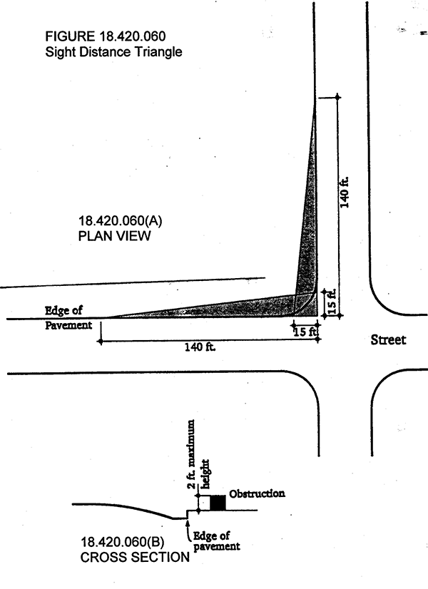 |
Effective on: 1/1/1901
18.420.070 Yard Exceptions - Rear Yards in Commercial and Industrial Districts
No rear yard shall be required in commercial or industrial districts on any lot used for business or industrial purposes, the rear line of which adjoins a railroad right-of-way or which has a rear railway track connection.
(History: Ord. ZRR-1725; ZRR-1637; ZRR-889 §18.48)
Effective on: 1/1/1901
18.420.080 Yard Exceptions - Rear Yards Adjoining Alleys
In computing the depth of a rear yard for any building where such yard adjoins an alley, one-half of such alley may be counted as a portion of the rear yard.
(History: Ord. ZRR-1725; ZRR-1637; ZRR-889 §18.48)
Effective on: 1/1/1901
18.420.090 Official Street Map - Adoption by the Governing Body
For purposes of establishing building or setback lines on existing and proposed major streets within the City, and proh ibiting any new building being located within such building or setback lines within the City, pursuant to the authority of K.S.A. 12-765, the Governing Body may adopt an ordinance establishing building or setback lines on such existing and proposed major streets or highways and to prohibit any new building being located within such building or setback lines, and, within such ordinance, to incorporate by reference the Official Street Map, including supplementary documents, which sets forth the major street plan for the City and shows, to the extent possible, the location and width of existing or proposed major streets or highways and building or setback lines. Not less than three (3) copies of the Official Street Map together with the adopting ordinance shall be on file and available for inspection in the offices of the Director of Planning and Development Services and the City Engineer and the City Clerk.
(History: Ord. ZRR-2343 §52, 2002; ZRR-1826 §1,93; ZRR-1725; ZRR-1637)
Effective on: 1/1/1901
18.420.100 Official Street Map - Filing with Register of Deeds
A certified copy of the Official Street Map and adopting ordinance shall be filed with the Register of Deeds of Johnson County.
(History: Ord. ZRR-1826 §2,93; ZRR-1725; ZRR-1637)
Effective on: 1/1/1901
18.420.110 Official Street Map - Measurement of Yard and Lot Areas
In measuring any required yard or lot area, those portions of a lot which lie in an established or proposed street right-of-way as depicted on the Official Street Map and supplementary documents shall not be counted as part of any such required yard or lot area.
(History: Ord. ZRR-1826 §3,93; ZRR-1725; ZRR-1637)
Effective on: 1/1/1901
18.420.120 Official Street Map - Building Setbacks
Notwithstanding any yard requirement, no building, parking area or other structure shall be located closer to a street right-of-way than a building setback established by the Official Street Map and supplementary documents.
(History: Ord. ZRR-1886 §1,94; ZRR-1826; ZRR-1725; ZRR-1637)
Effective on: 1/1/1901
18.420.130 Official Street Map - Modification of Building Restrictions
The Board of Zoning Appeals may modify or vary the building restrictions established by the Official Street Map in specific cases in order to avoid unwarranted hardship which constitutes a complete deprivation of use as distinguished from merely granting a privilege, provided that the intended purpose of the restrictions shall be strictly observed and the public welfare and public safety protected.
(History: Ord. ZRR-1826 §5,93; ZRR-1725; ZRR-1637)
Effective on: 1/1/1901
18.420.140 Official Street Map - Adoption of Building and Setback Lines
The building and setback lines for existing and proposed major streets and highways shall be those building and setback lines established by the applicable provisions of the Unified Development Ordinance, Overland Park Municipal Code.
(History: Ord. ZRR-1826 §6,93)
Effective on: 1/1/1901
18.430 Parking and Loading Regulations
- 18.430.010 Parking Required for All Structures
- 18.430.020 Improvement of Parking Areas
- 18.430.030 Access to Parking Lots and Parking Garages
- 18.430.040 Dimensions of Parking Areas
- 18.430.050 Accessible Parking
- 18.430.060 Head-in Parking
- 18.430.070 Setbacks
- 18.430.090 Screening
- 18.430.100 Landscaping
- 18.430.110 Deferred Construction of Parking Spaces
- 18.430.120 Paved Parking Areas for One- and Two-Family Dwellings
- 18.430.125 Maintenance of Gravel Driveways
- 18.430.130 Small Car Parking
- 18.430.140 Stacking Requirements for Drive-Thru Facilities
- 18.430.150 Required Parking
- 18.430.160 Map of Parking Rates
- 18.430.170 Authority to Adopt Shared Parking Reductions & Demand Reduction Amenities
- 18.430.180 Covenant to Maintain Private Parking Facilities
- 18.430.190 Loading Areas
- 18.430.200 Parking Waiver
- 18.430.210 Nonconforming Parking
18.430.010 Parking Required for All Structures
For all buildings or structures hereafter erected, constructed, reconstructed, moved or altered, parking in the form of garages or areas made available exclusively for parking shall be provided. Such parking spaces shall generally be located entirely on the same property as the main use with no portion other than the necessary drives extending into any street or other public way. Parking shall be provided in quantities stated below for the various zoning districts and certain occupancies which may have unusual parking needs. The issuance of building permits or certificates of occupancy shall require compliance with the minimum parking standards even though a development plan may have been approved previously which included fewer parking spaces due to the unknown or changing status of occupancy. Except as hereinafter provided, no parking of motor vehicles shall occur except on paved parking areas required by this Chapter. In commercial zoning districts, the required parking area shall not be used for motor vehicle maintenance or repair.
These provisions are intended to support the following goals:
- Limit the impacts of excessive and underutilized parking supply and increase opportunities for productive uses and open space.
- Foster economic vitality and mixed-use districts by supporting walkability and activity density with appropriate parking policies.
- Implement codes that maximize the efficient use of parking and support shared parking resources citywide.
- Develop provisions that create quality parking screening and design standards that minimize adverse impacts of the built environment.
- Manage the growth of traffic by encouraging projects and contributions that minimize driving trips.
(History: Ord. ZRR-3373 §37, 2023; Ord. ZRR-1725; ZRR-1637; ZRR-1181; ZRR-889)
Effective on: 1/1/1901
18.430.020 Improvement of Parking Areas
All parking areas and drives leading thereto shall be ready for use upon occupancy of a building and shall be surfaced with a permanent, bituminous or concrete paving meeting the standards of the City prior to the issuance of a certificate of occupancy, unless special permission is granted by the Director due to weather conditions not being satisfactory for placing asphaltic materials. Alternate all-weather, dust-free, permeable paving materials may be approved by the Director when used as a stormwater treatment facility as required under 16.210. All parking lots and drives leading thereto, except those serving one-family dwellings, shall have curbs and drainage facilities approved by the Director. In cases where raised curbs are eliminated as an integral part of a stormwater treatment facility, flat or “ribbon” curbing constructed from Portland Cement Concrete shall be utilized and alternate means of controlling vehicle movement shall be provided and approved by the Director.
(History: Ord. ZRR-3373 §38, 2023; Ord. ZRR-2675 §12, 2008; ZRR-1725; ZRR-1637; ZRR-1181; ZRR-935; ZRR-889 §18.50; ZRR-412 §28)
Effective on: 1/1/1901
18.430.030 Access to Parking Lots and Parking Garages
Ingress and egress to all parking areas shall be by means of paved access drives access meeting the requirements of the City's Design and Construction Standards Manual. See 18.43.040 for internal drive aisle dimensions.
(History: Ord. ZRR-3373 §39, 2023; Ord. ZRR-1725; ZRR-1637; ZRR-935)
Effective on: 1/1/1901
18.430.040 Dimensions of Parking Areas
-
A.Standard parking stall dimensions shall be not less than 9 feet by 18 feet, plus the necessary space for maneuvering into and out of the space. Where the end of the parking space abuts a curbed area at least 5 feet in width (with landscaping or sidewalk), an overhang may be permitted which would reduce the length of the parking space by 2 feet. Such overhang shall be measured from the face of the curb. For standard parking lots, minimum dimensions shall be as follows:
| PARKING CONFIGURATION: | |||
| 90-degree | 60-degree | 45-degree | |
| Aisle Width | |||
|
________ | 18 feet | 14 feet |
|
24 feet | 20 feet | 20 feet |
| End Parking Bay Width | |||
|
18 feet | 20 feet | 19 feet |
|
16 feet | 18 feet | 17 feet |
| Center Parking Bay Width | 18 feet | 18 feet | 16 feet |
See also Figure 18.430.040.
-
B.Minimum dimensions for a parallel parking space shall be 9 feet by 23 feet.
-
C.Minimum parking dimensions for other configurations shall be determined by the Planning Commission. For Small Car Parking, see 18.430.130.
-
D.Required aisle widths for fire lanes are subject to the requirements of the City's adopted Fire Code.
-
E.All parking design is subject to review and approval and shall meet good traffic engineering design principles.
(History: Ord. ZRR-3373 §40, 2023; Ord. ZRR-1725; ZRR-1637)
| FIGURE 18.430.040 |
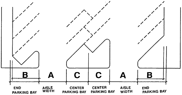 |
Effective on: 1/1/1901
18.430.050 Accessible Parking
-
A.For those buildings where such parking is required, parking areas servicing each building entrance shall have the number of level parking spaces for person(s) with disabilities set forth in the current version of the Americans with Disabilities Act Accessibility Guidelines and be identified by above-grade signs as reserved for person(s) with disabilities.
-
B.Such parking spaces shall conform with the requirements of the Building Code and applicable state law with regard to parking space dimensions and signage.
-
C.Accessible parking for the disabled shall be located to avoid the need for disabled persons to cross drive aisles. In instances where high traffic volumes along the face of a large building are expected, the Planning Commission or Governing Body may waive this requirement where the accessible parking will be located across the drive aisle or in another suitable location nearest the building entrance.
(History: Ord. ZRR-3373 §41, 2023; Ord. ZRR-2453 §1, 2003; ZRR-1725; ZRR-1637)
Effective on: 1/1/1901
18.430.060 Head-in Parking
Head-in parking from any public right-of-way shall only be permitted as specified in the City’s Design and Construction Standards Manual.
(History: Ord. ZRR-3373 §42, 2023; Ord. ZRR-2839 §1, 2010; ZRR-1725; ZRR-1637; ZRR-935)
Effective on: 1/1/1901
18.430.070 Setbacks
-
A.Parking areas in conventional zoning districts shall be set back per the following table. Except as hereinafter provided, no parking area shall be located within 6 feet of a lot line.
-
B.Parking areas in planned zoning districts shall be set back the same as that in any equivalent conventional zoning district or as noted in the table below, subject to modifications as provided in 18.150.070.
| Zoning District / Land Use | Parking Setback Requirement |
|---|---|
| A, RE, RP-OE, RP-OS, R-1, R-1A, RP-1N, R-2, MHP, and one- or two-family dwellings in any other district | 2 feet from lot line Exception from this setback if a driveway serves two properties |
| R-3, RP-4, RP-5, RP-6 | 30 feet from street right-of-way |
| Non-residential use in any residential district |
30 feet from street right-of-way |
| 25 feet from a lot line of property identified on the Future Development Plan for very-low or low-density residential development | |
| 10 feet from a lot line of property identified on the Future Development Plan for Medium-, Medium-High or High-Density residential development | |
| 6 feet from a lot line of property identified on the Future Development Plan for any other designation | |
| C-O | 15 feet from street right-of-way |
| new parking along the perimeter of a partially-developed office complex shall comply with the parking setbacks of the development plan approved prior to January 1, 2010 | |
| C-1, C-2, C-3 | 10 feet from street right-of-way |
| BP | 30 feet from street right-of-way |
| 10 feet from any peripheral property line other than a street right-of-way line or residentially zoned property | |
| 30 feet from residentially zoned property | |
| 6 feet from any internal property line | |
| M-1 | 30 feet from street right-of-way |
| M-2, PRN | 15 feet from street right-of-way |
-
C.Parking area setbacks for special uses shall be determined at the time of plan approval for the special use permit. The parking setback of the underlying zoning district or the most analogous zoning district shall be followed. Requests for reduced setbacks may be approved by the Planning Commission and Governing Body, taking into consideration the uniqueness of the facility and whether the proposed setback is compatible with:
-
1.The underlying zoning district,
-
2.The surrounding land uses, including impact on adjacent residential neighborhoods,
-
3.The use of the facility,
-
4.Similarity to setbacks allowed by right for other comparable uses in other zoning districts,
-
5.The relationship of the site to interstate highways, where applicable, and
-
6.The topography of the site.
-
(History: Ord. ZRR-3373 §43, 2023; Ord. ZRR-2848, §25, 2010; ZRR-2156, §5, 99; ZRR-1725; ZRR-1637)
Effective on: 1/1/1901
18.430.090 Screening
A parking area shall be screened in accordance with the provisions set forth in 18.450 and any applicable Design Standards.
(History: Ord. ZRR-3373 §44, 2023; Ord. ZRR-1725; ZRR-1637; ZRR-1427; ZRR-987; ZRR-889 §18.57)
Effective on: 1/1/1901
18.430.100 Landscaping
The interior of parking areas shall be landscaped in accordance with the provisions set forth in 18.450.070 and any applicable Design Standards.
(History: Ord. ZRR-3373 §45, 2023; Ord. ZRR-1725; ZRR-1637; ZRR-1427; ZRR-1217; ZRR-987; ZRR-889 §18.56)
Effective on: 1/1/1901
18.430.110 Deferred Construction of Parking Spaces
A portion of the parking area required under this title may remain unimproved until such time as the Planning Commission or Governing Body deems that it must be improved to adequately serve the parking demand.
-
A.Such delayed construction of parking may be permitted only after the Planning Commission or Governing Body is satisfied that the initial occupancy of the premises will be adequately served by the lesser number of spaces and only after approval of a final development plan clearly indicating the location, pattern and circulation to and from the deferred parking spaces.
-
B.The land area so delineated for future parking shall be brought to finished grade and landscaped, and shall not be used for building, storage, loading or other purposes.
-
C.If the construction of deferred parking exceeds the allowed parking range in 18.430.150, Demand Reduction Amenities or a waiver shall be required per 18.430.170 or 18.430.200.
(History: Ord. ZRR-3373 §46, 2023; Ord. ZRR-1725; ZRR-1637)
Effective on: 1/1/1901
18.430.120 Paved Parking Areas for One- and Two-Family Dwellings
Paved parking areas or customary driveways in the required yards abutting streets shall not exceed 35% of the area of such yards for one-family dwellings or 50% of the area of such yards for two-family dwellings, provided that any driveway may extend in a straight line directly from a garage to the street at a width equal to that of the garage, but not wider than 35 feet.
(History: Ord. ZRR-3373 §47, 2023; Ord. ZRR-2228 §1, 2000; ZRR-1925 §5, 95; ZRR-1725; ZRR-1637)
Effective on: 1/1/1901
18.430.125 Maintenance of Gravel Driveways
Where permitted, gravel driveways and parking areas shall be maintained to meet the following standards:
- A.The surface of the driveway or parking area shall consist of a uniform layer of gravel evenly distributed from edge to edge, and shall be free of bare spots and vegetation.
- B.The depth of the gravel layer shall be an average of 2 inches and a minimum of 1 inch.
- C.The material used for a gravel driveway or parking area shall be rock or crushed stone not more than 1 inch in diameter and shall not contain dirt, sticks, construction debris or other foreign material. Sand, rock powder or other similar material less than one-eighth inch in diameter is not prohibited, but shall not be included in the measurement of minimum gravel depth.
(History: Ord. ZRR-1747 §2, 92)
Effective on: 1/1/1901
18.430.130 Small Car Parking
In District CP-0, and for schools, churches and any special uses deemed by the Planning Commission and Governing Body to have low parking turnover and high user familiarity with the parking area, 30% of the required off-street parking spaces may be designated for small cars. Parking stall dimensions for small cars shall be not less than 8 feet by 16 feet, plus the necessary space for maneuvering into and out of the stall. Acceptable aisle width, layout of spaces, and overall design of the parking area shall be shown on the final development plan. A minimum of 30 parking spaces must be required before a portion of the spaces can be built to the smaller standard.
(History: Ord. ZRR-1725; ZRR-1637)
Effective on: 1/1/1901
18.430.140 Stacking Requirements for Drive-Thru Facilities
-
A.In addition to meeting the off-street parking requirements of this Section, drive-thru facilities shall meet the following stacking requirements:
| Use Type | Minimum Stacking Spaces | Measured From |
|---|---|---|
| Fast Food Restaurant | 11 | Pickup Window |
| Coffee | 16 | Pickup Window |
| Other Uses | Determined at the time of Final Development Plan |
-
-
1.One stacking space shall equal 20 feet.
-
2.All stacking shall be located in a designated drive-thru lane. Each drive-thru lane shall be clearly defined and designed to not conflict or interfere with other vehicular traffic using the site, parking spaces, or pedestrian routes.
-
3.If provided, a bypass lane shall be clearly designated and distinct from the stacking area.
-
4.Stacking amounts may be adjusted at the time of final development plan approval, based on stacking impacts to the public street system, internal parking lot circulation, access to adjacent properties or private drives and historical averages of the tenant. Additional traffic studies may be required to substantiate the need for proposed stacking. Site constraints or reuses of existing drive-thru facilities may be taken into consideration when reviewing reduced stacking.
-
(History: Ord. ZRR-3373 §48, 2023; Ord. ZRR-1725; ZRR-1637)
Effective on: 1/1/1901
18.430.150 Required Parking
-
A.Parking for the zoning districts and certain specific land uses shall be as indicated in the following table.
-
1.Where a specific use is listed below, parking shall be provided as indicated for that specific use, and the required parking for that zoning district does not have to be provided in addition to it.
-
2.See 18.430.170 for Shared Parking Reductions. Permission for such shared parking must be received as part of a preliminary or final development plan approval.
-
-
B.Where on-street parking is allowed, a maximum of 50% of the required parking may be provided on-street, subject to good traffic engineering design principles, provided the on-street spaces are located adjacent to the site. On-street parking spaces being counted towards the required parking must be identified on plans at time of submittal to the City.
-
C.When designated as Area A or Area B in the table below, parking for uses in the following districts and for the following specific uses is required within the range specified according to the Map of Parking Rates in 18.430.160.
-
1.Projects providing parking outside of these ranges must provide Demand Reduction Amenities according to 18.430.170.
-
| Zoning District / Land Use | Required Parking | |
|---|---|---|
| Area A | Area B | |
| A | 2 off-street per dwelling | |
| RE, RP-OE, RP-OS, R-1, RP-1, R-1A, RP-1A, RP-1N, R-2, RP-2 |
2 off-street per dwelling (1 must be covered)
Exception: 1 covered parking space is not required for dwellings approved as one of the City's adopted portfolio home designs |
|
| R-3, RP-3, RP-4, RP-5, RP-6, PRN | 1 to 2 spaces per unit | 1 to 2.5 spaces per unit |
| C-O, CP-O, C-1, CP-1, C-2, CP-2, C-3, CP-3, BP, M-1, MP-1, M-2, MP-2 | 1.5 to 2.5 spaces per 1,000 square feet of gross building area exclusive of restaurant uses | 2.5 to 4 spaces per 1,000 square feet of gross building area exclusive of restaurant uses |
| MXD | See the Parking Requirements section of the Mixed Use Design Standards (MUDS 7.1) | |
| DFD | See the Parking Requirements section of the Downtown Form-Based Code (DFD 703) | |
| Restaurants, clubs or drinking establishments (excluding MXD and DFD) | 6 to 12 spaces per 1,000 square feet of floor area | |
| Assembly halls, theaters, athletic fields and other seating facilities | 1 space for each 3 seats | |
| Hotels, motels, dormitories and similar boarding facilities | 1 space for each guest room plus 0.15 spaces for each employee | |
| Hospitals, nursing or convalescent homes, or congregate care facilities | 1 space for each 3 beds plus 1 space for each staff person or visiting doctor | |
| Churches and Religious Facilities (including contiguous facilities) | 1 space for each 4 seats in the main sanctuary | |
-
D.Any use not included in the parking requirements in this title shall be assigned a parking requirement by the Planning Commission or Governing Body.
-
E.Parking requirements for special uses not identified in the above table shall be determined at the time of plan approval for the special use permit. The parking requirement of the underlying zoning district or the most analogous zoning district may be considered. The Planning Commission and Governing Body may approve the requested parking after considering documentation and/or study provided by the applicant, staff’s recommendation, and giving decisive weight to all relevant facts, including but not limited to the following factors:
-
1.The underlying zoning district,
-
2.The surrounding land uses, including impact on adjacent residential neighborhoods,
-
3.Characteristics of the use, including hours of operation and peak parking demand times,
-
4.Similarity to required parking for other comparable uses in other zoning districts,
-
5.Availability and accessibility of alternative parking, and
-
6.Existing or potential shared parking arrangement.
-
(History: Ord. ZRR-3503; ZRR-3373 §49, 2023; ZRR-2156, §6, 99; ZRR-1725; ZRR-1637; ZRR-889 §18.50)
Effective on: 1/1/1901
18.430.160 Map of Parking Rates
Parking rates for zoning are reflected across two areas: Area A and Area B shown in the map below. Area A has lower parking demand due to greater density of land uses, a greater mix of land use types, an increased presence of mixed-use developments, and improved access to non-motorized transportation options. Projects with direct access to the dividing street line between Area A and Area B can use either standard.
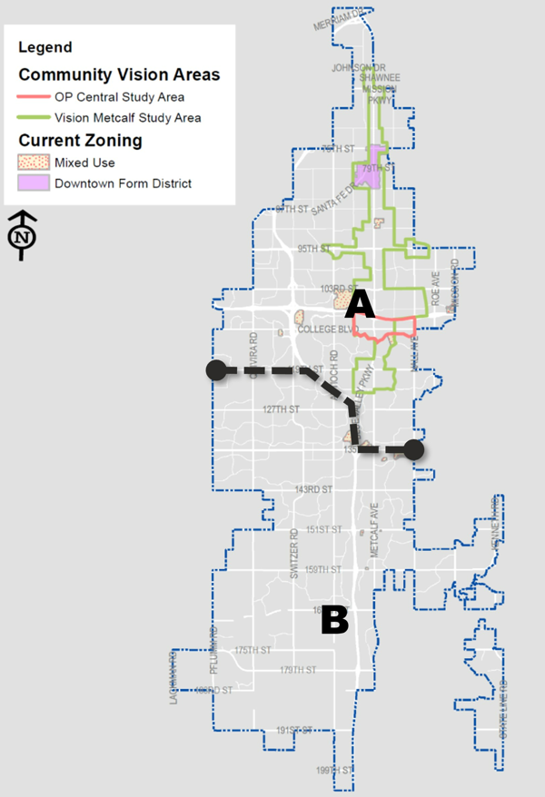
(History: Ord. ZRR-3373 §50, 2023; Ord. ZRR-1725; ZRR-1637; ZRR-889 §18.50)
Effective on: 1/1/1901
18.430.170 Authority to Adopt Shared Parking Reductions & Demand Reduction Amenities
The Shared Parking Reductions & Demand Reduction Amenities shall be adopted and amended by the Director and shall be on file in the office of the Director, and such document is hereby incorporated by reference. The Director may approve alternative or innovative practices that implement the intent of the standard and provide equivalent public benefits without significant adverse impacts on surrounding development.
-
A.Developments with more than one land use type may reduce on-site parking allotments according to the referenced Shared Parking Reduction table. A development seeking a shared parking arrangement may also cite the Shared Parking Reduction table in justifying the total on- and off-site parking provision.
-
B.Following application of the Shared Parking Reduction table, projects providing parking outside of the ranges provided in 18.430.150 must provide Demand Reduction Amenities. All proposed shared parking shall be identified by the applicant at the time of application submission.
(History: Ord. ZRR-3373 §51, 2023; Ord. ZRR-1725; ZRR-1637)
Effective on: 1/1/1901
18.430.180 Covenant to Maintain Private Parking Facilities
Prior to the issuance of a site development permit or building permit for the construction or major reconstruction of any access drive or parking area on privately-owned property in the City, the owner shall execute a Covenant to Maintain Private Parking Facility agreement and record that document with the Johnson County Register of Deeds. Provided, however, this requirement shall not apply to any drive or parking area for any federal, state, county, municipality; or public school district that is a political subdivision of the State of Kansas.
(History: Ord. ZRR-3373 §52, 2023; Ord. ZRR-3135 §1, 2016; ZRR-2839 §2, 2010)
Effective on: 1/1/1901
18.430.190 Loading Areas
Loading areas adequate to serve the uses or categories of uses proposed shall be determined at the time of site plan or preliminary development plan approval.
(History: Ord. ZRR-3373 §53, 2023)
Effective on: 1/1/1901
18.430.200 Parking Waiver
The Planning Commission or Governing Body may grant a waiver from full or partial compliance to allow amenities commensurate with the proposed improvements if it is found that the proposed amenities meet the intent of the ordinance without creating detrimental impact on surrounding properties (see 18.430.170). Consideration of the waiver is subject to review of documentation and/or study provided by the applicant, to be reviewed with staff’s recommendation and all relevant facts, including, but not limited to the following:
-
A.The characteristics of the use, including hours of operation and peak parking demand times;
-
B.Whether the proposed use is new or a small addition to an existing use;
-
C.Design and maintenance of off-street parking that will be provided;
-
D.Impact on adjacent residential neighborhoods;
-
E.Existing or potential shared parking arrangements or amenities;
-
F.Availability and accessibility of alternative parking; and
-
G.Property or ownership hardship (For example shared parking or similar agreements and requirements between adjoining property owners).
(History: Ord. ZRR-3373 §54, 2023)
Effective on: 1/1/1901
18.430.210 Nonconforming Parking
All developments approved prior to February 1, 2023 with existing or proposed parking outside of the allowed parking range shall meet the required parking or provide amenities for the parking provided outside the allowed range or shall be granted a waiver per 18.430.200.
(History: Ord. ZRR-3373 §55, 2023)
Effective on: 1/1/1901
18.435 Outdoor Lighting
18.435.010 Statement Of Intent
The purpose of these regulations is to ensure efficient exterior lighting that provides the functional needs for a development site in a manner that does not adversely affect adjacent properties, provides for fixtures that are architecturally and operationally compatible with the serviced property as well as the surrounding development and promotes safe vehicular and pedestrian access and circulation.
(History: Ord. No. ZRR-3447 §2, 2024)
Effective on: 1/1/1901
18.435.020 Applicability
These outdoor lighting regulations apply to the following:
-
A.All new outdoor lighting installations.
-
B.All replacement of existing light fixtures including:
-
1.Changes to the pole height or locations.
-
2.Changes to the lighting source type, wattage or light color/temperature.
-
(History: Ord. No. ZRR-3447 §3, 2024)
Effective on: 1/1/1901
18.435.030 Lighting Plan Requirements
-
A.For new construction, the lighting plan shall be included as part of the Final Development Plan or Site Plan approval required in 18.140.220 or 18.140.180.
-
B.For replacement lighting, the lighting plan shall be submitted with the building permit, if a building permit is required. If no building permit is required all lighting shall meet the requirements of this Chapter. The Director may approve a lighting plan that meets the requirements of this Chapter, to the maximum amount feasible.
-
C.All lighting plans shall be prepared by a certified lighting designer or professional engineer to include the following information:
-
1.North arrow and scale.
-
2.The location, size and surface of materials of all structures and parking areas.
-
3.The location, size, type and quantity of all proposed exterior fixtures and light poles.
-
4.
Cut Sheets for each light fixture with highlights on the exact model attributes.
-
5.
A point-by-point calculation using a five foot grid to show compliance with the lighting standards.
-
a.The horizontal calculations shall be measured at 5 feet above grade for lighting levels within the development site.
-
-
6.A development table containing average maintained footcandles, average to minimum, and maximum to minimum uniformity ratios.
-
7.A vertical plan footcandle calculation at 5-foot intervals at 5 feet above grade for property lines abutting residential properties.
-
8.If required by the Director, topographic information and final grading adequate to identify any unique situations that could affect parking lot lighting.
-
(History: Ord. No. ZRR-3447 §4, 2024)
Effective on: 1/1/1901
18-435.040 General Requirements and Additional Requirements
-
A.General Requirements
-
1.All light fixtures, including security lighting, must be zero uplight, per the IES Luminaire Classification System, non-adjustable type fixtures, with a mounting angle not exceeding 90 degrees.
-
2.All lighting shall be shielded or aimed in a manner as to not direct light onto neighboring properties.
-
3.House side shields shall be provided on all perimeter parking lot lighting within 100 feet of any neighboring single-family residential property line.
-
4.The maximum maintained vertical footcandles at the property line of a residentially zoned property shall be 0.5 footcandles measured at 5 feet above grade at 5-foot intervals.
-
5.Any light or combination of lights that cast light on a public street shall not exceed 1 footcandle (meter reading) as measured from the centerline of the street.
-
6.The Light Loss Factor for design calculations of LED lights is 0.91.
-
7.All lighting must comply with the City’s currently adopted Energy Conservation Code.
-
8.Color Rendering Index (CRI) shall be a minimum of 70.
-
-
B.Additional Requirements
-
1.Searchlights and similar spot light fixtures, such as moving, flashing, chasing and strobe lights used to attract attention to a place are prohibited unless approved as a Special Event Permit (18.380).
-
2.Temporary lighting installations are subject to a Special Event Permit (18.380).
-
3.Building mounted lighting installations are subject to Architectural Design Standards ADS4.19.
-
4.Illumination for signage is subject to 18.440.050.E.
-
5.Public streets are subject to the requirements of the Overland Park Streetlight Design Manual.
-
6.Private Drives serving residential development shall provide lighting which meets the Overland Park Streetlight Design Manual.
-
7.The designer shall certify that all proposed lighting for night-time activities provides adequate illumination for the scheduled activities as recommended by the Illuminating Engineering Society of North America.
-
(History: Ord. No. ZRR-3447 §5, 2024)
Effective on: 1/1/1901
18.435.050 Development and Performance Standards
Where provided, parking lot lighting, including building and pole mounted lighting is subject to the following standards:
-
A.Residential zoning listed below and all Non-Residential Uses in a Residential District.
| RP-2(R-2) | RP-3(R-3) | RP-4(R-4) | RP-5(R-5) | RP-6(R-6) | PRN (Multi-Family Uses) |
|---|
|
Maximum light temperature |
Maximum average footcandles |
Minimum average footcandles |
Average to minimum ratio |
Maximum to minimum ratio |
|---|---|---|---|---|
| 4000K | 2.0 | 1.0 | <6:1 | <20:1 |
-
-
1.Parking lot lighting mounting heights.
-
a.Maximum height of the pole and fixture shall be no taller than 20 feet when measured from grade. Measurement shall include the pole base.
-
-
-
B.Commercial and Industrial Uses
| CP-0(C-0) | CP-1(C-1) | CP-2(C-2) | CP-3(C-3) | MXD | DFD | BP |
MP-1 (M-1) |
MP-2 (M-2) |
|---|
|
Maximum light temperature |
Maximum average footcandles |
Minimum average footcandles |
Average to minimum ratio |
Maximum to minimum ratio |
|---|---|---|---|---|
| 4000K | 3.0 | 1.0 | <6:1 | <20:1 |
-
-
1.Parking lot lighting mounting heights.
-
a.Maximum height of the pole and fixture shall be no taller than 33 feet when measured from grade. Measurement shall include the pole base.
-
-
(History: Ord. No. ZRR-3447 §6, 2024)
Effective on: 1/1/1901
18.435.060 Lighting for Pedestrian Areas
-
A.Pedestrian Walkway Lighting. Pedestrian areas, including but not limited to, sidewalks, plazas and driveways, shall be illuminated to a minimum average of 1 footcandle. Lighting of pedestrian areas may be any combination of parking lot light poles or pedestrian level lighting, including but not limited to, bollard lighting, ground-mounted lighting, or other low glare-controlled fixtures mounted on building or landscape walls.
-
B.Lighting Height. Light fixtures used exclusively for the lighting of pedestrian areas are limited to 20 feet in height.
-
C.Lighting Waiver. The Planning Commission, as part of the approval of a final development plan, may waive the requirement for lighting a pedestrian area when the pedestrian area is part of an onsite trail system.
(History: Ord. No. ZRR-3447 §7, 2024)
Effective on: 1/1/1901
18.435.070 Drive-Thru and Gas Station Canopy Lighting
-
A.Lighting shall be adequate to serve drive-thru and gas station canopy uses. The maximum average maintained footcandles under the canopy shall not exceed 35 footcandles.
-
B.Lighting temperatures may exceed 4000K so long as the fixture is fully recessed and the cover is flush with the bottom surface (ceiling) of the canopy.
-
C.Parking lot lighting calculations in 18.435.050.B may exclude the areas below the canopies which are within five feet from the exterior edge of the canopy.
(History: Ord. No. ZRR-3447 §8, 2024)
Effective on: 1/1/1901
18.435.080 Parking Garage Lighting
-
A.Parking located on the roof of a parking structure shall meet the requirements of 18.435.050.
-
B.All fixtures shall be shielded from outside view of the garage with either garage walls or full cutoff fixtures.
(History: Ord. No. ZRR-3447 §9, 2024)
Effective on: 1/1/1901
18.435.090 Auto Dealer Lighting
-
A.Lighting for automobile dealerships shall be limited to non-adjustable, vertical mount, precise cut-off fixtures with flat lenses mounted horizontally to grade. The maximum allowable height for light poles shall be 24 feet, including pole base. A lighting plan, including photometrics, shall be submitted as part of the final development plan. The permitted light levels are as follows:
|
Maximum average maintained (footcandles) |
Maximum allowable illuminance |
Average to minimum ratio (maximum) |
Maximum to minimum ratio (maximum) |
|
|---|---|---|---|---|
| Vehicle display areas | 40 fc | 50 fc | 6:1 | 20:1 |
| All other Vehicle Areas | 5 fc | N/A | 6:1 | 20:1 |
-
B.The maximum light temperature is 4000K.
-
C.House side shields shall be provided on all perimeter parking lot lighting fixtures.
(History: Ord. No. ZRR-3447 §10, 2024)
Effective on: 1/1/1901
18.435.100 Athletic Field Lighting
-
A.All athletic field lighting is subject to review and approval as part of a site plan or final development plan.
-
B.The designer shall certify that all proposed lighting for night-time activities provides adequate illumination for the scheduled activities as recommended by the most recent standards of the Illuminating Engineering Society of North America.
-
C.Lighting shall be aimed at and directed to the activity areas.
-
D.Athletic field lighting shall be turned off within two hours after the event or closure of the facility.
(History: Ord. No. ZRR-3447 §11, 2024)
Effective on: 1/1/1901
18.435.110 Nonconforming Lighting
Outdoor lighting fixtures installed prior to July 1, 2024 which do not conform to this Chapter but that conformed to previous city code requirements when installed, shall be deemed legally nonconforming and may remain until replaced.
(History: Ord. No. ZRR-3447 §12, 2024)
Effective on: 1/1/1901
18.440 Signs
- 18.440.000 Generally
- 18.440.010 Purpose and Findings
- 18.440.020 Prohibited Signs
- 18.440.030 Signs Not Requiring Permits
- 18.440.040 Permit Required
- 18.440.050 Regulations Applicable to All Signs in All Districts
- 18.440.060 Regulations Applicable to Individual Sign Types
- 18.440.070 Permanent Signs - All Districts
- 18.440.080 Permanent Signs - Agricultural and Residential Districts
- 18.440.090 Permanent Signs - Office, Commercial, and Industrial Districts
- 18.440.100 Permanent Signs - Mixed Use District
- 18.440.110 Permanent Signs - Downtown Form District
- 18.440.120 Permanent Signs - Special Use Permit
- 18.440.130 Temporary Signs
- 18.440.140 Signs on Vehicles
- 18.440.150 Deviations
- 18.440.160 Nonconforming Signs
- 18.440.170 Removal of Signs
- 18.440.180 Substitution; State and Federal Law; Severability
- 18.440.190 Penalties and Violations
- 18.440.200 Definitions
18.440.000 Generally
No signs are allowed in any district except in accordance with the provisions of this Chapter.
(History: Ord. No. ZRR-3300 §1, 2020)
Effective on: 1/1/1901
18.440.010 Purpose and Findings
The purpose of this Chapter is to create a comprehensive and balanced system to regulate signs of all types (temporary and permanent) in a manner that:
- A.Protects state and federal constitutional rights to free speech by providing ample opportunities for expression through signs, while avoiding regulatory triggers or distinctions based on content and providing clear standards for approval.
- B.Protects public health and safety by:
- 1.Minimizing visual traffic hazards, distractions and obstructions for motorists, cyclists and pedestrians, or signs causing confusion by virtue of visual similarity to traffic control signs.
- 2.Reducing hazards caused by signs overhanging or projecting over public right-of-way.
- 3.Encouraging the upgrading, updating or removal of signs that are poorly maintained, out of character with their surroundings, or do not conform to this Chapter, and preventing signs that are potentially dangerous due to structural deficiencies and disrepair.
- C.Promotes the community’s appearance, character, quality and business climate by encouraging signs that are attractive and functional for their intended purpose, and that are in scale and architectural harmony with the development site and building(s) and with surrounding buildings and developments.
- D.Enhances and protects the community’s physical appearance and property values and prevents visual clutter or potential deterioration of the community’s appearance and attractiveness that might promote blight.
- E.Implements the goals and policies of the Comprehensive Plan by establishing uniform standards and procedures to regulate the size, type, number, design, placement, illumination, timeframe and maintenance of signs.
(History: Ord. No. ZRR-3300 §2, 2020; Ord. ZRR-1725; ZRR-1637)
Effective on: 1/1/1901
18.440.020 Prohibited Signs
The following signs are prohibited unless otherwise specifically provided for in this Chapter:
- A.Off-site Commerical Signs. Exception: Billboards allowed by Special Use Permit by 18.440.120.B, off-site commercial signs allowed by 18.440.070.B, and off-site temporary signs allowed by 18.440.130.G.
- B.Attention-Attracting Devices. (Examples include, but are not limited to, pennants and streamers, searchlights, and air and gas filled balloons and figures.) Exception: If and when device is allowed by Special Event Permit by 18.380.
- C.Snipe Signs.
- D.Directly Illuminated Signs. Exception: when approved by the Planning Commission or City Council as architectural lighting for a building.
- E.Digital Display. Exception: point-of-activity, kiosk, and detached canopy signs allowed by 18.440.060 or where allowed by Special Use Permit by 18.370.020 or by Special Event Permit by 18.380.
- F.Pole Signs.
- G.Roof Signs. Exception: where allowed in 18.440.100 and 18.440.110.
- H.Signs in Right-of-way. Exception: government signs allowed by 18.440.030.A.
- I.Abandoned or Obsolete Signs.
- J.False or Misleading Statements. This Code does not excuse any person or entity from civil or criminal liability for false or misleading statements placed on a sign.
- K.Signs posing traffic, pedestrian or other hazards.
- L.Illegal signs otherwise prohibited by federal, state, or local law, including but not limited to K.S.A. 21-6401.
(History: Ord. No. ZRR-3300 §3, 2020; Ord. ZRR 2427 §3, 2003; ZRR-2187; ZRR-1725; ZRR-1637; ZRR-889 §18.52)
Effective on: 1/1/1901
18.440.030 Signs Not Requiring Permits
The following signs are allowed in any District without a permit as long as they conform with all applicable requirements of this Chapter (including, but not limited to, 18.440.050):
- A.Government Signs. Notice, traffic or warning signs erected by or pursuant to the authority of a governmental entity. (Examples include legal notices, public identification and informational signs, traffic signs, directional signs, regulatory signs, and utility warning signs.)
Note: Wall and monument signs for governmental buildings must meet the requirements for Public/Semi-Public Facilities in 18.440.070.A.
- B.Flags.
- 1.One- and Two-Family Dwellings: 2 flags and 1 flagpole per premises. Flagpole height is limited to the lesser of 25 feet or the highest point of the principal building's roof.
- 2.Nonresidential Zoning Districts and Other Residential Uses: 3 flags and 3 flagpoles per premises. Each flag shall not exceed 24 s.f. Flagpole heights are limited to 30 feet.
- C.Incidental Signs in Residential Districts. Noncommercial signs in residential zoning districts not exceeding 4 s.f. in area. (Examples include, but are not limited to, address signs, resident name, signs on mailboxes or newspaper tubes, signs for private parking or warning the public against trespassing or danger from animals; and other noncommercial signs.)
- D.Incidental Signs in Commercial Districts.
- 1.Non-illuminated signs on properties in commercial districts oriented to individuals on the property, not exceeding 4 s.f. in area or letters up to 6 inches in height. (Examples include, but are not limited to, signs that display information such as occupant names and addresses, hours of operation, parking space designations, or instructions for deliveries.)
- 2.A-frame sign located immediately outside the business entry.
- a.One sign not exceeding 6 s.f. per business.
- b.Must be portable and can only be displayed during business hours.
- c.Cannot obstruct ADA or other pedestrian accessibility requirements.
- d.Not allowed in the City right-of-way.
- E.Machine/Equipment Signs. Signs customarily located on or incorporated into machinery or equipment related to the purpose or use of the machinery or equipment, not exceeding an aggregate area of 5 s.f. (Examples include signs providing instructions for machine use, such as signs affixed to vending machines, newspaper racks, and gasoline pumps.)
- F.Window Signs.
- 1.Non-illuminated signs of a temporary nature affixed to or painted on the inside surface of a window. (See also Architectural Design Standards ADS 4.16 Glazing.)
- 2.Neon, digital displays, or other illuminated signs not exceeding 10 s.f. (e.g., 60-inch TV) in area when installed inside a building within 4 feet of a window, provided such signs are not flashing, blinking, or rotating, and meet the illumination requirements of Section 18.440.050.E and F.
- G.Construction Trailer Signs. Signs at a construction site that are painted or otherwise permanently ascribed onto construction trailers actively used on the site.
- H.Artworks. Murals or other art installations shall be reviewed as part of the building design as detailed in 18.140.220, unless otherwise approved as part of the Public Art Master Plan.
(History: Ord. No. ZRR-3300 §4, 2020; Ord. ZRR 2427 §4, 2003; ZRR-2343 §53, 2002; ZRR-1725; ZRR-1637; ZRR-889 §18.52)
Effective on: 1/1/1901
18.440.040 Permit Required
- A.Applicability. It shall be unlawful for any person to construct, alter or relocate any sign within the City without first obtaining a permit, except as otherwise provided for in this Chapter.
- B.Applications. Each sign shall require a separate application. Applications shall be filed on forms prescribed by the City and include a non-refundable permit fee (set by resolution) and the following information.
- 1.Name and contact information for the property owner and (if applicable) name, contact information and license number for sign contractor.
- 2.Street address or legal description of the property where the proposed sign will be located.
- 3.Set of plans drawn to scale indicating sign size, shape, height, location, sight distance triangle, method of illumination, colors, materials of the sign and structure, and method of attachment.
- a.Plans for all attached signs shall depict the entire facade on which the sign is to be mounted or attached.
- b.A grading plan shall be provided for development entry monument signs located along an unimproved thoroughfare.
- 4.Any other information relating to the placement, construction, design or illumination of the sign as may be required by the Director.
- C.Review.
- 1.If the application is incomplete, the Director shall provide a list of items necessary to complete the application.
- 2.For applications subject to administrative review, the Director shall approve, approve with conditions, or deny the application in writing. Completed applications subject to Planning Commission or Governing Body review shall be placed on the next available agenda.
- D.Approval Criteria. A permit shall be issued if the proposed sign conforms with all applicable provisions of this Chapter and any conditions or stipulations of any applicable rezoning, Special Use Permit, site plan or (preliminary, final or other) development plan.
- E.Repairs and Maintenance. A sign permit is not required for the repair, routine maintenance or repainting of any existing sign which is deemed conforming or allowed to continue as a nonconforming sign by 18.440.160.
- F.Appeals. In the event of an appeal where it is alleged there is error in any order, requirement, decision or determination by the Director with respect to this Chapter, the Planning Commission shall have power to hear and decide the appeal (in the place of the Board of Zoning Appeals), and may reverse or affirm, wholly or partly, or may modify the order, requirement, decision or determination, and to that end shall have all the powers of the Director, may attach appropriate conditions, and may issue or direct the issuance of a permit. (See 18.140.330)
(History: Ord. No. ZRR-3300 §5, 2020; Ord. ZRR 2427 §5, 2003; ZRR-1725; ZRR-1637)
Effective on: 1/1/1901
18.440.050 Regulations Applicable to All Signs in All Districts
-
A.Sign Area. Measured in square feet (“s.f.”) and calculated as the width multiplied by the height of a single rectangle, parallel with the ground, that contains all sign elements, including decorative embellishments, and any internally illuminated or backlit panel, fabric or similar material not approved by the Planning Commission or Governing Body as an architectural design element of the final development plan approval.
|
Sign Area
|
|
|---|---|
|
|
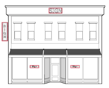 |
| Single sign area calculation | Sign area calculation for muliple signs |
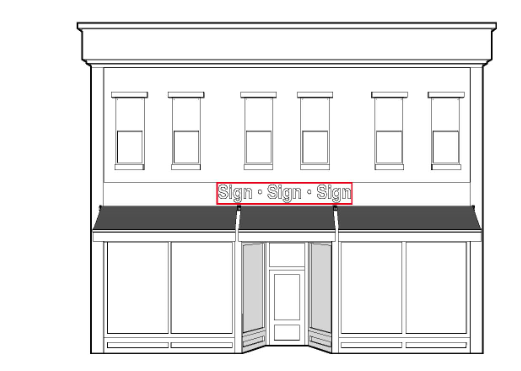
-
1.Sign area includes cabinets, background panels or colors that are part of the sign installation and not part of the building architecture or the sign support.
-
2.Only 1 side of a multi-faced sign shall be considered when determining the sign area, provided that the faces are equal in size, the interior angle formed by the faces is less than 45 degrees, and the 2 faces are not more than 18 inches apart.
-
a.Where the faces are not equal in size, but the interior angle formed by the faces is less than 45 degrees and the 2 faces are not more than 18 inches apart, the larger sign face shall be used as the basis for calculating sign area.
-
b.When the interior angle formed by the faces is greater than 45 degrees, or the faces are greater than 18 inches apart, all sides of such sign shall be considered in calculating the sign area.
-
|
Multi-Faced Sign Area
|
||
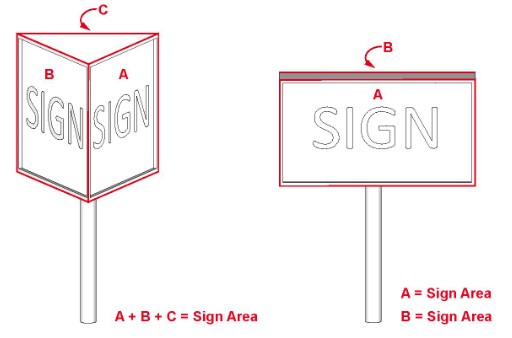 |
||
| Sign area calculation for multi-faced signs |
-
-
3.For irregularly shaped signs, sign area is calculated as the sum of 2 separate rectangles each containing a portion of the sign elements.
-
|
Sign Area - Irregularly Shaped Signs
|
||
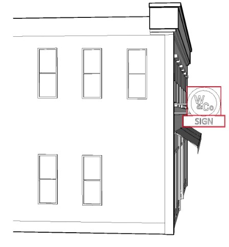 |
||
| Sign area calculation for irregularly shaped signs |
-
-
4.
For building-mounted signs allowed by this Chapter “per business”, all sign elements shall touch the facade of that particular business.
-
5.
The calculation of sign area for a single sign shall include all related sign elements on the same business facade or structure. Sign elements are related if they are all constructed in a similar manner and are located no more than 5 feet apart, horizontally or vertically. Additionally, in order to be considered a single sign, the facade on which the elements of the sign are mounted can be offset by no more than 5 feet.
-
6.
Where 2 or more signs are allowed on a facade, per the zoning district standards below, the separate sign area rectangles shall be added together to determine the total amount of sign area on that building facade.
-
-
B.Setback. No part of a freestanding permanent sign shall be located closer than 10 feet from any property line or curb line of a private drive, unless otherwise indicated.
-
C.Sign Height. Measured from the average finished grade to the highest point of the sign copy area.
-
D.Sign Support. Freestanding signs shall be securely fastened to the ground or a structure so there is virtually no danger that either the sign or the sign support may be moved by the wind or other forces of nature or cause injury to persons or property.
-
E.Illumination. Permanent signs may be illuminated via internal, indirect, and halo illumination configurations, unless otherwise indicated. Temporary signs shall not be illuminated.
-
1.Illuminated signs shall not operate at brightness levels of more than 0.3 foot-candles above ambient light conditions at the property line, as measured using a foot-candle meter. Illumination levels shall be measured in foot-candles with a meter sensor in a horizontal position at an approximate height of 3 feet above grade.
-
2.No rotating beam or flashing beacon light shall be used on any sign or sign structure.
-
3.Illuminated signs shall not blink, flash, or otherwise be used to display intermittent lighting sequences or to simulate motion.
-
4.Illuminated signs shall not be illuminated by flashing, intermittent, or moving lights, or consist of a static image projected upon a stationary object.
-
5.Except as provided in 18.440.100 and 18.440.110, the illumination source for a sign or building shall be hidden from view from any point on the ground by either an opaque or translucent material.
-
-
F.Digital Display. Where allowed, a digital display shall:
-
1.Include a sensor or other device that automatically determines the ambient illumination and is programmed to automatically dim according to ambient light conditions, or that can be adjusted to comply with the foot-candle requirement found in 18.440.050.E.
-
2.Contain static display only, and shall not have movement or the appearance or optical illusion of movement during the static display period of any part of the sign. Each static display shall not include any flashing or the varying of light intensity, and the display shall not scroll. The static display shall remain in a fixed position for at least 1 minute. An interval change time of 2 seconds or less is required. Exception: When approved by Special Use Permit by 18.440.120.C.
-
3.In the case of a malfunction, be turned off until repaired.
-
-
G.Changeable Copy. A manual changeable copy area shall be allowed in any allowed sign area.
-
H.No Hazard. No sign shall be erected such that its location, color, size, shape, nature or message creates a hazard or otherwise obstructs the view necessary for motorists, cyclists or pedestrians, or obstructs or is confused with traffic signals or other governmental signs.
-
I.Sight Triangle. Signs shall not obstruct the sight distance triangles (see 18.420.060) or otherwise interfere with the view necessary for motorists, cyclists or pedestrians to proceed safely through an intersection or to enter or exit public or private streets or driveways.
-
J.Maintenance and Appearance. All signs shall be of sound structural quality, maintained in good repair and have a clean and neat appearance. Land adjacent to signs shall be kept free from debris, weeds or trash.
-
K.Compliance. All signs and sign supports shall comply with all applicable federal, state and local laws, including the City’s building and electrical codes.
(History: Ord. No. ZRR-3300 §6, 2020; Ord. ZRR 3061 §1, 2015; ZRR 2427 §6, 2003; ZRR-1725; ZRR-1637; ZRR-889 §18.52)
Effective on: 1/1/1901
18.440.060 Regulations Applicable to Individual Sign Types
-
A.Attached Signs.
|
Attached Signs |
|||||||||||||||
|---|---|---|---|---|---|---|---|---|---|---|---|---|---|---|---|
|
Sign Type |
Number Limit | Sign Area Limit | Miscellaneous | ||||||||||||
| Wall Sign | Per zoning district | Per zoning district |
See 18.440.060.A.1 regarding Sign Design |
||||||||||||
| Painted Wall Sign | 1, in lieu of 1 wall sign | 10 s.f. | |||||||||||||
| Projecting Sign | 1, in lieu of 1 wall sign |
Per zoning district- same as wall sign area |
Cannot extend above wall surface or more than 3 feet from wall surface |
||||||||||||
| Building Entry Sign | Per zoning district | Per zoning district |
For multi-tenant buildings with an interior corridor |
||||||||||||
|
Ground Floor Tenant Wall Sign |
Per zoning district | Per zoning district |
For multi-story, multi-tenant buildings with separate ground floor tenant entries |
||||||||||||
| Under Canopy Sign |
1 per business entry, oriented toward pedestrians |
9 s.f. |
7-foot clearance required above sidewalk |
||||||||||||
| Roof Sign |
1 per building, in lieu of 1 wall sign |
Per zoning district- same as wall sign area |
Cannot extend above roofline. Structural members concealed, except for channel letter raceways |
||||||||||||
| Neon Sign |
Per zoning district, in lieu of an allowed attached sign |
Per sign area limit of attached sign type |
See 18.440.050.E regarding Illumination |
||||||||||||
| Incidential Sign | Per zoning district | Per zoning district |
See 18.440.060.A.1 regarding Sign Design |
||||||||||||
-
-
1.Sign Design
-
a.Wall Sign:
-
1.Shall have individual letters for the majority of the sign area. A cabinet sign shall provide push-through projections with at least ¾-inch relief.
-
-
-
|
Cabinet Sign - Letter Projections
|
.jpg) |
| Required letter projection for cabinet signs |
-
-
-
-
-
a.Secondary wall sign elements may be allowed as cabinet-type signs. A single rectangle drawn around all secondary sign elements shall be no more than 30% of the total wall sign area.
-
-
2.Shall not extend above the wall surface.
-
-
b.Incidential Sign:
-
1.Non-illuminated.
-
2.Wall-mounted incidental signs are not subject to the height limits specified per zoning district below.
-
3.This provision shall not apply to existing multi-tenant buildings with previously approved sign criteria for all the tenant wall signs to be printed on a uniform sign band around the bulding.
-
-
-
-
B.Detached Signs.
|
Detached Signs |
|||||||||||||||
|---|---|---|---|---|---|---|---|---|---|---|---|---|---|---|---|
|
Sign Type |
Number Limit | Sign Area Limit | Miscellaneous | ||||||||||||
| Monument Sign | Per zoning district | Per zoning district |
See 18.440.060.B.1 regarding Sign Design |
||||||||||||
| Parking Area Sign |
1 per development entry and at key parking area intersections |
4 s.f. | 5-foot height limit | ||||||||||||
| Incidental Sign | Per zoning district | Per zoning district |
See 18.440.060.B.1 regarding Sign Design |
||||||||||||
|
Internal Subdivision Monument Sign |
1 per entry to each unique internal subdivision phase |
6 s.f. | 5-foot height limit | ||||||||||||
| Kiosk |
As approved by the Planning Commission per City regulations |
20 s.f. |
10-foot height limit. Digital Display allowed. (18.440.050.F) |
||||||||||||
| Point-of-Activity Sign |
2 in conjunction with each customer interaction point |
32 s.f. |
8-foot height limit. Oriented toward the vehicle or person being served. Digital display allowed. (18.440.050.F) |
||||||||||||
|
Detached Canopy Sign (canopy 200 s.f. or less) |
1 per canopy fascia and 2 fascia maximum |
9 s.f. |
Cannot extend beyond edge of canopy fascia |
||||||||||||
|
Detached Canopy Sign (canopy over 200 s.f.) |
1 per canopy fascia and 3 fascia maximum |
Lesser of 10% of canopy fascia or 20 s.f. |
Canot extend beyond edge of canopy fascia. Digial Display allowed. (18.440.050.F) |
||||||||||||
| Light Pole Banner | Per zoning district. |
See 18.440.060.B.1 regarding Sign Design |
7-foot clearnace required. See 18.440.060.B.1 regarding Sign Design. |
||||||||||||
|
Permanent Display for Temporary Messages |
Per zoning disctrict | Per zoning district |
See 18.440.060.B.1 regarding Sign Design |
||||||||||||
-
-
1.Sign Design
-
a.Monument Sign:
-
1.
The width of the sign base shall be a minimum of one-half the width of the widest part of the sign face.
-
2.
The sign base shall consist of metal (rust and corrosion resistant) or a masonry or concrete substructure with an exterior consisting of durable masonry materials and include brick, split-face block, or natural or synthetic cementitious stone or brick. The sign base shall be composed of architectural features, forms, colors and materials consistent with the primary architectural elements and materials consistent with or used in the development or on the principal building.
-
a.
Alternative compatible, durable, materials may be approved by the Director or by the Planning Commission through the Final Development Plan approval process.
-
b.
Foam-backed products, such as EIFS or faux brick, wood, and/or other nondurable products shall not be used.
-
-
3.
The sign base may be in a designated landscape or hardscape area or must otherwise be protected from ongoing lawn maintenance. It cannot be located in a paved area, such as a parking stall.
-
4.
Shall not consist primarily of large, flat, backlit panels.
-
-
b.
Incidental Sign:
-
1.
May be single-or double-sided.
-
2.
Non-illuminated.
-
3.
If post-mounted, the posts shall be stained or painted and finished with decorative caps. The sign panel shall be mounted between the tow posts.
-
-
-
|
Incidental Sign
|
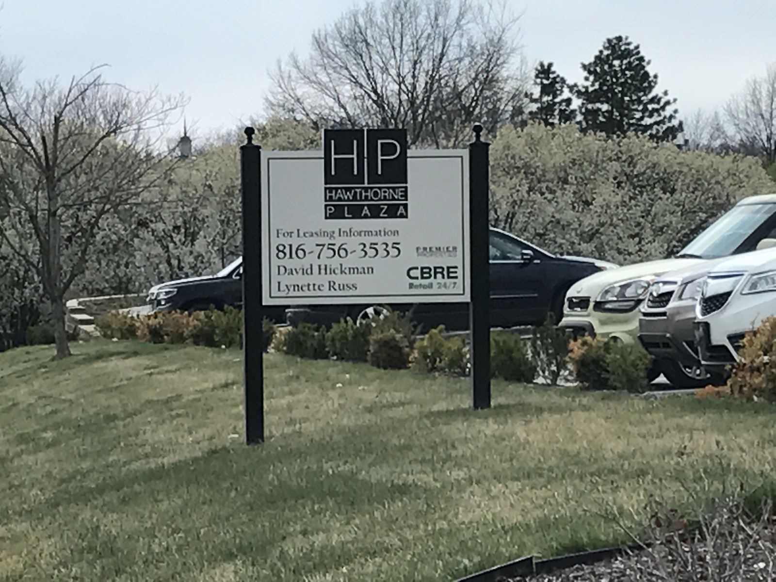 |
| Example of Incidental sign |
-
-
-
-
4.In the case of vacant land, one sign facing each street frontage shall be allowed, provided that all such signs shall meet the size, height and setback requirements listed per zoning district below, and that signs located on the same property shall be separated by at least 200 feet.
-
-
c.Light Pole Banners:
-
1.One sign permit shall be required for all of the banners in a development. A site plan shall be submitted with the permit application to identify all proposed locations.
-
2.Banners shall be periodically replaced to minimize fading, fraying, tearing, etc. A new sign permit shall not be required for replacement, unless the size, number, or locations of banners are proposed to change.
-
3.No more than two banners shall be allowed on each light pole. The sign area for a single light pole banner shall not exceed 20 s.f., with a limit of 20 s.f. per pole. Total light pole banner sign area for a site shall be calculated as 9 s.f. for every light pole.
-
-
d.Permanent Display for Temporary Messages: In conjunction with a monument sign, a permanent display for temporary messages is allowed subject to the following:
-
1.Display frame shall be removed when not in use unless installed in a permanent manner.
-
2.Frame shall be four-sided and shall not consist solely of two posts to display a banner. Provided, an alternative architectural or artistic design may be approved by the Director.
-
3.Frame shall be stained or painted.
-
-
-
|
Permanent Display for Temporary Messages
|
 |
| Example of permanent display for temporary messages |
(History: Ord. No. ZRR-3300 §7, 2020; Ord. ZRR 3061 §2, 2015; ZRR 2427 §7, 2003)
Effective on: 1/1/1901
18.440.070 Permanent Signs - All Districts
-
A.Public/Semi-Public Facilities. Churches, schools, libraries, community centers, parks or other public/semi-public facilities are allowed signs as follows:
|
Signs at Public/Semi-Public Facilities
|
|||
| Facilities<10 acres | Number Limit | Sign Area Limit | Height Limit |
|
Wall Sign (per building) |
1 per facade and 3 facades maximum |
32 s.f. | N.A. |
| Building Entry Sign | 1 per major building entry | 15 s.f | N.A. |
| Monument Sign | Up to 2, in lieu of wall signs | 32 s.f. | 5 feet1 |
|
Permanent Display for Temporary Messages |
1 per develoment frontage and 2 frontages maximum |
24 s.f. | 5 feet |
| Incidental Sign | 1 per development | 20 s.f. | 5 feet |
| Facilities>10 acres | Number Limit | Sign Area Limit | Height Limit |
|
Wall Sign (per building) |
1 per facade and 3 facades maximum |
50 s.f. | N.A. |
| Building Entry Sign | 1 per major building entry | 15 s.f. | N.A. |
| Monument Sign | Up to 2, in lieu of wall signs | 50 s.f. | 5 feet1 |
|
Permanent Display for Temporary Messages |
1 per development frontage and 2 frontages maximum |
32 s.f. | 5 feet |
| Incidental Sign | 1 per development | 20 s.f. | 5 feet |
|
Other Allowed Sign Types (See 18.440.060)
|
|||
|
Attached: Projecting, Under Canopy Detached: Parking Area, Light Pole Banners, Kiosk2 |
|||
|
Notes
|
|||
|
1For each 2-foot setback from right-of-way in excess of 10 feet, an additional foot may be added to the sign height to a maximum of 8 feet. 2For developments greater than 25 acres in area, the Planning Commission may approve kiosks internal to the development as needed to improve pedestrian or traffic circulation. |
|||
Notwithstanding the above, if a public/semi-public facility is located in an office, commercial, industrial, mixed use, or downtown form district, the facility operator has the option to use the sign provisions set forth in 18.440.090 or 18.440.100 in lieu of the above requirements.
-
B.Signs at Sports Venues. The Planning Commission shall approve signs at a sports venue in conjunction with an allowed non-residential use in a residential district or special use permit for a sports or recreation facility with an outdoor competitive athletic field. (For example, softball or soccer fields.)
-
1.Signs on scoreboards and fencing may be included in the proposed sign package for an outdoor athletic field; provided that a site plan indicates the location and approximate height of all potential signs, and signs are located to not be readily viewed from surrounding streets or adjacent properties (such as on the inside surface of the perimeter fencing around an athletic field). Such signs may include off-site signs.
-
2.Illumination
-
a.Fencing signs shall not be illuminated.
-
b.Scoreboard signs may only be illuminated when the scoreboard is in use and shall be turned off within two hours after the event or closure of the sports venue.
-
1.Digital Display. For scoreboard signs with digital display, the restrictions in 18.440.050.F shall apply, with the allowance for display movement.
-
-
-
3.For sports venues where scoreboard signs with digital display are utilized, fencing signs may be restricted or prohibited as a condition of approval.
-
(History: Ord. No. ZRR-3470; Ord. No. ZRR-3300 §8, 2020; Ord. ZRR-2773 §1, 2008; ZRR-2427 §8, 2003; ZRR-2203 §1, 2000; ZRR-1725; ZRR-1637; ZRR-889 §18.52)
Effective on: 1/1/1901
18.440.080 Permanent Signs - Agricultural and Residential Districts
-
A.
Applicability. This section applies to the Agricultural and Residential Districts. Provided, any condition of a rezoning, or RP or PRN planned district approval supersedes this section to the extent of any inconsistency.
-
B.
Dimensional Standards.
|
Signs for Agricultural and Residential Districts
|
|||
| Sign Type | Number Limit | Sign Area Limit | Height Limit |
|
Wall |
1, in lieu of monument sign |
50 s.f. | N.A. |
| Monument Sign |
1 per each side of entry to subdivision or multi-family development1 |
50 s.f | 5 feet2 |
| Incidental Sign |
1 per multi-family development |
20 s.f. | 5 feet |
|
Other Allowed Sign Types (See 18.440.060)
|
|||
|
Attached: Projecting Detached: Parking Area; Internal Subdivision Monument |
|||
|
Notes
|
|||
|
1One monument sign may also be allowed on private property adjacent to the intersection of 2 thoroughfares, 2 collectors, or any combination thereof. 2Overall sign structure height is limited to the height for accessory structures in that zoning district. |
|||
(History: Ord. No. ZRR-3300 §9, 2020; Ord. ZRR-2698 §16, 2007; ZRR-2427 §9, 2003; ZRR-2254 §1, 2000; ZRR-1725; ZRR-1637; ZRR-889 §18.52)
Effective on: 1/1/1901
18.440.090 Permanent Signs - Office, Commercial, and Industrial Districts
-
A.Applicability. This section applies to the Office, Commercial, and Industrial Districts, but does not include MXD or DFD. Provided, any condition of a rezoning, or CP or MP planned district approval supersedes this section to the extent of any inconsistency.
-
B.Districts C-O and CP-O.
-
1.Dimensional Standards.
-
|
C-0 and CP-O
|
|||
| Sign Type | Number Limit | Sign Area Limit | Height Limit |
|
Wall Sign (Per building) |
2 per facade and 3 facades maximum |
5% of facade area | N.A. |
| Monument Sign |
1 per building, in lieu of wall signs on 1 facade |
50 s.f. | 5 feet1 |
|
Permanent Display for Temporary Messages |
1 per development | 32 s.f. | 5 feet |
| Incidental Sign | 1 per building | 20 s.f. | 5 feet |
|
Alternative Signage for Multi-Story Multi-Tenant Buildings (See diagram below)
|
|||
|
Wall Sign (per building, upper portion of exterior wall) |
1 per facade and 3 facades maximum |
5% of facade area | N.A. |
|
Ground Floor Tenant Wall Sign |
1 per exterior facade and 3 facades maxiumum |
5% of facade area | N.A. |
|
Building Entry Sign (non-illumintated) |
1 per major building engry |
9 s.f. | N.A. |
|
Monument Sign |
1 per building, in lieu of wall signs on 1 facade |
50 s.f. | 5 feet1 |
|
Permanent Display for Temporary Messages |
1 per development | 32 s.f. | 5 feet |
| Incidental Sign | 1 per building | 20 s.f. | 5 feet |
|
Signage for Single-Story Multi-Tenant Buildings
|
|||
|
Wall Sign (per business) |
1 per exterior facade and 3 facades maximum |
5% of facade area | N.A. |
|
Building Entry Sign (non-illuminated) |
1 per major building entry |
9 s.f. | N.A. |
| Monument Sign | 1 per building | 50 s.f. | 5 feet1 |
|
Permanent Display for Temporary Messages |
1 per development | 32 s.f. | 5 feet |
| Incidental Sign | 1 per building | 20 s.f. | 5 feet |
| Other Allowed Sign Types (See 18.440.060) | |||
|
Attached: Under Canopy Detached: Parking Area, Point-of-Activity |
|||
| Notes | |||
| 1For each additional 2-foot setback from the right-of-way or private street curb line over 10 feet, 1 additional foot may be added to the height of the sign, to a maximum of 10 feet. | |||
|
Diagram of Alternative Signage for Multi-Story Multi-Tenant Buildings
|
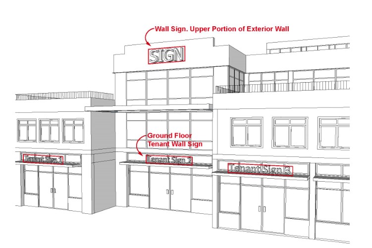 |
| Option for signs allowed on a multi-story, multi-tenant building |
-
C.Districts C-1 and CP-1
-
1.Dimensional Standards.
-
|
C-1 and CP-1
|
|||
| Sign Type |
Number Limit |
Sign Area Limit | Height Limit |
|
Wall Sign (per business) |
3 per facade and 3 facades maximum1 |
5% of facade areas | N.A. |
| Monument Sign2 |
1, in lieu of wall signs on 1 facade |
50 s.f. | 5 feet3 |
|
Permanent Display for Temporary Messages |
1 per development | 32 s.f. | 5 Feet |
| Incidental Sign | 1 per building | 20 s.f. | 5 feet |
|
Signage for Multi-Story, Multi-Tenant Buildings (See diagram in 18.440.090.B)
|
|||
|
Wall Sign (per building, upper portion of exterior wall) |
1 per facade and 3 facades maximum |
5% of facade area | N.A. |
|
Ground Floor Tenant Wall Sign |
3 per exterior facade and 3 facades maximum |
5% of facade area | N.A. |
|
Building Entry Sign (non-illuminated) |
1 per major building entry |
9 s.f. | N.A |
| Monument Sign2 |
1, in lieu of 1 wall sign (upper portion) |
50 s.f. | 5 feet3 |
|
Permanent Display for Temporary Messages |
1 per development | 32 s.f. | 5 feet |
| Incidental Sign | 1 per building | 20 s.f. | 5 feet |
|
Other Allowed Sign types (See 18.440.060)
|
|||
|
Attached: Painted Wall, Projecting, Upper Canopy Detached: Parking Area, Point-of-Activity |
|||
|
Notes
|
|||
|
1For a subtenant, 1 additional exterior wall sign may be allowed, provided the total area for all signs on the same facade does not exceed the allowable signage area. 2For a single-use building planned, developed and managed independently of any shopping center. See subsections E and F below for shopping center monument signs. 3For each additional 2-foot setback from the right-of-way or private street curb line over 10 feet, 1 additional foot may be added to the height of the sign, to a maximum of 10 feet. |
|||
-
D.Districts C-2, CP-2, C-3, CP-3, and Industrial Districts
-
1.Dimensional Standards.
-
|
C-2, CP-2, C-3, CP-3, and Industrial Districts
|
|||
| Sign Type | Number Limit | Sign Area Limit | Height Limit |
|
Wall Sign (per business) |
3 per facade and 3 facades maximum1 |
10% of facade area | N.A. |
| Monument Sign2 |
1, in lieu of wall signs on 1 facade |
50 s.f. | 10 feet3 |
|
Permanent Display for Temporary Messages |
1 per street frontage | 32 s.f. | 5 feet |
| Incidental Sign | 1 per building | 20 s.f. | 5 feet |
|
Signage for Multi-Story, Multi-Tenant Buildings (See diagram in 18.440.090.B)
|
|||
|
Wall Sign (per building, upper portion of exterior wall) |
1 per facade and 3 facades maximum |
10% of facade area | N.A. |
|
Ground Floor Tenant Wall Sign |
3 per exterior facade and 3 facades maximum |
10% of facade area | N.A. |
|
Building Entry Sign (non-illuminated) |
1 per major building entry |
9 s.f. | N.A. |
| Monument Sign2 |
1, in lieu of 1 wall sign (upper portion) |
50 s.f. | 10 feet3 |
|
Permanent Display for Temporary Messages |
1 per development | 32 s.f. | 5 feet |
| Incidental Sign | 1 per building | 20 s.f. | 5 feet |
|
Other Allowed Sign types (See 18.440.060)
|
|||
|
Attached: Painted Wall, Projecting, Upper Canopy Detached: Parking Area, Point-of Activity, Detached Canopy
|
|||
|
Notes
|
|||
|
1For a subtenant, 1 additional exterior wall sign may be allowed, provided the total area for all signs on the same facade does not exceed the allowable signage area. 2For a single-use building planned, developed and managed independently of any shopping center. See subsections E and F below for shopping center monument signs. 3For each additional 1-foot setback from the right-of-way, 1 additional foot may be added to the height of the sign to a maximum of 20 feet. |
|||
-
E.Development Entry Monument Signs. Developments in office, commercial, and industrial districts may have development entry monument signs as permitted below. An attached sign may be substituted in lieu of a monument sign.
-
1.Dimensional Standards.
-
|
Development Entry Monument Signs - Office, Commercial, and Industrial Districts
|
|||
|
Development Size (building area) |
Number Limit | Sign Area Limit | Height Limit |
| <150,000 s.f. | 1 | 50 s.f. | 10 feet |
| 150,000-399,999 s.f. | 1 | 100 s.f. | 20 feet |
| >400,000 s.f. |
2, no more than 1 per street frontage |
100 s.f. | 20 feet |
-
F.Highway Monument Signs. Developments in office, commercial, and industrial districts with 200 feet or more of highway frontage along I-35, I-435, I-635, and U.S. 69 Highway shall be allowed on-site monument signs along the highway frontage, subject to the following standards:
-
1.Dimensional Standards.
-
|
Highway Monument Signs - Office, Commercial, and Industrial Districts1
|
|||
|
Development Size (building area) |
Number Limit | Sign Area Limit | Height Limit2 |
| 150,000 - 399,999 s.f. | 1 | 300 s.f. |
30 feet (sign area), 35 feet (overall structure) |
| >400,000 s.f. |
2 (min 500' separation) |
300 s.f. |
30 feet (sign area), 35 feet (overall structure) |
|
Notes
|
|||
|
1Sign shall be vertically-oriented if over 10 feet in height. 2Measured from center line height of nearest through traffic lane. If the sign is located more than 15 feet above the center line, the maximum height is 10 feet.
|
|||
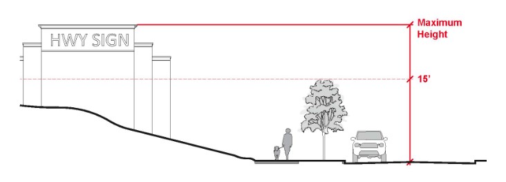
-
-
2.Landscaping. Landscaping, such as flowering trees, shrubs, and bushes, shall be provided around the base of the highway monument sign.
-
3.Digital Display. A Special Use Permit for a digital display on a highway monument sign may be approved as set forth in 18.440.120.C.
-
-
G.
Expanded Sign Package. Developments in office and commercial districts containing multiple buildings with separate tenants may apply to the Planning Commission for an expanded sign package to allow a design theme to be integrated throughout the development in exchange for sign designs that are exceptional in their creativity, materials and implementation. To qualify, the following applies:
-
1.
All signs must have a unified design theme based on exceptional design creativity, architectural harmony, and use of attractive and durable materials, without creating an environment of visual clutter or garish commercialism.
-
a.
Primary signs must be integrated with enhanced site amenities such as landscaping, water features, lighting or public spaces.
-
b.
The Planning Commission may stipulate specific design or maintenance standards.
-
-
2.
Dimensional Standards.
-
|
Expanded Sign Package - Office, Commercial, and Industrial Districts
|
|||
| Sign Type | Number Limit | Sign Area Limit | Height Limit |
|
Development Wall Sign |
1 | 10% of facade area | N.A. |
|
Development Entry Monument Sign |
1 per development entry |
50 s.f. | 10 feet |
| Design Element | repeated | 9 s.f. | N.A |
|
Other Allowed Sign Types (See 18.440.060)
|
|||
| Detached: Light Pole Banners, Kiosk | |||
(History: Ord. No. ZRR-3300 §10, 2020; Ord. ZRR-3164 §5, 2017; ZRR-2683 §2, 2008; ZRR-2491 §4, 2004; ZRR-2475 §1, 2004; ZRR-2427 §10, 2003; ZRR-2343 §54, 2002; ZRR-2160 §3, 99; ZRR-2061 §1, 97; ZRR-1881 §11, 94; ZRR-1725; ZRR-1698; ZRR-1637; ZRR-960; ZRR-889 §18.52)
Effective on: 1/1/1901
18.440.100 Permanent Signs - Mixed Use District
-
A.Applicability. This section applies to the MXD, Planned Mixed Use District. A sign package is required to be approved by the Planning Commission as part of a final development plan application.
-
B.Dimensional Standards.
|
MXD Signs
|
|||
| Sign Type | Number Limit | Sign Area Limit | Height Limit |
|
Wall Sign (per business) |
3 per facade and 3 facades maximum |
10% of facade area | N.A. |
| Monument Sign1 |
1 per development entry |
50 s.f. | 10 feet |
| Design Element | repeated | 9 s.f. | N.A. |
|
Permanent Display for Temporary Messages |
1 per street frontage | 32 s.f. | 5 feet2 |
| Incidental Sign | 1 per building | 20 s.f. | 5 feet 2 |
|
Signage for Multi-Story, Multi-Tenant Buildings (See diagram in 18.440.090.B)
|
|||
|
Wall Sign (per building, upper portion of exterior wall) |
1 per facade and 3 facades maximum |
10% of facade area | N.A. |
|
Ground Floor Tenant Wall Sign |
3 per exterior facade and 3 facades maximum |
10% of facade area | N.A. |
|
Building Entry Sign (non-illuminated) |
1 per major building entry |
9 s.f. | N.A. |
| Monument Sign1 |
1 per development entry |
50 s.f. | 10 feet |
| Design Element | repeated | 9 s.f. | N.A. |
|
Permanent Display for Temporary Messages |
1 per street frontage | 32 s.f. | 5 feet2 |
| Incidental Sign | 1 per building | 20 s.f. | 5 feet2 |
|
Other Allowed Sign Types (See 18.440.060)
|
|||
|
Attached: Painted Wall, Projecting, Under Canopy, Roof, Neon Detached: Parking Area, Point-of-Activity, Light Pole Banners, Kiosk, Detached Canopy
|
|||
|
Notes
|
|||
|
1An attached sign may be substituted in lieu of a monument sign when compatible with the architectural design of the development. 2If wall-mounted, no height limit shall apply. |
|||
-
C.Parking Garages. Adjacent to each entry to a parking garage, an additional wall sign, not to exceed 40 s.f., and a projecting sign, not to exceed 9 s.f., shall be allowed.
-
1.If a parking garage totally obscures a facade where a wall sign would have otherwise been allowed to be located, the Planning Commission may grant an exception to allow the wall sign to be mounted on the parking garage if:
-
a.The business occupies a space of at least 20,000 s.f. in area.
-
b.The wall sign is mounted on the same garage facade as the business facade that is obscured. (For example, if the east facade is obscured, the wall sign shall be mounted on the east facade of the garage.)
-
c.Only one wall sign is allowed per facade on the garage.
-
d.The wall sign is limited to 10% of the area of the lesser of the obscured facade or the garage facade.
-
-
-
D.Highway Monument Sign. Mixed use developments with 200 feet or more of highway frontage along I-35, I-435, I-635, and U.S. 69 Highway shall be allowed on-site monument signs along the highway frontage, subject to the standards in 18.440.090.F.
(History: Ord. No. ZRR-3300 §11, 2020; Ord. ZRR-2947 §1, 2012)
Effective on: 1/1/1901
18.440.110 Permanent Signs - Downtown Form District
-
A.Applicability. This section applies to the DFD, Downtown Form District.
-
B.Dimensional Standards - Detached and Townhouse/Small Apartment Frontages.
|
Signs for Detached and Townhouse/Small Apartment Frontages
|
|||
| Sign Type | Number Limit | Sign Area Limit | Height Limit |
| Wall Sign |
1 per street-facing facade for townhouse/ small apartment |
50 s.f. | N.A. |
| Incidental Sign |
1 per townhouse/small apartment developlment |
20 s.f. | 5 feet |
| Other Allowed Sign Types (See 18.440.060) | |||
|
Attached: Projecting Detached: Parking Area
|
|||
-
C.Dimensional Standards - General Urban and Workshop Frontages.
|
Signs for General Urban and Workshop Frontages
|
|||
| Sign Type | Number Limit | Sign Area Limit | Height Limit |
|
Wall Sign (per business) |
3 per facade and 3 facades maximum |
10% of facade area | N.A. |
| Monument Sign1 |
1 per development, in lieu of wall signs on 1 facade- on Metcalf frontage only |
50 s.f. | 5 feet |
| Design Element | repeated | 9 s.f. | N.A. |
|
Permanent Display for Temporary Messages |
1 per street frontage | 32 s.f. | 5 feet2 |
| Incidental Sign | 1 per building | 20 s.f. | 5 feet2 |
|
Signage for Multi-Story, Multi-Tenant Buildings (See diagram in 18.440.090.B)
|
|||
|
Wall Sign (per building, upper portion of exterior wall) |
1 per facade and 3 facades maximum |
10% of facade area | N.A. |
|
Ground Floor Tenant Wall Sign |
3 per exterior facade and 3 facades maximum |
10% of facade area | N.A. |
|
Building Entry Sign (non-illuminated) |
1 per major building entry | 9 s.f. | N.A. |
| Monument Sign1 |
1 per building, in lieu of 1 wall sign (upper portion) - on Metcalf frontage only |
50 s.f. | 5 feet |
| Design Element | repeated | 9 s.f. | N.A. |
|
Permanent Display for Temporary Messages |
1 per street frontage | 32 s.f. | 5 feet2 |
| Incidental Sign | 1 per building | 20 s.f. | 5 feet2 |
|
Other Allowed Sign Types (See 18.440.060)
|
|||
|
Attached: Painted Wall, Projecting, Under Canopy, Roof, Neon Detached: Parking Area, Point-of-Activity, Light Pole Banners, Kiosk, Detached Canopy
|
|||
|
Notes
|
|||
|
1An attached sign may be substituted in lieu of a monument sign. 2If wall-mounted, no height limit shall apply. |
|||
-
D.Parking Garages. Adjacent to each entry to a parking garage, an additional wall sign, not to exceed 40 s.f., and a projecting sign, not to exceed 9 s.f., shall be allowed.
-
1.If a parking garage totally obscures a facade where a wall sign would have otherwise been allowed to be located, the Planning Commission may grant an exception to allow the wall sign to be mounted on the parking garage if:
-
a.The business occupies a space of at least 20,000 s.f. in area.
-
b.The wall sign shall be mounted on the same garage facade as the facade that is obscured. (For example, if the east business facade is obscured, the wall sign shall be mounted on the east facade of the garage.)
-
c.Only one wall sign is allowed per facade on the garage.
-
d.The wall sign is limited to 10% of the area of the lesser of the obscured facade or the garage facade.
-
-
(History: Ord. No. ZRR-3300 §12, 2020; Ord. ZRR-1725; ZRR-1637; ZRR-889 §18.52)
Effective on: 1/1/1901
18.440.120 Permanent Signs - Special Use Permit
- A.Signs Accessory to a Special Use. Signs proposed on property with a use approved under a Special Use Permit (see 18.370) shall follow the sign regulations of the underlying zoning district or the most analogous zoning district. Requests for increased size or number of signs may be approved by the Planning Commission, taking into consideration the uniqueness of the facility and whether the proposed signs are compatible with:
- 1.The underlying zoning district,
- 2.The surrounding land uses,
- 3.The use of the facility,
- 4.Similarity to signs allowed by right for other comparable uses in other zoning districts,
- 5.The height of the building,
- 6.The relationship of the site to interstate highways, where applicable, and
- 7.The topography of the site.
- 8.The application for final development plan approval shall include detailed drawings, maps and text that clearly delineate the various types of signs being proposed and the locations where each type of sign may be installed. For each type of sign, the application shall include the maximum sign size, sign construction details, colors, fonts, and mounting method.
- B.Billboards. Upon the recommendation of the Planning Commission, the Governing Body may approve a Special Use Permit for a Billboard if all applicable conditions of this Chapter and 18.370 are met.
- 1.Size. Billboards are limited to 672 s.f. in area.
- 2.District. Billboards may be located on property zoned M-1 (Industrial Park) or M-2 (General Industrial) with frontage on I-35, I-435 or I-635.
- 3.Prohibited Locations. No Billboard shall be located within the following areas, whichever is more restrictive:
- a.Within 400 feet of the property line of any residentially-zoned property, park, playground, school, hospital or church. The measurements shall be made as a 400-foot linear measurement along the street frontage on which the Billboard is located.
- b.Within 200 feet of the property line of any residentially-zoned property, park, playground, school, hospital or church. The measurements shall be made as a 200-foot radial distance 360 degrees around the location of the proposed Billboard.
- c.A Billboard located within a parking lot shall not cause a reduction in the number of required parking spaces, or interfere with normal circulation patterns.
- 4.Spacing. Billboards shall maintain a minimum spacing of 1,200 feet from existing Billboards along interstate or adjacent frontage road rights-of-way. The 1,200-foot spacing dimension shall be measured along the side of the roadway where the sign is proposed regardless of the direction from which the sign may be viewed.
- 5.Height. Billboard height shall not exceed 30 feet above the right-of-way grade from which it is viewed. If the proposed Billboard location grade is higher than the adjacent right-of-way grade, the Governing Body may require the overall height of the Billboard to be lowered.
- 6.Lighting. Billboards shall be indirectly illuminated or non-illuminated and comply with all applicable City building codes and applicable lighting standards of this Chapter.
- 7.Roof or Wall Mounting Prohibited. No Billboard shall be allowed to be mounted, attached or affixed to a building rooftop or the walls of any building.
- 8.Yards and Setbacks. Billboards shall maintain the setback necessary for the pole and overall structure to be located on and over private property.
- 9.Maintenance. In addition to the maintenance requirements of this Chapter, the area around any Billboard and its sign support shall be kept clear of debris, and all scrub brush, tall grass and weeds shall be cleared away to a distance of a 10-foot radius from the Billboard and sign support. Landscaping approved as part of the Special Use Permit shall be maintained and replaced, as necessary.
- 10.Double-faced Billboards. No more than 1 double-faced Billboard shall be allowed per pole and/or location.
- 11.Time Limits. No Special Use Permit for a Billboard shall be granted for more than 5 years, with a 60-day time limit for removal in the event the permit is not renewed.
- C.Digital Display. Upon the recommendation of the Planning Commission, the Governing Body may approve a Special Use Permit for a Digital Display if all applicable conditions of this Chapter and 18.370 are met.
- 1.Highway Monument Sign with Digital Display
- a.Location. Digital display on a highway monument sign meeting the requirements of 18.440.090.F may be located on property:
- 1.Zoned CP-2 or CP-3
- a.Requires a minimum of 400,000 s.f. of floor area in the development
- 2.Zoned MXD
- a.Limited to a Mixed-Use Center or Mixed-Use Neighborhood development
- 3.Approved in conjunction with an indefinite Special Use Permit for a special use designated under 18.370.020 when such special use is:
- a.Intended for facilities for gatherings of large assemblies of people;
- b.Not for facilities for residential occupancy or for overnight guests; and
- c.Requires a minimum of 20 acres and 100,000 s.f. of floor area.
- b.Spacing. Highway monument signs with digital displays shall maintain a minimum spacing of 1,000 feet from existing digital displays along interstate rights-of-way. Such measurements shall be made as a 1,000-foot radial distance 360 degrees around the location of the proposed digital display.
- c.Setbacks. Highway monument signs with digital display shall meet the setback requirements found in 18.440.050.B.
- d.Appearance. Highway monument signs with digital display shall meet the requirements found in 18.440.050.E and F related to illumination and digital display.
- e.Hold Times and Transitions. Highway monument signs with digital display shall meet the digital display requirements found in 18.440.050.F.2. For developments with more than one digital display, the transitions shall be coordinated to occur simultaneously on every display.
- f.Concurrency. No permit for the installation of a digital display on a highway monument sign shall be issued until the construction of the main use has commenced.
- 2.Building-Mounted Digital Display
- a.Location. Digital display mounted on a building may be located on property with 200 feet or more of highway frontage along I-35, I-435, I-635, and U.S. 69 Highway in the following locations:
- 1.Zoned CP-O
- a.Requires a minimum of 400,000 s.f. of floor area in the development
- b.Requires a minimum 4-story building
- 2.Approved in conjunction with an indefinite Special Use Permit for a special use designated under 18.370.020 when such special use is:
- a.Intended for facilities for gatherings of large assemblies of people;
- b.Not for facilities for residential occupancy or for overnight guests; and
- c.Requires a minimum of 20 acres and 100,000 s.f. of floor area.
- b.Setbacks. A digital display mounted on a building shall be setback a minimum of 200 feet from highway right-of-way.
- c.Size. The digital display mounted on a building shall not exceed 10 percent of the total area of the facade upon which it is placed.
- d.Appearance. The digital display shall be attached directly to and made integral with architectural elements on the facade of the building to highlight or accentuate elements of the architectural design.
- e.Illumination. A digital display mounted on a building shall meet the requirements found in 18.440.050.F.1, as measured at the special use permit boundary.
- f.Display Movement. The speed of the digital display shall not exceed 5 feet per second. The display shall slowly move, shift, stream, scroll, or otherwise incorporate gentle motion as a smooth, rolling movement across or within the display area. Movement shall be appropriate to the scale and imagery, and shall not include flashing, blinking, strobing, quick cuts or fast motion.
- g.The brightness, movement or refresh rate of the display shall not create a public nuisance or hazard (pursuant to 7.04 or K.S.A. 12-1617e and each may be amended from time to time) that impacts highway traffic or any nearby residential properties.
(History: Ord. No. ZRR-3300 §13, 2020; Ord. ZRR-2698 §17, 2007; ZRR-2427 §11, 2003; ZRR-2343 §55, 2002; ZRR-1725; ZRR-1637; ZRR-960; ZRR-959; ZRR-889 §18.52)
Effective on: 1/1/1901
18.440.130 Temporary Signs
-
A.Generally.
-
1.Non-illuminated temporary signs may be placed on private property without a permit, subject to the regulations set forth in this and any other applicable provisions of this Chapter.
-
2.In addition to the prohibitions set forth in 18.440.020, temporary signs shall not be placed or otherwise affixed to, or located on, any right-of-way, park or other public property, unless it is placed by or with the permission of the City.
-
3.Temporary signs are the responsibility of the property owner or person in control of the property where the sign is located. Provided, however, temporary signs relating to an identifiable entity, group or individual shall be presumed to also be the responsibility of said entity, group or individual.
-
-
B.Temporary Signs - Residential Districts. This section applies to Residential Districts and to Detached and Townhouse/Small Apartment Frontages in the DFD, Downtown Form District.
|
Temporary Signs - Residential1
|
||||
| Sign Type | Number Limit | Sign Area Limit | Height Limit | Time Limit2 |
|
Single-Family or Two-Family Residential
|
||||
| Stake Sign | Up to 3 per lot |
9 s.f. for a single sign, or 3 s.f. each for multiple signs, not to exceed 9 total s.f. for all stake signs |
6 feet | 60 days |
|
Multi-Family Residential
|
||||
| Stake Sign |
Up to 3 per development |
9 s.f. for single sign, or 3 s.f. each for muliple signs, not to exceed 9 total s.f. for all stake signs |
6 feet | 60 days |
|
Banner - Ground- Mounted |
3 per development in lieu of stake sign(s) |
24 s.f. | 5 feet | 30 days |
|
Banner - Wall - Mounted |
1 per development | 24 s.f. | N.A. | 30 days |
|
Notes
|
||||
|
1For requests to exceed these allowances, or for temporary sign types not listed, a Special Event Permit is required per 18.380. 230 days between display periods (beginning with the first sign or banner). |
||||
-
C.Temporary Signs - Commercial, Industrial and Agricultural Districts; Non-residential Uses in Residential Districts. This section applies to: Commercial, Industrial and Agricultural Districts; General Urban and Workshop Frontages in the DFD, Downtown Form District; and non-residential uses in residential districts.
|
Temporary Signs - Commercial, Industrial and Agricultural1
|
||||
| Sign Type | Number Limit | Sign Area Limit | Height Limit | Time Limit2 |
| Stake Sign |
3 per lot or development |
32 total s.f. for all stake signs |
6 feet | 60 days |
|
Banner - Ground - Mounted |
3 per development, in lieu of stake sign(s) |
32 s.f. | 5 feet | 30 days |
|
Banner - Wall - Mounted |
1 per business/entity | 32 s.f. | N.A. | 30 days |
| Feather Sign |
3 per development, in lieu of stake sign(s) or ground-mounted banner(s) |
32 s.f. | 12 feet | 15 days |
|
Notes
|
||||
|
1For requests to exceed these allowances, or for temporary sign types not listed, a Special Event Permit is required per 18.380. For A-frame signs, see 18.440.030. For light pole banners and temporary banners in a permanent frame, see 18.440.060. 230 days between display periods (beginning with the first sign or banner). |
||||
-
D.Vacant Land. On undeveloped land that is vacant and unplatted, regardless of the zoning, the property owner has the option to install temporary signs that meet the requirements for Temporary Signs - Commercial, Industrial and Agricultural.
-
E.Construction Activities. In addition to any other allowed sign, additional temporary signs are allowed at a construction site with an active land disturbance, site development, or building permit. The signs shall not be erected until a permit is issued for the construction and shall be removed from the site as soon as a temporary or final certificate of occupancy or certificate of compliance is issued for the last building in each phase of the development.
|
Signs During Construction Activities1
|
|||
| Sign Type | Number Limit2 | Sign Area Limit | Height Limit |
| Free-standing3 |
3 total (any combination of sign type) |
32 s.f./maximum of 2 sign faces |
8 feet |
| Wall-mounted | 32 s.f. | N.A. | |
| Fence-mounted4 | 32 s.f. |
8 feet, not to exceed height of fence4 |
|
|
Printed on construction site fence screening material4 |
25% of fence dimensions |
8 feet, not to exceed height of fence |
|
|
Developments Involving a Single-Family or Two-Family Residence
|
|||
| Free-standing3 | 1 per lot | 9 s.f. | 6 feet |
|
Notes
|
|||
|
1For temporary sign requests to exceed these allowances, or for temporary sign types not listed, a Special Event Permit is required per 18.380. 2Where an independent construction project is taking place concurrently within a larger development project (e.g., a pad site building within a larger shopping center), an additional sign is allowed on the site. 3Free-standing signs shall be setback 10 feet from any property line. 4Signs are not allowed on construction fencing in right-of-way. If fencing blocks temporary signs on private property, the Director may approve a height limit increase to allow visibility over the fencing. |
|||
-
F.Property for Sale or Rent. When a property is actively listed for sale or rent, 1 additional temporary sign is allowed, subject to the dimensional standards in subsections B and C above for a single stake sign. This provision shall also apply to a structure being used as a temporary residential real estate sales office. This provision does not apply to properties in office, commercial, and multi-family districts with on-going leasing opportunities - see 18.440.080 through 18.440.110 for permanent sign options.
-
G.Additional Temporary Sign in Residential Districts. In addition to the temporary sign allowances set forth in Subsection B and C above, one additional temporary sign is allowed on corner lots in residential districts subject to the following requirements:
-
1.Sign area shall not exceed 3 s.f. per face with a maximum of 2 faces per sign;
-
2.Sign height shall not exceed 4 feet; and
-
3.Signs allowed by this provision are limited to a period of time each week starting on Fridays at 6 a.m. and ending on the following Sunday at 9 p.m.
-
-
H.Temporary Digital Display. A Special Event Permit is required, per 18.380.060.
-
I.Emergencies. During a natural or man-made disaster or other public emergency declared by the governor or appropriate county official, the City Manager is authorized to temporarily suspend enforcement of the requirements of this subsection with respect to temporary signs. The City Manager may also suspend in enforcement, in whole or in part, of the temporary signs allowed by district, number of temporary signs, temporary sign size or type of temporary sign to the extent needed to allow for effective communication during the disaster or public emergency.
(History: Ord. No. ZRR-3300 §14, 2020; Ord. ZRR-2683 §3, 2008; ZRR-2427 §12, 2003; ZRR-1725; ZRR-1637; ZRR-960; ZRR-959; ZRR-889 §18.52)
Effective on: 1/1/1901
18.440.140 Signs on Vehicles
- A.Vehicle signs do not require a sign permit, but must comply with the provisions of this Section.
- B.No vehicle (including trailers or other non-motorized wheeled vehicles carrying signage) shall be parked so that it functions primarily as a sign. Factors to determine whether a vehicle is being used primarily as a sign include, but are not limited to the following:
- 1.Is the vehicle parked at a prominent location?
- 2.Can the sign be easily read by people driving by the sign?
- 3.Is the vehicle parked at the same or similar locations for several hours during the same day or for several days during the same week?
- 4.Are there any stated or apparent reasons, other than signage purposes, that justify the vehicle being at that location?
While other factors may also establish a violation, a vehicle presumptively violates this provision if the first three questions are affirmative and there is no compelling answer to the fourth question to justify the parking location as opposed to some less conspicuous location.
- C.No vehicle (including trailers or other non-motorized wheeled vehicles carrying signage) shall traverse the right-of-way carrying or otherwise displaying signs for the primary purpose of advertising (e.g., a movable billboard).
- D.Vehicles (including trailers) used as part of the normal function of a business or organization are allowed to have incidental signs subject to the following limitations:
- 1.Signs must be painted or professionally wrapped directly on the body of the vehicle or securely mounted on the body of the vehicle. Roof-mounted signs are also allowed provided they do not exceed 3 s.f. in area per face.
- 2.Signs cannot be mounted on a framework: (1) attached to a vehicle, (2) in the bed of a truck, or (3) on an object carried by the vehicle. Signs cannot extend above the roof of a vehicle except as allowed by Subsection D.1 above.
- 3.Paper signs, electronic message signs, fabric signs, changeable copy signs or signs with a scrolling mechanism to change messages are not allowed.
- 4.When a vehicle is parked at or near the site of the business or organization, it shall be parked at least 75 feet from any right-of-way classified as a highway, thoroughfare, super-collector or collector. Provided, however, if there are no areas to park outside of that setback, no such vehicle shall park within a distance from the right-of-way equal to half of the distance from the main entry to the business or organization and the nearest right-of-way line.
- 5.Where the restrictions of Subsection 4 create clear practical difficulties regarding the availability of appropriate parking spaces or the functional requirements of the business, the Director may authorize an alternate parking location that is reasonably inconspicuous and lessens the practical difficulties. This Subsection shall not apply where the vehicle is:
- a.Temporarily parked at a loading dock;
- b.Substantially hidden from view from any public street by buildings, fences, mature landscaping or similar objects such that the vehicle does not attract attention to the business or organization; or
- c.A trailer at the site of an active construction project.
- 6.In a residential zoning district, the vehicle shall not be parked on a street curb or unenclosed driveway unless the vehicle is legally parked at the residence of the driver or is making a delivery or service call. (See also commercial vehicle regulations in Title 7.)
(History:Ord. No. ZRR-3300 §15, 2020; Ord. ZRR-2343 §56, 2002; ZRR-1725; ZRR-1637)
Effective on: 1/1/1901
18.440.150 Deviations
The Planning Commission may grant a deviation to this Chapter with regard to the size, color, location, illumination, and number of signs, based upon unique architectural treatments, special development conditions, or specific hardship. The consideration of a proposed deviation shall review (in a content-neutral manner) whether the proposed deviation:
- A.Complies with the general purpose and intent of this Chapter.
- B.Adversely affects neighboring property owners or residents, and whether it is consistent or compatible with the image and aesthetics of the area as a whole.
- C.Adversely affects the public health, safety, or welfare, including but not limited to, traffic on adjacent streets. For monument signs, a safe sight-distance setback is required, and the sign location must not encroach upon potential future right-of-way needs. The proposed deviation should not significantly distract traffic on adjacent streets.
- D.Significantly clutters or negatively impacts the visual landscape of the area. This review should take into account the addition of all existing or potential future signs in the surrounding area.
- E.Is intended to account for topography, landscaping, existing buildings or unusual building designs that would otherwise substantially block or impair the visibility of the proposed sign. While visibility of a sign is not guaranteed from all directions, a deviation may be appropriate to provide reasonable visibility of a business entity's main sign.
- F.Has any lighting that will disturb residents of nearby residential properties or adversely affects traffic on adjacent streets.
- G.Is of high quality and is compatible and integrates aesthetically with the daytime/nighttime color, lighting, signs and architecture of the development and adjacent buildings. Wall signs may include unique copy design including painting of walls or integration into canopies/awnings, shapes, materials, lighting and other design features compatible with the architecture of the development of the surrounding area. Deviations should be of a unique, high quality design, which accentuates the architecture of the building(s) served, versus functioning solely to draw attention to itself.
(History: Ord. No. ZRR-3300 §16, 2020; Ord. ZRR-3061 §3, 2015; ZRR-2794 §1, 2009; ZRR-2187 §2, 99; ZRR-2134 §4, 98; ZRR-1725; ZRR-1661; ZRR-1637; PS-914, 77; Res 779-A, 72; Res 779, 72)
Effective on: 1/1/1901
18.440.160 Nonconforming Signs
- A.A nonconforming sign legally existing upon the adoption of the ordinance from which this Chapter is derived may remain if: it undergoes no changes in the basic structure, source of illumination, location or appearance, or any maintenance or repair costing more than 50% of the sign's current value. If the current business closes or the current occupant relocates, the sign shall at such time be removed or otherwise brought into proper compliance with this Chapter or other City code.
- B.If any existing nonconforming sign, as provided for in this section, is damaged by any means, including, but not limited to, fire, flood, wind, explosion, act of God, or act of a public enemy, to an extent of 50% or more of the replacement, restoration or reconstruction value of the sign, or 50% of the square footage of the sign copy area, said sign shall not be replaced, restored or reconstructed unless it is brought into full compliance with the provisions of this Chapter or other City code. Any nonconforming sign which remains damaged or disrepaired, regardless of the percentage of construction (or damage) value or area of square footage which is damaged, for a period of 3 months following the date of damage without the issuance of a valid sign permit, shall not be replaced, restored or reconstructed unless it is brought into full compliance with all applicable codes and ordinances.
Exception: Notwithstanding the preceding paragraph, the Director may authorize an exception for a legal nonconforming sign that was previously authorized in conjunction with a development approval to be located in the right-of-way to be replaced with a sign of the same or smaller footprint and size in the event: (i) the sign was properly maintained prior to the damage; (ii) the replacement does not cause or continue a traffic, pedestrian or other hazard or nuisance; (iii) there is no other location outside of the right-of-way for a similar sized sign; and (iv) the developer/homes or business association has or agrees to a right-of-way use agreement with the City.
- C.Notwithstanding the setback requirement of 18.440.050 B, monument signs with a setback less than 10 feet or otherwise lawfully approved prior to January 1, 2021, may remain in their current location unless creating a traffic sight-line or other hazard.
- D.Incidental signs existing on the effective date of this ordinance which do not conform to the design requirements of 18.440.060.B.1.b, shall be removed by January 1, 2022.
(History: Ord. No. ZRR-3300 §17, 2020; Ord. ZRR-1725; ZRR-1637; ZRR-889 §18.52)
Effective on: 1/1/1901
18.440.170 Removal of Signs
- A.Determination of Obsolete Sign on Vacated Premises. If a building, structure or premise is vacated for 6 months or more, permanent signs located thereon shall be deemed obsolete. The property owner shall remove such obsolete sign and restore the building facade or related ground surface to its original condition. In the case of a monument that otherwise conforms with the requirements of this Chapter, the property owner may alternatively remove all lighting fixtures and structural members, or alternatively, arrange for an opaque surface to cover the fixtures and members.
- B.Removal of Signs on Private Property. If the Director determines a sign is prohibited, obsolete, unsafe, unsecure, a menace to the public, or otherwise constructed or maintained in violation of this Chapter, a written notice of violation shall be given to the property owner stating that the sign must be removed or brought into compliance. If the sign is not timely removed or brought into compliance (10 days for a temporary sign; 30 days for a permanent sign), the City may remove the sign and assess the costs to the property owner, and any applicable permit shall be revoked. No further sign permit shall be issued for the property until such costs have been paid. (The notice of violation shall follow the nuisance enforcement and appeal process set forth in 7.04.190; the removal and assessment shall follow the nuisance abatement process set forth in 7.04.200.)
- C.Immediate Removal of Signs.
- 1.City Removal. The City may immediately remove without notice any sign that is:
- a.In the right-of-way or on publicly owned land without City authorization; or
- b.An immediate peril to persons or property.
In such event, the City may assess the removal costs using the assessment process set forth in 7.04.200.
- 2.Property Owner Removal. A property owner may remove unauthorized signs placed by others on the owner’s private property without notice or compensation to the sign owner.
(History: Ord. No. ZRR-3300 §18, 2020)
Effective on: 1/1/1901
18.440.180 Substitution; State and Federal Law; Severability
- A.Substitution of Speech. This Chapter is intended to regulate signs in a manner consistent with the speech freedoms of both the United States and Kansas Constitutions. This Chapter regulates only the sign location, structure and copy design and not sign content. No provision of this Chapter shall be construed to regulate or restrict sign content or message. Any sign authorized in this Chapter may include noncommercial copy in lieu of any other copy.
- B.State and Federal Law. As the City is subordinate to the laws of the federal government and the state of Kansas, this Chapter does not prohibit signs, sign locations, or sign characteristics authorized by an express requirement of state or federal law.
- C.Severability. The sections, subsections sentences and phrases of this Chapter are hereby declared to be severable; and if any section, subsection, sentence or phrase is declared unconstitutional or otherwise invalid by any court of competent jurisdiction, such unconstitutionality or invalidity shall not affect any of the remaining sections, subsections, sentences or phrases of this Chapter.
(History: Ord. No. ZRR-3300 §19, 2020)
Effective on: 1/1/1901
18.440.190 Penalties and Violations
- A.It shall be unlawful for any person to construct or maintain any sign that does not comply with this Chapter. Any person who violates any provision of this Chapter is guilty of a public offense and upon conviction shall be punished as provided in 18.100.110.
- B.As appropriate, this penalty provision may be applied to the person or entity placing the sign, the business or entity advertised in the sign, or the property owner or vehicle owner on which the sign is placed.
- C.Prosecution of any offender under this Section shall not limit the City’s right to pursue abatement, assessment or collection of costs as set forth in 18.440.170 or by other laws.
- D.Each day that any violation of this Chapter continues shall constitute a separate offense.
- E.The City may further enforce this Chapter by filing an action in the appropriate court for an injunction to enforce the provisions of this Chapter; to cause correction of any such violation; for assessment and recovery of a civil penalty for such violation; or to pursue any other appropriate civil remedy.
(History: Ord. No. ZRR-3300 §20, 2020)
Effective on: 1/1/1901
18.440.200 Definitions
For the purposes of this Chapter, these words and phrases shall have the following meaning:
A-frame sign. A portable sign that is in the shape of an "A" with back to back sign faces, an easel, or a similar configuration.
Artworks. Works of art or integral decorative or architectural features of buildings that do not have moving parts or moving lights. “Works of art” means drawings, pictures, symbols, paintings (including the painting of patterns or designs) or sculptures.
Attached sign. A sign installed on a building.
Attention-attracting device. Any device with flashing, blinking, rotating or moving action or the appearance thereof, or any searchlight, costumed person or balloons designed or intended to attract the attention of the public to an establishment or the device. Provided, this shall not include an approved digital display.
Banner. A temporary, generally flexible sign constructed of plastic or vinyl.
Billboard. A freestanding sign or sign structure upon which copy is placed on a poster or panel and and mounted on a pole or structure, typically as follows: (1) posts or pole supports with secondary support (A-frame) and a single display panel, (2) multi-mast structure constructed with poles, I-beam or equivalent as primary support and a single display panel, or (3) monopole structure constructed with support, framing and a single display panel with a foundation.
Building entry sign. A sign located next to the entry of a building, for instance, in the case of a multi-tenant building with one entry and central corridor, where tenants do not have individual exterior entries. (Examples include, but are not limited to, a listing of tenants, directions to tenant spaces, etc.)
Business. Typically a commercial or industrial entity, a public or private organization or agency, a not-for-profit entity, or a similar organizational entity operating independent of other such businesses on the same site. Provided, for the purposes of this Chapter a “business” will include any tenant or occupant of an office, commercial or industrial development. A business is considered independent of other businesses on the same site if it: (1) has its own exterior entry that leads directly to its own interior space that is physically defined and can be physically separated from the interior space of any other business; (2) has its own employees that are scheduled and supervised separately from any adjacent business; (3) has separate cash registers or payment systems for any merchandise that is sold or service that is rendered; and (4) has separate storage, processing or fabrication areas from any adjacent business.
Changeable copy. A sign where the text message is changed by hand, or in a non-mechanized manner.
Design element. A theme established throughout the development on buildings, parking structures, light pole banners, monument signs, etc. (Examples include, but are not limited to, a logo, development initials, other emblem, etc.)
Detached sign. Any sign located on the ground or on a structure located on the ground and not attached to a building.
Detached canopy sign. A sign installed on a canopy structure that is detached from the building.
Development entry monument sign. A sign located at the entry to a subdivision or development.
Digital display. Any sign, graphic display, or portion thereof, where the content or graphic display is designed to be changeable or moveable by electronic, electro-mechanical or optical means. A television used for the purpose of signage is considered to be a digital display.
Directly illuminated sign. Any sign where the source of illumination of the sign, such as, but not limited to, an incandescent bulb, neon tube or fluorescent tube, is visible to a person standing on the ground.
Facade. The area directly adjacent to a particular business’ tenant space or building floor area. “Facade” or “business facade” includes parapet walls, canopies, towers or similar building features that are directly adjacent to and clearly associated with the business’ tenant space or building floor area, but does not include any facade area adjacent to and clearly associated with another business or with a vacant tenant space or building floor area. No part of a building may be counted as part of more than one business facade. Where a business utilizes more than one building or structure, or occupies a building with multiple building surfaces or planes, the “facade” shall be equal to all of the building surfaces that are oriented in the same direction or within 45 degrees of the same direction.
Feather sign. A banner in the shape of a feather, quill, sail, blade or teardrop, and mounted on a solid or flexible pole or cord. These are sometimes referred to as “quill signs” or “sail banners.”
Ground floor tenant wall sign. A wall sign located on the ground floor of a multi-story building occupied by a tenant or occupant having a facade and an exterior door leading directly to its occupied space.
Halo illumination. A source of illumination entirely within an individual letter, cabinet or structure which makes the sign visible at night by means of lighting the background upon which the individual letters are mounted. The letters are typically opaque, and thus are silhouetted against the background. The source of illumination is not visible. Also called “internal indirect” or “reverse channel” lighting.
Incidental sign. A sign in addition to the primary sign for the property that has a purpose secondary to the allowed use of the property. (Examples include, but are not limited to, leasing information, directional information, etc.)
Indirectly illuminated / indirect illumination. Partial or complete illumination of a sign at any time by a light source which is shielded as to not be visible at eye level.
Internal subdivision monument sign. Monument sign located internal to a subdivision. (Examples include, but are not limited to, entry markers to various phases of the subdivision, etc.)
Internally illuminated / internal illumination (or “backlighted”). A sign which is illuminated from a light source located inside or behind the sign face and where light is transmitted through a translucent material that is part of the sign face or surface surrounding the sign face.
Kiosk. A freestanding pedestrian-oriented structure upon which messages are posted.
|
Kiosk
|
 |
| Example of a Kiosk |
Light pole banner. Fabric banner mounted on a light pole that is periodically replaced.
Monument sign. A detached sign where the width of the base of the sign is a minimum of one-half the width of the widest part of the sign face.
Neon sign. A directly illuminated sign or display which is a free-formed surface or tubular shape that creates words, numerals, figures, devices, designs, trademarks or logos, and for which the light source is luminescent gas.
Nonconforming sign. A sign that, on the effective date of this Chapter, does not conform to one or more of the regulations set forth in this Chapter.
Obsolete sign. A sign for a business, product, service or activity which is no longer conducted or available on the premises.
Off-site commercial sign. A sign with commercial content that refers to a for-profit business, organization, product, activity or service that is not located or available on the premises where the sign is located. “Off-site commercial sign” includes, but is not limited to, signs affixed or painted onto structures such as benches and shelters, and freestanding signs commonly referred to as Billboards.
Off-site sign. A sign where the information provided is not specific to the property on which it is located. (Examples include, but are not limited to, real estate pointer signs referring to residential properties other than the property where the sign is located, etc.)
Painted wall sign. Any sign painted directly upon a wall surface.
Parking area sign. Sign within parking lots and internal circulation areas at a building site entry, at key intersections within the site and at each drive-through facility entry.
Permanent display for temporary messages. A permanent frame or display where a development may install temporary signs or messages within the designated area of the permanent frame or display without requiring a Special Event Permit or being subject to the sign area, height, or time limits of 18.440.130.
Point-of-activity sign. A sign directed to the person at the location where an activity or transaction occurs, whether freestanding or on a menu board, product dispenser, etc. (Examples include, but are not limited to, menu boards, gas pumps, ATMs, etc.)
Pole sign. A detached sign with one or more vertical sign supports that does not meet the definition of a “monument sign.”
Portable sign. A sign that is designed to be readily movable from location to location either by being carried or by being towed or pulled. (Examples include, but are not limited to, A-frame and movable billboard signs.)
Projecting sign. Any sign extending more than one foot from the face of the building to which it is attached.
Roof sign. A sign located upon the roof of the building and having the roof as a principal means of sign support. No roof sign allowed by this Chapter shall extend above the roofline. See 18.440.100 and 18.440.110. Signs mounted on the upper edge of an awning or canopy are not considered roof signs.
|
Roof Sign
|
|
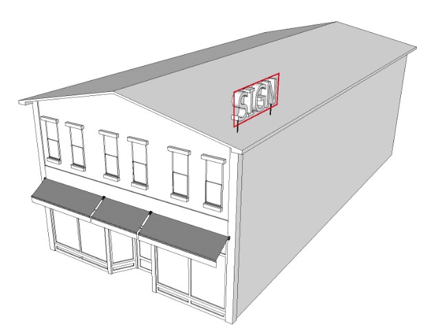 |
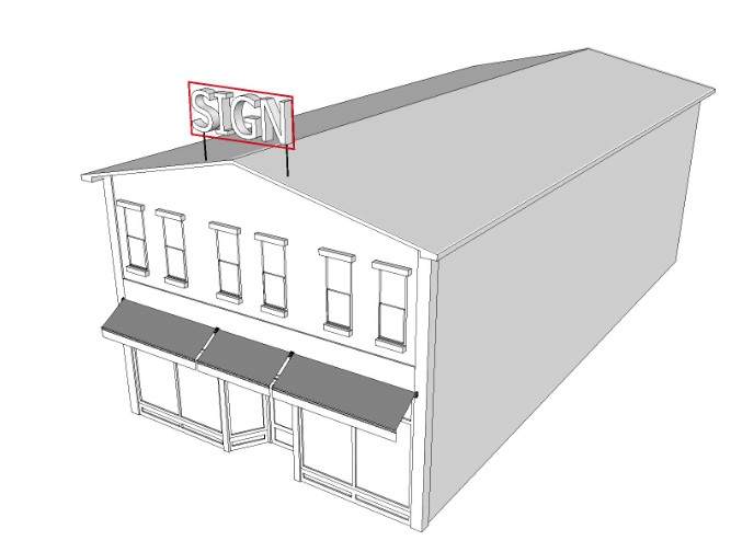 |
| Good example of a roof sign | Bad example of a roof sign |
Sign. Any surface or object which is used to display or which is fabricated to create words, numerals, figures, devices, designs, trademarks or logos, and which is sufficiently visible to persons located outside of any building to attract the attention of such persons or to communicate information to them. “Sign” includes sign supports.
Sign area. See 18.440.050.
Sign face. The surface of a sign that is separated from the front of any other sign face on the same sign structure by an exterior angle of at least 270 degrees.
Sign maintenance. The normal care and minor repair that is necessary to retain a safe, attractive and finished structure, frame, pole, brackets or surface.
Sign support. The supporting members of the sign such as frame poles, brackets or structures by which a sign is mounted on or affixed to a building or the ground.
Snipe sign. Any temporary sign which is attached to a fence, window, tree, shrub, utility pole, benches, street lights, portable stand or temporary structure, or any sign which is not securely fastened to a building or firmly anchored to the ground. Snipe sign does not include A-frame signs authorized by 18.440.030.D.2 or temporary signs authorized by 18.440.130.
Stake sign. A temporary, rigid sign constructed of plastic, vinyl, metal, or wood.
Subtenant. An establishment which leases space and conducts business or activities within another establishment (primary tenant) but does not have an exterior facade and a dedicated entry leading directly to the subtenant space. The subtenant's business is a separate legal entity from the primary tenant's business, as opposed to a department, division or subsidiary of the primary tenant's business. Entities within an enclosed shopping mall or activities that are conducted primarily by automated machines are not considered subtenants.
Temporary sign. A sign constructed of durable and/or non-durable materials, such as cloth, canvas, cardboard, paper, fabric, wood, metal or plastic, with or without a structural frame, displayed for a limited period of time. This includes but is not limited to banners, feather signs, and stake signs. This definition does not authorize temporary signs that are prohibited by 18.440.020. (Examples of temporary signs are as follows, provided that these examples are intended to assist in interpreting this code and not to restrict the content of signs: political signs, public demonstrations, grand opening signs, contractor signs, real estate signs, and signs that announce an event such as a carnival, circus, or similar event.)
Under canopy sign. A sign mounted under a building canopy.
Wall sign. Any sign attached to and erected parallel to and within 1 foot of the face or wall of a building, including signs painted on or projected on the walls of buildings. “Wall sign” includes signs attached to or printed on canopies, awnings, mansard roofs or similar near-vertical elements of a building facade, but which are not part of the building roof. Near-vertical shall refer to a pitch exceeding 1:3 (1 foot horizontal and 3 feet vertical).
Window sign. A sign installed on the interior of a window so that it is visible outside the building.
(History: Ord. No. ZRR-3300 §21, 2020)
Effective on: 1/1/1901
18.450 Landscaping and Screening
- 18.450.010 Statement of Intent
- 18.450.020 Interpretation of Landscaping Terms
- 18.450.030 General Requirements
- 18.450.040 Landscaping Plan Required
- 18.450.050 Minimum Tree Requirements
- 18.450.060 Minimum Planting Requirements
- 18.450.070 Planting Requirements within Parking and Vehicular Use Areas
- 18.450.080 Time Landscaping Required to Be in Place
- 18.450.090 Maintenance of Landscaping
- 18.450.100 Screening Requirements
18.450.010 Statement of Intent
The intent of this Chapter is as follows: to provide greenery to visually soften paved areas and buildings; to establish optimum environmental conditions by providing shade, air purification, oxygen regeneration, groundwater recharge, retardation of stormwater runoff, and abatement of noise, glare and heat; to ensure the replenishment of the local stock of native trees by utilizing plant materials that are generally native or hearty to the region; to preserve existing trees; to screen certain unsightly equipment or materials from the view of persons on public streets or adjoining properties; and to buffer uncomplimentary land uses and generally enhance the quality and appearance of developed properties within the City.
(History: Ord. ZRR-2848 §26, 2010; ZRR-1725; ZRR-1637; ZRR-987 §2; ZRR-889 §18.56)
Effective on: 1/1/1901
18.450.020 Interpretation of Landscaping Terms
Where necessary in order to interpret the precise meaning of technical landscaping terms utilized in this Chapter or elsewhere in this Ordinance, reference shall be had to The American Standard For Nursery Stock, as published by the American Association of Nurserymen.
(History: Ord. ZRR-2848 §27, 2010; ZRR-1725; ZRR-1637; ZRR-987 §3; ZRR-889 §18.56)
Effective on: 1/1/1901
18.450.030 General Requirements
All land areas which are to be unpaved or not covered by buildings shall be brought to finished grade and planted with turf or native grass or other appropriate ground cover. In addition to the minimum number of trees required to be planted by this Chapter, an appropriate number or amount of shrubs, ground cover and/or turf area plantings shall be included within each project, to be determined by the design criteria for the project relating to visual safety, species and landscape function.
(History: Ord. ZRR-2848 §28, 2010; ZRR-1725; ZRR-1637; ZRR-987 §1; ZRR-889 §18.56)
Effective on: 1/1/1901
18.450.040 Landscaping Plan Required
All plans submitted in support of a final development plan, site plan, building permit or site development permit, except for any residential use in Districts RE, R-1, RP-1, R-1A, RP-1A and R-2, shall include a landscaping plan signed by a registered landscape architect. Property located within District A, Agriculture, is excluded from this requirement. All landscaping plans shall include the following information:
- A.North point and scale.
- B.Topographic information and final grading adequate to identify and properly specify planting for areas needing slope protection.
- C.The location, size and surface of materials of all structures and parking areas.
- D.The location, size and type of all above-ground and underground utilities and structures with proper notation, where appropriate, as to any safety hazards to avoid during installation of landscaping.
- E.The location, size, type and quantity of all proposed landscaping materials, along with common and botanical names of all plant species. The size, grading and condition shall be specified according to American Association of Nurserymen Standards.
- F.The location, size and common name of all existing plant materials to be retained on the site.
- G.Mature sizes of plant materials shall be drawn to scale and called out on the plan by a common name or appropriate key.
- H.Location of hose connections and other watering sources.
- I.The location of all trees, 12-inch caliper or larger, measured at 4-1/2 feet above ground level, that are proposed for removal.
- J.All screening required by this Chapter.
(History: Ord. ZRR-2420 §24, 2003; ZRR-1795 §1, 93; ZRR-1637; ZRR-889 §18.56)
Effective on: 1/1/1901
18.450.050 Minimum Tree Requirements
- A.In District R-1 and RP-1, one tree per 40 feet of public or private street frontage, or portion thereof, shall be required within the right-of-way of all streets, accessways, and roadways, excluding thoroughfares, alley, and service drives. Street trees shall be spaced a minimum of fifteen (15) feet and a maximum of forty (40) feet for the full length of all streets and roadways. Where not allowed within a thoroughfare right-of-way, street trees shall be planted on the private lots along the thoroughfare right-of-way.
- B.In District R-2 and RP-2, one tree per 40 feet of public or private street frontage, or portion thereof, shall be required within the right-of-way of all streets, accessways, and roadways, excluding thoroughfares, alley, and service drives. Street trees shall be spaced a minimum of fifteen (15) feet and a maximum of forty (40) feet for the full length of all streets and roadways. Where not allowed within a thoroughfare right-of-way, street trees shall be planted on the private lots along the thoroughfare right-of-way. In addition to the trees required based upon street frontage, additional trees shall be required at a ratio of .75 tree for every dwelling unit.
- C.In Districts R-3 and RP-3, one tree per 40 feet of public or private street frontage, or portion thereof, shall be required within the right-of-way of all streets, accessways, and roadways, excluding thoroughfares, alley, and service drives. Street trees shall be spaced a minimum of fifteen (15) feet and a maximum of forty (40) feet for the full length of all streets and roadways. Where not allowed within a thoroughfare right-of-way, street trees shall be planted on the private lots along the thoroughfare right-of-way. In addition to the trees required based upon street frontage, .75 tree for every dwelling unit. Such trees may include the trees required in parking lots pursuant to Section 18.450.070.
- D.In Districts R-4 and RP-4, one tree per 40 feet of public or private street frontage, or portion thereof, shall be required within right-of-way of all streets, accessways, and roadways, excluding thoroughfares, alley, and service drives. Street trees shall be spaced a minimum of fifteen (15) feet and a maximum of forty (40) feet for the full length of all streets and roadways. Where not allowed within a thoroughfare right-of-way, street trees shall be planted on the private lots along the thoroughfare right-of-way. In addition to the trees required based upon street frontage, additional trees shall be required at a ratio of one tree for every dwelling unit. Such trees may include the trees required in parking lots pursuant to Section 18.450.070.
- E.In Districts R-5 and RP-5, one tree per 40 feet of public or private street frontage, or portion thereof, shall be required within the right-of-way of all streets, accessways, and roadways, excluding thoroughfares, alley, and service drives. Street trees shall be spaced a minimum of fifteen (15) feet and a maximum of forty (40) feet for the full length of all streets and roadways. Where not allowed within a thoroughfare right-of-way, street trees shall be planted on the private lots along the thoroughfare right-of-way. In addition to the trees required based upon street frontage, additional trees shall be required at a ratio of one tree for every two (2) dwelling units. Such trees may include the trees required in parking lots pursuant to Section 18.450.070.
- F.In Districts R-6 and RP-6, one tree per 40 feet of public or private street frontage, or portion thereof, shall be required within the right-of-way of all streets, accessways, and roadways, excluding thoroughfares, alley, and service drives. Street trees shall be spaced a minimum of fifteen (15) feet and a maximum of forty (40) feet for the full length of all streets and roadways. Where not allowed within a thoroughfare right-of-way, street trees shall be planted on the private lots along the thoroughfare right-of-way. In addition to the trees required based upon street frontage, additional trees shall be required at a ratio of one tree for every three (3) dwelling units. Such trees may include the trees required in parking lots pursuant to Section 18.450.070.
- G.In District PRN, one tree per 40 feet of public or private street frontage, or portion thereof, shall be required within the right-of-way of all streets, accessways, and roadways, excluding thoroughfares, alley, and service drives. Such trees may be clustered or arranged within the setback and need not be placed evenly at 40-feet intervals. Street trees shall be spaced a minimum of fifteen (15) feet and a maximum of forty (40) feet for the full length of all streets and roadways. Where not allowed within a thoroughfare right-of-way, street trees shall be planted on the private lots along the thoroughfare right-of-way. In addition to the trees required based upon street frontage, additional trees shall be required at a ratio of one tree for every three dwelling units. Such trees may include the trees required in parking lots pursuant to Section 18.450.070.
- H.In Districts C-O and CP-O, one tree for every 40 feet of public or private street frontage, or portion thereof, shall be required within the right-of-way of all streets, accessways, and roadways, excluding thoroughfares, alley, and service drives. Street trees shall be spaced a minimum of fifteen (15) feet and a maximum of forty (40) feet for the full length of all streets and roadways. Where not allowed within a thoroughfare right-of-way, street trees shall be planted on the private lots along the thoroughfare right-of-way. In addition to the trees required based upon street frontage, one tree shall be required for every 3,000 square feet of landscaped open space. Such trees may include the trees required in parking lots pursuant to Section 18.450.070.
- I.In Districts C-1, CP-1, C-2, CP-2, C-3, CP-3 and BP, one tree for every 40 feet of public or private street frontage, or portion thereof, shall be required within the right-of-way of all streets, accessways, and roadways, excluding thoroughfares, alley, and service drives. Street trees shall be spaced a minimum of fifteen (15) feet and a maximum of forty (40) feet for the full length of all streets and roadways. Where not allowed within a thoroughfare right-of-way, street trees shall be planted on the private lots along the thoroughfare right-of-way. In addition to the trees required based upon street frontage, one tree shall also be required for every 3,000 square feet of landscaped open space. Such trees may include the trees required in parking lots pursuant to Section 18.450.070.
- J.In District MXD, one tree for every 40 feet of public or private street frontage, or portion thereof, shall be required within the landscaped setback abutting said street frontage. Additional street tree and landscaping requirements are located in the Mixed Use Design Standards.
- K.In Districts M-1, MP-1, M-2 and MP-2, one tree for every 40 feet of public or private street frontage, or portion thereof, shall be required within the landscaped setback abutting said street frontage. Such trees may be clustered or arranged within the setback and need not be placed evenly at 40-feet intervals. In addition to the trees required based upon street frontage, one tree shall be required for every 4,000 square feet of landscaped open space. Such trees may include the trees required in parking lots pursuant to Section 18.450.070.
- L.Existing trees saved on the site during construction may be credited toward the minimum number of trees required as specified for each zoning district, provided that such trees are a minimum of 4-inch caliper as measured 4-1/2 feet above ground for medium and large deciduous species or three (3) feet in height for ornamental and evergreen species. All existing plant material saved shall be healthy and free of mechanical injury.
- M.Non-residential uses in residential districts:
- 1.One tree per 40 feet of public or private street frontage, or portion thereof, shall be required within the landscaped setback abutting said street frontage. Such trees may be clustered or arranged within the setback and need not be placed evenly at 40-feet intervals. In addition to the trees required based upon street frontage, additional trees shall be required for every 3,000 square feet of landscaped open space. Such trees may include the trees required in parking lots pursuant to Section 18.450.070.
- 2.Perimeter parking lot landscaping shall be provided for parking areas adjacent to property identified on the Future Development Plan for very-low and low-density residential development. Landscaping shall be provided as required by the Planning Commission for perimeter parking areas adjacent to all other Future Development Plan designations.
Unless otherwise required by the Planning Commission, perimeter parking lot landscaping shall be provided according to the following schedule as a minimum for each 100 linear feet of perimeter width or portion thereof of parking area:
- a.Eight (8) evergreen trees
- b.Two (2) shade trees
- c.One (1) ornamental tree
- d.The above landscaping materials may be deviated from provided an alternative list of materials is approved by the Planning Commission which achieves comparable screening and buffering.
- e.A one to one credit shall be given for each tree preserved within the parking lot setback which meets or exceeds the minimum size requirements, subject to the approval of an alternative plan as outlined above.
- f.Where the perimeter parking setbacks exceed 45 feet, the minimum landscaping requirement may be reduced at the discretion of the Planning Commission.
(History: Ord. ZRR-2848 §29, 2010; ZRR-2829, §9, 2009; ZRR-2590, §7, 2005; ZRR-2156, §7, 99; ZRR-1725; ZRR-1637; ZRR-1427 §28; ZRR-1217 §2; ZRR-987 §4; ZRR-889 §18.56)
Effective on: 1/1/1901
18.450.060 Minimum Planting Requirements
Minimum planting requirements shall be as follows:
- A.Medium and large deciduous shade trees - 2 inch caliper as measured 6 inches above ground.
- B.Small deciduous or ornamental trees - 6 feet in height, with the exception of true dwarf species.
- C.Conifers - 5 to 6 feet in height.
- D.Upright evergreen trees - 4 feet in height, except for true dwarf species.
- E.The size of deciduous and conifer shrubs, including spreader and globe tree forms, shall be determined by the applicant.
- F.Ground cover plants, whether in the form of crowns, plugs or containers, shall be planted in a number as appropriate by species to provide 50% surface coverage after two growing seasons.
- G.All areas shall be sodded unless otherwise approved for seeding at the time of final development plan approval by the Planning Commission or, in the case of unplanned zoning districts, by the Director of Planning and Development Services.
(History: Ord. ZRR-2343 §57, 2002; ZRR-1725; ZRR-1637; ZRR-987 §5; ZRR-889 §18.56)
Effective on: 1/1/1901
18.450.070 Planting Requirements within Parking and Vehicular Use Areas
Except in those districts not requiring a landscaping plan, automobile storage lots, multiple level parking structures and parking lots having a paved area no wider than a double-loaded aisle or more than 65 feet in width, all parking areas and all zoning districts shall include the following as minimum requirements in order to encourage interior landscaping within vehicular parking areas, to break up the large expanses of pavement, to provide relief from reflected glare and heat, and to guide vehicular and pedestrian traffic:
- A.Not less than 6% of the interior of a parking lot shall be landscaped. The interior of a parking lot shall be calculated by multiplying the number of parking spaces by 280 square feet. Plantings required along the perimeter of a parking lot shall not be considered as part of the interior landscaping requirement.
- B.Landscaping and planting areas shall be reasonably dispersed throughout the parking lot.
- C.The interior dimensions of any planting area or planting median shall be sufficient to protect the landscaping materials planted therein and to ensure proper growth; in no event shall any such area be less than 60 square feet in area or less than seven feet in width. Each area shall be protected by Portland cement concrete curbs or similar structures.
- D.The primary landscaping materials used in parking lots shall be trees which provide shade or are capable of providing shade at maturity. Shrubbery, hedges and other planting materials may be used to complement the tree landscaping, but shall not be the sole means of landscaping. Effective use of earth berms and existing topography is also encouraged as a component of the landscaping plan.
- E.Landscape islands in parking lots may alternately be designed and planted to serve as a dual-purpose landscape area and stormwater treatment facility. When landscape islands are designed as a stormwater treatment facility, usage of trees as the primary landscaping material shall not be required when the City determines that trees are incompatible with native plantings proposed for use as a means of stormwater treatment.
- F.In those instances where plant materials exist on a parking lot site prior to its development, such materials may be used if approved as meeting the requirements in Section 18.450.060.
- G.No landscaping, tree, shrub, fence, wall or similar item shall be placed in zones of ingress or egress at street corners, or in the intersection of a public right-of-way, that the Traffic Engineer of the City, or his or her designee, determines is an obstruction to visibility, extends into a sight distance triangle as set forth in Section 18.420.070, or is otherwise a traffic hazard.
(History: Ord. ZRR-2848 §30, 2010; ZRR-2675 §13, 2008; ZRR-1725; ZRR-1637; ZRR-987 §6; ZRR-889 §18.56)
Effective on: 1/1/1901
18.450.080 Time Landscaping Required to Be in Place
All required landscaping materials, both living and non-living, shall be in place prior to the time of issuance of a final Certificate of Occupancy, weather permitting. In periods of adverse weather conditions, a temporary Certificate of Occupancy may be issued, subject to the posting of a cash escrow or irrevocable letter of credit in an amount equal to one and one-half times the estimated cost of the landscaping, with said estimated cost to be certified by a landscaping provider. The cash escrow or irrevocable letter of credit may be forfeited if the landscaping is not completed within one year after the issuance of the temporary Certificate of Occupancy. Forfeiture of any cash escrow or irrevocable letter of credit shall not relieve the owner of the responsibility to complete the required landscaping.
(History: Ord. ZRR-1725; ZRR-1637; ZRR-987 §7; ZRR-889 §18.56)
Effective on: 1/1/1901
18.450.090 Maintenance of Landscaping
- A.Trees, shrubs, and other landscaping materials depicted on landscaping plans approved by the City shall be considered to be elements of the project in the same manner as parking, building materials and other details. The developer, its successor and/or subsequent owners and their agents shall be responsible for maintenance of landscaping on the property on a continuing basis for the life of the development. Plant materials which exhibit evidence of insect pests, disease and/or damage shall be appropriately treated, and dead plants promptly removed and replaced within the next planting season after installation. All landscaping will be subject to periodic inspection by the City's Zoning Officer, or his or her designee. Should landscaping not be installed, maintained and replaced as needed to comply with the approved plan, the owner and its agent or agents shall be considered in violation of the terms of the Certificate of Occupancy. The Director of Planning and Development Services is empowered to enforce the terms of this Chapter.
- B.As a condition to issuance of a final Certificate of Occupancy, a cash escrow or irrevocable letter of credit in the amount of 25% of the initial landscaping costs shall be posted to ensure the needed replacement of materials and the continued maintenance of the same for a period of two years after initial installation. Said cash escrow or irrevocable letter of credit may be forfeited if the necessary maintenance and replacement has not been performed in a satisfactory manner within the two-year period. Further, should it be determined that the landscaping as approved on the landscaping plan is not being maintained as specified beyond the initial two-year maintenance period, resubmission of the approved plan and the posting of an additional maintenance escrow may be required by the City.
(History: Ord. ZRR-2848 §31, 2010; ZRR-2343 §58, 2002; ZRR-1725; ZRR-1637; ZRR-987 §8, 78; ZRR-889 §18.56)
Effective on: 1/1/1901
18.450.100 Screening Requirements
Plans for all residential projects containing multi-family dwellings, all non-residential projects in residential districts, and all commercial and industrial projects shall include a detailed drawing of enclosure and screening methods as provided hereinafter.
- A.Trash containers, trash compactors, roll-off recycling containers, and groupings of three or more recycling containers and/or recycling containers larger than 10-cubic yards shall be screened from public view on all four sides with a solid wall constructed of masonry and a gate constructed of compatible, durable, low-maintenance materials, and shall be appropriately landscaped. Plans for these containers may be approved by the Director of Planning and Development Services, or his/her designee. Alternative compatible, durable, material other than masonry may be approved by the Planning Commission through the Final Development Plan approval process.
- B.Recycling containers of 10-cubic yards or smaller in size may be located on the property without meeting the screening requirements as stipulated in 18.450.100 A, under the following conditions. All such recycling containers shall be:
- 1.Located at or behind the front line of the building and be screened 80% or more from view from adjacent residentially zoned properties and the public rights-of-way or located 150 feet or more from any such properties and rights-of-way.
- 2.Where screening is required under Section B.1, such screening shall be accomplished by the use of a solid fence, wall, or gate constructed of cedar, redwood, masonry, vinyl, or steel, earthen berm, and/or landscaping. Such fencing or wall may be subject to required building permits.
- 3.Placed on a paved or other solid surface.
- 4.Limited to a maximum of two (2) such recycling containers, which must be grouped at one location on the property.
- 5.Restricted from collecting hazardous materials such as paint and chemicals or glass.
- 6.Located so as not to impede normal traffic circulation on the site.
- 7.If not practical to meet part or all of the above conditions for such recycling containers, applicants may submit a screening plan for approval by the Director of Planning and Development Services, or his or her designee, which substantially screens the recycling containers from all residentially zoned properties and public rights-of-way and substantially meets conditions 2 through 6.
- C.Exterior ground-mounted or building-mounted equipment including, but not limited to, mechanical equipment, utilities and banks of meters, shall be screened from public view with landscaping or with an architectural treatment compatible with the building architecture.
- D.All rooftop equipment shall be screened from public view with an architectural treatment which is compatible with the building architecture.
- 1.For purposes of this Section, the phrase "screened from public view" means not visible from any adjoining properties or any street right-of-way.
- 2.For purposes of this Section, the phrase "architectural treatment compatible with the building architecture" shall not include painted mechanical units or prefinished mechanical units. For mechanical units not adequately screened by the parapet, supplementary screening shall be provided by the use of prefinished architectural metal panels, stucco panels, masonry walls, or other similar building materials. The height of the screen shall be no lower than the height of the unit as measured from the roof surface.
- E.All buildings or additions thereto in commercial or industrial districts shall provide a solid screen fence or wall not less than six (6) feet in height along all rear and side property lines which are common to property zoned for residential purposes, except that such screening shall not extend in front of the building line or adjacent dwellings. Such screening shall not be required where similar screening exists on the abutting residential property.
(History: Ord. ZRR-2848 §32, 2010; ZRR-2754 §1, 2008; ZRR-2061 §2, 97; ZRR-1725; ZRR-1637; ZRR-987 §9; ZRR-889 §18.56)
Effective on: 1/1/1901
18.460 Subdivisions and Lot Splits
- 18.460.005 Statement of Intent
- 18.460.010 Plat Approval
- 18.460.011 Platting Required
- 18.460.020 Conditions Stated on Plat
- 18.460.030 Endorsement and Filing of Plats
- 18.460.040 Preliminary Development Plan as Substitute for Preliminary Plat
- 18.460.050 Minor Subdivisions
- 18.460.060 Protection from Flooding
- 18.460.070 Subdivision Arrangement
- 18.460.080 Relation of Streets to Adjoining Streets and Land
- 18.460.090 Cul-de-sacs
- 18.460.100 Street Arrangements for Oversized Lots
- 18.460.110 Street Design Standards
- 18.460.130 Block Lengths
- 18.460.140 Pedestrian Walkways
- 18.460.150 Lots on Collector Streets
- 18.460.160 Lot Frontage
- 18.460.170 Double-frontage Lots
- 18.460.180 Residential Lots on Designated Thoroughfares or Super-Collectors
- 18.460.190 Average Depth of Residential Lots
- 18.460.200 Width of Residential Lots
- 18.460.210 Rule Exceptions
- 18.460.220 Master Fence/Screening Plan
- 18.460.230 Dedication of Right-of-way for Abutting Streets
- 18.460.235 Dedication of Utility Easements
- 18.460.240 Dedication of Parkland
- 18.460.250 Construction of Required Public Improvements
- 18.460.260 Required Improvements -- Streets
- 18.460.270 Required Improvements -- Sidewalks
- 18.460.280 Required Improvements -- Storm Drainage Facilities
- 18.460.290 Required Improvements -- Underground Utilities
- 18.460.300 Required Improvements -- Sanitary Sewers and Other Utilities
- 18.460.310 Required Improvements -- Street Signs
- 18.460.320 Required Improvements -- Street Lighting
- 18.460.330 Improvement Bonds
- 18.460.340 Funds for Improvement of Abutting Super-Collectors and Collectors (Repealed)
- 18.460.370 Lot Splits
18.460.005 Statement of Intent
It is the intent of this chapter to create standards for the platting and subdividing of land that will yield: (1) an accurate and easily accessible public record of parcel and easement boundaries; and (2) a logical and efficient pattern of lots, blocks, easements and rights-of-way. The requirements for platting are intended to result in: (1) a highly accurate description of parcel, easement and right-of-way boundaries; (2) a public record format that is easily accessible and readily understandable; and (3) an approval process that includes an opportunity for public review and comment. The requirements for the subdividing of land are intended to result in: (1) a logical pattern of lots and blocks that are appropriately sized and shaped for the range of uses for which they are zoned; (2) an efficient pattern of streets which provide safe and convenient access to each parcel and reasonable connections between adjacent subdivisions; and (3) a well-built and consistent set of public improvements designed to serve the needs of the platted area in a safe, efficient and aesthetically pleasing manner.
(History: Ord. ZRR-1893 §2, 94)
Effective on: 1/1/1901
18.460.010 Plat Approval
Except as otherwise provided in this chapter, no subdivision may be created nor any plat recorded with the Register of Deeds until both a preliminary and final plat have been submitted and approved in accordance with the provisions of 18.140. Approval of a preliminary plat does not constitute acceptance of the subdivision, but authorizes preparation of the final plat. No improvements shall take place within the platted area prior to approval and recording of the final plat, and the submittal and approval of construction plans by the City Engineer.
(History: Ord. ZRR-1893 §4, 94; ZRR-1725; ZRR-1637; ZRR-413 §17.08)
Effective on: 1/1/1901
18.460.011 Platting Required
- A.All land shall be platted prior to: 1) the subdivision of land; 2) the issuance of a building permit for the construction of a building or building addition; or 3) the development of a recreation facility including but not limited to development of a golf course, golf practice range or athletic fields. Provided, however, that platting shall not be required where:
- 1.The land being subdivided is zoned A-J Agricultural District (under the 1982 Oxford Township regulations) or RUR, Rural District (under the Johnson County, Kansas, Zoning and Subdivision Regulations), and the resulting parcels are all at least ten (10) acres in size;
- 2.The land being subdivided is zoned A, Agricultural District, and the resulting parcels are all at least twenty (20) acres in size;
- 3.The building or building addition being proposed for construction is located on land zoned A, Agricultural District, or A-J, Agricultural District (under the 1982 Oxford Township regulations) or RUR, Rural District (under the Johnson County, Kansas, Zoning and Subdivision Regulations);
- 4.The building being proposed for construction is a detached accessory building that is clearly subordinate and incidental to the main use of the property;
- 5.The building addition being proposed for construction is an addition to an existing, single-family residential structure and will not change the primary use of the property; or
- 6.The building addition being proposed for construction is deemed by the Director of Planning and Development Services, or his or her designee, to be a minor addition to the existing structure that will not substantially change the character, extent or intensity of the existing development. In the event the platting exemption is denied by the Director of Planning and Development Services, the decision may be appealed to the Governing Body. In no event shall a building addition be deemed a minor addition if the added floor area exceeds ten (10) percent of the gross floor area of the original building;
- 7.The building or building addition being proposed for construction is a single-family residential structure that is intended to replace an existing single-family structure that has been damaged by a fire, tornado or other similar event outside the control of the landowner.
- B.A recreation facility shall be required to be platted whether or not accessory buildings, such as a clubhouse, concession and restroom facility or maintenance facility, are being constructed in conjunction therewith. Provided, however, that the City and the developer may enter into a development agreement providing that a recreation facility being constructed as part of a larger planned development may be platted incrementally as surrounding areas of the development are platted. The preliminary plat shall contain the entire recreation facility and shall be accompanied by a general statement of the proposed phasing plan for final platting of the recreation facility.
(History: Ord. ZRR-3039 §4, 2014; ZRR-2692 §1, 2008; ZRR-2625 §1, 2006; ZRR-2398 §1, 2002; ZRR-2140 §1, 98; ZRR-1893 §3, 94)
Effective on: 1/1/1901
18.460.020 Conditions Stated on Plat
All conditions to approval of a subdivision by the Planning Commission which run with the land or the acceptance of dedications of land by the Governing Body, and all rule exceptions granted by the Planning Commission, shall be clearly stated on the final plat prior to its recording by appropriate City officials.
(History: Ord. ZRR-1725; ZRR-1637)
Effective on: 1/1/1901
18.460.030 Endorsement and Filing of Plats
Approval of a final plat by the Planning Commission shall be endorsed on the plat by the Chairman of the Planning Commission. Acceptance of lands dedicated for public purposes that have been approved by the Governing Body shall be endorsed on the plat by the Mayor.
Thereafter, the final plat shall be filed with the Register of Deeds as provided by law; no plat shall be filed with the Register of Deeds prior to its endorsement by the appropriate City officials. No final plat shall be recorded except by the City without approval of the Director of Planning and Development Services or his or her designee.
(History: Ord. ZRR-2343 §59, 2002; ZRR-1725; ZRR-1637)
Effective on: 1/1/1901
18.460.040 Preliminary Development Plan as Substitute for Preliminary Plat
Where property has been zoned to a planned zoning district, an approved preliminary development plan may substitute for a preliminary plat where said preliminary development plan contains all information required for preliminary plats as set forth in Section 18.140.090.
(History: Ord. ZRR-1725; ZRR-1637; ZRR-413 §17.08)
Effective on: 1/1/1901
18.460.050 Minor Subdivisions
Minor subdivisions may be presented by combining the preliminary and final plat. For purposes of this Section, a "minor subdivision" shall mean a subdivision containing not more than three lots.
(History: Ord. ZRR-1725; ZRR-1637)
Effective on: 1/1/1901
18.460.060 Protection from Flooding
Subdivision proposals shall be designed to assure that all such proposals are consistent with the need to minimize flood damage, that all public utilities and facilities (such as sewer, gas, electrical and water systems) are located, elevated and constructed to minimize or eliminate flood damage and that adequate drainage is provided so as to reduce exposure to flood hazards. Subdivisions shall be designed in accordance with the standards established in 18.360, Floodplain Management, and 15.08, Storm Sewers.
(History: Ord. ZRR-2450 §20, 2003; ZRR-1725; ZRR-1637; ZRR-942; ZRR-831 §17.12.120)
Effective on: 1/1/1901
18.460.070 Subdivision Arrangement
Care shall be exercised in the design and laying out of streets, lots and other elements of a subdivision such that good planning principles are followed, efficient use is made of land, and natural assets such as trees and topography can be retained wherever practicable. Except as provided in Section 18.460.090, dead-end streets shall not be permitted except where such streets are provided to connect with future streets on adjacent land. Off-center street intersections with an offset of less than 150 feet between center lines shall not be permitted. Surface drainage easements shall be provided as necessary, and the City may require installation of pipe, masonry or rip-rap flumes, or such other protective devices in order that adjacent or surrounding property shall not be endangered and maintenance requirements will be kept to a minimum.
(History: Ord. ZRR-1725; ZRR-1637)
Effective on: 1/1/1901
18.460.080 Relation of Streets to Adjoining Streets and Land
The system of streets designated for a subdivision must connect with any streets already platted to its boundary from abutting subdivisions. Streets must be continued to the boundaries of the tract subdivided at reasonable intervals such that future abutting subdivisions may connect therewith. Any new street proposed to be located opposite an existing street or major driveway shall be constructed with street geometrics that coordinate with the geometrics of the existing street or driveway.
(History: Ord. ZRR-1847 §1, 94; ZRR-1725; ZRR-1637; ZRR-413 §17.12)
Effective on: 1/1/1901
18.460.090 Cul-de-sacs
Cul-de-sacs may be permitted where a vehicular connection is not essential. Cul-de-sacs shall provide proper access to all lots and a turnaround shall be provided at the closed end with an outside street line radius of at least 50 feet. For R-1 and R-1A zoning districts, the length of cul-de-sacs shall not exceed 1,000 feet, measured from the near-side right-of-way line of the intersecting street to the center line of the cul-de-sac turnaround.
For the RP-1, RP-1A, RP-1N, and PRN zoning districts, the length of the cul-de-sacs shall not exceed 500 feet, measured from the near-side right-of-way line of the intersecting street to the center line of the cul-de-sac turnaround.
(History: Ord. ZRR-2848 §33, 2010; ZRR-1725; ZRR-1637; ZRR-413 §17.04.040)
Effective on: 1/1/1901
18.460.100 Street Arrangements for Oversized Lots
A tract subdivided into parcels larger than normal building lots shall be arranged so as to permit the opening of future streets and a logical pattern of resubdivision.
(History: Ord. ZRR-1725; ZRR-1637; ZRR-413 §17.12)
Effective on: 1/1/1901
18.460.110 Street Design Standards
All streets within a subdivision or plat shall conform to the Standards as defined and incorporated by reference in 13.10 provided however, that thoroughfares within a subdivision or plat need not be brought into conformance with such design standards at the time of platting.
(History: Ord. ZRR-2843 §2, 2010; ZRR-2698 §19, 2007; ZRR-2590 §8, 2005; ZRR-1886 §2, 94; ZRR-1725; ZRR-1637)
Effective on: 1/1/1901
18.460.130 Block Lengths
Intersecting streets determining block lengths shall be provided at such intervals as to serve cross traffic adequately and to meet existing or future streets. Where no existing plats control, block lengths shall not exceed 1,500 feet.
(History: Ord. ZRR-1725; ZRR-1637; ZRR-413 §17.12.060)
Effective on: 1/1/1901
18.460.140 Pedestrian Walkways
In blocks where substantial pedestrian traffic may occur, e.g., adjacent to schools, the Planning Commission may require pedestrian walkways through blocks. Such walkways shall be 10 to 15 feet in width, constructed of concrete the entire length and adequately fenced. Such walkways may be required to be dedicated to the public in the same manner as streets.
(History: Ord. ZRR-1725; ZRR-1637; ZRR-413 §17.12.070)
Effective on: 1/1/1901
18.460.150 Lots on Collector Streets
The number of lots facing onto collector streets shall be kept to a minimum in each subdivision. The street patterns shall be so designed that the side lines of lots abut collector streets wherever land shapes and topography permit.
(History: Ord. ZRR-1725; ZRR-1637; ZRR-413 §17.12.120)
Effective on: 1/1/1901
18.460.160 Lot Frontage
All lots, including unplatted parcels, shall front on a public or private street. The frontage distance shall conform to the required lot width in the applicable zoning district regulations, except as otherwise provided in Section 18.460.200. Exceptions to this lost frontage requirement may be made for:
- A.Commercially or industrially zoned lots with access to a street by means of a public access easement to a point approved by the City or by means of an approved plan for a planned zoning district; or
- B.Unimproved agriculturally zoned lots under common ownership with adjacent lots which are being used for Agricultural use.
(History: Ord. ZRR-3039 §5, 2014; ZRR-1725; ZRR-1637; ZRR-413 §17.12)
Effective on: 1/1/1901
18.460.170 Double-frontage Lots
The use of double-frontage lots shall be minimized in all subdivisions.
(History: Ord. ZRR-1725; ZRR-1637)
Effective on: 1/1/1901
18.460.180 Residential Lots on Designated Thoroughfares or Super-Collectors
Residential lots shall not be designed so as to face onto existing or designated thoroughfares or super-collectors. No person shall construct or have constructed a driveway on a residential lot with direct access onto a designated thoroughfare or super-collector. All plats shall contain language prohibiting the construction of driveways onto designated thoroughfares or super-collectors.
(History: Ord. ZRR-2698 §20, 2007; ZRR-1725; ZRR-1637; ZRR-1124; ZRR-413 §17.12.130)
Effective on: 1/1/1901
18.460.190 Average Depth of Residential Lots
Residential lots in conventional zoning districts shall have an average depth of not less than 115 feet.
(History: Ord. ZRR-1725; ZRR-1637; ZRR-1124; §17.12.135)
Effective on: 1/1/1901
18.460.200 Width of Residential Lots
Residential lots shall be of a width which conforms to the applicable zoning district regulations. Lots otherwise containing sufficient lot area may have a width at the front lot line of not less than 35 feet when such lots front on a cul-de-sac.
(History: Ord. ZRR-1725; ZRR-1637; ZRR-413 §17.12.140)
Effective on: 1/1/1901
18.460.210 Rule Exceptions
In case of hardship caused by the size, location or configuration of land, topography or other factors which affect a specific tract or subdivision or portion thereof, the subdivider may request a rule exception from the requirements of this chapter relating to lot and street layout, block lengths, cul-de-sac lengths, lot width or lot depth. Rule exceptions shall be requested at the time of filing the application for the preliminary or final plat on forms provided by the City. Rule exceptions shall not be approved by the Planning Commission unless it finds that such approval will not be contrary to the public interest or unnecessarily burden the City.
(History: Ord. ZRR-1725; ZRR-1637; ZRR-1218 §17.24; ZRR-413)
Effective on: 1/1/1901
18.460.220 Master Fence/Screening Plan
- A.Purpose: The purpose of the master landscape/screening plan is to increase privacy, mitigate noise, reduce glare and enhance the aesthetics of the streetscape through the use of fences, walls, berms and professional landscaping to separate residential units from thoroughfare streets.
- B.Required: In any subdivision located within the R-1, R-1A, R-2 or equivalent planned zoning district, a master landscape/screening plan shall be required along that portion of the subdivision abutting an existing or future thoroughfare or super-collector, unless there is a separate tract designated as a hike/bike trail. Such improvements shown on the approved master landscape/screening plan shall be considered a subdivision improvement and completion of the improvements shall be required prior to the issuance of building permits for any lots within the affected final plat covered by the master landscape/screening plan. In cases when the planting of landscape material may be inappropriate due to weather, the developer may submit an escrow payment equal to the value of the landscaping material as outlined in bids from the developer's landscape installer or contractor. Said escrow shall be held by the City until such time as all landscaping is installed per the approved plan.
- C.Landscape Easement: A landscape easement shall be shown on each preliminary and final plat which is subject to these regulations. Said landscape easement shall be immediately adjacent to the public thoroughfare or super-collector right-of-way, where required, and shall be a minimum of 25 feet wide as measured at all points along the thoroughfare or super-collector, where required. The width of the landscape easement shall be in addition to the minimum required lot depth, lot width and yard setback requirements of the zoning district. The final plat and homes association deed restrictions shall contain language as approved by the Director of Planning and Development Services which identifies the homes association as the entity which will have permanent responsibility and authority to enter upon the said landscape easement to maintain, plant, replant, replace, mow, clip, trim, spray, chemically treat, repair, and otherwise maintain any and all grass, trees, shrubs, flowers, plants, fences, and walls. Said homes association deed restrictions shall be recorded with the Johnson County Records and Tax Administration concurrent or prior to recording of the final plat. As an alternative, a separate landscape tract of the same 25-foot dimension and subject to the same language outlined above may be utilized instead of the landscape easement.
- D.Design:
- 1.Landscaping: The approved master fence/screening plan shall contain the following landscaping materials as a minimum for each 100 linear feet or portion thereof of thoroughfare or super-collector frontage.
- a.Eight (8) evergreen (conifers) trees with a minimum size of six (6) feet in height;
- b.Two (2) shade trees with a minimum caliper of two (2) inches as measured six (6) inches above the ground;
- c.One (1) ornamental tree with a minimum size of 10 feet in height.
- d.The above landscaping materials may be deviated from provided an alternative list of materials is approved by the Director of Planning and Development Services which achieves comparable screening and buffering.
- e.For each tree preserved within the easement or separate tract which meets or exceeds the minimum size requirements outlined above and is part of an alternative plan provided for in Section 18.460.220 D(1)d above, a one-to-one credit shall be given against the minimum tree requirements of this Section.
- 2.Fences/walls: Fences or walls are not required as part of the master landscape/screening plan. In cases when the developer of the subdivision chooses to install a fence or wall the following standards shall apply:
All types of fences installed by the developer, except wrought iron, split rail or similar see-through fence/wall types must be located one-foot inside the boundaries of the separate tract or landscape easement along the residential lot side of the tract. Wrought iron or similar see-through fences may be installed by the developer anywhere within the landscape easement or separate tract, except they may be no closer than five (5) feet from the right-of-way line of the abutting thoroughfare or super-collector.
- 3.Berms: Berms are not required as part of the master fence/screening plan. In cases when the developer of the subdivision chooses to install a berm the following standards shall apply:
- a.The slope of all installed berms shall not exceed three-to-one;
- b.All berms shall be consistent with good engineering and landscape architectural design; and
- c.The grading plan for berms within the separate tract or landscape easement shall be consistent with the approved subdivision grading plan and shall be approved by the City Engineer.
- E.Approval: All plans submitted in compliance with these regulations shall be approved by the Director of Planning and Development Services. All decisions made by the Director may be appealed to the Planning Commission in writing within 30 days of the decision.
(History: Ord. ZRR-2698 §21, 2007; ZRR-2343 §60, 2002; ZRR-1945; ZRR-1725; ZRR-1637; ZRR-1610; ZRR-1409 §17.04 & 17.12; ZRR-413)
Effective on: 1/1/1901
18.460.230 Dedication of Right-of-way for Abutting Streets
Whenever a proposed plat or subdivision abuts a public street, or a proposed public street as indicated on the plat or the Official Street Map, and adequate right-of-way does not exist for such street or proposed street in accordance with the Standards as defined and incorporated by reference in 13.10 or such other right-of-way requirements established by a transportation corridor study, traffic analysis, preliminary engineering study or area plan accepted and/or approved by the City, the subdivider shall dedicate to the City, without charge, such right-of-way as is necessary to provide conformity with such standards up to a total of one-half of the indicated right-of-way requirements. If the street alignment shown in a transportation corridor study, traffic analysis, preliminary engineering study or area plan requires a dedication of more than one-half of the indicated total right-of-way requirements for a particular property, the subdivider shall be required to dedicate the additional right-of-way only if the transportation corridor study, traffic analysis, preliminary engineering study or area plan was the subject of a public hearing with notice to the abutting property owners prior to its acceptance and/or approval by the City Council. However, such dedication requirements shall not apply to thoroughfares unless such dedication can be shown to be reasonably related to the development of the proposed plat or subdivision and the cost of such dedication can be shown to be roughly proportional to the traffic impact of the proposed development in accordance with the provisions of 18.400. Such dedication shall be shown on the preliminary and final plat.
(History: Ord. ZRR-2843 §4, 2010; ZRR-2483 §_, 2004; ZRR-2015 §16, 97; ZRR-1886 §3, 94; ZRR-1725; ZRR-1637)
Effective on: 1/1/1901
18.460.235 Dedication of Utility Easements
- A.All final plats for properties zoned R-E, RP-OE, RP-OS, R-1, RP-1, R-1A, RP-1A, RP-1N, R-2, RP-2 and PRN and being subdivided for residential purposes shall include a dedication of utility easements as outlined below:
- 1.Utility easements shall be provided along the rear of all lots, with a minimum width of 15 feet. If adjoining lots, tracts or parcels abut each other along their rear lines or if a rear line abuts a side line, the easement may be located partially on each lot, tract or parcel.
- 2.Exceptions to the location and width requirements for rear utility easements may be granted by the City Engineer in cases where drainage ways or existing vegetation, or both, would be negatively impacted by locating easements in those areas.
- B.Where required to provide connections to other easements, utility easements shall be provided along the side lines of lots, tracts or parcels, with a minimum width of 14 feet. If lots, tracts or parcels abut each other along their side lines, the easement may be located partially on each lot, tract or parcel.
- C.In the cases where the subdivider chooses to locate utility easements along front lines abutting the street right-of-way in addition to those required in Subsections 1 and 2 above, those utility easements shall meet the following requirements: if no sidewalk will be constructed along the street frontage, the width shall be at least 10 feet. If a sidewalk will be constructed along the street frontage, the width shall be at least 15 feet.
- D.The Director of Planning and Development Services may waive the utility easement location and/or width requirements listed in this Subsection for any plat that is a replat of all or part of an existing subdivision plat when it is determined that the waiver will not detrimentally impact the provision of utility services for properties within or near that plat.
(History: Ord. ZRR-2843 §5, 2010; ZRR-2748 §3, 2008)
Effective on: 1/1/1901
18.460.240 Dedication of Parkland
Whenever a proposed subdivision contains land which is included as a part of the City's Greenway Linkages Plan the dedication of such land or an appropriate easement across such land may be required as a condition of plat approval. Such dedication or easement shall be consistent with the standards of the Greenway Linkages Plan, and shall be granted by the subdivider without charge to the City.
(History: Ord. ZRR-1725; ZRR-1637)
Effective on: 1/1/1901
18.460.250 Construction of Required Public Improvements
The subdivider shall be required to construct certain public improvements within the subdivision as hereinafter provided. Such improvements shall not be installed prior to proper recording of the final plat by the City. All improvements installed by the developer shall comply with the specifications and standards of the City as set forth in this ordinance or elsewhere in the Code.
(History: Ord. ZRR-1725; ZRR-1637)
Effective on: 1/1/1901
18.460.260 Required Improvements - Streets
For purposes of this Section: “Interior Street” means a public street whereby the entire public street and right-of-way is located within the platted boundary of the development. A “Perimeter Street” means a public street contiguous to the plat boundary where a portion of the public street right-of-way is outside of the plat boundary. As used in this Section, the term “Standards” shall have the same meaning as set forth in Section 13.10.010 of the Code.
-
A.Interior Streets: The subdivider shall be responsible for the installation of all Interior Streets and associated appurtenances within the boundaries of the subdivision. No grading or other construction shall take place within a street right-of-way until the construction plans have been approved by the City Engineer. All street construction must comply with the Standards, and compliance therewith must be confirmed by the City Engineer prior to release of any surety required hereinafter. For new Interior Streets designated as thoroughfares on the City’s official street map, the subdivider shall be responsible for construction of an interim thoroughfare in compliance with the Standards.
-
B.New Perimeter Streets - Collector and Super-Collectors: Where a subdivision abuts a proposed super-collector or collector street where no street currently exists, the subdivider shall pay the City an amount equal to one-half of the cost of the design and construction of a super-collector or a collector street complying with the Standards. Said amount shall be either determined or approved by the City Engineer, and is to be based upon the work involved, including but not limited to, design, survey, construction and permitting costs. The subdivider shall deposit said amount in cash with the City’s Director of Budget and Finance, for designation in the street improvements escrow funds. The Governing Body may waive all or a portion of the payment required by this Section in such cases where it determines that the circumstances are unique and compensating benefits are provided to the public.
Where feasible based upon available right-of-way and easements, the subdivider may, with approval of the City, construct an equivalent length of Perimeter Street in lieu of escrowing funds. In cases where additional length of said street is required to provide required access and circulation within the proposed development, the subdivider shall be responsible for said construction as part of the development process.
-
C.New Perimeter Streets - Thoroughfares: Where a subdivision abuts a proposed thoroughfare as shown on the City’s Official Street Map and where no street currently exists, the subdivider shall be responsible to construct any portion of the thoroughfare necessary to achieve sufficient access and site circulation. Said street shall be constructed as an interim thoroughfare in compliance with the Standards.
-
D.Existing Perimeter Streets - Collectors, Supercollectors, and Thoroughfares: In the case of a subdivision which abuts an existing or proposed collector, super-collector or thoroughfare street that does not contain a paved surface conforming to the Standards, the following standards and procedures shall apply:
-
1.If the street consists of seal-coated surface, crushed rock or material other than asphaltic concrete, or if the pavement is less than 22 feet in width and three inches in depth, or has an irregular or deteriorated surface as determined by the City Engineer, the subdivider shall improve the length of such street abutting the subdivision as part of the subdivision development process. Such improvement shall consist of up to a 3-inch overlay 24 feet in width, as determined by the City Engineer.
-
2.In lieu of making the required improvements set forth in subsection (D)(1), the subdivider may, subject to the approval of the Director, voluntarily choose to enter into an agreement with the City whereby the subdivider deposits in cash with the City’s Director of Budget and Finance a street maintenance escrow equivalent to the estimated cost of a 3-inch asphaltic concrete overlay from the edge of the street to the street centerline for the platted frontage and for the cost of a full depth widening of the street.
-
a.Costs shall be based on widening of at least a 2-foot wide section, to a minimum overall street width of 22 feet, along the platted frontage. The cost shall be determined by the City Engineer on an annual basis and shall be based upon a review of recent bid prices for roadway surfacing, restriping, traffic control, and other associated costs for a maintenance overlay. Such funds shall be set aside for future maintenance and/or widening of the abutting street, either by the City or a third party. Funds shall be used to defray maintenance and/or widening costs.
-
b.In such event, these funds shall be the only financial contribution paid by the subdivider or its successors in interest related to existing unimproved collector, supercollectors, and thoroughfare maintenance and repairs. Said funds shall not be utilized towards ultimate reconstruction of the street to improved standards.
-
c.The City Engineer may maintain a map that is updated on a periodic basis which determines which streets are eligible for the street maintenance escrow fund option based on an evaluation of pavement section, condition, and width.
-
-
-
E.In addition to requirements of A-D above, the subdivider shall also perform whatever grading is necessary so that the subdivision grades are compatible with those depicted for any adjacent proposed collector, super-collector or thoroughfare street in street plans available from the City Engineer. In the event that preliminary or final street plans have not been prepared for the collector, super-collector or thoroughfare street, the subdivider must furnish a preliminary street plan in compliance with the Standards. Plans and specifications for said pavement and grading, and where applicable preliminary street plans shall be approved by the City Engineer in the same manner as other construction in the City. Preliminary street plans shall be approved by the City Engineer, and will be kept on file in the office of the City Engineer.
(History: Ord. ZRR-3394 §1, 2023; Ord. ZRR-2698 §22, 2007; ZRR-2220 §1, 2000; ZRR-1725; ZRR-1637; ZRR-1443; ZRR-1343 §17.12 & 17.16; ZRR-413)
Effective on: 1/1/1901
18.460.270 Required Improvements -- Sidewalks
- A.Within the boundaries of a subdivision, sidewalks shall be installed by the subdivider on both sides of all thoroughfares, super-collector and collector streets and on one side of all local residential streets. See Section 18.245.050 to determine the location and width of sidewalks in developments zoned PRN, Planned Residential Neighborhood District. In industrial parks or business parks, sidewalks shall be required only on thoroughfares, super-collectors, collector streets or peripheral streets. In the case of collector and local residential streets within subdivisions zoned RE, Residential Estates, no sidewalk shall be required. All sidewalks shall be no less than four (4) feet in width, of Portland cement concrete, and shall comply with the specifications of the City. Sidewalks shall be located in the platted street right-of-way, abutting the property line. Sidewalks shall also be installed in any pedestrian easements as may be required by the Planning Commission. Sidewalks need not be installed where a sidewalk variance has been granted pursuant to the provisions of Section 13.08.160 of the Code.
- B.Where a subdivision abuts an existing collector street, super-collector or a thoroughfare that does not contain a paved surface conforming to the standards in Title 13 of the Code, the subdivider need not install sidewalks, but shall pay to the City sufficient funds to pay the costs of construction of all required sidewalks abutting the collector streets, super-collectors or thoroughfares. Such payment shall be made prior to the recording of the final plat. The amount of such payment is to be estimated by the City Engineer and is to be based upon the work involved and shall be deposited in cash with the City's Chief Financial Officer. If such sum is $50,000 or greater, the applicant may deposit either cash or an irrevocable letter of credit from an acceptable financial institution payable to the City, collectible no later than one year from the date of recording of the plat. The funds collected from the applicant or from the irrevocable letter of credit shall be placed in an escrow account and set aside for the construction of said sidewalks, to be constructed when scheduled on the City's Capital Improvements Program or, in any event, within 20 years from the time the cash is placed in escrow, or within 19 years from the cashing of the irrevocable letter of credit. In the event that the construction of such sidewalks is not made within the time stated above, the funds from the escrow account, together with the actual accrued interest, shall be returned to the subdivider or its successors in interest.
(History: Ord. ZRR-2698 §23, 2007; ZRR-2590 §9, 2005; ZRR-1725; ZRR-1637; ZRR-1443 §17.16; ZRR-1058; ZRR-413)
Effective on: 1/1/1901
18.460.280 Required Improvements -- Storm Drainage Facilities
The subdivider shall install culverts, storm sewers, rip-rap slopes, stabilized ditches, stormwater detention facilities, stormwater treatment facilities and other improvements necessary to adequately handle stormwater. All improvements shall comply with the minimum standards of the City and shall be approved by the City Engineer prior to construction. Where developments are determined by the City Engineer to be in close proximity to unimproved stream channels, an engineering study shall be required to determine the stability of the stream banks as required under Section 18.365.060 of this Code.
(History: Ord. ZRR-2675 §14, 2008; ZRR-1725; ZRR-1637; ZRR-413 §17.16)
Effective on: 1/1/1901
18.460.290 Required Improvements -- Underground Utilities
- A.Except as otherwise provided in this Section, all utilities shall be installed underground within designated easements by the subdivider or utility company prior to the issuance of a certificate of occupancy. For purposes of this Section, the term "utilities" shall include, but not be limited to, all pipes, poles, wires, connections, conductors, switchers, line transformers and insulators which supply natural gas, electricity, sewage or water, or which may be used for communications transmission.
- B.The subdivider, developer or owner of any such area or portion thereof shall make the necessary arrangements for the installation of underground utilities. Such arrangements shall be made with the utility company. A letter from the utility company confirming that such underground insulation as required by this Section has been completed shall be submitted to the Code Administrator at the time that a certificate of occupancy is requested. A certificate of occupancy shall not be granted absent such confirmation.
- C.The provisions of this Section shall not apply to any of the following uses:
- 1.All electrical power lines rated at or above "feeder" line class. For purposes hereof, a "feeder" line is defined as that portion of an electrical circuit which provides power from a power substation and which has a rated capacity of 3,000 KVA or more.
- 2.All telecable lines rated at or above "trunk" line class. For purposes hereof, a "trunk" line is defined as that portion of a telecable systems line that is .750 inches in diameter.
- 3.Existing poles, overhead wires, and associated overhead structures, when part of a continuous line, or services to individual properties from such existing overhead lines that are within a subdivision previously approved in accordance in conformance with existing regulations.
- 4.Existing poles, overhead wires, and associated overhead structures, when part of a continuous line, or services to individual properties from such existing overhead lines that serve properties adjacent to but not within areas being subdivided.
- 5.Any communication line which would otherwise be required by this Section to be underground that uses an overhead pole or structure exempted by this Section.
- 6.Radio and television antennas.
- 7.Structures on corner lots, in streets and alleys, and on easements adjacent thereto, and in cases where electrical and communication wires cross a street or other district boundary from an area where overhead wires are not prohibited, may be connected to said overhead wires.
- 8.Overhead lines attached to the exterior surface of a building by means of a bracket or other fixture and extending from one location of the building to another location of the building or to an adjacent building without crossing a property line.
- 9.Poles used exclusively for street or area lighting or for traffic control facilities.
- 10.Service terminals, transformers, regulators, meters or other on- and above-ground appurtenances normally used with and as a part of an underground distribution system.
- D.Nothing in this Section will prevent the replacement of poles, overhead wires, and associated overhead structures on these lines when necessary for the purpose of maintaining the line or upgrading the capacity thereof or, in the case of single-phase lines, the addition of the necessary facilities to three-phasing of the line.
(History: Ord. ZRR-1725; ZRR-1637; ZRR-1218 §17.16)
Effective on: 1/1/1901
18.460.300 Required Improvements -- Sanitary Sewers and Other Utilities
- A.The subdivider shall be responsible for the proper installation of all utilities and sanitary sewers and connection to approved treatment facilities, water supply approved by the Kansas Board of Health, natural gas, electricity and tel ephone service. Such utility shall be installed according to the specifications and minimum standards of the controlling utility company or public agency except as otherwise provided by this ordinance.
- B.Except as otherwise provided in 7.52 of the Code, no subdivision shall be approved and no construction therein permitted until a sewer district has been created.
(History: Ord. ZRR-1725; ZRR-1637; ZRR-1343; ZRR-1218; ZRR-901 §17.16.060; ZRR-413)
Effective on: 1/1/1901
18.460.310 Required Improvements -- Street Signs
The subdivider is responsible for the cost and installation of all street name, regulatory, warning, guidance signage and object markers. All necessary signage, markers and related improvements shall comply with the minimum standards and regulations of the City and shall be approved by the City Engineer prior to construction. Street sign names shall follow the street names designated on the approved final plat.
(History: Ord. ZRR-3029 §1, 2014; ZRR-1761 §1, 92; ZRR-1725; ZRR-1637; ZRR-413 §17.16)
Effective on: 1/1/1901
18.460.320 Required Improvements -- Street Lighting
Street lighting shall be installed by the subdivider in accordance with the provisions of 13.10.
(History: Ord. ZRR-2843 §6, 2010; ZRR-1725; ZRR-1637)
Effective on: 1/1/1901
18.460.330 Improvement Bonds
The proper installation of streets, curbs and gutters, sidewalks, storm drainage facilities, pedestrian walkways, street lights, right-of-way and lot grading and other required improvements shall be guaranteed by the subdivider or his agent by furnishing surety in the form of a performance and maintenance bond. Said bond shall be to the favor of the City and shall be furnished at the time construction plans are submitted for approval. The amount of the bond shall be for the full cost of the improvements and shall remain in effect for one year from the date of completion and acceptance by the City. Said bond shall be properly executed prior to any grading or construction and shall be released upon written approval of the City Engineer. A building permit shall not be issued for a lot or tract in a subdivision which abuts a street for which a bond has not been furnished.
(History: Ord. ZRR-1725; ZRR-1637; ZRR-413 §17.16)
Effective on: 1/1/1901
18.460.340 Funds for Improvement of Abutting Super-Collectors and Collectors (Repealed)
Repealed. See 18.460.260.
(History: Ord. ZRR-3394 §2, 2023; Ord. ZRR-2698 §24, 2007; ZRR-1886 §4, 94; ZRR-1725; ZRR-1637; ZRR-1443; ZRR-1411; ZRR-1355; ZRR-1343; ZRR-1058; ZRR-967; ZRR-901; ZRR-413)
Effective on: 1/1/1901
18.460.370 Lot Splits
-
A.A previously platted lot may be divided as a lot split by either metes and bounds description or by replatting. If such a lot is to be divided by metes and bounds description, it may only be divided one time and by only one new dividing lot line, and shall not again be divided without replatting. Any such lot split need not comply with the procedures set out in this ordinance for platting. All lots produced by a lot split shall conform to all minimum standards of this ordinance and other applicable codes of the City. No building permit shall be issued for a lot produced by a lot split until the lot split has been reviewed and approved by the Director as being in compliance with this ordinance.
-
B.Lots zoned for industrial purposes may be divided into two or more tracts without replatting such lot. Provided, however, that the lot so produced shall conform to all minimum standards of this Unified Development Ordinance and other applicable codes of the City.
(History: Ord. ZRR-3527, §20, 2026; Ord. ZRR-2343 §61, 2002; ZRR-1725; ZRR-1637; ZRR-777)
Effective on: 1/1/1901
18.470 Vacation of Streets and Reservations
18.470.010 Vacation Generally
When deemed to be in the public interest, and where no private rights will be injured or endangered and the public will suffer no loss or inconvenience thereby, all or a portion of any street, alley or public reservation, including, but not limited to, public utility or drainage easements, dedicated building setback lines and access control, may be vacated. Applications for vacation of any street, alley or a public reservation shall be made as provided in Section 18.140.310, and may be made by the City, at the direction of the Planning Commission or Governing Body, or by any owner of property on which the street, alley or public reservation lies or adjoins.
(History: Ord. ZRR-1725; ZRR-1637)
Effective on: 1/1/1901
18.470.020 Vacation by Platting or Replatting
Any street, alley or public reservation, or portion thereof, may be vacated by a plat approved in accordance with the provisions of this ordinance. Provided, that whenever a street, alley or public reservation has been vacated by platting or replatting, the following language, or language substantially similar to the following language, shall appear on the face of the plat:
The undersigned proprietor of said property shown on this plat does hereby dedicate for public use and public ways and thoroughfares, all parcels and parts of land indicated on said plat as streets, terraces, places, roads, drives, lanes, avenues and alleys not heretofore dedicated. Where prior easement rights have been granted to any person, utility or corporation on said parts of the land so dedicated, and any pipes, lines, poles and wires, conduits, ducts or cables heretofore installed thereupon and therein are required to be relocated, in accordance with proposed improvements as now set forth, the undersigned proprietor hereby absolves and agrees to indemnify the City of Overland Park, Kansas, from any expense incident to the relocation of any such existing utility installations within said prior easement.
(History: Ord. ZRR-1725; ZRR-1637)
Effective on: 1/1/1901
18.470.030 Vacation by Ordinance
Any street, alley or public reservation, or portion thereof, may be vacated by ordinance adopted by the Governing Body, following public notice and hearing as provided in 18.140. Any application for vacation by ordinance shall be filed both in the office of the City Clerk and in the office of the Director of Planning and Development Services. Following the adoption of any ordinance vacating any street, alley or public reservation, or portion thereof, the City Clerk shall file a copy thereof, certified by the City Clerk as a true and correct copy, in the office of the County Clerk and in the office of the Register of Deeds.
(History: Ord. ZRR-2343 §62, 2002; ZRR-1725; ZRR-1637)
Effective on: 1/1/1901
18.470.040 Reservation of Easements
In vacating any street, alley or public reservation, or portion thereof, either by plat or by ordinance, the City may reserve to the City and public utilities such rights of way and other easements as in the judgment of the City are necessary or desirable for public service.
(History: Ord. ZRR-1725; ZRR-1637)
Effective on: 1/1/1901
18.470.050 Reversion of Land Vacated
Streets, alleys or other public reservations which have been vacated shall revert to the owners of adjoining properties as provided by K.S.A. 12- 506, and any amendments thereto.
(History: Ord. ZRR-1725; ZRR-1637)
Effective on: 1/1/1901
Repealed Sections of Title 18
Repealed Sections of 18.110 Definitions
18.110.122 Communication Tower
Repealed.
(History: Ord. ZRR-3134 §25, 2016; ZRR-2004 §2, 96)
Effective on: 1/1/1901
18.110.410 Master Plan (Repealed.)
Master Plan means the current comprehensive plan adopted by the Planning Commission pursuant to K.S.A. 12-747.Repealed.
(History: Ord. ZRR-3416 §24, 2023; Ord. ZRR-1725; ZRR-1661; ZRR-1637)
Effective on: 1/1/1901
18.110.370 Land Use Intensity System (Repealed.)
Land Use Intensity System means the procedure of applying floor area ratios, open space requirements, densities and other development criteria to proposed development. Such criteria are contained in a separate manual and are not contained in this ordinance.Repealed.
(History: Ord. ZRR-3416 §24, 2023; Ord. ZRR-1725; ZRR-1661; ZRR-1637; ZRR-889 §18.02)
Effective on: 1/1/1901
18.110.560 Sign
Repealed. See Section 18.440.200.
(History: Ord. ZRR-3300 §31, 2020; Ord. ZRR-2848 §1 and 2, 2010; ZRR-2683 §1, 2008; ZRR-2491 §1, 2004; ZRR-2427 §1, 2003; ZRR-1725; ZRR-1661; ZRR-1637; ZRR-1366; ZRR-1186; ZRR-960; ZRR-959; ZRR-889)
Effective on: 1/1/1901
18.110.565 Sign Alteration (Repealed. See Section 18.440)
Repealed. See Section 18.440.
(History: Ord. No. ZRR-3300 §31, 2020; Ord. ZRR-1725; ZRR-1661; ZRR-1637; ZRR-960)
Effective on: 1/1/1901
18.110.570 Sign Maintenance
Repealed. See Section 18.440.200.
(History: Ord. No. ZRR-3300 §31, 2020; Ord. ZRR-1725; ZRR-1661; ZRR-1637; ZRR-960)
Effective on: 1/1/1901
18.110.575 Sign Refacing (Repealed. See Section 18.440)
Repealed. See Section 18.440.
(History: Ord. No. ZRR-3300 §31, 2020; Ord. ZRR-1725; ZRR-1661; ZRR-1637; ZRR-960)
Effective on: 1/1/1901
18.110.580 Sign Support
Repealed. See Section 18.440.200.
(History: Ord. No. ZRR-3300 §31, 2020; Ord. ZRR-1725; ZRR-1661; ZRR-1637; ZRR-960)
Effective on: 1/1/1901
18.120.120 Downtown Development Review Board – Authority for Continuation (Repleaded)
Repealed.
(History: ZRR-2343 §68, 2002; ZRR-2005 §1, 97; ZRR-1725 §1, 1992; ZRR-1637 §1, 1990)
Effective on: 1/1/1901
18.120.130 Downtown Development Review Board - Membership, Terms and Vacancies (Repealed)
Repealed.
(History: Ord. ZRR-2343 §68, 2002; ZRR-2005 §2, 97; ZRR-1725 §1, 1992)
Effective on: 1/1/1901
18.120.140 Downtown Development Review Board - Rules and Bylaws (Repealed)
Repealed.
(History: Ord. ZRR-2343 §68, 2002; ZRR-1725 §1, 1992; ZRR-1637 §1, 1990)
Effective on: 1/1/1901
18.120.150 Downtown Development Review Board - Officers (Repealed)
Repealed.
(History: Ord. ZRR-2343 §68, 2002; ZRR-1725 §1, 1992; ZRR-1637 §1, 1990)
Effective on: 1/1/1901
18.120.160 Downtown Development Review Board - Meetings (Repealed)
Repealed.
(History: Ord. ZRR-2343 §68, 2002; ZRR-1725 §1, 1992; ZRR-1637 §1, 1990)
Effective on: 1/1/1901
18.120.170 Downtown Development Review Board - Powers and Duties (Repealed)
Repealed.
(History: Ord. ZRR-2343 §68, 2002; ZRR-1725 §1, 1992; ZRR-1637 §1, 1990)
Effective on: 1/1/1901
Repealed Sections of 18.130 Permits and Certificates of Occupancy
18.130.060 Sign Permits - When Required (Repealed. See Section 18.440)
Repealed. See Section 18.440.
(History: Ord. No. ZRR-3300 §31, 2020; Ord. ZRR-2343 §13, 2002; ZRR-1725; ZRR-1637; ZRR-889 §18.52)
Effective on: 1/1/1901
18.130.070 Sign Permits - Applications (Repealed. See Section 18.130.070.)
Repealed. See Section 18.440.040.
(History: Ord. No. ZRR-3300 §31, 2020; Ord. ZRR-2343 §14, 2002; ZRR-1725; ZRR-1637; ZRR-889 §18.52)
Effective on: 1/1/1901
Repealed Sections of 18.140 Applications and Procedures
18.140.230 Recording of Development Plans for Planned Zoning Districts (Repealed)
Repealed.
(History: Ord. No. ZRR-3417 §5, 2023; Ord. ZRR-1725; ZRR-1637)
Effective on: 1/1/1901
18.140.440 Review of Applications by Downtown Development Review Board (Repealed)
Repealed.
(History: Ord. ZRR-2343 §68, 2002; ZRR-2005 §3, 97; ZRR-1725; ZRR-1637)
Effective on: 1/1/1901
18.140.480 Downtown Development Plans – Contents and Submission Requirements (Repealed)
Repealed.
(History: Ord. ZRR-3164 §6, 2017; ZRR-2343 §37, 2002)
Effective on: 1/1/1901
18.140.470 Consideration of Residential Day Care Permits (Repealed)
Repealed.
(History: Ord. ZRR-2903 §3, 2011; ZRR-2454 §9, 2003; ZRR-2343 §36, 2002; ZRR-1725; ZRR-1693)
Effective on: 1/1/1901
18.140.490 Consideration of Downtown Development Plans (Repealed)
Repealed.
(History: Ord. ZRR-3164 §6, 2017; ZRR-2454 §10, 2003; ZRR-2431 §1, 2003; ZRR-2420 §20, 2003; ZRR-2343 §38, 2002)
Effective on: 1/1/1901
Repealed Sections of 18.150 Zoning Districts
18.150.080 Downtown Districts; General Requirements
Repealed.
(History: Ord. ZRR-3164 §6, 2017; ZRR-2343 §41, 2002)
Effective on: 1/1/1901
Repealed Sections of 18.160 A Agricultural District
18.160.050 Building on Unplatted Land (Repealed)
Repealed.
(History: Ord. ZRR-3039 §6, 2014; ZRR-2343 §42, 2002; ZRR-1725; ZRR-1637; ZRR-889 §18.06)
Effective on: 1/1/1901
Repealed Sections of 18.170 A Agricultural District
18.170.070 Building on Unplatted Land (Repealed)
Repealed.
(History: Ord. ZRR-3039 §6, 2014; ZRR-2343 §43, 2002; ZRR-1725; ZRR-1637; ZRR-1342)
Effective on: 1/1/1901
Repealed Sections of 18.320 MS1 Main Street District 1
18.320.010 Statement of Intent (Repealed)
Repealed.
(History: Ord. ZRR-3164 §6, 2017; ZRR-2343 §63, 2002)
Effective on: 1/1/1901
18.320.020 Permitted Uses (Repealed)
Repealed.
(History: Ord. ZRR-3164 §6, 2017; ZRR-2343 §63, 2002)
Effective on: 1/1/1901
18.320.030 Height and Area Regulations (Repealed)
Repealed.
(History: Ord. ZRR-3164 §6, 2017; ZRR-2343 §63, 2002)
Effective on: 1/1/1901
18.320.040 Parking Regulations (Repealed)
Repealed.
(History: Ord. ZRR-3164 §6, 2017; ZRR-2343 §63, 2002)
Effective on: 1/1/1901
18.320.050 Development and Performance Standards (Repealed)
Repealed.
(History: Ord. ZRR-3164 §6, 2017; ZRR-2343 §63, 2002)
Effective on: 1/1/1901
Repealed Sections of 18.322 MS2 Main Street District 2 (Repealed)
18.322.010 Statement of Intent (Repealed)
Repealed.
(History: Ord. ZRR-3164 §6, 2017; ZRR-2343 §64, 2002)
Effective on: 1/1/1901
18.322.020 Permitted Uses (Repealed)
Repealed.
(History: Ord. ZRR-3164 §6, 2017; ZRR-2343 §64, 2002)
Effective on: 1/1/1901
18.322.030 Height and Area Regulations (Repealed)
Repealed.
(History: Ord. ZRR-3164 §6, 2017; ZRR-2343 §64, 2002)
Effective on: 1/1/1901
18.322.040 Parking Regulations (Repealed)
Repealed.
(History: Ord. ZRR-3164 §6, 2017; ZRR-2343 §64, 2002)
Effective on: 1/1/1901
18.322.050 Development and Performance Standards
- A.Drive-up, drive-thru, or drive-in service for any use is prohibited.
- B.Residential uses shall not consist of more than 35% of the ground level street frontage within any commercial or office building.
- C.Only retail merchandise designed for exterior use and made from weather-resistant materials may be displayed or stored outside a building. Such merchandise shall be kept off of the public sidewalks and the public rights-of-way, except that limited displays on the public sidewalk may be permitted as part of a temporary promotional event approved through a Special Event Permit issued by the City. All other merchandise, materials or equipment shall be stored inside a building.
- D.Sales and consumption of cereal malt beverages or alcoholic liquor shall be subject to the provisions set out in Section 18.260.050, and as required in Chapters 5.12, 5.20, and 5.48, as applicable.
- E.Restaurants may have an outdoor service area that is accessory to the main restaurant function. The outdoor service area must be a well-defined space, designed and serviced to keep debris from blowing off the premises. Patrons must gain entrance through the main entrance to the restaurant, but at least one exit must be provided for fire safety. The outdoor seating area may be located adjacent to the public street right-of-way, in which case, the perimeter of the outdoor seating area shall be enclosed by a low wall and/or hedge located at the right-of-way line.
- F.The Planning Commission or City Council may require assurance of the financial and administrative ability of any agency created by a developer for the purpose of maintaining common open space and facilities of a non-public nature.
- G.No smoke, radiation, vibration or concussion, heat or glare shall be produced that is perceptible outside a building, and no dust, fly ash or gas that is toxic, caustic or obviously injurious to humans or property shall be produced.
- H.Prior to the issuance of any building permit, downtown development plan approval shall be obtained as provided for in 18.140.
(History: Ord. ZRR-2343 §64, 2002)
Effective on: 1/1/1901
Repealed Sections of 18.324 FD Santa Fe District (Repealed)
18.324.010 Statement of Intent (Repealed)
Repealed.
(History: Ord. ZRR-3164 §6, 2017; ZRR-2343 §65, 2002)
Effective on: 1/1/1901
18.324.020 Permitted Uses (Repealed)
Repealed.
(History: Ord. ZRR-3164 §6, 2017; ZRR-2418 §1, 2002; ZRR-2343 §65, 2002)
Effective on: 1/1/1901
18.324.030 Height and Area Regulations (Repealed)
Repealed.
(History: Ord. ZRR-3164 §6, 2017; ZRR-2343 §65, 2002)
Effective on: 1/1/1901
18.324.040 Parking Regulations (Repealed)
Repealed.
(History: Ord. ZRR-3164 §6, 2017; ZRR-2343 §65, 2002)
Effective on: 1/1/1901
18.324.050 Development and Performance Standards (Repealed)
Repealed.
(History: Ord. ZRR-3164 §6, 2017; ZRR-2343 §65, 2002)
Effective on: 1/1/1901
Repealed Sections of 18.326 MD Metcalf District
18.326.010 Statement of Intent (Repealed)
Repealed.
(History: Ord. ZRR-3164 §6, 2017; ZRR-2343 §66, 2002)
Effective on: 1/1/1901
18.326.020 Permitted Uses (Repealed)
Repealed.
(History: Ord. ZRR-3164 §6, 2017; ZRR-2343 §66, 2002)
Effective on: 1/1/1901
18.326.030 Height and Area Regulations (Repealed)
Repealed.
(History: Ord. ZRR-3164 §6, 2017; ZRR-2343 §66, 2002)
Effective on: 1/1/1901
18.326.040 Parking Regulations (Repealed)
Repealed.
(History: Ord. ZRR-3164 §6, 2017; ZRR-2343 §66, 2002)
Effective on: 1/1/1901
18.326.050 Development and Performance Standards (Repealed)
Repealed.
(History: Ord. ZRR-3164 §6, 2017; ZRR-2343 §66, 2002)
Effective on: 1/1/1901
Repealed Sections of 18.328 DND Downtown Neighborhood District (Repealed)
18.328.010 Statement of Intent (Repealed)
Repealed.
(History: Ord. ZRR-3164 §6, 2017; ZRR-2343 §67, 2002)
Effective on: 1/1/1901
18.328.020 Permitted Uses (Repealed)
Repealed.
(History: Ord. ZRR-3164 §6, 2017; ZRR-2418 §2, 2003; ZRR-2343 §67, 2002)
Effective on: 1/1/1901
18.328.030 Height and Area Regulations (Repealed)
Repealed.
(History: Ord. ZRR-3164 §6, 2017; ZRR-2343 §67, 2002)
Effective on: 1/1/1901
18.328.040 Parking Regulations (Repealed)
Repealed.
(History: Ord. ZRR-3164 §6, 2017; ZRR-2343 §67, 2002)
Effective on: 1/1/1901
18.328.050 Development and Performance Standards (Repealed)
Repealed.
(History: Ord. ZRR-3164 §6, 2017; ZRR-2343 §67, 2002)
Effective on: 1/1/1901
Repealed Sections of 18.330 CBD Central Business District
(This entire chapter has been repealed.)
18.330.010 Statement of Intent (Repealed)
Repealed.
(History: Ord. ZRR-3164 §6, 2017; ZRR-2431 §2, 2003; ZRR-2021 §1, 97; ZRR-1725; ZRR-1637)
Effective on: 1/1/1901
18.330.020 Permitted Uses (Repealed)
Repealed.
(History: Ord. ZRR-3164 §6, 2017; ZRR-2431 §2, 2003; ZRR-2021 §2, 97; ZRR-1725; ZRR-1637)
Effective on: 1/1/1901
18.330.030 Height and Area Regulations (Repealed)
Repealed.
(History: Ord. ZRR-3164 §6, 2017; ZRR-2431 §2, 2003; ZRR-2021 §3, 97; ZRR-1725; ZRR-1637)
Effective on: 1/1/1901
18.330.040 Parking Regulations (Repealed)
Repealed.
(History: Ord. ZRR-3164 §6, 2017; ZRR-2431 §2, 2003; ZRR-2021 §4, 97; ZRR-1725; ZRR-1637)
Effective on: 1/1/1901
18.330.050 Development and Performance Standards (Repealed)
Repealed.
(History: Ord. ZRR-3164 §6, 2017; ZRR-2431 §2, 2003; ZRR-2285 §16, 2001; ZRR-2021 §5, 97; ZRR-1725; ZRR-1637)
Effective on: 1/1/1901
DD Downtown District (Repealed)
18.340.010 Statement of Intent (Repealed)
Repealed.
(History: Ord. ZRR-3164 §6, 2017; ZRR-1725; ZRR-1637)
Effective on: 1/1/1901
18.340.020 Permitted Uses (Repealed)
Repealed.
(History: Ord. ZRR-3164 §6, 2017; ZRR-2021 §6, 97; ZRR-1725; ZRR-1637)
Effective on: 1/1/1901
18.340.030 Height and Area Regulations (Repealed)
Repealed.
(History: Ord. ZRR-3164 §6, 2017; ZRR-2021 §7, 97; ZRR-1725; ZRR-1637)
Effective on: 1/1/1901
18.340.040 Parking Regulations (Repealed)
Repealed.
(History: Ord. ZRR-3164 §6, 2017; ZRR-2021 §8, 97; ZRR-1725; ZRR-1637)
Effective on: 1/1/1901
18.340.050 Development and Performance Standards (Repealed)
Repealed.
(History: Ord. ZRR-3164 §6, 2017; ZRR-2285 §17, 2001; ZRR-2021 §9,97; ZRR-1725; ZRR-1637)
Effective on: 1/1/1901
Repealed Sections of 18.360 Floodplain Management Ordinance
18.360.010 Generally (Repealed)
Repealed.
(History: Ord. ZRR-2450 §21, 2003; ZRR-2343 §47, 2002; ZRR-1725; ZRR-1635; ZRR-1432 §1; ZRR-940)
Effective on: 1/1/1901
18.360.020 Definitions (Repealed)
Repealed.
(History: Ord. ZRR-2450 §21, 2003; ZRR-1725; ZRR-1704; ZRR-1637; ZRR-1432; ZRR-940)
Effective on: 1/1/1901
18.360.030 Findings of Fact (Repealed)
Repealed.
(History: Ord. ZRR-2450 §21, 2003; ZRR-1725; ZRR-1637; ZRR-1432; ZRR-940)
Effective on: 1/1/1901
18.360.040 Methods Used to Analyze Flood Hazards (Repealed)
Repealed.
(History: Ord. ZRR-2450 §21, 2003; ZRR-1725; ZRR-1637; ZRR-1432; ZRR-940)
Effective on: 1/1/1901
18.360.050 Adoption of Studies (Repealed)
Repealed.
(History: Ord. ZRR-2450 §21, 2003; ZRR-1725; ZRR-1637; ZRR-1432; ZRR-940)
Effective on: 1/1/1901
18.360.060 Statement of Purpose (Repealed)
Repealed.
(History: Ord. ZRR-2450 §21, 2003; ZRR-1725; ZRR-1637; ZRR-1432; ZRR-940)
Effective on: 1/1/1901
18.360.070 Land to Which Ordinance Applies (Repealed)
Repealed.
(History: Ord. ZRR-2450 §21, 2003; ZRR-1725; ZRR-1637; ZRR-1432; ZRR-940)
Effective on: 1/1/1901
18.360.080 The Enforcement Officer (Repealed)
Repealed.
(History: Ord. ZRR-2450 §21, 2003; ZRR-1725; ZRR-1637; ZRR-1432; ZRR-940)
Effective on: 1/1/1901
18.360.090 Rules for Interpretation of District Boundaries (Repealed)
Repealed.
(History: Ord. ZRR-2450 §21, 2003; ZRR-1725; ZRR-1637; ZRR-1432; ZRR-940)
Effective on: 1/1/1901
18.360.100 Compliance (Repealed)
Repealed.
(History: Ord. ZRR-2450 §21, 2003; ZRR-1725; ZRR-1637; ZRR-1432; ZRR-940)
Effective on: 1/1/1901
18.360.110 Abrogation and Greater Restrictions (Repealed)
Repealed.
(History: Ord. ZRR-2450 §21, 2003; ZRR-1725; ZRR-1637; ZRR-1432; ZRR-940)
Effective on: 1/1/1901
18.360.120 Interpretation (Repealed)
Repealed.
(History: Ord. ZRR-2450 §21, 2003; ZRR-1725; ZRR-1637; ZRR-1432; ZRR-940)
Effective on: 1/1/1901
18.360.130 Warning and Disclaimer of Liability (Repealed)
Repealed.
(History: Ord. ZRR-2450 §21, 2003; ZRR-1725; ZRR-1637; ZRR-1432; ZRR-940)
Effective on: 1/1/1901
18.360.140 Permit Required (Repealed)
Repealed.
(History: Ord. ZRR-2450 §21, 2003; ZRR-1725; ZRR-1637; ZRR-1432; ZRR-940)
Effective on: 1/1/1901
18.360.150 Application for Building or Land Use Permit (Repealed)
Repealed.
(History: Ord. ZRR-2450 §21, 2003; ZRR-1725; ZRR-1637; ZRR-1704; ZRR-1432; ZRR-940)
Effective on: 1/1/1901
18.360.160 Establishment of Zoning Districts (Repealed)
Repealed.
(History: Ord. ZRR-2450 §21, 2003; ZRR-1725; ZRR-1637; ZRR-1432; ZRR-940)
Effective on: 1/1/1901
18.360.170 Standards for the Floodway Overlay District and the Floodway Fringe Overlay District; Permit Required (Repealed)
Repealed.
(History: Ord. ZRR-2450 §21, 2003; ZRR-1725; ZRR-1637; ZRR-1432; ZRR-940)
Effective on: 1/1/1901
18.360.180 Undesignated Areas Comply (Repealed)
Repealed.
(History: Ord. ZRR-2450 §21, 2003; ZRR-1725; ZRR-1637; ZRR-1432; ZRR-940)
Effective on: 1/1/1901
18.360.190 Standards (Repealed)
Repealed.
(History: Ord. ZRR-2450 §21, 2003; ZRR-1725; ZRR-1637; ZRR-1432, A; ZRR-1432; ZRR-940)
Effective on: 1/1/1901
18.360.200 Floodway Overlay District; Permitted Uses (Repealed)
Repealed.
(History: Ord. ZRR-2450 §21, 2003; ZRR-2382 '2, 2002; ZRR-1725; ZRR-1637; ZRR-1432; ZRR-940)
Effective on: 1/1/1901
18.360.210 Floodway Overlay District; Prohibited Uses (Repealed)
Repealed.
(History: Ord. ZRR-2450 §21, 2003; ZRR-1725; ZRR-1637; ZRR-1432; ZRR-940)
Effective on: 1/1/1901
18.360.220 Floodway Fringe Overlay District; Permitted Uses (Repealed)
Repealed.
(History: Ord. ZRR-2450 §21, 2003; ZRR-1725; ZRR-1637; ZRR-1432; ZRR-940)
Effective on: 1/1/1901
18.360.230 Standards for the Floodway Fringe Overlay District (Repealed)
Repealed.
(History: Ord. ZRR-2450 §21, 2003; ZRR-1725; ZRR-1637; ZRR-1432, A; ZRR-1432; ZRR-940)
Effective on: 1/1/1901
18.360.240 Prohibited Uses (Repealed)
Repealed.
(History: Ord. ZRR-2450 §21, 2003; ZRR-1725; ZRR-1637; ZRR-1432; ZRR-940)
Effective on: 1/1/1901
18.360.250 Nonconforming Use and Restoration (Repealed)
Repealed.
(History: Ord. ZRR-2450 §21, 2003; ZRR-1725; ZRR-1637; ZRR-1432; ZRR-940)
Effective on: 1/1/1901
18.360.260 Variances and Variance Procedures (Repealed)
Repealed.
(History: Ord. ZRR-2450 §21, 2003; ZRR-1725; ZRR-1637; ZRR-1432; ZRR-940)
Effective on: 1/1/1901
18.360.270 Variances for Historic Places (Repealed)
Repealed.
(History: Ord. ZRR-2450 §21, 2003; ZRR-1725; ZRR-1637; ZRR-1432; ZRR-940)
Effective on: 1/1/1901
18.360.280 Additional Conditions for Variances (Repealed)
Repealed.
(History: Ord. ZRR-2450 §21, 2003; ZRR-1725; ZRR-1637; ZRR-1432; ZRR-940)
Effective on: 1/1/1901
18.360.290 Reporting of Variances (Repealed)
Repealed.
(History: Ord. ZRR-2450 §21, 2003; ZRR-1725; ZRR-1637; ZRR-1432; ZRR-940)
Effective on: 1/1/1901
18.360.300 Penalties for Violation (Repealed)
Repealed.
(History: Ord. ZRR-2450 §21, 2003; ZRR-1725; ZRR-1635; ZRR-1432; ZRR-1406; ZRR-940)
Effective on: 1/1/1901
18.360.310 Appeals (Repealed)
Repealed.
(History: Ord. ZRR-2450 §21, 2003; ZRR-1725; ZRR-1637; ZRR-1432; ZRR-940)
Effective on: 1/1/1901
18.360.320 Severability (Repealed)
Repealed.
(History: Ord. ZRR-2450 §21, 2003; ZRR-1725; ZRR-1637; ZRR-1432; ZRR-940)
Effective on: 1/1/1901
Repealed Sections 18.410 Nonconforming Situations and Vested Rights
18.410.100 Nonconforming Signs (Repealed. See Section 18.440.160)
Repealed. See Section 18.440.160.
(History: Ord. No. ZRR-3300 §31, 2020; Ord. ZRR-2427 §2, 2003; ZRR-1725; ZRR-1637)
Effective on: 1/1/1901
Repealed Sections 18.430.080
18.430.080 Lighting
Repealed. See 18.435.
(History: Ord. No. ZRR-3447 §23, 2024; Ord. ZRR-1725; ZRR-1637; ZRR-935)
Effective on: 1/1/1901
Repealed Sections of 18.440 Signs
18.440.085DFD Signage (Repealed. See Section 18.440.110)
Repealed. See Section 18.440.110.
(History: Ord. No. ZRR-3300 §31, 2020)
Effective on: 1/1/1901
Repealed Sections of 18.442 K-150 Corridor Area of Special Control
18.442.010 K-150 Designated as Area of Special Control (Repealed)
Repealed.
(History: Ord. ZRR-3300 § 31, 2020; Ord. SSC-1731 §1, 92)
Effective on: 1/1/1901
18.442.020 Statement of Intent
Repealed.
(History: Ord. ZRR-3300 §31, 2020;Ord. SSC-1731 §2, 92)
Effective on: 1/1/1901
18.442.030 Application of Sign Regulations
Repealed.
(History: Ord. ZRR-3300 §31, 2020; Ord. SSC-1731 §3, 92)
Effective on: 1/1/1901
18.442.040 Definitions
Repealed.
(History: Ord. ZRR-3300 §31, 2020; Ord. ZRR-2698 §18, 2007; SSC-1731 §4, 92)
Effective on: 1/1/1901
18.442.050 Use of Signature Markers in Commercial and Industrial Districts (Repealed)
Repealed.
(History: Ord. ZRR-3300 §31, 2020; Ord. SSC-1731 §5, 92)
Effective on: 1/1/1901
18.442.060 Requirements for Signature Markers and Entry Markers (Repealed)
Repealed.
(History: Ord. ZRR-3300 §31, 2020; Ord. SSC-1731 §6, 92)
Effective on: 1/1/1901
Repealed Sections of 18.460 Subdivisions and Lot Splits
18.460.120 Private Streets (Repealed)
Repealed.
(History: Ord. ZRR-2839 §3, 2010; ZRR-2843 §3, 2010; ZRR-1725; ZRR-1637)
Effective on: 1/1/1901
18.460.350 Minimum Dwelling Size Classifications
Repealed.
(History: Ord. ZRR-3527, §21, 2026; Ord. ZRR-1725; ZRR-1637; ZRR-1438 §17.20; ZRR-413)
Effective on: 1/1/1901
18.460.360 Designation of Dwelling Size Classifications
Repealed.
(History: Ord. ZRR-3527, §21, 2026; Ord. ZRR-1725; ZRR-1637; ZRR-1438 §17.20; ZRR-413)
Effective on: 1/1/1901